Brownheath Common
Settlement in Worcestershire Wychavon
England
Brownheath Common

Brownheath Common is a picturesque area located in Worcestershire, England. Covering an area of approximately 200 acres, it is a designated Site of Special Scientific Interest (SSSI) due to its rich biodiversity and unique heathland habitat. The common is situated about 3 miles east of the town of Kidderminster, nestled between the villages of Wolverley and Cookley.
The common is characterized by its undulating terrain, featuring a mix of open heathland, woodland, and wetland areas. The heathland itself is a rare and valuable ecosystem, supporting a diverse range of plant and animal species. Visitors to Brownheath Common can expect to see an array of colorful wildflowers, including heather, gorse, and bilberry, which contribute to the area's vibrant landscape.
The common is also home to a variety of wildlife, attracting birdwatchers and nature enthusiasts. Species such as the Dartford warbler, nightjar, and woodlark can be spotted among the heather and gorse. Additionally, the wetland areas provide a habitat for amphibians, including the common frog and smooth newt.
For outdoor enthusiasts, Brownheath Common offers numerous walking trails and paths, allowing visitors to explore its natural beauty. The common is managed by the Worcestershire Wildlife Trust, which works to maintain and protect its unique ecosystem.
Overall, Brownheath Common is a captivating destination for those seeking tranquility and natural beauty. Its diverse habitats, rare plant species, and thriving wildlife make it a must-visit location for both locals and tourists alike.
If you have any feedback on the listing, please let us know in the comments section below.
Brownheath Common Images
Images are sourced within 2km of 52.238078/-2.1625025 or Grid Reference SO8960. Thanks to Geograph Open Source API. All images are credited.


Brownheath Common is located at Grid Ref: SO8960 (Lat: 52.238078, Lng: -2.1625025)
Administrative County: Worcestershire
District: Wychavon
Police Authority: West Mercia
What 3 Words
///nets.washroom.lists. Near Fernhill Heath, Worcestershire
Nearby Locations
Related Wikis
Martin Hussingtree
Martin Hussingtree is a small village situated between Droitwich Spa and Worcester in the county of Worcestershire, England. It is north of another village...
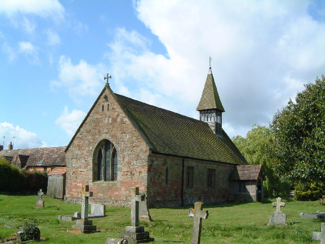
Church of St Michael and All Angels, Martin Hussingtree
The Church of St Michael and All Angels is a Grade I listed church in Martin Hussingtree, Worcestershire.The west wall is probably of 12th century origin...
Hindlip
Hindlip or Hinlip is a village and civil parish 3 miles (4.8 km) north east of Worcester, in the Wychavon district, in the county of Worcestershire, England...
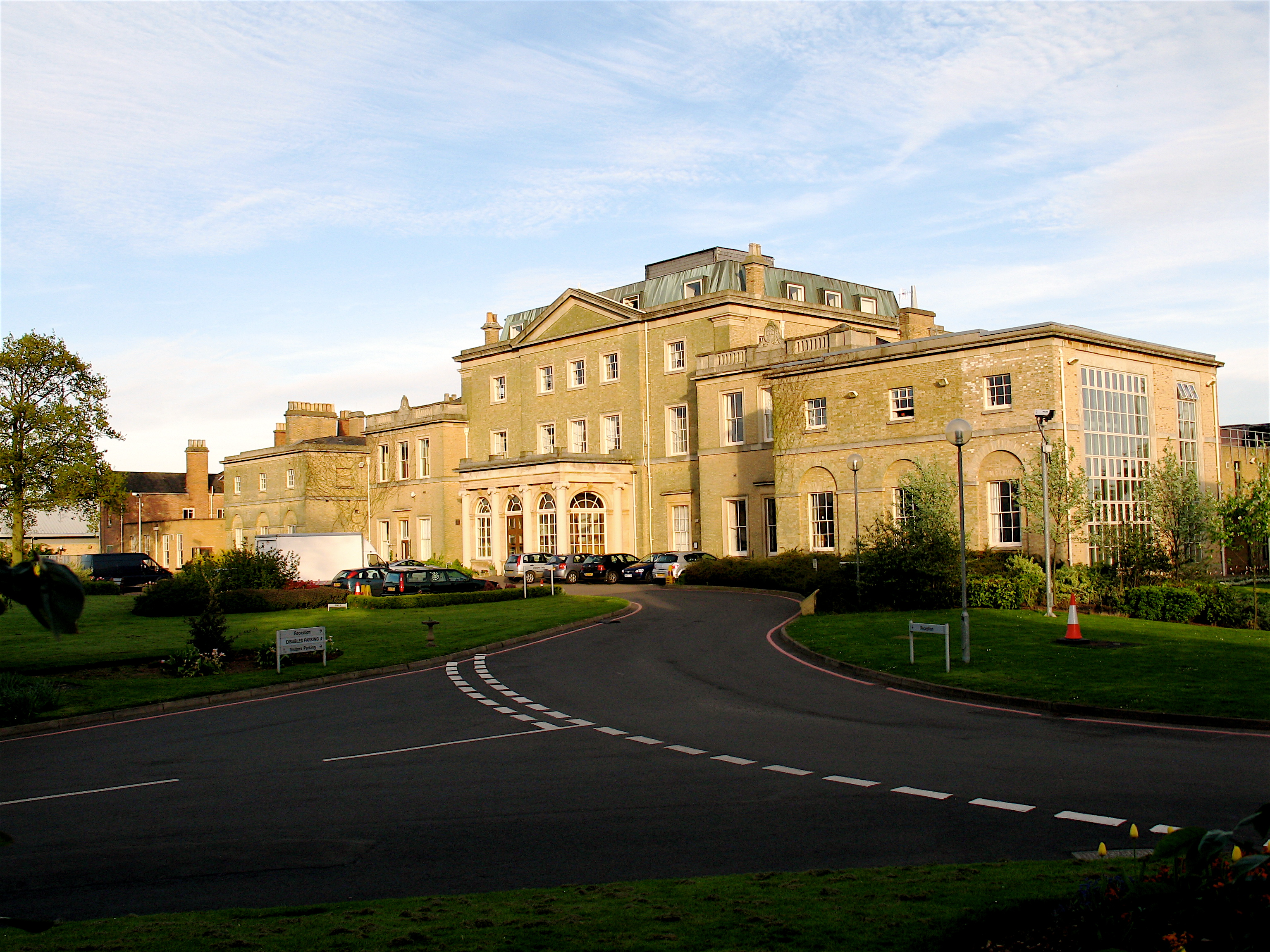
Hindlip Hall
Hindlip Hall is a stately home in Hindlip, Worcestershire, England. The first major hall was built before 1575, and it played a significant role in both...

Oddingley
Oddingley is a village and civil parish in the English county of Worcestershire, approximately 9 km (5.6 mi) north-east of the county town of Worcester...
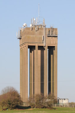
Droitwich Water Tower
The Droitwich Water Tower, also known as Yew Tree Hill Water Tower, is a structure on Yew Tree Hill in Droitwich, England, owned and operated by Severn...
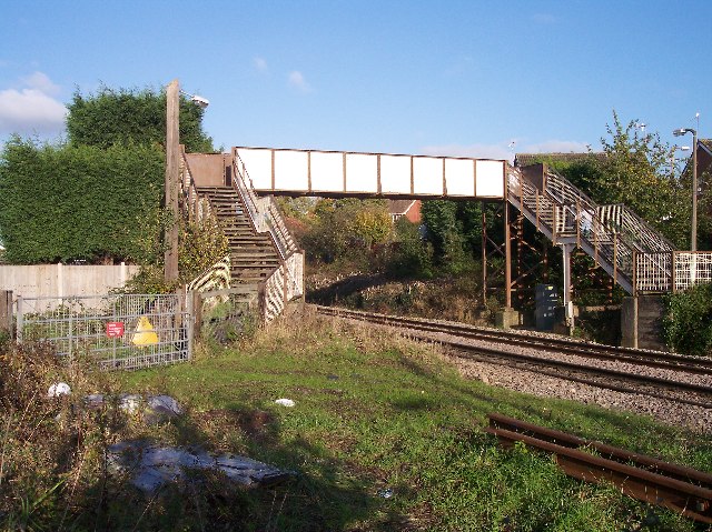
Fernhill Heath railway station
Fernhill Heath railway station was an intermediate railway station on the Oxford, Worcester and Wolverhampton Railway between Worcester (Tunnel Junction...

Church of the Sacred Heart and St Catherine of Alexandria
The Church of the Sacred Heart and St Catherine of Alexandria is a Catholic church situated in Droitwich Spa, Worcestershire, England, noted for its remarkable...
Nearby Amenities
Located within 500m of 52.238078,-2.1625025Have you been to Brownheath Common?
Leave your review of Brownheath Common below (or comments, questions and feedback).