Norton Juxta Kempsey

Civil Parish in Worcestershire Wychavon

England

Norton Juxta Kempsey

Birch Plantation Grown very close together. Bio mass fuel?
Birch Plantation Credit: Bob Embleton

Norton Juxta Kempsey is a civil parish located in Worcestershire, England. It is situated about three miles south of the city of Worcester and is bordered by the River Severn to the east. The parish covers an area of approximately 4.5 square kilometers and has a population of around 1,000 residents.

The area has a rich history, with evidence of human habitation dating back to the prehistoric period. Norton Juxta Kempsey was mentioned in the Domesday Book of 1086 and has since been an important agricultural and industrial center. In the past, the village was known for its ironworks, corn mills, and tanneries, which contributed to its economic growth.

Today, Norton Juxta Kempsey is primarily a residential area with a mix of housing styles, ranging from traditional cottages to modern developments. The village has a small but active community, with amenities such as a local pub, a village hall, and a primary school.

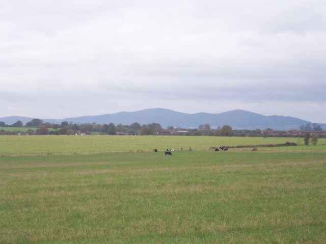
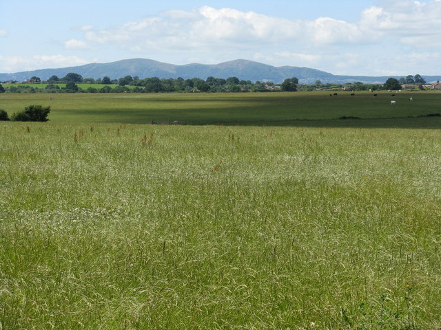
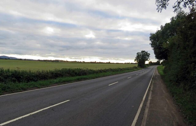
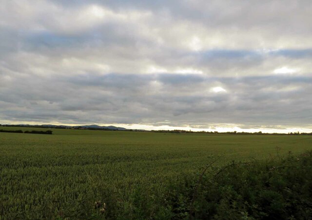
The area also offers beautiful natural surroundings, including the nearby Worcestershire countryside and the River Severn, which attracts visitors for recreational activities such as boating and fishing. The parish is well-connected to the surrounding areas, with good transport links to Worcester and other nearby towns.

Overall, Norton Juxta Kempsey combines a rich historical past with a peaceful and picturesque setting, making it an attractive place to live and visit in Worcestershire.

If you have any feedback on the listing, please let us know in the comments section below.

Norton Juxta Kempsey Images

Images are sourced within 2km of 52.157645/-2.17237 or Grid Reference SO8851. Thanks to Geograph Open Source API. All images are credited.

Birch Plantation Grown very close together. Bio mass fuel?
Birch Plantation
Grown very close together. Bio mass fuel?
View from Stoulton of The Malvern Hills Supplementary. Worcestershire Beacon and North Hill with Sugarloaf in between.
View from Stoulton of The Malvern Hills
Supplementary. Worcestershire Beacon and North Hill with Sugarloaf in between.
Fields before the Malvern Hills, near Stoulton
B4064 towards Worcester
Fields south of the B4084 The Malvern Hills are visible on the horizon.
Fields south of the B4084
The Malvern Hills are visible on the horizon.
Railway at Abbotswood Class 66 No 66506 hauls a train of scrap metal for South Wales past Abbotswood. This freight train was operated by Freightliner. Just to the north of this location is Abbotswood Junction where the line divides for Worcester and Bromsgrove [direct route]. The signal for the junction can be seen to the left of the locomotive.
Railway at Abbotswood
Class 66 No 66506 hauls a train of scrap metal for South Wales past Abbotswood. This freight train was operated by Freightliner. Just to the north of this location is Abbotswood Junction where the line divides for Worcester and Bromsgrove [direct route]. The signal for the junction can be seen to the left of the locomotive.
Bridle way Looking back to the start of a path that has wonderful views to the Malverns
Bridle way
Looking back to the start of a path that has wonderful views to the Malverns
Littleworth Allotments
Sportsfield, Littleworth Sportsfield and club house at Littleworth.
Sportsfield, Littleworth
Sportsfield and club house at Littleworth.
Houses at Abbotswood
Minor road towards Littleworth
Wadborough Road to Littleworth
Lane from Hatfield to Stonehall
Approaching the turning to Littleworth
Field entrance off National Cycle Route 45, Hatfield
National Cycle Route 45 towards Hatfield village
Sheep grazing off National Cycle Route 45, Hatfield
Show me another place!

Norton Juxta Kempsey is located at Grid Ref: SO8851 (Lat: 52.157645, Lng: -2.17237)

Administrative County: Worcestershire

District: Wychavon

Police Authority: West Mercia

What 3 Words

///february.nurtures.munched. Near Kempsey, Worcestershire

Related Wikis

Norton Halt railway station

Norton Halt railway station was a station in Norton, Worcestershire, England. The station was opened in 1879 and closed in 1966. == References == ��2...

Norton-juxta-Kempsey

Norton-juxta-Kempsey is a civil parish to the south of Worcester in the United Kingdom. It contains the villages of Norton and Littleworth. The parish...

Worcestershire Parkway railway station

Worcestershire Parkway is a split-level railway station where the Cotswold and Cross Country lines cross near Norton, Worcester, England. It opened on...

Littleworth, Worcestershire

Littleworth is a medium-sized village on the outskirts of Worcester. The village is the location of Nortan Juxta Kempsey Primary School and the Norton...

Hatfield, Worcestershire

Hatfield is a small hamlet in the district of Wychavon near the city of Worcester, in England. It is surrounded by the villages of Littleworth, Norton...

Abbots Wood Junction railway station

Abbots Wood Junction railway station was an early railway station in England, close to Worcester. The station, 68 miles 60 chains (68.75 miles, 110.64...
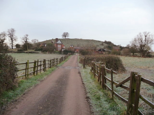
Whittington Tump

Whittington Tump or Crookbarrow Hill is a partly artificial mound in central Worcestershire, England. There is evidence of prehistoric activity at the...
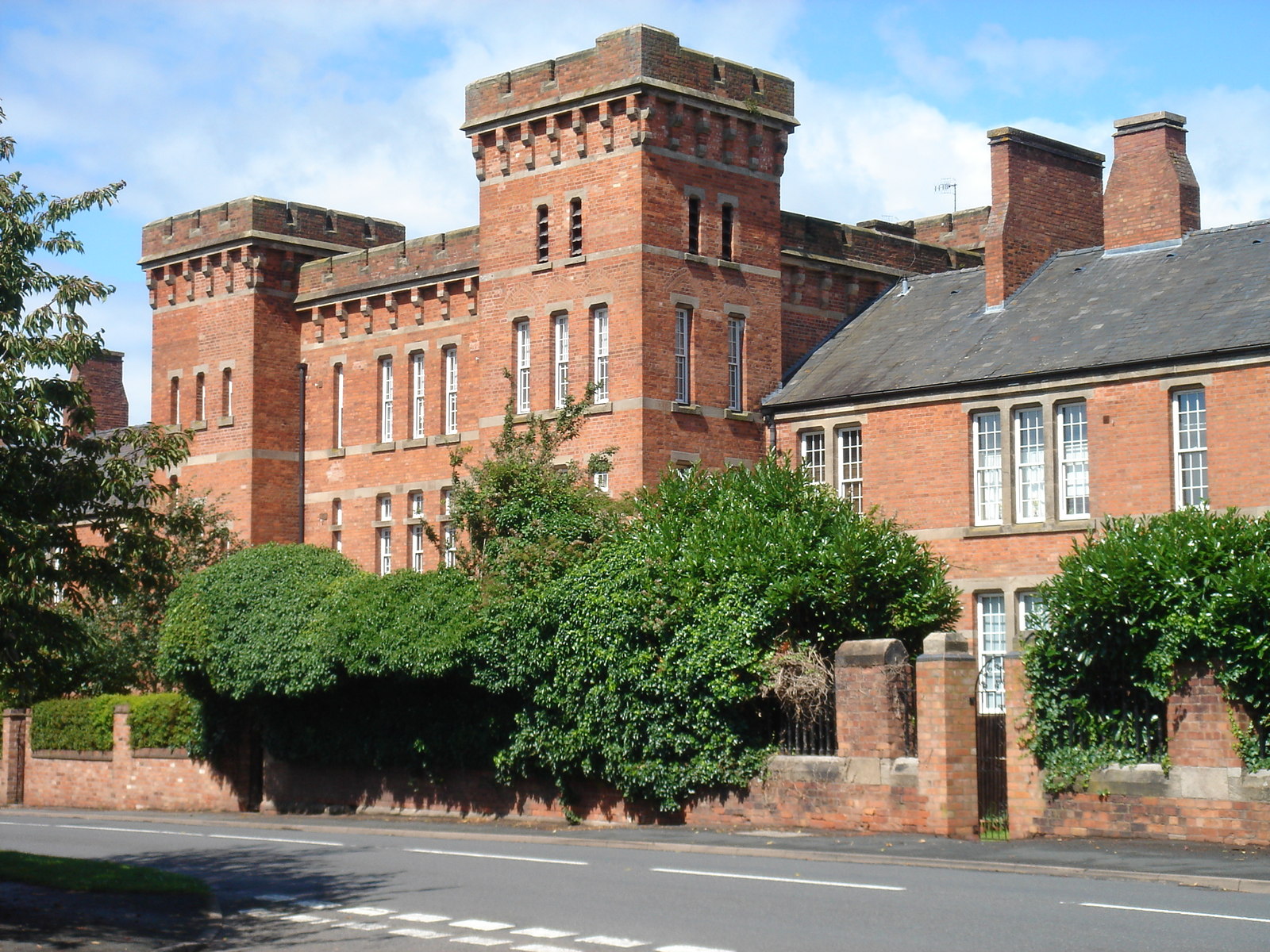
Norton Barracks

Norton Barracks is a military installation in Norton, Worcestershire. The keep is a Grade II listed building. == History == The barracks were built in...

Nearby Amenities

Located within 500m of 52.157645,-2.17237
Crossing: uncontrolled
Crossing Barrier: gate
Railway: crossing
Lat/Long: 52.1547608/-2.1672143
Norton Halt
Historic Railway: halt
Railway: site
Source: Bing;OSM
Wikidata: Q30595901
Wikipedia: en:Norton Halt railway station
Lat/Long: 52.1573377/-2.1732953
Post Office
Naptan AtcoCode: 2000G040400
Naptan Bearing: NW
Naptan BusStopType: CUS
Naptan CommonName: Post Office
Naptan Indicator: adj
Naptan Landmark: opp Church
Naptan NaptanCode: wocdjaga
Naptan Street: Church Lane
Naptan Verified: no
Source: naptan_import
Lat/Long: 52.158483/-2.1784297
Church
Naptan AtcoCode: 2000G138100
Naptan Bearing: SE
Naptan BusStopType: CUS
Naptan CommonName: Church
Naptan Indicator: adj
Naptan NaptanCode: wocgawda
Naptan Street: Church Lane
Naptan Verified: no
Source: naptan_import
Lat/Long: 52.1584648/-2.1786196
Bus Stop
Retreat Inn
Bus: yes
Naptan AtcoCode: 2000G323159
Naptan Bearing: S
Naptan CommonName: Retreat Inn
Naptan Crossing: Woodbury Lane
Naptan Indicator: Adj
Naptan Landmark: Retreat Inn
Naptan NaptanCode: wocdtamg
Naptan Street: Wadborough Road
Naptan Verified: no
Public Transport: platform
Source: naptan_import
Lat/Long: 52.15626/-2.1744386
Bus Stop
Retreat Inn
Bus: yes
Naptan AtcoCode: 2000G600005
Naptan Bearing: N
Naptan CommonName: Retreat Inn
Naptan Crossing: Woodbury Lane
Naptan Indicator: Opp
Naptan Landmark: Retreat Inn
Naptan NaptanCode: wocdpmag
Naptan Street: Wadborough Road
Naptan Verified: no
Public Transport: platform
Source: naptan_import
Lat/Long: 52.1563989/-2.1745589
Pub
The Retreat
Lat/Long: 52.1564633/-2.1739668
Post Box
Note: This is not WR5 159 - i've checked it.
Post Box Design: type_m
Post Box Type: lamp
Ref: WR5 132
Lat/Long: 52.1582903/-2.1780423
Crossing: uncontrolled
Railway: level_crossing
Lat/Long: 52.1559056/-2.1665982
Railway: switch
Lat/Long: 52.1572967/-2.1730434
Railway: switch
Lat/Long: 52.1568566/-2.1715611
Crossing: uncontrolled
Crossing Barrier: gate
Railway: crossing
Lat/Long: 52.1547798/-2.1671774
Railway: switch
Lat/Long: 52.1574698/-2.173684
Barrier: stile
Foot: yes
Lat/Long: 52.1541776/-2.1693662
Barrier: stile
Foot: yes
Lat/Long: 52.1557229/-2.1721007
Barrier: kissing_gate
Foot: yes
Lat/Long: 52.1568887/-2.1731316
Barrier: kissing_gate
Foot: yes
Lat/Long: 52.1545225/-2.1688471
Barrier: stile
Foot: yes
Lat/Long: 52.1553916/-2.1735616
Barrier: stile
Foot: yes
Lat/Long: 52.1536628/-2.1699669
Barrier: stile
Foot: yes
Lat/Long: 52.1553202/-2.1722903
Barrier: stile
Foot: yes
Lat/Long: 52.155774/-2.1760764
Barrier: kissing_gate
Foot: yes
Lat/Long: 52.1564972/-2.1746128
Telephone
Booth: K6
Covered: booth
Lat/Long: 52.1583876/-2.1789694
Bench
Backrest: yes
Image: http://storage3.openstreetcam.org/files/photo/2017/4/5/lth/67231_7967e_58e52284ecc7e.jpg
Survey Date: 2017-04-05
Lat/Long: 52.1585439/-2.1788162
Information: board
Tourism: information
Lat/Long: 52.1582681/-2.177993
Historic: memorial
Memorial: war_memorial
Lat/Long: 52.1585197/-2.178821
Barrier: stile
Foot: yes
Lat/Long: 52.1558557/-2.1758408
Norton
Place: hamlet
Wikidata: Q7060565
Lat/Long: 52.1590372/-2.1792954
Power: pole
Lat/Long: 52.1599516/-2.1666608
Power: pole
Lat/Long: 52.1564741/-2.1693237
Telecommunication Tower Norton
Material: wood
Power: pole
Transformer: distribution
Voltage Primary: 11000
Lat/Long: 52.1559706/-2.169838
Material: wood
Power: pole
Lat/Long: 52.1554292/-2.1703993
Power: pole
Lat/Long: 52.154246/-2.1677989
Material: wood
Power: pole
Lat/Long: 52.1545504/-2.1688986
Power: pole
Lat/Long: 52.154492/-2.1703993
Power: pole
Lat/Long: 52.154483/-2.1713957
Power: pole
Lat/Long: 52.1535894/-2.1722621
Generator Method: photovoltaic
Generator Output Electricity: yes
Generator Source: solar
Generator Type: solar_photovoltaic_panel
Location: roof
Power: generator
Lat/Long: 52.158791/-2.1784875
Man Made: tower
Tower Type: communication
Lat/Long: 52.156396/-2.1714467
Norton Village
Power: pole
Transformer: distribution
Voltage Primary: 11000
Lat/Long: 52.1565095/-2.1745782
Power: pole
Lat/Long: 52.1560344/-2.1727958
Power: pole
Lat/Long: 52.1557155/-2.1715111
Network Rail Woodbury Lane
Material: wood
Power: pole
Transformer: distribution
Voltage Primary: 11000
Lat/Long: 52.1571422/-2.1686464
Norton Junction
Railway: junction
Lat/Long: 52.1568341/-2.1715734
Power: pole
Lat/Long: 52.1594369/-2.1671216
Power: pole
Lat/Long: 52.1583788/-2.167414
Woodhall
Power: pole
Transformer: distribution
Voltage Primary: 11000
Lat/Long: 52.1595307/-2.172372
Power: pole
Lat/Long: 52.1591226/-2.1716626
Power: pole
Lat/Long: 52.1587696/-2.1710323
Power: pole
Lat/Long: 52.1583632/-2.1706514
Power: pole
Lat/Long: 52.1580242/-2.169541
Norton House Farm
Power: pole
Transformer: distribution
Voltage Primary: 11000
Lat/Long: 52.1572229/-2.1672383
Material: wood
Power: pole
Lat/Long: 52.1570517/-2.1687444
Power: pole
Lat/Long: 52.1576141/-2.1681871
Barrier: stile
Material: wood
Stile: stepover
Lat/Long: 52.1558222/-2.1666338
Barrier: stile
Material: wood
Stile: stepover
Lat/Long: 52.1559662/-2.1665957
The data included in this document is from www.openstreetmap.org. The data is made available under ODbL.

Have you been to Norton Juxta Kempsey?

Leave your review of Norton Juxta Kempsey below (or comments, questions and feedback).