Norton

Civil Parish in Herefordshire

England

Norton

View over Bromyard View over the town of Bromyard from the Bromyard Downs.
View over Bromyard Credit: Philip Halling

Norton is a civil parish located in the county of Herefordshire, England. It is situated approximately 2.5 miles southeast of the city of Hereford and covers an area of around 6 square miles. The parish is made up of a small, tight-knit community, with a population of approximately 500 residents.

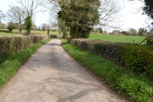
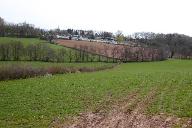
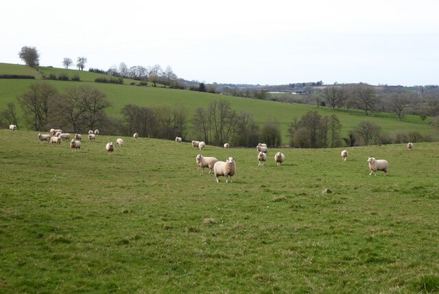
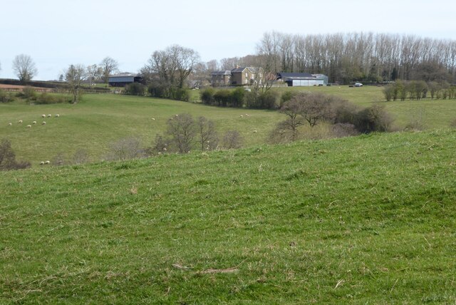
Norton is primarily an agricultural area, with much of the land used for farming and livestock rearing. The landscape is characterized by rolling hills, lush green fields, and charming countryside views. The parish is known for its picturesque beauty and tranquil atmosphere, attracting visitors who seek a peaceful retreat from the bustling city life.

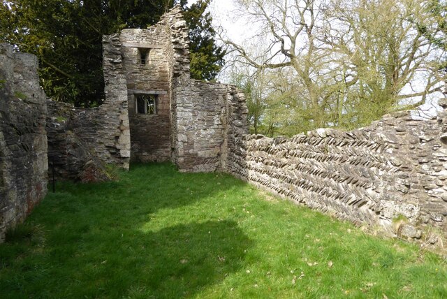
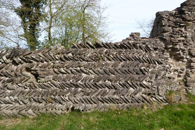
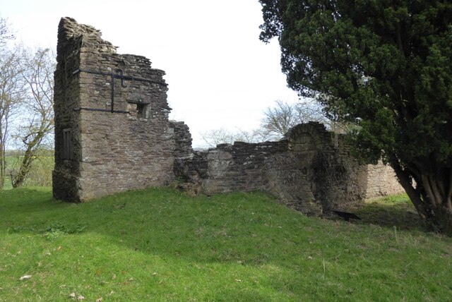
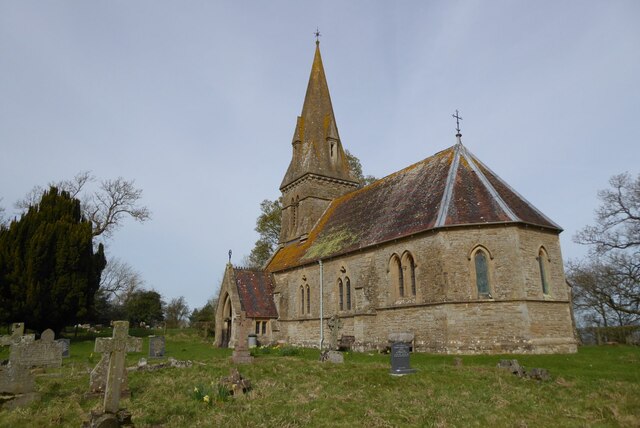
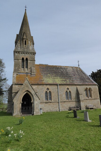
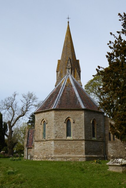
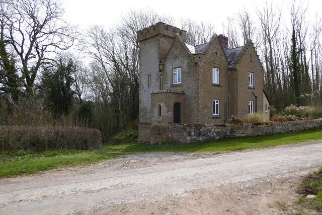
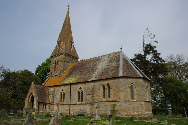
The village of Norton itself is a small settlement, featuring a handful of period buildings, including a historic church that dates back to the 12th century. The community is proud of its heritage, and efforts have been made to preserve the village's traditional character. There are also a few local amenities, such as a village hall and a pub, which serve as important social hubs for residents.

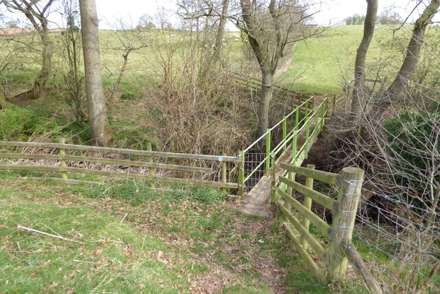
Norton offers a range of outdoor activities for nature enthusiasts, including walking and cycling trails that showcase the area's natural beauty. The parish is well-connected to surrounding towns and cities by road, making it easily accessible for both residents and visitors.

Overall, Norton, Herefordshire is a charming rural parish that offers a peaceful and idyllic lifestyle, surrounded by beautiful countryside and a close-knit community.

If you have any feedback on the listing, please let us know in the comments section below.
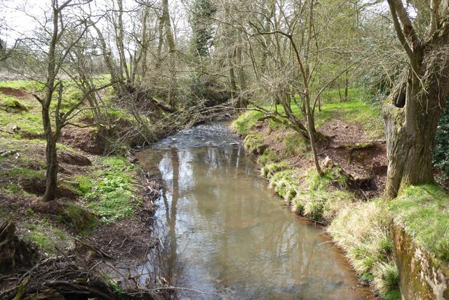
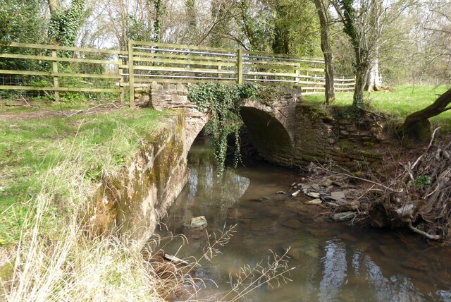
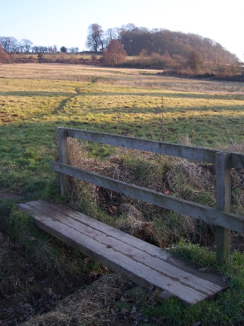
Norton Images

Images are sourced within 2km of 52.206125/-2.493359 or Grid Reference SO6656. Thanks to Geograph Open Source API. All images are credited.

View over Bromyard View over the town of Bromyard from the Bromyard Downs.
View over Bromyard
View over the town of Bromyard from the Bromyard Downs.
Ruins of Edvin Loach church The nave of the old church at Edvin Loach. The church was replaced by the Victorians with St Mary's church which is situated in the same churchyard. The name Edvin Loach is derived from the de Loges family which owned the surrounding land in the late 11th century when the old church was built. Notice the herring bone masonry in the north wall on the right.
Ruins of Edvin Loach church
The nave of the old church at Edvin Loach. The church was replaced by the Victorians with St Mary's church which is situated in the same churchyard. The name Edvin Loach is derived from the de Loges family which owned the surrounding land in the late 11th century when the old church was built. Notice the herring bone masonry in the north wall on the right.
Herring bone masonry Herring bone masonry in the north wall of the old Edvin Loach church.
Herring bone masonry
Herring bone masonry in the north wall of the old Edvin Loach church.
Ruin of old Edvin Loach church The ruins of the old Edvin Loach church which was in use until the 1860s, when it was replaced by the adjacent new church.
Ruin of old Edvin Loach church
The ruins of the old Edvin Loach church which was in use until the 1860s, when it was replaced by the adjacent new church.
St Mary's church, Edvin Loach St Mary's church was designed by Sir George Gilbert Scott and built in 1859-60.  The new church in Edvin Loach replaced the earlier abandoned church, the ruins of which are adjacent to this church.  The church is Grade II listed, see: <span class="nowrap"><a title="https://historicengland.org.uk/listing/the-list/list-entry/1082257?section=official-list-entry" rel="nofollow ugc noopener" href="https://historicengland.org.uk/listing/the-list/list-entry/1082257?section=official-list-entry">Link</a><img style="margin-left:2px;" alt="External link" title="External link - shift click to open in new window" src="https://s1.geograph.org.uk/img/external.png" width="10" height="10"/></span>
St Mary's church, Edvin Loach
St Mary's church was designed by Sir George Gilbert Scott and built in 1859-60. The new church in Edvin Loach replaced the earlier abandoned church, the ruins of which are adjacent to this church. The church is Grade II listed, see: LinkExternal link
Country road at Edvin Loach A quiet country road in the sparse community of Edvin Loach.  The farm in the middle distance on the right is Steeples.
Country road at Edvin Loach
A quiet country road in the sparse community of Edvin Loach. The farm in the middle distance on the right is Steeples.
Saltmarsh Castle Caravan Park Until 1955 when it was demolished this was the site of Saltmarshe Castle, a Victorian crenelated house. Today it is the site of the Saltmarshe Castle Caravan Park, its open and exposed elevated position making it a blot on a rural sparsely populated landscape.
Saltmarsh Castle Caravan Park
Until 1955 when it was demolished this was the site of Saltmarshe Castle, a Victorian crenelated house. Today it is the site of the Saltmarshe Castle Caravan Park, its open and exposed elevated position making it a blot on a rural sparsely populated landscape.
Former lodge Former lodge or gatehouse to Saltmarshe Castle.  The castle which was a Victorian crenellated country house was demolished in 1955.
Former lodge
Former lodge or gatehouse to Saltmarshe Castle. The castle which was a Victorian crenellated country house was demolished in 1955.
Sheep in a field Sheep in a field near New House Farm, Edvin Loach.
Sheep in a field
Sheep in a field near New House Farm, Edvin Loach.
Footbridge on a footpath Footbridge on a footpath near New House Farm, Edvin Loach.
Footbridge on a footpath
Footbridge on a footpath near New House Farm, Edvin Loach.
New House Farm New House Farm viewed from a footpath to the south-west.
New House Farm
New House Farm viewed from a footpath to the south-west.
Stream near Edvin Loach
Footbridge over a stream Footbridge on a bridleway crossing a stream between Edvin Loach and Edwyn Ralph.
Footbridge over a stream
Footbridge on a bridleway crossing a stream between Edvin Loach and Edwyn Ralph.
Headland bridleway Headland bridleway near Edvin Loach.
Headland bridleway
Headland bridleway near Edvin Loach.
Headland bridleway Headland bridleway in a field of winter cereal near Edwyn Raplh.  The Bromyard Downs are in the background.
Headland bridleway
Headland bridleway in a field of winter cereal near Edwyn Raplh. The Bromyard Downs are in the background.
Trees in farmland These trees in an arable field may well be on the line of a former hedgerow.
Trees in farmland
These trees in an arable field may well be on the line of a former hedgerow.
Show me another place!

Norton is located at Grid Ref: SO6656 (Lat: 52.206125, Lng: -2.493359)

Unitary Authority: County of Herefordshire

Police Authority: West Mercia

What 3 Words

///remarried.hoaxes.beaters. Near Bromyard, Herefordshire

Nearby Locations

Buckenhill Wood Norton

Related Wikis

Bromyard Downs

Bromyard Downs is an area of registered common land, and a scattered settlement, just outside the town of Bromyard in Herefordshire, England. The 114 hectares...

Norton, Herefordshire

Norton is a civil parish in north-east Herefordshire, England, and is approximately 14 miles (23 km) north-east from the city and county town of Hereford...

Bromyard Town F.C.

Bromyard Town Football Club is a football club based in Bromyard, Herefordshire, England. They are currently members of the West Midlands (Regional) League...

Edvin Loach

Edvin Loach, also Edwin Loach, is a village and former civil parish, now in the parish of Edvin Loach and Saltmarshe, in east Herefordshire, England, and...

Nearby Amenities

Located within 500m of 52.206125,-2.493359
Barrier: stile
Lat/Long: 52.2087121/-2.4945934
Barrier: stile
Lat/Long: 52.202677/-2.4958585
Barrier: stile
Lat/Long: 52.203158/-2.4961243
Barrier: stile
Lat/Long: 52.2039087/-2.4996448
Barrier: stile
Lat/Long: 52.2061606/-2.4979028
Barrier: stile
Lat/Long: 52.2063891/-2.4970085
Barrier: stile
Bicycle: no
Foot: yes
Horse: no
Motor Vehicle: no
Lat/Long: 52.2076044/-2.4980254
Barrier: kissing_gate
Bicycle: no
Foot: yes
Horse: no
Motor Vehicle: no
Lat/Long: 52.2077323/-2.4980882
Barrier: cattle_grid
Lat/Long: 52.2055462/-2.4873304
West View Norton
Power: pole
Transformer: distribution
Voltage Primary: 11000
Lat/Long: 52.2049508/-2.4870361
Wood Lodge
Power: pole
Transformer: distribution
Voltage Primary: 11000
Lat/Long: 52.2087613/-2.4944282
Power: pole
Lat/Long: 52.2086586/-2.4957566
Power: pole
Lat/Long: 52.2085633/-2.4970715
Power: pole
Lat/Long: 52.2084437/-2.4986728
The Elms
Power: pole
Transformer: distribution
Voltage Primary: 11000
Lat/Long: 52.2077439/-2.4994822
Power: pole
Lat/Long: 52.2081129/-2.499794
The data included in this document is from www.openstreetmap.org. The data is made available under ODbL.

Have you been to Norton?

Leave your review of Norton below (or comments, questions and feedback).