North Rauceby
Civil Parish in Lincolnshire North Kesteven
England
North Rauceby

North Rauceby is a civil parish located in the county of Lincolnshire, England. Situated approximately 3 miles south of Sleaford, it covers an area of about 7.5 square kilometers. The parish is predominantly rural, with a small population of around 400 residents.
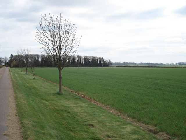
The village of North Rauceby is characterized by its charming and picturesque countryside setting. The landscape is primarily agricultural, with rolling fields and meadows stretching out as far as the eye can see. The village itself is made up of a collection of traditional stone and brick houses, some of which date back several centuries.
At the heart of the village is St. Peter's Church, a historic parish church that dates back to the 12th century. The church is renowned for its beautiful architecture and is a popular attraction for visitors interested in the area's rich history.
Despite its small size, North Rauceby offers several amenities for its residents. These include a village hall, a primary school, and a pub, providing a sense of community and meeting places for locals to gather.
The surrounding countryside provides ample opportunities for outdoor activities, such as walking and cycling, with numerous footpaths and trails crisscrossing the area. The village is also well-connected to nearby towns and cities, with good transport links and easy access to major roads.
Overall, North Rauceby is a tranquil and idyllic rural parish, offering residents a peaceful way of life in a picturesque setting.
If you have any feedback on the listing, please let us know in the comments section below.
North Rauceby Images
Images are sourced within 2km of 53.013355/-0.494395 or Grid Reference TF0147. Thanks to Geograph Open Source API. All images are credited.


North Rauceby is located at Grid Ref: TF0147 (Lat: 53.013355, Lng: -0.494395)
Administrative County: Lincolnshire
District: North Kesteven
Police Authority: Lincolnshire
What 3 Words
///poses.interviewer.still. Near Cranwell, Lincolnshire
Nearby Locations
Related Wikis

North Rauceby
North Rauceby is a village and civil parish in the North Kesteven district of Lincolnshire, England. It is situated 4 miles (6 km) north-west from Sleaford...

No. 16 Squadron RAF
Number 16 Squadron Royal Air Force, nicknamed 'the Saints', is a flying squadron of the Royal Air Force (RAF) who currently provide elementary flying training...

Central Flying School
The Central Flying School (CFS) is the Royal Air Force's primary institution for the training of military flying instructors. Established in 1912 at the...

RAF Cranwell
Royal Air Force Cranwell or more simply RAF Cranwell (ICAO: EGYD) is a Royal Air Force station in Lincolnshire, England, close to the village of Cranwell...

South Rauceby Hall
South Rauceby Hall, South Rauceby, Lincolnshire, England is a country house dating from the mid-19th century. It was designed by William Burn in 1842 for...

South Rauceby
South Rauceby is a village and civil parish in the North Kesteven district of Lincolnshire, England. It is situated 2.5 miles (4.0 km) west from Sleaford...

Royal Air Force College Cranwell
The Royal Air Force College (RAFC) is the Royal Air Force military academy which provides initial training to all RAF personnel who are preparing to become...
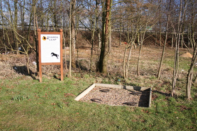
Byard's Leap
Byard's Leap is a hamlet in the North Kesteven district of Lincolnshire, England. It is situated approximately 3 miles (5 km) west from Cranwell, and is...
Nearby Amenities
Located within 500m of 53.013355,-0.494395Have you been to North Rauceby?
Leave your review of North Rauceby below (or comments, questions and feedback).