Normanton on Trent

Civil Parish in Nottinghamshire Bassetlaw

England

Normanton on Trent

Normanton Hall's drive, Normanton on Trent Shown on the large scale OS map published in the 1880s. The single storey building alongside is the lodge, once home to a gatekeeper employed by the owner of Normanton hall.
Normanton Hall's drive, Normanton on Trent Credit: Christine Johnstone

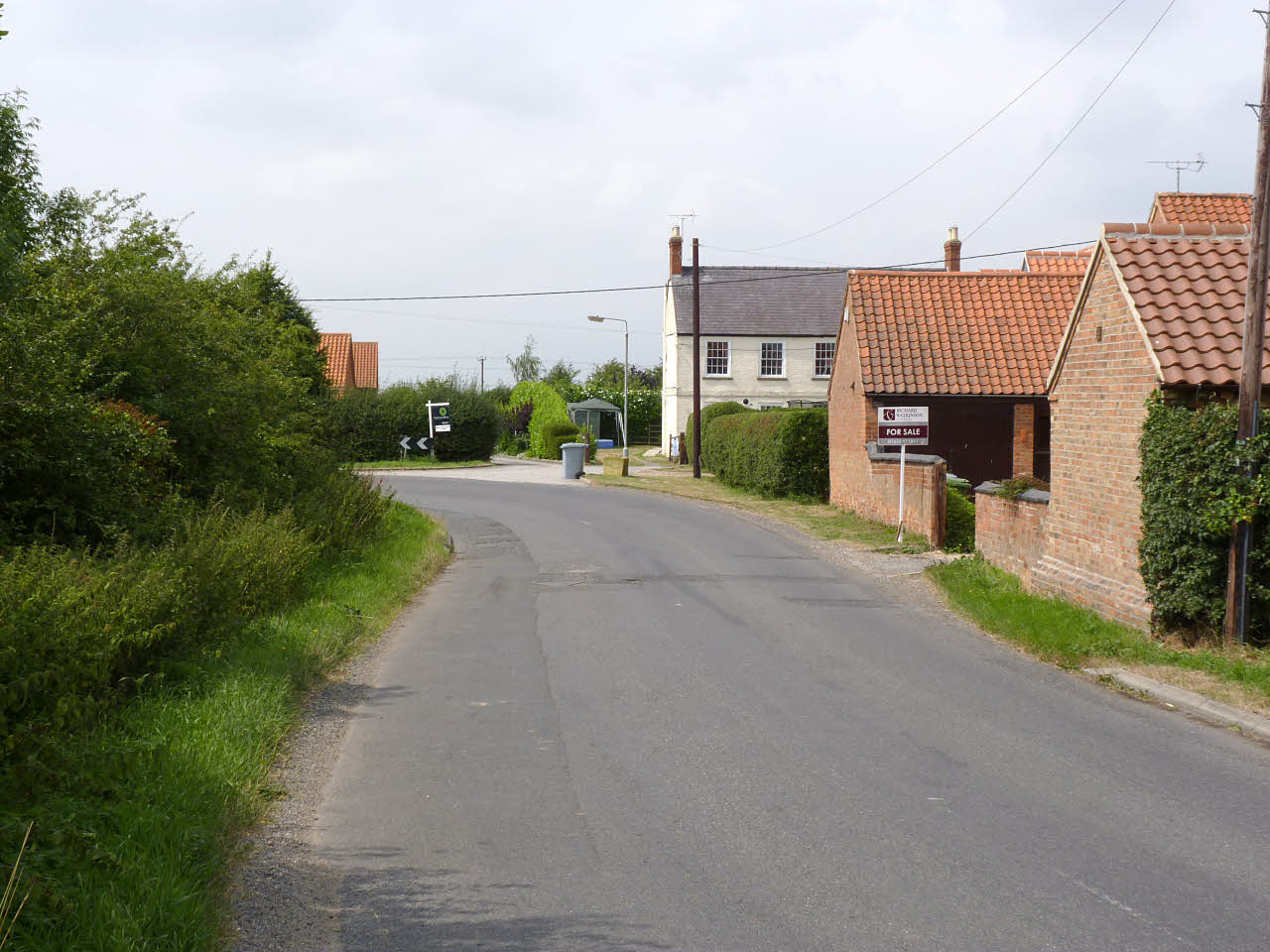
Normanton on Trent is a civil parish located in the county of Nottinghamshire, England. It is situated along the River Trent, approximately 7 miles northeast of the town of Newark-on-Trent. The parish covers an area of about 1,500 acres and has a population of around 500 residents.

The village of Normanton on Trent is known for its picturesque setting, surrounded by fertile farmlands and green countryside. The River Trent flows through the parish, providing beautiful views and recreational opportunities for residents and visitors alike. The village is also home to several historic buildings, including St. Matthew's Church, which dates back to the 13th century.

The parish has a strong sense of community, with various local amenities and activities available for residents. These include a village hall, a primary school, and a local pub. The village hall hosts regular events and gatherings, fostering a sense of togetherness among the residents.

Normanton on Trent benefits from its proximity to Newark-on-Trent, which offers a wide range of services and amenities, including shops, restaurants, and leisure facilities. The village is well-connected to other parts of Nottinghamshire, with good transport links to nearby towns and cities.

In conclusion, Normanton on Trent is a charming and close-knit community in Nottinghamshire, offering a tranquil rural setting, historic landmarks, and a range of amenities for its residents.

If you have any feedback on the listing, please let us know in the comments section below.

Normanton on Trent Images

Images are sourced within 2km of 53.209194/-0.808917 or Grid Reference SK7968. Thanks to Geograph Open Source API. All images are credited.

Normanton Hall's drive, Normanton on Trent Shown on the large scale OS map published in the 1880s. The single storey building alongside is the lodge, once home to a gatekeeper employed by the owner of Normanton hall.
Normanton Hall's drive, Normanton on Trent
Shown on the large scale OS map published in the 1880s. The single storey building alongside is the lodge, once home to a gatekeeper employed by the owner of Normanton hall.
Mill Lane, Normanton on Trent Once leading to Normanton windmill. Now lined with new houses and leading to the village school.
Mill Lane, Normanton on Trent
Once leading to Normanton windmill. Now lined with new houses and leading to the village school.
Houses on the north side of Tuxford Road At the west end of Normanton on Trent.
Houses on the north side of Tuxford Road
At the west end of Normanton on Trent.
The east-west road through Normanton on Trent Where Tuxford Road morphs into Eastgate.
The east-west road through Normanton on Trent
Where Tuxford Road morphs into Eastgate.
Notts CC signpost, Normanton on Trent Erected by Nottinghamshire County Council. Much older than the other street furniture alongside.
Notts CC signpost, Normanton on Trent
Erected by Nottinghamshire County Council. Much older than the other street furniture alongside.
Centre of communications, Normanton on Trent Noticeboard, post box and bus stop, as well as a bench.
Centre of communications, Normanton on Trent
Noticeboard, post box and bus stop, as well as a bench.
Footpath to Low Marnham The path turns to the left at the tree on the left.
Footpath to Low Marnham
The path turns to the left at the tree on the left.
Stubble field near Grassthorpe The photograph is taken looking along the line of the boundary between the parishes of Normanton on Trent (left) and Grassthorpe. The boundary is also that between Bassetlaw and Newark and Sherwood districts.
Stubble field near Grassthorpe
The photograph is taken looking along the line of the boundary between the parishes of Normanton on Trent (left) and Grassthorpe. The boundary is also that between Bassetlaw and Newark and Sherwood districts.
Meadow Lane, Normanton on Trent
Autumn sown crop off Meadow Lane, Normanton on Trent
Footpath to Low Marnham
Meadow Lane, Normanton on Trent
Holme Lane, Normanton on Trent
Drain off Holme Lane, Normanton on Trent
Holme Lane, Normanton on Trent
Footpath to Ingram Lane
Footpath to Low Marnham Clearly marked through a large stubble field.
Footpath to Low Marnham
Clearly marked through a large stubble field.
Show me another place!

Normanton on Trent is located at Grid Ref: SK7968 (Lat: 53.209194, Lng: -0.808917)

Administrative County: Nottinghamshire

District: Bassetlaw

Police Authority: Nottinghamshire

What 3 Words

///camper.plots.germinate. Near Sutton on Trent, Nottinghamshire

Nearby Locations

Normanton on Trent

Related Wikis

St Matthew's Church, Normanton-upon-Trent

St Matthew's Church, Normanton-on-Trent is a Grade II* listed parish church in the Church of England in Normanton on Trent. == History == The church dates...

Grassthorpe

Grassthorpe is a small village and civil parish in the Newark and Sherwood district of Nottinghamshire, England. Population details are included in the...

Marnham, Nottinghamshire

Marnham is a civil parish in the Bassetlaw district, in the county of Nottinghamshire, England. The parish includes the village of Low Marnham and the...

St Wilfrid's Church, Low Marnham

St Wilfrid's Church is a redundant Anglican church in the village of Low Marnham, Nottinghamshire, England. It is recorded in the National Heritage List...

Nearby Amenities

Located within 500m of 53.209194,-0.808917
Parking
Parking: layby
Lat/Long: 53.2084423/-0.8020665
Barrier: stile
Steps: 2
Stile: stepover
Lat/Long: 53.2105065/-0.8127098
Barrier: stile
Steps: 2
Stile: stepover
Lat/Long: 53.2101592/-0.8150991
Barrier: stile
Steps: 2
Stile: stepover
Lat/Long: 53.2100002/-0.8052634
Oak Tree Farm
Place: farm
Lat/Long: 53.2068266/-0.8030827
Defibrillator
Emergency: defibrillator
Lat/Long: 53.210474/-0.8158523
Direction: 170
Generator Method: photovoltaic
Generator Output Electricity: yes
Generator Solar Modules: 10
Generator Source: solar
Generator Type: solar_photovoltaic_panel
Location: roof
Power: generator
Lat/Long: 53.2105854/-0.8159698
Direction: S
Generator Method: photovoltaic
Generator Output Electricity: yes
Generator Solar Modules: 16
Generator Source: solar
Generator Type: solar_photovoltaic_panel
Location: roof
Power: generator
Lat/Long: 53.2084073/-0.8161794
The data included in this document is from www.openstreetmap.org. The data is made available under ODbL.

Have you been to Normanton on Trent?

Leave your review of Normanton on Trent below (or comments, questions and feedback).