Merton

Civil Parish in Devon Torridge

England

Merton

Sculpture at Dunsbear Sculpture made of tiles by local schoolchildren at Dunsbear on the Tarka Trail
Sculpture at Dunsbear Credit: Ron Strutt

Merton is a civil parish located in the county of Devon, in the southwestern part of England. Situated approximately 9 miles west of Okehampton, the parish covers an area of around 15 square miles and is home to a population of approximately 400 people.

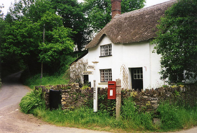
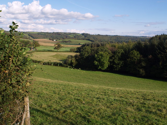
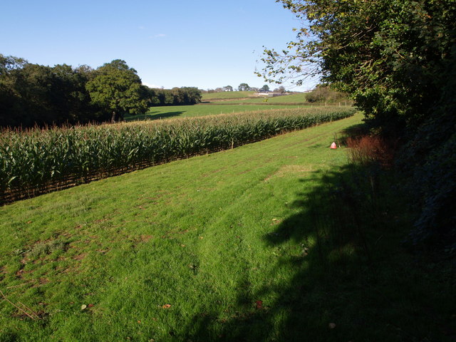
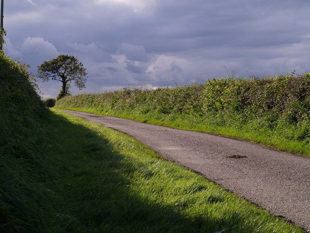
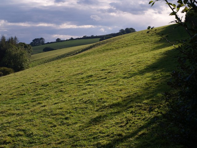
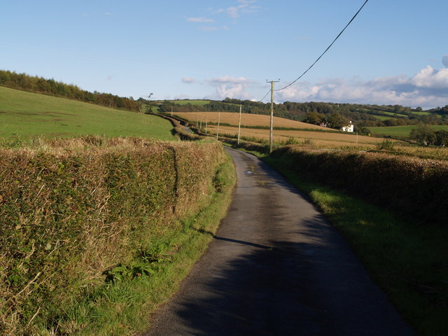
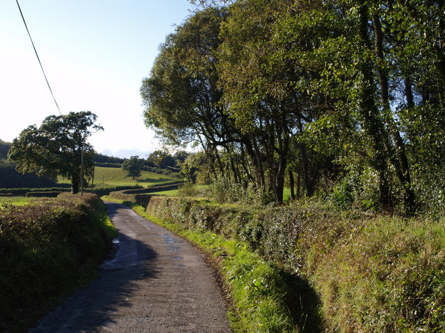
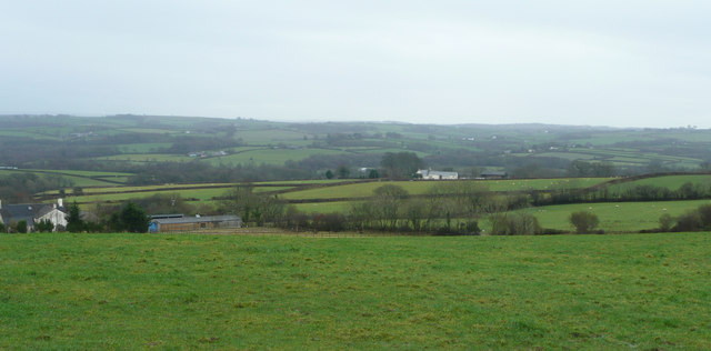
The village of Merton itself is nestled in the picturesque countryside, surrounded by rolling hills and lush green fields. It is a traditional English village, with charming thatched cottages and a historic church at its heart. The village is well-served by amenities, including a primary school, a village hall, and a post office.

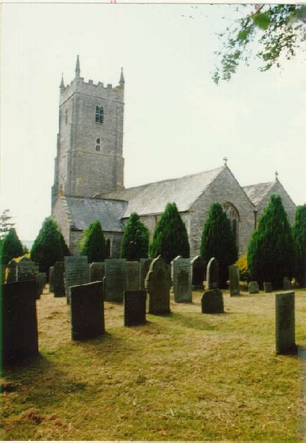
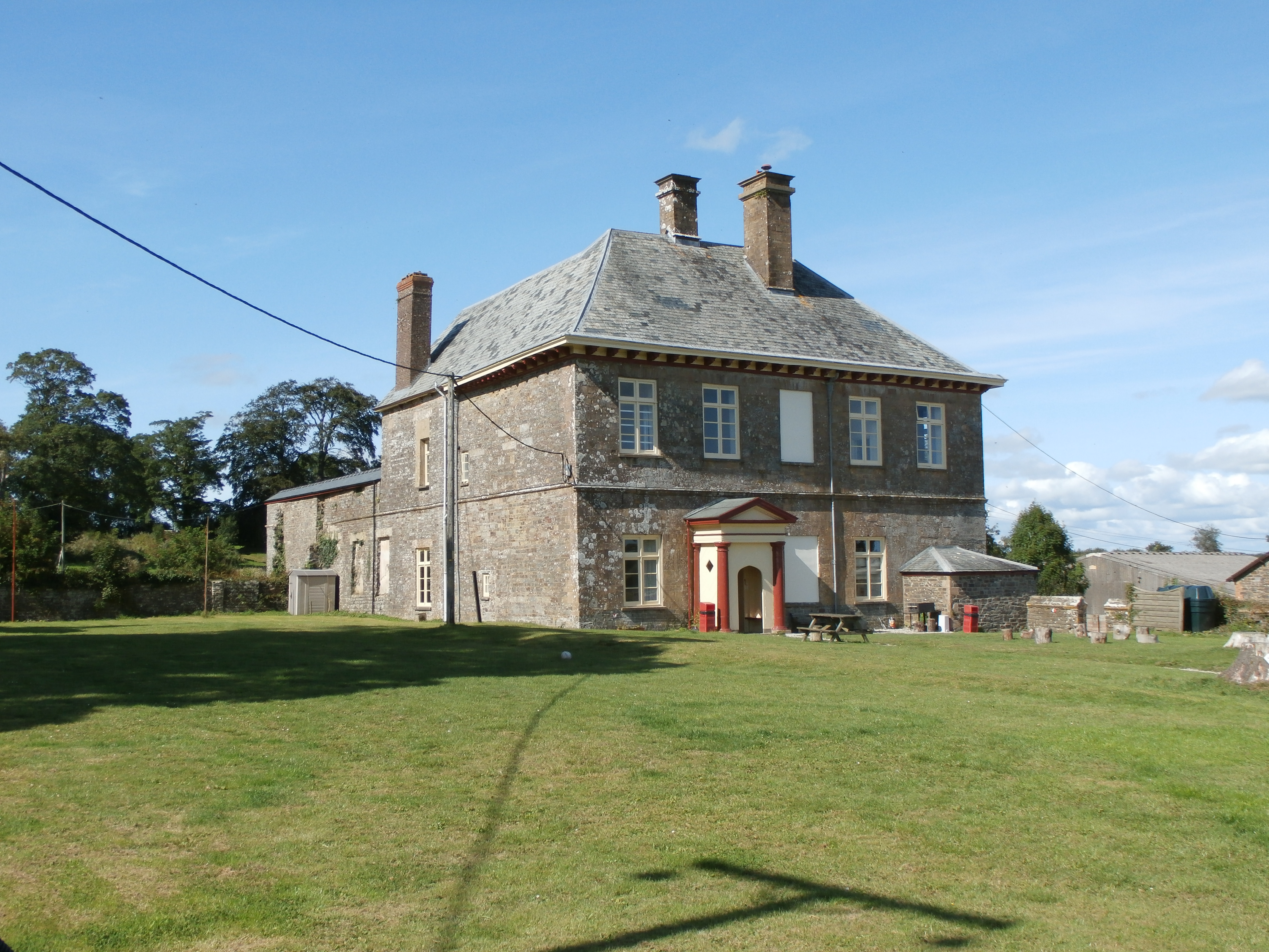
Merton boasts a rich history, dating back to medieval times. The parish church of St. Mary the Virgin, with its Norman origins, is a prominent landmark and a testament to the area's historical significance. The Merton Manor, a Grade II listed building, also stands as a reminder of the village's past.

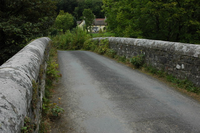
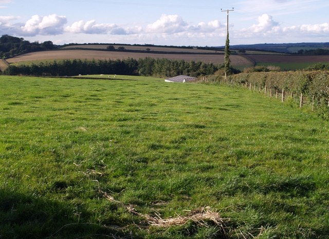
The surrounding countryside offers ample opportunities for outdoor activities, with footpaths and bridleways providing access to the beautiful Devonshire landscape. The village is located close to Dartmoor National Park, a vast and stunning area of moorland and forests, which is a popular destination for nature enthusiasts and hikers.

Overall, Merton is a tranquil and picturesque village in Devon, offering a peaceful and idyllic setting for residents and visitors alike. With its rich history, beautiful countryside, and a close-knit community, Merton is a charming destination for those seeking a quintessential English village experience.

If you have any feedback on the listing, please let us know in the comments section below.

Merton Images

Images are sourced within 2km of 50.903535/-4.100139 or Grid Reference SS5213. Thanks to Geograph Open Source API. All images are credited.

Sculpture at Dunsbear Sculpture made of tiles by local schoolchildren at Dunsbear on the Tarka Trail
Sculpture at Dunsbear
Sculpture made of tiles by local schoolchildren at Dunsbear on the Tarka Trail
Merton Church Another Devon location where my BLIGHT ancestors came from.
Merton Church
Another Devon location where my BLIGHT ancestors came from.
Merton: cottage by Merton Mill Cross As the signpost states, the road on the left leads to Beaford – via Balls Corner and Beaford Mill, on the river Torridge
Merton: cottage by Merton Mill Cross
As the signpost states, the road on the left leads to Beaford – via Balls Corner and Beaford Mill, on the river Torridge
Beaford Bridge and Beaford Mill Beaford Bridge crosses the river Torridge. The picturesque Beaford Mills can be seen in the background.
Beaford Bridge and Beaford Mill
Beaford Bridge crosses the river Torridge. The picturesque Beaford Mills can be seen in the background.
Cattle at Dunsbeare A line-up of curious beasts by the lane that climbs a ridge from Dunsbear (sic) Moor to Pretty Top. The valley behind them runs to the right to join the River Mere. The buildings beyond are on a further ridge-top lane. In the distance, some 25 kilometres away, is Dartmoor.
Cattle at Dunsbeare
A line-up of curious beasts by the lane that climbs a ridge from Dunsbear (sic) Moor to Pretty Top. The valley behind them runs to the right to join the River Mere. The buildings beyond are on a further ridge-top lane. In the distance, some 25 kilometres away, is Dartmoor.
Farmland at Potheridge A field boundary seems to have vanished recently in this large field by the lane from Brandis Corner to Pinkhill Farm. The hedge with the isolated tree runs along the foot of a shallow valley which soon steepens to the right as it plunges 100 metres through Huntingham Hill Wood to meet the Torridge a mile away. The building in the far trees is Great Potheridge, home of General Monk (of the Restoration), "a puzzling and tantalizing fragment" according to Cherry & Pevsner.
Farmland at Potheridge
A field boundary seems to have vanished recently in this large field by the lane from Brandis Corner to Pinkhill Farm. The hedge with the isolated tree runs along the foot of a shallow valley which soon steepens to the right as it plunges 100 metres through Huntingham Hill Wood to meet the Torridge a mile away. The building in the far trees is Great Potheridge, home of General Monk (of the Restoration), "a puzzling and tantalizing fragment" according to Cherry & Pevsner.
Field at Pinkhill Farm The roofs of a couple of the farm's barns peep above the grass. The conifer wood is Furzehill Plantation, largely in SS5114.
Field at Pinkhill Farm
The roofs of a couple of the farm's barns peep above the grass. The conifer wood is Furzehill Plantation, largely in SS5114.
Hillies Wood The view from a gateway near Whiteland Head. A rather small stream occupying quite a broad valley emerges from the wood. The lane to Balls Corner Cross  continues, on the left, into SS5413 - photos <a href="https://www.geograph.org.uk/photo/570031">SS5413 : Countryside near Balls</a>, <a href="https://www.geograph.org.uk/photo/569969">SS5413 : Balls</a> and <a href="https://www.geograph.org.uk/photo/569981">SS5413 : Lane to  Whiteland Head</a> were all taken from where the lane goes out of sight.
Hillies Wood
The view from a gateway near Whiteland Head. A rather small stream occupying quite a broad valley emerges from the wood. The lane to Balls Corner Cross continues, on the left, into SS5413 - photos SS5413 : Countryside near Balls, SS5413 : Balls and SS5413 : Lane to Whiteland Head were all taken from where the lane goes out of sight.
Maize field by the Torridge The river, flowing in a deep incised meander, is just some 10 metres through the trees on the left. To the right is the edge of Poundcleave Wood. The farm in the distance is Yeory.
Maize field by the Torridge
The river, flowing in a deep incised meander, is just some 10 metres through the trees on the left. To the right is the edge of Poundcleave Wood. The farm in the distance is Yeory.
Lane near Pinkhill Farm The lane from the farm to Brandis Corner, with a threatening sky to the west.
Lane near Pinkhill Farm
The lane from the farm to Brandis Corner, with a threatening sky to the west.
Field at Whiteland Head From the same gateway as <a href="https://www.geograph.org.uk/photo/568070">SS5313 : Hillies Wood</a>, a view of a steep field above Hillies Wood.
Field at Whiteland Head
From the same gateway as SS5313 : Hillies Wood, a view of a steep field above Hillies Wood.
Balls Balls is the white farm across the fields. The lane is leading from Whiteland Head to Balls Corner Cross.
Balls
Balls is the white farm across the fields. The lane is leading from Whiteland Head to Balls Corner Cross.
Lane to  Whiteland Head Looking in the opposite direction from close to the spot where <a href="https://www.geograph.org.uk/photo/569969">SS5413 : Balls</a> was taken. The lane is about to cross a gridline; the tree on the left is just inside SS5313.
Lane to Whiteland Head
Looking in the opposite direction from close to the spot where SS5413 : Balls was taken. The lane is about to cross a gridline; the tree on the left is just inside SS5313.
Countryside near Balls A view from close to where <a href="https://www.geograph.org.uk/photo/569969">SS5413 : Balls</a> and <a href="https://www.geograph.org.uk/photo/569981">SS5413 : Lane to  Whiteland Head</a> were taken, across the valley mentioned in <a href="https://www.geograph.org.uk/photo/568070">SS5313 : Hillies Wood</a>. The woods on the far slope are Highridge Copse (left) and New Plantation (centre right); the small wood between them is at Highridge. On the right, Hillies Wood is casting a long evening shadow.
Countryside near Balls
A view from close to where SS5413 : Balls and SS5413 : Lane to Whiteland Head were taken, across the valley mentioned in SS5313 : Hillies Wood. The woods on the far slope are Highridge Copse (left) and New Plantation (centre right); the small wood between them is at Highridge. On the right, Hillies Wood is casting a long evening shadow.
Merton Methodist Church This appears to have been converted into a private dwelling, but has been renovated very sympathetically. The road is the A386 between Merton and Great Torrington. The telephone box shown on maps has vanished.
Merton Methodist Church
This appears to have been converted into a private dwelling, but has been renovated very sympathetically. The road is the A386 between Merton and Great Torrington. The telephone box shown on maps has vanished.
The Speccotts Little Speccott to the left, and Speccott Barton, centre, further away. All viewed from the A386 five miles south of Great Torrington.
The Speccotts
Little Speccott to the left, and Speccott Barton, centre, further away. All viewed from the A386 five miles south of Great Torrington.
Flooding at Beaford Bridge No way through here in an ordinary car. The water is following the artificial mill race - the bridge itself high enough to be unaffected.
Flooding at Beaford Bridge
No way through here in an ordinary car. The water is following the artificial mill race - the bridge itself high enough to be unaffected.
Flooded mill-race At Beaford Mill, in the Torridge valley.
Flooded mill-race
At Beaford Mill, in the Torridge valley.
Show me another place!

Merton is located at Grid Ref: SS5213 (Lat: 50.903535, Lng: -4.100139)

Administrative County: Devon

District: Torridge

Police Authority: Devon & Cornwall

What 3 Words

///poets.steadily.kilowatt. Near Great Torrington, Devon

Nearby Locations

Merton

Related Wikis

Potheridge

Potheridge (alias Great Potheridge, Poderigge, Poderidge or Powdrich) is a former Domesday Book estate in the parish of Merton, in the historic hundred...

Merton, Devon

Merton is a village, ecclesiastical parish, former manor and civil parish administered by the local government district of Torridge, Devon, England. The...

Barometer World

Barometer World was the world's only barometer museum, and was located in the village of Merton, near Great Torrington, Devon, England. Barometer World...

Dunsbear Halt railway station

Dunsbear Halt was a relatively well-used halt on the initially privately run North Devon and Cornwall Junction Light Railway. Opened in 1925 and closed...

Brealeys

Brealeys is a village in Devon, England. == References == == External links == Media related to Brealeys at Wikimedia Commons

Marland Works railway station

Marlands Works was a busy industrial site for just over a century, firstly on the Torrington and Marland Railway, built to carry bricks and clay on a three...

Huish, Torridge

Huish (anciently Hiwis) is a small village, civil parish and former manor in the Torridge district of Devon, England. The eastern boundary of the parish...

Petrockstow railway station

Petrockstow railway station was a station serving the village of Petrockstowe in West Devon, which is about one mile away. The station was, throughout...

Have you been to Merton?

Leave your review of Merton below (or comments, questions and feedback).