Brotherlee

Settlement in Durham

England

Brotherlee

Plantation east of Weather Hill This is a small rectangular plantation lying north of an area known as Heights Pasture which is in turn north of Heights Quarry, (a large excavation on the north side of the Wear valley). It's seen here from the local high point - Weather Hill - just a few tens of metres to the west.
Plantation east of Weather Hill Credit: Trevor Littlewood

Brotherlee is a small village located in the county of Durham, England. Situated in the North East of the country, it is part of the larger rural area known as the Durham Dales. The village is nestled in a picturesque valley and is surrounded by rolling hills, making it a popular destination for nature enthusiasts and outdoor activities.

With a population of around 500 residents, Brotherlee retains its charming and close-knit community feel. It is known for its peaceful atmosphere and offers a tranquil escape from the hustle and bustle of city life. The village is predominantly residential, with a mix of traditional stone-built cottages and more modern houses.

Despite its small size, Brotherlee boasts a few amenities for its residents. This includes a local pub, The Durham Arms, which serves as a social hub for the community. Additionally, there is a small primary school that caters to the educational needs of the local children.

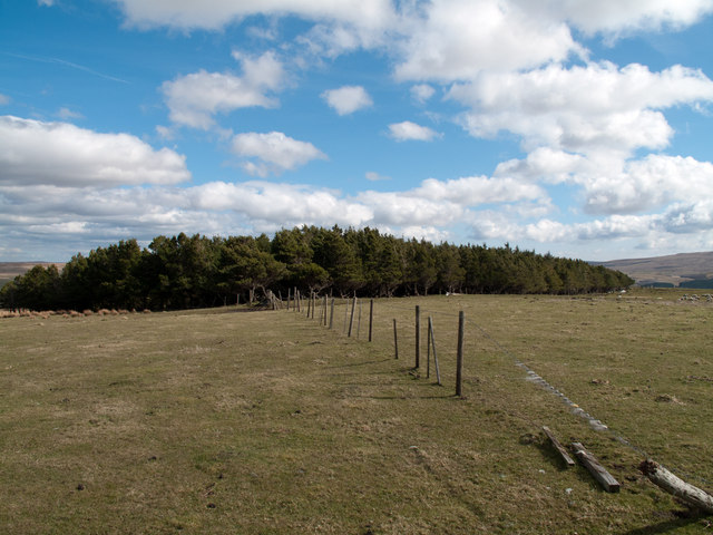
The surrounding countryside offers numerous opportunities for outdoor pursuits, such as hiking, cycling, and fishing. The nearby River Wear provides beautiful views and is a popular spot for anglers. The village is also within close proximity to the North Pennines Area of Outstanding Natural Beauty, which attracts visitors from far and wide.

Overall, Brotherlee offers a peaceful and idyllic lifestyle for its residents, with its stunning natural surroundings and strong sense of community making it a truly desirable place to live.

If you have any feedback on the listing, please let us know in the comments section below.

Brotherlee Images

Images are sourced within 2km of 54.734595/-2.119549 or Grid Reference NY9237. Thanks to Geograph Open Source API. All images are credited.

Plantation east of Weather Hill This is a small rectangular plantation lying north of an area known as Heights Pasture which is in turn north of Heights Quarry, (a large excavation on the north side of the Wear valley). It's seen here from the local high point - Weather Hill - just a few tens of metres to the west.
Plantation east of Weather Hill
This is a small rectangular plantation lying north of an area known as Heights Pasture which is in turn north of Heights Quarry, (a large excavation on the north side of the Wear valley). It's seen here from the local high point - Weather Hill - just a few tens of metres to the west.
West Rigg Opencut A panorama of 4 stitched photos <span class="nowrap"><a title="http://zoom.it/KHGE" rel="nofollow ugc noopener" href="http://zoom.it/KHGE">Link</a><img style="margin-left:2px;" alt="External link" title="External link - shift click to open in new window" src="https://s1.geograph.org.uk/img/external.png" width="10" height="10"/></span>
This site is a disused ironstone quarry which has exposed the structure of the Slitt lead vein. Iron-containing hot water flowing through the vein caused large deposits of ironstone to be formed in the Great Limestone. These largely horizontal deposits were known as 'flats' by the miners. Opencast removal of the ironstone in the second half of the C19th uncovered the vein which remains as the wide rib of rock in the centre. The Slitt Vein was mined for lead ore from levels dug from just west of the road well before it was opened up by the ironstone mine. The narrow slit or 'stope' visible in the end of the vein shows the conditions in which the early miners operated <a href="https://www.geograph.org.uk/photo/2413793">NY9139 : Lead mine at West Rigg Opencut</a>. The Slitt Vein here though had little lead content, consisting mainly of quartz and fluorite and is probably the reason why it remained.
West Rigg Opencut
A panorama of 4 stitched photos LinkExternal link This site is a disused ironstone quarry which has exposed the structure of the Slitt lead vein. Iron-containing hot water flowing through the vein caused large deposits of ironstone to be formed in the Great Limestone. These largely horizontal deposits were known as 'flats' by the miners. Opencast removal of the ironstone in the second half of the C19th uncovered the vein which remains as the wide rib of rock in the centre. The Slitt Vein was mined for lead ore from levels dug from just west of the road well before it was opened up by the ironstone mine. The narrow slit or 'stope' visible in the end of the vein shows the conditions in which the early miners operated NY9139 : Lead mine at West Rigg Opencut. The Slitt Vein here though had little lead content, consisting mainly of quartz and fluorite and is probably the reason why it remained.
Primitive Methodist Chapel, Westgate The two parts of the building date from 1824 and 1871, the original chapel becoming a schoolroom. It is one of the best preserved examples of its kind in the north, and has been managed by the Historic Chapels Trust since 2009. Westgate was the main centre for Primitive Methodism in Weardale. The chapel is outstanding in that it retains its Victorian layout complete with a full set of pews and original windows. A public meeting was recently held to discuss the future of the building.
<span class="nowrap"><a title="http://www.hct.org.uk/chapels/north-east/westgate-methodist-chapel-formerly-primitive-methodist/25" rel="nofollow ugc noopener" href="http://www.hct.org.uk/chapels/north-east/westgate-methodist-chapel-formerly-primitive-methodist/25">Link</a><img style="margin-left:2px;" alt="External link" title="External link - shift click to open in new window" src="https://s1.geograph.org.uk/img/external.png" width="10" height="10"/></span>
Primitive Methodist Chapel, Westgate
The two parts of the building date from 1824 and 1871, the original chapel becoming a schoolroom. It is one of the best preserved examples of its kind in the north, and has been managed by the Historic Chapels Trust since 2009. Westgate was the main centre for Primitive Methodism in Weardale. The chapel is outstanding in that it retains its Victorian layout complete with a full set of pews and original windows. A public meeting was recently held to discuss the future of the building. LinkExternal link
Doorways, Primitive Methodist Chapel, Westgate There is a view of the building here <a href="https://www.geograph.org.uk/photo/2407167">NY9038 : Primitive Methodist Chapel, Westgate</a>
Doorways, Primitive Methodist Chapel, Westgate
There is a view of the building here NY9038 : Primitive Methodist Chapel, Westgate
Rear of Primitive Methodist Chapel, Westgate There is a view of the front of this large building here <a href="https://www.geograph.org.uk/photo/2407167">NY9038 : Primitive Methodist Chapel, Westgate</a>
Rear of Primitive Methodist Chapel, Westgate
There is a view of the front of this large building here NY9038 : Primitive Methodist Chapel, Westgate
Track to Weeds, Westgate Looking up the track from the main road just east of the Methodist Chapel to the old hamlet of Weeds <a href="https://www.geograph.org.uk/photo/2407409">NY9038 : The settlement of Weeds, north-west of Westgate</a>
Before the main road (A689) was constructed through Weardale the old route through Westgate was on the old path network that passes by Weeds, east to cross the Middlehope Burn, probably via an old bridge, and north of the site of the old Castle to Wapping and High Westgate, a line now followed by footpaths.
Westgate, medieval road, Weardale (Westgate) <span class="nowrap"><a title="http://www.keystothepast.info/article/10339/Site-Details?PRN=D8739" rel="nofollow ugc noopener" href="http://www.keystothepast.info/article/10339/Site-Details?PRN=D8739">Link</a><img style="margin-left:2px;" alt="External link" title="External link - shift click to open in new window" src="https://s1.geograph.org.uk/img/external.png" width="10" height="10"/></span>

This area seems to have been settled as early as 1250, originally known as New Close, a clearing on the west edge of the Deer Forest. Some of the present buildings in Weeds date from 1840 to 1896.
Weeds (Westgate) <span class="nowrap"><a title="http://www.keystothepast.info/article/10339/Site-Details?PRN=D8532" rel="nofollow ugc noopener" href="http://www.keystothepast.info/article/10339/Site-Details?PRN=D8532">Link</a><img style="margin-left:2px;" alt="External link" title="External link - shift click to open in new window" src="https://s1.geograph.org.uk/img/external.png" width="10" height="10"/></span>
Track to Weeds, Westgate
Looking up the track from the main road just east of the Methodist Chapel to the old hamlet of Weeds NY9038 : The settlement of Weeds, north-west of Westgate Before the main road (A689) was constructed through Weardale the old route through Westgate was on the old path network that passes by Weeds, east to cross the Middlehope Burn, probably via an old bridge, and north of the site of the old Castle to Wapping and High Westgate, a line now followed by footpaths. Westgate, medieval road, Weardale (Westgate) LinkExternal link This area seems to have been settled as early as 1250, originally known as New Close, a clearing on the west edge of the Deer Forest. Some of the present buildings in Weeds date from 1840 to 1896. Weeds (Westgate) LinkExternal link
The settlement of Weeds, north-west of Westgate There is a wider view of Weeds here <a href="https://www.geograph.org.uk/photo/2032402">NY9038 : Weeds</a>
The settlement of Weeds, north-west of Westgate
There is a wider view of Weeds here NY9038 : Weeds
Waterfall on the Middlehope Burn The rock just below the footbridge, east of Weeds, is the Scar Limestone. This is a hard rock often responsible for the characteristic 'scars' on hillsides in other parts of the Pennine Dales and also, as here, for low waterfalls where streams have cut down to it at lower levels.
Waterfall on the Middlehope Burn
The rock just below the footbridge, east of Weeds, is the Scar Limestone. This is a hard rock often responsible for the characteristic 'scars' on hillsides in other parts of the Pennine Dales and also, as here, for low waterfalls where streams have cut down to it at lower levels.
Footpath north of Westgate This footpath, bounded by dry stone walls, runs from the footbridge over the Middlehope Burn south-east to the fell road. The allotments are on the right and the site of Westgate Castle beyond the ruined building on the left. The end of Fell View cottages seemingly blocks the path ahead. The S-curved nature of the path is suggested as evidence that it is a very old route <span class="nowrap"><a title="http://www.keystothepast.info/article/10339/Site-Details?PRN=D8727" rel="nofollow ugc noopener" href="http://www.keystothepast.info/article/10339/Site-Details?PRN=D8727">Link</a><img style="margin-left:2px;" alt="External link" title="External link - shift click to open in new window" src="https://s1.geograph.org.uk/img/external.png" width="10" height="10"/></span>
The path is also shown here <a href="https://www.geograph.org.uk/photo/1397250">NY9038 : Footbridge over Middlehope Burn, Westgate</a>
Footpath north of Westgate
This footpath, bounded by dry stone walls, runs from the footbridge over the Middlehope Burn south-east to the fell road. The allotments are on the right and the site of Westgate Castle beyond the ruined building on the left. The end of Fell View cottages seemingly blocks the path ahead. The S-curved nature of the path is suggested as evidence that it is a very old route LinkExternal link The path is also shown here NY9038 : Footbridge over Middlehope Burn, Westgate
Former Wesleyan Chapel, Westgate Previously the North Road Wesleyan Chapel and Caretakers House, built in 1791 by masons from Haltwhistle, now converted into three cottages <a href="https://www.geograph.org.uk/photo/1391350">NY9038 : Cottages in Westgate</a>

In about 1748, Christopher Hopper, a Methodist preacher from Allendale and close associate of Wesley, came to Westgate. He records that he ‘preached under the crumbling walls of an old castle at Westgate to a few women and children who looked hard at me’. This is traditionally regarded as the first Wesleyan sermon preached in Weardale, and the North Road Chapel, built in 1791, is said to stand on the very spot where Hopper preached.

The size of these chapels in Weardale is a sign of the strength of the Methodist movement and the much larger population of the times. After the Wesleyan and Primitive Methodists re-united, the chapel was sold in 1937 becoming, to local outrage, a dance hall.

Undated old photos in the Beamish Museum People's Collection <span class="nowrap"><a title="http://collections.beamish.org.uk/search-detail?item=NEG15713" rel="nofollow ugc noopener" href="http://collections.beamish.org.uk/search-detail?item=NEG15713">Link</a><img style="margin-left:2px;" alt="External link" title="External link - shift click to open in new window" src="https://s1.geograph.org.uk/img/external.png" width="10" height="10"/></span>  <span class="nowrap"><a title="http://collections.beamish.org.uk/search-detail?item=NEG1072" rel="nofollow ugc noopener" href="http://collections.beamish.org.uk/search-detail?item=NEG1072">Link</a><img style="margin-left:2px;" alt="External link" title="External link - shift click to open in new window" src="https://s1.geograph.org.uk/img/external.png" width="10" height="10"/></span>
Former Wesleyan Chapel, Westgate
Previously the North Road Wesleyan Chapel and Caretakers House, built in 1791 by masons from Haltwhistle, now converted into three cottages NY9038 : Cottages in Westgate In about 1748, Christopher Hopper, a Methodist preacher from Allendale and close associate of Wesley, came to Westgate. He records that he ‘preached under the crumbling walls of an old castle at Westgate to a few women and children who looked hard at me’. This is traditionally regarded as the first Wesleyan sermon preached in Weardale, and the North Road Chapel, built in 1791, is said to stand on the very spot where Hopper preached. The size of these chapels in Weardale is a sign of the strength of the Methodist movement and the much larger population of the times. After the Wesleyan and Primitive Methodists re-united, the chapel was sold in 1937 becoming, to local outrage, a dance hall. Undated old photos in the Beamish Museum People's Collection LinkExternal link LinkExternal link
Fell View, Westgate Former lead miners' cottages. The road on the right is Scutterhill Bank which climbs steeply over the hills to Rookhope.
Fell View, Westgate
Former lead miners' cottages. The road on the right is Scutterhill Bank which climbs steeply over the hills to Rookhope.
New houses, Westgate Compare changes to Richard Webb's photo from 2008 <a href="https://www.geograph.org.uk/photo/1137653">NY9038 : New houses, Westgate</a>
New houses, Westgate
Compare changes to Richard Webb's photo from 2008 NY9038 : New houses, Westgate
Archaeological excavation at Westgate 'Castle' Trench revealed an area of a possible cobbled courtyard west of the 'Castle' site. The ruined building is a later structure but may have reused some castle masonry.
Archaeological excavation at Westgate 'Castle'
Trench revealed an area of a possible cobbled courtyard west of the 'Castle' site. The ruined building is a later structure but may have reused some castle masonry.
Archaeological excavation at Westgate 'Castle' This main trench across the east wall of the 'castle' tower revealed the massive thickness of the original walls and some fine courses of masonry on either side of a window. This suggests that the original floor level will be much lower than that currently dug with lots more to be revealed by future excavation. The mass of stone in the rear of the trench is material arising from a previous collapse of the higher ruined wall to the right.
Archaeological excavation at Westgate 'Castle'
This main trench across the east wall of the 'castle' tower revealed the massive thickness of the original walls and some fine courses of masonry on either side of a window. This suggests that the original floor level will be much lower than that currently dug with lots more to be revealed by future excavation. The mass of stone in the rear of the trench is material arising from a previous collapse of the higher ruined wall to the right.
Archaeological excavation at Westgate 'Castle' Weardale's 'Lost Castle' in Westgate was one of the most important buildings in the North Pennines from the mid C13th through until the early C17th century. It provided the 'west gate' into the Bishop of Durham's great deer park (which originally extended as far as Stanhope, but later contracted to Eastgate), and was probably used as a defensive tower house, administrative centre and hunting lodge. When ruined, most of its masonry was reused in adjacent buildings especially the adjacent school building (now an abattoir) which
dates from c1820, leaving nothing visible above ground. The site was well known to local people and with foresight of the current owner of the land, preserved from further development.

A recent geophysical survey revealed the likely location of buried walls and a preliminary community archaeology project was undertaken for a week in May 2011 to open a few trial trenches. Following public tours of the excavations on the afternoon of Saturday 14th May the site is due to be reburied awaiting funds and a proposal for a future full archaeology project.

The excavation was undertaken by the North Pennines AONB Partnership's 'Altogether Archaeology' project funded by the Heritage Lottery Fund and English Heritage directed by Durham University Archaeological Services.

North Pennines AONB <span class="nowrap"><a title="http://www.northpennines.org.uk" rel="nofollow ugc noopener" href="http://www.northpennines.org.uk">Link</a><img style="margin-left:2px;" alt="External link" title="External link - shift click to open in new window" src="https://s1.geograph.org.uk/img/external.png" width="10" height="10"/></span>
Archaeological excavation at Westgate 'Castle'
Weardale's 'Lost Castle' in Westgate was one of the most important buildings in the North Pennines from the mid C13th through until the early C17th century. It provided the 'west gate' into the Bishop of Durham's great deer park (which originally extended as far as Stanhope, but later contracted to Eastgate), and was probably used as a defensive tower house, administrative centre and hunting lodge. When ruined, most of its masonry was reused in adjacent buildings especially the adjacent school building (now an abattoir) which dates from c1820, leaving nothing visible above ground. The site was well known to local people and with foresight of the current owner of the land, preserved from further development. A recent geophysical survey revealed the likely location of buried walls and a preliminary community archaeology project was undertaken for a week in May 2011 to open a few trial trenches. Following public tours of the excavations on the afternoon of Saturday 14th May the site is due to be reburied awaiting funds and a proposal for a future full archaeology project. The excavation was undertaken by the North Pennines AONB Partnership's 'Altogether Archaeology' project funded by the Heritage Lottery Fund and English Heritage directed by Durham University Archaeological Services. North Pennines AONB LinkExternal link
Archaeological excavation at Westgate 'Castle' This trench on the south-east corner of the tower revealed several steps of a spiral staircase built in to the 7 foot thickness of the wall. The steps are likely to go down much further as the base of the trench is still well above the predicted ground level.
Archaeological excavation at Westgate 'Castle'
This trench on the south-east corner of the tower revealed several steps of a spiral staircase built in to the 7 foot thickness of the wall. The steps are likely to go down much further as the base of the trench is still well above the predicted ground level.
Archaeological excavation at Westgate 'Castle' Weardale's 'Lost Castle' in Westgate was one of the most important buildings in the North Pennines from the mid C13th through until the early C17th century. It provided the 'west gate' into the Bishop of Durham's great deer park (which originally extended as far as Stanhope, but later contracted to Eastgate), and was probably used as a defensive tower house, administrative centre and hunting lodge. When ruined, most of its masonry was reused in adjacent buildings especially the adjacent school building (now an abattoir) which
dates from c1820, leaving nothing visible above ground. The site was well known to local people and with foresight of the current owner of the land, preserved from further development.

A recent geophysical survey revealed the likely location of buried walls and a preliminary community archaeology project was undertaken for a week in May 2011 to open a few trial trenches. Following public tours of the excavations on the afternoon of Saturday 14th May the site is due to be reburied awaiting funds and a proposal for a future full archaeology project.

The excavation was undertaken by the North Pennines AONB Partnership's 'Altogether Archaeology' project funded by the Heritage Lottery Fund and English Heritage directed by Durham University Archaeological Services.

North Pennines AONB <span class="nowrap"><a title="http://www.northpennines.org.uk" rel="nofollow ugc noopener" href="http://www.northpennines.org.uk">Link</a><img style="margin-left:2px;" alt="External link" title="External link - shift click to open in new window" src="https://s1.geograph.org.uk/img/external.png" width="10" height="10"/></span>
Archaeological excavation at Westgate 'Castle'
Weardale's 'Lost Castle' in Westgate was one of the most important buildings in the North Pennines from the mid C13th through until the early C17th century. It provided the 'west gate' into the Bishop of Durham's great deer park (which originally extended as far as Stanhope, but later contracted to Eastgate), and was probably used as a defensive tower house, administrative centre and hunting lodge. When ruined, most of its masonry was reused in adjacent buildings especially the adjacent school building (now an abattoir) which dates from c1820, leaving nothing visible above ground. The site was well known to local people and with foresight of the current owner of the land, preserved from further development. A recent geophysical survey revealed the likely location of buried walls and a preliminary community archaeology project was undertaken for a week in May 2011 to open a few trial trenches. Following public tours of the excavations on the afternoon of Saturday 14th May the site is due to be reburied awaiting funds and a proposal for a future full archaeology project. The excavation was undertaken by the North Pennines AONB Partnership's 'Altogether Archaeology' project funded by the Heritage Lottery Fund and English Heritage directed by Durham University Archaeological Services. North Pennines AONB LinkExternal link
Notice Board, Westgate Details of a tour of the archaeological excavations at Westgate Castle on Saturday 14th May 2011.
Notice Board, Westgate
Details of a tour of the archaeological excavations at Westgate Castle on Saturday 14th May 2011.
Show me another place!

Brotherlee is located at Grid Ref: NY9237 (Lat: 54.734595, Lng: -2.119549)

Unitary Authority: County Durham

Police Authority: Durham

What 3 Words

///tell.stem.excellent. Near Stanhope, Co. Durham

Related Wikis

Brotherlee

Brotherlee is a small village in the civil parish of Stanhope, in County Durham, England situated on the south side of Weardale, between Stanhope and Daddry...

A689 road

The A689 is a road in northern England that runs east from the A595, 3.1 miles (5.0 km) to the west of Carlisle in Cumbria, to Hartlepool in County Durham...

Westgate, County Durham

Westgate is a village in the civil parish of Stanhope, in County Durham, England. It is situated in Weardale between St John's Chapel and Eastgate. In...

North Pennines

The North Pennines is the northernmost section of the Pennine range of hills which runs north–south through northern England. It lies between Carlisle...

Nearby Amenities

Located within 500m of 54.734595,-2.119549
Bus Stop
New Park House Farm
Naptan AtcoCode: 13004514C
Naptan Bearing: E
Naptan CommonName: New Park House Farm
Naptan Indicator: east bound
Naptan Landmark: Landmark not known
Naptan NaptanCode: durdapwg
Naptan Notes: New Park House Farm- A689- West of Eastgate.
Naptan Street: A689
Naptan Verified: no
Source: naptan_import
Lat/Long: 54.7370259/-2.1191247
Bus Stop
New Park House Farm
Naptan AtcoCode: 13004514G
Naptan Bearing: W
Naptan CommonName: New Park House Farm
Naptan Indicator: west bound
Naptan Landmark: Landmark not known
Naptan NaptanCode: durdapwj
Naptan Notes: Opposite New Park House Farm- A689- West of Eastgate.
Naptan Street: A689
Naptan Verified: no
Source: naptan_import
Lat/Long: 54.7369808/-2.1193576
Barrier: kissing_gate
Lat/Long: 54.7363858/-2.1170506
Brotherlee Farm
Place: farm
Source Name: OS OpenData StreetView
Lat/Long: 54.7344737/-2.1167082
New Park House Farm
Addr City: Bishop Auckland
Addr Postcode: DL13 1PE
Place: farm
Source Name: OS OpenData StreetView
Source Postcode: CodePoint Open
Lat/Long: 54.7372952/-2.1179366
High House
Addr City: Bishop Auckland
Addr Postcode: DL13 1SS
Image: https://www.geograph.org.uk/photo/7528849
Place: isolated_dwelling
Source Name: Historic OS mapping
Source Postcode: CodePoint Open
Lat/Long: 54.7302442/-2.1210775
Barrier: entrance
Lat/Long: 54.7361722/-2.1250491
Barrier: cattle_grid
Lat/Long: 54.7336642/-2.1166418
Brotherlee
Place: hamlet
Wikidata: Q4975637
Wikipedia: en:Brotherlee
Lat/Long: 54.7342538/-2.1191195
The data included in this document is from www.openstreetmap.org. The data is made available under ODbL.

Have you been to Brotherlee?

Leave your review of Brotherlee below (or comments, questions and feedback).