Marldon

Civil Parish in Devon South Hams

England

Marldon

Marldon Bowls Club
Marldon Bowls Club Credit: andrew auger

Marldon is a civil parish located in the county of Devon, in the southwest of England. It is situated approximately 3 miles west of the popular seaside town of Torquay and 7 miles south of the historic market town of Newton Abbot. The parish covers an area of around 4 square miles and is home to a population of approximately 1,500 residents.

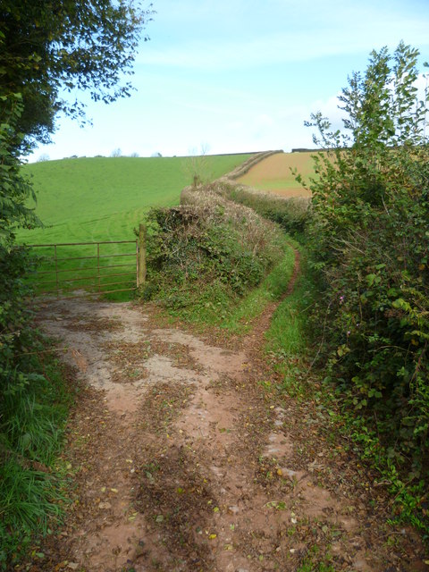
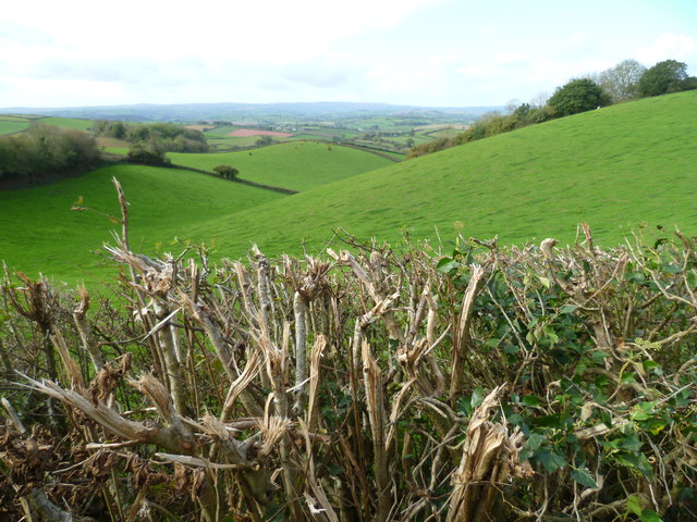
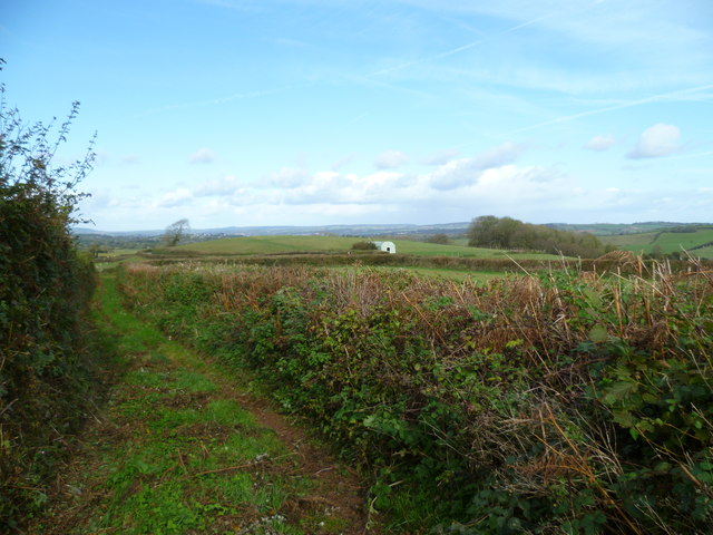
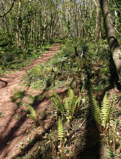
Marldon is a picturesque village surrounded by stunning countryside, with the rolling hills of the South Hams Area of Outstanding Natural Beauty just a short distance away. The landscape is characterized by lush green fields, woodlands, and hedgerows, creating a tranquil and idyllic setting.

The village itself boasts a charming and traditional character, with a range of historic buildings and thatched cottages lining its streets. It is a close-knit community, with a local primary school, village hall, and a parish church, St. John the Baptist, which dates back to the 12th century.

Marldon is well-connected to nearby towns and cities, with good transport links including regular bus services and easy access to the A380 road. This allows residents to enjoy the peaceful surroundings of the countryside while still being within reach of urban amenities.

The parish is also known for its active community, with various clubs and societies catering to a range of interests. It is a popular destination for walkers and nature enthusiasts, thanks to its proximity to the beautiful South Devon coastline and Dartmoor National Park.

In summary, Marldon is a charming and picturesque civil parish in Devon, offering a peaceful and rural lifestyle within easy reach of urban amenities and stunning natural landscapes.

If you have any feedback on the listing, please let us know in the comments section below.

Marldon Images

Images are sourced within 2km of 50.463097/-3.603192 or Grid Reference SX8663. Thanks to Geograph Open Source API. All images are credited.

Marldon Bowls Club
Marldon Bowls Club
Garden at Compton Castle The thatched roof of a large barn is in the background.
Garden at Compton Castle
The thatched roof of a large barn is in the background.
A quiet seat at Compton Castle This is close to the Knot Garden.
A quiet seat at Compton Castle
This is close to the Knot Garden.
Orange Way in Devon and Torbay (68) A footpath leaves the bridleway used on this walk near Loventor Manor. A different view of this junction is at <a title="https://www.geograph.org.uk/photo/804578" href="https://www.geograph.org.uk/photo/804578">Link</a>.
Orange Way in Devon and Torbay (68)
A footpath leaves the bridleway used on this walk near Loventor Manor. A different view of this junction is at Link.
Orange Way in Devon and Torbay (69) Here the bridleway bends through 90°.
Orange Way in Devon and Torbay (69)
Here the bridleway bends through 90°.
Orange Way in Devon and Torbay (70) This is the view from the bridleway at Butterball Copse.  The masts are on Beacon Hill and were seen earlier at <a href="https://www.geograph.org.uk/photo/2667966">SX8757 : Orange Way in Devon and Torbay (24)</a>.  This time they are less than a mile away.
Orange Way in Devon and Torbay (70)
This is the view from the bridleway at Butterball Copse. The masts are on Beacon Hill and were seen earlier at SX8757 : Orange Way in Devon and Torbay (24). This time they are less than a mile away.
Orange Way in Devon and Torbay (71) Aptor Lane stretches ahead with a field entrance on the left.
Orange Way in Devon and Torbay (71)
Aptor Lane stretches ahead with a field entrance on the left.
Orange Way in Devon and Torbay (72) The hedge along Aptor Lane has been brutally cut.  I hope it survives.
Orange Way in Devon and Torbay (72)
The hedge along Aptor Lane has been brutally cut. I hope it survives.
Orange Way in Devon and Torbay (73) Taken on Aptor Lane the camera is looking towards the building on Ipplepen Road.  Aptor Lane was difficult to walk along as all the (large) hedge cuttings has been left underfoot.
Orange Way in Devon and Torbay (73)
Taken on Aptor Lane the camera is looking towards the building on Ipplepen Road. Aptor Lane was difficult to walk along as all the (large) hedge cuttings has been left underfoot.
Orange Way in Devon and Torbay (74) Here Aptor Lane ends at Ipplepen Road.  About a mile away on the right of the picture the windmill at North Whinborough can be seen.  I believe it to be a private residence now.
Orange Way in Devon and Torbay (74)
Here Aptor Lane ends at Ipplepen Road. About a mile away on the right of the picture the windmill at North Whinborough can be seen. I believe it to be a private residence now.
Orange Way in Devon and Torbay (75) Wrigwell Lane leaves Ipplepen Road ahead.
Orange Way in Devon and Torbay (75)
Wrigwell Lane leaves Ipplepen Road ahead.
Orange Way in Devon and Torbay (76) This is looking along Wrigwell Lane from Ipplepen Road.  An earlier view is at <a title="https://www.geograph.org.uk/photo/1125132" href="https://www.geograph.org.uk/photo/1125132">Link</a> and it seems the bridleway sign has been moved between times.
Orange Way in Devon and Torbay (76)
This is looking along Wrigwell Lane from Ipplepen Road. An earlier view is at Link and it seems the bridleway sign has been moved between times.
Orange Way in Devon and Torbay (77) The Orange Way is on the bridleway called Wrigwell Lane which crosses Tanyard Lane here.
Orange Way in Devon and Torbay (77)
The Orange Way is on the bridleway called Wrigwell Lane which crosses Tanyard Lane here.
Road to Shiphay from Gallows Gate roundabout The signs point to a woodland burial site and picnic spot (these are distinct!)
Road to Shiphay from Gallows Gate roundabout
The signs point to a woodland burial site and picnic spot (these are distinct!)
A drink or two at Ye Olde Smokey House, Churscombe Translucent pints at the pub shown in <a href="https://www.geograph.org.uk/photo/765261">SX8762 : Ye Olde Smokey House, Churscombe</a>; a good way to end a walk.
A drink or two at Ye Olde Smokey House, Churscombe
Translucent pints at the pub shown in SX8762 : Ye Olde Smokey House, Churscombe; a good way to end a walk.
A380, southbound The A380 is an 18 mile long road in South Devon.
It leaves the A38 at Kennford. It then proceeds in a generally southerly direction, climbing over the Haldon Hills before descending past the towns of Kingsteignton and Newton Abbot, where it meets the A381.
Beyond Newton Abbot, the road bypasses the village of Kingskerswell before bypassing the large seaside resort of Torquay. The A380 finally ends at Collaton St Mary, 1 mile  inland from Paignton, where it meets the A3022 and the A385. The road is dual carriageway to Churscombe Cross but single south of there.
A380, southbound
The A380 is an 18 mile long road in South Devon. It leaves the A38 at Kennford. It then proceeds in a generally southerly direction, climbing over the Haldon Hills before descending past the towns of Kingsteignton and Newton Abbot, where it meets the A381. Beyond Newton Abbot, the road bypasses the village of Kingskerswell before bypassing the large seaside resort of Torquay. The A380 finally ends at Collaton St Mary, 1 mile inland from Paignton, where it meets the A3022 and the A385. The road is dual carriageway to Churscombe Cross but single south of there.
A380 The A380 is an 18 mile long road in South Devon.
It leaves the A38 at Kennford. It then proceeds in a generally southerly direction, climbing over the Haldon Hills before descending past the towns of Kingsteignton and Newton Abbot, where it meets the A381.
Beyond Newton Abbot, the road bypasses the village of Kingskerswell before bypassing the large seaside resort of Torquay. The A380 finally ends at Collaton St Mary, 1 mile  inland from Paignton, where it meets the A3022 and the A385. The road is dual carriageway to Churscombe Cross but single south of there.
A380
The A380 is an 18 mile long road in South Devon. It leaves the A38 at Kennford. It then proceeds in a generally southerly direction, climbing over the Haldon Hills before descending past the towns of Kingsteignton and Newton Abbot, where it meets the A381. Beyond Newton Abbot, the road bypasses the village of Kingskerswell before bypassing the large seaside resort of Torquay. The A380 finally ends at Collaton St Mary, 1 mile inland from Paignton, where it meets the A3022 and the A385. The road is dual carriageway to Churscombe Cross but single south of there.
A380 approaching Occombe The A380 is an 18 mile long road in South Devon.
It leaves the A38 at Kennford. It then proceeds in a generally southerly direction, climbing over the Haldon Hills before descending past the towns of Kingsteignton and Newton Abbot, where it meets the A381.
Beyond Newton Abbot, the road bypasses the village of Kingskerswell before bypassing the large seaside resort of Torquay. The A380 finally ends at Collaton St Mary, 1 mile  inland from Paignton, where it meets the A3022 and the A385. The road is dual carriageway to Churscombe Cross but single south of there.
A380 approaching Occombe
The A380 is an 18 mile long road in South Devon. It leaves the A38 at Kennford. It then proceeds in a generally southerly direction, climbing over the Haldon Hills before descending past the towns of Kingsteignton and Newton Abbot, where it meets the A381. Beyond Newton Abbot, the road bypasses the village of Kingskerswell before bypassing the large seaside resort of Torquay. The A380 finally ends at Collaton St Mary, 1 mile inland from Paignton, where it meets the A3022 and the A385. The road is dual carriageway to Churscombe Cross but single south of there.
Show me another place!

Marldon is located at Grid Ref: SX8663 (Lat: 50.463097, Lng: -3.603192)

Administrative County: Devon

District: South Hams

Police Authority: Devon & Cornwall

What 3 Words

///runner.crypt.publisher. Near Marldon, Devon

Related Wikis

Marldon

Marldon is a village in the South Hams in Devon, United Kingdom, to the north-west of Paignton. It is the most northeasterly Civil Parish in the South...
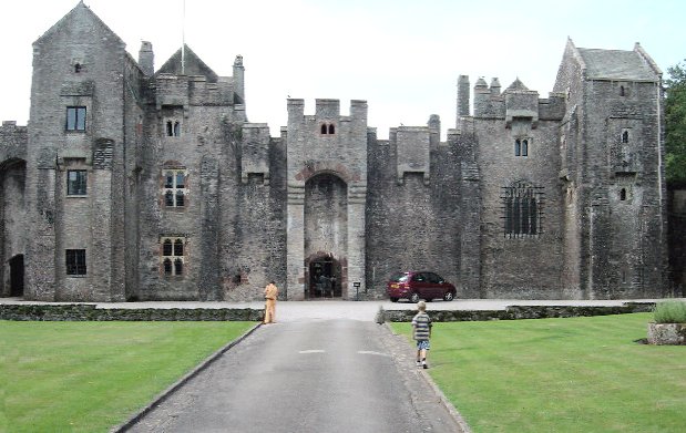
Compton Castle

Compton Castle in the parish of Marldon in Devon, is a fortified manor house in the village of Compton (formerly "Compton Pole"), about 5 miles (8 km)...

Occombe Valley Woods

Occombe Valley Woods is a Local Nature Reserve near Paignton in Devon. It is an ancient woodland owned by Torbay Borough Council, and managed by the Torbay...

Combe Fishacre

Combe Fishacre is a village in the English county of Devon. == References == The geographic coordinates are from the Ordnance Survey. == External links... ==

Nearby Amenities

Located within 500m of 50.463097,-3.603192
Door: hinged
Entrance: main
Lat/Long: 50.4609413/-3.5986909
Telephone
Booth: K6
Covered: booth
Listed Status: Grade II
Lat/Long: 50.4613617/-3.5982704
Marldon Airstrip
Aeroway: airstrip
Lat/Long: 50.4608826/-3.6078246
Post Box
Brand: Royal Mail
Brand Wikidata: Q638098
Brand Wikipedia: en:Royal Mail
Collection Plate: CP7
Collection Times: Mo-Fr 16:30; Sa 08:30; Su off
Operator: Royal Mail
Operator Wikidata: Q638098
Post Box Design: type_b
Post Box Mounting: brick_pillar
Post Box Type: wall
Ref: TQ3 117
Royal Cypher: GR
Royal Cypher Wikidata: Q33102273
Source: survey;streetlevel imagery;aerial imagery
Lat/Long: 50.4610782/-3.598024
The data included in this document is from www.openstreetmap.org. The data is made available under ODbL.

Have you been to Marldon?

Leave your review of Marldon below (or comments, questions and feedback).