Broompark

Settlement in Durham

England

Broompark

Brandon to Bishop Auckland Railway Path This is part of National Cycle Network route 70.
Brandon to Bishop Auckland Railway Path Credit: Clive Nicholson

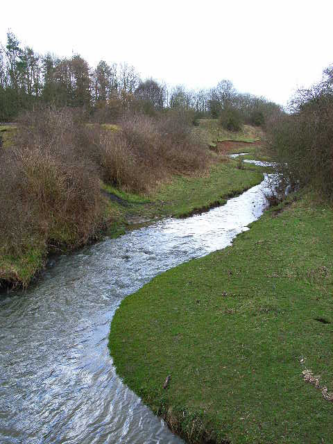
Broompark is a small village located in County Durham, in the northeast of England. Situated approximately 4 miles northwest of Durham city center, it lies within the civil parish of Brandon and Byshottles. Broompark is nestled between the River Browney and the River Deerness, offering picturesque views of the surrounding countryside.

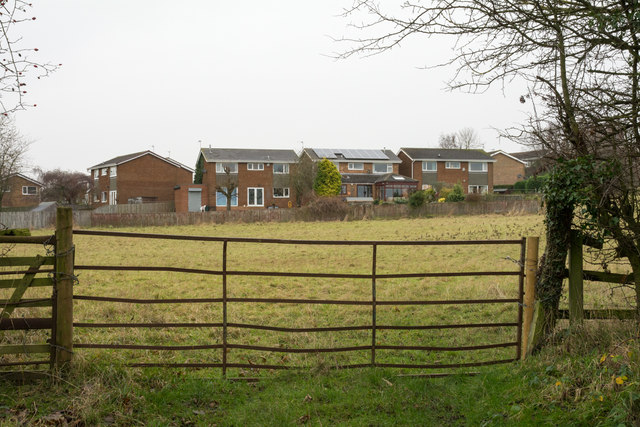
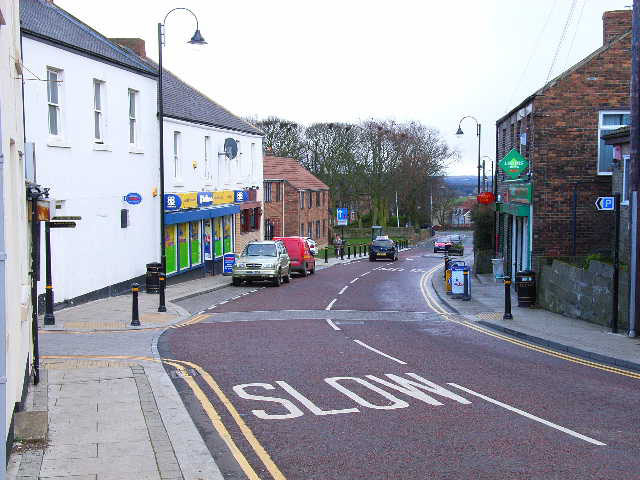
The village is primarily residential, with a mix of old stone houses and newer developments. It has a close-knit community feel, with a population of around 500 residents. Broompark is known for its peaceful and tranquil atmosphere, making it an ideal place for those seeking a quieter lifestyle away from the hustle and bustle of city living.

Despite its small size, Broompark is well-connected to the neighboring areas. The A690 road runs nearby, providing easy access to Durham, Sunderland, and the wider region. The village also benefits from regular bus services, ensuring convenient transportation links for its residents.

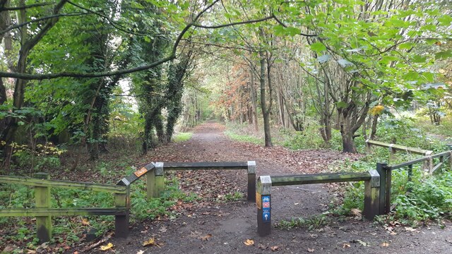
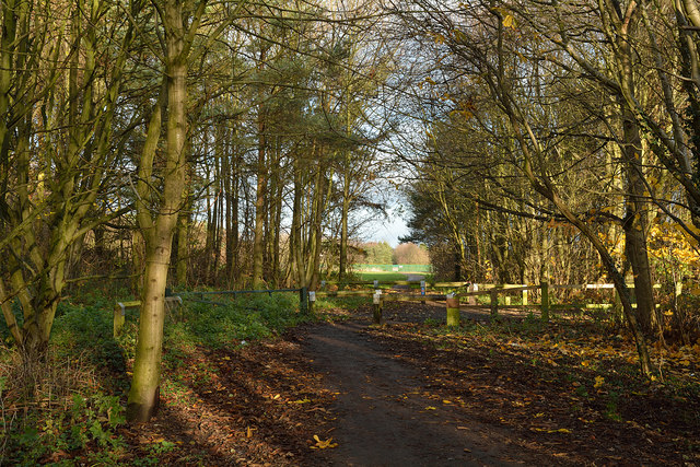
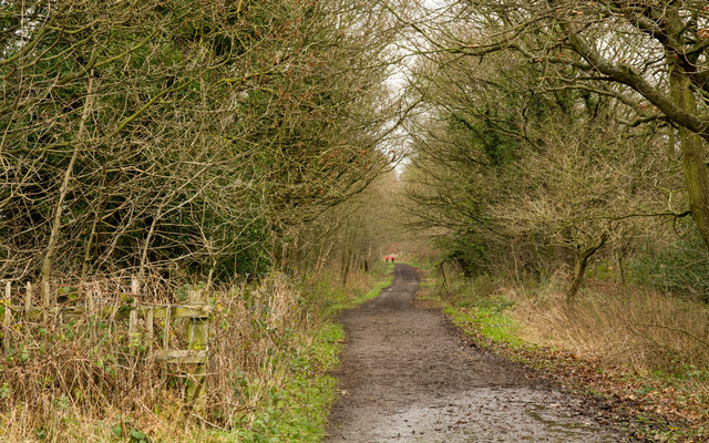
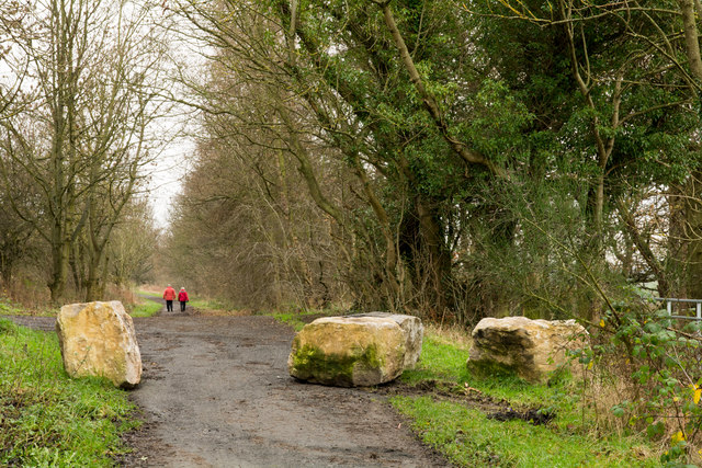
The natural beauty of Broompark is a major draw for visitors and residents alike. The nearby Houghall Woods and Browney Valley Nature Reserve offer opportunities for peaceful walks and wildlife spotting. The historic city of Durham is within easy reach, offering a wide range of amenities, including shops, restaurants, and cultural attractions such as Durham Cathedral and Durham Castle.

In summary, Broompark is a charming and tranquil village in County Durham, offering a peaceful lifestyle within reach of both nature and the amenities of nearby Durham city.

If you have any feedback on the listing, please let us know in the comments section below.
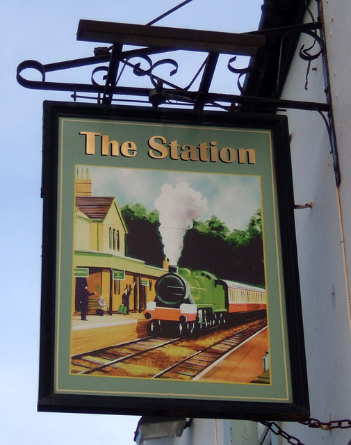
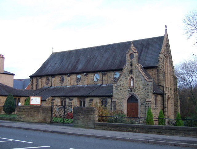
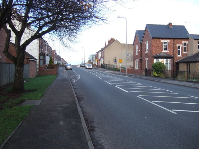
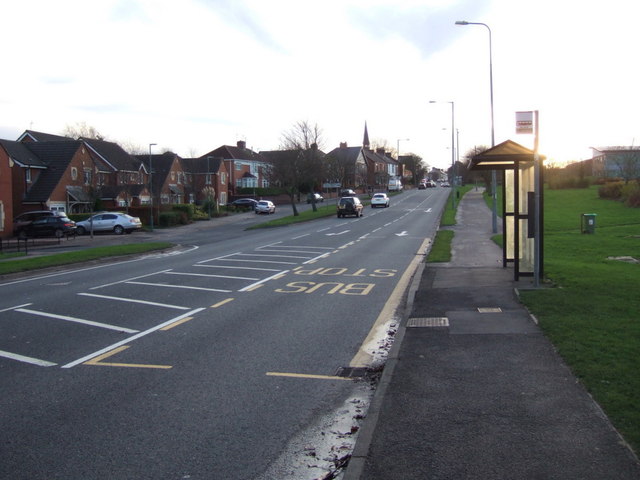
Broompark Images

Images are sourced within 2km of 54.769656/-1.623032 or Grid Reference NZ2441. Thanks to Geograph Open Source API. All images are credited.

Brandon to Bishop Auckland Railway Path This is part of National Cycle Network route 70.
Brandon to Bishop Auckland Railway Path
This is part of National Cycle Network route 70.
Farm Land North of Hett Looking in a north easterly direction toward Sunderland Bridge and Brandon
Farm Land North of Hett
Looking in a north easterly direction toward Sunderland Bridge and Brandon
Church of St John the Evangelist Parish church of Meadowfield, Brandon, near Durham.
Church of St John the Evangelist
Parish church of Meadowfield, Brandon, near Durham.
Brandon Cemetery
Brandon Cemetery
Brandon - Bishop Auckland Railway Path The Brandon to Bishop Auckland Railway Path here is passing between Brandon and Meadowfield, heading north-east.
Brandon - Bishop Auckland Railway Path
The Brandon to Bishop Auckland Railway Path here is passing between Brandon and Meadowfield, heading north-east.
St John the Evangelist Church, Meadowfield
Deerness Valley Walk below Broompark The Deerness Valley Railway Walk follows, as would be imagined, an old railway route, using its track bed. Much of the way, as at this location, passes through trees; those to the right in the image are of Cooke's West Wood.
Deerness Valley Walk below Broompark
The Deerness Valley Railway Walk follows, as would be imagined, an old railway route, using its track bed. Much of the way, as at this location, passes through trees; those to the right in the image are of Cooke's West Wood.
Boulders on Deerness Valley Railway Walk Immediately beyond the rocks a steep, rough road rises to the left reaching the B6302, Broom Lane, between Broompark and Ushaw Moor. They are surely in place to prevent vehicles descending to the railway path and then travelling along it in the direction of the camera!
Boulders on Deerness Valley Railway Walk
Immediately beyond the rocks a steep, rough road rises to the left reaching the B6302, Broom Lane, between Broompark and Ushaw Moor. They are surely in place to prevent vehicles descending to the railway path and then travelling along it in the direction of the camera!
Field beyond metal gate The field lies on the west side of a lane rising from the B6302 at the west end of the village of Broompark. The modern houses beyond the field maybe considered as being in Broompark or the neighbouring village of Ushaw Moor; they are closer to the former but the estate is more contiguous with the latter.
Field beyond metal gate
The field lies on the west side of a lane rising from the B6302 at the west end of the village of Broompark. The modern houses beyond the field maybe considered as being in Broompark or the neighbouring village of Ushaw Moor; they are closer to the former but the estate is more contiguous with the latter.
The Station Inn, Langley Moor On High Street South.
The Station Inn, Langley Moor
On High Street South.
Sign for the Station Inn, Langley Moor
The Duke Of Wellington public house, Durham An Ember Inn on Darlington Road.
The Duke Of Wellington public house, Durham
An Ember Inn on Darlington Road.
Sign for the Duke Of Wellington public house, Durham
War Memorial, Neville's Cross In front of St John's Church.
War Memorial, Neville's Cross
In front of St John's Church.
St John's Church, Neville's Cross
St Patrick's Church at Meadowfield
High Street (A690), Meadowfield Looking north east.
High Street (A690), Meadowfield
Looking north east.
Bus stop and shelter on High Street (A690), Meadowfield
Show me another place!

Broompark is located at Grid Ref: NZ2441 (Lat: 54.769656, Lng: -1.623032)

Unitary Authority: County Durham

Police Authority: Durham

What 3 Words

///candle.curving.bless. Near Ushaw Moor, Co. Durham

Related Wikis

Broompark

Broompark is a village in County Durham, England. It is situated some 3 miles (4.8 km) west of Durham city. It was once the site of the Broompark colliery...

River Deerness

The River Deerness in County Durham, England is a tributary to the River Browney, which is itself a tributary the River Wear. It rises near Tow Law and...

Aldin Grange for Bearpark railway station

Aldin Grange for Bearpark railway station was located on the Lanchester Valley Railway that operated in County Durham, England. The railway station opened...

Bearpark

Bearpark is a village and civil parish in County Durham in England. It is situated two and a half miles west of Durham, and a short distance to the north...

Nearby Amenities

Located within 500m of 54.769656,-1.623032
Broompark
Alt Name: Broom Park
Place: village
Wikidata: Q9180058
Wikipedia: en:Broompark
Lat/Long: 54.7706652/-1.6220522
Bus Stop
The Loves
Naptan AtcoCode: 13005054D
Naptan Bearing: SE
Naptan CommonName: The Loves
Naptan Indicator: south east bound
Naptan Landmark: opposite 19 Front Street
Naptan NaptanCode: durdgpag
Naptan PlusbusZoneRef: DRHM
Naptan Street: B6302 - Broom Lane
Naptan Verified: yes
Source: naptan_import; survey
Lat/Long: 54.7706751/-1.6224376
Bus Stop
The Loves
Bench: no
Bin: yes
Bus: yes
Departures Board: timetable
Naptan AtcoCode: 13005054H
Naptan Bearing: NW
Naptan CommonName: The Loves
Naptan Indicator: north west bound
Naptan Landmark: 12m east of 19 Front Street
Naptan NaptanCode: durdgpaj
Naptan PlusbusZoneRef: DRHM
Naptan Street: B6302 - Broom Lane
Naptan Verified: yes
Public Transport: platform
Shelter: yes
Source: naptan_import; survey
Lat/Long: 54.7704482/-1.6219416
Bus Stop
Broomhall Drive
Bus: yes
Naptan AtcoCode: 13005055D
Naptan Bearing: SE
Naptan CommonName: Broomhall Drive
Naptan Indicator: south east bound
Naptan Landmark: Landmark not known
Naptan NaptanCode: durdgpam
Naptan Notes: On Broom Lane- 10m east of boundary of 6 Alderdene Close- Ushaw Moor
Naptan Street: B6302 - Broom Lane
Naptan Verified: no
Public Transport: platform
Source: naptan_import
Lat/Long: 54.7727049/-1.6283202
Turning Circle
Lat/Long: 54.7691516/-1.6222473
Post Box
Brand: Royal Mail
Brand Wikidata: Q638098
Collection Times: Mo-Fr 09:00; Sa 07:00
Operator: Royal Mail
Operator Wikidata: Q638098
Ref: DH7 62
Royal Cypher: EIIR
Royal Cypher Wikidata: Q33102113
Lat/Long: 54.7704687/-1.6220551
Barrier: stile
Foot: yes
Lat/Long: 54.767642/-1.6296137
Barrier: stile
Lat/Long: 54.7678685/-1.6292932
Barrier: stile
Stile: stepover
Lat/Long: 54.7679395/-1.6291167
Bench
Backrest: yes
Lat/Long: 54.7691239/-1.6165191
Bench
Backrest: yes
Lat/Long: 54.7697111/-1.6282591
Power: pole
Lat/Long: 54.7704569/-1.6193689
Power: pole
Lat/Long: 54.7713102/-1.6184033
Power: pole
Lat/Long: 54.7721596/-1.6174136
Power: pole
Lat/Long: 54.7655077/-1.6214517
Power: pole
Lat/Long: 54.7662474/-1.6211271
Power: pole
Lat/Long: 54.7669275/-1.6207972
Power: pole
Lat/Long: 54.767322/-1.6206363
Power: pole
Lat/Long: 54.7679975/-1.620305
Broom Farm Guest House
Addr City: Durham
Addr Postcode: DH7 7QX
Addr Street: Front Street
Addr Village: Broompark
Fhrs Id: 537036
Source Addr: FHRS Open Data
Tourism: guest_house
Lat/Long: 54.7707029/-1.6218775
Noexit: yes
Lat/Long: 54.7702797/-1.6222321
Generator Method: photovoltaic
Generator Output Electricity: yes
Generator Source: solar
Generator Type: solar_photovoltaic_panel
Location: roof
Power: generator
Lat/Long: 54.7735667/-1.6254187
Generator Method: photovoltaic
Generator Output Electricity: yes
Generator Source: solar
Generator Type: solar_photovoltaic_panel
Location: roof
Power: generator
Lat/Long: 54.773313/-1.6260061
Generator Method: photovoltaic
Generator Output Electricity: yes
Generator Source: solar
Generator Type: solar_photovoltaic_panel
Location: roof
Power: generator
Lat/Long: 54.7734507/-1.6258585
Generator Method: photovoltaic
Generator Output Electricity: yes
Generator Source: solar
Generator Type: solar_photovoltaic_panel
Location: roof
Power: generator
Lat/Long: 54.7735389/-1.6263843
Generator Method: photovoltaic
Generator Output Electricity: yes
Generator Source: solar
Generator Type: solar_photovoltaic_panel
Location: roof
Power: generator
Lat/Long: 54.7702464/-1.6247454
Generator Method: photovoltaic
Generator Output Electricity: yes
Generator Source: solar
Generator Type: solar_photovoltaic_panel
Location: roof
Power: generator
Lat/Long: 54.7698349/-1.624032
Generator Method: photovoltaic
Generator Output Electricity: yes
Generator Source: solar
Generator Type: solar_photovoltaic_panel
Location: roof
Power: generator
Lat/Long: 54.7701915/-1.6224816
Generator Method: photovoltaic
Generator Output Electricity: yes
Generator Source: solar
Generator Type: solar_photovoltaic_panel
Location: roof
Power: generator
Lat/Long: 54.7688748/-1.6204847
Generator Method: photovoltaic
Generator Output Electricity: yes
Generator Source: solar
Generator Type: solar_photovoltaic_panel
Location: roof
Power: generator
Lat/Long: 54.7685777/-1.6204083
The data included in this document is from www.openstreetmap.org. The data is made available under ODbL.

Have you been to Broompark?

Leave your review of Broompark below (or comments, questions and feedback).