Broomhill

Settlement in Nottinghamshire Ashfield

England

Broomhill

Cycle and foot path beside Bishop's Way Part of NCN route 6.
Cycle and foot path beside Bishop's Way Credit: David Lally

Broomhill is a small rural village located in the county of Nottinghamshire in England. Situated about 5 miles north of Retford, it is nestled amidst picturesque countryside and rolling hills. The village is part of the Bassetlaw district and falls within the East Midlands region.

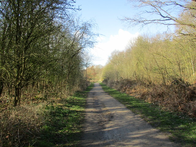
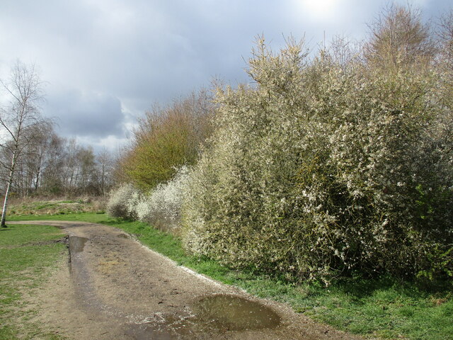
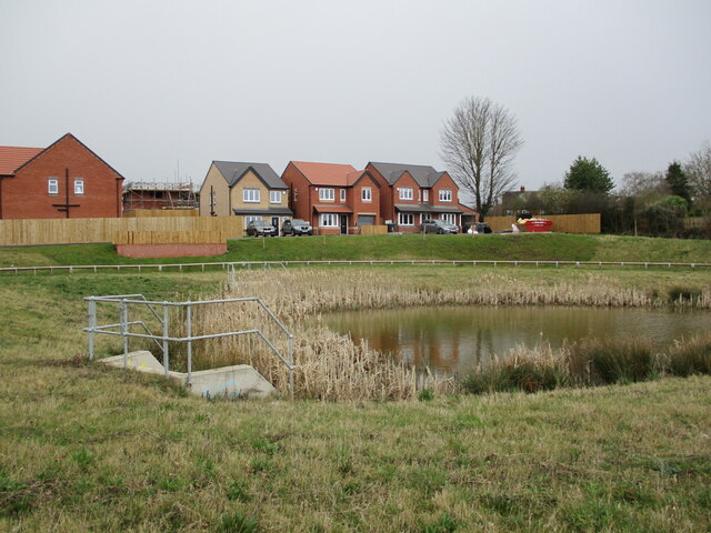
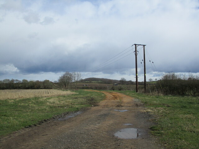
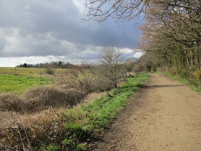
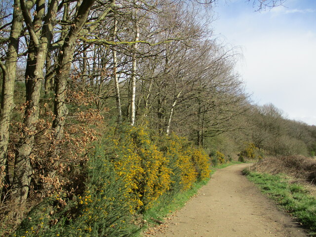
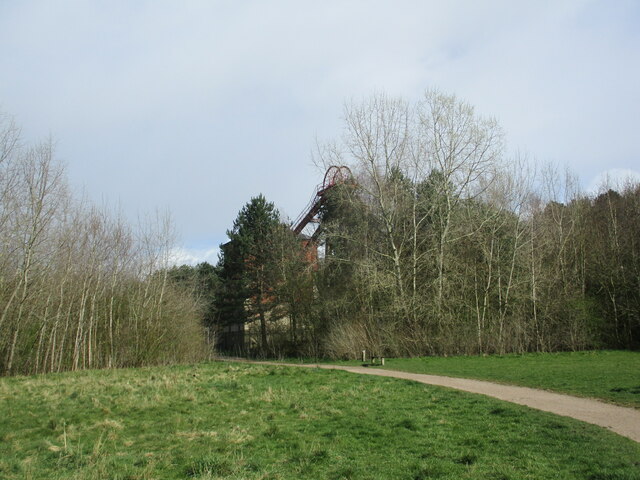
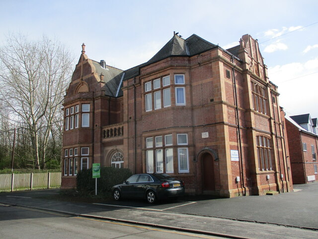
Broomhill is characterized by its tranquil and idyllic setting, making it a popular destination for nature lovers and those seeking a peaceful retreat. The village is surrounded by lush green fields and meadows, dotted with charming traditional cottages and farmhouses. The landscape also features small woodlands and hedgerows, adding to its scenic beauty.

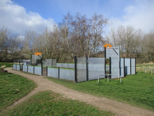
Despite its small size, Broomhill boasts a strong sense of community, with friendly and welcoming residents. The village has a close-knit atmosphere and organizes various community events throughout the year, such as fairs and festivals, which bring together locals and visitors alike.

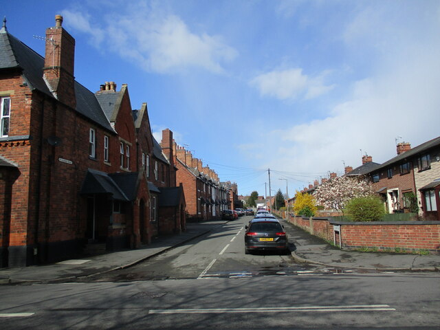
The village is well-connected to nearby towns and cities, with good transport links including road and rail networks. This allows residents to easily access amenities and services available in the surrounding areas. Broomhill also benefits from the proximity to the larger town of Retford, which provides a wider range of shops, schools, and healthcare facilities.

In summary, Broomhill is a charming rural village in Nottinghamshire, offering a peaceful and picturesque environment for its residents. With its strong community spirit and convenient location, it provides a desirable place to live for those seeking a countryside lifestyle with access to nearby amenities.

If you have any feedback on the listing, please let us know in the comments section below.
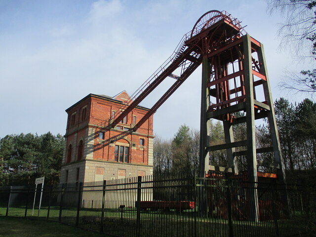
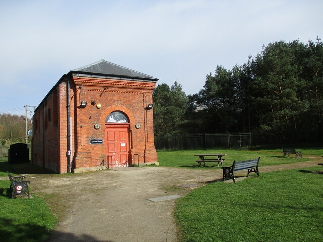
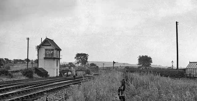
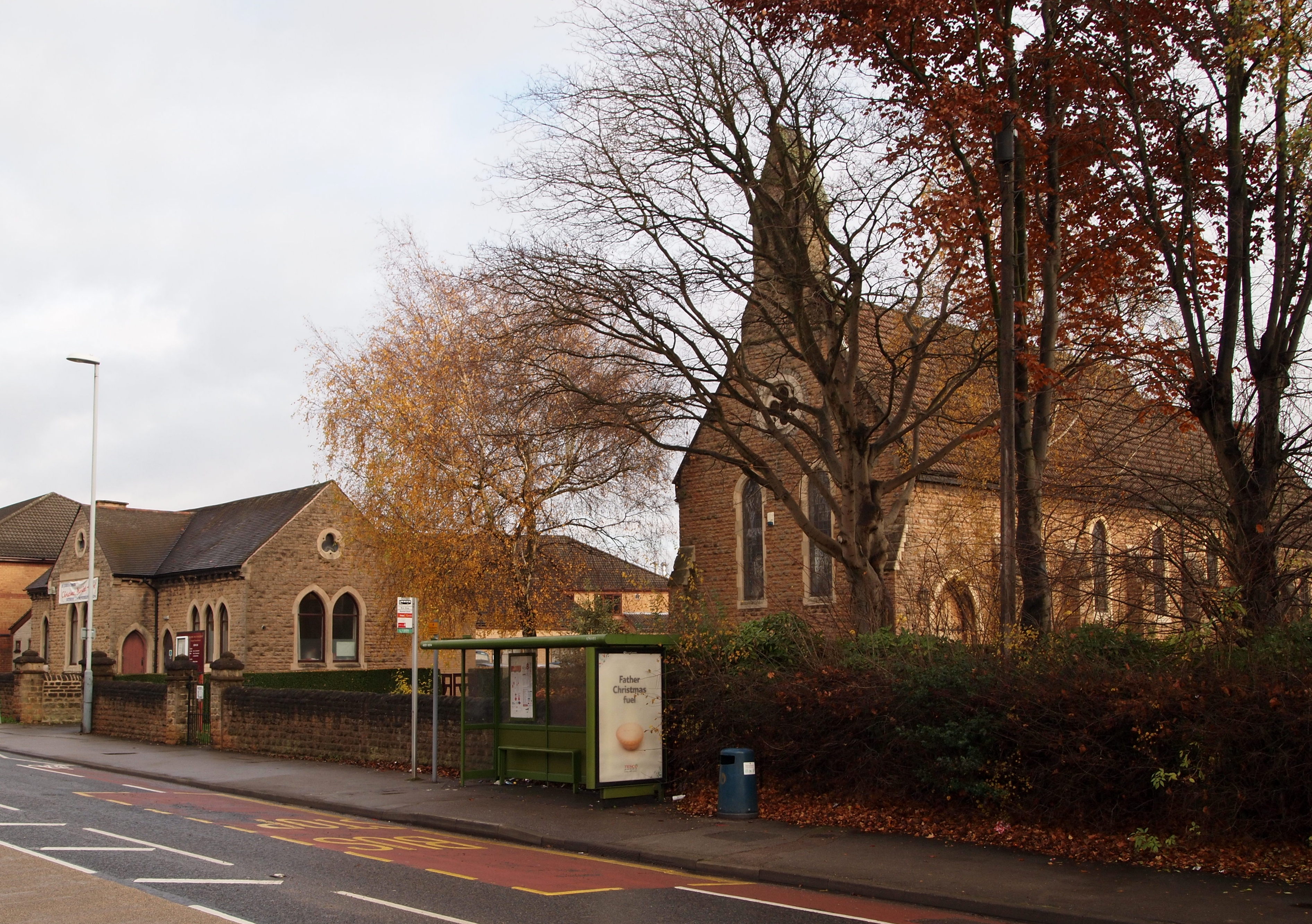
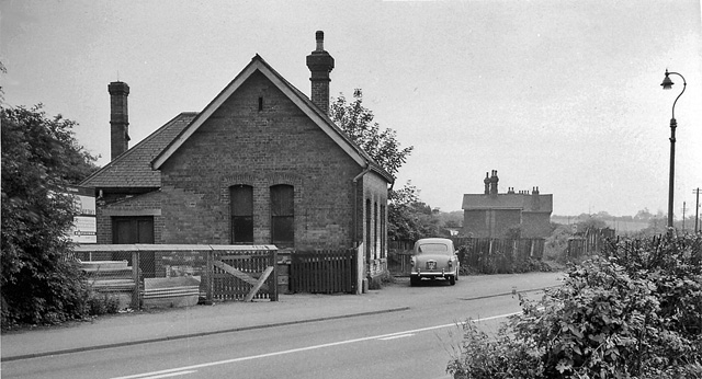
Broomhill Images

Images are sourced within 2km of 53.027417/-1.191085 or Grid Reference SK5448. Thanks to Geograph Open Source API. All images are credited.

Cycle and foot path beside Bishop's Way Part of NCN route 6.
Cycle and foot path beside Bishop's Way
Part of NCN route 6.
Track to Bestwood Village, Bestwood Country Park
Footpath and blackthorn, Bestwood Country Park
New housing and balancing pond, Bestwood Village
Farm track off Goosedale Lane
Track to Bestwood Village, Bestwood Country Park
Gorse by a track, Bestwood Country Park
Winding House and Headstocks at the former Bestwood Colliery Date from 1873 <span class="nowrap"><a title="https://historicengland.org.uk/listing/the-list/list-entry/1235186?section=official-list-entry" rel="nofollow ugc noopener" href="https://historicengland.org.uk/listing/the-list/list-entry/1235186?section=official-list-entry">Link</a><img style="margin-left:2px;" alt="External link" title="External link - shift click to open in new window" src="https://s1.geograph.org.uk/img/external.png" width="10" height="10"/></span> The colliery closed in 1967.
Winding House and Headstocks at the former Bestwood Colliery
Date from 1873 LinkExternal link The colliery closed in 1967.
Dynamo House at the former Bestwood Colliery
Trees around the Winding House and Headstocks at the former Bestwood Colliery
MUGA at Bestwood Village Multi Use Games Area,
MUGA at Bestwood Village
Multi Use Games Area,
St, Albans Road, Bestwood Village Nineteenth century colliery housing on the left,
St, Albans Road, Bestwood Village
Nineteenth century colliery housing on the left,
The former Institute, Bestwood Village This became the Bestwood Hotel but is now in domestic use.
The former Institute, Bestwood Village
This became the Bestwood Hotel but is now in domestic use.
Former colliery housing, Bestwood Village
The Clock Tower, Bestwood Village The former offices of the Bestwood Coal and Iron Company <span class="nowrap"><a title="https://historicengland.org.uk/listing/the-list/list-entry/1470986?section=official-list-entry" rel="nofollow ugc noopener" href="https://historicengland.org.uk/listing/the-list/list-entry/1470986?section=official-list-entry">Link</a><img style="margin-left:2px;" alt="External link" title="External link - shift click to open in new window" src="https://s1.geograph.org.uk/img/external.png" width="10" height="10"/></span>
The Clock Tower, Bestwood Village
The former offices of the Bestwood Coal and Iron Company LinkExternal link
War memorial, Bestwood Village Dates from about 1920 <span class="nowrap"><a title="https://historicengland.org.uk/listing/the-list/list-entry/1227458?section=official-list-entry" rel="nofollow ugc noopener" href="https://historicengland.org.uk/listing/the-list/list-entry/1227458?section=official-list-entry">Link</a><img style="margin-left:2px;" alt="External link" title="External link - shift click to open in new window" src="https://s1.geograph.org.uk/img/external.png" width="10" height="10"/></span>
War memorial, Bestwood Village
Dates from about 1920 LinkExternal link
St. Mark's church, Bestwood Village Designed by J. Medland Taylor <span class="nowrap"><a title="https://manchestervictorianarchitects.org.uk/architects/james-medland-taylor" rel="nofollow ugc noopener" href="https://manchestervictorianarchitects.org.uk/architects/james-medland-taylor">Link</a><img style="margin-left:2px;" alt="External link" title="External link - shift click to open in new window" src="https://s1.geograph.org.uk/img/external.png" width="10" height="10"/></span> 1886-7.
St. Mark's church, Bestwood Village
Designed by J. Medland Taylor LinkExternal link 1886-7.
St, Mark's church, Bestwood Village Designed by J. Medland Taylor <span class="nowrap"><a title="https://manchestervictorianarchitects.org.uk/architects/james-medland-taylor" rel="nofollow ugc noopener" href="https://manchestervictorianarchitects.org.uk/architects/james-medland-taylor">Link</a><img style="margin-left:2px;" alt="External link" title="External link - shift click to open in new window" src="https://s1.geograph.org.uk/img/external.png" width="10" height="10"/></span> 1886-7.
St, Mark's church, Bestwood Village
Designed by J. Medland Taylor LinkExternal link 1886-7.
Show me another place!

Broomhill is located at Grid Ref: SK5448 (Lat: 53.027417, Lng: -1.191085)

Administrative County: Nottinghamshire

District: Ashfield

Police Authority: Nottinghamshire

What 3 Words

///jacket.played.smashes. Near Hucknall, Nottinghamshire

Nearby Locations

Broomhill Butler's Hill

Related Wikis

Butler's Hill

Butler's Hill is a residential area near to the town centre of Hucknall. It is approximately seven miles north-west of Nottingham, England. The Butler...

Butler's Hill tram stop

Butler's Hill is a tram stop on the Nottingham Express Transit network, serving the suburb of Butler's Hill, Ashfield in Nottinghamshire, England. The...

Butler's Hill railway station

Butler's Hill railway station was a former station on the Great Northern Railway's Nottingham to Shirebrook line.The station should not be confused with...

Church of St John the Evangelist, Hucknall

The Church of St John the Evangelist, Hucknall is a parish church in the Church of England in the Butler's Hill suburb of Hucknall, Nottinghamshire....

Whyburn

The Whyburn (known locally as Town Brook, and by the UK Government as Baker Lane Brook) is the main watercourse flowing through the town of Hucknall in...

Bestwood Colliery railway station

Bestwood Colliery railway station was a former station on the Great Northern Railway Nottingham to Shirebrook line. == References ==

Hucknall Urban District

Hucknall was an urban district in Nottinghamshire, England, from 1894 to 1974. It was created under the Local Government Act 1894 based on the Hucknall...

Bestwood St. Albans

Bestwood St. Albans is a former civil parish in the Gedling borough of Nottinghamshire, England. According to the 2001 census it had a population of 4...

Nearby Amenities

Located within 500m of 53.027417,-1.191085
Butler's Hill
Local Ref: NET39
Naptan AtcoCode: 3300NET39
Naptan Bearing: SE
Naptan CommonName: Tram Station
Naptan Indicator: Stop NET39
Naptan Landmark: Tram Station
Naptan NaptanCode: ntsamjpd
Naptan Notes: None
Naptan Street: Story Gardens
Naptan Verified: no
Network: Nottingham Express Transit
Operator: Tramlink Nottingham Ltd.
Public Transport: stop_position
Railway: tram_stop
Source: naptan_import
Tram: yes
Lat/Long: 53.0288407/-1.1885212
Crossing
Crossing: traffic_signals
Source: survey
Lat/Long: 53.0305462/-1.1956726
Bus Stop
Beardall Street
Bus: yes
Local Ref: AS0210
Naptan AtcoCode: 3300AS0210
Naptan Bearing: S
Naptan CommonName: Beardall Street
Naptan Crossing: Beardall Street
Naptan Indicator: opp
Naptan Landmark: St John Church
Naptan NaptanCode: ntsdwtgp
Naptan Notes: none
Naptan Street: Portland Road
Naptan Verified: yes
Public Transport: platform
Shelter: yes
Source: naptan_import
Lat/Long: 53.0302869/-1.1955609
Bus Stop
Beardall Street
Bus: yes
Local Ref: AS0211
Naptan AtcoCode: 3300AS0211
Naptan Bearing: N
Naptan CommonName: Beardall Street
Naptan Crossing: Beardall Street
Naptan Indicator: adj
Naptan Landmark: St John Church
Naptan NaptanCode: ntsdwtgt
Naptan Notes: none
Naptan Street: Portland Road
Naptan Verified: yes
Public Transport: platform
Shelter: yes
Source: naptan_import
Lat/Long: 53.0300726/-1.1957737
Bus Stop
Jenny Burton Way
Bus: yes
Local Ref: AS0212
Naptan AtcoCode: 3300AS0212
Naptan Bearing: NW
Naptan CommonName: Jenny Burton Way
Naptan Crossing: Jenny Burton Way
Naptan Indicator: opp
Naptan Landmark: The Bowman
Naptan NaptanCode: ntsdwtgw
Naptan Notes: none
Naptan Street: Nottingham Road
Naptan Verified: yes
Public Transport: platform
Shelter: no
Source: naptan_import
Lat/Long: 53.0268168/-1.1928969
Bus Stop
Cemetery
Bus: yes
Local Ref: AS0378
Naptan AtcoCode: 3300AS0378
Naptan Bearing: NE
Naptan CommonName: Cemetery
Naptan Crossing: Nottingham Road
Naptan Indicator: adj
Naptan Landmark: Cemetery
Naptan NaptanCode: ntsgajag
Naptan Notes: none
Naptan Street: Broomhill Road
Naptan Verified: yes
Public Transport: platform
Shelter: no
Source: naptan_import
Lat/Long: 53.0294295/-1.196397
Bus Stop
Cemetery
Bus: yes
Local Ref: AS0379
Naptan AtcoCode: 3300AS0379
Naptan Bearing: SW
Naptan CommonName: Cemetery
Naptan Crossing: Nottingham Road
Naptan Indicator: opp
Naptan Landmark: Cemetery
Naptan NaptanCode: ntsgajaj
Naptan Notes: none
Naptan Street: Broomhill Road
Naptan Verified: yes
Public Transport: platform
Shelter: yes
Source: naptan_import
Lat/Long: 53.0294369/-1.1961583
Bus Stop
Jenny Burton Way
Bus: yes
Naptan AtcoCode: 3300AS0493
Naptan Bearing: SE
Naptan CommonName: Jenny Burton Way
Naptan Crossing: Jenny Burton Way
Naptan Indicator: adj
Naptan Landmark: The Bowman
Naptan NaptanCode: ntsdtapd
Naptan Notes: none
Naptan Street: Nottingham Road
Naptan Verified: no
Public Transport: platform
Source: naptan_import
Lat/Long: 53.0264172/-1.192293
Railway: switch
Lat/Long: 53.0283263/-1.188232
Railway: switch
Lat/Long: 53.0293935/-1.1888683
Crossing
Crossing: uncontrolled
Crossing Island: yes
Lat/Long: 53.0307906/-1.1958393
Crossing
Crossing: unmarked
Tactile Paving: yes
Lat/Long: 53.0301369/-1.1909928
Turning Circle
Lat/Long: 53.0284473/-1.190381
Entrance: main
Lat/Long: 53.0305595/-1.1957977
Crossing
Crossing: uncontrolled
Crossing Island: yes
Crossing Markings: yes
Lat/Long: 53.0258442/-1.1918591
Crossing
Crossing: uncontrolled
Crossing Island: yes
Tactile Paving: yes
Lat/Long: 53.0297375/-1.1957741
Bus Stop
Shelton Avenue
Bench: no
Bus: yes
Local Ref: AS0776
Naptan AtcoCode: 3300AS0776
Naptan NaptanCode: ntsgtdgj
Public Transport: platform
Shelter: no
Source: survey
Lat/Long: 53.0238148/-1.1901596
Crossing
Crossing: uncontrolled
Crossing Island: yes
Crossing Markings: yes
Tactile Paving: yes
Lat/Long: 53.0230411/-1.1898167
Crossing
Crossing: uncontrolled
Crossing Island: yes
Crossing Markings: yes
Lat/Long: 53.0253609/-1.1914567
Crossing
Crossing: unmarked
Lat/Long: 53.025639/-1.193489
Post Box
Collection Times: Mo-Fr 09:00; Sa 07:00
Post Box Type: pillar
Ref: NG15 24D
Royal Cypher: EIIR
Royal Cypher Wikidata: Q33102113
Source: survey
Lat/Long: 53.030059/-1.1910196
Entrance: main
Lat/Long: 53.0309245/-1.1936391
Entrance: main
Lat/Long: 53.03111/-1.1938809
Childcare
The Rocking Horse Nursery
Addr Postcode: NG15 6AJ
Addr Street: Broomhill Road
Fhrs Id: 56279
Source: survey
Source Addr: FHRS Open Data
Lat/Long: 53.0281209/-1.1974141
Railway: level_crossing
Lat/Long: 53.0281696/-1.1880686
Railway: tram_level_crossing
Lat/Long: 53.0281816/-1.1881602
Bicycle Parking
Bicycle Parking: stands
Capacity: 8
Covered: no
Source: survey
Lat/Long: 53.0290026/-1.1888065
Give Way
Direction: backward
Lat/Long: 53.0297932/-1.1867497
Crossing
Crossing: unmarked
Tactile Paving: yes
Lat/Long: 53.0299829/-1.1906534
Give Way
Direction: forward
Lat/Long: 53.0300852/-1.1866612
Bus Stop
Shelton Avenue
Bench: no
Bus: yes
Local Ref: AS0777
Naptan AtcoCode: 3300AS0777
Naptan NaptanCode: ntsgtdgm
Public Transport: platform
Shelter: no
Source: survey
Lat/Long: 53.0240526/-1.1905186
Barrier: cycle_barrier
Lat/Long: 53.0259724/-1.1923506
Brickyard Lane Level Crossing
Crossing Barrier: half
Railway: tram_level_crossing
Lat/Long: 53.0312201/-1.1902804
Brickyard Lane Level Crossing
Crossing Barrier: half
Railway: level_crossing
Lat/Long: 53.0312415/-1.1901964
Direction: 175
Generator Method: photovoltaic
Generator Output Electricity: yes
Generator Solar Modules: 12
Generator Source: solar
Generator Type: solar_photovoltaic_panel
Location: roof
Power: generator
Lat/Long: 53.0243295/-1.1883162
Direction: SW
Generator Method: photovoltaic
Generator Output Electricity: yes
Generator Solar Modules: 16
Generator Source: solar
Generator Type: solar_photovoltaic_panel
Location: roof
Power: generator
Lat/Long: 53.0246859/-1.1921069
Direction: WSW
Generator Method: photovoltaic
Generator Output Electricity: yes
Generator Solar Modules: 16
Generator Source: solar
Generator Type: solar_photovoltaic_panel
Location: roof
Power: generator
Lat/Long: 53.0256079/-1.1923024
Direction: 215
Generator Method: photovoltaic
Generator Output Electricity: yes
Generator Solar Modules: 8
Generator Source: solar
Generator Type: solar_photovoltaic_panel
Location: roof
Power: generator
Lat/Long: 53.0272368/-1.1922031
Direction: 125
Generator Method: photovoltaic
Generator Output Electricity: yes
Generator Solar Modules: 8
Generator Source: solar
Generator Type: solar_photovoltaic_panel
Location: roof
Power: generator
Lat/Long: 53.027252/-1.1921381
Direction: 275
Generator Method: photovoltaic
Generator Output Electricity: yes
Generator Solar Modules: 12
Generator Source: solar
Generator Type: solar_photovoltaic_panel
Location: roof
Power: generator
Lat/Long: 53.0273964/-1.1907013
Direction: WSW
Generator Method: photovoltaic
Generator Output Electricity: yes
Generator Solar Modules: 6
Generator Source: solar
Generator Type: solar_photovoltaic_panel
Location: roof
Power: generator
Lat/Long: 53.0306774/-1.1904579
Direction: ENE
Generator Method: photovoltaic
Generator Output Electricity: yes
Generator Solar Modules: 6
Generator Source: solar
Generator Type: solar_photovoltaic_panel
Location: roof
Power: generator
Lat/Long: 53.0307/-1.1903908
Direction: WSW
Generator Method: photovoltaic
Generator Output Electricity: yes
Generator Solar Modules: 10
Generator Source: solar
Generator Type: solar_photovoltaic_panel
Location: roof
Power: generator
Lat/Long: 53.0308946/-1.1906104
Direction: 215
Generator Method: photovoltaic
Generator Output Electricity: yes
Generator Solar Modules: 13
Generator Source: solar
Generator Type: solar_photovoltaic_panel
Location: roof
Power: generator
Lat/Long: 53.0252925/-1.196718
Direction: 215
Generator Method: photovoltaic
Generator Output Electricity: yes
Generator Solar Modules: 13
Generator Source: solar
Generator Type: solar_photovoltaic_panel
Location: roof
Power: generator
Lat/Long: 53.025207/-1.1965276
Direction: S
Generator Method: photovoltaic
Generator Output Electricity: yes
Generator Solar Modules: 13
Generator Source: solar
Generator Type: solar_photovoltaic_panel
Location: roof
Power: generator
Lat/Long: 53.0258765/-1.1977668
Direction: S
Generator Method: photovoltaic
Generator Output Electricity: yes
Generator Solar Modules: 13
Generator Source: solar
Generator Type: solar_photovoltaic_panel
Location: roof
Power: generator
Lat/Long: 53.0259023/-1.197351
Direction: S
Generator Method: photovoltaic
Generator Output Electricity: yes
Generator Solar Modules: 13
Generator Source: solar
Generator Type: solar_photovoltaic_panel
Location: roof
Power: generator
Lat/Long: 53.0258991/-1.1972679
Direction: SE
Generator Method: photovoltaic
Generator Output Electricity: yes
Generator Solar Modules: 10
Generator Source: solar
Generator Type: solar_photovoltaic_panel
Location: roof
Power: generator
Lat/Long: 53.0274241/-1.1983851
Direction: 240
Generator Method: photovoltaic
Generator Output Electricity: yes
Generator Solar Modules: 4
Generator Source: solar
Generator Type: solar_photovoltaic_panel
Location: roof
Power: generator
Lat/Long: 53.0255322/-1.1891762
Direction: 240
Generator Method: photovoltaic
Generator Output Electricity: yes
Generator Solar Modules: 4
Generator Source: solar
Generator Type: solar_photovoltaic_panel
Location: roof
Power: generator
Lat/Long: 53.0254877/-1.1891312
Direction: 185
Generator Method: photovoltaic
Generator Output Electricity: yes
Generator Solar Modules: 10
Generator Source: solar
Generator Type: solar_photovoltaic_panel
Location: roof
Power: generator
Lat/Long: 53.0275307/-1.1905144
Direction: 190
Generator Method: photovoltaic
Generator Output Electricity: yes
Generator Solar Modules: 11
Generator Source: solar
Generator Type: solar_photovoltaic_panel
Location: roof
Power: generator
Lat/Long: 53.026845/-1.189051
Direction: 190
Generator Method: photovoltaic
Generator Output Electricity: yes
Generator Solar Modules: 11
Generator Source: solar
Generator Type: solar_photovoltaic_panel
Location: roof
Power: generator
Lat/Long: 53.0268299/-1.1889336
Direction: 175
Generator Method: photovoltaic
Generator Output Electricity: yes
Generator Solar Modules: 18
Generator Source: solar
Generator Type: solar_photovoltaic_panel
Location: roof
Power: generator
Lat/Long: 53.0269836/-1.1882225
Direction: 185
Generator Method: photovoltaic
Generator Output Electricity: yes
Generator Solar Modules: 10
Generator Source: solar
Generator Type: solar_photovoltaic_panel
Location: roof
Power: generator
Lat/Long: 53.0283302/-1.1911675
Bench
Lat/Long: 53.0277966/-1.1842318
Generator Method: photovoltaic
Generator Output Electricity: yes
Generator Source: solar
Generator Type: solar_photovoltaic_panel
Location: roof
Power: generator
Lat/Long: 53.0303029/-1.1864564
Crossing
Crossing: unmarked
Tactile Paving: yes
Lat/Long: 53.0296006/-1.1906314
Crossing
Crossing: unmarked
Tactile Paving: yes
Lat/Long: 53.0302582/-1.1911964
Crossing
Crossing: unmarked
Tactile Paving: yes
Lat/Long: 53.0304497/-1.1922644
Crossing
Crossing: unmarked
Tactile Paving: yes
Lat/Long: 53.0306444/-1.1929572
Crossing
Crossing: uncontrolled
Crossing Island: yes
Crossing Markings: yes
Tactile Paving: yes
Lat/Long: 53.0266555/-1.1926534
Crossing
Crossing: uncontrolled
Crossing Island: yes
Crossing Markings: yes
Tactile Paving: yes
Lat/Long: 53.0248415/-1.1910441
Give Way
Direction: forward
Lat/Long: 53.0307902/-1.195769
Crossing
Crossing: uncontrolled
Crossing Island: yes
Crossing Markings: yes
Lat/Long: 53.027211/-1.1932227
Generator Method: photovoltaic
Generator Output Electricity: yes
Generator Source: solar
Generator Type: solar_photovoltaic_panel
Location: roof
Power: generator
Lat/Long: 53.0266693/-1.1897991
Generator Method: photovoltaic
Generator Output Electricity: yes
Generator Source: solar
Generator Type: solar_photovoltaic_panel
Location: roof
Power: generator
Lat/Long: 53.02803/-1.1957972
Generator Method: photovoltaic
Generator Output Electricity: yes
Generator Source: solar
Generator Type: solar_photovoltaic_panel
Location: roof
Power: generator
Lat/Long: 53.0280978/-1.1958575
Generator Method: photovoltaic
Generator Output Electricity: yes
Generator Source: solar
Generator Type: solar_photovoltaic_panel
Location: roof
Power: generator
Lat/Long: 53.0288713/-1.1965013
Generator Method: photovoltaic
Generator Output Electricity: yes
Generator Source: solar
Generator Type: solar_photovoltaic_panel
Location: roof
Power: generator
Lat/Long: 53.0287333/-1.1965388
Generator Method: photovoltaic
Generator Output Electricity: yes
Generator Source: solar
Generator Type: solar_photovoltaic_panel
Location: roof
Power: generator
Lat/Long: 53.0286075/-1.1964342
Generator Method: photovoltaic
Generator Output Electricity: yes
Generator Source: solar
Generator Type: solar_photovoltaic_panel
Location: roof
Power: generator
Lat/Long: 53.0285543/-1.196689
Crossing
Crossing: uncontrolled
Crossing Island: yes
Crossing Markings: yes
Lat/Long: 53.0242428/-1.1905714
Turning Circle
Lat/Long: 53.0299959/-1.1938821
Crossing
Crossing: uncontrolled
Crossing Island: yes
Crossing Markings: no
Tactile Paving: yes
Lat/Long: 53.0249919/-1.1913645
Crossing
Crossing: unmarked
Crossing Island: yes
Tactile Paving: yes
Lat/Long: 53.0246721/-1.1907129
Generator Method: photovoltaic
Generator Output Electricity: yes
Generator Source: solar
Generator Type: solar_photovoltaic_panel
Location: roof
Power: generator
Lat/Long: 53.0237642/-1.1906715
Generator Method: photovoltaic
Generator Output Electricity: yes
Generator Source: solar
Generator Type: solar_photovoltaic_panel
Location: roof
Power: generator
Lat/Long: 53.0269605/-1.1942247
Generator Method: photovoltaic
Generator Output Electricity: yes
Generator Source: solar
Generator Type: solar_photovoltaic_panel
Location: roof
Power: generator
Lat/Long: 53.026952/-1.1943052
Give Way
Direction: backward
Lat/Long: 53.0278486/-1.1979668
Give Way
Direction: forward
Lat/Long: 53.0276593/-1.1935593
Give Way
Direction: backward
Lat/Long: 53.0267638/-1.1928353
Give Way
Direction: forward
Lat/Long: 53.0250164/-1.1912749
Crossing
Crossing: uncontrolled
Crossing Island: no
Tactile Paving: yes
Lat/Long: 53.0297817/-1.1959924
Give Way
Direction: backward
Lat/Long: 53.0297558/-1.1959678
Give Way
Direction: forward
Lat/Long: 53.0297417/-1.1957225
Butler's Hill
Historic Railway: station
Railway: site
Wikidata: Q5002544
Wikipedia: en:Butler's Hill railway station
Lat/Long: 53.0306259/-1.1902904
Crossing
Crossing: unmarked
Crossing Markings: no
Lat/Long: 53.0240048/-1.1905088
Crossing
Crossing: unmarked
Crossing Markings: no
Lat/Long: 53.0242346/-1.1906741
Crossing
Crossing: unmarked
Crossing Markings: no
Lat/Long: 53.0260406/-1.1921213
Crossing
Crossing: unmarked
Crossing Markings: no
Lat/Long: 53.0262158/-1.1922822
Crossing
Crossing: unmarked
Crossing Markings: no
Lat/Long: 53.0267576/-1.192852
Crossing
Crossing: unmarked
Crossing Markings: no
Lat/Long: 53.0273149/-1.1934029
Butlers Hill
Place: suburb
Lat/Long: 53.0298797/-1.1920635
Broomhill
Place: suburb
Lat/Long: 53.0259147/-1.1930603
The data included in this document is from www.openstreetmap.org. The data is made available under ODbL.

Have you been to Broomhill?

Leave your review of Broomhill below (or comments, questions and feedback).