Lyme Handley

Civil Parish in Cheshire

England

Lyme Handley

Bakestonedale Brickworks Brick-making started here in around 1820 due to readily accessible clay and coal. From the late 19th century the Hammond family were producing specialist firebricks. The brickworks extended either side of the road, and several kiln chimneys survive. Mining ceased in 1956 and brick-making in 1968 although Hammonds continued to make refractory materials until the 1990s. Since then the works have been developed into small business units and the area still an air of prosperity. For more of the history, see <span class="nowrap"><a title="https://www.williamhammondltd.com/history" rel="nofollow ugc noopener" href="https://www.williamhammondltd.com/history">Link</a><img style="margin-left:2px;" alt="External link" title="External link - shift click to open in new window" src="https://s1.geograph.org.uk/img/external.png" width="10" height="10"/></span> .
Bakestonedale Brickworks Credit: Alan Murray-Rust

Lyme Handley is a civil parish located in the county of Cheshire, England. It is situated within the borough of Macclesfield and encompasses an area of approximately 3.5 square miles. The parish is located in the eastern part of the county, close to the border with Derbyshire.

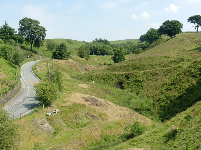
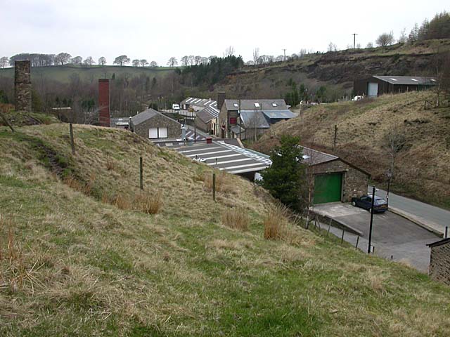
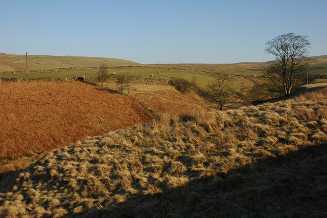
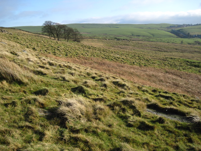
Lyme Handley is a rural area characterized by its picturesque landscapes and rolling hills. It is predominantly agricultural, with farming and livestock rearing being the main economic activities. The village itself is small and compact, with a population of around 200 residents.

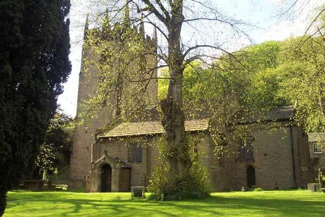
The parish is known for its rich history, dating back to the medieval period. It was mentioned in the Domesday Book of 1086 and has since retained much of its traditional charm. There are several historic buildings and landmarks in the area, including St. Thomas' Church, which dates back to the 12th century, and Lyme Hall, a grand country house built in the 16th century.

Lyme Handley offers a peaceful and tranquil environment, attracting visitors who appreciate its natural beauty and the opportunity for outdoor activities such as hiking, cycling, and horse riding. The area is also home to a variety of wildlife, making it popular among nature enthusiasts and birdwatchers.

Overall, Lyme Handley is a charming and idyllic civil parish, offering a glimpse into the rural heritage of Cheshire. Its historical significance, coupled with its natural beauty, make it a desirable destination for those seeking a quiet retreat in the English countryside.

If you have any feedback on the listing, please let us know in the comments section below.
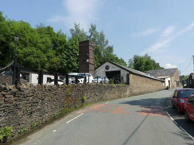
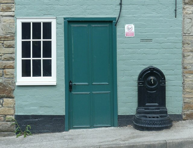
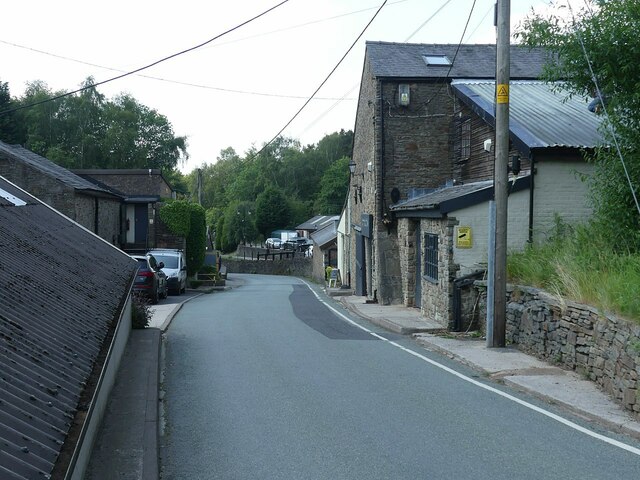
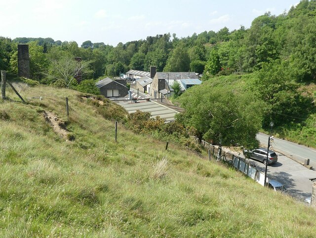
Lyme Handley Images

Images are sourced within 2km of 53.329061/-2.068976 or Grid Reference SJ9581. Thanks to Geograph Open Source API. All images are credited.

Bakestonedale Brickworks Brick-making started here in around 1820 due to readily accessible clay and coal. From the late 19th century the Hammond family were producing specialist firebricks. The brickworks extended either side of the road, and several kiln chimneys survive. Mining ceased in 1956 and brick-making in 1968 although Hammonds continued to make refractory materials until the 1990s. Since then the works have been developed into small business units and the area still an air of prosperity. For more of the history, see <span class="nowrap"><a title="https://www.williamhammondltd.com/history" rel="nofollow ugc noopener" href="https://www.williamhammondltd.com/history">Link</a><img style="margin-left:2px;" alt="External link" title="External link - shift click to open in new window" src="https://s1.geograph.org.uk/img/external.png" width="10" height="10"/></span> .
Bakestonedale Brickworks
Brick-making started here in around 1820 due to readily accessible clay and coal. From the late 19th century the Hammond family were producing specialist firebricks. The brickworks extended either side of the road, and several kiln chimneys survive. Mining ceased in 1956 and brick-making in 1968 although Hammonds continued to make refractory materials until the 1990s. Since then the works have been developed into small business units and the area still an air of prosperity. For more of the history, see LinkExternal link .
Bakestonedale Brickworks 'Cottage' entrance and drinking water supply. It's not clear whether this was in practice a dwelling or a small office.
Bakestonedale Brickworks
'Cottage' entrance and drinking water supply. It's not clear whether this was in practice a dwelling or a small office.
Bakestonedale Brickworks Brick-making started here in around 1820 due to readily accessible clay and coal. From the late 19th century the Hammond family were producing specialist firebricks. The brickworks extended either side of the road, and several kiln chimneys survive. Mining ceased in 1956 and brick-making in 1968 although Hammonds continued to make refractory materials until the 1990s. Since then the works have been developed into small business units and the area still an air of prosperity. For more of the history, see <span class="nowrap"><a title="https://www.williamhammondltd.com/history" rel="nofollow ugc noopener" href="https://www.williamhammondltd.com/history">Link</a><img style="margin-left:2px;" alt="External link" title="External link - shift click to open in new window" src="https://s1.geograph.org.uk/img/external.png" width="10" height="10"/></span> .
Bakestonedale Brickworks
Brick-making started here in around 1820 due to readily accessible clay and coal. From the late 19th century the Hammond family were producing specialist firebricks. The brickworks extended either side of the road, and several kiln chimneys survive. Mining ceased in 1956 and brick-making in 1968 although Hammonds continued to make refractory materials until the 1990s. Since then the works have been developed into small business units and the area still an air of prosperity. For more of the history, see LinkExternal link .
Old Brickworks Recreating this 'First' for the square <a title="https://www.geograph.org.uk/photo/61820" href="https://www.geograph.org.uk/photo/61820">Link</a> .

Brick-making started here in around 1820 due to readily accessible clay and coal. From the late 19th century the Hammond family were producing specialist firebricks. The brickworks extended either side of the road, and several kiln chimneys survive. Mining ceased in 1956 and brick-making in 1968 although Hammonds continued to make refractory materials until the 1990s. Since then the works have been developed into small business units and the area still an air of prosperity. For more of the history, see <span class="nowrap"><a title="https://www.williamhammondltd.com/history" rel="nofollow ugc noopener" href="https://www.williamhammondltd.com/history">Link</a><img style="margin-left:2px;" alt="External link" title="External link - shift click to open in new window" src="https://s1.geograph.org.uk/img/external.png" width="10" height="10"/></span> .
Old Brickworks
Recreating this 'First' for the square Link . Brick-making started here in around 1820 due to readily accessible clay and coal. From the late 19th century the Hammond family were producing specialist firebricks. The brickworks extended either side of the road, and several kiln chimneys survive. Mining ceased in 1956 and brick-making in 1968 although Hammonds continued to make refractory materials until the 1990s. Since then the works have been developed into small business units and the area still an air of prosperity. For more of the history, see LinkExternal link .
Bakestonedale Looking up the dale from the former brickworks. The spoil tips alongside the road are evidence of the working of coal in the area.
Bakestonedale
Looking up the dale from the former brickworks. The spoil tips alongside the road are evidence of the working of coal in the area.
Skeleton Sculpture, Old Brickworks This has clearly taken a few steps across the yard since 2020 <a title="https://www.geograph.org.uk/photo/6562702" href="https://www.geograph.org.uk/photo/6562702">Link</a> !
Skeleton Sculpture, Old Brickworks
This has clearly taken a few steps across the yard since 2020 Link !
Old Brickworks The old Hammond's firebrick works at Bakestonedale is now a small industrial estate.
Old Brickworks
The old Hammond's firebrick works at Bakestonedale is now a small industrial estate.
Bakestonedale Moor Bakestonedale Moor viewed from Bakestonedale Road to the east of Pott Shrigley.
Bakestonedale Moor
Bakestonedale Moor viewed from Bakestonedale Road to the east of Pott Shrigley.
Shrigley Hall Hotel Shrigley Hall Hotel is a former country house which is now owned by the Spanish hotel chain Barcelo. The hotel grounds amount to a 262 acres golf course. This building has been a hotel since 1989, my old OS map from the 1970s indicates that this building used to be a college.  I have since been informed that it was a Catholic Seminary.
Shrigley Hall Hotel
Shrigley Hall Hotel is a former country house which is now owned by the Spanish hotel chain Barcelo. The hotel grounds amount to a 262 acres golf course. This building has been a hotel since 1989, my old OS map from the 1970s indicates that this building used to be a college. I have since been informed that it was a Catholic Seminary.
Shrigley Hall Hotel Shrigley Hall Hotel is a former country house which is now owned by the Spanish hotel chain Barcelo. The hotel grounds amount to a 262 acres golf course. This building has been a hotel since 1989.
Shrigley Hall Hotel
Shrigley Hall Hotel is a former country house which is now owned by the Spanish hotel chain Barcelo. The hotel grounds amount to a 262 acres golf course. This building has been a hotel since 1989.
Leisure complex, Shrigley Hall Hall The entrance to the pool and leisure complex at Shrigley Hall Hotel. The swimming pool is in the former church.
Leisure complex, Shrigley Hall Hall
The entrance to the pool and leisure complex at Shrigley Hall Hotel. The swimming pool is in the former church.
Interior of Shrigley Hall Hotel Dome interior of the stairway in Shrigley Hall Hotel.
Interior of Shrigley Hall Hotel
Dome interior of the stairway in Shrigley Hall Hotel.
Shrigley Hall Grade II* listed mansion, built in around 1825 for a Blackburn mill owner, Sir William Turner, to replace a previous building owned by the Downes family.  Later in 19th century it passed by marriage to the Lowther family.  Following the death in 1928 of the last surviving member of that family, it was sold in 1929 for the grand sum of £8,000 to the Roman Catholic order, the Salesian Society, who ran it as a missionary college.  The college closed in 1983, having educated over 2000 boys during its lifetime.  In 1985 the estate was sold, after which the hall was converted into a hotel, with a golf course being created in the grounds, designed by Donald Steel.

On the right is the grade II listed chapel, built as a shrine to Don Bosco, the founder of the Salesian Order.  The first sod was cut on 1 April 1934, the date of Don Bosco's canonisation in Rome.  It was designed by Philip Tilden and completed in 1938.  It now houses the health club for the hotel.

For listing particulars of the two buildings, see <span class="nowrap"><a title="www.historicengland.org.uk/listing/the-list/list-entry/1232168" rel="nofollow ugc noopener" href="http://www.historicengland.org.uk/listing/the-list/list-entry/1232168">Link</a><img style="margin-left:2px;" alt="External link" title="External link - shift click to open in new window" src="https://s1.geograph.org.uk/img/external.png" width="10" height="10"/></span> and <span class="nowrap"><a title="www.historicengland.org.uk/listing/the-list/list-entry/1232118" rel="nofollow ugc noopener" href="http://www.historicengland.org.uk/listing/the-list/list-entry/1232118">Link</a><img style="margin-left:2px;" alt="External link" title="External link - shift click to open in new window" src="https://s1.geograph.org.uk/img/external.png" width="10" height="10"/></span>.
Shrigley Hall
Grade II* listed mansion, built in around 1825 for a Blackburn mill owner, Sir William Turner, to replace a previous building owned by the Downes family. Later in 19th century it passed by marriage to the Lowther family. Following the death in 1928 of the last surviving member of that family, it was sold in 1929 for the grand sum of £8,000 to the Roman Catholic order, the Salesian Society, who ran it as a missionary college. The college closed in 1983, having educated over 2000 boys during its lifetime. In 1985 the estate was sold, after which the hall was converted into a hotel, with a golf course being created in the grounds, designed by Donald Steel. On the right is the grade II listed chapel, built as a shrine to Don Bosco, the founder of the Salesian Order. The first sod was cut on 1 April 1934, the date of Don Bosco's canonisation in Rome. It was designed by Philip Tilden and completed in 1938. It now houses the health club for the hotel. For listing particulars of the two buildings, see LinkExternal link and LinkExternal link.
Pott Mill Farm A farm off Bakestonedate Road, viewed from the edge of Shrigley Hall Golf Course.
Pott Mill Farm
A farm off Bakestonedate Road, viewed from the edge of Shrigley Hall Golf Course.
Pott Mill Farm and Moorside Quarry Pott Mill Farm with the former Moorside Quarry beyond.
Pott Mill Farm and Moorside Quarry
Pott Mill Farm with the former Moorside Quarry beyond.
Shrigley Hall The facade of this Grade II* listed mansion, built in around 1825 for a Blackburn mill owner, Sir William Turner, to replace a previous building owned by the Downes family.  Later in 19th century it passed by marriage to the Lowther family.  Following the death in 1928 of the last surviving member of that family, it was sold in 1929 for the grand sum of £8,000 to the Roman Catholic order, the Salesian Society, who ran it as a missionary college.  The college closed in 1983, having educated over 2000 boys during its lifetime.  In 1985 the estate was sold, after which the hall was converted into a hotel, with a golf course being created in the grounds, designed by Donald Steel.

For listing particulars, see <span class="nowrap"><a title="www.historicengland.org.uk/listing/the-list/list-entry/1232168" rel="nofollow ugc noopener" href="http://www.historicengland.org.uk/listing/the-list/list-entry/1232168">Link</a><img style="margin-left:2px;" alt="External link" title="External link - shift click to open in new window" src="https://s1.geograph.org.uk/img/external.png" width="10" height="10"/></span>.
Shrigley Hall
The facade of this Grade II* listed mansion, built in around 1825 for a Blackburn mill owner, Sir William Turner, to replace a previous building owned by the Downes family. Later in 19th century it passed by marriage to the Lowther family. Following the death in 1928 of the last surviving member of that family, it was sold in 1929 for the grand sum of £8,000 to the Roman Catholic order, the Salesian Society, who ran it as a missionary college. The college closed in 1983, having educated over 2000 boys during its lifetime. In 1985 the estate was sold, after which the hall was converted into a hotel, with a golf course being created in the grounds, designed by Donald Steel. For listing particulars, see LinkExternal link.
Shrigley Hall Grade II* listed mansion, built in around 1825 for a Blackburn mill owner, Sir William Turner, to replace a previous building owned by the Downes family.  Later in 19th century it passed by marriage to the Lowther family.  Following the death in 1928 of the last surviving member of that family, it was sold in 1929 for the grand sum of £8,000 to the Roman Catholic order, the Salesian Society, who ran it as a missionary college.  The college closed in 1983, having educated over 2000 boys during its lifetime.  In 1985 the estate was sold, after which the hall was converted into a hotel, with a golf course being created in the grounds, designed by Donald Steel.

For listing particulars, see <span class="nowrap"><a title="www.historicengland.org.uk/listing/the-list/list-entry/1232168" rel="nofollow ugc noopener" href="http://www.historicengland.org.uk/listing/the-list/list-entry/1232168">Link</a><img style="margin-left:2px;" alt="External link" title="External link - shift click to open in new window" src="https://s1.geograph.org.uk/img/external.png" width="10" height="10"/></span>.
Shrigley Hall
Grade II* listed mansion, built in around 1825 for a Blackburn mill owner, Sir William Turner, to replace a previous building owned by the Downes family. Later in 19th century it passed by marriage to the Lowther family. Following the death in 1928 of the last surviving member of that family, it was sold in 1929 for the grand sum of £8,000 to the Roman Catholic order, the Salesian Society, who ran it as a missionary college. The college closed in 1983, having educated over 2000 boys during its lifetime. In 1985 the estate was sold, after which the hall was converted into a hotel, with a golf course being created in the grounds, designed by Donald Steel. For listing particulars, see LinkExternal link.
Bakestonedale Moor
Bakestonedale Moor
Show me another place!

Lyme Handley is located at Grid Ref: SJ9581 (Lat: 53.329061, Lng: -2.068976)

Unitary Authority: Cheshire East

Police Authority: Cheshire

What 3 Words

///aquatic.branch.simmer. Near Pott Shrigley, Cheshire

Related Wikis

Lyme Park

Lyme Park is a large estate south of Disley, Cheshire, England, managed by the National Trust and consisting of a mansion house surrounded by formal gardens...

Lyme Handley

Lyme Handley, sometimes known as Lyme, is a former civil parish, now in the parish of Kettleshulme and Lyme Handley, in between Disley and Stockport, in...

Bowstones

The Bowstones are a pair of Anglian cross shafts in Cheshire, England. Situated beside the old ridgeway between Disley and Macclesfield, overlooking Lyme...

Shrigley Hall

Shrigley Hall is a former country house standing to the northwest of the village of Pott Shrigley, Cheshire, England. It has since been used as a school...

Higher Poynton railway station

Higher Poynton was a railway station serving the eastern side of the town of Poynton in Cheshire, England. It was opened in 1869 by the Macclesfield, Bollington...

Leonard Haigh

Leonard Haigh (19 October 1880 – 6 August 1916) was an English rugby player. He won seven caps for England between 1910 and 1911, and also represented...

St Christopher's Church, Pott Shrigley

St Christopher's Church is in the small village of Pott Shrigley, Cheshire, England. The church is recorded in the National Heritage List for England...

Pott Shrigley

Pott Shrigley is a small village and civil parish in the unitary authority of Cheshire East and the ceremonial county of Cheshire, England. According...

Nearby Amenities

Located within 500m of 53.329061,-2.068976
Barrier: stile
Lat/Long: 53.3309495/-2.0643741
Barrier: stile
Foot: yes
Lat/Long: 53.32846/-2.0724003
Barrier: stile
Lat/Long: 53.3310933/-2.064932
Barrier: stile
Lat/Long: 53.3311679/-2.0647141
Fixme: This must cross wall somehow
Lat/Long: 53.3253963/-2.0655231
Fixme: This must cross wall somehow
Lat/Long: 53.3254178/-2.0655363
Bench
Material: wood
Lat/Long: 53.3307877/-2.0654042
The data included in this document is from www.openstreetmap.org. The data is made available under ODbL.

Have you been to Lyme Handley?

Leave your review of Lyme Handley below (or comments, questions and feedback).