Longney and Epney

Civil Parish in Gloucestershire Stroud

England

Longney and Epney

Foreshore of the River Severn adjacent to the Anchor Inn Epney This was taken 10 minutes before the Severn Bore rushed past at high tide.
Foreshore of the River Severn adjacent to the Anchor Inn Epney Credit: Dr Duncan Pepper

Longney and Epney is a civil parish located in the county of Gloucestershire, England. Situated about 7 miles southwest of the city of Gloucester, the parish is nestled in the picturesque countryside of the Severn Vale. It covers an area of approximately 7 square miles and is home to a population of around 300 residents.

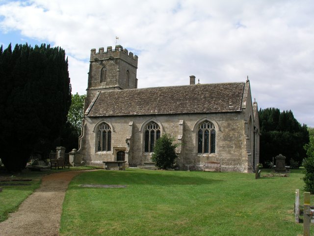
Longney is a small village within the parish and is known for its charming rural setting. The village is characterized by its traditional stone houses and cottages, many of which date back several centuries. The centerpiece of the village is the beautiful St. Lawrence Church, which is believed to have been built in the 12th century.

Epney, on the other hand, is a hamlet located on the banks of the River Severn. It is renowned for its stunning riverside views and is a popular spot for boating and fishing enthusiasts. The hamlet is also home to a number of historic buildings, including a 17th-century pub called The Old Passage Inn, which offers visitors a chance to relax and enjoy the tranquil surroundings.

Both Longney and Epney offer a peaceful and idyllic lifestyle, away from the hustle and bustle of larger towns and cities. The parish is surrounded by beautiful countryside, with rolling hills, meandering rivers, and lush green fields, making it a haven for nature lovers and outdoor enthusiasts. Despite its small size, Longney and Epney have a strong sense of community, with local events and activities bringing residents together throughout the year.

If you have any feedback on the listing, please let us know in the comments section below.

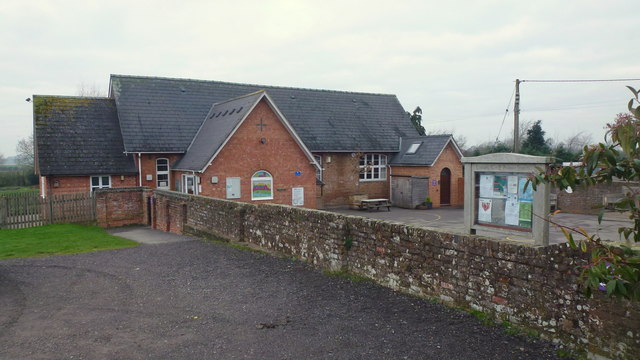
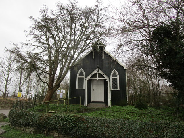
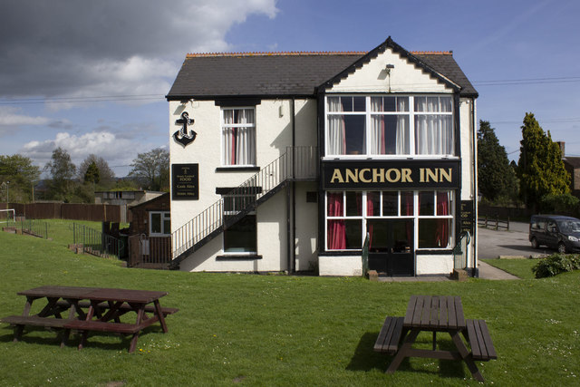
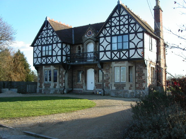
Longney and Epney Images

Images are sourced within 2km of 51.809022/-2.341309 or Grid Reference SO7612. Thanks to Geograph Open Source API. All images are credited.

Foreshore of the River Severn adjacent to the Anchor Inn Epney This was taken 10 minutes before the Severn Bore rushed past at high tide.
Foreshore of the River Severn adjacent to the Anchor Inn Epney
This was taken 10 minutes before the Severn Bore rushed past at high tide.
Flood control sluice gate at Epney Adjacent to the Anchor Inn.
Flood control sluice gate at Epney
Adjacent to the Anchor Inn.
Foreshore of the River Severn just South of Epney The Severn Bore has just passed, raiding the river level by several feet.
Foreshore of the River Severn just South of Epney
The Severn Bore has just passed, raiding the river level by several feet.
The banks of the River Severn just South of Epney Easy access to the Severn Bore which has just passed makes this a popular spot with surfers.
The banks of the River Severn just South of Epney
Easy access to the Severn Bore which has just passed makes this a popular spot with surfers.
After the Severn Bore has passed The River Severn here has reversed flow and risen several feet bringing back a lot of floating debris.
After the Severn Bore has passed
The River Severn here has reversed flow and risen several feet bringing back a lot of floating debris.
Lane to Castle End, Longney One of many scattered farms hereabouts.
Lane to Castle End, Longney
One of many scattered farms hereabouts.
View to Monk's Hill A 41m mountain with a trig point yet to be photographed for Geograph. It lies well away from public access so permission would need to be sought.
See Phil's identical shot from 2008; <a href="https://www.geograph.org.uk/photo/784586">SO7613 : Monks' Hill, Longney</a>.
View to Monk's Hill
A 41m mountain with a trig point yet to be photographed for Geograph. It lies well away from public access so permission would need to be sought. See Phil's identical shot from 2008; SO7613 : Monks' Hill, Longney.
Oakey Farm Farm set just above the flood line between the Severn and the Gloucester and Sharpness Canal. Accessed by private track and public path.
Oakey Farm
Farm set just above the flood line between the Severn and the Gloucester and Sharpness Canal. Accessed by private track and public path.
Power lines across the floodplain Looking west from the public path to Oakey Farm.
Power lines across the floodplain
Looking west from the public path to Oakey Farm.
Track and path from Oakey Farm Looking towards the junction with Castle Lane at Parkend Bridge over the Gloucester and Sharpness Canal.
Track and path from Oakey Farm
Looking towards the junction with Castle Lane at Parkend Bridge over the Gloucester and Sharpness Canal.
The Anchor Inn Epney
Castle Lane Epney
Castle Lane Epney
Bridleway to Kenton Green Via a track next to Madam's End Cottage.
Bridleway to Kenton Green
Via a track next to Madam's End Cottage.
View to the Vicarage Also the subject of the first Geograph for this square; <a href="https://www.geograph.org.uk/photo/140791">SO7712 : Vicarage, Longney</a>, taken in March 2006.
View to the Vicarage
Also the subject of the first Geograph for this square; SO7712 : Vicarage, Longney, taken in March 2006.
C. of E. Primary School, Longney, 2018 A revisit to this square has the photographer inadvertently taking almost the same shot, ten years on. Notice the changes to the entrance and the signage in the decade since <a href="https://www.geograph.org.uk/photo/759253">SO7612 : C. of E. Primary School, Longney, Gloucestershire.</a>.
Again, the photographer chooses school holidays to photograph a school.
C. of E. Primary School, Longney, 2018
A revisit to this square has the photographer inadvertently taking almost the same shot, ten years on. Notice the changes to the entrance and the signage in the decade since SO7612 : C. of E. Primary School, Longney, Gloucestershire.. Again, the photographer chooses school holidays to photograph a school.
Rodley Mission Church Dates from 1908 and appears to be well maintained.
Rodley Mission Church
Dates from 1908 and appears to be well maintained.
Ellis's Farm Traditional farm buildings at Ellis's farm
Ellis's Farm
Traditional farm buildings at Ellis's farm
Anchor Inn
Anchor Inn
Show me another place!

Longney and Epney is located at Grid Ref: SO7612 (Lat: 51.809022, Lng: -2.341309)

Administrative County: Gloucestershire

District: Stroud

Police Authority: Gloucestershire

What 3 Words

///pushover.mistaking.closet. Near Frampton on Severn, Gloucestershire

Nearby Locations

Longney Longney and Epney

Related Wikis

Longney

Longney is a village on the River Severn 5 miles south-west of Gloucester, Gloucestershire, England, within the parish of Longney and Epney. The parish...

Epney

Epney is a small village on the River Severn. It is 8 miles (13 km) South-West of Gloucester, Gloucestershire, England within the parish of Longney and...

Rodley, Gloucestershire

Rodley is a settlement in Westbury-on-Severn parish, Forest of Dean District, Gloucestershire, England. It lies to the south east of Westbury-on-Severn...

River Frome, Stroud

The River Frome, once also known as the Stroudwater, is a small river in Gloucestershire, England. It is to be distinguished from another River Frome...

Hardwicke Court

Hardwicke Court is a Grade II* listed country house in Hardwicke, Gloucestershire, England. The house is Late Georgian in style. It was designed by Sir...

Moreton Valence

Moreton Valence is a village and civil parish 6 miles (9.7 km) south-west of Gloucester, Gloucestershire, England. The village is on the A38, just east...

Framilode

Framilode is a village on the banks of the River Severn in Gloucestershire, England, in the parish of Fretherne with Saul. It consists of two settlements...

St Nicholas Church, Hardwicke

Saint Nicholas Church is a grade I listed building located in Hardwicke, Gloucestershire. It practices Christianity through the Church of England denomination...

Nearby Amenities

Located within 500m of 51.809022,-2.341309
Post Box
Operator: Royal Mail
Post Box Type: lamp
Ref: GL2 179
Royal Cypher: EIIR
Royal Cypher Wikidata: Q33102113
Lat/Long: 51.8110828/-2.3451764
Bus Stop
Manor Farm
Naptan AtcoCode: 1600GLS1013
Naptan Bearing: S
Naptan CommonName: Manor Farm
Naptan NaptanCode: gloataga
Naptan Street: Epney Rd
Naptan Verified: no
Source: naptan_import
Lat/Long: 51.808126/-2.3430337
Bus Stop
Manor Farm
Naptan AtcoCode: 1600GLS1014
Naptan Bearing: N
Naptan CommonName: Manor Farm
Naptan NaptanCode: gloatadw
Naptan Street: Epney Rd
Naptan Verified: no
Source: naptan_import
Lat/Long: 51.8082426/-2.3431507
Bus Stop
Longney Primary School
Naptan AtcoCode: 1600GLS1015
Naptan Bearing: S
Naptan CommonName: Longney Primary School
Naptan Indicator: Opp
Naptan NaptanCode: gloapwtj
Naptan Street: Chatter St
Naptan Verified: no
Source: naptan_import
Lat/Long: 51.8101801/-2.344732
Bus Stop
Longney Primary School
Naptan AtcoCode: 1600GLS1016
Naptan Bearing: N
Naptan CommonName: Longney Primary School
Naptan NaptanCode: gloapwtd
Naptan Street: Chatter St
Naptan Verified: no
Source: naptan_import
Lat/Long: 51.8101258/-2.3448476
Give Way
Direction: backward
Lat/Long: 51.8087113/-2.3429372
Give Way
Direction: forward
Lat/Long: 51.8087131/-2.3431927
Defibrillator
Booth: K6
Defibrillator Location: inside phone box, Chatter Street, Longney
Emergency: defibrillator
Man Made: telephone_box
Lat/Long: 51.8110952/-2.3451821
The data included in this document is from www.openstreetmap.org. The data is made available under ODbL.

Have you been to Longney and Epney?

Leave your review of Longney and Epney below (or comments, questions and feedback).