Longhope

Civil Parish in Gloucestershire Forest of Dean

England

Longhope

The Latchen, Longhope Looking towards the village centre.
To the right we see the bus shelter detailed in <a href="https://www.geograph.org.uk/photo/7666756">SO6818 : Longhope bus shelter</a>.
The Latchen, Longhope Credit: Jonathan Billinger

Longhope is a civil parish located in the county of Gloucestershire, in the southwestern part of England. Situated in the Forest of Dean district, the parish covers an area of approximately 11 square miles. It is surrounded by picturesque countryside, with the River Severn running along its western boundary.

The village of Longhope, after which the parish is named, serves as its main settlement. It is a charming rural village with a population of around 2,000 people. The village has a rich history that dates back to medieval times, and remnants of its past can still be seen in some of the historic buildings and landmarks that dot the area.

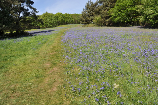
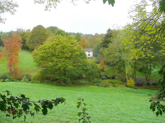
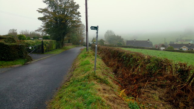
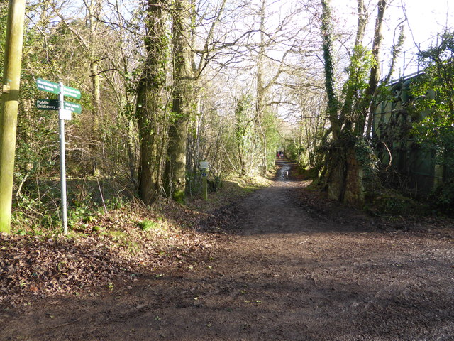
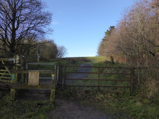
Longhope is known for its beautiful landscapes, with rolling hills and woodlands that provide ample opportunities for outdoor activities such as hiking, cycling, and horse riding. The area is also popular with nature enthusiasts, as it is home to a variety of wildlife, including deer and various bird species.

The village has a strong community spirit, with a range of amenities and services available to residents. These include a primary school, a village hall, a post office, a pub, and a few local shops. There are also several churches in the parish that cater to different religious denominations.

Overall, Longhope offers a peaceful and idyllic environment for those seeking a rural lifestyle, while still being within reach of larger towns and cities in Gloucestershire.

If you have any feedback on the listing, please let us know in the comments section below.
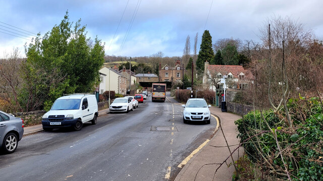
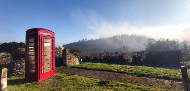
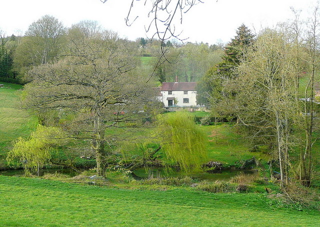
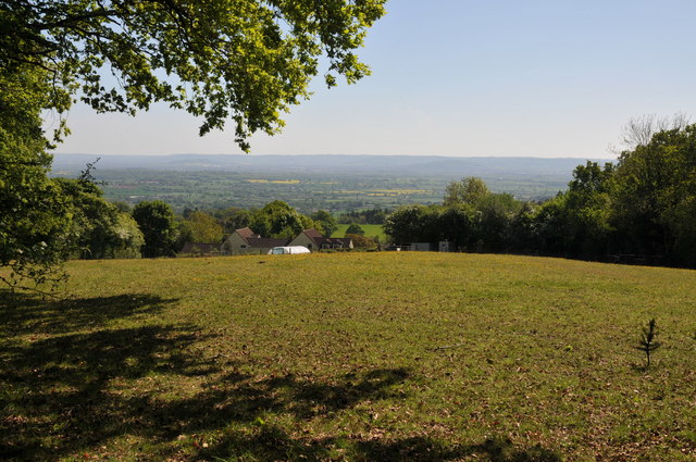
Longhope Images

Images are sourced within 2km of 51.873794/-2.455739 or Grid Reference SO6819. Thanks to Geograph Open Source API. All images are credited.

The Latchen, Longhope Looking towards the village centre.
To the right we see the bus shelter detailed in <a href="https://www.geograph.org.uk/photo/7666756">SO6818 : Longhope bus shelter</a>.
The Latchen, Longhope
Looking towards the village centre. To the right we see the bus shelter detailed in SO6818 : Longhope bus shelter.
Upper Boxbush House I last treated Geograph to a photo of the Christmas lights of Boxbush in 2020.
<a href="https://www.geograph.org.uk/photo/6711459">SO6720 : The lights of Boxbush</a>
Upper Boxbush House
I last treated Geograph to a photo of the Christmas lights of Boxbush in 2020. SO6720 : The lights of Boxbush
Farmer's Boy Christmas lights, 2023 In competition with the Boxbush House lights on the opposite side of the A40 seen in <a href="https://www.geograph.org.uk/photo/6711459">SO6720 : The lights of Boxbush</a>.
Farmer's Boy Christmas lights, 2023
In competition with the Boxbush House lights on the opposite side of the A40 seen in SO6720 : The lights of Boxbush.
Public Telephone Box with Fog Covered Bright's Hill Beyond
Dream cottage This place is a feature of my daily commute to Gloucester. View to the north of the A40 on a light spring evening.
Dream cottage
This place is a feature of my daily commute to Gloucester. View to the north of the A40 on a light spring evening.
View across the Vale of Gloucester View across the Vale of Gloucester from the slopes of May Hill.  The Cotswold Hills are on the horizon.
View across the Vale of Gloucester
View across the Vale of Gloucester from the slopes of May Hill. The Cotswold Hills are on the horizon.
Bluebells on May Hill
Dream cottage in autumn The same view (almost) as in <a href="https://www.geograph.org.uk/photo/2343022">SO7020 : Dream cottage</a> nearly seven months on.
Dream cottage in autumn
The same view (almost) as in SO7020 : Dream cottage nearly seven months on.
Dursley Cross The gridline crosses the scene just about where the bridleway sign stands.
Dursley Cross
The gridline crosses the scene just about where the bridleway sign stands.
May Hill Sign National Trust land for a great walk up path to explore May Hill.
May Hill Sign
National Trust land for a great walk up path to explore May Hill.
Footpath junction on May Hill, Glos The Wysis Way and Gloucestershire Way meet and merge here I believe. Good walking around these parts.
Footpath junction on May Hill, Glos
The Wysis Way and Gloucestershire Way meet and merge here I believe. Good walking around these parts.
Access gate onto May Hill, Glos The National Trust land boundary and access point.
Access gate onto May Hill, Glos
The National Trust land boundary and access point.
Bearfoot Cottage On the slopes of May Hill.
Bearfoot Cottage
On the slopes of May Hill.
Services in Little London On the A4136. Images shows telephone box, post box, water hydrant, telegraph pole and information about neighbourhood watch, all located opposite the bus stop on the other (northern) side of the road here.
Services in Little London
On the A4136. Images shows telephone box, post box, water hydrant, telegraph pole and information about neighbourhood watch, all located opposite the bus stop on the other (northern) side of the road here.
Decommissioned telephone box Yet another decommissioned telephone box, this one in May Hill Village is being used as an Information Centre.  I photographed exactly the same scene six years ago in May 2011 <a href="https://www.geograph.org.uk/photo/2400242">SO7020 : Track in May Hill Village</a>.
Decommissioned telephone box
Yet another decommissioned telephone box, this one in May Hill Village is being used as an Information Centre. I photographed exactly the same scene six years ago in May 2011 SO7020 : Track in May Hill Village.
The A40, Dursley Cross
Rough ground by Sterry's Lane Hillside Brewery can be seen just below the woodland of Huntley Hill.
The gabled house is on the A40.
Rough ground by Sterry's Lane
Hillside Brewery can be seen just below the woodland of Huntley Hill. The gabled house is on the A40.
Show me another place!

Longhope is located at Grid Ref: SO6819 (Lat: 51.873794, Lng: -2.455739)

Administrative County: Gloucestershire

District: Forest of Dean

Police Authority: Gloucestershire

What 3 Words

///picture.motored.dart. Near Longhope, Gloucestershire

Nearby Locations

Longhope Churchfield Wood

Related Wikis

Longhope

Longhope is a village in west Gloucestershire, situated within the Forest of Dean, England, United Kingdom. Arthur Bullock, who was born in Longhope in...

Longhope railway station

Longhope railway station is a disused stone-built railway station that served the village of Longhope in Gloucestershire, England. Opened in 1855 with...

Hobbs Quarry SSSI, Longhope

Hobbs Quarry, Longhope (grid reference SO695195) is a 1-hectare (2.5-acre) geological and biological Site of Special Scientific Interest in Gloucestershire...

Longhope Hill

Longhope Hill (grid reference SO693185) is a 0.2-hectare (0.49-acre) geological Site of Special Scientific Interest in Gloucestershire, notified in 1989...

Boxbush

Boxbush is a village in Gloucestershire, England. == References ==

Land Grove Quarry, Mitcheldean

Land Grove Quarry, Mitcheldean (grid reference SO672185) is a 3.8-hectare (9.4-acre) geological Site of Special Scientific Interest in Gloucestershire...

The Mount, Nottswood Hill

The Mount, Nottswood Hill, is a grade II listed house near Blaisdon in Gloucestershire. The house is thought to have been rebuilt in the later nineteenth...

May Hill

May Hill is a prominent English hill between Gloucester and Ross-on-Wye. Its summit, on the western edge of Gloucestershire and its northern slopes in...

Nearby Amenities

Located within 500m of 51.873794,-2.455739
Bus Stop
The Wend
Naptan AtcoCode: 1600GLA36637
Naptan Bearing: N
Naptan CommonName: The Wend
Naptan NaptanCode: glogmdwg
Naptan Street: Church Rd
Naptan Verified: no
Source: naptan_import
Lat/Long: 51.8696715/-2.4554605
Bus Stop
Rectory Meadow
Naptan AtcoCode: 1600GLA36639
Naptan Bearing: N
Naptan CommonName: Rectory Meadow
Naptan NaptanCode: glogmdwm
Naptan Street: Church Rd
Naptan Verified: no
Source: naptan_import
Lat/Long: 51.873899/-2.4585494
Bus Stop
Rectory Meadow
Naptan AtcoCode: 1600GLA36640
Naptan Bearing: S
Naptan CommonName: Rectory Meadow
Naptan Indicator: Opp
Naptan NaptanCode: glogmdwp
Naptan Street: Church Rd
Naptan Verified: no
Source: naptan_import
Lat/Long: 51.8738099/-2.4583596
Ford: yes
Lat/Long: 51.8762022/-2.4580453
Ford: yes
Lat/Long: 51.8736172/-2.4570527
The data included in this document is from www.openstreetmap.org. The data is made available under ODbL.

Have you been to Longhope?

Leave your review of Longhope below (or comments, questions and feedback).