Churchfield Wood

Wood, Forest in Gloucestershire Forest of Dean

England

Churchfield Wood

Longhope bus shelter Plenty to engage travellers as they wait to board the No. 33 to Gloucester.
Nicely dressed for the coming Christmas festivities.
Longhope bus shelter Credit: Jonathan Billinger

Churchfield Wood is a picturesque woodland located in the county of Gloucestershire, England. Covering an area of approximately 50 hectares, this enchanting forest is situated just outside the village of Churchfield, offering a serene and peaceful retreat for nature enthusiasts and walkers alike.

The woodland is predominantly made up of native broadleaf trees such as oak, beech, and ash, creating a diverse and vibrant ecosystem. These towering trees provide a dense canopy that filters sunlight, allowing an array of flora to flourish on the forest floor. Bluebells, wild garlic, and wood sorrel are just a few of the enchanting plant species that can be found carpeting the ground during the springtime.

Churchfield Wood is also home to a variety of wildlife, including many species of birds, mammals, and insects. Woodpeckers, owls, and buzzards can often be heard or spotted amongst the treetops, while squirrels and deer can be seen darting through the undergrowth. The forest's diverse habitat also attracts a range of butterflies, bees, and beetles, making it a haven for nature lovers and wildlife photographers.

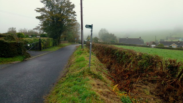
Visitors to Churchfield Wood can enjoy a network of well-maintained footpaths that wind their way through the forest, offering stunning views and opportunities for exploration. The peaceful atmosphere and natural beauty of the woodland make it an ideal location for picnics, leisurely strolls, or simply immersing oneself in the tranquility of nature.

Overall, Churchfield Wood in Gloucestershire is a magical forest that offers a captivating blend of natural beauty, biodiversity, and recreational opportunities, making it a must-visit destination for anyone seeking solace in the great outdoors.

If you have any feedback on the listing, please let us know in the comments section below.

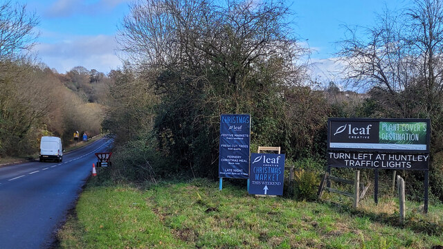
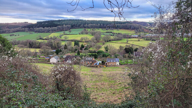
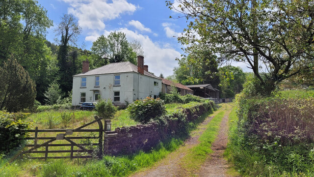
Churchfield Wood Images

Images are sourced within 2km of 51.877353/-2.4642193 or Grid Reference SO6819. Thanks to Geograph Open Source API. All images are credited.

Longhope bus shelter Plenty to engage travellers as they wait to board the No. 33 to Gloucester.
Nicely dressed for the coming Christmas festivities.
Longhope bus shelter
Plenty to engage travellers as they wait to board the No. 33 to Gloucester. Nicely dressed for the coming Christmas festivities.
Dursley Cross The gridline crosses the scene just about where the bridleway sign stands.
Dursley Cross
The gridline crosses the scene just about where the bridleway sign stands.
Cattle on hillside
Cattle on hillside
Rolling hills
Rolling hills
A4136 at Longhope Seasonal signage in the run up to Christmas.
A4136 at Longhope
Seasonal signage in the run up to Christmas.
The Longhope Valley Looking west across to Hope Wood, an outlier of the Forest of Dean.
The Longhope Valley
Looking west across to Hope Wood, an outlier of the Forest of Dean.
Colony of Snowdrops 2022 is shaping up to be a fine year for Galanthophiles like me!
Colony of Snowdrops
2022 is shaping up to be a fine year for Galanthophiles like me!
Road repair works, 3 This is advance work for the repair of the collapsing carriageway of the A40 near May Hill.
Looking west towards Ross.
Road repair works, 3
This is advance work for the repair of the collapsing carriageway of the A40 near May Hill. Looking west towards Ross.
Deansway Road, Mitcheldean The village housing is dominated by the former Rank Xerox buildings which are now a huge sprawling business park.
Deansway Road, Mitcheldean
The village housing is dominated by the former Rank Xerox buildings which are now a huge sprawling business park.
Bridleway by Marshes Farm The path is part of the Gloucestershire Way.
Bridleway by Marshes Farm
The path is part of the Gloucestershire Way.
Carisbrooke Road, Mitcheldean Two posh new bus shelters on the edge of the village.
Carisbrooke Road, Mitcheldean
Two posh new bus shelters on the edge of the village.
Wayside Cross, Longhope In the churchyard, sitting on top of an inspection cover. This is probably the base of a wayside cross once located at SO 69207 18642 in front of what was, in the 1880s, the Plough Inn (long gone). 

There are more details in the Heritage Gateway site, but the data dates from 1970 when the cross may have been opposite the medieval site. See <span class="nowrap"><a title="https://www.heritagegateway.org.uk/Gateway/Results_Single.aspx?uid=6b1d3a87-8b8d-44ba-a26e-785cce394f5c&resourceID=19191" rel="nofollow ugc noopener" href="https://www.heritagegateway.org.uk/Gateway/Results_Single.aspx?uid=6b1d3a87-8b8d-44ba-a26e-785cce394f5c&resourceID=19191">Link</a><img style="margin-left:2px;" alt="External link" title="External link - shift click to open in new window" src="https://s1.geograph.org.uk/img/external.png" width="10" height="10"/></span>

Milestone Society National ID: GLFD_LON
Wayside Cross, Longhope
In the churchyard, sitting on top of an inspection cover. This is probably the base of a wayside cross once located at SO 69207 18642 in front of what was, in the 1880s, the Plough Inn (long gone). There are more details in the Heritage Gateway site, but the data dates from 1970 when the cross may have been opposite the medieval site. See LinkExternal link Milestone Society National ID: GLFD_LON
Longhope Industrial Estate, 1 The vehicles here are to do with Longhope Motor Services.
Longhope Industrial Estate, 1
The vehicles here are to do with Longhope Motor Services.
Longhope Industrial Estate, 2 Longhope Motor Services in the centre of shot.
Longhope Industrial Estate, 2
Longhope Motor Services in the centre of shot.
Church Road, Longhope Looking north with Constance Court on the right and the entrance to Longhope Industrial Estate on the left.
Church Road, Longhope
Looking north with Constance Court on the right and the entrance to Longhope Industrial Estate on the left.
Hope Brook Primary School entrance Taken during the last few days of the summer holidays 2022.
Hope Brook Primary School entrance
Taken during the last few days of the summer holidays 2022.
Longhope Welding Company A business operating in the village for almost 50 years (2022).
Longhope Welding Company
A business operating in the village for almost 50 years (2022).
Napping Lane Looking from Church Road; a dead-end lane with several cul-de-sacs.
Napping Lane
Looking from Church Road; a dead-end lane with several cul-de-sacs.
Show me another place!

Churchfield Wood is located at Grid Ref: SO6819 (Lat: 51.877353, Lng: -2.4642193)

Administrative County: Gloucestershire

District: Forest of Dean

Police Authority: Gloucestershire

What 3 Words

///pacifist.mixers.roaming. Near Longhope, Gloucestershire

Nearby Locations

Longhope Churchfield Wood

Related Wikis

Longhope

Longhope is a village in west Gloucestershire, situated within the Forest of Dean, England, United Kingdom. Arthur Bullock, who was born in Longhope in...

Boxbush

Boxbush is a village in Gloucestershire, England. == References ==

Longhope railway station

Longhope railway station is a disused stone-built railway station that served the village of Longhope in Gloucestershire, England. Opened in 1855 with...

Hobbs Quarry SSSI, Longhope

Hobbs Quarry, Longhope (grid reference SO695195) is a 1-hectare (2.5-acre) geological and biological Site of Special Scientific Interest in Gloucestershire...

Land Grove Quarry, Mitcheldean

Land Grove Quarry, Mitcheldean (grid reference SO672185) is a 3.8-hectare (9.4-acre) geological Site of Special Scientific Interest in Gloucestershire...

Luxley

Luxley is a village in the southwest Midlands of England, on the border between Gloucestershire and Herefordshire near May Hill. Luxley is 12 km (7.5 mi...

Longhope Hill

Longhope Hill (grid reference SO693185) is a 0.2-hectare (0.49-acre) geological Site of Special Scientific Interest in Gloucestershire, notified in 1989...

May Hill

May Hill is a prominent English hill between Gloucester and Ross-on-Wye. Its summit, on the western edge of Gloucestershire and its northern slopes in...

Nearby Amenities

Located within 500m of 51.877353,-2.4642193
Bus Stop
Cross Hands
Naptan AtcoCode: 1600GLA36683
Naptan Bearing: W
Naptan BusStopType: CUS
Naptan CommonName: Cross Hands
Naptan NaptanCode: glogmgjw
Naptan Street: Ross Rd A40
Naptan Verified: no
Source: naptan_import
Lat/Long: 51.8799018/-2.4617049
Bus Stop
Cross Hands
Naptan AtcoCode: 1600GLA36684
Naptan Bearing: E
Naptan CommonName: Cross Hands
Naptan NaptanCode: glogmgma
Naptan Street: Gloucester Rd A40
Naptan Verified: no
Source: naptan_import
Lat/Long: 51.8799647/-2.46172
Pub
The Nags Head Inn
Addr City: Longhope
Addr Postcode: GL17 0LW
Addr Street: Ross Road
Phone: +44 1452 830284
Source: survey
Lat/Long: 51.8809211/-2.4633166
Ford: yes
Lat/Long: 51.8762022/-2.4580453
Ford: yes
Lat/Long: 51.8741336/-2.4650312
Ford: yes
Lat/Long: 51.8743903/-2.4678164
The data included in this document is from www.openstreetmap.org. The data is made available under ODbL.

Have you been to Churchfield Wood?

Leave your review of Churchfield Wood below (or comments, questions and feedback).