Long Wittenham

Civil Parish in Berkshire South Oxfordshire

England

Long Wittenham

B4016 near Pearith Cottages
B4016 near Pearith Cottages Credit: Colin Pyle

Long Wittenham is a civil parish located in the county of Berkshire, England. Situated on the banks of the River Thames, it is a picturesque village with a rich history dating back to the Roman times. The parish covers an area of approximately 5 square kilometers and has a population of around 1,300 people.

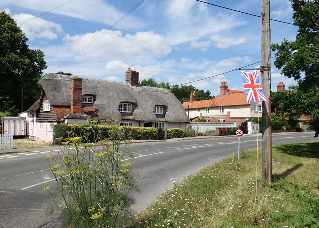
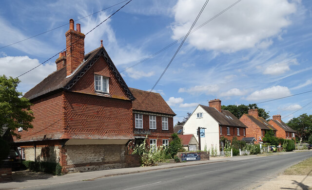
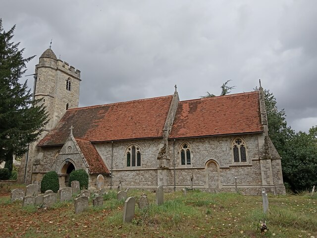
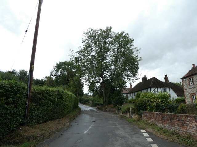
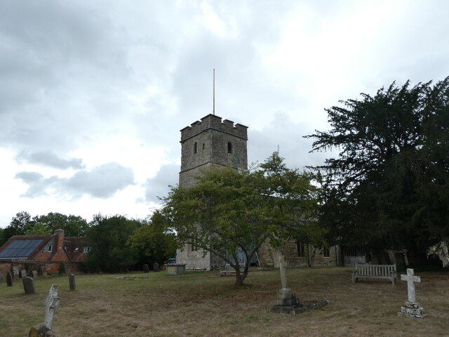
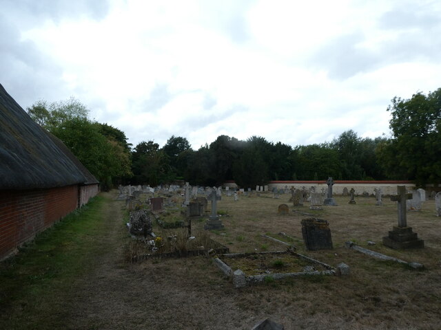
The village is known for its charming thatched cottages and historic buildings, which add to its quaint and traditional atmosphere. One of the notable landmarks is the All Saints' Church, a Grade I listed building that dates back to the 12th century. The church features stunning medieval stained glass windows and a unique Norman font.

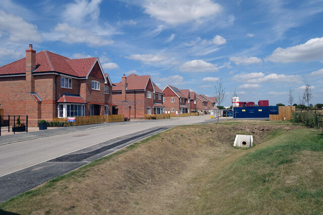
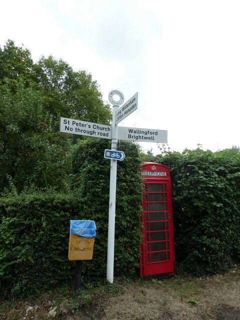
Long Wittenham is also home to a thriving community with various amenities and services. It has a primary school, a village hall, a community shop, and a pub, providing essential facilities for its residents. The village is well-connected with regular bus services and good road links to nearby towns and cities.

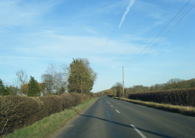
The surrounding natural landscape of Long Wittenham is another highlight of the area. The village is surrounded by beautiful countryside, including the Wittenham Clumps, two hills that offer breathtaking views of the surrounding area. The Clumps are also a designated Site of Special Scientific Interest due to their rich biodiversity.

Overall, Long Wittenham is a charming and historic village in Berkshire, offering a peaceful and idyllic setting for its residents and visitors alike. Its rich heritage, picturesque scenery, and strong sense of community make it a highly desirable place to live.

If you have any feedback on the listing, please let us know in the comments section below.

Long Wittenham Images

Images are sourced within 2km of 51.638971/-1.205506 or Grid Reference SU5593. Thanks to Geograph Open Source API. All images are credited.

B4016 near Pearith Cottages
Sires Hill at Westfield Farm
St Michael’s Church, Clifton Hampden Showing the church on the steep bank above the River Thames
St Michael’s Church, Clifton Hampden
Showing the church on the steep bank above the River Thames
St Michael’s Church, Clifton Hampden St Michael’s Church and the steep bank down to the River Thames
St Michael’s Church, Clifton Hampden
St Michael’s Church and the steep bank down to the River Thames
St Michael’s Church and River Thames, Clifton Hampden A view from the road bridge across the River Thames
St Michael’s Church and River Thames, Clifton Hampden
A view from the road bridge across the River Thames
River Thames at Clifton Hampden View along river showing the different height of the banks on either side of the river
River Thames at Clifton Hampden
View along river showing the different height of the banks on either side of the river
Clifton Hampden Bridge A view of the bridge from the north
Clifton Hampden Bridge
A view of the bridge from the north
St Michael’s Church, Clifton Hampden A view across the River Thames showing the river cliff on the northern bank
St Michael’s Church, Clifton Hampden
A view across the River Thames showing the river cliff on the northern bank
Clifton Hampden Manor House A view across the River Thames showing the height of the river cliff on which the Manor House sits
Clifton Hampden Manor House
A view across the River Thames showing the height of the river cliff on which the Manor House sits
Earl's Forge, Long Wittenham New houses going up in Long Wittenham, like they are everywhere else round here.
The name is off the developer's notice board just behind me. I don't know the reason.
Earl's Forge, Long Wittenham
New houses going up in Long Wittenham, like they are everywhere else round here. The name is off the developer's notice board just behind me. I don't know the reason.
Thatched House, Long Wittenham One of the nice old properties on Long Wittenham's attractive High Street. The flag is left over from the Queen's jubilee last month.
Thatched House, Long Wittenham
One of the nice old properties on Long Wittenham's attractive High Street. The flag is left over from the Queen's jubilee last month.
The Plough, Long Wittenham Long Wittenham's village pub.
The Plough, Long Wittenham
Long Wittenham's village pub.
St Peter, Little Wittenham: early September 2022
Phone box, Little Wittenham: early September 2022
Little Wittenham War Memorial: early September 2022 See here for Green's service record
Little Wittenham War Memorial: early September 2022
See here for Green's service record
Rush hour in Little Wittenham
St Mary, Long Wittenham: early September 2022
St Mary, Long Wittenham: churchyard
Show me another place!

Long Wittenham is located at Grid Ref: SU5593 (Lat: 51.638971, Lng: -1.205506)

Administrative County: Oxfordshire

District: South Oxfordshire

Police Authority: Thames Valley

What 3 Words

///onions.pointed.airstrip. Near Didcot, Oxfordshire

Related Wikis

Sylva Foundation

The Sylva Foundation is an environmental organisation focusing on trees and forestry established in 2006, and registered as a charity in England and Wales...

Long Wittenham

Long Wittenham is a village and small civil parish about 3 miles (5 km) north of Didcot, and 3.5 miles (5.6 km) southeast of Abingdon. It was part of Berkshire...

Paradise Wood

Paradise Wood is a research woodland established by the Earth Trust (formerly Northmoor Trust) between the villages of Little Wittenham and Long Wittenham...
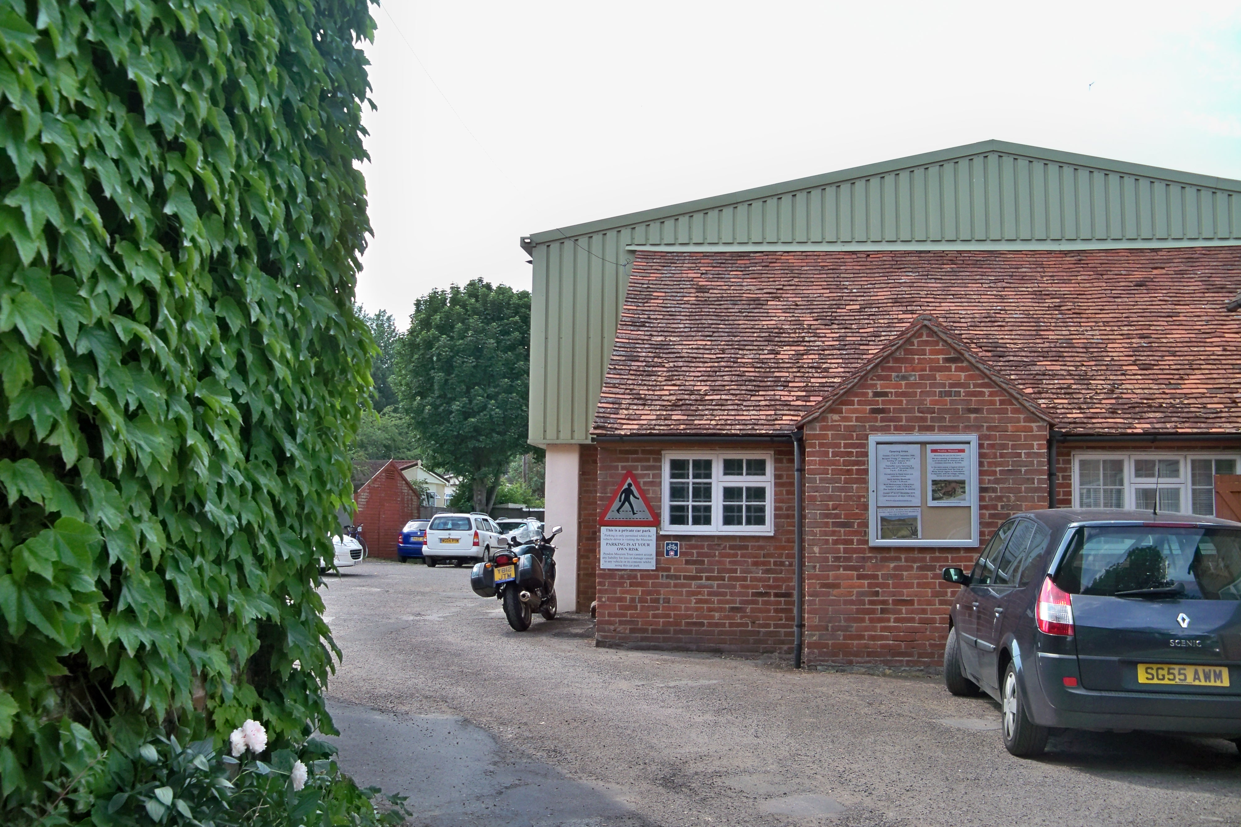
Pendon Museum

Pendon Museum, located in Long Wittenham near Didcot, Oxfordshire, England, is a museum that displays scale models, in particular a large scene representing...

Nearby Amenities

Located within 500m of 51.638971,-1.205506
Traffic Calming: chicane
Lat/Long: 51.6406003/-1.2109337
Traffic Calming: chicane
Lat/Long: 51.6416286/-1.2087423
Passing Place
Lat/Long: 51.641624/-1.2027216
Long Wittenham
Place: village
Wikidata: Q2787064
Wikipedia: en:Long Wittenham
Lat/Long: 51.641101/-1.2097904
Bus Stop
The Plough Inn
Naptan AtcoCode: 340000489OPL
Naptan Bearing: SW
Naptan CommonName: The Plough Inn
Naptan Indicator: Opposite
Naptan Landmark: The Plough Inn PH
Naptan NaptanCode: oxfapjtm
Naptan Street: High Street
Naptan Verified: no
Public Transport: platform
Source: naptan_import
Wheelchair: yes
Lat/Long: 51.640298/-1.211925
The Plough Inn
Naptan AtcoCode: 340000489PLO
Naptan Bearing: NE
Naptan BusStopType: CUS
Naptan CommonName: The Plough Inn
Naptan Indicator: Outside
Naptan Landmark: The Plough Inn PH
Naptan NaptanCode: oxfapjtj
Naptan Street: High Street
Naptan Verified: no
Shelter: yes
Source: naptan_import
Lat/Long: 51.6402537/-1.2118669
Bus Stop
Saxons Heath
Bus: yes
Naptan AtcoCode: 340001831SAX
Naptan Bearing: NW
Naptan CommonName: Saxons Heath
Naptan Indicator: Corner
Naptan Landmark: Saxons Heath
Naptan NaptanCode: oxfgjtjm
Naptan Street: Didcot Road
Naptan Verified: no
Public Transport: platform
Shelter: no
Source: naptan_import
Lat/Long: 51.6382191/-1.2116431
Bus Stop
High Street
Naptan AtcoCode: 340003285CNR
Naptan Bearing: SW
Naptan CommonName: High Street
Naptan Indicator: o/s Little Wittenham Turn
Naptan Landmark: The Vicarage
Naptan NaptanCode: oxfgjtpm
Naptan Street: High Street
Naptan Verified: no
Source: naptan_import
Lat/Long: 51.6422288/-1.2075559
High Street
Naptan AtcoCode: 340003285OPP
Naptan Bearing: NE
Naptan BusStopType: CUS
Naptan CommonName: High Street
Naptan Indicator: Opp Little Wittenham Turn
Naptan Landmark: The Vicarage
Naptan NaptanCode: oxfgjtpj
Naptan Street: High Street
Naptan Verified: no
Source: naptan_import
Lat/Long: 51.6422123/-1.207773
Traffic Calming: table
Lat/Long: 51.6411145/-1.209745
Passing Place
Lat/Long: 51.6412921/-1.2005412
Pub
The Vine and Spice
Description: pub / restaurant
Source: View from S;local_knowledge
Toilets Wheelchair: no
Wheelchair: yes
Lat/Long: 51.6409754/-1.2098079
Pub
The Plough
Wheelchair: yes
Wikidata: Q26312705
Lat/Long: 51.6402263/-1.2123851
Power: pole
Source: Bing
Lat/Long: 51.6372152/-1.2100109
Power: pole
Source: Bing
Lat/Long: 51.6386835/-1.2055039
Power: pole
Source: Bing
Lat/Long: 51.6393851/-1.2049569
Power: pole
Source: Bing
Lat/Long: 51.6416264/-1.2032591
Power: pole
Source: Bing
Lat/Long: 51.6382989/-1.2066118
Power: pole
Source: Bing
Lat/Long: 51.64011/-1.2044084
Power: pole
Source: Bing
Lat/Long: 51.6381794/-1.204596
Power: pole
Source: Bing
Lat/Long: 51.6408537/-1.2038384
Power: pole
Source: Bing
Lat/Long: 51.6422456/-1.2031625
Power: pole
Source: Bing
Lat/Long: 51.6376106/-1.203602
Power: pole
Source: Bing
Lat/Long: 51.6370268/-1.2025726
Power: pole
Source: Bing
Lat/Long: 51.6431453/-1.2030204
Power: pole
Source: Bing
Lat/Long: 51.6384569/-1.211418
Entrance: yes
Lat/Long: 51.6426252/-1.2087401
Entrance: yes
Lat/Long: 51.6424524/-1.2086881
Barrier: kissing_gate
Material: wood;metal
Lat/Long: 51.6419901/-1.2098171
Crossing
Crossing: unmarked
Kerb: lowered
Lat/Long: 51.6389124/-1.2124427
Give Way
Lat/Long: 51.642739/-1.2069361
Give Way
Lat/Long: 51.6428015/-1.2070758
Give Way
Lat/Long: 51.6426155/-1.2071434
Public Bookcase
Defibrillator
Booth: K6
Colour: red
Defibrillator Location: inside red telephone box (now used as comunity bookshelf) near Plough Inn, High Street, Long Wittenham
Disused Amenity: telephone
Emergency: defibrillator
Man Made: telephone_box
Public Bookcase Type: phone_box
Ref: CHT-10-262
Lat/Long: 51.6402624/-1.2118169
Historic: memorial
Lat/Long: 51.6412595/-1.2097093
Post Box
Post Box Type: lamp
Royal Cypher: EIIR
Royal Cypher Wikidata: Q33102113
Lat/Long: 51.6422599/-1.2077097
Power: pole
Lat/Long: 51.6363452/-1.2013379
Fixme: continue
Lat/Long: 51.6394317/-1.2082963
Give Way
Direction: forward
Lat/Long: 51.6417138/-1.2085471
Direction: 155
Generator Method: photovoltaic
Generator Output Electricity: yes
Generator Solar Modules: 96
Generator Source: solar
Generator Type: solar_photovoltaic_panel
Location: roof
Power: generator
Tilt: 10
Lat/Long: 51.6415469/-1.2059149
Give Way
Direction: backward
Lat/Long: 51.6405252/-1.2111409
Crossing
Crossing: zebra
Crossing Markings: yes
Lat/Long: 51.6388265/-1.2122522
The data included in this document is from www.openstreetmap.org. The data is made available under ODbL.

Have you been to Long Wittenham?

Leave your review of Long Wittenham below (or comments, questions and feedback).