Broomer's Corner

Settlement in Sussex Horsham

England

Broomer's Corner

Blonks Barn Once part of Blonks Farm the barn has been converted into a domestic dwelling. Is there a law that says if you want to convert a barn into a house then it has to be ugly?
Blonks Barn Credit: Andy Potter

Broomer's Corner is a quaint and picturesque village located in the county of Sussex, England. Nestled amidst rolling hills and lush green countryside, this idyllic hamlet exudes a sense of timeless charm and tranquility. With a population of just under 500 residents, Broomer's Corner offers a close-knit community atmosphere that is highly sought after by those seeking a peaceful and rural lifestyle.

The village is characterized by its traditional architecture, with charming cottages and historic buildings lining its narrow streets. Walking through Broomer's Corner feels like stepping back in time, as the village has managed to preserve its historic charm while still embracing modern conveniences.

Surrounded by natural beauty, Broomer's Corner boasts stunning views of the Sussex countryside. The village is located within close proximity to several nature reserves and parks, offering residents and visitors ample opportunities for outdoor activities such as hiking, cycling, and picnicking.

Despite its small size, Broomer's Corner has a strong sense of community spirit. The village hosts various events throughout the year, including a summer fair and a Christmas market, which bring residents together for a day of fun and celebration.

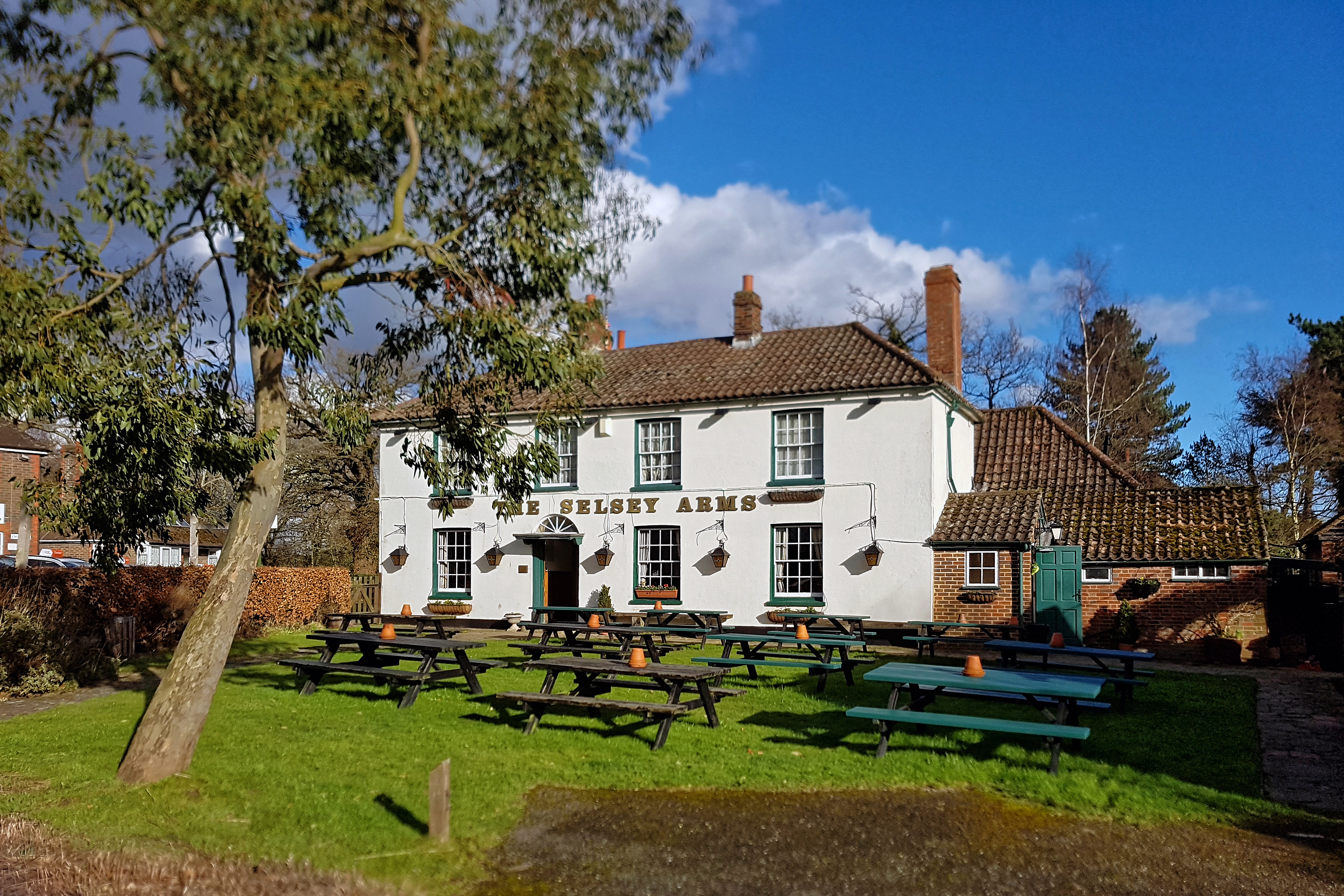
Amenities in Broomer's Corner are limited, with a small convenience store, a village pub, and a primary school being the main facilities available. However, the village is within easy reach of larger towns and cities such as Brighton and Worthing, where residents can find a wider range of amenities and services.

In summary, Broomer's Corner is a charming and peaceful village in the heart of Sussex, offering a serene lifestyle amidst beautiful natural surroundings. Its historic architecture, sense of community, and proximity to larger towns make it an attractive place to reside for those seeking a rural escape.

If you have any feedback on the listing, please let us know in the comments section below.

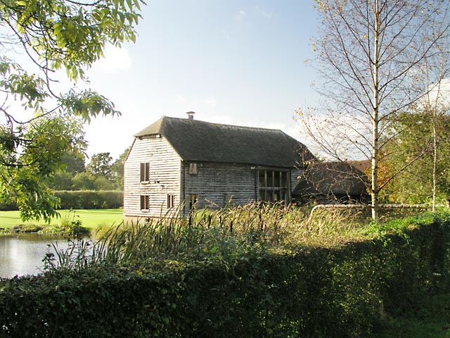
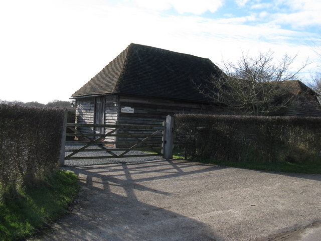
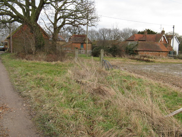
Broomer's Corner Images

Images are sourced within 2km of 50.978376/-0.399591 or Grid Reference TQ1221. Thanks to Geograph Open Source API. All images are credited.

Blonks Barn Once part of Blonks Farm the barn has been converted into a domestic dwelling. Is there a law that says if you want to convert a barn into a house then it has to be ugly?
Blonks Barn
Once part of Blonks Farm the barn has been converted into a domestic dwelling. Is there a law that says if you want to convert a barn into a house then it has to be ugly?
Blonks Barn Very near to Blonks Farm
Blonks Barn
Very near to Blonks Farm
Bridleway and footpath junction West of Blonks Farm
Bridleway and footpath junction
West of Blonks Farm
Sunny and soggy Bridleway from near Blonks Farm to Bowford Farm
Sunny and soggy
Bridleway from near Blonks Farm to Bowford Farm
Approach to Apsley Farm
Derelict barns On the Explorer maps these are marked as Upper Barn which are below Lower barn in the next square north. Lower barn is marked on the Landranger maps as Palace Land Farm (confusing.com) <a href="https://www.geograph.org.uk/photo/1159694">TQ1220 : Lower barn or Palace Land Farm</a>.
Derelict barns
On the Explorer maps these are marked as Upper Barn which are below Lower barn in the next square north. Lower barn is marked on the Landranger maps as Palace Land Farm (confusing.com) TQ1220 : Lower barn or Palace Land Farm.
Seen better days Hay trailers left to rot
Seen better days
Hay trailers left to rot
Waymarker for footpath to Bottomshole Copse
Bridleway 1882 heads north On the distant gate West Sussex County Council had pinned a notice warning that the bridleway was impassable for walkers in winter. They had added words to the effect that since they were strapped for cash, they would only do something about this if enough people complained - their priorities would be complaint driven. Weald Clay bridleways are a problem - they become waterlogged and extremely muddy and slippery in winter, and rock hard, rutted and pocked in summer.  In between there are brief periods of pleasant plasticity.
Bridleway 1882 heads north
On the distant gate West Sussex County Council had pinned a notice warning that the bridleway was impassable for walkers in winter. They had added words to the effect that since they were strapped for cash, they would only do something about this if enough people complained - their priorities would be complaint driven. Weald Clay bridleways are a problem - they become waterlogged and extremely muddy and slippery in winter, and rock hard, rutted and pocked in summer. In between there are brief periods of pleasant plasticity.
Public Bridleway BW1882 (2.148km) heading to Hamphires Farm
Public Bridleway
BW1882 (2.148km) heading to Hamphires Farm
Public Bridleway BW2362 (1.795km in length) off Hooklands Lane
Public Bridleway BW2362
(1.795km in length) off Hooklands Lane
Public Footpath FP2365 Through Brookhouse Farm off Hooklands Lane
Public Footpath
FP2365 Through Brookhouse Farm off Hooklands Lane
Bridleway to Hooklands Lane Public bridleway 2362.
Bridleway to Hooklands Lane
Public bridleway 2362.
Bridleway with Ditch Public bridleway 2362.
Bridleway with Ditch
Public bridleway 2362.
Footpath leaves bridleway near Hooklands Lane See <a title="https://www.geograph.org.uk/photo/1158762" href="https://www.geograph.org.uk/photo/1158762">Link</a> for a picture from 2009.
Footpath leaves bridleway near Hooklands Lane
See Link for a picture from 2009.
Bridleway to Hooklands Lane near Blonks Farm
Hooklands Lane
Hooklands Lane
Skew-whiff water trough Not much use now, but how did it get like this?
Skew-whiff water trough
Not much use now, but how did it get like this?
Show me another place!

Broomer's Corner is located at Grid Ref: TQ1221 (Lat: 50.978376, Lng: -0.399591)

Administrative County: West Sussex

District: Horsham

Police Authority: Sussex

What 3 Words

///detriment.notifying.strapping. Near Ashington, West Sussex

Related Wikis

RAF Coolham

Royal Air Force Coolham or more simply RAF Coolham is a former Royal Air Force Advanced Landing Ground located in West Sussex, England. The following units...

Coolham

Coolham is a small village in the civil parish of Shipley and the Horsham District of West Sussex, England. It is located at the crossroads of the A272...

Brightling Park

Brightling Park (previously known as Rose Hill) is a country estate which lies in the parishes of Brightling and Dallington in the Rother district of East...

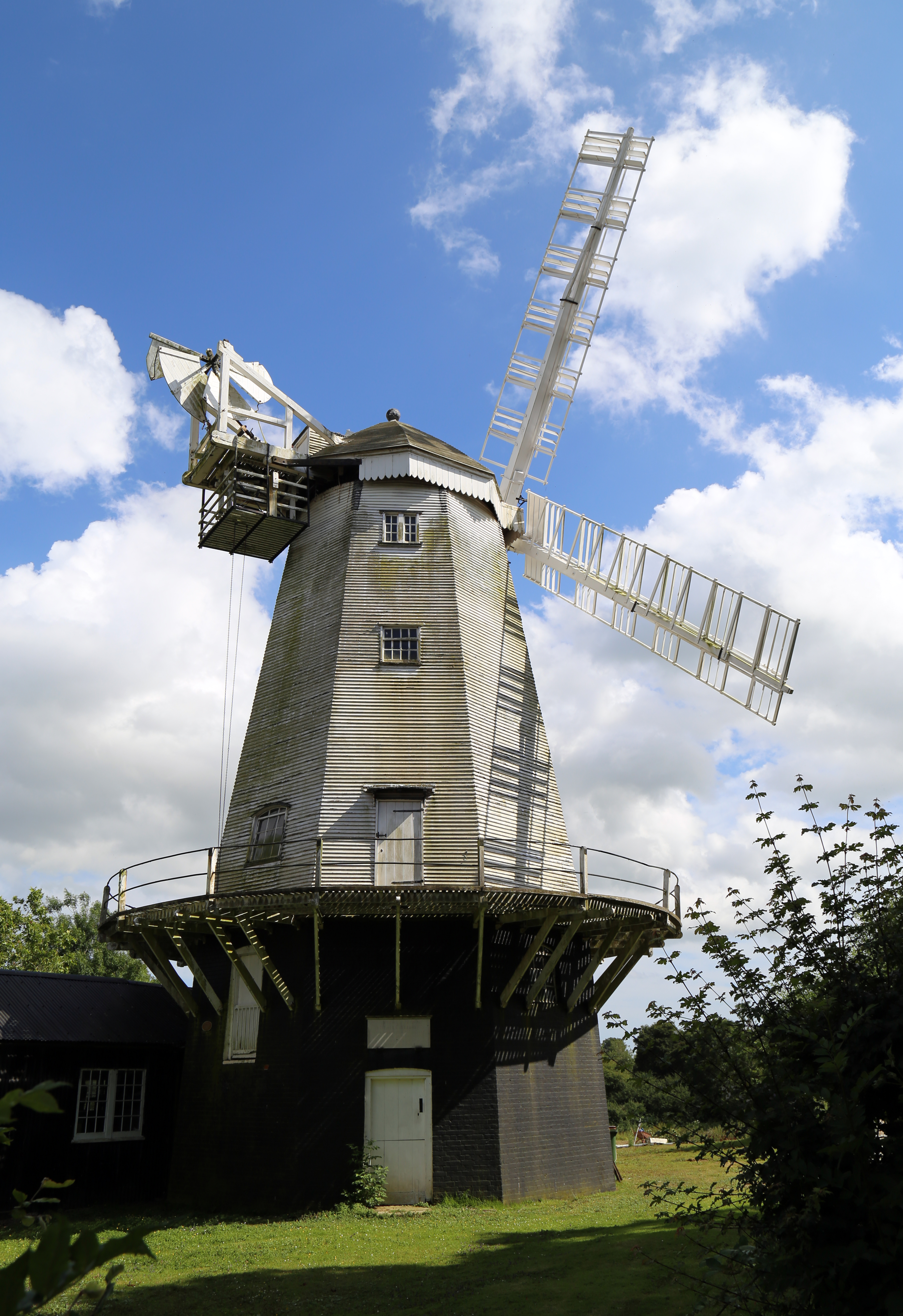
King's Mill, Shipley

King's Mill or Vincent's Mill, Shipley, West Sussex, England, is a smock mill built in 1879. == History == King's Mill was built in 1879 for Friend Martin...

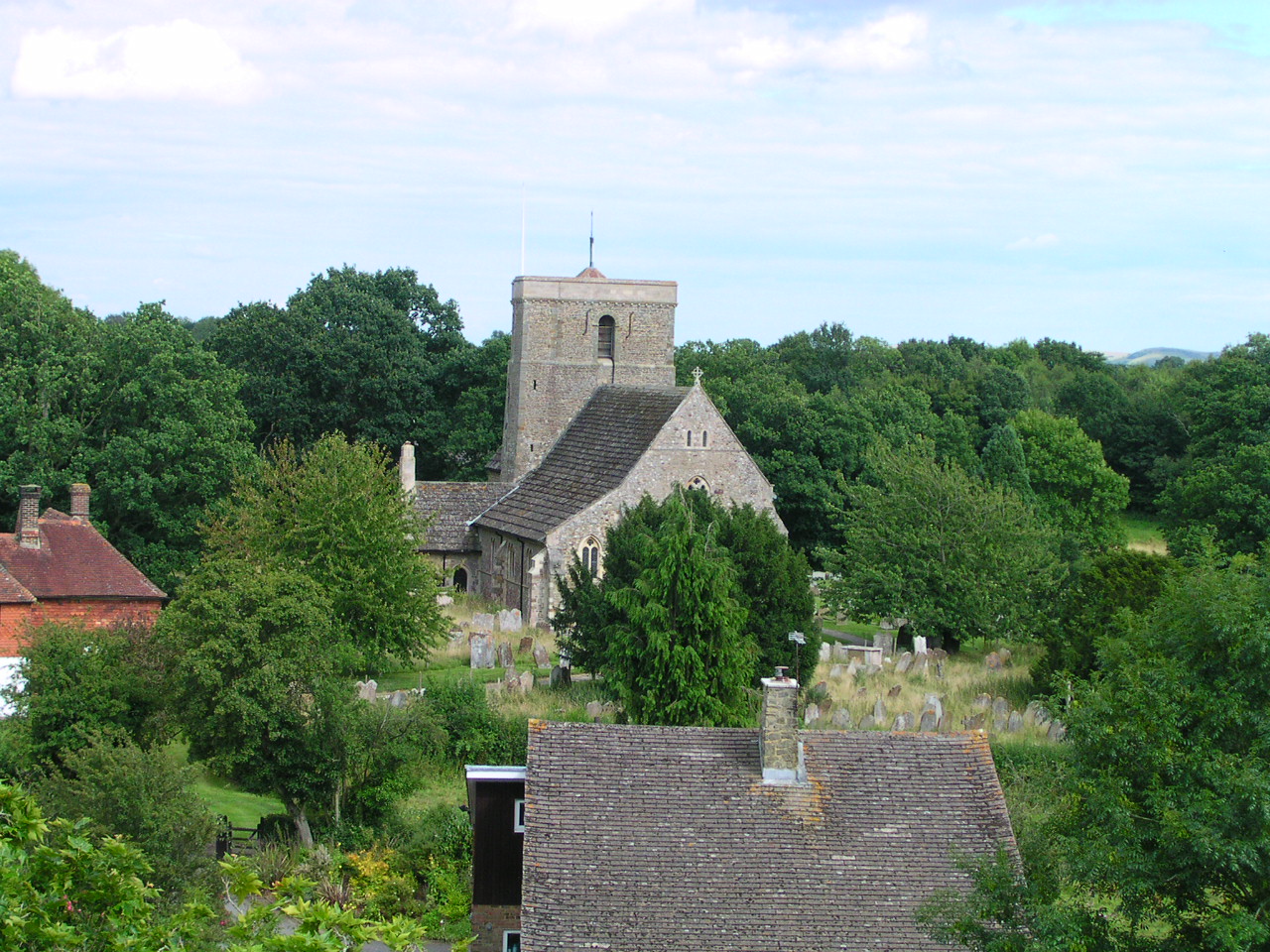
St Mary's Church, Shipley

The Church of St Mary the Virgin is an Anglican church in the village of Shipley, in West Sussex, England. It is in the Diocese of Chichester. Built in...

Shipley, West Sussex

Shipley is a village and civil parish in the Horsham District of West Sussex, England. It lies just off the A272 road 6 miles (10 kilometres) north-east...

Dragon's Green

Dragon's Green is a hamlet in the civil parish of Shipley, and the Horsham district of West Sussex, England. The hamlet is 5 miles (8 km) south from the...

Parson's Brook

Parson's Brook is a minor river (brook) located in the Horsham District of West Sussex, England. It is a tributary to the River Adur. == Course == The...

Nearby Amenities

Located within 500m of 50.978376,-0.399591
Broomers Corner
Addr Place: Broomers Corner
Note: name is on a road-type sign, not sure if refers to a settlement or not...
Place: hamlet
Lat/Long: 50.9778701/-0.3964817
Post Box
Ref: RH13 56
Lat/Long: 50.9778429/-0.3966478
Turning Loop
Lat/Long: 50.9804836/-0.395487
Piper's Farm
Place: farm
Lat/Long: 50.9816246/-0.4012583
Falconer's
Place: isolated_dwelling
Lat/Long: 50.9771388/-0.4011715
Bryant's Platt Farm
Place: farm
Lat/Long: 50.9786306/-0.4002059
Ivydene Farm
Place: isolated_dwelling
Lat/Long: 50.9786897/-0.4009077
Barnfield House
Place: isolated_dwelling
Lat/Long: 50.9765383/-0.4030398
The data included in this document is from www.openstreetmap.org. The data is made available under ODbL.

Have you been to Broomer's Corner?

Leave your review of Broomer's Corner below (or comments, questions and feedback).