Little Houghton

Civil Parish in Yorkshire Barnsley

England

Little Houghton

Edderthorpe Flash
Edderthorpe Flash Credit: Mike Pennington

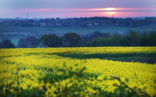
Little Houghton is a civil parish located in the county of Yorkshire, England. Situated approximately 3 miles east of Barnsley, it is a small village with a population of around 900 residents. The village is set in a rural landscape, surrounded by picturesque countryside and farmland.

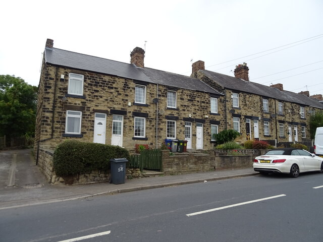
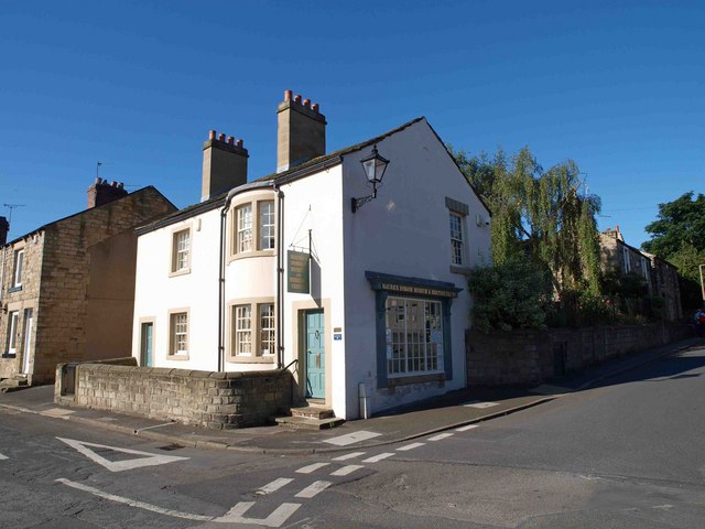
Historically, Little Houghton has been an agricultural community, with farming playing a significant role in the local economy. The village is known for its idyllic charm, characterized by its traditional stone cottages and quaint village green. The local parish church, St. Michael and All Angels, is a prominent feature and dates back to the 12th century, offering a glimpse into the area's rich history.

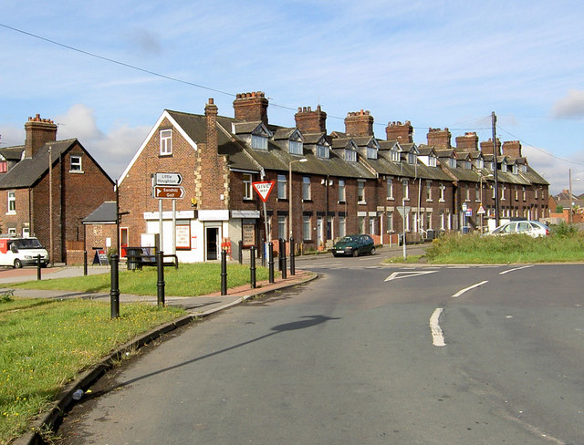
In terms of amenities, Little Houghton has a primary school, providing education for the local children. The village also boasts a village hall, which serves as a community hub for various events and activities. Additionally, there is a local pub that offers a place for residents to socialize and enjoy a drink or meal.

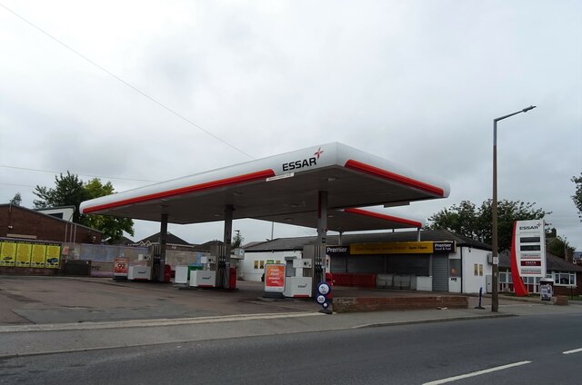
Little Houghton benefits from its proximity to Barnsley, where residents can access a wider range of amenities and services. The village is well-connected to the surrounding areas by road, making it easily accessible for commuters.

Overall, Little Houghton offers a peaceful and close-knit community for its residents, with a charming rural setting that showcases the beauty of the Yorkshire countryside.

If you have any feedback on the listing, please let us know in the comments section below.

Little Houghton Images

Images are sourced within 2km of 53.548679/-1.363307 or Grid Reference SE4205. Thanks to Geograph Open Source API. All images are credited.

Edderthorpe Flash
Edderthorpe Flash
Wind turbine, Grimethorpe
Carlton Main Brickworks, Grimethorpe: aerial 2022
Billingley War Memorial
Stubble field and power lines off West Kirk Lane
West Kirk Lane
West Kirk Lane
Rotherham Road (B6273)
Entering Great Houghton on Rotherham Road (B6273)
Houses on Rotherham Road
The Sandhill Tavern, Great Houghton
Sign for the Sandhill Tavern, Great Houghton
Houses on Rotherham Road
Rotherham Road (B6273)
Miners' Welfare Hall
Thurnscoe Lane (B6411)
Service station on High Street
Bus stop on High Street (B6273)
The Houghton Arms
The Houghton Arms
Show me another place!

Little Houghton is located at Grid Ref: SE4205 (Lat: 53.548679, Lng: -1.363307)

Division: West Riding

Administrative County: South Yorkshire

District: Barnsley

Police Authority: South Yorkshire

What 3 Words

///scariest.sensible.pigment. Near Little Houghton, South Yorkshire

Related Wikis

Little Houghton, South Yorkshire

Little Houghton is a hamlet and civil parish in the Metropolitan Borough of Barnsley, South Yorkshire, England. At the 2001 census it had a population...

Great Houghton, South Yorkshire

Great Houghton is a village and civil parish in the Metropolitan Borough of Barnsley in South Yorkshire, England), on the border with West Yorkshire. It...

St Michael and All Angels Church, Great Houghton

St Michael and All Angels Church is the parish church of Great Houghton in South Yorkshire. The church is dedicated to St Michael, and was originally a...

Middlecliffe

Middlecliffe is a small hamlet in South Yorkshire, England. It straddles the road between Darfield and Great Houghton, close to Barnsley, where Middlecliff...

Great Houghton Halt railway station

Great Houghton Halt was a small railway station on the Dearne Valley Railway (DVR) situated between Goldthorpe and Thurnscoe Halt and Grimethorpe Halt...

Darfield railway station

Darfield railway station was opened in 1840 by the North Midland Railway, serving the village of Darfield in South Yorkshire, England. The original station...

Millhouses, Barnsley

Millhouses is a district of Barnsley in the English county of South Yorkshire. Millhouses adjoins the town of Darfield near the A635 road to the east of...

Darfield, South Yorkshire

Darfield is a village within the Metropolitan Borough of Barnsley, South Yorkshire, England. It is historically part of the West Riding of Yorkshire. The...

Nearby Amenities

Located within 500m of 53.548679,-1.363307
Little Houghton
Place: village
Wikidata: Q2079768
Wikipedia: en:Little Houghton, South Yorkshire
Lat/Long: 53.5453995/-1.3612268
Bus Stop
Middlecliffe Lane
Alt Name: Middlecliffe Lane
Naptan AltCommonName: Middlecliffe Lane
Naptan AtcoCode: 370050373
Naptan Bearing: SE
Naptan CommonName: Middlecliffe Lane
Naptan Indicator: 50373
Naptan Landmark: Colliery Farm/Opposite No 147
Naptan PlusbusZoneRef: ROTHCEN
Naptan Street: Middlecliffe Lane
Naptan Verified: no
Source: naptan_import
Lat/Long: 53.5451514/-1.3603393
Bus Stop
Middlecliffe Lane
Alt Name: Middlecliffe Lane
Naptan AltCommonName: Middlecliffe Lane
Naptan AtcoCode: 370055086
Naptan Bearing: N
Naptan CommonName: Middlecliffe Lane
Naptan Indicator: 55086
Naptan Landmark: Opposite Old Pit
Naptan PlusbusZoneRef: ROTHCEN
Naptan Street: Middlecliffe Lane
Naptan Verified: no
Source: naptan_import
Lat/Long: 53.5463206/-1.3621328
Bus Stop
Ings Lane/Middlecliff Lane
Alt Name: Ings Lane/Middlecliff Lane
Naptan AltCommonName: Ings Lane/Middlecliff Lane
Naptan AtcoCode: 370055110
Naptan Bearing: SE
Naptan CommonName: Ings Lane/Middlecliff Lane
Naptan Indicator: 55110
Naptan Landmark: Haughton Colliery
Naptan PlusbusZoneRef: ROTHCEN
Naptan Street: Ings Lane
Naptan Verified: no
Source: naptan_import
Lat/Long: 53.5470016/-1.3655698
Ings Lane/Middlecliffe Lane
Naptan AtcoCode: 370055558
Naptan Bearing: NW
Naptan BusStopType: CUS
Naptan CommonName: Ings Lane/Middlecliffe Lane
Naptan Indicator: 55558
Naptan Landmark: COLLIERY FARM/OPPOSITE NO. 147
Naptan PlusbusZoneRef: ROTHCEN
Naptan Street: Ings Lane
Naptan Verified: no
Source: naptan_import
Lat/Long: 53.5450804/-1.3605064
Power: pole
Lat/Long: 53.5472435/-1.3636166
Power: pole
Lat/Long: 53.5469781/-1.3618516
Power: pole
Lat/Long: 53.546787/-1.360512
Power: pole
Lat/Long: 53.5461252/-1.3589631
Houghton Main Colliery Memorial
Historic: monument
Lat/Long: 53.5469535/-1.3650896
Generator Method: photovoltaic
Generator Orientation: S
Generator Output Electricity: yes
Generator Source: solar
Generator Type: solar_photovoltaic_panel
Location: roof
Power: generator
Lat/Long: 53.5446959/-1.3599923
Generator Method: photovoltaic
Generator Orientation: S
Generator Output Electricity: yes
Generator Source: solar
Generator Type: solar_photovoltaic_panel
Location: roof
Power: generator
Lat/Long: 53.5458535/-1.3600623
Generator Method: photovoltaic
Generator Orientation: S
Generator Output Electricity: yes
Generator Source: solar
Generator Type: solar_photovoltaic_panel
Location: roof
Power: generator
Lat/Long: 53.5456882/-1.3595894
Generator Method: photovoltaic
Generator Orientation: S
Generator Output Electricity: yes
Generator Source: solar
Generator Type: solar_photovoltaic_panel
Location: roof
Power: generator
Lat/Long: 53.5454134/-1.3602245
Generator Method: photovoltaic
Generator Orientation: S
Generator Output Electricity: yes
Generator Source: solar
Generator Type: solar_photovoltaic_panel
Location: roof
Power: generator
Lat/Long: 53.545603/-1.3600863
Generator Method: photovoltaic
Generator Orientation: S
Generator Output Electricity: yes
Generator Source: solar
Generator Type: solar_photovoltaic_panel
Location: roof
Power: generator
Lat/Long: 53.5448633/-1.3598404
Defibrillator
Access: yes
Check Date: 2023-03-09
Defibrillator Location: On outside wall.
Emergency: defibrillator
Indoor: no
Opening Hours: 24/7
Lat/Long: 53.5454141/-1.35829
Post Box
Collection Times: Mo-Fr 17:15; Sa 12:00
Post Box Type: lamp
Ref: S72 101
Royal Cypher: EIIR
Royal Cypher Wikidata: Q33102113
Lat/Long: 53.5462457/-1.3624238
Buttercross Stone
Historic: wayside_cross
Lat/Long: 53.5462959/-1.3622577
Parking
Capacity: 3
Fee: no
Lat/Long: 53.5458336/-1.3666133
Power: pole
Lat/Long: 53.5460957/-1.3594821
Power: pole
Lat/Long: 53.5466534/-1.3608034
Power: pole
Lat/Long: 53.5468472/-1.3621167
Power: pole
Lat/Long: 53.5471917/-1.3633027
Power: pole
Lat/Long: 53.5470225/-1.3632065
Power: transformer
Lat/Long: 53.5470315/-1.3638203
Power: transformer
Lat/Long: 53.5471136/-1.3640992
Power: switch
Lat/Long: 53.5472649/-1.3639753
Power: switch
Lat/Long: 53.5471751/-1.3638731
Power: switch
Lat/Long: 53.5471774/-1.3636801
Power: switch
Lat/Long: 53.5471061/-1.3636362
The data included in this document is from www.openstreetmap.org. The data is made available under ODbL.

Have you been to Little Houghton?

Leave your review of Little Houghton below (or comments, questions and feedback).