Alexandra Park

Settlement in Lancashire

England

Alexandra Park

Welcome to Trafford - Nr Man Utd Stadium where the A56 meets the A5014
Welcome to Trafford - Nr Man Utd Stadium where the A56 meets the A5014 Credit: Gary Barber

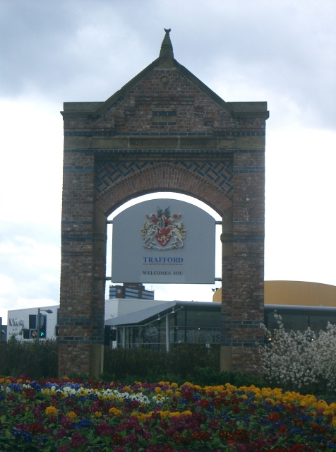
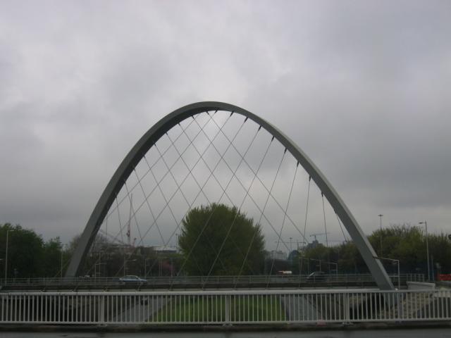
Alexandra Park is a picturesque urban park located in the heart of Lancashire, England. Spanning over 60 acres, it is a popular destination for both locals and tourists, offering a serene and tranquil environment away from the bustling city life. The park is situated in the town of Oldham, just a short distance from Manchester.

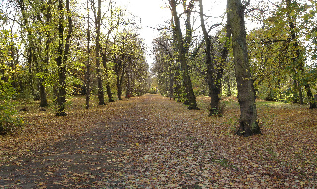
Established in 1865, Alexandra Park holds historical significance as it was built to commemorate the marriage of the Prince and Princess of Wales. It was named after Queen Alexandra of Denmark, who later became Queen Consort of the United Kingdom. The park's design was influenced by the Victorian era, featuring beautiful landscaped gardens, ornamental lakes, and charming pathways.

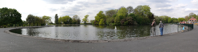
One of the park's main attractions is its stunning boating lake, where visitors can rent paddle boats and enjoy a leisurely ride on the water. The lake is also home to a variety of waterfowl, making it an ideal spot for birdwatching. In addition, Alexandra Park boasts a well-maintained football pitch, tennis courts, and a children's playground, providing ample recreational opportunities for all ages.

Throughout the year, the park hosts various events and festivals, including outdoor concerts, art exhibitions, and food markets. These events attract a diverse range of visitors, adding vibrancy and excitement to the already enchanting atmosphere of Alexandra Park.

Overall, Alexandra Park is a cherished gem in Lancashire, offering a peaceful escape from city life and providing a range of activities for nature enthusiasts, sports lovers, and families.

If you have any feedback on the listing, please let us know in the comments section below.

Alexandra Park Images

Images are sourced within 2km of 53.44968/-2.255194 or Grid Reference SJ8394. Thanks to Geograph Open Source API. All images are credited.

Welcome to Trafford - Nr Man Utd Stadium where the A56 meets the A5014
The Southern, Nell Lane, Chorlton
Chorlton Library
Chorlton Library
KingBee Records, Wilbraham Road, Chorlton King Bee sell some brand new stuff and a vast array of varying styles of second hand vinyl and CD's. It can get cramped in there at times, but it's worth it because you'll find a bargain every now and again.
KingBee Records, Wilbraham Road, Chorlton
King Bee sell some brand new stuff and a vast array of varying styles of second hand vinyl and CD's. It can get cramped in there at times, but it's worth it because you'll find a bargain every now and again.
St. Bede's College and Prep School, Alexandra Road, Whalley Range
The Whitworth Art Gallery
The Hulme Arch Bridge
Platt Brook Platt Brook runs parallel to the old railway line, now part of the Fallowfield Loop cycle path.
Platt Brook
Platt Brook runs parallel to the old railway line, now part of the Fallowfield Loop cycle path.
Alexandra Park Alexandra Park is one of Manchester's oldest man-made parks. Designed in 1869 by Alexander Henell and built in 1870, it covers some 23ha and still has many of the original trees and much of the original layout.
Alexandra Park
Alexandra Park is one of Manchester's oldest man-made parks. Designed in 1869 by Alexander Henell and built in 1870, it covers some 23ha and still has many of the original trees and much of the original layout.
Princess Road - Mauldeth Road Junction at Hough End Corner of Hough End playing fields at the junction of Princess Road and Mauldeth Road, looking west. 27 football pitches cover a large open area - it used to be the site of Alexandra Park aerodrome from which UK's first domestic air service to Southport and Blackpool commenced on 24th May 1919.
Princess Road - Mauldeth Road Junction at Hough End
Corner of Hough End playing fields at the junction of Princess Road and Mauldeth Road, looking west. 27 football pitches cover a large open area - it used to be the site of Alexandra Park aerodrome from which UK's first domestic air service to Southport and Blackpool commenced on 24th May 1919.
Platt Fields Park A panoramic view of Platt Fields Park lake. The heart-shaped lake and island were constructed in the winter of 1908-9 by some 700 previously unemployed men.
Platt Fields Park
A panoramic view of Platt Fields Park lake. The heart-shaped lake and island were constructed in the winter of 1908-9 by some 700 previously unemployed men.
Maine Road Football Ground Former home of Manchester City FC being demolished
Maine Road Football Ground
Former home of Manchester City FC being demolished
Old Trafford Fulford Street, Old Trafford from its junction with Northumberland Road. A typical residential street of the area. SJ822958
Old Trafford
Fulford Street, Old Trafford from its junction with Northumberland Road. A typical residential street of the area. SJ822958
Seymour Park, Old Trafford Looking NW across the park. SJ821959
Seymour Park, Old Trafford
Looking NW across the park. SJ821959
Hough End Hall and Mauldeth House This picture taken from SJ824931 looking North east from Nell Lane. Hough End hall is directly in front and Mauldeth House is to the left of the picture.
Hough End Hall and Mauldeth House
This picture taken from SJ824931 looking North east from Nell Lane. Hough End hall is directly in front and Mauldeth House is to the left of the picture.
St Werburghs This is St Werburghs Church on the corner of Wilbraham Road and St Werburghs Road. The picture was taken from SJ823940 looking north.
St Werburghs
This is St Werburghs Church on the corner of Wilbraham Road and St Werburghs Road. The picture was taken from SJ823940 looking north.
Road Junction This is the view down Wilbraham Road from the railway bridge approaching the junction with albany and Corkland roads. Taken from SJ818940 facing west.
Road Junction
This is the view down Wilbraham Road from the railway bridge approaching the junction with albany and Corkland roads. Taken from SJ818940 facing west.
Alexandra Park Municipal Park, Whalley Range, Manchester. looking south. SJ83389525.
Alexandra Park
Municipal Park, Whalley Range, Manchester. looking south. SJ83389525.
Show me another place!

Alexandra Park is located at Grid Ref: SJ8394 (Lat: 53.44968, Lng: -2.255194)

Unitary Authority: Manchester

Police Authority: Greater Manchester

What 3 Words

///twig.doll.locker. Near Chorlton cum Hardy, Manchester

Nearby Locations

Alexandra Park

Related Wikis

Hartley Victoria College

Hartley Victoria College was a Methodist theological college in Manchester, England. In 1934, after the union that created the Methodist Church of Great...

Whalley Range, Manchester

Whalley Range is an area of Manchester, England, about 2 miles (3.2 km) southwest of the city centre. The population at the 2011 census was 15,430. Historically...

St Bede's College, Manchester

St Bede's College is an Independent Roman Catholic co-educational day school for pupils between 3 and 18 years located on Alexandra Road South in Whalley...

Alexandra Park, Manchester

Alexandra Park is a 60-acre (24 ha) park in Manchester, England, designed by Alexander Gordon Hennell, and opened to the public in 1870. The lodge and...

British Muslim Heritage Centre

The British Muslim Heritage Centre, formerly the GMB National College, College Road, Whalley Range, Manchester, is an early Gothic Revival building. The...

William Hulme's Grammar School

William Hulme's Grammar School is a mixed all-through school in Whalley Range, Manchester, England. == History == William Hulme (1631–1691) of Hulme Hall...

Maine Road F.C.

Maine Road Football Club is a football club, based in Chorlton-cum-Hardy, Manchester, England. Founded in 1955 by Manchester City supporters, they are...

Manley Hall, Manchester

Manley Hall was a large house in Whalley Range, Manchester. It was a two-storey Victorian Italianate building with fifty rooms, very grandly furnished...

Nearby Amenities

Located within 500m of 53.44968,-2.255194
Turning Circle
Lat/Long: 53.448129/-2.255457
Crossing
Lat/Long: 53.4519171/-2.2575739
Source: Yahoo imagery
Lat/Long: 53.4536802/-2.256378
Source: Yahoo imagery
Lat/Long: 53.4541106/-2.2552203
Bus Stop
Yarburgh St/Withington Road
Bus: yes
Naptan AtcoCode: 1800SB31891
Naptan Bearing: NE
Naptan CommonName: Yarburgh St/Withington Road
Naptan Indicator: Opp House 46
Naptan Landmark: OPP HOUSE 46
Naptan NaptanCode: mangtwdp
Naptan PlusbusZoneRef: MNCRPIC
Naptan ShortCommonName: Withington Road
Naptan Street: YARBURGH STREET
Naptan Verified: no
Network: TfGM
Public Transport: platform
Source: naptan_import
Lat/Long: 53.4539872/-2.2557062
Bus Stop
Alexandra Park, Alexandra Road South / near Range Road
Bus: yes
Naptan AtcoCode: 1800SB31921
Naptan Bearing: N
Naptan CommonName: Alexandra Road South/Range Road
Naptan Indicator: St Edmunds Hall
Naptan Landmark: CHURCH
Naptan NaptanCode: mangtwga
Naptan PlusbusZoneRef: MNCRPIC
Naptan ShortCommonName: Range Road
Naptan Street: Alexandra Road S
Naptan Verified: no
Network: TfGM
Operator: TfGM
Public Transport: platform
Source: naptan_import
Tactile Paving: no
Lat/Long: 53.4531493/-2.2524033
Bus Stop
Alexandra Rd South/St Bede's College
Bus: yes
Naptan AtcoCode: 1800SB31931
Naptan Bearing: N
Naptan CommonName: Alexandra Rd South/St Bede's College
Naptan Indicator: St Bedes Colleg
Naptan Landmark: COLLEGE
Naptan NaptanCode: mangtwgd
Naptan PlusbusZoneRef: MNCRPIC
Naptan ShortCommonName: St Bede's College
Naptan Street: Alexandra Road S
Naptan Verified: no
Network: TfGM
Public Transport: platform
Source: naptan_import
Tactile Paving: no
Lat/Long: 53.4519809/-2.2523211
Bus Stop
Alexandra Park, Alexandra Road South / Wellington Road
Bus: yes
Naptan AtcoCode: 1800SB31941
Naptan Bearing: S
Naptan CommonName: Alexandra Road South/Wellington Rd
Naptan Indicator: Opp St Bedes
Naptan Landmark: COLLEGE
Naptan NaptanCode: mangtwgj
Naptan PlusbusZoneRef: MNCRPIC
Naptan ShortCommonName: Wellington Rd
Naptan Street: Alexandra Road S
Naptan Verified: no
Network: TfGM
Operator: TfGM
Public Transport: platform
Source: naptan_import
Tactile Paving: no
Lat/Long: 53.4516308/-2.2521232
Bus Stop
Alexandra Park, Alexandra Road South / near Demesne Road
Bus: yes
Naptan AtcoCode: 1800SB31951
Naptan Bearing: N
Naptan CommonName: Alexandra Road South/Demesne Road
Naptan Indicator: House 36
Naptan Landmark: Park
Naptan NaptanCode: mangtwgm
Naptan PlusbusZoneRef: MNCRPIC
Naptan ShortCommonName: Demesne Road
Naptan Street: Alexandra Road South
Naptan Verified: no
Network: TfGM
Operator: TfGM
Public Transport: platform
Source: naptan_import
Tactile Paving: no
Lat/Long: 53.4495812/-2.2521713
Bus Stop
Alexandra Park, Alexandra Road South / adjacent Demesne Road
Bus: yes
Naptan AtcoCode: 1800SB31961
Naptan Bearing: S
Naptan CommonName: Alexandra Road South/Demesne Road
Naptan Indicator: Park
Naptan Landmark: PARK
Naptan NaptanCode: mangtwgp
Naptan PlusbusZoneRef: MNCRPIC
Naptan ShortCommonName: Demesne Road
Naptan Street: Alexandra Road S
Naptan Verified: no
Network: TfGM
Operator: TfGM
Public Transport: platform
Source: naptan_import
Lat/Long: 53.44933/-2.251959
Bus Stop
Whalley Range, Alexandra Road South / near Brantingham Road
Bus: yes
Naptan AtcoCode: 1800SB31971
Naptan Bearing: S
Naptan CommonName: Alexandra Rd South/Brantingham Rd
Naptan Indicator: House 41
Naptan Landmark: Church
Naptan NaptanCode: mangtwgt
Naptan PlusbusZoneRef: MNCRPIC
Naptan ShortCommonName: Brantingham Rd
Naptan Street: Alexandra Road S
Naptan Verified: no
Network: TfGM
Operator: TfGM
Public Transport: platform
Shelter: no
Source: naptan_import
Tactile Paving: no
Lat/Long: 53.4465889/-2.2518217
Bus Stop
Manley Road/Russell Avenue
Bus: yes
Naptan AtcoCode: 1800SB33031
Naptan Bearing: E
Naptan CommonName: Manley Road/Russell Avenue
Naptan Indicator: House 102
Naptan Landmark: HOUSE 102
Naptan NaptanCode: mangwapj
Naptan PlusbusZoneRef: MNCRPIC
Naptan ShortCommonName: Russell Avenue
Naptan Street: MANLEY ROAD
Naptan Verified: no
Network: TfGM
Public Transport: platform
Source: naptan_import
Lat/Long: 53.4470198/-2.2603772
Bus Stop
Withington Road/Yarburgh Street
Bus: yes
Naptan AtcoCode: 1800SB14501
Naptan Bearing: S
Naptan CommonName: Withington Road/Yarburgh Street
Naptan Indicator: Victoria Wine
Naptan Landmark: TESCO EXPRESS
Naptan NaptanCode: mangtapw
Naptan PlusbusZoneRef: MNCRPIC
Naptan ShortCommonName: Yarburgh Street
Naptan Street: WITHINGTON ROAD
Naptan Verified: no
Network: TfGM
Public Transport: platform
Source: naptan_import
Lat/Long: 53.4537315/-2.257557
Withington Road/Manley Road
Bench: no
Bus: yes
Disused Highway: bus_stop
Disused Public Transport: platform
Naptan AtcoCode: 1800SB14931
Naptan Bearing: S
Naptan CommonName: Withington Road/Manley Road
Naptan Indicator: Grassland
Naptan Landmark: GRASSLAND
Naptan NaptanCode: mangtdjd
Naptan PlusbusZoneRef: MNCRPIC
Naptan ShortCommonName: Manley Road
Naptan Street: WITHINGTON ROAD
Naptan Verified: no
Network: TfGM
Shelter: no
Source: naptan_import
Tactile Paving: no
Lat/Long: 53.4468921/-2.257094
Bus Stop
Withington Road/Manley Road
Bench: no
Bus: yes
Naptan AtcoCode: 1800SB14941
Naptan Bearing: N
Naptan CommonName: Withington Road/Manley Road
Naptan Indicator: House 174
Naptan Landmark: HOUSE 174
Naptan NaptanCode: mangtdjg
Naptan Notes: INDICATOR AMENDED
Naptan PlusbusZoneRef: MNCRPIC
Naptan ShortCommonName: Manley Road
Naptan Street: WITHINGTON ROAD
Naptan Verified: no
Network: TfGM
Public Transport: platform
Shelter: no
Source: naptan_import
Tactile Paving: no
Lat/Long: 53.4472692/-2.2572619
Bus Stop
Withington Road/Burford Road
Bus: yes
Naptan AtcoCode: 1800SB31091
Naptan Bearing: S
Naptan CommonName: Withington Road/Burford Road
Naptan Indicator: House 173
Naptan Landmark: HOUSE 173
Naptan NaptanCode: mangtmtp
Naptan PlusbusZoneRef: MNCRPIC
Naptan ShortCommonName: Burford Road
Naptan Street: WITHINGTON ROAD
Naptan Verified: no
Network: TfGM
Public Transport: platform
Source: naptan_import
Lat/Long: 53.4490937/-2.2573633
Bus Stop
Withington Road/Burford Road
Bus: yes
Naptan AtcoCode: 1800SB31101
Naptan Bearing: N
Naptan CommonName: Withington Road/Burford Road
Naptan Indicator: St Margaret Sch
Naptan Landmark: SCHOOL
Naptan NaptanCode: mangtmtw
Naptan PlusbusZoneRef: MNCRPIC
Naptan ShortCommonName: Burford Road
Naptan Street: WITHINGTON ROAD
Naptan Verified: no
Network: TfGM
Public Transport: platform
Source: naptan_import
Lat/Long: 53.4494893/-2.2578415
Bus Stop
Withington Road/Range Road
Bus: yes
Naptan AtcoCode: 1800SB31111
Naptan Bearing: S
Naptan CommonName: Withington Road/Range Road
Naptan Indicator: Garage
Naptan Landmark: MOSQUE
Naptan NaptanCode: mangtmwa
Naptan PlusbusZoneRef: MNCRPIC
Naptan ShortCommonName: Range Road
Naptan Street: WITHINGTON ROAD
Naptan Verified: no
Network: TfGM
Public Transport: platform
Source: naptan_import
Lat/Long: 53.4525273/-2.2574142
Whalley Range
Name Ur: والی رینج
Place: suburb
Wikidata: Q7990577
Wikipedia: en:Whalley Range, Manchester
Lat/Long: 53.4493633/-2.2574686
Alexandra Park Demesne Road Pavilion Entrance
Addr City: Manchester
Addr Postcode: M16 8HZ
Addr Street: Demesne Road
Opening Hours: 24/7
Wheelchair: yes
Lat/Long: 53.448922/-2.24918
Place Of Worship
Addr City: Manchester
Addr Country: GB
Denomination: catholic
Religion: christian
Lat/Long: 53.451844/-2.253092
Tesco Express
Brand: Tesco Express
Brand Wikidata: Q98456772
Brand Wikipedia: en:Tesco
Contact Website: https://www.tesco.com/store-locator/manchester/94a-withington-rd
Shop: convenience
Wheelchair: yes
Lat/Long: 53.453767/-2.2578605
Bicycle Parking
Access: yes
Bicycle Parking: stands
Capacity: 6
Covered: no
Fee: no
Lat/Long: 53.4494818/-2.2486909
Access: yes
Leisure: playground
Wheelchair: yes
Lat/Long: 53.4501718/-2.2499891
Cafe
The Pavillion
Addr Housename: Coffee Cranks Co-operative Cafe
Addr Postcode: M16 8PJ
Addr Street: Demesne Road
Contact Phone: +44 161 459 0450
Cuisine: coffee_shop
Old Name: Coffee Cranks
Outdoor Seating: yes
Smoking: no
Takeaway: yes
Wheelchair: yes
Lat/Long: 53.4496191/-2.2486962
Tourism: picnic_site
Wheelchair: yes
Lat/Long: 53.4495105/-2.2488625
Man Made: flagpole
Lat/Long: 53.4515004/-2.2496006
Cafe
Mediterranean Cafe
Addr City: Manchester
Addr Postcode: M16 8FB
Addr Street: Withington Road
Cuisine: coffee_shop
Outdoor Seating: yes
Wheelchair: no
Lat/Long: 53.4521004/-2.2578256
Azam News
Shop: newsagent
Wheelchair: yes
Lat/Long: 53.4519174/-2.2578363
Atm
Wheelchair: yes
Lat/Long: 53.4536999/-2.2577887
Dentist
Dental Practice
Lat/Long: 53.4519631/-2.2578337
Pamela Jean
Shop: hairdresser
Wheelchair: no
Lat/Long: 53.4520546/-2.2578283
Aluk Motors
Shop: car
Lat/Long: 53.4523923/-2.2571169
Telephone
Booth: KX100
Covered: booth
Lat/Long: 53.452918/-2.257236
Car Wash
Crystal Shine
Wheelchair: yes
Lat/Long: 53.4536282/-2.2571885
Car Wash
Wonder Wash
Wheelchair: yes
Lat/Long: 53.452462/-2.2570968
Bicycle Parking
Bicycle Parking: wall_loops
Capacity: 3
Covered: no
Fee: no
Lat/Long: 53.451733/-2.257271
Range Solicitors
Addr City: Manchester
Office: lawyer
Wheelchair: yes
Lat/Long: 53.4527405/-2.2577384
Pharmacy
Range Pharmacy
Dispensing: yes
Drive Through: no
Healthcare: pharmacy
Wheelchair: yes
Lat/Long: 53.4531041/-2.2571792
The Clean Machine
Shop: laundry
Wheelchair: no
Lat/Long: 53.4527904/-2.2576277
Fast Food
Noodle House
Cuisine: chinese
Takeaway: yes
Wheelchair: yes
Lat/Long: 53.4528423/-2.2576224
Bench
Lat/Long: 53.452284/-2.251867
Whalley Range Malik Super Store
Shop: convenience
Wheelchair: yes
Lat/Long: 53.453775/-2.257442
Euromark Travel
Shop: travel_agency
Lat/Long: 53.4535345/-2.2572945
Pharmacy
Everest Pharmacy
Drive Through: no
Healthcare: pharmacy
Wheelchair: yes
Lat/Long: 53.453483/-2.257271
Doctors
Range Medical Centre
Healthcare: doctor
Wheelchair: yes
Lat/Long: 53.4529987/-2.2571819
Recycling
Recycling Clothes: yes
Recycling Type: container
Lat/Long: 53.4522386/-2.2570812
Post Box
Ref: M16 100D
Lat/Long: 53.4522741/-2.2523403
Bench
Lat/Long: 53.451154/-2.25196
Waste Basket
Lat/Long: 53.45089/-2.251666
Bargain World
Addr City: Manchester
Addr Country: GB
Addr Housenumber: 94A
Addr Postcode: M16 8FA
Addr Street: Withington Road
Shop: convenience
Wheelchair: yes
Lat/Long: 53.4536467/-2.2577995
Fast Food
Mr Hot
Cuisine: chinese
Takeaway: only
Lat/Long: 53.4520089/-2.257831
Fast Food
Rajas
Lat/Long: 53.4528943/-2.257617
Leisure: picnic_table
Lat/Long: 53.4503503/-2.2531594
Bbq
Lat/Long: 53.4503471/-2.2532171
Recycling
Recycling Cans: yes
Recycling Glass: yes
Recycling Paper: yes
Lat/Long: 53.4502093/-2.2532677
Entrance: yes
Lat/Long: 53.4518042/-2.2574223
Entrance: yes
Lat/Long: 53.4503439/-2.2524741
Fast Food
Subway
Addr City: Manchester
Addr Country: GB
Addr Housenumber: 94A
Addr Postcode: M16 8FA
Addr Street: Withington Road
Brand: Subway
Brand Wikidata: Q244457
Brand Wikipedia: en:Subway (restaurant)
Contact Website: https://restaurants.subway.com/united-kingdom/en/manchester/94a-withington-road
Cuisine: sandwich
Takeaway: yes
Lat/Long: 53.4535316/-2.257782
William Hill
Addr City: Manchester
Addr Country: GB
Addr Housenumber: 110-112
Addr Postcode: M16 8FA
Addr Street: Withington Road
Brand: William Hill
Brand Wikidata: Q4053147
Shop: bookmaker
Lat/Long: 53.4530066/-2.2576241
Shop: newsagent
Lat/Long: 53.453256/-2.2576581
Food Basket
Shop: convenience
Lat/Long: 53.4534157/-2.2577202
Fast Food
Chester's
Brand: Chester's
Brand Wikidata: Q5093401
Brand Wikipedia: en:Chester's International
Cuisine: chicken
Drive In: no
Drive Through: no
Takeaway: yes
Lat/Long: 53.453304/-2.2576782
Fast Food
Papa Carlo
Cuisine: kebab
Drive In: no
Drive Through: no
Wheelchair: no
Lat/Long: 53.453212/-2.257747
Post Box
Collection Times: Mo-Fr 09:00, Sa 07:00
Ref: M16 188D
Royal Cypher: VR
Royal Cypher Wikidata: Q33102356
Lat/Long: 53.448075/-2.2573081
Addr Flats: 1-9
Delivery Point Access: restricted
Delivery Point Type: communal
Entrance: yes
Lat/Long: 53.4480614/-2.2600064
Place Of Worship
Minhaj-ul-Qur'an Central Mosque
Religion: muslim
Lat/Long: 53.4523886/-2.2580139
Range Interiors
Addr City: Manchester
Addr Country: GB
Addr Housenumber: 3
Addr Postcode: M16 8GQ
Addr Street: Dudley Road
Entrance: yes
Shop: interior_decoration
Lat/Long: 53.4535713/-2.2583326
Blue Sky Travel Services
Shop: travel_agency
Lat/Long: 53.452943/-2.2576144
Addr Postcode: M16 8FZ
Lat/Long: 53.4534751/-2.2552099
Addr Postcode: M16 8FZ
Lat/Long: 53.4535218/-2.255059
Addr Postcode: M16 8FZ
Lat/Long: 53.4535691/-2.2551003
Addr Postcode: M16 8FZ
Lat/Long: 53.4534822/-2.255187
Addr Postcode: M16 8FZ
Lat/Long: 53.4535785/-2.2550701
Addr Postcode: M16 8FZ
Lat/Long: 53.4536258/-2.2551114
Addr Postcode: M16 8FZ
Lat/Long: 53.4535853/-2.2552423
Addr Postcode: M16 8FZ
Lat/Long: 53.4535379/-2.255201
Addr Postcode: M16 8FZ
Lat/Long: 53.4535142/-2.2550834
Addr Postcode: M16 8FZ
Lat/Long: 53.4535295/-2.2552283
Addr Postcode: M16 8FZ
Lat/Long: 53.4535795/-2.255261
Addr Postcode: M16 8FZ
Lat/Long: 53.4536186/-2.2551347
Addr Postcode: M16 8FZ
Lat/Long: 53.4534669/-2.255042
Addr Postcode: M16 8FZ
Lat/Long: 53.4534277/-2.2551686
Addr Postcode: M16 8FZ
Lat/Long: 53.4536268/-2.2553023
Addr Postcode: M16 8FZ
Lat/Long: 53.4536659/-2.255176
Addr Postcode: M16 8FZ
Lat/Long: 53.453819/-2.2545754
Addr Postcode: M16 8FZ
Lat/Long: 53.4538111/-2.2546651
Addr Postcode: M16 8FZ
Lat/Long: 53.4537875/-2.2547412
Addr Postcode: M16 8FZ
Lat/Long: 53.453717/-2.2544863
Addr Postcode: M16 8FZ
Lat/Long: 53.4537122/-2.2545788
Addr Postcode: M16 8FZ
Lat/Long: 53.4537357/-2.2545027
Addr Postcode: M16 8FZ
Lat/Long: 53.4537057/-2.2546699
Addr Postcode: M16 8FZ
Lat/Long: 53.4537293/-2.2545937
Addr Postcode: M16 8FZ
Lat/Long: 53.4537993/-2.2545582
Addr Postcode: M16 8FZ
Lat/Long: 53.4537954/-2.2546515
Addr Postcode: M16 8FZ
Lat/Long: 53.4537225/-2.2546845
Addr Postcode: M16 8FZ
Lat/Long: 53.4538028/-2.2547545
Addr Postcode: M16 8FZ
Lat/Long: 53.453699/-2.2547606
Addr Postcode: M16 8FZ
Lat/Long: 53.4537405/-2.2544102
Addr Postcode: M16 8FZ
Lat/Long: 53.4538229/-2.2544821
Addr Postcode: M16 8FZ
Lat/Long: 53.4537792/-2.2548306
Blue Sky Travel Services
Shop: travel_agency
Lat/Long: 53.452943/-2.2576144
Entrance: main
Lat/Long: 53.4493419/-2.2599057
Addr Flats: 1-12
Addr Housename: Madina Hall
Delivery Point Access: restricted
Entrance: yes
Lat/Long: 53.4523361/-2.257985
Addr Flats: 7
Delivery Point: yes
Delivery Point Access: public
Entrance: yes
Lat/Long: 53.4486673/-2.2497287
Addr Flats: 1-6
Delivery Point Access: public
Delivery Point Type: clustered
Entrance: yes
Lat/Long: 53.4487112/-2.2498095
Delivery Point: yes
Delivery Point Access: public
Entrance: home
Lat/Long: 53.4487103/-2.2498595
Addr Flats: 62A
Delivery Point: yes
Delivery Point Access: public
Entrance: yes
Lat/Long: 53.4486139/-2.2499274
Addr Flats: 10
Delivery Point: yes
Delivery Point Access: public
Entrance: yes
Lat/Long: 53.4485207/-2.2510719
Addr Flats: 12
Delivery Point: yes
Delivery Point Access: public
Entrance: yes
Lat/Long: 53.4486215/-2.2509772
Addr Flats: 1-4
Delivery Point: yes
Delivery Point Access: public
Delivery Point Type: clustered
Entrance: yes
Lat/Long: 53.4486573/-2.2514131
Addr Flats: 5-16
Delivery Point: yes
Delivery Point Access: public
Delivery Point Type: clustered
Entrance: main
Lat/Long: 53.4486579/-2.2513683
1
Addr Flats: 1
Delivery Point: yes
Delivery Point Access: public
Entrance: yes
Lat/Long: 53.4482716/-2.2514513
2-22
Addr Flats: 2-22
Delivery Point: yes
Delivery Point Access: restricted
Entrance: main
Lat/Long: 53.4482908/-2.2515825
2,3,5-15
Addr Flats: 2;3;5-15
Delivery Point: yes
Delivery Point Access: restricted
Entrance: main
Lat/Long: 53.4480656/-2.2515678
4
Addr Flats: 4
Delivery Point: yes
Delivery Point Access: public
Entrance: yes
Lat/Long: 53.4479677/-2.2517369
1
Addr Flats: 1
Delivery Point: yes
Delivery Point Access: public
Entrance: yes
Lat/Long: 53.4480485/-2.2517421
Addr Flats: Basement
Delivery Point: yes
Delivery Point Access: public
Entrance: yes
Lat/Long: 53.4477983/-2.2514844
1-6
Addr Flats: 1-6
Delivery Point: yes
Delivery Point Access: public
Delivery Point Type: communal
Entrance: yes
Lat/Long: 53.4477944/-2.2517279
Flat 2
Addr Flats: 2
Delivery Point Access: public
Entrance: yes
Lat/Long: 53.4494949/-2.2561016
Flats 7,8
Addr Flats: 7;8
Delivery Point Access: public
Delivery Point Type: communal
Entrance: yes
Lat/Long: 53.4495096/-2.255892
Addr Flats: 1-6
Delivery Point Access: public
Delivery Point Type: communal
Entrance: main
Lat/Long: 53.4496149/-2.2558772
Flats 13-20
Addr Flats: 13-20
Delivery Point Access: public
Delivery Point Type: clustered
Entrance: yes
Lat/Long: 53.4496793/-2.252477
Flats 7-12
Addr Flats: 7-12
Delivery Point Access: public
Delivery Point Type: clustered
Entrance: yes
Lat/Long: 53.4497942/-2.2526746
Flats 1-6
Addr Flats: 1-6
Delivery Point Access: public
Delivery Point Type: clustered
Entrance: yes
Lat/Long: 53.4498026/-2.2524206
Addr Flats: 9-12;12A;14-16
Delivery Point Access: public
Delivery Point Type: clustered
Entrance: yes
Lat/Long: 53.448943/-2.2539272
Addr Flats: 1-8
Delivery Point Access: public
Delivery Point Type: clustered
Entrance: yes
Lat/Long: 53.4489379/-2.2541432
Flat 2
Addr Flats: 2
Delivery Point Access: public
Entrance: yes
Lat/Long: 53.4489071/-2.2560785
Basement flat
Addr Flats: Basement
Delivery Point Access: public
Entrance: yes
Lat/Long: 53.4488382/-2.2561542
1,3-6
Addr Flats: 1;3-6
Delivery Point Access: public
Delivery Point Type: communal
Entrance: main
Lat/Long: 53.4488388/-2.2561287
Addr Flats: 3
Delivery Point Access: public
Delivery Point Type: individual
Entrance: yes
Lat/Long: 53.4528855/-2.2592246
Addr Flats: 2
Delivery Point Access: public
Delivery Point Type: individual
Entrance: yes
Lat/Long: 53.4528199/-2.2590767
Addr Flats: 1;4-11
Delivery Point Access: timed
Entrance: yes
Lat/Long: 53.4528752/-2.2591125
Addr Flats: 1-4;6-8;10-12
Delivery Point Access: restricted
Entrance: main
Lat/Long: 53.4532363/-2.2543082
Addr Flats: 1-6
Delivery Point Access: restricted
Entrance: yes
Lat/Long: 53.4512635/-2.257389
Addr Flats: 7-8
Delivery Point Access: public
Delivery Point Type: clustered
Entrance: yes
Lat/Long: 53.4512787/-2.2573892
Entrance: main
Lat/Long: 53.4501454/-2.2572291
Entrance: main
Lat/Long: 53.4502648/-2.2571673
Flat 3-7
Addr Flats: 3-7
Delivery Point Access: public
Entrance: yes
Lat/Long: 53.4498692/-2.2558343
Flat 2
Addr Flats: 2
Delivery Point Access: public
Entrance: yes
Lat/Long: 53.4500017/-2.2557982
Entrance: main
Lat/Long: 53.4499925/-2.2556264
Flat 5
Addr Flats: 5
Delivery Point Access: public
Entrance: yes
Lat/Long: 53.449984/-2.2553847
Flats 1-4
Addr Flats: 1-4
Delivery Point Access: public
Delivery Point Type: clustered
Entrance: yes
Lat/Long: 53.4498908/-2.255326
Flat 2
Addr Flats: 2
Delivery Point Access: public
Entrance: yes
Lat/Long: 53.449941/-2.2550993
Flat 1
Addr Flats: 1
Delivery Point Access: public
Entrance: yes
Lat/Long: 53.4499482/-2.2549082
Flats 3-6
Addr Flats: 3-6
Delivery Point Access: public
Delivery Point Type: clustered
Entrance: yes
Lat/Long: 53.4500208/-2.2549633
Addr Flats: 1
Delivery Point Access: public
Entrance: yes
Lat/Long: 53.4501713/-2.2550994
Addr Flats: 2-3
Delivery Point Access: public
Delivery Point Type: clustered
Entrance: yes
Lat/Long: 53.4501949/-2.2549617
Addr Flats: 1-3
Delivery Point Access: public
Delivery Point Type: clustered
Entrance: yes
Lat/Long: 53.4506621/-2.255082
Addr Flats: 4-8
Delivery Point Access: restricted
Entrance: yes
Lat/Long: 53.4506478/-2.2551387
2
Addr Flats: 2
Delivery Point Access: public
Entrance: yes
Lat/Long: 53.4504923/-2.2572298
1
Addr Flats: 1
Delivery Point Access: public
Entrance: yes
Lat/Long: 53.4506019/-2.2572351
3-6
Addr Flats: 3-6
Delivery Point Access: timed
Delivery Point Type: individual
Entrance: yes
Lat/Long: 53.4505786/-2.2571593
8-13
Addr Flats: 8-13
Delivery Point Access: timed
Delivery Point Type: individual
Entrance: yes
Lat/Long: 53.4510212/-2.2552402
1-7
Addr Flats: 1-7
Delivery Point Access: timed
Delivery Point Type: individual
Entrance: yes
Lat/Long: 53.451032/-2.2550787
20-25
Addr Flats: 20-25
Delivery Point Access: timed
Delivery Point Type: individual
Entrance: yes
Lat/Long: 53.4511677/-2.2551376
15-19
Addr Flats: 15-19
Delivery Point Access: timed
Delivery Point Type: individual
Entrance: yes
Lat/Long: 53.4512887/-2.2551579
Addr Flats: 3
Delivery Point Access: public
Delivery Point Type: individual
Entrance: yes
Lat/Long: 53.4478422/-2.2522302
Addr Flats: 1;2;4-10
Delivery Point Access: public
Delivery Point Type: clustered
Entrance: yes
Lat/Long: 53.4478147/-2.2522292
20
Addr Flats: 20
Delivery Point Access: public
Delivery Point Type: individual
Entrance: yes
Lat/Long: 53.4476275/-2.2527615
19
Addr Flats: 19
Delivery Point Access: public
Delivery Point Type: individual
Entrance: yes
Lat/Long: 53.447629/-2.2526852
18
Addr Flats: 18
Delivery Point Access: public
Delivery Point Type: individual
Entrance: yes
Lat/Long: 53.4476888/-2.2525197
17
Addr Flats: 17
Delivery Point Access: public
Delivery Point Type: individual
Entrance: yes
Lat/Long: 53.447677/-2.2525191
14-16
Addr Flats: 14-16
Delivery Point Access: public
Delivery Point Type: communal
Entrance: yes
Lat/Long: 53.4476733/-2.2524139
13
Addr Flats: 13
Delivery Point Access: public
Delivery Point Type: individual
Entrance: yes
Lat/Long: 53.4476739/-2.2523818
12
Addr Flats: 12
Delivery Point Access: public
Delivery Point Type: individual
Entrance: yes
Lat/Long: 53.4476642/-2.2522274
11
Addr Flats: 11
Delivery Point Access: public
Delivery Point Type: individual
Entrance: yes
Lat/Long: 53.4476283/-2.2522256
9-10
Addr Flats: 9-10
Delivery Point Access: public
Delivery Point Type: communal
Entrance: yes
Lat/Long: 53.4476161/-2.2522249
8
Addr Flats: 8
Delivery Point Access: public
Delivery Point Type: individual
Entrance: yes
Lat/Long: 53.447584/-2.2522233
7
Addr Flats: 7
Delivery Point Access: public
Delivery Point Type: individual
Entrance: yes
Lat/Long: 53.4475647/-2.2524729
6
Addr Flats: 6
Delivery Point Access: public
Delivery Point Type: individual
Entrance: yes
Lat/Long: 53.4475638/-2.2525233
5
Addr Flats: 5
Delivery Point Access: public
Delivery Point Type: individual
Entrance: yes
Lat/Long: 53.4475629/-2.2525738
4
Addr Flats: 4
Delivery Point Access: public
Delivery Point Type: individual
Entrance: yes
Lat/Long: 53.4475619/-2.2526242
3
Addr Flats: 3
Delivery Point Access: public
Delivery Point Type: individual
Entrance: yes
Lat/Long: 53.447561/-2.2526747
2
Addr Flats: 2
Delivery Point Access: public
Delivery Point Type: individual
Entrance: yes
Lat/Long: 53.44756/-2.2527251
1
Addr Flats: 1
Delivery Point Access: public
Delivery Point Type: individual
Entrance: yes
Lat/Long: 53.4475591/-2.2527756
Letter Box
Delivery Point Access: public
Delivery Point Type: clustered
Post Flats: 1-8
Lat/Long: 53.4473005/-2.2525692
Letter Box
Delivery Point Access: public
Delivery Point Type: clustered
Post Flats: 9-12;14-17
Lat/Long: 53.4473025/-2.252347
Letter Box
Delivery Point Access: public
Delivery Point Type: clustered
Post Flats: 1-8
Lat/Long: 53.4471592/-2.2521179
Delivery Point: yes
Delivery Point Access: public
Entrance: main
Lat/Long: 53.4511787/-2.2579064
Addr City: Manchester
Addr Country: GB
Addr Flats: 1;2
Addr Housenumber: 140A
Addr Postcode: M16 8FB
Addr Street: Withington Road
Delivery Point Access: public
Delivery Point Type: communal
Entrance: yes
Lat/Long: 53.4511291/-2.2580267
Crossing
Crossing: traffic_signals
Crossing Ref: pelican
Kerb: lowered
Tactile Paving: yes
Lat/Long: 53.4530579/-2.2574303
Addr Flats: 40B
Delivery Point Access: public
Delivery Point Type: individual
Entrance: yes
Lat/Long: 53.4481673/-2.2600726
Addr Flats: B;C
Delivery Point Access: public
Delivery Point Type: individual
Entrance: yes
Lat/Long: 53.4476469/-2.2586895
Addr Flats: A
Delivery Point Access: public
Delivery Point Type: individual
Entrance: yes
Lat/Long: 53.4475972/-2.2587636
Addr Flats: 1-8
Delivery Point: no
Entrance: yes
Lat/Long: 53.4473041/-2.2525892
Addr Flats: 1-8
Delivery Point: no
Entrance: yes
Lat/Long: 53.4471485/-2.2521114
Addr Flats: 9-12;14-17
Delivery Point: no
Entrance: yes
Lat/Long: 53.4473064/-2.25233
Addr City: Manchester
Addr Country: GB
Addr Housenumber: 15A
Addr Postcode: M16 8GE
Addr Street: Alexandra Road South
Delivery Point Access: public
Entrance: yes
Lat/Long: 53.4475737/-2.2516901
Addr City: Manchester
Addr Country: GB
Addr Housenumber: 15
Addr Postcode: M16 8GE
Addr Street: Alexandra Road South
Delivery Point Access: public
Entrance: yes
Lat/Long: 53.4476371/-2.2517215
Addr Flats: 1;3-6
Delivery Point Access: public
Delivery Point Type: communal
Entrance: main
Lat/Long: 53.4496045/-2.2561556
Addr Flats: 5;9
Delivery Point Access: public
Delivery Point Type: individual
Entrance: yes
Lat/Long: 53.4532832/-2.2545496
Addr Flats: 1-9;11
Delivery Point: yes
Delivery Point Access: restricted
Delivery Point Type: clustered
Entrance: main
Lat/Long: 53.4486633/-2.2510745
Addr Flats: 5
Delivery Point Access: public
Delivery Point Type: individual
Entrance: yes
Fixme: Check delivery_point details
Lat/Long: 53.4480878/-2.257554
Addr Flats: 1-4
Delivery Point Access: public
Delivery Point Type: clustered
Entrance: yes
Fixme: Check delivery_point details
Lat/Long: 53.44817/-2.2575717
Addr Flats: B
Delivery Point Access: public
Delivery Point Type: individual
Entrance: yes
Lat/Long: 53.4534939/-2.2573059
Addr Flats: A
Delivery Point Access: public
Delivery Point Type: individual
Entrance: yes
Lat/Long: 53.4535057/-2.2573131
Addr Flats: 1-4
Delivery Point Access: public
Delivery Point Type: clustered
Entrance: yes
Lat/Long: 53.4538197/-2.2574943
Addr Flats: 1-9
Delivery Point Access: public
Delivery Point Type: communal
Entrance: yes
Lat/Long: 53.4470486/-2.2560696
Addr Flats: 10-11
Delivery Point Access: public
Delivery Point Type: communal
Entrance: yes
Lat/Long: 53.446962/-2.2559922
Bench
Backrest: yes
Operator: Age Friendly Whalley Range
Lat/Long: 53.451904/-2.2611961
Bench
Backrest: yes
Operator: Age Friendly Whalley Range
Lat/Long: 53.4529965/-2.2594795
Bench
Backrest: yes
Operator: Age Friendly Whalley Range
Lat/Long: 53.4517363/-2.2574665
Bench
Backrest: yes
Operator: Age Friendly Whalley Range
Lat/Long: 53.4496015/-2.2575711
Addr City: Manchester
Addr Country: GB
Addr Housenumber: 10A
Delivery Point Access: public
Delivery Point Type: individual
Entrance: yes
Lat/Long: 53.4535809/-2.2527234
Addr City: Manchester
Addr Country: GB
Addr Flats: 1-6
Addr Housenumber: 10
Delivery Point Access: public
Delivery Point Type: restricted
Entrance: yes
Lat/Long: 53.4535478/-2.2526386
Addr City: Manchester
Addr Country: GB
Addr Flats: 1-3
Addr Housenumber: 12
Delivery Point Access: restricted
Delivery Point Type: clustered
Entrance: yes
Lat/Long: 53.4534574/-2.2526363
Addr Flats: 38B
Delivery Point Access: public
Delivery Point Type: individual
Entrance: yes
Lat/Long: 53.4481685/-2.2599458
Delivery Point Access: public
Delivery Point Type: communal
Entrance: yes
Lat/Long: 53.4520801/-2.2551504
Delivery Point: no
Entrance: main
Lat/Long: 53.4520824/-2.2550121
Addr City: Manchester
Addr Country: GB
Addr Flats: 1-2
Addr Housenumber: 12A
Delivery Point Access: public
Delivery Point Type: clustered
Entrance: yes
Lat/Long: 53.4534632/-2.2528085
Defibrillator
Defibrillator Location: in code locked box to the right of main entrance and the left of the changing rooms facing duck pond.
Emergency: defibrillator
Indoor: no
Lat/Long: 53.4495642/-2.2486634
Toilets
Access: yes
Changing Table: yes
Opening Hours: Mo 12:00-16:00; Tu-Su 10:00-16:30
Wheelchair: yes
Lat/Long: 53.4496797/-2.2487613
Addr Flats: 2-12;14-40
Delivery Point Access: restricted
Delivery Point Type: individual
Entrance: main
Lat/Long: 53.4517351/-2.2611663
Addr Flats: 1
Delivery Point Access: public
Entrance: home
Lat/Long: 53.4517347/-2.2612424
Entrance: main
Lat/Long: 53.4537959/-2.2532877
Addr Flats: 7
Delivery Point Access: public
Entrance: home
Level: 1
Lat/Long: 53.4517117/-2.2601268
Addr Flats: 4
Delivery Point Access: public
Entrance: home
Level: 0
Lat/Long: 53.4517055/-2.2601101
Addr Flats: 6
Delivery Point Access: public
Entrance: home
Level: 1
Lat/Long: 53.4517055/-2.260092
Addr Flats: 3
Delivery Point Access: public
Entrance: home
Level: 0
Lat/Long: 53.4517048/-2.260019
Addr Flats: 5
Delivery Point Access: public
Entrance: home
Level: 1
Lat/Long: 53.4517048/-2.260006
Addr Flats: 2
Delivery Point Access: public
Entrance: home
Lat/Long: 53.4516516/-2.259929
Addr Flats: 1
Delivery Point Access: public
Entrance: home
Lat/Long: 53.4515896/-2.2599494
Entrance: main
Lat/Long: 53.4453329/-2.2534812
Entrance: main
Lat/Long: 53.4454647/-2.25349
Entrance: main
Lat/Long: 53.4455148/-2.253493
Entrance: main
Lat/Long: 53.4455649/-2.253496
Entrance: main
Lat/Long: 53.4456268/-2.2534994
Entrance: main
Lat/Long: 53.4456769/-2.2535024
Entrance: main
Lat/Long: 53.445727/-2.2535054
Entrance: main
Lat/Long: 53.445789/-2.2535097
Entrance: main
Lat/Long: 53.4458391/-2.2535127
Entrance: main
Lat/Long: 53.4458892/-2.2535158
Entrance: main
Lat/Long: 53.4459393/-2.2535188
Entrance: main
Lat/Long: 53.4458781/-2.2539355
Entrance: main
Lat/Long: 53.4458746/-2.2540798
Entrance: main
Lat/Long: 53.4458724/-2.254174
Entrance: main
Lat/Long: 53.4458288/-2.254193
Entrance: main
Lat/Long: 53.4457428/-2.2541872
Entrance: main
Lat/Long: 53.4456568/-2.2541813
Entrance: main
Lat/Long: 53.4455737/-2.2541255
Entrance: main
Lat/Long: 53.4455252/-2.2541222
Entrance: main
Lat/Long: 53.4454768/-2.2541189
Entrance: main
Lat/Long: 53.4454283/-2.2541156
Entrance: main
Lat/Long: 53.4453392/-2.2541098
Entrance: main
Lat/Long: 53.4452907/-2.2541065
Entrance: main
Lat/Long: 53.4452423/-2.2541032
Post Box
Lat/Long: 53.4474075/-2.2519916
Bus Stop
Whalley Range, Alexandra Road South / adjacent Manley Road
Bus: yes
Naptan AtcoCode: 1800SB31981
Naptan Bearing: N
Naptan CommonName: Manley Road
Naptan Indicator: adj
Naptan Landmark: Flats
Naptan NaptanCode: MANGTWGW
Naptan Street: Alexandra Road South
Naptan Verified: no
Network: TfGM
Operator: TfGM
Public Transport: platform
Shelter: yes
Source: naptan;bing;naptan_compare_tool
Lat/Long: 53.4473755/-2.251973
Entrance: main
Lat/Long: 53.4483551/-2.2504733
Entrance: main
Lat/Long: 53.4483351/-2.2507253
Entrance: main
Lat/Long: 53.4484804/-2.250405
Entrance: main
Lat/Long: 53.4485909/-2.2504976
Entrance: main
Lat/Long: 53.4485641/-2.2507348
Entrance: main
Lat/Long: 53.4530786/-2.2532245
Delivery Point: no
Entrance: yes
Lat/Long: 53.4490173/-2.2590271
Delivery Point: no
Entrance: yes
Lat/Long: 53.4489321/-2.2590258
Entrance: main
Lat/Long: 53.4485215/-2.258898
Entrance: main
Lat/Long: 53.448718/-2.2588581
Entrance: main
Lat/Long: 53.4489162/-2.2588888
Entrance: main
Lat/Long: 53.4479667/-2.2523873
Entrance: main
Lat/Long: 53.4483137/-2.2522795
Entrance: main
Lat/Long: 53.4486565/-2.2526622
Entrance: main
Lat/Long: 53.4484933/-2.252203
Entrance: main
Lat/Long: 53.4486182/-2.2522111
Entrance: main
Lat/Long: 53.4472923/-2.2568411
Entrance: main
Lat/Long: 53.4467542/-2.256364
Entrance: main
Lat/Long: 53.446721/-2.2563628
Entrance: main
Lat/Long: 53.4466879/-2.2563615
Entrance: main
Lat/Long: 53.4466547/-2.2563603
Entrance: main
Lat/Long: 53.4466132/-2.2563588
Entrance: main
Lat/Long: 53.4465635/-2.2563569
Entrance: main
Lat/Long: 53.4465534/-2.2567203
Entrance: main
Lat/Long: 53.4465844/-2.2567215
Entrance: main
Lat/Long: 53.4466155/-2.2567226
Entrance: main
Lat/Long: 53.4466465/-2.2567238
Entrance: main
Lat/Long: 53.4466896/-2.2567422
Entrance: main
Lat/Long: 53.4463912/-2.2521485
Entrance: main
Lat/Long: 53.4462427/-2.2522447
Entrance: main
Lat/Long: 53.4462384/-2.252454
Entrance: main
Lat/Long: 53.4509514/-2.2573926
Entrance: main
Lat/Long: 53.4508021/-2.2572779
Entrance: main
Lat/Long: 53.4508315/-2.2570501
Entrance: main
Lat/Long: 53.4510519/-2.2573103
Entrance: main
Lat/Long: 53.4511035/-2.2572848
Entrance: main
Lat/Long: 53.4511551/-2.2572553
Addr Housename: St Bede's College Pavilion
Addr Street: Brantingham Road
Entrance: home
Lat/Long: 53.4458708/-2.258596
Man Made: mast
Tower Construction: freestanding
Tower Type: communication
Lat/Long: 53.4523588/-2.2570226
Place Of Worship
Chosen Generation Assembly (RCCG)
Addr City: Manchester
Addr Country: GB
Addr Housenumber: 98A
Addr Postcode: M16 8FA
Addr Street: Withington Road
Denomination: evangelical
Entrance: yes
Religion: christian
Lat/Long: 53.4533366/-2.2576492
Addr City: Manchester
Addr Country: GB
Addr Housenumber: 100A
Addr Street: Withington Road
Delivery Point Access: public
Entrance: home
Lat/Long: 53.4532893/-2.2576358
Addr City: Manchester
Addr Country: GB
Addr Housenumber: 102A
Addr Street: Withington Road
Delivery Point Access: public
Entrance: home
Lat/Long: 53.453245/-2.2576232
Addr City: Manchester
Addr Country: GB
Addr Housenumber: 104A
Addr Street: Withington Road
Delivery Point Access: public
Entrance: home
Lat/Long: 53.4532297/-2.2576189
Addr City: Manchester
Addr Country: GB
Addr Housenumber: 114A
Addr Street: Withington Road
Delivery Point Access: public
Entrance: home
Lat/Long: 53.4529284/-2.2575873
Addr City: Manchester
Addr Country: GB
Addr Housenumber: 116A
Addr Street: Withington Road
Delivery Point Access: public
Entrance: home
Lat/Long: 53.4529133/-2.2575886
Bicycle Parking
Bicycle Parking: stands
Capacity: 12
Fee: no
Lat/Long: 53.4530536/-2.2573041
Entrance: main
Lat/Long: 53.4492981/-2.2523833
Bicycle Rental
Burford Road
Bicycle Rental: docking_station
Capacity: 6
Email: support@beryl.cc
Fee: yes
Network: tfgm_cycle_hire
Operator: Beryl
Operator Wikidata: Q106575369
Payment App: yes
Payment Cash: no
Payment Credit Cards: no
Payment Cryptocurrencies: no
Payment Debit Cards: no
Payment Electronic Purses: no
Phone: +44 20 3003 5044
Ref Gbfs: beryl_greater_manchester:4053
Rental: city_bike;ebike
Website: https://beryl.cc/scheme/greater-manchester
Lat/Long: 53.449285/-2.257737
Manchester Appliance Repairs
Addr City: Manchester
Addr Housename: 31 Greysham
Addr Housenumber: 52-60
Addr Postcode: M16 8PF
Addr Street: Demesne Road
Check Date: 2023-02-18
Currency XBT: yes
Email: manchesterappliancerepairs@gmail.com
Operator: Bas Bassam
Payment Lightning: yes
Payment Onchain: yes
Phone: +447858156064
Shop: repair
Website: https://www.manchesterappliancerepairs.co.uk/
Lat/Long: 53.448488/-2.2502728
Colour: Green
Leisure: picnic_table
Lit: no
Material: metal
Lat/Long: 53.4506295/-2.2505776
Colour: Green
Leisure: picnic_table
Lit: no
Material: metal
Lat/Long: 53.4505254/-2.2503492
Capacity: 12
Heating: no
Leisure: outdoor_seating
Lit: no
Seasonal: no
Lat/Long: 53.4503677/-2.2502921
Bench
Backrest: yes
Material: wood
Lat/Long: 53.4491083/-2.248804
Bench
Backrest: yes
Material: wood
Lat/Long: 53.4507468/-2.2485157
Crossing
Crossing: uncontrolled
Crossing Markings: zebra
Lat/Long: 53.4496025/-2.2580923
Addr City: Manchester
Addr Housenumber: 61A
Addr Postcode: M16 8PA
Addr Street: Brantingham Road
Addr Suburb: Whalley Range
Lat/Long: 53.4458206/-2.2529035
Barrier: entrance
Lat/Long: 53.45031/-2.2540202
Barrier: entrance
Lat/Long: 53.4502399/-2.2541669
Barrier: entrance
Lat/Long: 53.4501903/-2.2539985
Barrier: entrance
Lat/Long: 53.45026/-2.2538396
The data included in this document is from www.openstreetmap.org. The data is made available under ODbL.

Have you been to Alexandra Park?

Leave your review of Alexandra Park below (or comments, questions and feedback).