Alexandra Park
Settlement in Lanarkshire
Scotland
Alexandra Park

Alexandra Park is a well-known public park located in the town of Lanarkshire, Scotland. Covering an area of approximately 50 acres, the park offers a wide range of recreational activities and beautiful natural surroundings for both locals and tourists to enjoy.
The park is named after Princess Alexandra, who officially opened it in 1870. It boasts lush green spaces, vibrant flower beds, and well-maintained paths that are perfect for leisurely strolls or jogging. The park's landscape is further enhanced by the presence of a picturesque pond, which attracts an array of wildlife, including ducks and swans.
Sports enthusiasts can take advantage of the various facilities available in Alexandra Park. The park features a well-equipped sports center that offers tennis courts, bowling greens, and a skate park. Additionally, there is a large football pitch where local teams often gather for matches.
For families, the park provides several playgrounds that cater to children of different age groups. These play areas are equipped with swings, slides, climbing frames, and sandpits, ensuring that kids have a great time while parents relax and enjoy the park's serene atmosphere.
Throughout the year, Alexandra Park hosts a variety of events and festivals, attracting visitors from far and wide. These include music concerts, outdoor theater performances, and a popular annual fireworks display.
Overall, Alexandra Park is a cherished and well-utilized space in Lanarkshire, offering a diverse range of activities and a peaceful retreat from the bustle of everyday life.
If you have any feedback on the listing, please let us know in the comments section below.
Alexandra Park Images
Images are sourced within 2km of 55.858376/-4.2063328 or Grid Reference NS6265. Thanks to Geograph Open Source API. All images are credited.


Alexandra Park is located at Grid Ref: NS6265 (Lat: 55.858376, Lng: -4.2063328)
Unitary Authority: City of Glasgow
Police Authority: Greater Glasgow
What 3 Words
///files.jungle.spices. Near Rutherglen, South Lanarkshire
Nearby Locations
Related Wikis

Greencity Wholefoods
Greencity Wholefoods is a worker co-operative wholefoods wholesaler in Glasgow, Scotland. The co-operative was founded in 1978 in Hillington, in the outskirts...

Haghill
Haghill is a residential neighbourhood in Glasgow, Scotland. It is situated in the east end of the city, north of the River Clyde. The housing includes...
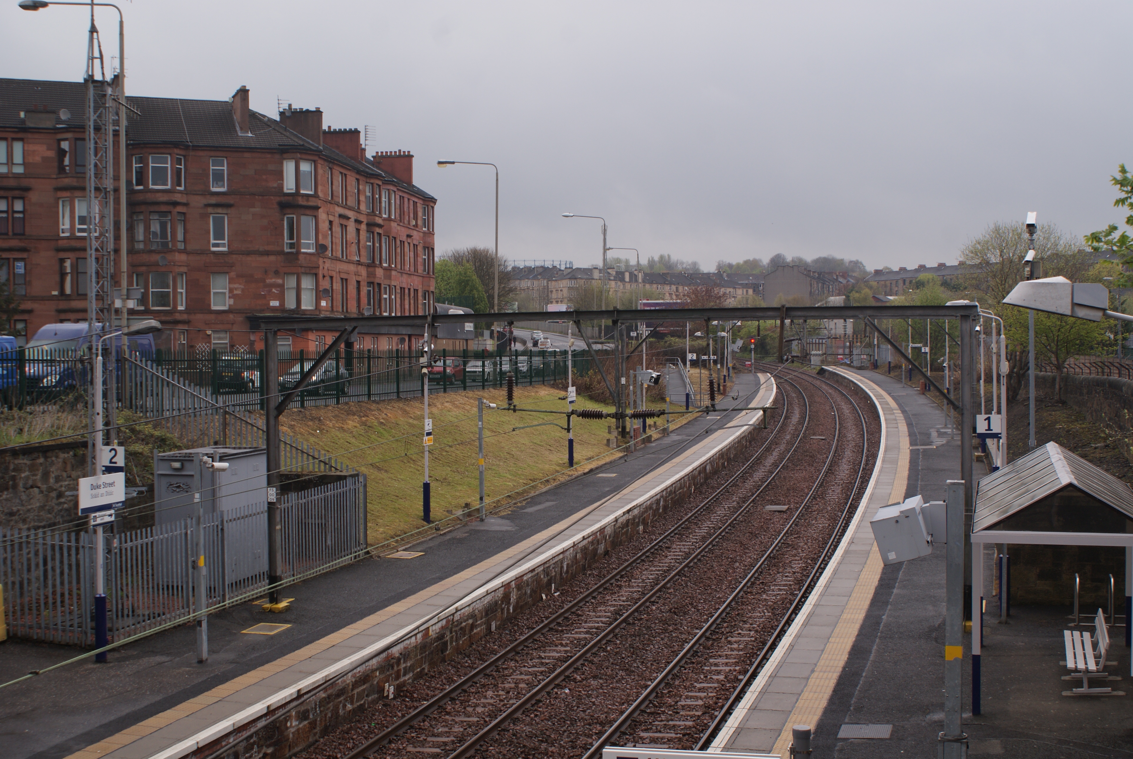
Duke Street railway station
Duke Street Railway Station is a railway station in Glasgow, Scotland. The station is managed by ScotRail and is served by trains on the North Clyde Line...

A728 road
The A728 is a route number in Glasgow, Scotland applied to two connected roads. The eastern branch, known as the Glasgow East End Regeneration Route runs...
Glasgow Inner Ring Road
The Glasgow Inner Ring Road was a proposed ring road encircling the city centre of Glasgow, Scotland. Construction of the roads began in 1965, and half...
Vinegarhill
Vinegarhill was a location in Glasgow, Scotland, that served as a residence and place of business for travelling communities from all over the United Kingdom...
Whitehill Secondary School
Whitehill Secondary School (formerly Whitehill Senior Secondary School) is a Scottish non-denominational comprehensive secondary school located in the...
Camlachie
Camlachie (; Scottish Gaelic: Camadh Làthaich) is an area of Glasgow in Scotland, located in the East End of the city, between Dennistoun to the north...
Nearby Amenities
Located within 500m of 55.858376,-4.2063328Have you been to Alexandra Park?
Leave your review of Alexandra Park below (or comments, questions and feedback).