Little Casterton

Civil Parish in Rutland

England

Little Casterton

Fields near Little Casterton
Fields near Little Casterton Credit: Terry Butcher

Little Casterton is a small civil parish located in the county of Rutland, England. It is situated approximately 2 miles to the northeast of the town of Stamford. The parish covers an area of around 680 acres and is predominantly rural in nature.

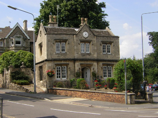
The village of Little Casterton is home to a small population, with just over 50 residents as per the latest census data. The community mainly comprises of agricultural workers and professionals who enjoy the peaceful countryside setting. The housing in the area consists of a mix of traditional stone-built cottages and modern houses.

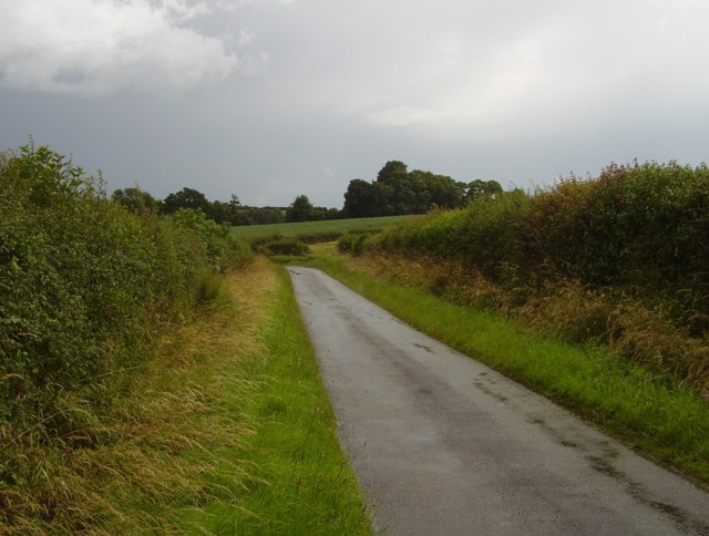
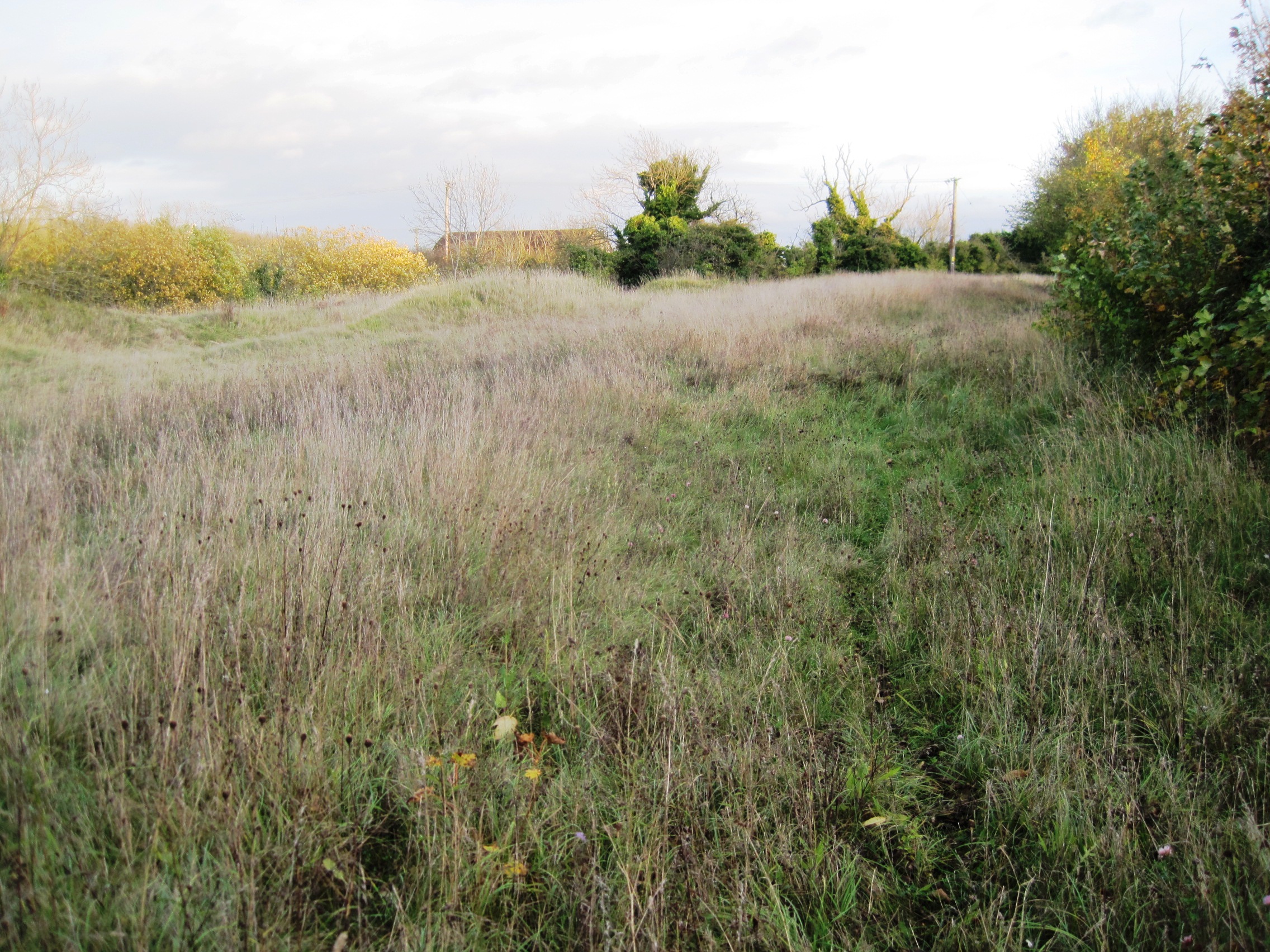
The parish is surrounded by picturesque countryside, with rolling hills and farmland stretching as far as the eye can see. This makes it a popular destination for nature lovers and hikers, with several walking trails and footpaths crisscrossing the area. The nearby River Gwash adds to the natural beauty of the surroundings.

Although Little Casterton is a small village, it has a strong sense of community spirit. The village hall serves as a hub for various social activities and events, providing a place for residents to come together and engage in recreational pursuits.

For amenities and services, residents of Little Casterton typically rely on the nearby town of Stamford, which offers a wider range of facilities including shops, schools, and healthcare services. Overall, Little Casterton offers a tranquil and idyllic setting for those seeking a peaceful rural lifestyle.

If you have any feedback on the listing, please let us know in the comments section below.

Little Casterton Images

Images are sourced within 2km of 52.668609/-0.500137 or Grid Reference TF0108. Thanks to Geograph Open Source API. All images are credited.

Fields near Little Casterton
Tolethorpe Hall near Stamford Pre-performance picnics at the home of the Stamford Shakespeare Company. This company, made up of amateurs, was founded in Stamford in 1968 and moved to Tolethorpe Hall in 1977. The theatre is open air in a natural amphitheatre with a permanent canopy, (the blue structure on the left), covering the auditorium. See <span class="nowrap"><a title="http://www.stamfordshakespeare.co.uk/tolethorpe-hall.htm" rel="nofollow ugc noopener" href="http://www.stamfordshakespeare.co.uk/tolethorpe-hall.htm">Link</a><img style="margin-left:2px;" alt="External link" title="External link - shift click to open in new window" src="https://s1.geograph.org.uk/img/external.png" width="10" height="10"/></span> for lots of information including a detailed history of the company.
Tolethorpe Hall near Stamford
Pre-performance picnics at the home of the Stamford Shakespeare Company. This company, made up of amateurs, was founded in Stamford in 1968 and moved to Tolethorpe Hall in 1977. The theatre is open air in a natural amphitheatre with a permanent canopy, (the blue structure on the left), covering the auditorium. See LinkExternal link for lots of information including a detailed history of the company.
Picnic slope at Tolethorpe Hall Looking across the restored Victorian gardens towards the area of the Hall grounds dedicated to pre-performance picnics. See <span class="nowrap"><a title="http://www.stamfordshakespeare.co.uk/tolethorpe-hall.htm" rel="nofollow ugc noopener" href="http://www.stamfordshakespeare.co.uk/tolethorpe-hall.htm">Link</a><img style="margin-left:2px;" alt="External link" title="External link - shift click to open in new window" src="https://s1.geograph.org.uk/img/external.png" width="10" height="10"/></span> for information about the Stamford Shakespeare Company who are based here.
Picnic slope at Tolethorpe Hall
Looking across the restored Victorian gardens towards the area of the Hall grounds dedicated to pre-performance picnics. See LinkExternal link for information about the Stamford Shakespeare Company who are based here.
Farmland at Tolethorpe Hall All Saints Church at <a href="https://www.geograph.org.uk/photo/214693">TF0109 : Little Casterton near Stamford</a> across the fields.
Farmland at Tolethorpe Hall
All Saints Church at TF0109 : Little Casterton near Stamford across the fields.
Even road try to avoid this square
Towards Ryhall Road
Towards Ryhall Road
Towards Tolethorpe Hall
Great Casterton farmland View from Rutland Round to farmland north of Great Casterton. From SK to TF myriad
Great Casterton farmland
View from Rutland Round to farmland north of Great Casterton. From SK to TF myriad
Parkland near Tolethorpe Hall A view just down the road from Tolethorpe Hall, a popular venue for Shakespearian plays performed outdoors.
Parkland near Tolethorpe Hall
A view just down the road from Tolethorpe Hall, a popular venue for Shakespearian plays performed outdoors.
A1 northbound crossing the River Gwash The A1 is the longest numbered road in the UK at 410 miles long. It connects London with Edinburgh, via the east of England. 
For much of its path it follows the Great North Road the old coaching route between London and Edinburgh. Several sections of the route are classified as motorway A1(M). The modern A1 bypasses the towns the Great North Road passed through and is dual carriageway for most of its route through England.
A1 northbound crossing the River Gwash
The A1 is the longest numbered road in the UK at 410 miles long. It connects London with Edinburgh, via the east of England. For much of its path it follows the Great North Road the old coaching route between London and Edinburgh. Several sections of the route are classified as motorway A1(M). The modern A1 bypasses the towns the Great North Road passed through and is dual carriageway for most of its route through England.
Great North Road through Great Casterton Former A1, now part of B1081, bypassed along with Stamford in the 1950s.
Great North Road through Great Casterton
Former A1, now part of B1081, bypassed along with Stamford in the 1950s.
The Great North Road, Great Casterton This was the Roman Ermine Street, and there was a Roman town here, now only identifiable by the surrounding banks and ditches.  The buildings alongside the road hint at past prosperity, but the road is quiet now that the traffic is on the Stamford Bypass.
The Great North Road, Great Casterton
This was the Roman Ermine Street, and there was a Roman town here, now only identifiable by the surrounding banks and ditches. The buildings alongside the road hint at past prosperity, but the road is quiet now that the traffic is on the Stamford Bypass.
The Clock House The Clock House reputedly stands on the site of Stamford Eleanor Cross, destroyed during the Commonwealth.
The Clock House
The Clock House reputedly stands on the site of Stamford Eleanor Cross, destroyed during the Commonwealth.
Ingthorpe Farm
Ingthorpe Farm
Great Casterton Roman Town
Glebe Barn
Glebe Barn
All Saints, Stamford
St. John the Baptist, Stamford
Show me another place!

Little Casterton is located at Grid Ref: TF0108 (Lat: 52.668609, Lng: -0.500137)

Unitary Authority: Rutland

Police Authority: Leicestershire

What 3 Words

///units.pens.exhaling. Near Stamford, Lincolnshire

Nearby Locations

Little Casterton

Related Wikis

Great Casterton

Great Casterton is a village and civil parish in the county of Rutland in the East Midlands of England. It is located at the crossing of the Roman Ermine...

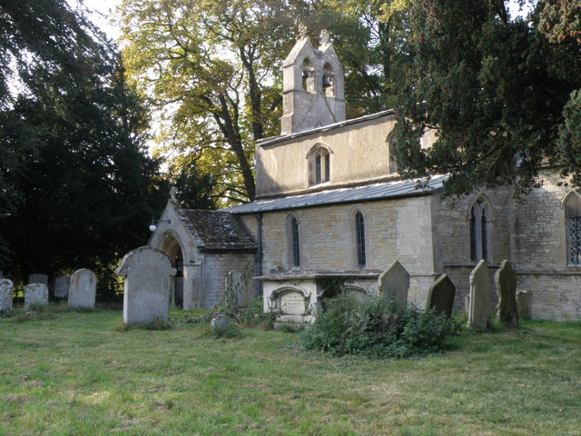
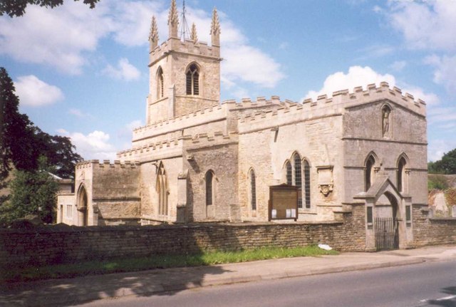
All Saints' Church, Little Casterton

All Saints' Church is a church in Little Casterton, Rutland. The Church of England parish church is a Grade II* listed building. == History == The church...

Great Casterton Road Banks

Great Casterton Road Banks is a 0.4-hectare (0.99-acre) biological Site of Special Scientific Interest on the western outskirts of Stamford in Lincolnshire...

Little Casterton

Little Casterton is a small village and civil parish in Rutland, England. The population of the civil parish at the 2001 census was 148, increasing to...

Nearby Amenities

Located within 500m of 52.668609,-0.500137
Natural: peak
Source: Bing
Lat/Long: 52.6655872/-0.5053957
The data included in this document is from www.openstreetmap.org. The data is made available under ODbL.

Have you been to Little Casterton?

Leave your review of Little Casterton below (or comments, questions and feedback).