Linkinhorne

Civil Parish in Cornwall

England

Linkinhorne

Rillaton view View from Meadow Barn across the Lynher valley towards Caradon Hill
Rillaton view Credit: Richard Croft

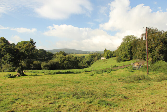
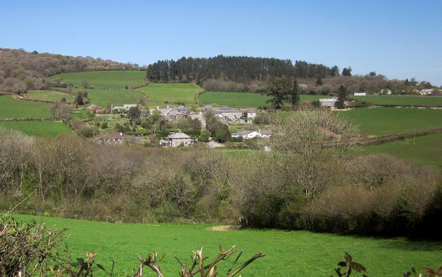
Linkinhorne is a civil parish located in the county of Cornwall, England. Situated in the southeast part of the county, it covers an area of approximately 32 square kilometers. The parish is nestled within the picturesque landscape of Bodmin Moor, renowned for its natural beauty and rich history.

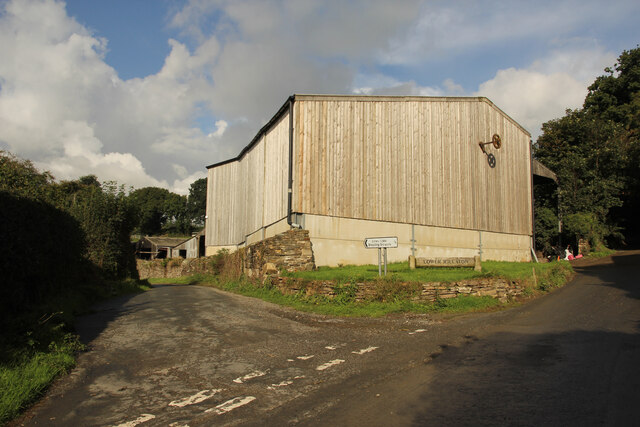
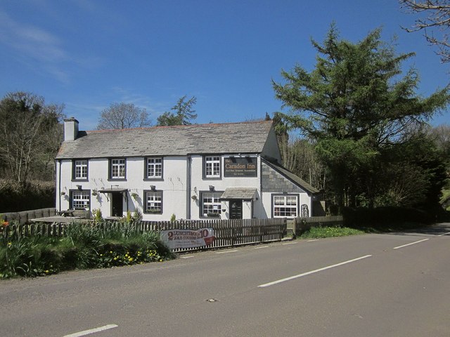
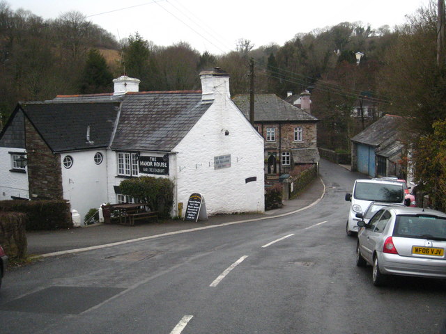
The village of Linkinhorne is the main settlement within the parish, which is home to a close-knit community of around 600 residents. The village itself is characterized by its charming stone cottages and traditional architecture, creating a quaint and idyllic atmosphere.

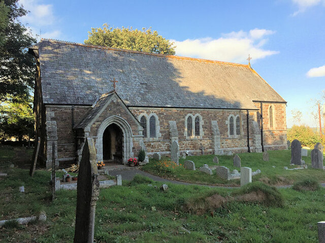
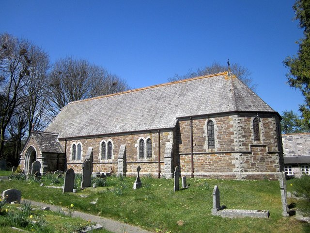
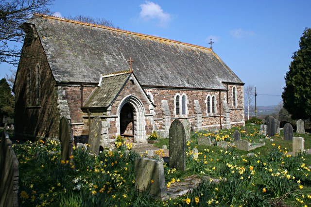
Linkinhorne boasts a number of noteworthy landmarks and attractions. St. Melor's Church, a Grade I listed building, stands as a prominent feature within the village. Dating back to the 13th century, this historic church exhibits stunning architectural details and houses several interesting artifacts.

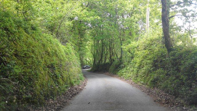
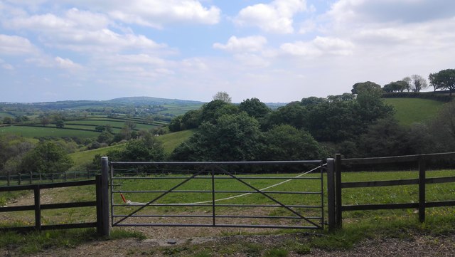
Nature enthusiasts will find much to explore in the surrounding area. The parish is encompassed by the rugged landscape of Bodmin Moor, offering ample opportunities for hiking, cycling, and wildlife spotting. The moorland is dotted with ancient monuments, including stone circles and standing stones, contributing to the area's mystical allure.

Additionally, Linkinhorne is home to several nature reserves and protected areas, such as Kit Hill Country Park, which provides stunning panoramic views of the surrounding countryside.

Overall, Linkinhorne is a tranquil and picturesque civil parish that offers a blend of natural beauty, historical heritage, and a strong sense of community. It is a place where residents and visitors can immerse themselves in the charm and tranquility of rural Cornwall.

If you have any feedback on the listing, please let us know in the comments section below.

Linkinhorne Images

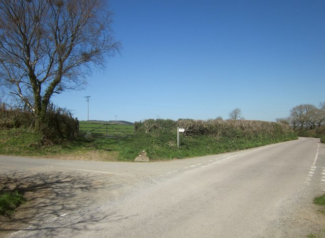
Images are sourced within 2km of 50.528869/-4.415001 or Grid Reference SX2872. Thanks to Geograph Open Source API. All images are credited.

Rillaton view View from Meadow Barn across the Lynher valley towards Caradon Hill
Rillaton view
View from Meadow Barn across the Lynher valley towards Caradon Hill
Rillaton view View from Meadow Barn across the Lynher valley towards Caradon Hill
Rillaton view
View from Meadow Barn across the Lynher valley towards Caradon Hill
Rillaton view View from Meadow Barn across the Lynher valley towards Caradon Hill
Rillaton view
View from Meadow Barn across the Lynher valley towards Caradon Hill
Lower Rillaton Farm Large Dairy Farm at Rillaton
Lower Rillaton Farm
Large Dairy Farm at Rillaton
Former Wesleyan chapel, Rilla Mill
St Paul's Church, Upton Cross
Former Wesleyan Methodist Chapel
Former Plymouth Brethren Meeting House
Rural Road next to Dwellamill Woods
Valley Scene looking towards Ashlake Wood
View across the River Lynher to Caradon Hill TV Mast
Old Guide Stone by Halwinnick Butts, Linkinhorne Parish By the UC road, in parish of Linkinhorne (Caradon District), Halwinnick Butts, at cross roads.

Inscription reads:-
: RED / GATE / E : : LIS / KEA / RD : : LAU / N / CES / TON : : CAM / EL / FORE / RD :

Grade II listed. List Entry Number: 1159047
<span class="nowrap"><a title="https://historicengland.org.uk/listing/the-list/list-entry/1159047" rel="nofollow ugc noopener" href="https://historicengland.org.uk/listing/the-list/list-entry/1159047">Link</a><img style="margin-left:2px;" alt="External link" title="External link - shift click to open in new window" src="https://s1.geograph.org.uk/img/external.png" width="10" height="10"/></span>

Surveyed

Milestone Society National ID: CW_XLINK
Old Guide Stone by Halwinnick Butts, Linkinhorne Parish
By the UC road, in parish of Linkinhorne (Caradon District), Halwinnick Butts, at cross roads. Inscription reads:- : RED / GATE / E : : LIS / KEA / RD : : LAU / N / CES / TON : : CAM / EL / FORE / RD : Grade II listed. List Entry Number: 1159047 LinkExternal link Surveyed Milestone Society National ID: CW_XLINK
Old Guidepost at Halwinnick Butts Guidepost by the UC road, in parish of Linkinhorne (Caradon District), Halwinnick Butts, at cross roads.

Inscription reads:-
: RED / GAT / E : : LIS / KEA / RD : : LAU / N / CES / TON : : CAM / EL / FOR / DE : 

Grade II listed. 
List Entry Number: 1159047 <span class="nowrap"><a title="https://historicengland.org.uk/listing/the-list/list-entry/1159047" rel="nofollow ugc noopener" href="https://historicengland.org.uk/listing/the-list/list-entry/1159047">Link</a><img style="margin-left:2px;" alt="External link" title="External link - shift click to open in new window" src="https://s1.geograph.org.uk/img/external.png" width="10" height="10"/></span>

Surveyed

Milestone Society National ID: CW_XLINK
Old Guidepost at Halwinnick Butts
Guidepost by the UC road, in parish of Linkinhorne (Caradon District), Halwinnick Butts, at cross roads. Inscription reads:- : RED / GAT / E : : LIS / KEA / RD : : LAU / N / CES / TON : : CAM / EL / FOR / DE : Grade II listed. List Entry Number: 1159047 LinkExternal link Surveyed Milestone Society National ID: CW_XLINK
Old Boundary Marker County Bridge Marker on the south side of the unclassified road 100 metres west of Plusha Bridge, River Lynher. Linkinhorne parish. Inscribed C. The stone marks the extent of roadway adjoining the bridge that the County was obliged to maintain.

Milestone Society National ID: CW_LINKIN03br
Old Boundary Marker
County Bridge Marker on the south side of the unclassified road 100 metres west of Plusha Bridge, River Lynher. Linkinhorne parish. Inscribed C. The stone marks the extent of roadway adjoining the bridge that the County was obliged to maintain. Milestone Society National ID: CW_LINKIN03br
Treovis Cross A crossroads on the B3254 that is more or less on a grid line. The right turn here is shown in <a href="https://www.geograph.org.uk/photo/4446942">SX2873 : Lane to Treovis</a>.
Treovis Cross
A crossroads on the B3254 that is more or less on a grid line. The right turn here is shown in SX2873 : Lane to Treovis.
Darley Farm From the same place on the B3254 as <a href="https://www.geograph.org.uk/photo/4447026">SX2772 : B3254 approaching Darleyford</a> looking across the valley of a tributary of the Lynher, and a grid line. Amid the farming hamlet is the listed farmhouse <span class="nowrap"><a title="http://www.historicengland.org.uk/listing/the-list/list-entry/1329173" rel="nofollow ugc noopener" href="http://www.historicengland.org.uk/listing/the-list/list-entry/1329173">Link</a><img style="margin-left:2px;" alt="External link" title="External link - shift click to open in new window" src="https://s1.geograph.org.uk/img/external.png" width="10" height="10"/></span> . Behind is Darley Wood.
Darley Farm
From the same place on the B3254 as SX2772 : B3254 approaching Darleyford looking across the valley of a tributary of the Lynher, and a grid line. Amid the farming hamlet is the listed farmhouse LinkExternal link . Behind is Darley Wood.
The Caradon Inn Another photo (see <a href="https://www.geograph.org.uk/photo/376937">SX2772 : The Caradon Inn</a>) of the pub beside the B3254. It is on the fringe of the designated area of the Cornwall and West Devon Mining Landscape.
The Caradon Inn
Another photo (see SX2772 : The Caradon Inn) of the pub beside the B3254. It is on the fringe of the designated area of the Cornwall and West Devon Mining Landscape.
St Paul's Church, Upton Cross A further image of the C19 church shown in <a href="https://www.geograph.org.uk/photo/376917">SX2872 : Upton Cross Church</a> and <a href="https://www.geograph.org.uk/photo/4447580">SX2872 : St Paul's Church, Upton Cross</a>, from the churchyard. A bit of a rookery in the background.
St Paul's Church, Upton Cross
A further image of the C19 church shown in SX2872 : Upton Cross Church and SX2872 : St Paul's Church, Upton Cross, from the churchyard. A bit of a rookery in the background.
Show me another place!

Linkinhorne is located at Grid Ref: SX2872 (Lat: 50.528869, Lng: -4.415001)

Unitary Authority: Cornwall

Police Authority: Devon & Cornwall

What 3 Words

///lofts.disbanded.judges. Near North Hill, Cornwall
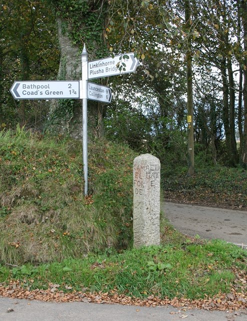
Nearby Locations

Upton Cross Linkinhorne

Related Wikis

Netherton, Cornwall

Netherton is a hamlet in the parish of Linkinhorne, Cornwall, England. == References ==

Rilla Mill

Rilla Mill (Cornish: Melin Reslegh) is a village in Cornwall, England. It is about one and half miles west of Linkinhorne. == References ==

Upton Cross

Upton Cross and Upton are hamlets a quarter of a mile apart in east Cornwall, England, United Kingdom. Upton is situated at grid reference SX 279 724 north...
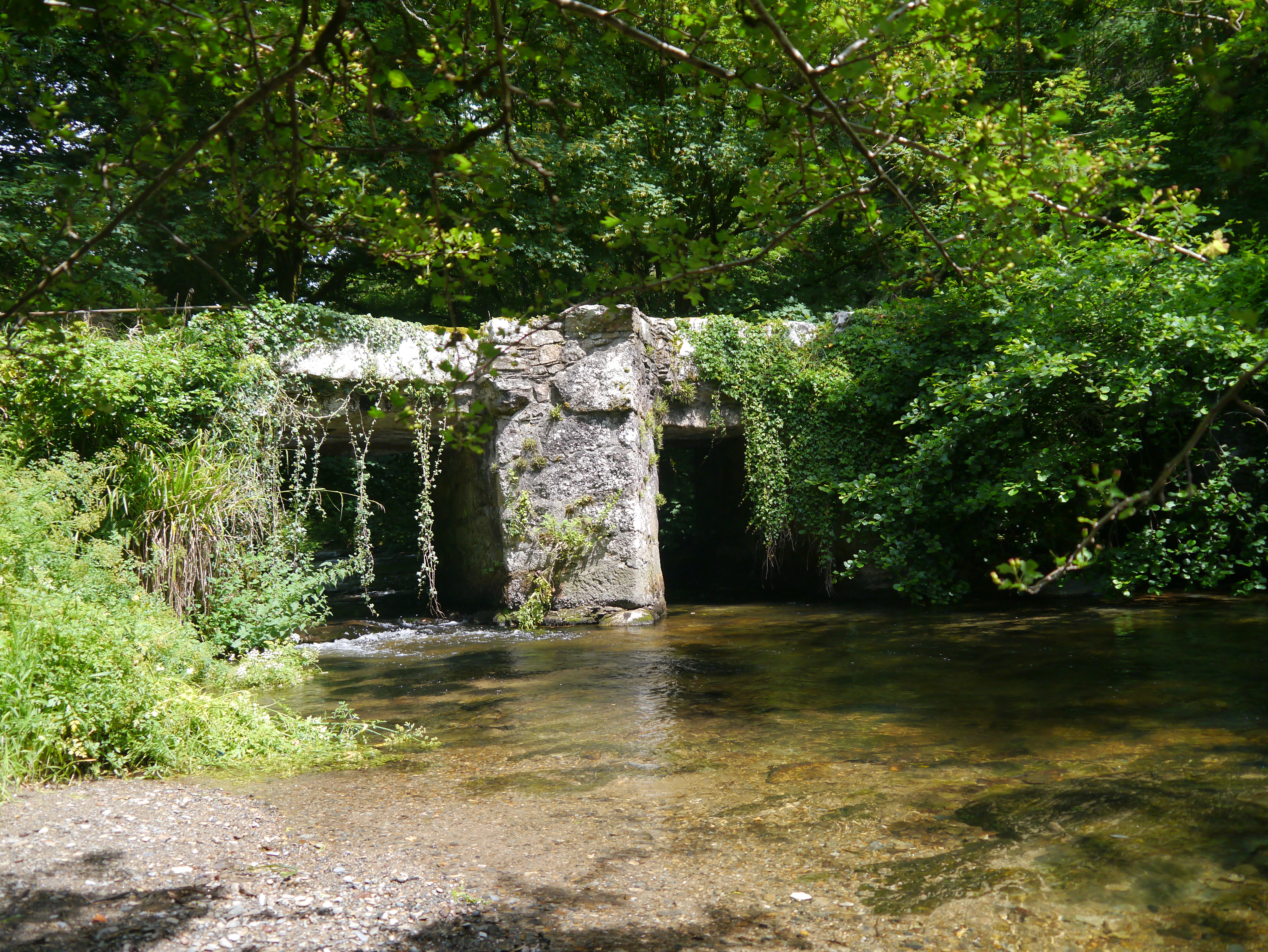
Stara Bridge

Stara Bridge is a clapper bridge across the River Lynher in east Cornwall, England, dating to the Late Middle Ages and now scheduled under the Ancient...

Nearby Amenities

Located within 500m of 50.528869,-4.415001
Netherton
Name Kw: Trewoles
Place: hamlet
Source: OS_OpenData_StreetView
Wikidata: Q15058904
Lat/Long: 50.5317914/-4.4144472
Generator Method: photovoltaic
Generator Output Electricity: yes
Generator Source: solar
Generator Type: solar_photovoltaic_panel
Location: roof
Power: generator
Lat/Long: 50.5324746/-4.4136746
The data included in this document is from www.openstreetmap.org. The data is made available under ODbL.

Have you been to Linkinhorne?

Leave your review of Linkinhorne below (or comments, questions and feedback).