Layer Breton

Civil Parish in Essex Colchester

England

Layer Breton

Abberton Reservoir from Layer Breton Hill
Abberton Reservoir from Layer Breton Hill Credit: PAUL FARMER

Layer Breton is a civil parish located in the county of Essex, England. It is situated in the Colchester borough and covers an area of approximately 5.6 square kilometers. The parish is predominantly rural, with a small population of around 500 residents.

Layer Breton is characterized by its picturesque countryside, with rolling hills, open fields, and scattered woodlands. The landscape is dotted with charming farmhouses, cottages, and agricultural buildings that reflect the area's rich farming heritage. The parish is surrounded by several other rural communities, including Layer Marney, Layer de la Haye, and Birch.

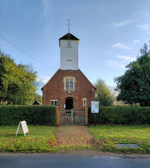
The centerpiece of Layer Breton is the Grade I listed St. Mary's Church, which dates back to the 14th century. The church is known for its beautiful architecture, including a stunning medieval tower and a collection of intricate stained glass windows. It serves as a place of worship for the local community and is also a popular destination for history enthusiasts and tourists.

The parish offers a peaceful and idyllic lifestyle, with ample opportunities for outdoor activities such as walking, cycling, and horse riding. The nearby Layer Wood and Layer Breton Heath provide scenic nature trails for residents and visitors to explore. Additionally, the parish is well-connected to the larger town of Colchester, which offers a range of amenities including shops, schools, and leisure facilities.

Overall, Layer Breton is a charming rural parish that offers a tranquil and picturesque setting for its residents, while also providing easy access to the nearby town of Colchester.

If you have any feedback on the listing, please let us know in the comments section below.

Layer Breton Images

Images are sourced within 2km of 51.820438/0.823553 or Grid Reference TL9417. Thanks to Geograph Open Source API. All images are credited.

Abberton Reservoir from Layer Breton Hill
St Mary's Church Layer Breton
Birch: Craxe's Green road junction
Layer Breton: Abberton Reservoir
Layer Breton: Abberton Reservoir, road and footpath
Layer Breton: Abberton Reservoir
Layer Breton: Abberton Reservoir, road and footpath
Layer Breton Causeway, Abberton Reservoir One of many places to view the birds on the reservoir.
Layer Breton Causeway, Abberton Reservoir
One of many places to view the birds on the reservoir.
Layer Breton Causeway, Abberton Reservoir Parking is possible along the road, making for easy viewing of the birds on this section of the reservoir.
Layer Breton Causeway, Abberton Reservoir
Parking is possible along the road, making for easy viewing of the birds on this section of the reservoir.
Layer Marney Tower.  Essex The magnificent Tudor gatehouse of this renowned Essex Mansion, built by Henry, the first Lord Marney, who never lived to see its completion.
Layer Marney Tower. Essex
The magnificent Tudor gatehouse of this renowned Essex Mansion, built by Henry, the first Lord Marney, who never lived to see its completion.
Tree and Red Campion The OS Map shows this area to be woodland I expect it has been cleared as part of the expansion of the Abberton Reservoir the <a href="https://www.geograph.org.uk/photo/2403426">TL9618 : Red Campion</a> is really taking advantage of the changed habitat.
Tree and Red Campion
The OS Map shows this area to be woodland I expect it has been cleared as part of the expansion of the Abberton Reservoir the TL9618 : Red Campion is really taking advantage of the changed habitat.
Red Campion Red Campion growing in abundance on newly cleared land take a closer look at <a href="https://www.geograph.org.uk/photo/2403434">TL9618 : Red Campion up Close</a>
Red Campion
Red Campion growing in abundance on newly cleared land take a closer look at TL9618 : Red Campion up Close
Red Campion up Close A Close up of <a href="https://www.geograph.org.uk/photo/2403426">TL9618 : Red Campion</a>
Red Campion up Close
A Close up of TL9618 : Red Campion
Trees & Red Campion It was such a shame I couldn't wait until the light improved imagine the scene with blue sky and bright sunshine!
Trees & Red Campion
It was such a shame I couldn't wait until the light improved imagine the scene with blue sky and bright sunshine!
Horse and cattle grid, Layer Marney
Layer Marney Tower, Essex
Black sheep, Layer Marney
Show me another place!

Layer Breton is located at Grid Ref: TL9417 (Lat: 51.820438, Lng: 0.823553)

Administrative County: Essex

District: Colchester

Police Authority: Essex

What 3 Words

///squirted.witless.visions. Near Layer de la Haye, Essex

Nearby Locations

Layer Breton

Related Wikis

Layer Breton

Layer Breton is a village and a civil parish in the City of Colchester district of Essex, England. According to the 2011 census there were 144 males and...

Layer Marney

Layer Marney is a village and civil parish in the City of Colchester district of Essex, England, near Tiptree. Layer Marney has a Tudor palace called Layer...

Layer Marney Tower

Layer Marney Tower is an incomplete early Tudor country house, with gardens and parkland, dating from about 1523, in Layer Marney, Essex, England, between...
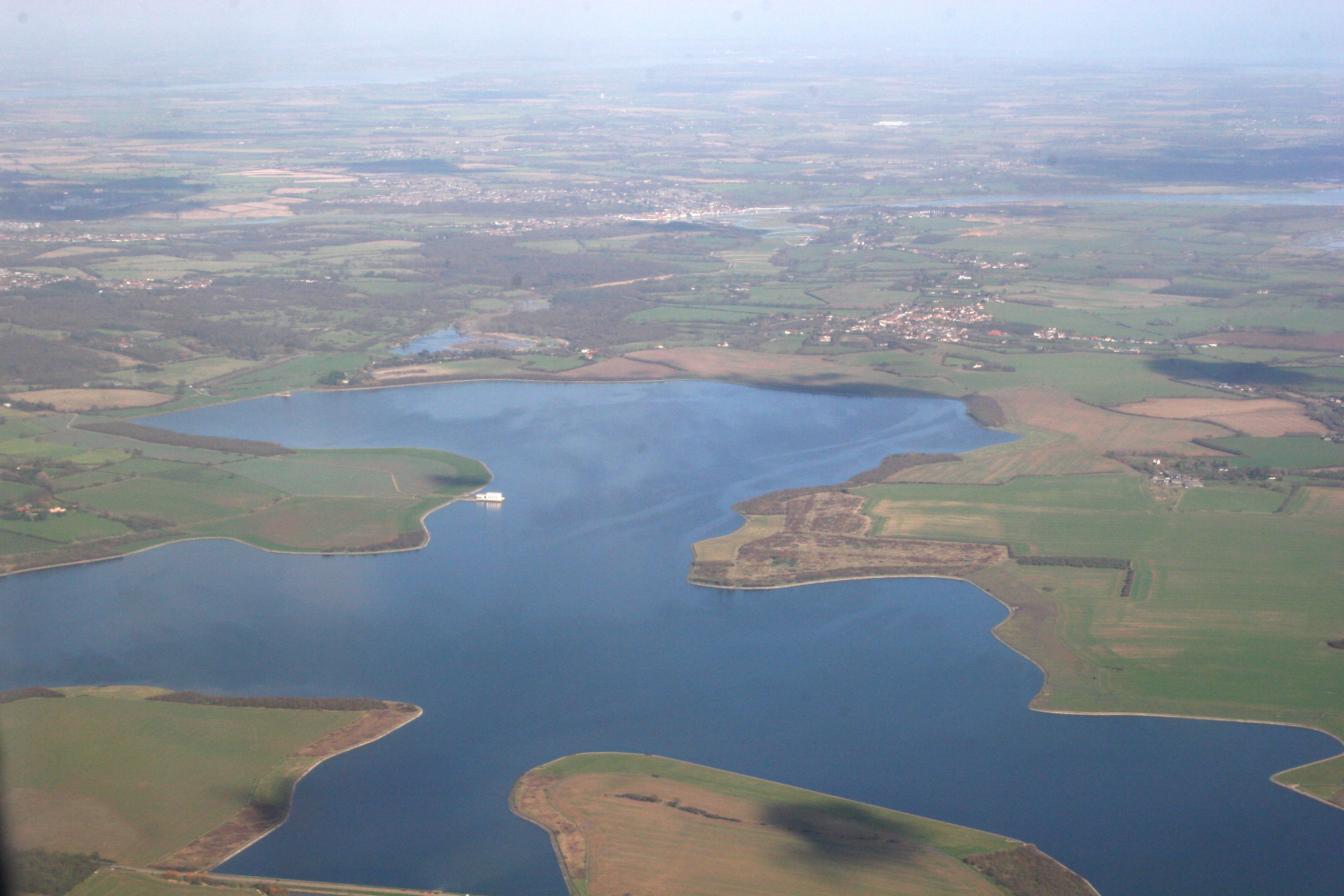
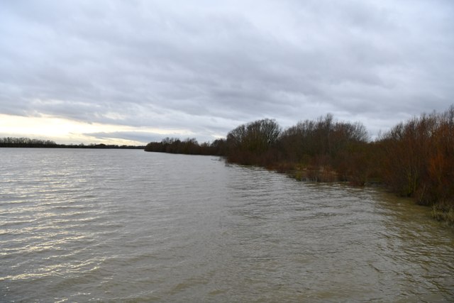
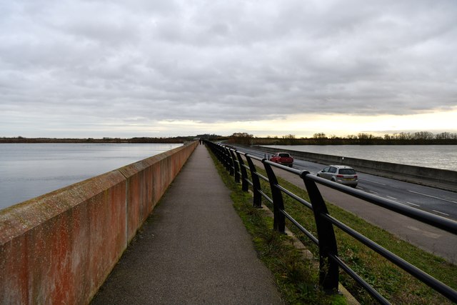
Abberton Reservoir

Abberton Reservoir is a pumped storage freshwater reservoir in eastern England near the Essex coast, with an area of 700 hectares (1,700 acres). Most of...

Nearby Amenities

Located within 500m of 51.820438,0.823553
Power: tower
Lat/Long: 51.8198133/0.8190904
Power: tower
Lat/Long: 51.823503/0.8266945
Power: tower
Lat/Long: 51.8217434/0.8230574
Bus Stop
Layer Breton Hall
Bus: yes
Naptan AtcoCode: 150014010012
Naptan Bearing: S
Naptan BusStopType: CUS
Naptan CommonName: Layer Breton Hall
Naptan Indicator: o/s
Naptan Landmark: Layer Breton Hall
Naptan NaptanCode: esxgjdtd
Naptan Street: Colchester Road
Naptan Verified: no
Public Transport: platform
Source: naptan_import
Lat/Long: 51.8191814/0.8267576
Bus Stop
Layer Breton Hall
Bus: yes
Naptan AtcoCode: 150014010Y12
Naptan Bearing: N
Naptan BusStopType: CUS
Naptan CommonName: Layer Breton Hall
Naptan Indicator: Opp
Naptan Landmark: Layer Breton Hall
Naptan NaptanCode: esxgtjta
Naptan Street: Colchester Road
Naptan Verified: no
Public Transport: platform
Source: naptan_import
Lat/Long: 51.8191565/0.826669
The data included in this document is from www.openstreetmap.org. The data is made available under ODbL.

Have you been to Layer Breton?

Leave your review of Layer Breton below (or comments, questions and feedback).