Lawshall

Civil Parish in Suffolk Babergh

England

Lawshall

Church of All Saints, Lawshall A largely fifteenth century church <span class="nowrap"><a title="https://historicengland.org.uk/listing/the-list/list-entry/1036594" rel="nofollow ugc noopener" href="https://historicengland.org.uk/listing/the-list/list-entry/1036594">Link</a><img style="margin-left:2px;" alt="External link" title="External link - shift click to open in new window" src="https://s1.geograph.org.uk/img/external.png" width="10" height="10"/></span>
Church of All Saints, Lawshall Credit: Jonathan Thacker

Lawshall is a civil parish located in the county of Suffolk, England. It is situated approximately four miles southwest of the town of Bury St Edmunds. The parish covers an area of around 13 square kilometers and has a population of around 800 residents.

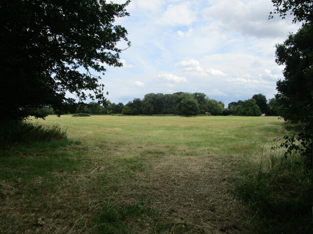
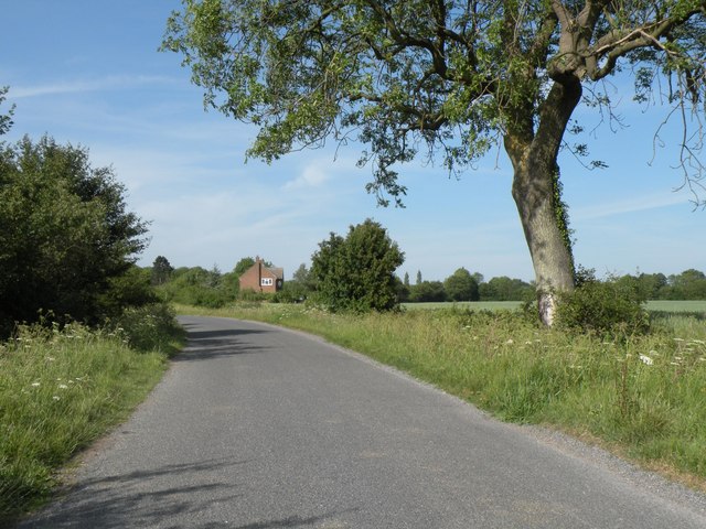
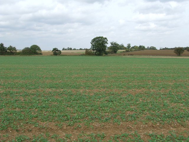
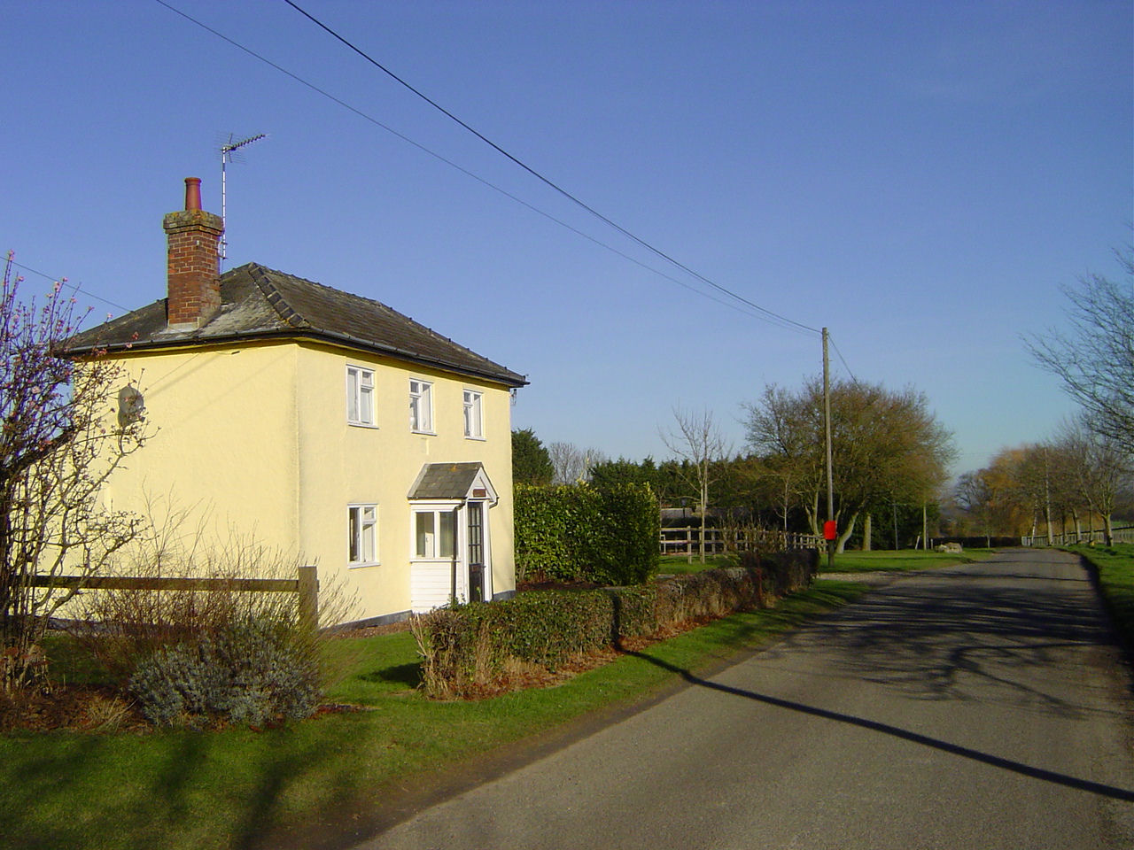
The village of Lawshall is known for its picturesque rural setting, surrounded by beautiful countryside and farmland. The area is characterized by rolling hills, quaint cottages, and charming traditional English architecture. The parish is predominantly residential, with a mix of period properties and modern homes.

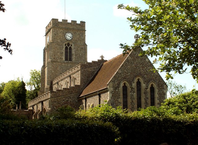
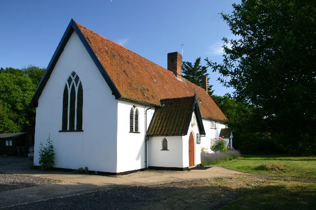
Lawshall is home to a number of amenities and facilities, including a village hall, a primary school, and a church. The village hall serves as a community hub, hosting various events and activities throughout the year. The primary school provides education for local children aged 4 to 11.

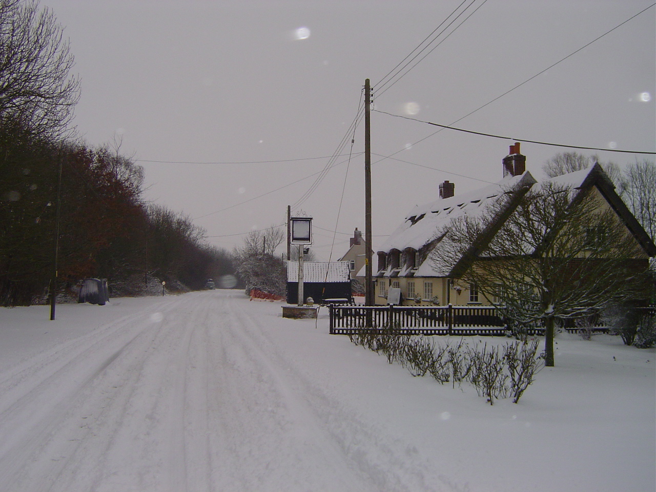
The village also has a pub, The Swan Inn, which dates back to the 16th century and offers a warm and friendly atmosphere for locals and visitors alike. The surrounding countryside provides ample opportunities for outdoor activities such as walking, cycling, and horse riding.

Lawshall is well-connected to neighboring towns and villages via road networks, making it easily accessible to commuters and visitors. The nearby town of Bury St Edmunds offers a wider range of amenities, including shops, restaurants, and leisure facilities.

Overall, Lawshall is a charming and peaceful rural parish, offering a tranquil and idyllic setting for its residents and visitors to enjoy.

If you have any feedback on the listing, please let us know in the comments section below.

Lawshall Images

Images are sourced within 2km of 52.155975/0.725848 or Grid Reference TL8654. Thanks to Geograph Open Source API. All images are credited.

Church of All Saints, Lawshall A largely fifteenth century church <span class="nowrap"><a title="https://historicengland.org.uk/listing/the-list/list-entry/1036594" rel="nofollow ugc noopener" href="https://historicengland.org.uk/listing/the-list/list-entry/1036594">Link</a><img style="margin-left:2px;" alt="External link" title="External link - shift click to open in new window" src="https://s1.geograph.org.uk/img/external.png" width="10" height="10"/></span>
Church of All Saints, Lawshall
A largely fifteenth century church LinkExternal link
Grass field near Lawshall
Isolated tree near Makin's Farm
Shimpling Road, heading towards Lawshall
Footpath to Shimpling Street from Shimpling Road
Part of Shimpling Road in Lawshall
The approach to Hanningfields Farm
The village sign at Lawshall
Road junction in Lawshall This junction is actually a crossroads.  The road to the right is Melford Road with Bury Road off to the left.  Straight ahead is Lambs Lane and opposite is Golden Lane.
Road junction in Lawshall
This junction is actually a crossroads. The road to the right is Melford Road with Bury Road off to the left. Straight ahead is Lambs Lane and opposite is Golden Lane.
Donkey Lane, between Lawshall and Stanningfield
Open Fields Open fields near to Brockley, Suffolk.
Open Fields
Open fields near to Brockley, Suffolk.
Memorial To Johannes Bartholomeus Jat Van Mesdag WWII memorial to crashed Mustang pilot Johannes Bartholomeus Jat Van Mesdag at side of a country road near to Lawshall, Suffolk. For more info on this young airman see <span class="nowrap"><a title="http://www.aircrewremembered.com/van-mesdag-johannes.html" rel="nofollow ugc noopener" href="http://www.aircrewremembered.com/van-mesdag-johannes.html">Link</a><img style="margin-left:2px;" alt="External link" title="External link - shift click to open in new window" src="https://s1.geograph.org.uk/img/external.png" width="10" height="10"/></span> and for overall view see <a title="https://www.geograph.org.uk/photo/2595650" href="https://www.geograph.org.uk/photo/2595650">Link</a>
Memorial To Johannes Bartholomeus Jat Van Mesdag
WWII memorial to crashed Mustang pilot Johannes Bartholomeus Jat Van Mesdag at side of a country road near to Lawshall, Suffolk. For more info on this young airman see LinkExternal link and for overall view see Link
Airman's Memorial WWII memorial to crashed Mustang pilot Johannes Bartholomeus Jat Van Mesdag at side of a country road near to Lawshall, Suffolk. For more info on this young airman see <span class="nowrap"><a title="http://www.aircrewremembered.com/van-mesdag-johannes.html" rel="nofollow ugc noopener" href="http://www.aircrewremembered.com/van-mesdag-johannes.html">Link</a><img style="margin-left:2px;" alt="External link" title="External link - shift click to open in new window" src="https://s1.geograph.org.uk/img/external.png" width="10" height="10"/></span> and for close up view see <a title="https://www.geograph.org.uk/photo/2595635" href="https://www.geograph.org.uk/photo/2595635">Link</a>
Airman's Memorial
WWII memorial to crashed Mustang pilot Johannes Bartholomeus Jat Van Mesdag at side of a country road near to Lawshall, Suffolk. For more info on this young airman see LinkExternal link and for close up view see Link
At Work Farmer and his tractor at work near to Stanningfield, Suffolk.
At Work
Farmer and his tractor at work near to Stanningfield, Suffolk.
Farming Farming activity near to Stanningfield, Suffolk.
Farming
Farming activity near to Stanningfield, Suffolk.
St.Edmunds Way The long distance footpath St.Edmunds Way on the left and Saxes Grove in the neighbouring square near to Lawshall, Suffolk.
St.Edmunds Way
The long distance footpath St.Edmunds Way on the left and Saxes Grove in the neighbouring square near to Lawshall, Suffolk.
Footbridge Footbridge near to Lawshall, Suffolk.
Footbridge
Footbridge near to Lawshall, Suffolk.
Fields Fields near to Lawshall, Suffolk.
Fields
Fields near to Lawshall, Suffolk.
Show me another place!

Lawshall is located at Grid Ref: TL8654 (Lat: 52.155975, Lng: 0.725848)

Administrative County: Suffolk

District: Babergh

Police Authority: Suffolk

What 3 Words

///costumed.waxer.hillsides. Near Lavenham, Suffolk

Nearby Locations

Frithy Wood Lawshall

Related Wikis

Lawshall

Lawshall is a village and civil parish in Suffolk, England. Located around a mile off the A134 between Bury St Edmunds and Sudbury, it is part of Babergh...

All Saints' Church, Lawshall

The Parish Church of All Saints' Lawshall, is an Anglican church in the village of Lawshall, Suffolk, England. It has been designated by English Heritage...

The Street, Lawshall

The Street is a linear settlement in the civil parish of Lawshall in the Babergh district in the county of Suffolk, England. It extends from Lawshall Hall...

Lawshall Hall

Lawshall Hall is a Grade II* listed building, re-built in 1557, that is located in the parish of Lawshall in Suffolk. The Hall is adjacent to All Saints...

Hart's Green

Hart's Green is a hamlet in the civil parish of Lawshall in the Babergh District in the county of Suffolk, England. It is located between Stanningfield...

Hanningfield Green

Hanningfield Green, sometimes referred to as Hanningfields Green, is a hamlet in the civil parish of Lawshall in the Babergh district in the county of...

Bury Road, Lawshall

Bury Road, Lawshall is a linear settlement in the civil parish of Lawshall in the Babergh district in the county of Suffolk, England. The northern part...

Frithy and Chadacre Woods

Frithy and Chadacre Woods is a 28.7-hectare (71-acre) biological Site of Special Scientific Interest (SSSI) in the parishes of Lawshall and Shimpling in...

Nearby Amenities

Located within 500m of 52.155975,0.725848
Lawshall
Created By: Potlatch 0.10b
Place: village
Wikidata: Q1983563
Lat/Long: 52.1559645/0.7234059
Bus Stop
Swanfield
Naptan AtcoCode: 390010437
Naptan Bearing: E
Naptan CommonName: Swanfield
Naptan Indicator: opp
Naptan Landmark: Swanfield
Naptan NaptanCode: sufagdwg
Naptan Street: The Street
Naptan Verified: no
Shelter: yes
Source: naptan_import
Lat/Long: 52.1551023/0.7296642
Bus Stop
Swanfield
Naptan AtcoCode: 390010438
Naptan Bearing: W
Naptan BusStopType: CUS
Naptan CommonName: Swanfield
Naptan Indicator: adj
Naptan Landmark: Swanfield
Naptan NaptanCode: sufagdwj
Naptan Street: The Street
Naptan Verified: no
Source: naptan_import
Lat/Long: 52.1549938/0.7296416
Bus Stop
Primary School
Naptan AtcoCode: 390010439
Naptan Bearing: E
Naptan BusStopType: CUS
Naptan CommonName: Primary School
Naptan Indicator: o/s
Naptan Landmark: Primary School
Naptan NaptanCode: sufagdwm
Naptan Street: The Street
Naptan Verified: no
Source: naptan_import
Lat/Long: 52.154988/0.7246506
Bus Stop
Primary School
Naptan AtcoCode: 390010440
Naptan Bearing: W
Naptan BusStopType: CUS
Naptan CommonName: Primary School
Naptan Indicator: opp
Naptan Landmark: Primary School
Naptan NaptanCode: sufagdwp
Naptan Street: The Street
Naptan Verified: no
Source: naptan_import
Lat/Long: 52.1548792/0.7246878
Power: pole
Lat/Long: 52.1598228/0.7235339
Power: pole
Lat/Long: 52.1591169/0.7225683
Power: pole
Lat/Long: 52.1583945/0.721584
Power: pole
Lat/Long: 52.1562456/0.7186389
Power: pole
Lat/Long: 52.1576805/0.7205916
Power: pole
Lat/Long: 52.1569466/0.7195991
Public Bookcase
Phonebox Book Swap Shop
Booth: K6
Colour: red
Disused Amenity: telephone
Historic: monument
Inscription: An old red phone box that was restored and converted to a book swap shop for the village to enjoy.
Man Made: telephone_box
Public Bookcase Type: phone_box
Lat/Long: 52.1551044/0.7295588
Post Box
Post Box Type: lamp
Ref: IP29 2130
Lat/Long: 52.1550058/0.7249615
The data included in this document is from www.openstreetmap.org. The data is made available under ODbL.

Have you been to Lawshall?

Leave your review of Lawshall below (or comments, questions and feedback).