Lane End

Civil Parish in Buckinghamshire

England

Lane End

Farmland, Lane End A crop of wheat on the western flank of a dry valley to the south of Fillingdon Farm.
Farmland, Lane End Credit: Andrew Smith

Lane End is a civil parish located in the county of Buckinghamshire, England. Situated in the south-eastern part of the county, it lies approximately 10 miles east of High Wycombe and 6 miles west of Marlow. The parish covers an area of around 3 square miles and is home to a population of approximately 2,000 residents.

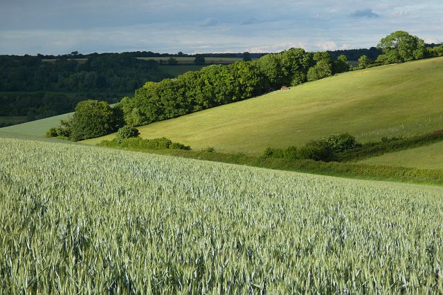
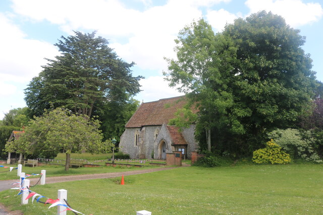
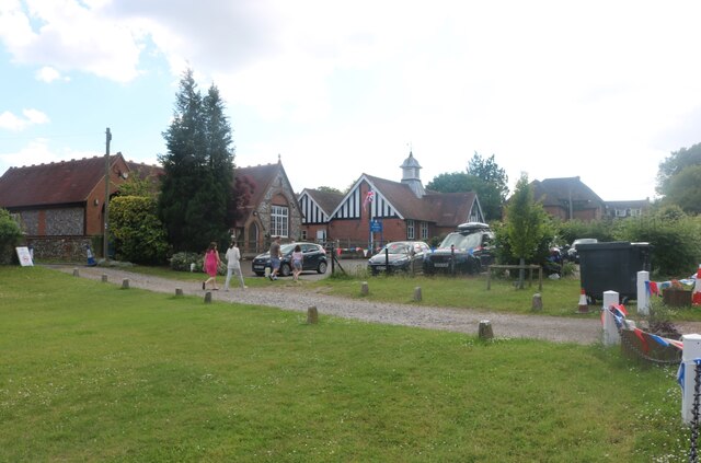
Lane End is a picturesque village surrounded by beautiful countryside, with the rolling Chiltern Hills to the north and the River Thames to the south. It is known for its charming rural character and tranquil atmosphere. The village itself offers a range of amenities and services, including a post office, a primary school, a library, and a few shops and eateries.

The area has a rich history, with evidence of human settlement dating back to the Iron Age. In the 19th century, Lane End became known for its brickmaking industry, which thrived due to the abundance of clay in the area. The village's heritage is still visible today, with several old brick kilns and buildings that have been preserved.

Lane End is well-connected to neighboring towns and cities, with good transport links. The M40 motorway is easily accessible, providing convenient access to London and Birmingham. The nearby towns of High Wycombe and Marlow offer additional amenities and entertainment options.

Overall, Lane End is a charming civil parish with a rich history, beautiful countryside surroundings, and a close-knit community. It provides a peaceful and scenic place to live, while still offering easy access to larger urban areas.

If you have any feedback on the listing, please let us know in the comments section below.
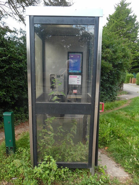
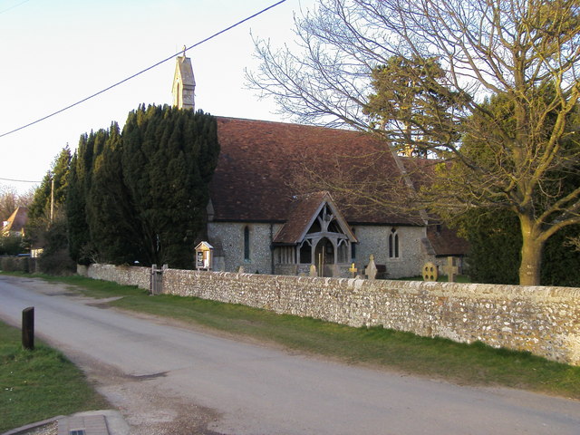
Lane End Images

Images are sourced within 2km of 51.622496/-0.851903 or Grid Reference SU7992. Thanks to Geograph Open Source API. All images are credited.

Farmland, Lane End A crop of wheat on the western flank of a dry valley to the south of Fillingdon Farm.
Farmland, Lane End
A crop of wheat on the western flank of a dry valley to the south of Fillingdon Farm.
Church Road, Frieth
Church Road, Frieth
The church in Frieth
Frieth Church Hall
Frieth Church Hall
Church Road, Frieth
Church Road, Frieth
St Mary-le-Moor Church The church was built in 1851, but a Chapel of St Mary is known to have been in existence since 1247.  The roof tiles of the present church were made locally at Cadmore End Kiln and the building is today Grade II listed.
St Mary-le-Moor Church
The church was built in 1851, but a Chapel of St Mary is known to have been in existence since 1247. The roof tiles of the present church were made locally at Cadmore End Kiln and the building is today Grade II listed.
Farmland, Stokenchurch A line of oaks approaches the south-west corner of Leygrove's Wood.
Farmland, Stokenchurch
A line of oaks approaches the south-west corner of Leygrove's Wood.
Farmland, Lane End A crop of maize in fields to the south of Fining Wood.
Farmland, Lane End
A crop of maize in fields to the south of Fining Wood.
Grouse & Ale The grade II-listed pub was previously the Clayton Arms - and named after its original owner Sir Robert Clayton who built it in 1679.
Grouse & Ale
The grade II-listed pub was previously the Clayton Arms - and named after its original owner Sir Robert Clayton who built it in 1679.
Lane End pond
Lane End pond
Inscription at Black Well, Lane End This inscription is on the side of the Black Well in The Row. It has the following wording:

                     BLACK WELL
                        circa 1850
                    restored through
                    local effort 1986
Inscription at Black Well, Lane End
This inscription is on the side of the Black Well in The Row. It has the following wording: BLACK WELL circa 1850 restored through local effort 1986
Black Well at Lane End This former well is in The Row HP14 3JS, and dates from about 1850. It was restored through local effort in 1986, but is now kept securely locked.
Black Well at Lane End
This former well is in The Row HP14 3JS, and dates from about 1850. It was restored through local effort in 1986, but is now kept securely locked.
Information Board outside the Grouse & Ale, Lane End The information board is on the east side of the Grouse & Ale Inn in High Street HP14 3JG. It has the following wording:

                                                              GROUSE & ALE

  The Grouse & Ale, formerly the Clayton Arms, was built in 1679 as a manor house
  by Sir Robert Clayton, Knight and Lord Mayor of London after the fire of London in
  1666. A wealthy influential city merchant who with his accumulated wealth was able
  to lend £30,000 to King William III, started life as the son of a small farmer in Northants.
  It was his brother's family who actually lived at the manor house until it was brought
                          by Robert Scott of Danefield in the early 18th century.

  By the late 19th century the Clayton Arms was occupied by the family of Fred Goodchild,
       organist & chair maker and in the yard was the sawmill and grinding business.

       The motto for the coat of arms 'Virtus in actione' means 'Manliness is in the doing'.
Information Board outside the Grouse & Ale, Lane End
The information board is on the east side of the Grouse & Ale Inn in High Street HP14 3JG. It has the following wording: GROUSE & ALE The Grouse & Ale, formerly the Clayton Arms, was built in 1679 as a manor house by Sir Robert Clayton, Knight and Lord Mayor of London after the fire of London in 1666. A wealthy influential city merchant who with his accumulated wealth was able to lend £30,000 to King William III, started life as the son of a small farmer in Northants. It was his brother's family who actually lived at the manor house until it was brought by Robert Scott of Danefield in the early 18th century. By the late 19th century the Clayton Arms was occupied by the family of Fred Goodchild, organist & chair maker and in the yard was the sawmill and grinding business. The motto for the coat of arms 'Virtus in actione' means 'Manliness is in the doing'.
Entrance to Lane End Telephone Exchange Taken in Marlow Road (B482), this photo shows the entrance to Lane End TE with the blue metal gates and the board erected by Openreach, the company that maintains the telephone and broadband network in the United Kingdom. The TE can be seen in the distance to the right of the photo <a title="https://www.geograph.org.uk/photo/1277068" href="https://www.geograph.org.uk/photo/1277068">Link</a> refers.
Entrance to Lane End Telephone Exchange
Taken in Marlow Road (B482), this photo shows the entrance to Lane End TE with the blue metal gates and the board erected by Openreach, the company that maintains the telephone and broadband network in the United Kingdom. The TE can be seen in the distance to the right of the photo Link refers.
West Wycombe Estate Notice Located on the footpath between Denham Farm and Great Wood, this notice has been erected by the West Wycombe Estate and has the following wording:

                                            WEST WYCOMBE ESTATE

                                                  IN THE INTEREST
                                  OF CONSERVATION AND WILDLIFE
                            PLEASE KEEP TO PUBLIC RIGHTS OF WAY
                                            AND KEEP DOGS ON LEADS
                                                             
                                                                                      THANK YOU.
West Wycombe Estate Notice
Located on the footpath between Denham Farm and Great Wood, this notice has been erected by the West Wycombe Estate and has the following wording: WEST WYCOMBE ESTATE IN THE INTEREST OF CONSERVATION AND WILDLIFE PLEASE KEEP TO PUBLIC RIGHTS OF WAY AND KEEP DOGS ON LEADS THANK YOU.
Removal Notice inside KX100 telephone box, Lane End This BT removal notice dated the 15th August 2023 is inside the KX100 telephone box in Park Lane. It has the following wording:

  We're planning
   to remove this
  payphone

  Unfortunately, it just isn't used enough for us to carry
  on running it.
  If you think it should stay, please contact your local
  authority within 90 days of the date on this notice.
  Call 0800 661 610 (option 1) to find out how to
  contact your local authority.

  c British Telecommunications plc 2023. Registered office: BT Group plc
  1 Braham Street, London, E1 8EE. Registered in England No. 1800000.
Removal Notice inside KX100 telephone box, Lane End
This BT removal notice dated the 15th August 2023 is inside the KX100 telephone box in Park Lane. It has the following wording: We're planning to remove this payphone Unfortunately, it just isn't used enough for us to carry on running it. If you think it should stay, please contact your local authority within 90 days of the date on this notice. Call 0800 661 610 (option 1) to find out how to contact your local authority. c British Telecommunications plc 2023. Registered office: BT Group plc 1 Braham Street, London, E1 8EE. Registered in England No. 1800000.
KX100 Telephone Box in Park Lane, Land End Situated in Park Lane HP14 3LB, this telephone box has a blue notice inside it mentioning that it is shortly to be removed due to little use being made of it <a title="https://www.geograph.org.uk/photo/7581823" href="https://www.geograph.org.uk/photo/7581823">Link</a> refers. Already, it has a few plants that have creeped inside so its removal in due course would be of no surprise to any passer-by. Mount Pleasant can just be seen to the right of the photo.
KX100 Telephone Box in Park Lane, Land End
Situated in Park Lane HP14 3LB, this telephone box has a blue notice inside it mentioning that it is shortly to be removed due to little use being made of it Link refers. Already, it has a few plants that have creeped inside so its removal in due course would be of no surprise to any passer-by. Mount Pleasant can just be seen to the right of the photo.
Old Milestone by the B482 in Lane End, High Wycombe Carved stone post by the B482, in parish of Lane End (Wycombe District), High Street; by Lane End Village Hall, on lawn in front of hall entrance, on West side of road. Marlow pillar, erected by the Gt Marlow & Stokenchurch turnpike trust in the 19th century. 

Inscription reads:-
STOKENCHURCH
4½
MARLOW
(5)

Buckinghamshire HER.
HER Number: 1354300000 <span class="nowrap"><a title="https://www.heritagegateway.org.uk/Gateway/Results_Single.aspx?uid=MBC25646&resourceID=1024" rel="nofollow ugc noopener" href="https://www.heritagegateway.org.uk/Gateway/Results_Single.aspx?uid=MBC25646&resourceID=1024">Link</a><img style="margin-left:2px;" alt="External link" title="External link - shift click to open in new window" src="https://s1.geograph.org.uk/img/external.png" width="10" height="10"/></span>

Milestone Society National ID: BU_MWST05
Old Milestone by the B482 in Lane End, High Wycombe
Carved stone post by the B482, in parish of Lane End (Wycombe District), High Street; by Lane End Village Hall, on lawn in front of hall entrance, on West side of road. Marlow pillar, erected by the Gt Marlow & Stokenchurch turnpike trust in the 19th century. Inscription reads:- STOKENCHURCH 4½ MARLOW (5) Buckinghamshire HER. HER Number: 1354300000 LinkExternal link Milestone Society National ID: BU_MWST05
Show me another place!

Lane End is located at Grid Ref: SU7992 (Lat: 51.622496, Lng: -0.851903)

Unitary Authority: Buckinghamshire

Police Authority: Thames Valley

What 3 Words

///fixtures.composts.whips. Near Stokenchurch, Buckinghamshire

Related Wikis

Bolter End

Bolter End is a hamlet 5 mi (8.0 km) to the west of High Wycombe in Buckinghamshire, England. Bolter End lies on the B482 road that connects Stokenchurch...

Bolter End Sand Pit

Bolter End Sand Pit is a 0.33-hectare (0.82-acre) geological Site of Special Scientific Interest at Bolter End Common in Buckinghamshire. The site is a...

Cadmore

Cadmore, also known as Cadmore End, is a village in the civil parish of Lane End in the English county of Buckinghamshire. Historically Cadmore End was...

Wheeler End

Wheeler End is a hamlet in the parish of Piddington and Wheeler End, in Buckinghamshire, England. The hamlet is located close to the main A40 between...

Nearby Amenities

Located within 500m of 51.622496,-0.851903
Note: Shown on Google Street View but has since been removed, per survey 2016-03-19
Operator: Royal Mail
Post Box Type: wall
Ref: HP14 130
Removed Amenity: post_box
Royal Cypher: EVIIR
Lat/Long: 51.6259269/-0.8474319
Turning Loop
Lat/Long: 51.6233443/-0.8540148
Direction: 200
Generator Method: photovoltaic
Generator Output Electricity: yes
Generator Solar Modules: 17
Generator Source: solar
Generator Type: solar_photovoltaic_panel
Location: roof
Power: generator
Lat/Long: 51.6259292/-0.8482607
Direction: 140
Fixme: survey for panel count
Generator Method: photovoltaic
Generator Output Electricity: yes
Generator Solar Modules: 16
Generator Source: solar
Generator Type: solar_photovoltaic_panel
Location: roof
Power: generator
Lat/Long: 51.6233157/-0.8506928
Power: pole
Lat/Long: 51.6250181/-0.847656
The data included in this document is from www.openstreetmap.org. The data is made available under ODbL.

Have you been to Lane End?

Leave your review of Lane End below (or comments, questions and feedback).