Lands common to Holme Abbey, Holme Low and Holme St Cuthbert

Civil Parish in Cumberland Allerdale

England

Lands common to Holme Abbey, Holme Low and Holme St Cuthbert

Shingle beach at Grune Point On the far side of Moricambe Bay, it is possible to make out the masts of the Anthorn Radio Station <a href="https://www.geograph.org.uk/gridref/NY1757">NY1757</a>.
Shingle beach at Grune Point Credit: Oliver Dixon

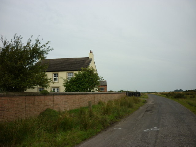
The lands common to Holme Abbey, Holme Low, and Holme St Cuthbert are located in the Civil Parish of Cumberland, England. These areas are characterized by their natural beauty, with rolling hills, lush green fields, and picturesque landscapes.

The common lands are primarily used for agricultural purposes, with farmers tending to their livestock and cultivating crops. The fertile soil and favorable climate in this region make it ideal for farming, and the local community heavily relies on these lands for sustenance and economic livelihood.

The area is also home to several historical landmarks and sites of cultural significance. Holme Abbey, a former Cistercian monastery, stands as a testament to the region's rich history. The ruins of the abbey still attract visitors who are keen to explore its architectural beauty and learn about its religious past.

Furthermore, the lands provide ample opportunities for outdoor activities and leisure. Locals and tourists alike often take advantage of the expansive green spaces for walking, hiking, and picnicking. The tranquil environment and stunning vistas make it a popular destination for nature enthusiasts and those seeking a peaceful retreat.

Overall, the common lands of Holme Abbey, Holme Low, and Holme St Cuthbert offer a harmonious blend of agricultural productivity, cultural heritage, and natural beauty. They contribute significantly to the local economy, provide a sanctuary for wildlife, and offer a serene escape from the hustle and bustle of modern life.

If you have any feedback on the listing, please let us know in the comments section below.

Lands common to Holme Abbey, Holme Low and Holme St Cuthbert Images

Images are sourced within 2km of 54.88707/-3.320672 or Grid Reference NY1555. Thanks to Geograph Open Source API. All images are credited.

Shingle beach at Grune Point On the far side of Moricambe Bay, it is possible to make out the masts of the Anthorn Radio Station <a href="https://www.geograph.org.uk/gridref/NY1757">NY1757</a>.
Shingle beach at Grune Point
On the far side of Moricambe Bay, it is possible to make out the masts of the Anthorn Radio Station NY1757.
Dewpond on Grune Point
Skinburness Creek Seen from Grune Point looking over to Tickhill Scar.
Skinburness Creek
Seen from Grune Point looking over to Tickhill Scar.
Pillbox on Grune Point Or to give its full title "Cumberland Machine-Gun and Anti-Tank Rifle Emplacement". Uniquely constructed from sandbags filled with concrete; the hessian of the sacks has rotted away long since. The cairn on the top is a memorial to four firemen who drowned in an open boat in December 1956 during a rescue attempt following a report of a wildfowler stranded on the marshes. The report subsequently prove to be a false alarm.
Pillbox on Grune Point
Or to give its full title "Cumberland Machine-Gun and Anti-Tank Rifle Emplacement". Uniquely constructed from sandbags filled with concrete; the hessian of the sacks has rotted away long since. The cairn on the top is a memorial to four firemen who drowned in an open boat in December 1956 during a rescue attempt following a report of a wildfowler stranded on the marshes. The report subsequently prove to be a false alarm.
Interior of the Grune Point pillbox The roof is supported by a central pillar. For further detail see <a href="https://www.geograph.org.uk/photo/6960697">NY1456 : Pillbox on Grune Point</a>.
Interior of the Grune Point pillbox
The roof is supported by a central pillar. For further detail see NY1456 : Pillbox on Grune Point.
Grune Point Some of the masts of Anthorn Radio Station are on the far side of Moricambe Bay.  In the far distance is Cold Fell (621m) marking the northernmost extremity of the Pennines.
Grune Point
Some of the masts of Anthorn Radio Station are on the far side of Moricambe Bay. In the far distance is Cold Fell (621m) marking the northernmost extremity of the Pennines.
Cottages near East Border Farm
A derelict farm building at West Border
A minor road to Skinburness
Sea Dike End
Sea Dike End
The flood gate at Sea Dyke End
Sea Dyke Defences Sea dyke field entrance and sea defence gate on minor road to Skinburness.
Sea Dyke Defences
Sea dyke field entrance and sea defence gate on minor road to Skinburness.
Grune Eroded silt banks on the south side of Grune Point.
Grune
Eroded silt banks on the south side of Grune Point.
Pillbox on Grune Point World War II pillbox with, apparently, a (cemented) cairn on top.
Pillbox on Grune Point
World War II pillbox with, apparently, a (cemented) cairn on top.
Grune Point The end of Grune Point. The masts in the distance are those of Anthorn Radio Station in <a href="https://www.geograph.org.uk/gridref/NY1758">NY1758</a> and surrounding squares, on the English side of the Solway Firth.
Grune Point
The end of Grune Point. The masts in the distance are those of Anthorn Radio Station in NY1758 and surrounding squares, on the English side of the Solway Firth.
View from Grune Point Looking back towards Skinburnness from near the end of Grune Point.
View from Grune Point
Looking back towards Skinburnness from near the end of Grune Point.
Lagoon on Grune Point This lagoon, occupied by a single Ringed Plover when I visited, is at the end of Grune Point, protected from the Solway Firth by a bank of shingle.
Lagoon on Grune Point
This lagoon, occupied by a single Ringed Plover when I visited, is at the end of Grune Point, protected from the Solway Firth by a bank of shingle.
On Grune Point Gorsy grassland on Grune Point. Saw Cuckoo, Linnet, Meadow Pipit, Skylark.
On Grune Point
Gorsy grassland on Grune Point. Saw Cuckoo, Linnet, Meadow Pipit, Skylark.
Show me another place!

Lands common to Holme Abbey, Holme Low and Holme St Cuthbert is located at Grid Ref: NY1555 (Lat: 54.88707, Lng: -3.320672)

Administrative County: Cumbria

District: Allerdale

Police Authority: Cumbria

What 3 Words

///revamped.boot.digit. Near Silloth, Cumbria

Related Wikis

Solway Coast

The Solway Coast is a designated Area of Outstanding Natural Beauty in northern Cumbria, England. It incorporates two areas of coastline along the Solway...

River Wampool

The River Wampool is a river flowing through north western Cumbria in England. It is in the Waver and Wampool (or Wampool and Waver) catchment which includes...

Moricambe Bay

Moricambe Bay is an inlet of the Solway Firth in Cumbria (before 1974 in Cumberland) in north west England, created by the confluence of two rivers, the...

Calvo, Cumbria

Calvo is a hamlet in Cumbria, England. == See also == Listed buildings in Holme Low == References ==

Nearby Amenities

Located within 500m of 54.88707,-3.320672
Source: PGS
Lat/Long: 54.8889396/-3.3179374
Source: PGS
Lat/Long: 54.8887825/-3.3247891
Source: PGS
Lat/Long: 54.8891485/-3.3260526
The data included in this document is from www.openstreetmap.org. The data is made available under ODbL.

Have you been to Lands common to Holme Abbey, Holme Low and Holme St Cuthbert?

Leave your review of Lands common to Holme Abbey, Holme Low and Holme St Cuthbert below (or comments, questions and feedback).