Lanchester

Civil Parish in Durham

England

Lanchester

Humber Hill The trig is perched on the edge of a small quarry.
Humber Hill Credit: Richard Webb

Lanchester is a civil parish located in County Durham, England. Situated approximately 8 miles southwest of the city of Durham, Lanchester is a vibrant village with a rich history dating back to Roman times.

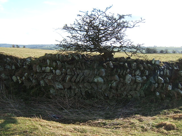
The village is known for its picturesque setting, surrounded by rolling hills and countryside, making it a popular destination for nature lovers and outdoor enthusiasts. Lanchester is home to a diverse range of flora and fauna, with several nature reserves and walking trails in the vicinity.

The village itself boasts a charming and traditional atmosphere, with a variety of local amenities and services. These include a selection of shops, pubs, restaurants, and cafes, providing residents and visitors with a range of options for dining, shopping, and entertainment.

Lanchester is also renowned for its historical significance. The remains of a Roman fort, known as Longovicium, can be found on the outskirts of the village. This archaeological site attracts visitors from all over the country, offering insights into the area's Roman past.

In addition to its historical heritage, Lanchester hosts a number of annual events and festivals that celebrate local traditions and culture. These include the Lanchester Agricultural Show, which showcases the region's agricultural heritage, and the Lanchester Beer Festival, which brings together a selection of local breweries.

Overall, Lanchester is a charming and vibrant village that offers a mix of natural beauty, historical significance, and community spirit. It is a place where residents and visitors can enjoy the best of rural England while being within easy reach of larger urban centers.

If you have any feedback on the listing, please let us know in the comments section below.

Lanchester Images

Images are sourced within 2km of 54.813157/-1.746099 or Grid Reference NZ1646. Thanks to Geograph Open Source API. All images are credited.

Humber Hill The trig is perched on the edge of a small quarry.
Humber Hill
The trig is perched on the edge of a small quarry.
Open Access Land A small patch of Open Access land with steps down from the Lanchester Valley Cycle and Walk Way. Down the steps and duck under the pipe.
Open Access Land
A small patch of Open Access land with steps down from the Lanchester Valley Cycle and Walk Way. Down the steps and duck under the pipe.
Lanchester Village Green
Alderdene Burn Looking south east from the unclassified road just about Branch Villas
Alderdene Burn
Looking south east from the unclassified road just about Branch Villas
Lanchester Nurseries The Roman road 'Dere Street' passes through the field of cows and underneath the left hand most polytunnels.
Lanchester Nurseries
The Roman road 'Dere Street' passes through the field of cows and underneath the left hand most polytunnels.
Malton Picnic Area On the Lanchester Valley Walk
Malton Picnic Area
On the Lanchester Valley Walk
Lanchester Cemetery
Lanchester Cemetery
Lanchester View south from the Lanchester Cycleway.
Lanchester
View south from the Lanchester Cycleway.
River Browney At the Malton picnic area adjacent to the Lanchester Valley Cycleway.
River Browney
At the Malton picnic area adjacent to the Lanchester Valley Cycleway.
Lanchester Roman Fort The fort is on private land with no public access.
Lanchester Roman Fort
The fort is on private land with no public access.
Valley of the River Browney Viewed from the road between Cornsay village and Wilks Hill. Lanchester in the distance, and the transmitter mast at Burnhope on the skyline
Valley of the River Browney
Viewed from the road between Cornsay village and Wilks Hill. Lanchester in the distance, and the transmitter mast at Burnhope on the skyline
Colepike Hall boundary wall The stone pillars once had iron railings between them, doubtless removed and melted down for the war effort.
Colepike Hall boundary wall
The stone pillars once had iron railings between them, doubtless removed and melted down for the war effort.
Longovicium The distinctive herringbone pattern walls of this Roman fort are much more readily visible in winter when the vegetation has died down. There is no public access so the road view is all you get.
Longovicium
The distinctive herringbone pattern walls of this Roman fort are much more readily visible in winter when the vegetation has died down. There is no public access so the road view is all you get.
Bee Court Lanchester At the bottom of the hill leading from Annfield Plain
Bee Court Lanchester
At the bottom of the hill leading from Annfield Plain
St Bede's School Lanchester
Road above the church Lanchester
Burnhope to Lanchester road
Road to Witton Gilber from Lanchester -High Burnhopeside
Show me another place!

Lanchester is located at Grid Ref: NZ1646 (Lat: 54.813157, Lng: -1.746099)

Unitary Authority: County Durham

Police Authority: Durham

What 3 Words

///last.anchovies.routs. Near Lanchester, Co. Durham

Nearby Locations

Lanchester The Rookery

Related Wikis

Longovicium

Longovicium (or Lanchester Roman Fort) was an auxiliary fort located on Roman Dere Street, in the Roman province of Britannia Inferior. It is located just...

Lanchester railway station

Lanchester railway station served the village of Lanchester, County Durham, England from 1862 to 1965 on the Lanchester Valley Line. == History == The...

Lanchester, County Durham

Lanchester is a village and civil parish in County Durham, England, 8 miles (13 km) west of Durham and 5 miles (8 km) from Consett. It had a population...

Ornsby Hill

Ornsby Hill is a village in County Durham, in England. Ornsby Hill is situated immediately to the north of Lanchester at the junction of the A691 and A6076...

Nearby Amenities

Located within 500m of 54.813157,-1.746099
Bus Stop
Greenwell Farm
Naptan AtcoCode: 13001217A
Naptan Bearing: N
Naptan CommonName: Greenwell Farm
Naptan Indicator: north bound
Naptan Landmark: Landmark not known
Naptan NaptanCode: duradgma
Naptan Notes: Ford Road 60m south of road entrance to Newfield Hall- South Of Lanchester. Durham
Naptan Street: B6301 - Bargate Bank
Naptan Verified: no
Source: naptan_import
Lat/Long: 54.8126274/-1.744345
Bus Stop
Greenwell Farm
Naptan AtcoCode: 13001217E
Naptan Bearing: S
Naptan CommonName: Greenwell Farm
Naptan Indicator: south bound
Naptan Landmark: Landmark not known
Naptan NaptanCode: duradgmd
Naptan Notes: stop not found-assumed location on Ford Rd (B6301)35m south of The Lodge- durham
Naptan Street: B6301 - Bargate Bank
Naptan Verified: no
Source: naptan_import
Lat/Long: 54.8126002/-1.7442362
Generator Method: photovoltaic
Generator Orientation: 270
Generator Output Electricity: yes
Generator Solar Modules: 16
Generator Source: solar
Generator Type: solar_photovoltaic_panel
Location: roof
Power: generator
Lat/Long: 54.8166588/-1.7440983
Power: pole
Lat/Long: 54.8098057/-1.741097
Power: pole
Lat/Long: 54.809645/-1.7416951
Power: pole
Lat/Long: 54.8094703/-1.7423576
Power: pole
Transformer: distribution
Lat/Long: 54.8123291/-1.7385408
Power: pole
Lat/Long: 54.8093134/-1.7429611
The data included in this document is from www.openstreetmap.org. The data is made available under ODbL.

Have you been to Lanchester?

Leave your review of Lanchester below (or comments, questions and feedback).