Lamesley

Civil Parish in Durham Gateshead

England

Lamesley

Road junctions below the A1 The roundabout for access to the A1 and the road on the left into Team Valley
Road junctions below the A1 Credit: Eirian Evans

Lamesley is a civil parish located in the county of Durham, England. Situated about 5 miles south of the city of Newcastle upon Tyne, it is part of the Metropolitan Borough of Gateshead. The parish covers an area of approximately 4.5 square miles and is home to a population of around 3,000 people.

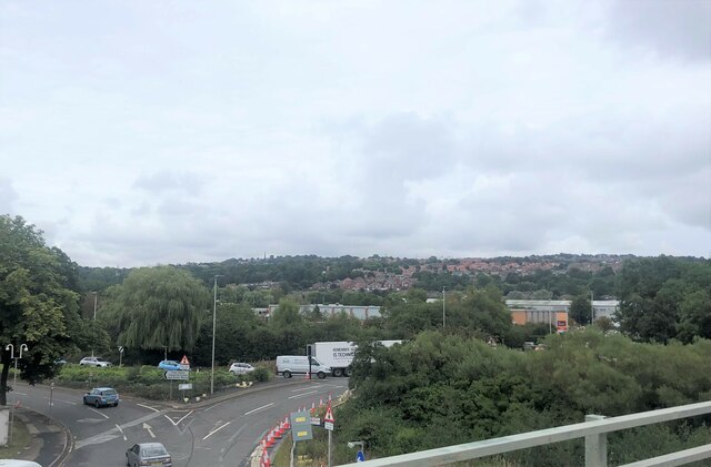
Lamesley is characterized by its picturesque rural landscapes, with rolling hills and open countryside. The area is dotted with small villages and hamlets, including Kibblesworth, Eighton Banks, and Marley Hill. The parish is surrounded by natural beauty, with the River Team flowing through its borders and offering opportunities for outdoor activities such as fishing and hiking.

Historically, Lamesley was an important mining area, with several collieries operating in the 19th and early 20th centuries. The remnants of this industrial heritage can still be seen in the form of old mine shafts and buildings. Today, the local economy is more diverse, with a mix of agriculture, small businesses, and residential areas.

Lamesley is well-connected to neighboring towns and cities, with good road links to Newcastle and Gateshead. The A1(M) motorway runs through the parish, providing easy access to other parts of the region. The area is also served by public transportation, including bus services that connect Lamesley to surrounding areas.

In terms of amenities, Lamesley has a primary school, a community center, and a few local shops and pubs. The parish enjoys a close-knit community spirit, with various events and activities organized throughout the year, including festivals, fairs, and sports tournaments.

If you have any feedback on the listing, please let us know in the comments section below.

Lamesley Images

Images are sourced within 2km of 54.908948/-1.62861 or Grid Reference NZ2357. Thanks to Geograph Open Source API. All images are credited.

Road junctions below the A1 The roundabout for access to the A1 and the road on the left into Team Valley
Road junctions below the A1
The roundabout for access to the A1 and the road on the left into Team Valley
A corner of the Team Valley Retail Park
Team Valley Retail World A view of the retail park with low, dark, swirling cloud
Team Valley Retail World
A view of the retail park with low, dark, swirling cloud
Silverhills Nursery A view of the farm and the side of the greenhouses of Silverhills Nursery. The farm has cross country biking tracks
Silverhills Nursery
A view of the farm and the side of the greenhouses of Silverhills Nursery. The farm has cross country biking tracks
Old Ravensworth Farm A view of the entrance to the farm with the sprawl of southern Gateshead in the distance.
Old Ravensworth Farm
A view of the entrance to the farm with the sprawl of southern Gateshead in the distance.
Silverhills Newly built farm buildings on the Lamesley-Sunniside road
Silverhills
Newly built farm buildings on the Lamesley-Sunniside road
Railway sidings These sidings are on the East Coast Main Line, which runs from London's Kings Cross to Newcastle and beyond. Here you can see a local train travelling to Newcastle.
Railway sidings
These sidings are on the East Coast Main Line, which runs from London's Kings Cross to Newcastle and beyond. Here you can see a local train travelling to Newcastle.
Team Valley Retail World 2 A picture of the retail park with less threatening cloud!
Team Valley Retail World 2
A picture of the retail park with less threatening cloud!
Field, looking SE towards Ravensworth Grange ...and beyond!
Field, looking SE towards Ravensworth Grange
...and beyond!
St. Andrew, Lamesley
St. Andrews Lamesley church gates
Footpath with carved stone This marks the point where the Great North Forest Trail crosses Birkland Lane. Here the trail follows the course of the old  Pontop and Jarrow Railway. Birkhead Cottages can just be seen through the mist.
Footpath with carved stone
This marks the point where the Great North Forest Trail crosses Birkland Lane. Here the trail follows the course of the old Pontop and Jarrow Railway. Birkhead Cottages can just be seen through the mist.
Field and sheep, beside Birkland Lane The near hedge and most of the sheep are in the square. The far hedge and trees are not!
Field and sheep, beside Birkland Lane
The near hedge and most of the sheep are in the square. The far hedge and trees are not!
Birkheads Lanes Nursery Garden Nursery with mining tradition
Birkheads Lanes Nursery Garden
Nursery with mining tradition
Great North Forest Trail Cycle Trail on line of former Jarrow Railway
Great North Forest Trail
Cycle Trail on line of former Jarrow Railway
Kibblesworth Main Street
Beet Field Moormill Lane Looking NE from Great North Cycle Trail. Field boundary marks Moormill Lane
Beet Field Moormill Lane
Looking NE from Great North Cycle Trail. Field boundary marks Moormill Lane
East Coast Mainline at Lamesley, 1st May 2006
Show me another place!

Lamesley is located at Grid Ref: NZ2357 (Lat: 54.908948, Lng: -1.62861)

Administrative County: Tyne and Wear

District: Gateshead

Police Authority: Northumbria

What 3 Words

///goofy.modes.swimsuits. Near Lamesley, Tyne & Wear

Related Wikis

Kibblesworth

Kibblesworth is a village 2 miles (3.2 km) west of Birtley, Tyne and Wear, England. Kibblesworth was a mainly rural community until the development of...
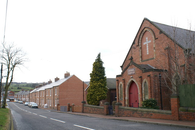
Lamesley

Lamesley is a village and civil parish in the Metropolitan Borough of Gateshead, Tyne and Wear, England. The population of the civil parish at the 2011...

Lamesley railway station

Lamesley railway station served the village of Lamesley, Tyne and Wear, England from 1868 to 1959 on the East Coast Main Line. == History == The station...
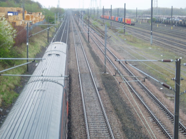
Tyne Yard

Tyne Yard (TY) is a railway yard in Birtley, England, on the East Coast Main Line, operated by DB Cargo UK. The yard is the major freight yard of the North...

Nearby Amenities

Located within 500m of 54.908948,-1.62861
Power: tower
Lat/Long: 54.9106884/-1.6219684
Power: tower
Lat/Long: 54.9117184/-1.6258426
Power: tower
Lat/Long: 54.9129086/-1.6303476
The data included in this document is from www.openstreetmap.org. The data is made available under ODbL.

Have you been to Lamesley?

Leave your review of Lamesley below (or comments, questions and feedback).