Knighton on Teme

Civil Parish in Worcestershire Malvern Hills

England

Knighton on Teme

Sheep on Rochford Castle Viewed from the churchyard at St. Michael's parish church.
Sheep on Rochford Castle Credit: Fabian Musto

Knighton on Teme is a civil parish located in the county of Worcestershire, England. It is situated on the eastern banks of the River Teme, approximately 10 miles south of the city of Worcester. The parish covers an area of around 15 square kilometers and is bordered by the parishes of Pensax, Lindridge, Kyre, and Mamble.

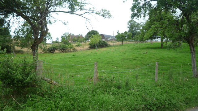
The village of Knighton on Teme is a charming rural settlement characterized by its picturesque countryside and tranquil atmosphere. It is home to a small, close-knit community of around 400 residents. The village boasts a variety of architectural styles, with several historic buildings dating back to the 17th and 18th centuries.

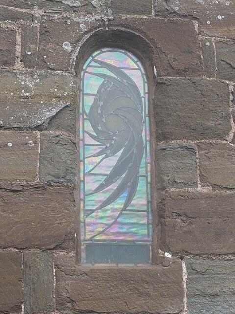
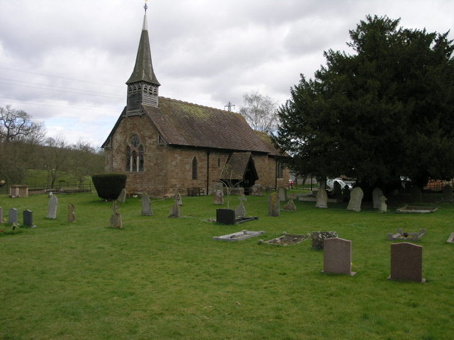
The centerpiece of Knighton on Teme is St. Michael's Church, a Grade II listed building that dates back to the 12th century. The church features a distinctive tower and is known for its beautiful stained glass windows. The village also has a primary school, which serves the local children.

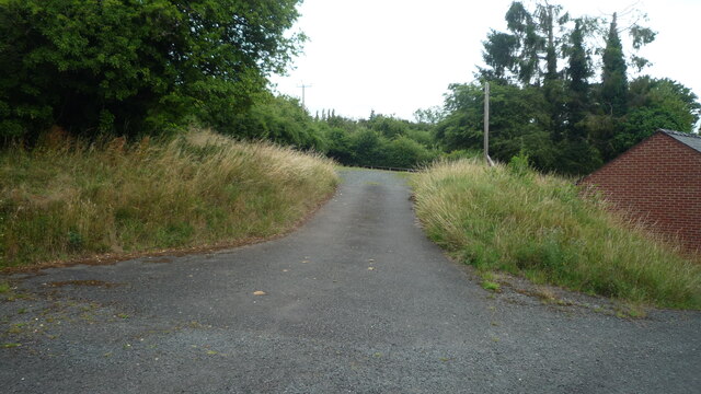
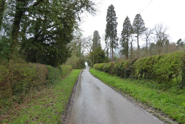
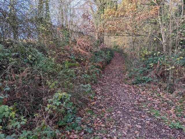
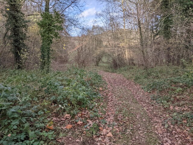
The surrounding area offers plenty of opportunities for outdoor activities and exploration. The River Teme is popular among anglers, attracting visitors who enjoy fishing for trout and grayling. The nearby countryside provides numerous walking and cycling routes, allowing residents and visitors to enjoy the natural beauty of the Worcestershire landscape.

Overall, Knighton on Teme is a peaceful and idyllic parish that offers a charming rural lifestyle while still being within easy reach of larger towns and cities.

If you have any feedback on the listing, please let us know in the comments section below.

Knighton on Teme Images

Images are sourced within 2km of 52.326117/-2.535823 or Grid Reference SO6369. Thanks to Geograph Open Source API. All images are credited.

Sheep on Rochford Castle Viewed from the churchyard at St. Michael's parish church.
Sheep on Rochford Castle
Viewed from the churchyard at St. Michael's parish church.
Window at St. Michael's church (Rochford) The exterior of the stained-glass window in the north wall of the nave. Here is the inside view of it <a href="https://www.geograph.org.uk/photo/7765337">SO6268 : Window inside St. Michael's church (Rochford)</a>.
Window at St. Michael's church (Rochford)
The exterior of the stained-glass window in the north wall of the nave. Here is the inside view of it SO6268 : Window inside St. Michael's church (Rochford).
War memorial at St. Michael's church (Rochford) One of two war memorials in the north wall of the nave, and this tablet is dedicated to the people who gave their lives in the First World War.
War memorial at St. Michael's church (Rochford)
One of two war memorials in the north wall of the nave, and this tablet is dedicated to the people who gave their lives in the First World War.
War memorial at St. Michael's church (Rochford) One of two war memorials in the north wall of the nave, and this tablet is dedicated to the people who gave their lives in the Second World War.
War memorial at St. Michael's church (Rochford)
One of two war memorials in the north wall of the nave, and this tablet is dedicated to the people who gave their lives in the Second World War.
Organ at St. Michael's church (Rochford) This pipe organ has a mahogany case and brass inlays from around 1810, which includes the two headed eagle and foliage on top (source: Churches of Worcestershire, Tim Bridges, 2005).
Organ at St. Michael's church (Rochford)
This pipe organ has a mahogany case and brass inlays from around 1810, which includes the two headed eagle and foliage on top (source: Churches of Worcestershire, Tim Bridges, 2005).
Window inside St. Michael's church (Rochford) The stained-glass window in the north wall of the nave dates from the turn of the C20, which was installed in memory of Kieron Gledhill (1976-99), who is buried in the churchyard along with his sister Nicola (d.2003). Here is the outside view of the stained-glass <a href="https://www.geograph.org.uk/photo/7765325">SO6268 : Window at St. Michael's church (Rochford)</a>.
Window inside St. Michael's church (Rochford)
The stained-glass window in the north wall of the nave dates from the turn of the C20, which was installed in memory of Kieron Gledhill (1976-99), who is buried in the churchyard along with his sister Nicola (d.2003). Here is the outside view of the stained-glass SO6268 : Window at St. Michael's church (Rochford).
Window inside St. Michael's church (Rochford) This stained-glass window is in the north wall of the chancel, which depicts a robin above the inscription "In Loving Memory of; Cliff Johnson 1925-2015; Hilda Johnson 1925-2007".
Window inside St. Michael's church (Rochford)
This stained-glass window is in the north wall of the chancel, which depicts a robin above the inscription "In Loving Memory of; Cliff Johnson 1925-2015; Hilda Johnson 1925-2007".
Inside St. Michael's church (Rochford) Here is the tranquil interior of St. Michael parish church in Rochford, home to several features from the C12, early C14 and mid C19. The chancel arch is from the C12, while the stained glass in the east window was installed by William Morris and Co. in 1863, the same time Henry Curzon restored the church until 1865.
Inside St. Michael's church (Rochford)
Here is the tranquil interior of St. Michael parish church in Rochford, home to several features from the C12, early C14 and mid C19. The chancel arch is from the C12, while the stained glass in the east window was installed by William Morris and Co. in 1863, the same time Henry Curzon restored the church until 1865.
Churchyard at St. Michael's church (Rochford) The iron crosses closest to the camera are dedicated to Frances Mary Bennett (d. 06.09.1934) and Roy Element (d. 13.01.1933), who passed away at fifteen and thirteen years old respectively. R.I.P.
Churchyard at St. Michael's church (Rochford)
The iron crosses closest to the camera are dedicated to Frances Mary Bennett (d. 06.09.1934) and Roy Element (d. 13.01.1933), who passed away at fifteen and thirteen years old respectively. R.I.P.
Bishops Barn and Old Hall (Rochford) The timber-framed building to the left does not have listed status as of writing this text, but the sandstone/brick building to the right, built in 1704 with C17 or earlier origins, is grade II listed. Viewed from a path south of St. Michael's parish church.
Bishops Barn and Old Hall (Rochford)
The timber-framed building to the left does not have listed status as of writing this text, but the sandstone/brick building to the right, built in 1704 with C17 or earlier origins, is grade II listed. Viewed from a path south of St. Michael's parish church.
Glimpse of Peter's Cottage (Rochford) The grade II listed cottage in the distance was built in the C17, which had additions and alterations in the late C19 and C20. This photo was taken from the path south of St. Michael's parish church.
Glimpse of Peter's Cottage (Rochford)
The grade II listed cottage in the distance was built in the C17, which had additions and alterations in the late C19 and C20. This photo was taken from the path south of St. Michael's parish church.
Path to St. Michael's church (Rochford) The churchyard at Rochford parish church is home to several trees of different specimen, and here is the building from a path to the south.
Path to St. Michael's church (Rochford)
The churchyard at Rochford parish church is home to several trees of different specimen, and here is the building from a path to the south.
Lane by Knighton on Teme Parish Room This country lane goes into a car park by the parish room at Knighton on Teme.
Lane by Knighton on Teme Parish Room
This country lane goes into a car park by the parish room at Knighton on Teme.
Information board at Knighton on Teme This information board is placed by the parish room at Knighton on Teme.
Information board at Knighton on Teme
This information board is placed by the parish room at Knighton on Teme.
Hilltop Farm (Knighton on Teme) Taken from a country lane by the parish room.
Hilltop Farm (Knighton on Teme)
Taken from a country lane by the parish room.
No through road at Bickley No through road giving access to Bickley House.
No through road at Bickley
No through road giving access to Bickley House.
Path to Bickley Taken on a walk from Knighton-on-Teme to the Leominster Canal (northeast of Newnham Bridge).
Path to Bickley
Taken on a walk from Knighton-on-Teme to the Leominster Canal (northeast of Newnham Bridge).
Path to the Leominster Canal Taken on a walk from Knighton-on-Teme to the Leominster Canal (northeast of Newnham Bridge).
Path to the Leominster Canal
Taken on a walk from Knighton-on-Teme to the Leominster Canal (northeast of Newnham Bridge).
Show me another place!

Knighton on Teme is located at Grid Ref: SO6369 (Lat: 52.326117, Lng: -2.535823)

Administrative County: Worcestershire

District: Malvern Hills

Police Authority: West Mercia

What 3 Words

///retailing.jaunts.spoke. Near Tenbury Wells, Worcestershire

Nearby Locations

Knighton on Teme

Related Wikis

Knighton on Teme

Knighton on Teme is a village and civil parish once in the hundred of Doddingtree and now in the Malvern Hills District of the county of Worcestershire...

Newnham Bridge railway station

Newnham Bridge railway station was a station on the Tenbury and Bewdley Railway in Newnham Bridge, Worcestershire, England. The station was named 'Newnham...

Newnham Bridge

Newnham Bridge is a village in the parish of Knighton on Teme, near Tenbury Wells, Worcestershire, England, United Kingdom. The village derives part of...

Rochford, Worcestershire

Rochford consists of two hamlets, Lower and Upper Rochford. A civil parish in the Malvern Hills District near Tenbury Wells, in the county of Worcestershire...

Nearby Amenities

Located within 500m of 52.326117,-2.535823
Bus Stop
Knighton-on-Teme- Church Lane
Bus: yes
Naptan AtcoCode: 2000G199300
Naptan Bearing: W
Naptan CommonName: Knighton-on-Teme- Church Lane
Naptan Indicator: Adj
Naptan Landmark: Church Lane
Naptan NaptanCode: wocdpamg
Naptan Street: Church Lane
Naptan Verified: no
Public Transport: platform
Source: naptan_import
Lat/Long: 52.3255972/-2.5321549
Power: tower
Source: bing
Lat/Long: 52.3242783/-2.5383136
Power: tower
Source: bing
Lat/Long: 52.324711/-2.5325093
Power: tower
Source: bing
Lat/Long: 52.3250127/-2.5298057
Power: tower
Source: bing
Lat/Long: 52.3240684/-2.5417361
The data included in this document is from www.openstreetmap.org. The data is made available under ODbL.

Have you been to Knighton on Teme?

Leave your review of Knighton on Teme below (or comments, questions and feedback).