Kingshurst

Civil Parish in Warwickshire Solihull

England

Kingshurst

Old Croft Lane, Birmingham
Old Croft Lane, Birmingham Credit: Ian S

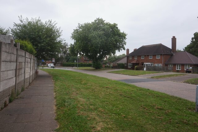
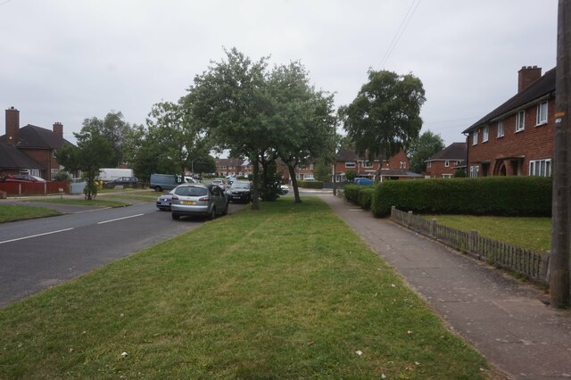
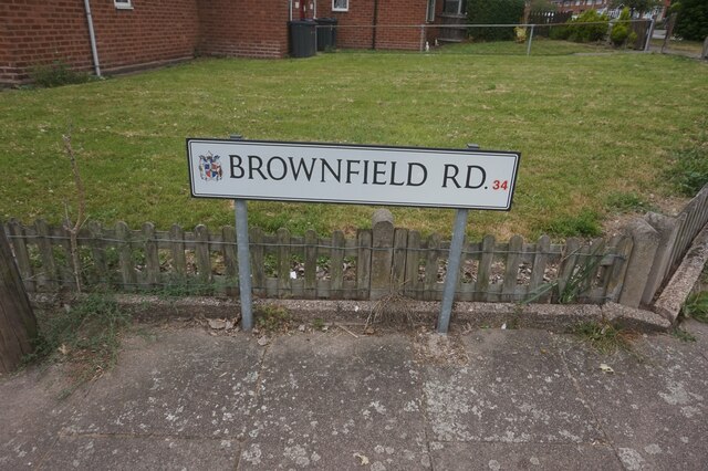
Kingshurst is a civil parish located in Warwickshire, England. It is situated approximately 10 miles east of Birmingham city center. The area is predominantly residential and is known for its close-knit community and friendly atmosphere.

The parish is home to a population of around 12,000 people. It is characterized by a mix of housing types, including council estates, privately owned houses, and a number of apartment complexes. The area has seen significant development in recent years, with the construction of new housing estates and the regeneration of existing properties.

Kingshurst benefits from excellent transport links, with easy access to major road networks including the M6 and M42 motorways. The nearby Birmingham International Airport provides convenient air travel options for residents.

In terms of amenities, Kingshurst boasts a range of facilities to cater to the needs of its residents. These include several primary schools, a secondary school, a community center, and a library. There are also numerous parks and green spaces, providing opportunities for outdoor activities and recreational pursuits.

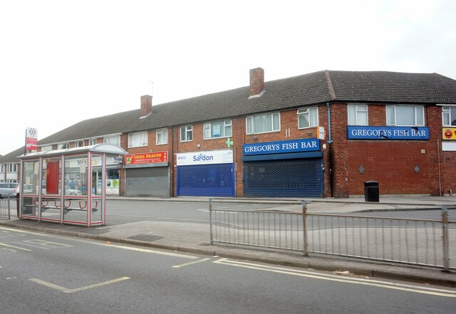
The local economy is diverse, with a mix of retail, service, and industrial sectors. The nearby Chelmsley Wood Shopping Centre offers a range of shops, supermarkets, and restaurants, providing residents with convenient access to daily necessities.

Overall, Kingshurst offers a pleasant and welcoming environment for its residents, with a range of amenities and excellent transport links. Its close proximity to Birmingham makes it an attractive location for commuters looking to escape the hustle and bustle of city life.

If you have any feedback on the listing, please let us know in the comments section below.

Kingshurst Images

Images are sourced within 2km of 52.491064/-1.752094 or Grid Reference SP1688. Thanks to Geograph Open Source API. All images are credited.

Old Croft Lane, Birmingham
Brownfield Road, Birmingham
West Avenue from Green Lane, Castle Bromwich
Shops on Green Lane, Castle Bromwich
Auckland Drive, Castle Bromwich
Swift Close off Auckland Drive, Castle Bromwich
Sandra Croft off Auckland Drive, Castle Bromwich
The Centurion public house On Forth Drive, Fordbridge.
The Centurion public house
On Forth Drive, Fordbridge.
The Centurion public house On Forth Drive, Fordbridge.
The Centurion public house
On Forth Drive, Fordbridge.
Hedgetree Croft off Chelmsley Road, Chelmsley Wood
Chester Road, Castle Bromwich
Castle Bromwich Shopping, Chester Road
Peacock Butterfly at Sheldon Hall School Aglais io, the peacock butterfly, with its distinctive four eyespots, is seen here on the site of the former Sheldon Hall School in Tile Cross.
Peacock Butterfly at Sheldon Hall School
Aglais io, the peacock butterfly, with its distinctive four eyespots, is seen here on the site of the former Sheldon Hall School in Tile Cross.
Reflections in the Lake Shard End Lake from beside Pithall Road
Reflections in the Lake
Shard End Lake from beside Pithall Road
A Brutalist Pilgrimage Admirers of Modernist architecture have come to see Our Lady Help of Christians, a Catholic church in Kitts Green, Birmingham, that was completed in 1967 to designs by Richard Gilbert Scott, of the famous Scott dynasty of architects. The tour was led by members of Brutiful Birmingham, which defends and promotes the city's much-maligned Modernist and Brutalist architecture. On Brutiful Birmingham see Joe Holyoak at Building Design <span class="nowrap"><a title="https://www.bdonline.co.uk/briefing/review-birmingham-the-brutiful-years/5119945.article" rel="nofollow ugc noopener" href="https://www.bdonline.co.uk/briefing/review-birmingham-the-brutiful-years/5119945.article">Link</a><img style="margin-left:2px;" alt="External link" title="External link - shift click to open in new window" src="https://s1.geograph.org.uk/img/external.png" width="10" height="10"/></span> .
A Brutalist Pilgrimage
Admirers of Modernist architecture have come to see Our Lady Help of Christians, a Catholic church in Kitts Green, Birmingham, that was completed in 1967 to designs by Richard Gilbert Scott, of the famous Scott dynasty of architects. The tour was led by members of Brutiful Birmingham, which defends and promotes the city's much-maligned Modernist and Brutalist architecture. On Brutiful Birmingham see Joe Holyoak at Building Design LinkExternal link .
Our Lady Help of Christians, Kitts Green This is a Catholic church built in 1966-7 to designs by Richard Gilbert Scott of Giles Scott, Son and Partners. The building is T-shaped in plan; each arm of the T is roofed with an upward-sweeping curve of reinforced concrete with serrated ribbed trusses. The roof is of felt coated with copper. A pair of side chapels nestle in the corners of the T, each with a bell-shaped roof; the Lady Chapel can be seen here. The church is Grade II* listed: see the listing at Historic England <span class="nowrap"><a title="https://historicengland.org.uk/listing/the-list/list-entry/1245546?section=official-list-entry" rel="nofollow ugc noopener" href="https://historicengland.org.uk/listing/the-list/list-entry/1245546?section=official-list-entry">Link</a><img style="margin-left:2px;" alt="External link" title="External link - shift click to open in new window" src="https://s1.geograph.org.uk/img/external.png" width="10" height="10"/></span> and the entry at the Gilbert Scott Dynasty site <span class="nowrap"><a title="https://gilbertscott.org/our-lady-help-of-christians-church/" rel="nofollow ugc noopener" href="https://gilbertscott.org/our-lady-help-of-christians-church/">Link</a><img style="margin-left:2px;" alt="External link" title="External link - shift click to open in new window" src="https://s1.geograph.org.uk/img/external.png" width="10" height="10"/></span> .
Our Lady Help of Christians, Kitts Green
This is a Catholic church built in 1966-7 to designs by Richard Gilbert Scott of Giles Scott, Son and Partners. The building is T-shaped in plan; each arm of the T is roofed with an upward-sweeping curve of reinforced concrete with serrated ribbed trusses. The roof is of felt coated with copper. A pair of side chapels nestle in the corners of the T, each with a bell-shaped roof; the Lady Chapel can be seen here. The church is Grade II* listed: see the listing at Historic England LinkExternal link and the entry at the Gilbert Scott Dynasty site LinkExternal link .
Our Lady Help of Christians with Baptistery, Kitts Green This is a view of the church from the southeast (liturgically north), showing one of its sweeps of zigzag copper-coated concrete roofing and the bell-shaped lantern of the baptistery. The architect, Richard Gilbert Scott, achieved astonishing results on a tight budget and at a time of experimentation and uncertainty - but also opportunity - in Catholic church design following the Second Vatican Council (1962-65) and its reforms. The building is Grade II* listed - see the listing at the Historic England site <span class="nowrap"><a title="https://historicengland.org.uk/listing/the-list/list-entry/1245546" rel="nofollow ugc noopener" href="https://historicengland.org.uk/listing/the-list/list-entry/1245546">Link</a><img style="margin-left:2px;" alt="External link" title="External link - shift click to open in new window" src="https://s1.geograph.org.uk/img/external.png" width="10" height="10"/></span> .
Our Lady Help of Christians with Baptistery, Kitts Green
This is a view of the church from the southeast (liturgically north), showing one of its sweeps of zigzag copper-coated concrete roofing and the bell-shaped lantern of the baptistery. The architect, Richard Gilbert Scott, achieved astonishing results on a tight budget and at a time of experimentation and uncertainty - but also opportunity - in Catholic church design following the Second Vatican Council (1962-65) and its reforms. The building is Grade II* listed - see the listing at the Historic England site LinkExternal link .
Show me another place!

Kingshurst is located at Grid Ref: SP1688 (Lat: 52.491064, Lng: -1.752094)

Administrative County: West Midlands

District: Solihull

Police Authority: West Midlands

What 3 Words

///assets.bumpy.goals. Near Chelmsley Wood, West Midlands

Nearby Locations

York's Wood Kingshurst

Related Wikis

Kingshurst

Kingshurst is a post-war village and civil parish in the Metropolitan Borough of Solihull, in the West Midlands. It lies about 9 miles (14 km) east of...

Yorks Wood

Yorks Wood is a Local Nature Reserve in Kingshurst, Solihull, England. It is an 11 hectares (27 acres) ancient wood of predominantly oak trees. The River...

Tudor Grange Academy, Kingshurst

Tudor Grange Academy, Kingshurst (previously CTC Kingshurst Academy) is a coeducational secondary school and sixth form located in Kingshurst, Solihull...
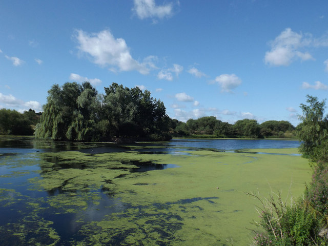
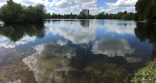
Babbs Mill Lake

Babbs Mill Lake, sometimes called Kingshurst Lake, is a man-made lake in the Kingfisher Country Park in Kingshurst, Solihull in England. The lake was created...

Fordbridge

Fordbridge is a town and civil parish in the Metropolitan Borough of Solihull, in the West Midlands, England. It is 8 miles (13 km) east of Birmingham...

John Henry Newman Catholic College

John Henry Newman Catholic College (JHNCC), formerly Archbishop Grimshaw School, is an English secondary school in the Fordbridge area of Solihull, although...

Smith's Wood Academy

Smith's Wood Academy (formerly Smith's Wood School and then Smith's Wood Sports College) is a co-educational secondary school located in Smith's Wood in...
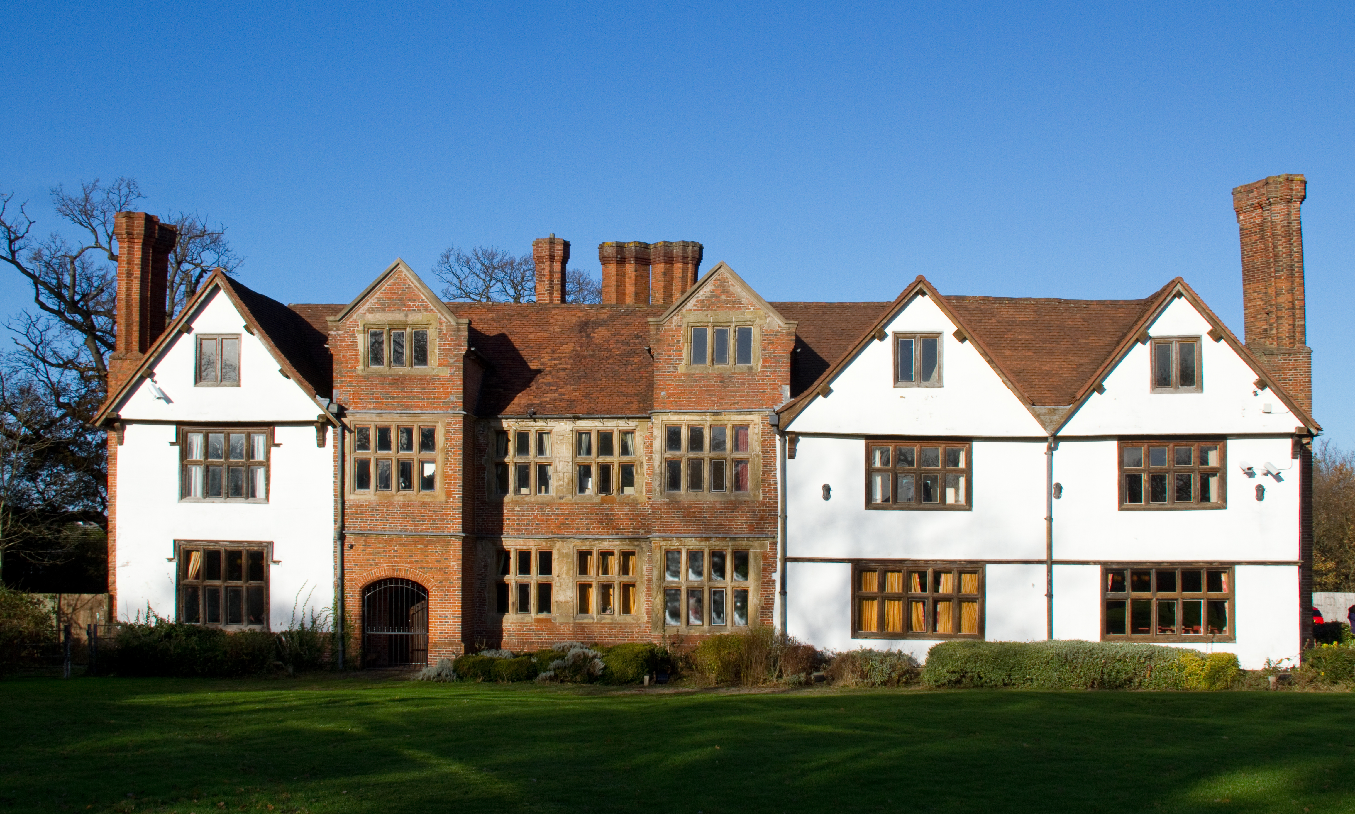
Sheldon Hall

Sheldon Hall is an early 16th-century Grade II* listed manor house located on Gressel Lane in the Tile Cross area of Birmingham, England, consisting of...

Related Videos

A 4-Star Luxury Hotel! Genting Hotel Resorts World Birmingham U.K.#travel#hotel#resort#luxury#uk#

One Night stay at the Genting Hotel Resorts World Birmingham. Very nice signature double room with a lovely view of the lake.

Nearby Amenities

Located within 500m of 52.491064,-1.752094
Mini Roundabout
Direction: clockwise
Lat/Long: 52.4908235/-1.7478943
Source: bing
Traffic Calming: bump
Lat/Long: 52.4901038/-1.7496227
Source: bing
Traffic Calming: bump
Lat/Long: 52.4897986/-1.7506273
Source: bing
Traffic Calming: bump
Lat/Long: 52.4890719/-1.7520234
Source: bing
Traffic Calming: bump
Lat/Long: 52.4906954/-1.7552361
Source: bing
Traffic Calming: bump
Lat/Long: 52.49197/-1.7558931
Source: bing
Traffic Calming: bump
Lat/Long: 52.4928963/-1.7559448
Source: bing
Traffic Calming: bump
Lat/Long: 52.4929375/-1.7567651
Source: bing
Traffic Calming: bump
Lat/Long: 52.4889379/-1.7549991
Source: bing
Traffic Calming: bump
Lat/Long: 52.4897773/-1.7542183
Source: bing
Traffic Calming: bump
Lat/Long: 52.4891476/-1.756357
Source: bing
Traffic Calming: bump
Lat/Long: 52.4933552/-1.755549
Traffic Calming: bump
Lat/Long: 52.4899668/-1.7532201
Source: bing
Traffic Calming: bump
Lat/Long: 52.4908622/-1.7517882
Source: bing
Traffic Calming: bump
Lat/Long: 52.4912117/-1.7509856
Source: bing
Traffic Calming: bump
Lat/Long: 52.4927244/-1.751908
Source: bing
Traffic Calming: bump
Lat/Long: 52.4932978/-1.7519381
Source: bing
Traffic Calming: bump
Lat/Long: 52.4933434/-1.7514027
Mini Roundabout
Source: bing
Lat/Long: 52.493494/-1.7512337
Source: bing
Traffic Calming: bump
Lat/Long: 52.4920874/-1.7529787
Source: bing
Traffic Calming: bump
Lat/Long: 52.4922524/-1.7558292
Kingshurst
Is In: Solihull,West Midlands,England,UK
Place: village
Wikidata: Q11739322
Wikipedia: en:Kingshurst
Lat/Long: 52.4939094/-1.7502744
Source: bing
Traffic Calming: bump
Lat/Long: 52.4943866/-1.7472928
Source: bing
Traffic Calming: bump
Lat/Long: 52.4943254/-1.7550567
Source: bing
Traffic Calming: bump
Lat/Long: 52.4938474/-1.7554292
Source: bing
Traffic Calming: bump
Lat/Long: 52.4915344/-1.7511903
Source: bing
Traffic Calming: bump
Lat/Long: 52.4933209/-1.7570381
Source: bing
Traffic Calming: bump
Lat/Long: 52.4914795/-1.7499387
Source: bing
Traffic Calming: bump
Lat/Long: 52.4880385/-1.7467438
Source: bing
Traffic Calming: bump
Lat/Long: 52.4880844/-1.7491296
Source: bing
Traffic Calming: bump
Lat/Long: 52.4871416/-1.7519108
Bus Stop
Cooks Lane / Corinne Croft
Bench: no
Bus: yes
Naptan AtcoCode: 43000179302
Naptan Bearing: NE
Naptan BusStopType: MKD
Naptan CommonName: Corinne Croft
Naptan Indicator: adj
Naptan Landmark: N.Solihull Sports Centre
Naptan NaptanCode: nwmagjam
Naptan PlusbusZoneRef: BHAMNWS
Naptan Status: ACT
Naptan StopType: BCT
Naptan Street: COOKS LANE
Naptan Towards: Castle Bromwich
Naptan Verified: no
Public Transport: platform
Route Ref: 71;71A;94
Shelter: no
Source: WMCA
Tactile Paving: no
Lat/Long: 52.4877494/-1.7473269
Bus Stop
Fordbridge Rd / Kingshurst Way
Bench: no
Bus: yes
Naptan AtcoCode: 43000181101
Naptan Bearing: W
Naptan BusStopType: MKD
Naptan CommonName: Kingshurst Way
Naptan Indicator: opp
Naptan NaptanCode: nwmagjmd
Naptan PlusbusZoneRef: BHAMNWS
Naptan Status: ACT
Naptan StopType: BCT
Naptan Street: FORDBRIDGE RD
Naptan Towards: Birmingham
Naptan Verified: no
Public Transport: platform
Route Ref: 56;59
Shelter: no
Source: WMCA
Tactile Paving: no
Lat/Long: 52.4884222/-1.755158
Bus Stop
Fordbridge Rd / Schofield Rd
Bench: no
Bus: yes
Naptan AtcoCode: 43000181201
Naptan Bearing: NE
Naptan BusStopType: MKD
Naptan CommonName: Schofield Rd
Naptan Indicator: adj
Naptan NaptanCode: nwmagjmg
Naptan PlusbusZoneRef: BHAMNWS
Naptan Status: ACT
Naptan StopType: BCT
Naptan Street: FORDBRIDGE RD
Naptan Towards: Birmingham
Naptan Verified: no
Public Transport: platform
Route Ref: 56;59
Shelter: no
Source: WMCA
Tactile Paving: no
Lat/Long: 52.4899138/-1.7505104
Bus Stop
Fordbridge Rd / Schofield Rd
Bench: no
Bus: yes
Naptan AtcoCode: 43000181202
Naptan Bearing: SW
Naptan BusStopType: MKD
Naptan CommonName: Schofield Rd
Naptan Indicator: opp
Naptan NaptanCode: nwmagjmj
Naptan PlusbusZoneRef: BHAMNWS
Naptan Status: ACT
Naptan StopType: BCT
Naptan Street: FORDBRIDGE RD
Naptan Towards: Kingshurst
Naptan Verified: no
Public Transport: platform
Route Ref: 56;59
Shelter: no
Source: WMCA
Tactile Paving: no
Lat/Long: 52.4897597/-1.750614
Bus Stop
Gilson Way / Oakthorpe Drive
NaPTANAreaCode: 43000181301
Bench: yes
Bus: yes
Naptan AtcoCode: 43000181301
Naptan Bearing: S
Naptan BusStopType: MKD
Naptan CommonName: Oakthorpe Drive
Naptan Indicator: opp
Naptan NaptanCode: nwmagjmp
Naptan PlusbusZoneRef: BHAMNWS
Naptan Status: ACT
Naptan StopType: BCT
Naptan Street: GILSON WAY
Naptan Towards: Chelmsley Wood
Naptan Verified: no
Network: 55
Public Transport: platform
Route Ref: 55;55A;56;59;71;71A
Shelter: yes
Shelter Ref: 807867
Source: WMCA
Tactile Paving: no
Lat/Long: 52.4912427/-1.7482209
Bus Stop
Gilson Way / Oakthorpe Drive
NaPTANAreaCode: 43000181302
Bench: yes
Bus: yes
Naptan AtcoCode: 43000181302
Naptan Bearing: N
Naptan BusStopType: MKD
Naptan CommonName: Oakthorpe Drive
Naptan Indicator: adj
Naptan NaptanCode: nwmagjmt
Naptan PlusbusZoneRef: BHAMNWS
Naptan Status: ACT
Naptan StopType: BCT
Naptan Street: GILSON WAY
Naptan Towards: Birmingham
Naptan Verified: no
Network: 55
Public Transport: platform
Route Ref: 55;55A;56;59;71;71A
Shelter: yes
Shelter Ref: 807807
Source: WMCA
Tactile Paving: no
Lat/Long: 52.4910928/-1.7480102
Bus Stop
Marston Dr / Overgreen Drive
Bus: yes
Naptan AtcoCode: 43000181401
Naptan Bearing: W
Naptan BusStopType: MKD
Naptan CommonName: Overgreen Drive
Naptan Indicator: before
Naptan NaptanCode: nwmagjmw
Naptan PlusbusZoneRef: BHAMNWS
Naptan Status: ACT
Naptan StopType: BCT
Naptan Street: MARSTON DR
Naptan Towards: Birmingham
Network: 55
Public Transport: platform
Route Ref: 55;55A;56;59;71;71A
Shelter: yes
Source: WMCA
Lat/Long: 52.4934678/-1.7495507
Bus Stop
Over Green Dr / Silverbirch Rd
Bus: yes
Naptan AtcoCode: 43000181501
Naptan Bearing: S
Naptan BusStopType: MKD
Naptan CommonName: Silverbirch Rd
Naptan Indicator: opp
Naptan NaptanCode: nwmagjpa
Naptan PlusbusZoneRef: BHAMNWS
Naptan Status: ACT
Naptan StopType: BCT
Naptan Street: OVER GREEN DR
Naptan Towards: Chelmsley Wood
Naptan Verified: no
Public Transport: platform
Route Ref: 56;59;71;71A
Source: WMCA
Lat/Long: 52.4952552/-1.7510547
Bus Stop
Silver Birch Rd / Kingshurst Way
Bus: yes
Naptan AtcoCode: 43000181701
Naptan Bearing: NW
Naptan BusStopType: MKD
Naptan CommonName: Kingshurst Way
Naptan Indicator: adj
Naptan NaptanCode: nwmagjpm
Naptan PlusbusZoneRef: BHAMNWS
Naptan Status: ACT
Naptan StopType: BCT
Naptan Street: SILVER BIRCH RD
Naptan Towards: Birmingham
Public Transport: platform
Route Ref: 55;55A
Shelter: yes
Source: WMCA
Lat/Long: 52.4948961/-1.755245
Bus Stop
Silver Birch Rd / Kingshurst Way
Bus: yes
Naptan AtcoCode: 43000181702
Naptan Bearing: SE
Naptan BusStopType: MKD
Naptan CommonName: Kingshurst Way
Naptan Indicator: opp
Naptan NaptanCode: nwmagjpt
Naptan PlusbusZoneRef: BHAMNWS
Naptan Status: ACT
Naptan StopType: BCT
Naptan Street: SILVER BIRCH RD
Naptan Towards: Chelmsley Wood
Naptan Verified: no
Public Transport: platform
Route Ref: 55;55A
Source: WMCA
Lat/Long: 52.4951594/-1.7546009
Bus Stop
Over Green Dr / Marston Drive
NaPTANAreaCode: 43001810002
Bus: yes
Naptan AtcoCode: 43001810002
Naptan Bearing: S
Naptan BusStopType: MKD
Naptan CommonName: Marston Drive
Naptan Indicator: adj
Naptan Landmark: The Mountfort
Naptan NaptanCode: nwmdmjdj
Naptan PlusbusZoneRef: BHAMNWS
Naptan Status: ACT
Naptan StopType: BCT
Naptan Street: OVER GREEN DR
Naptan Towards: Chelmsley Wood
Public Transport: platform
Route Ref: 55;55A;56;59;71;71A
Shelter: yes
Shelter Ref: 807718
Source: WMCA
Lat/Long: 52.4936654/-1.7511437
Postal Code: B37
Lat/Long: 52.4892423/-1.7569221
Source: bing
Traffic Calming: bump
Lat/Long: 52.4896429/-1.7569097
Source: bing
Traffic Calming: bump
Lat/Long: 52.4893143/-1.7543978
Source: bing
Traffic Calming: bump
Lat/Long: 52.4929889/-1.7587067
Source: bing
Traffic Calming: bump
Lat/Long: 52.4937233/-1.7573432
Source: bing
Traffic Calming: bump
Lat/Long: 52.4940457/-1.7485537
Source: bing
Traffic Calming: bump
Lat/Long: 52.4927191/-1.7557131
Source: bing
Traffic Calming: bump
Lat/Long: 52.4928538/-1.7572584
Source: bing
Traffic Calming: bump
Lat/Long: 52.4930403/-1.7556392
Source: bing
Traffic Calming: bump
Lat/Long: 52.4936922/-1.7566077
Source: bing
Traffic Calming: bump
Lat/Long: 52.4937492/-1.7579631
Source: bing
Traffic Calming: bump
Lat/Long: 52.4907177/-1.7532271
Source: bing
Traffic Calming: bump
Lat/Long: 52.4909483/-1.7555305
Source: bing
Traffic Calming: bump
Lat/Long: 52.4914026/-1.7526143
Source: bing
Traffic Calming: bump
Lat/Long: 52.4886143/-1.7576909
Source: bing
Traffic Calming: bump
Lat/Long: 52.488763/-1.7581003
Source: bing
Traffic Calming: bump
Lat/Long: 52.48944/-1.7579956
Source: bing
Traffic Calming: bump
Lat/Long: 52.4899527/-1.7579212
Source: bing
Traffic Calming: bump
Lat/Long: 52.4922247/-1.751694
Source: bing
Traffic Calming: bump
Lat/Long: 52.4886124/-1.7544129
Source: bing
Traffic Calming: bump
Lat/Long: 52.488658/-1.755105
Crossing
Crossing: uncontrolled
Source: bing
Lat/Long: 52.4934905/-1.7501832
Source: bing
Traffic Calming: bump
Lat/Long: 52.4935077/-1.7527833
Source: bing
Traffic Calming: bump
Lat/Long: 52.4937544/-1.7534273
Source: bing
Traffic Calming: bump
Lat/Long: 52.4939413/-1.7513866
Source: bing
Traffic Calming: bump
Lat/Long: 52.4948667/-1.7512671
Source: bing
Traffic Calming: bump
Lat/Long: 52.4890922/-1.7557493
Source: bing
Traffic Calming: bump
Lat/Long: 52.4905395/-1.7569318
Source: bing
Traffic Calming: bump
Lat/Long: 52.488712/-1.7529176
Source: bing
Traffic Calming: bump
Lat/Long: 52.4885724/-1.7556585
Source: bing
Traffic Calming: bump
Lat/Long: 52.4902991/-1.7558258
Source: bing
Traffic Calming: bump
Lat/Long: 52.4918579/-1.7513204
Source: bing
Traffic Calming: bump
Lat/Long: 52.4918861/-1.7521747
Source: bing
Traffic Calming: bump
Lat/Long: 52.4942101/-1.7557373
Source: bing
Traffic Calming: bump
Lat/Long: 52.4943739/-1.7568341
Source: bing
Traffic Calming: bump
Lat/Long: 52.4946434/-1.7549725
Source: bing
Traffic Calming: bump
Lat/Long: 52.4867579/-1.7512924
Source: bing
Traffic Calming: bump
Lat/Long: 52.4867866/-1.7523235
Source: bing
Traffic Calming: bump
Lat/Long: 52.4876045/-1.7509324
Source: bing
Traffic Calming: bump
Lat/Long: 52.4883718/-1.7482455
Source: bing
Traffic Calming: bump
Lat/Long: 52.4940001/-1.7540964
Source: bing
Traffic Calming: bump
Lat/Long: 52.4904002/-1.7488762
Source: bing
Traffic Calming: bump
Lat/Long: 52.4906353/-1.7483299
Source: bing
Traffic Calming: bump
Lat/Long: 52.491865/-1.7490717
Library
Kingshurst Library
Lat/Long: 52.4937051/-1.7501347
Fast Food
Greggs
Brand: Greggs
Brand Wikidata: Q3403981
Brand Wikipedia: en:Greggs
Contact Website: https://www.greggs.co.uk/shop-finder?shop-code=0513
Cuisine: sandwich;bakery
Takeaway: yes
Lat/Long: 52.4942922/-1.7503382
Co-op Food
Brand: Co-op Food
Brand Wikidata: Q3277439
Brand Wikipedia: en:Co-op Food
Operator: Central England Co-operative
Operator Wikidata: Q16986583
Shop: supermarket
Source: survey
Website: https://stores.centralengland.coop/west-midlands/birmingham/marston-drive
Lat/Long: 52.4942591/-1.750099
Costcutter
Brand: Costcutter
Brand Wikidata: Q5175072
Brand Wikipedia: en:Costcutter
Contact Website: https://store-locator.costcutter.co.uk/costcutter-a6bba6a1ffc0
Shop: convenience
Source: survey
Lat/Long: 52.4943979/-1.7502477
Atm
Lat/Long: 52.4938174/-1.750395
Source: survey
Tourism: artwork
Lat/Long: 52.4937891/-1.7508954
Source: survey
Tourism: artwork
Lat/Long: 52.4938536/-1.7502696
Pharmacy
Browns Pharmacy
Healthcare: pharmacy
Lat/Long: 52.4938945/-1.7505613
Shop: butcher
Source: survey
Lat/Long: 52.4941411/-1.7503935
Post Office
Kingshurst Post Office
Addr City: Birmingham
Addr Housenumber: 12-14
Addr Postcode: B37 6BA
Addr Street: The Parade
Addr Village: Kingshurst
Opening Hours: Mo,Th 06:00-18:00; Tu,We,Fr,Sa 06:00-19:00; Su 07:00-13:00
Ref Pol Id: 131871
Source: pol_branch_list_2018-02
Lat/Long: 52.4937739/-1.7504684
Post Box
Post Box Type: wall
Ref: B37 376
Royal Cypher: EIIR
Royal Cypher Wikidata: Q33102113
Source: survey
Lat/Long: 52.4943207/-1.7501132
Crossing
Crossing: uncontrolled
Crossing Island: no
Tactile Paving: yes
Lat/Long: 52.4909508/-1.7479925
Post Box
Ref: B37 1063
Lat/Long: 52.4922923/-1.7556717
Post Box
Collection Times: Mo-Fr 09:00; Sa 07:00
Ref: B37 1085
Royal Cypher: EIIR
Royal Cypher Wikidata: Q33102113
Lat/Long: 52.4887189/-1.7534777
Generator Method: photovoltaic
Generator Output Electricity: yes
Generator Source: solar
Generator Type: solar_photovoltaic_panel
Location: roof
Power: generator
Lat/Long: 52.4938668/-1.7576328
Generator Method: photovoltaic
Generator Output Electricity: yes
Generator Source: solar
Generator Type: solar_photovoltaic_panel
Location: roof
Power: generator
Lat/Long: 52.4938211/-1.7571849
Generator Method: photovoltaic
Generator Output Electricity: yes
Generator Source: solar
Generator Type: solar_photovoltaic_panel
Location: roof
Power: generator
Lat/Long: 52.4872459/-1.7513055
Generator Method: photovoltaic
Generator Output Electricity: yes
Generator Source: solar
Generator Type: solar_photovoltaic_panel
Location: roof
Power: generator
Lat/Long: 52.4942163/-1.7472151
Generator Method: photovoltaic
Generator Output Electricity: yes
Generator Source: solar
Generator Type: solar_photovoltaic_panel
Location: roof
Power: generator
Lat/Long: 52.4917111/-1.7451471
Generator Method: photovoltaic
Generator Output Electricity: yes
Generator Source: solar
Generator Type: solar_photovoltaic_panel
Location: roof
Power: generator
Lat/Long: 52.4918156/-1.7448521
Generator Method: photovoltaic
Generator Output Electricity: yes
Generator Source: solar
Generator Type: solar_photovoltaic_panel
Location: roof
Power: generator
Lat/Long: 52.4906985/-1.7506966
Generator Method: photovoltaic
Generator Output Electricity: yes
Generator Source: solar
Generator Type: solar_photovoltaic_panel
Location: roof
Power: generator
Lat/Long: 52.4907671/-1.7504847
Generator Method: photovoltaic
Generator Output Electricity: yes
Generator Source: solar
Generator Type: solar_photovoltaic_panel
Location: roof
Power: generator
Lat/Long: 52.4908439/-1.7502031
Generator Method: photovoltaic
Generator Output Electricity: yes
Generator Source: solar
Generator Type: solar_photovoltaic_panel
Location: roof
Power: generator
Lat/Long: 52.4913828/-1.7537114
Generator Method: photovoltaic
Generator Output Electricity: yes
Generator Source: solar
Generator Type: solar_photovoltaic_panel
Location: roof
Power: generator
Lat/Long: 52.4915266/-1.7540333
Generator Method: photovoltaic
Generator Output Electricity: yes
Generator Source: solar
Generator Type: solar_photovoltaic_panel
Location: roof
Power: generator
Lat/Long: 52.4914482/-1.7543069
Generator Method: photovoltaic
Generator Output Electricity: yes
Generator Source: solar
Generator Type: solar_photovoltaic_panel
Location: roof
Power: generator
Lat/Long: 52.4910725/-1.7549747
Generator Method: photovoltaic
Generator Output Electricity: yes
Generator Source: solar
Generator Type: solar_photovoltaic_panel
Location: roof
Power: generator
Lat/Long: 52.4910186/-1.755259
Generator Method: photovoltaic
Generator Output Electricity: yes
Generator Source: solar
Generator Type: solar_photovoltaic_panel
Location: roof
Power: generator
Lat/Long: 52.4899881/-1.7547816
Generator Method: photovoltaic
Generator Output Electricity: yes
Generator Source: solar
Generator Type: solar_photovoltaic_panel
Location: roof
Power: generator
Lat/Long: 52.4899587/-1.7555514
Generator Method: photovoltaic
Generator Output Electricity: yes
Generator Source: solar
Generator Type: solar_photovoltaic_panel
Location: roof
Power: generator
Lat/Long: 52.4896876/-1.7563748
Generator Method: photovoltaic
Generator Output Electricity: yes
Generator Solar Modules: 15
Generator Source: solar
Generator Type: solar_photovoltaic_panel
Location: roof
Power: generator
Lat/Long: 52.4892581/-1.7550579
Generator Method: photovoltaic
Generator Output Electricity: yes
Generator Solar Modules: 15
Generator Source: solar
Generator Type: solar_photovoltaic_panel
Location: roof
Power: generator
Lat/Long: 52.4892858/-1.7557392
Generator Method: photovoltaic
Generator Output Electricity: yes
Generator Source: solar
Generator Type: solar_photovoltaic_panel
Location: roof
Power: generator
Lat/Long: 52.4906692/-1.756914
Generator Method: photovoltaic
Generator Output Electricity: yes
Generator Source: solar
Generator Type: solar_photovoltaic_panel
Location: roof
Power: generator
Lat/Long: 52.4950605/-1.7529282
Generator Method: photovoltaic
Generator Output Electricity: yes
Generator Source: solar
Generator Type: solar_photovoltaic_panel
Location: roof
Power: generator
Lat/Long: 52.4950654/-1.7530274
Generator Method: photovoltaic
Generator Output Electricity: yes
Generator Source: solar
Generator Type: solar_photovoltaic_panel
Location: roof
Power: generator
Lat/Long: 52.4946229/-1.7520216
Generator Method: photovoltaic
Generator Output Electricity: yes
Generator Source: solar
Generator Type: solar_photovoltaic_panel
Location: roof
Power: generator
Lat/Long: 52.4929457/-1.7476925
Generator Method: photovoltaic
Generator Output Electricity: yes
Generator Source: solar
Generator Type: solar_photovoltaic_panel
Location: roof
Power: generator
Lat/Long: 52.4924705/-1.7561844
Generator Method: photovoltaic
Generator Output Electricity: yes
Generator Source: solar
Generator Type: solar_photovoltaic_panel
Location: roof
Power: generator
Lat/Long: 52.4924607/-1.7561187
Generator Method: photovoltaic
Generator Output Electricity: yes
Generator Source: solar
Generator Type: solar_photovoltaic_panel
Location: roof
Power: generator
Lat/Long: 52.4936725/-1.7538267
Generator Method: photovoltaic
Generator Output Electricity: yes
Generator Source: solar
Generator Type: solar_photovoltaic_panel
Location: roof
Power: generator
Lat/Long: 52.492266/-1.7503539
Generator Method: photovoltaic
Generator Output Electricity: yes
Generator Source: solar
Generator Type: solar_photovoltaic_panel
Location: roof
Power: generator
Lat/Long: 52.4922843/-1.7502628
Generator Method: photovoltaic
Generator Output Electricity: yes
Generator Source: solar
Generator Type: solar_photovoltaic_panel
Location: roof
Power: generator
Lat/Long: 52.4923011/-1.750193
Generator Method: photovoltaic
Generator Output Electricity: yes
Generator Source: solar
Generator Type: solar_photovoltaic_panel
Location: roof
Power: generator
Lat/Long: 52.4923137/-1.7500938
Generator Method: photovoltaic
Generator Output Electricity: yes
Generator Source: solar
Generator Type: solar_photovoltaic_panel
Location: roof
Power: generator
Lat/Long: 52.492326/-1.7500368
Generator Method: photovoltaic
Generator Output Electricity: yes
Generator Source: solar
Generator Type: solar_photovoltaic_panel
Location: roof
Power: generator
Lat/Long: 52.4923366/-1.7499717
Generator Method: photovoltaic
Generator Output Electricity: yes
Generator Source: solar
Generator Type: solar_photovoltaic_panel
Location: roof
Power: generator
Lat/Long: 52.4953643/-1.7499965
Generator Method: photovoltaic
Generator Output Electricity: yes
Generator Source: solar
Generator Type: solar_photovoltaic_panel
Location: roof
Power: generator
Lat/Long: 52.4942277/-1.7472634
Generator Method: photovoltaic
Generator Output Electricity: yes
Generator Source: solar
Generator Type: solar_photovoltaic_panel
Location: roof
Power: generator
Lat/Long: 52.4921259/-1.7495996
Generator Method: photovoltaic
Generator Output Electricity: yes
Generator Source: solar
Generator Type: solar_photovoltaic_panel
Location: roof
Power: generator
Lat/Long: 52.4921863/-1.749621
Generator Method: photovoltaic
Generator Output Electricity: yes
Generator Source: solar
Generator Type: solar_photovoltaic_panel
Location: roof
Power: generator
Lat/Long: 52.4922811/-1.74968
Generator Method: photovoltaic
Generator Output Electricity: yes
Generator Source: solar
Generator Type: solar_photovoltaic_panel
Location: roof
Power: generator
Lat/Long: 52.4923333/-1.7496988
Generator Method: photovoltaic
Generator Output Electricity: yes
Generator Source: solar
Generator Type: solar_photovoltaic_panel
Location: roof
Power: generator
Lat/Long: 52.4924231/-1.7497391
Generator Method: photovoltaic
Generator Output Electricity: yes
Generator Source: solar
Generator Type: solar_photovoltaic_panel
Location: roof
Power: generator
Lat/Long: 52.4922308/-1.7506363
Generator Method: photovoltaic
Generator Output Electricity: yes
Generator Source: solar
Generator Type: solar_photovoltaic_panel
Location: roof
Power: generator
Lat/Long: 52.4921753/-1.7506114
Generator Method: photovoltaic
Generator Output Electricity: yes
Generator Source: solar
Generator Type: solar_photovoltaic_panel
Location: roof
Power: generator
Lat/Long: 52.4918912/-1.7504525
Generator Method: photovoltaic
Generator Output Electricity: yes
Generator Source: solar
Generator Type: solar_photovoltaic_panel
Location: roof
Power: generator
Lat/Long: 52.4919487/-1.7504894
Generator Method: photovoltaic
Generator Output Electricity: yes
Generator Source: solar
Generator Type: solar_photovoltaic_panel
Location: roof
Power: generator
Lat/Long: 52.4920532/-1.75048
Generator Method: photovoltaic
Generator Output Electricity: yes
Generator Source: solar
Generator Type: solar_photovoltaic_panel
Location: roof
Power: generator
Lat/Long: 52.4920977/-1.7505102
Generator Method: photovoltaic
Generator Output Electricity: yes
Generator Source: solar
Generator Type: solar_photovoltaic_panel
Location: roof
Power: generator
Lat/Long: 52.4918858/-1.749965
Generator Method: photovoltaic
Generator Output Electricity: yes
Generator Source: solar
Generator Type: solar_photovoltaic_panel
Location: roof
Power: generator
Lat/Long: 52.491932/-1.7499959
Generator Method: photovoltaic
Generator Output Electricity: yes
Generator Source: solar
Generator Type: solar_photovoltaic_panel
Location: roof
Power: generator
Lat/Long: 52.49197/-1.750016
Generator Method: photovoltaic
Generator Output Electricity: yes
Generator Source: solar
Generator Type: solar_photovoltaic_panel
Location: roof
Power: generator
Lat/Long: 52.4920165/-1.7500569
Generator Method: photovoltaic
Generator Output Electricity: yes
Generator Source: solar
Generator Type: solar_photovoltaic_panel
Location: roof
Power: generator
Lat/Long: 52.4920728/-1.750081
Power: substation
Ref Wpd: 722103
Source: wpd_opendata
Lat/Long: 52.4942326/-1.7488405
Generator Method: photovoltaic
Generator Output Electricity: yes
Generator Source: solar
Generator Type: solar_photovoltaic_panel
Location: roof
Power: generator
Lat/Long: 52.4946727/-1.7546609
Power: substation
Ref Wpd: 723632
Lat/Long: 52.4930894/-1.7515294
Generator Method: photovoltaic
Generator Output Electricity: yes
Generator Source: solar
Generator Type: solar_photovoltaic_panel
Location: roof
Power: generator
Lat/Long: 52.4930094/-1.7513189
Generator Method: photovoltaic
Generator Output Electricity: yes
Generator Source: solar
Generator Type: solar_photovoltaic_panel
Location: roof
Power: generator
Lat/Long: 52.493016/-1.7516273
Generator Method: photovoltaic
Generator Output Electricity: yes
Generator Solar Modules: 6
Generator Source: solar
Generator Type: solar_photovoltaic_panel
Location: roof
Power: generator
Lat/Long: 52.4931303/-1.7536088
Generator Method: photovoltaic
Generator Output Electricity: yes
Generator Solar Modules: 6
Generator Source: solar
Generator Type: solar_photovoltaic_panel
Location: roof
Power: generator
Lat/Long: 52.4931388/-1.7534385
Power: substation
Source: wpd_opendata
Lat/Long: 52.4890711/-1.7563051
Bleed Control Kit
Emergency: bleed_control_kit
Note: precise location needed
Operator: West Midlands Ambulance Service
Source: West Midlands Police & Crime Comissioner
Lat/Long: 52.4942538/-1.7500623
School
Lat/Long: 52.4925401/-1.7506485
The data included in this document is from www.openstreetmap.org. The data is made available under ODbL.

Have you been to Kingshurst?

Leave your review of Kingshurst below (or comments, questions and feedback).