Kingsclere

Civil Parish in Hampshire Basingstoke and Deane

England

Kingsclere

Knowl Hill Farm Buildings This picture was taken from the private road that intersects with the road running diagonally from north to south across the grid square, looking north.
Knowl Hill Farm Buildings Credit: Pam Brophy

Kingsclere is a civil parish located in the county of Hampshire, England. Situated in the North Wessex Downs Area of Outstanding Natural Beauty, it is surrounded by picturesque countryside and rolling hills. The parish covers an area of approximately 16 square kilometers and is home to a population of around 3,000 people.

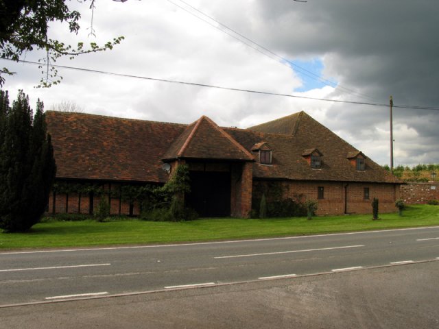
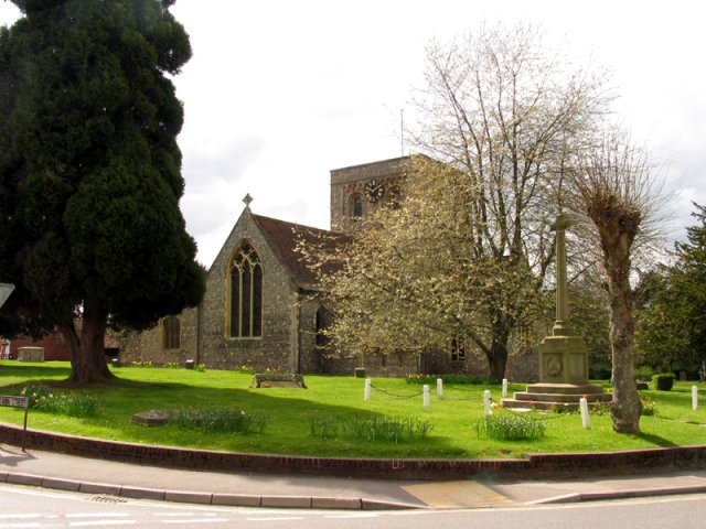
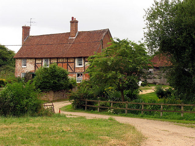
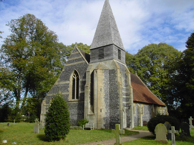
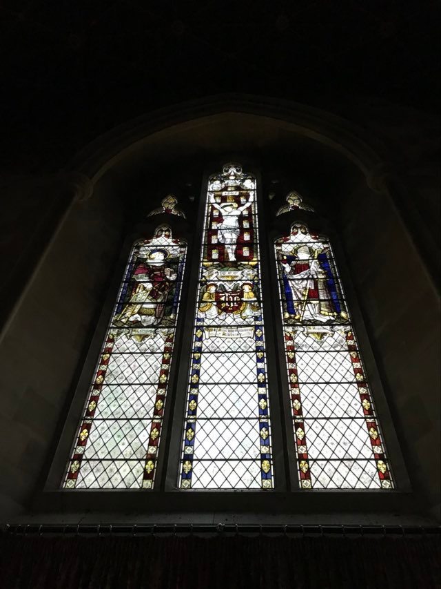
The village of Kingsclere itself is a charming and historic settlement with a rich heritage. It features a mix of architectural styles, including timber-framed buildings, that reflect its long-standing history. The centerpiece of the village is St. Mary's Church, a Grade I listed building that dates back to the 12th century.

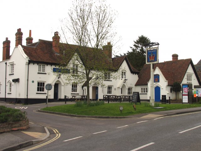
The community in Kingsclere is vibrant and welcoming, with a range of amenities and services available to residents and visitors alike. These include local shops, a post office, pubs, and restaurants, providing everything needed for everyday life. The village also has a primary school, offering educational opportunities for young children.

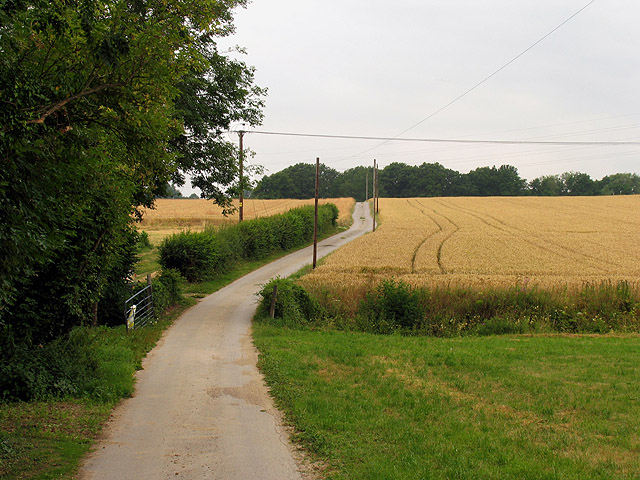
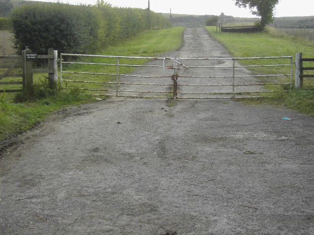
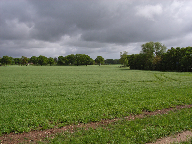
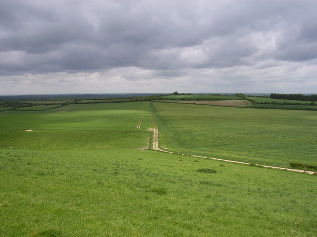
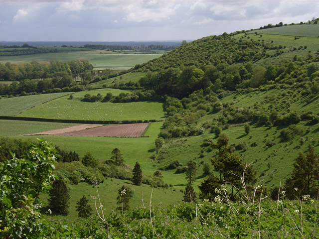
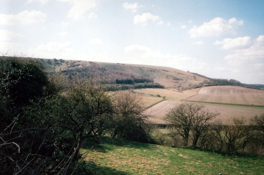
Nature lovers will find plenty to explore in Kingsclere, with numerous walking and cycling routes that showcase the area's natural beauty. The surrounding countryside is dotted with farms and fields, creating a picturesque rural landscape. Additionally, Watership Down, made famous by Richard Adams' novel of the same name, is located nearby and offers stunning views of the surrounding area.

Overall, Kingsclere in Hampshire is a picturesque and historic civil parish that combines natural beauty with a strong sense of community. Its rural charm and range of amenities make it an attractive place to live or visit.

If you have any feedback on the listing, please let us know in the comments section below.

Kingsclere Images

Images are sourced within 2km of 51.321172/-1.250645 or Grid Reference SU5258. Thanks to Geograph Open Source API. All images are credited.

Knowl Hill Farm Buildings This picture was taken from the private road that intersects with the road running diagonally from north to south across the grid square, looking north.
Knowl Hill Farm Buildings
This picture was taken from the private road that intersects with the road running diagonally from north to south across the grid square, looking north.
Church in Kingsclere The church is situated in the centre of the upper half of the grid square. The picture was taken from the east side of the church looking west (hence problems with the sun!). Kingsclere is an attractive village with many very old buildings.
Church in Kingsclere
The church is situated in the centre of the upper half of the grid square. The picture was taken from the east side of the church looking west (hence problems with the sun!). Kingsclere is an attractive village with many very old buildings.
Kingsclere Village Centre The pub is on the east side of the Church in the lower centre of the upper half of the grid square in the centre of the village.
Kingsclere Village Centre
The pub is on the east side of the Church in the lower centre of the upper half of the grid square in the centre of the village.
Coldridges Farm Situated in the western section near the edge of the grid square, this picture was taken from the A339 to Newbury, looking north east.
Coldridges Farm
Situated in the western section near the edge of the grid square, this picture was taken from the A339 to Newbury, looking north east.
Farm near Ashford Hill At this point, the footpath splits and goes of at right angles to each other. This is the view at the split (Harriden's Farm).
Farm near Ashford Hill
At this point, the footpath splits and goes of at right angles to each other. This is the view at the split (Harriden's Farm).
Farmland near Ashford Hill This section of farmland is south west of Harridens Great Copse in 5360, and the view is in the north east corner of the square between Harridens farm and Halls Farm.
Farmland near Ashford Hill
This section of farmland is south west of Harridens Great Copse in 5360, and the view is in the north east corner of the square between Harridens farm and Halls Farm.
Isle Hill house near Kingsclere This house is hidden behind quite a steep bank, it is at the bottom of this square.
Isle Hill house near Kingsclere
This house is hidden behind quite a steep bank, it is at the bottom of this square.
Gate near Kingsclere This is a gate across a private road in the very bottom right of the square, the picture is looking due south.
Gate near Kingsclere
This is a gate across a private road in the very bottom right of the square, the picture is looking due south.
Park House Stables near Kingsclere These stables are about a mile due south of Kingsclere just off the B3051
Park House Stables near Kingsclere
These stables are about a mile due south of Kingsclere just off the B3051
White Hill beauty spot This is a very scenic beauty spot with parking spaces and magnificent views across the Hampshire countryside. This picture was taken from the main road and looks north westerly towards Cannon Heath Down.
White Hill beauty spot
This is a very scenic beauty spot with parking spaces and magnificent views across the Hampshire countryside. This picture was taken from the main road and looks north westerly towards Cannon Heath Down.
Wayfarers Walk at White Hill This gate is where the Wayfarers Walk joins the B3051 at the White Hill beauty spot, the path goes in a westerly direction to Watership Down about a mile away, the area made famous by Richard Adams with his book about the local rabbits.
Wayfarers Walk at White Hill
This gate is where the Wayfarers Walk joins the B3051 at the White Hill beauty spot, the path goes in a westerly direction to Watership Down about a mile away, the area made famous by Richard Adams with his book about the local rabbits.
Sandford Springs Golf Club This picture of Sanford Springs golf course was taken from the club entrance, just off the A339, looking over the greens in a north westerly direction
Sandford Springs Golf Club
This picture of Sanford Springs golf course was taken from the club entrance, just off the A339, looking over the greens in a north westerly direction
Cottington's Hill from White Hill. South of Kingsclere.
Cottington's Hill from White Hill.
South of Kingsclere.
Farmland near Kingsclere Looking down towards the A339 at Stanton's Farm.
Farmland near Kingsclere
Looking down towards the A339 at Stanton's Farm.
Field Barn Farm The track is the public footpath from Kingsclere onto Watership Down.
Field Barn Farm
The track is the public footpath from Kingsclere onto Watership Down.
Hannington Transmitter Cottington's Hill from the top of the steep wooded slope of Freemantle Park Down.
Hannington Transmitter
Cottington's Hill from the top of the steep wooded slope of Freemantle Park Down.
Downs above Kingsclere The track is the Hannington to Kingsclere bridleway.
Downs above Kingsclere
The track is the Hannington to Kingsclere bridleway.
The Warren Looking across The Warren from Cannon Heath Down. White Hill, the B3051, is in the tall trees on Stubbington Down on the other side of the basin.
The Warren
Looking across The Warren from Cannon Heath Down. White Hill, the B3051, is in the tall trees on Stubbington Down on the other side of the basin.
Show me another place!

Kingsclere is located at Grid Ref: SU5258 (Lat: 51.321172, Lng: -1.250645)

Administrative County: Hampshire

District: Basingstoke and Deane

Police Authority: Hampshire

What 3 Words

///thundered.heats.knowledge. Near Kingsclere, Hampshire

Nearby Locations

Kingsclere Kingsclere

Related Wikis

Kingsclere and Whitchurch Rural District

Kingsclere and Whitchurch Rural District was a rural district between 1932 and 1974 in Hampshire, England. The district was formed as a merger of the abolished...

Kingsclere

Kingsclere is a large village and civil parish in Hampshire, England. == Geography == Kingsclere is approximately equidistant 13 kilometres (8.1 mi) from...

Hannington transmitting station

Hannington transmitting station is a television and radio transmitting station located on Cottington Hill near the village of Hannington, Hampshire. The...

Ecchinswell

Ecchinswell is a village and former civil parish, now in the parish of Ecchinswell, Sydmonton and Bishops Green, in the Basingstoke and Deane district...

St Lawrence's Church, Ecchinswell

St Lawrence's Church (St Laurence) is a Grade II listed sacred edifice in Ecchinswell, Hampshire, England, in the rural deanery of Whitchurch, within the...

Watership Down, Hampshire

Watership Down is a hill or a down at Ecchinswell in the civil parish of Ecchinswell, Sydmonton and Bishops Green in the English county of Hampshire, as...

Brock's Green

Brock's Green is a small village in the Basingstoke and Deane district of Hampshire, England. Its nearest town is Newbury, which lies approximately 4.7...

Wolverton, Hampshire

Wolverton is a village in north Hampshire, England. It is within the civil parish of Baughurst, and located approximately 7 miles (11 km) from both Newbury...

Nearby Amenities

Located within 500m of 51.321172,-1.250645
Barrier: cycle_barrier
Lat/Long: 51.323603/-1.2458647
Post Box
Collection Times: Mo-Fr 16:00; Sa 11:00
Post Box Type: wall
Postal Code: RG20
Ref: RG20 1280
Royal Cypher: EIIR
Royal Cypher Wikidata: Q33102113
Lat/Long: 51.3240735/-1.2476918
Crossing
Crossing: unmarked
Kerb: lowered
Lat/Long: 51.3249783/-1.2472556
Crossing
Crossing: unmarked
Kerb: lowered
Sloped Curb: yes
Lat/Long: 51.3249183/-1.2470376
Barrier: kissing_gate
Lat/Long: 51.3220363/-1.2530812
War Memorial
Historic: memorial
Memorial: war_memorial
Wikidata: Q26677149
Lat/Long: 51.3248705/-1.2472119
old post office Gallery
Postal Code: RG20 5PJ
Shop: stationery
Lat/Long: 51.3240886/-1.24771
Swan Hotel
Tourism: hotel
Wikidata: Q26624016
Lat/Long: 51.3239282/-1.2476584
Pharmacy
Dispensing: yes
Lat/Long: 51.3240898/-1.2474096
McColl's
Brand: McColl's
Brand Wikidata: Q16997477
Brand Wikipedia: en:McColl's
Contact Website: https://www.mccolls.co.uk/storelocator/newbury-kingsclere-swan-st/
Shop: convenience
Lat/Long: 51.3244199/-1.2471534
Spar
Addr Postcode: RG20 5PP
Addr Street: Swan Street
Brand: Spar
Brand Wikidata: Q610492
Brand Wikipedia: en:Spar (retailer)
Shop: convenience
Lat/Long: 51.3242775/-1.2472552
Parking
Lat/Long: 51.3251897/-1.2535563
Barrier: kissing_gate
Lat/Long: 51.3239731/-1.2518471
Barrier: kissing_gate
Lat/Long: 51.32179/-1.2531174
Barrier: kissing_gate
Lat/Long: 51.3203149/-1.2534865
Crossing
Crossing: unmarked
Kerb: lowered
Sloped Curb: yes
Lat/Long: 51.3201401/-1.2513219
Barrier: stile
Lat/Long: 51.3200913/-1.2449828
Barrier: kissing_gate
Source: GPS
Lat/Long: 51.3209872/-1.2448884
Bus Stop
Kingsclere Square
Bench: no
Bin: no
Lit: yes
Naptan AtcoCode: 1900HA010163
Naptan Bearing: E
Naptan CommonName: Kingsclere Square
Naptan Crossing: Anchor Road
Naptan NaptanCode: hamdmjwd
Naptan Street: George Street
Naptan Verified: no
Shelter: no
Source: naptan_import
Tactile Paving: no
Lat/Long: 51.3247828/-1.2465078
Bus Stop
Kingsclere Square
Bench: no
Bin: yes
Lit: yes
Naptan AtcoCode: 1900HA010582
Naptan Bearing: W
Naptan CommonName: Kingsclere Square
Naptan Crossing: Anchor Road
Naptan NaptanCode: hamdmjwa
Naptan Street: George Street
Naptan Verified: no
Shelter: no
Source: naptan_import
Tactile Paving: no
Lat/Long: 51.3247463/-1.2467811
Kingsclere
Board Type: history
Check Date: 2022-09-19
Information: board
Tourism: information
Lat/Long: 51.3246724/-1.246829
Board Type: nature
Information: board
Tourism: information
Lat/Long: 51.3214437/-1.2442209
Bench
Lat/Long: 51.3214503/-1.2441258
Bench
Lat/Long: 51.3218516/-1.2450933
Bench
Lat/Long: 51.3228759/-1.2453679
Bench
Lat/Long: 51.324289/-1.2486633
Bicycle Parking
Bicycle Parking: stands
Capacity: 4
Covered: no
Lat/Long: 51.3245548/-1.2469753
The Lynches
Building: house
Source: Bing
Source Name: OS_OpenData_StreetVeiw
Lat/Long: 51.3208401/-1.2479034
Phaleron Cottages
Place: isolated_dwelling
Source: OS_OpenData_StreetView
Lat/Long: 51.3198646/-1.2458914
Gaily Mill
Place: locality
Source: OS_OpenData_StreetView
Lat/Long: 51.3198175/-1.252672
Crossing
Crossing: unmarked
Kerb: lowered
Sloped Curb: yes
Lat/Long: 51.3173146/-1.2525786
Park House Cottages
Place: isolated_dwelling
Source: OS_OpenData_StreetView
Lat/Long: 51.3168138/-1.2523287
Sainfoin
Landuse: farm
Note Retag: CS #48756035
Source: OS_OpenData_StreetView;Bing
Lat/Long: 51.3173504/-1.2521616
Crossing
Crossing: unmarked
Kerb: lowered
Lat/Long: 51.3250652/-1.2474708
Crossing
Crossing: unmarked
Kerb: lowered
Sloped Curb: yes
Lat/Long: 51.3249846/-1.2471049
Crossing
Crossing: unmarked
Crossing Island: no
Kerb: lowered
Sloped Curb: yes
Tactile Paving: no
Lat/Long: 51.3247768/-1.2469737
Barrier: kerb
Kerb: lowered
Tactile Paving: yes
Lat/Long: 51.3248021/-1.2470305
Kingsclere Square
Place: locality
Source: bus stop
Lat/Long: 51.3245976/-1.2468429
Bench
Backrest: no
Lat/Long: 51.3247647/-1.2468497
Bench
Lat/Long: 51.3247458/-1.2482454
Bench
Lat/Long: 51.3245249/-1.2474541
Barrier: cycle_barrier
Lat/Long: 51.324692/-1.2482925
Cafe
Honesty Kingsclere
Addr City: Kingsclere
Addr Housename: Honesty Kingsclere
Addr Housenumber: 3
Addr Postcode: RG20 5ND
Addr Street: Swan Street
Cuisine: coffee_shop
Email: info@honestygroup.co.uk
Internet Access Fee: no
Opening Hours: Mo-Sa 08:00-16:00; Su 08:30-14:00
Phone: +44 1635 298510
Website: https://www.honestygroup.co.uk/
Lat/Long: 51.3243504/-1.2472231
Give Way
Source: Bing
Lat/Long: 51.3214288/-1.250811
twist
Shop: beauty
Lat/Long: 51.324169/-1.2475853
Post Office
Kingsclere Post Office
Addr Country: GB
Addr Postcode: RG20 5PP
Brand: Post Office
Brand Wikidata: Q1783168
Contact Website: https://www.postoffice.co.uk/branch-finder/2639394/kingsclere
Ref Pol Id: 141230
Lat/Long: 51.3242746/-1.2472165
Power: pole
Lat/Long: 51.3191218/-1.2568188
Power: pole
Lat/Long: 51.3200639/-1.2566337
Power: pole
Lat/Long: 51.3208032/-1.2565452
Power: pole
Lat/Long: 51.3225263/-1.2568939
The data included in this document is from www.openstreetmap.org. The data is made available under ODbL.

Have you been to Kingsclere?

Leave your review of Kingsclere below (or comments, questions and feedback).