Keresley

Civil Parish in Warwickshire Coventry

England

Keresley

The Farm on "Pikers" Watch out for cars and horses on this bend, and the scary dog which lives on the farm.
The Farm on "Pikers" Credit: Chris Carlson

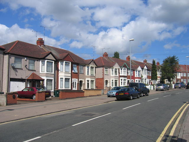
Keresley is a civil parish located in the county of Warwickshire, England. Situated to the north of Coventry, it covers an area of approximately 9 square kilometers. The parish is primarily residential, with a population of around 6,000 people.

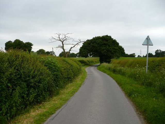
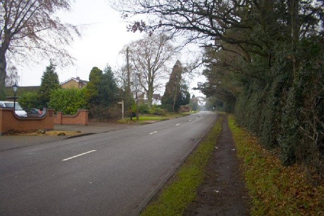
Keresley is known for its picturesque countryside and green spaces, offering residents a peaceful and scenic environment. The area is characterized by its charming rural landscapes, including fields, meadows, and woodland areas. These natural features attract visitors who enjoy outdoor activities such as walking, cycling, and birdwatching.

The parish has a rich history, with evidence of settlements dating back to Roman times. The name "Keresley" is believed to derive from the old English words "caer" meaning "fort" and "leah" meaning "clearing," indicating its historical connection to fortified clearings in the area.

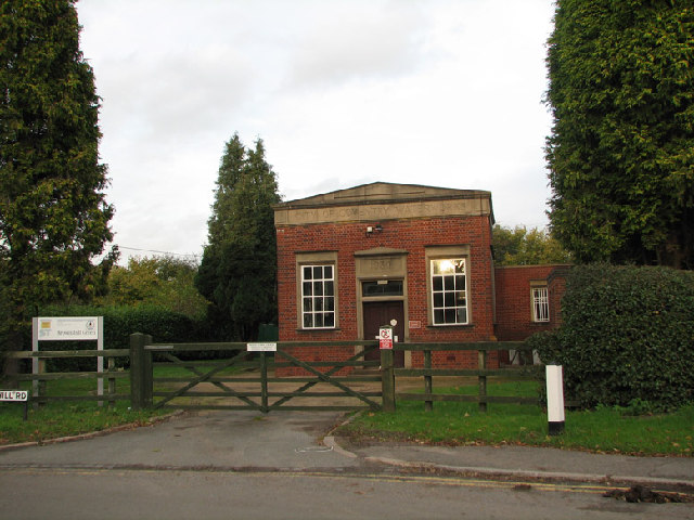
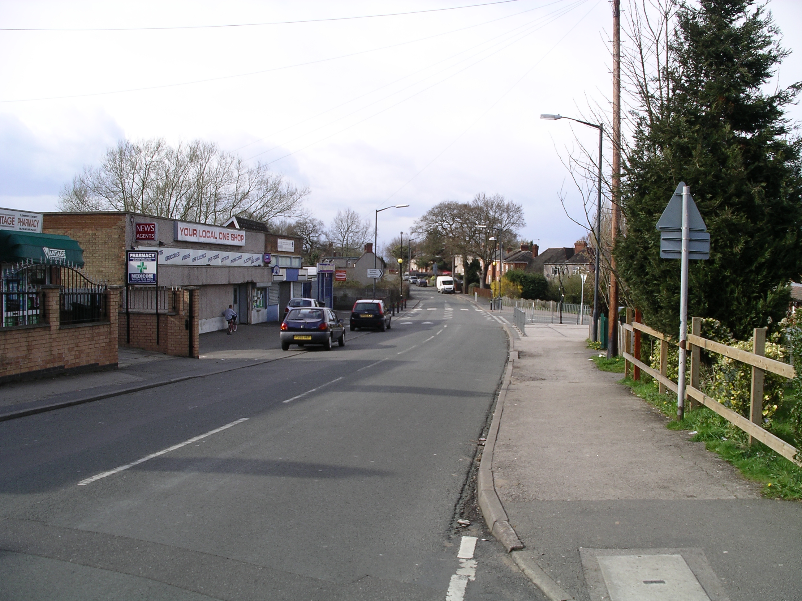
In terms of amenities, Keresley offers a range of facilities to cater to the needs of its residents. There are several schools, including primary and secondary education options, ensuring that families have access to quality education. The parish also has a community center, a local library, and a few small shops and businesses.

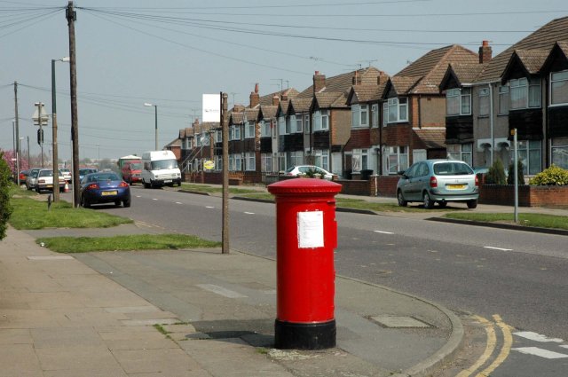
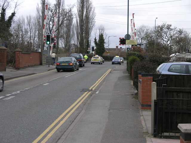
Keresley benefits from its proximity to the city of Coventry, which offers a wider array of services and amenities. The parish has good transport links, with regular bus services connecting it to Coventry and other neighboring towns.

Overall, Keresley is a peaceful and idyllic civil parish, providing a rural retreat within close proximity to urban conveniences.

If you have any feedback on the listing, please let us know in the comments section below.

Keresley Images

Images are sourced within 2km of 52.452546/-1.538173 or Grid Reference SP3183. Thanks to Geograph Open Source API. All images are credited.

The Farm on "Pikers" Watch out for cars and horses on this bend, and the scary dog which lives on the farm.
The Farm on "Pikers"
Watch out for cars and horses on this bend, and the scary dog which lives on the farm.
Pikers Lane The northern end of Pikers Lane.
Pikers Lane
The northern end of Pikers Lane.
Pikers lane junction The junction of Pikers lane and wall hill road, the road goes up a noticeable hill just outside the picture
Pikers lane junction
The junction of Pikers lane and wall hill road, the road goes up a noticeable hill just outside the picture
Hollyfast Lane This is the only straight part of Hollyfast Lane, all the rest is tight blind turns.
Hollyfast Lane
This is the only straight part of Hollyfast Lane, all the rest is tight blind turns.
The entrance to Corley Centre, Church Lane, Corley Corley Centre consists of a school and Coventry Autism Support Service (CASS). 
The school caters for 72 students aged 11 - 16 with complex social and communication difficulties and associated learning difficulties. The school includes extended day and residential facilities. <span class="nowrap"><a title="www.corleycentre.com" rel="nofollow ugc noopener" href="http://www.corleycentre.com">Link</a><img style="margin-left:2px;" alt="External link" title="External link - shift click to open in new window" src="https://s1.geograph.org.uk/img/external.png" width="10" height="10"/></span>
The entrance to Corley Centre, Church Lane, Corley
Corley Centre consists of a school and Coventry Autism Support Service (CASS). The school caters for 72 students aged 11 - 16 with complex social and communication difficulties and associated learning difficulties. The school includes extended day and residential facilities. LinkExternal link
Pikers Lane Farm, Pikers Lane, Allesley A well maintained original farmhouse - the only property on this short very narrow lane.
Pikers Lane Farm, Pikers Lane, Allesley
A well maintained original farmhouse - the only property on this short very narrow lane.
Caged trig point, Corley This one isn't allowed to roam from the Severn Trent site on Church Lane.
Caged trig point, Corley
This one isn't allowed to roam from the Severn Trent site on Church Lane.
Church Lane, Corley A small, trimmed godcake at the junction of a private drive with Church Lane.
Church Lane, Corley
A small, trimmed godcake at the junction of a private drive with Church Lane.
Pikers Lane near Pikers Lane Farm Some characteristic features of 'Ancient Arden' can be seen here: winding lane, small-scale topography, massive hedges, hedgerow oaks, scattered farms and dwellings.
Pikers Lane near Pikers Lane Farm
Some characteristic features of 'Ancient Arden' can be seen here: winding lane, small-scale topography, massive hedges, hedgerow oaks, scattered farms and dwellings.
Pillar Box at the junction of Beake Avenue and Rylston Avenue Rylston Avenue was once on the boundary of the city.  It now stands some distance inside.  Beake Avenue is a well established, fairly typical Coventry residential road
Pillar Box at the junction of Beake Avenue and Rylston Avenue
Rylston Avenue was once on the boundary of the city. It now stands some distance inside. Beake Avenue is a well established, fairly typical Coventry residential road
Brownshill Green Water Works Opposite the White Lion public house, fantastic food and service, very busy so be quick on a Sunday lunch time!
Brownshill Green Water Works
Opposite the White Lion public house, fantastic food and service, very busy so be quick on a Sunday lunch time!
Burrow Hill Rocks Just to the right of the photo lies the site of Burrow Hill Fort.
Burrow Hill Rocks
Just to the right of the photo lies the site of Burrow Hill Fort.
St. Thomas' Church, Keresley Does what it says on the sign....
St. Thomas' Church, Keresley
Does what it says on the sign....
Corley church The church at Corley, just off the M6 outside Coventry.
Corley church
The church at Corley, just off the M6 outside Coventry.
Tamworth Road, Coventry The road that links Coventry, Radford with Corley, M6.
Tamworth Road, Coventry
The road that links Coventry, Radford with Corley, M6.
Corley Cricket Club Corley Cricket Club on the Keresley Road, Coventry...crikey!
Corley Cricket Club
Corley Cricket Club on the Keresley Road, Coventry...crikey!
Traffic on a Level Crossing Although the traffic appears to be turning onto the railway it isn't but onto a new link road to the A444.
Traffic on a Level Crossing
Although the traffic appears to be turning onto the railway it isn't but onto a new link road to the A444.
Parkville Highway Housing typical of the 1930s suburban expansion of Coventry.
Parkville Highway
Housing typical of the 1930s suburban expansion of Coventry.
Show me another place!

Keresley is located at Grid Ref: SP3183 (Lat: 52.452546, Lng: -1.538173)

Administrative County: West Midlands

District: Coventry

Police Authority: West Midlands

What 3 Words

///slurs.shaky.harp. Near Keresley, West Midlands

Nearby Locations

Keresley

Related Wikis

Keresley End

Keresley End is a village in the Nuneaton & Bedworth District of Warwickshire, England, also known as Keresley Village or Keresley Newlands. Population...

Coventry Colliery

Coventry Colliery was a coal mine located in the village of Keresley End in northern Warwickshire, between Bedworth and Coventry, England. Closed in 1991...

Corley

Corley (and the associated hamlets of Corley Ash and Corley Moor) is a village and civil parish in the North Warwickshire district of Warwickshire, England...

Cardinal Newman Catholic School and Community College

Cardinal Newman Catholic School is a coeducational Roman Catholic secondary school and sixth form located in the Keresley area of Coventry, West Midlands...

President Kennedy School

President Kennedy School is a coeducational secondary school and sixth form with academy status, located in the Keresley area of Coventry, England. The...

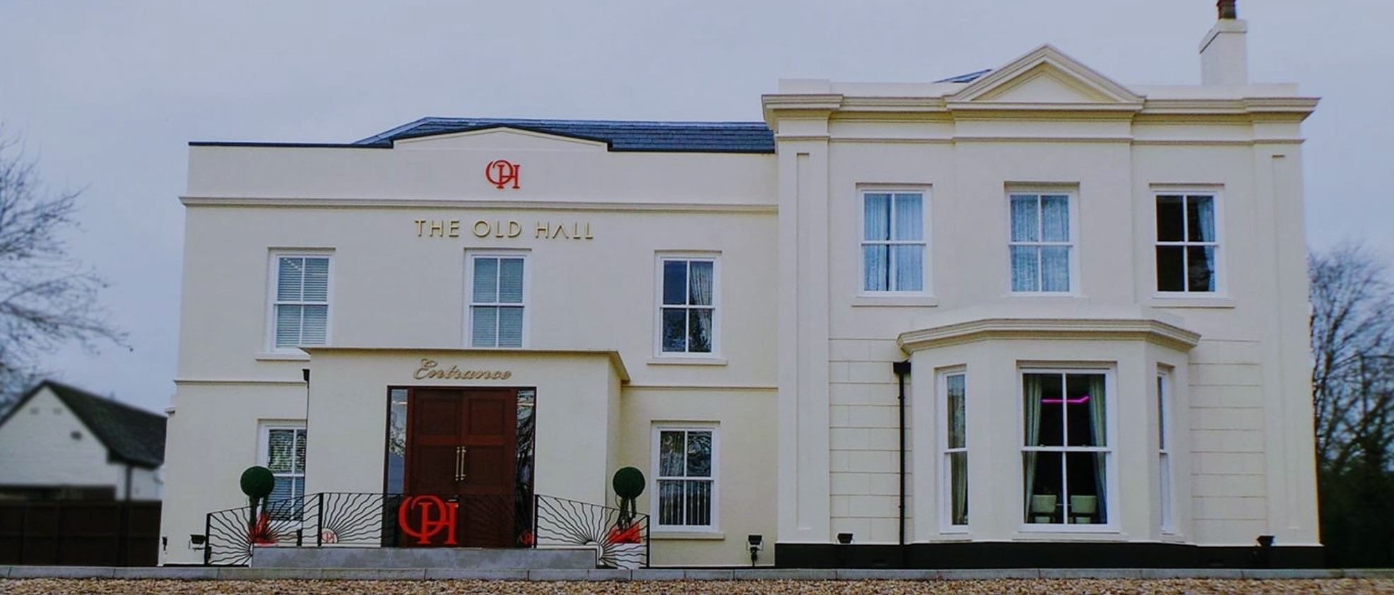
The Old Hall Hotel, Coventry

The Old Hall Hotel in Coundon near Coventry, England, is a building of historical significance and is Grade II listed on the English Heritage Register...

Brownshill Green

Brownshill Green is a suburban hamlet 3.5 miles northwest of Coventry by road, adjacent to the suburbs of Allesley, Coundon and Keresley. It is bordered...

Ash Green, Warwickshire

Ash Green is a village in the Nuneaton and Bedworth borough of Warwickshire, England. It forms part of the Coventry and Bedworth urban area. == Geography... ==

Nearby Amenities

Located within 500m of 52.452546,-1.538173
Keresley
Is In: Coventry
Place: suburb
Lat/Long: 52.4500531/-1.5345344
Bus Stop
Bennetts Rd / Fivefield Rd
Bench: no
Bin: no
Bus: yes
Lit: yes
Naptan AtcoCode: 43000014201
Naptan Bearing: N
Naptan BusStopType: MKD
Naptan CommonName: Fivefield Rd
Naptan Indicator: adj
Naptan Landmark: Hare and Hounds
Naptan NaptanCode: nwmptpgj
Naptan PlusbusZoneRef: BHAMNWS
Naptan Status: ACT
Naptan StopType: BCT
Naptan Street: BENNETTS RD
Naptan Towards: Keresley
Public Transport: platform
Route Ref: 16;16A
Shelter: no
Source: WMCA
Tactile Paving: no
Lat/Long: 52.4520834/-1.5331131
Bus Stop
Bennetts Rd / Fivefield Rd
Bench: no
Bin: no
Bus: yes
Lit: yes
Naptan AtcoCode: 43000014202
Naptan Bearing: S
Naptan BusStopType: MKD
Naptan CommonName: Fivefield Rd
Naptan Indicator: opp
Naptan Landmark: Hare and Hounds
Naptan NaptanCode: nwmptpgm
Naptan PlusbusZoneRef: BHAMNWS
Naptan Status: ACT
Naptan StopType: BCT
Naptan Street: BENNETTS RD
Naptan Towards: City Centre
Naptan Verified: no
Public Transport: platform
Route Ref: 16;16A
Shelter: no
Source: WMCA
Tactile Paving: no
Lat/Long: 52.4519142/-1.5329709
Bus Stop
Bennetts Rd / Ravenswood
Bench: no
Bin: no
Bus: yes
Lit: yes
Naptan AtcoCode: 43000014301
Naptan Bearing: N
Naptan BusStopType: MKD
Naptan CommonName: Ravenswood
Naptan Indicator: adj
Naptan NaptanCode: nwmptpgp
Naptan PlusbusZoneRef: BHAMNWS
Naptan Status: ACT
Naptan StopType: BCT
Naptan Street: BENNETTS RD
Naptan Towards: Keresley
Public Transport: platform
Route Ref: 16;16A
Shelter: no
Source: WMCA
Tactile Paving: no
Lat/Long: 52.4539105/-1.5331225
Bus Stop
Bennetts Rd / Ravenswood
Bench: no
Bin: no
Bus: yes
Lit: yes
Naptan AtcoCode: 43000014302
Naptan Bearing: S
Naptan BusStopType: MKD
Naptan CommonName: Ravenswood
Naptan Indicator: opp
Naptan NaptanCode: nwmptpgt
Naptan PlusbusZoneRef: BHAMNWS
Naptan Status: ACT
Naptan StopType: BCT
Naptan Street: BENNETTS RD
Naptan Towards: City Centre
Naptan Verified: no
Public Transport: platform
Route Ref: 16;16A
Shelter: no
Source: WMCA
Tactile Paving: no
Lat/Long: 52.4537061/-1.5329542
Power: tower
Source: OS 1:25k
Lat/Long: 52.4525617/-1.5356474
Power: tower
Source: OS 1:25k
Lat/Long: 52.449819/-1.540272
Barrier: kissing_gate
Lat/Long: 52.4507297/-1.5414855
Barrier: stile
Lat/Long: 52.4517511/-1.53899
Barrier: stile
Lat/Long: 52.4519169/-1.5384953
Barrier: kissing_gate
Lat/Long: 52.4536573/-1.5353248
Barrier: kissing_gate
Lat/Long: 52.4540324/-1.5360403
Barrier: kissing_gate
Lat/Long: 52.4553596/-1.5378355
Barrier: kissing_gate
Lat/Long: 52.4487814/-1.5361047
Barrier: kissing_gate
Lat/Long: 52.4492109/-1.538072
Barrier: kissing_gate
Lat/Long: 52.4509111/-1.5407404
Barrier: kissing_gate
Lat/Long: 52.4542303/-1.5426273
Keresley Green
Place: hamlet
Website: http://www.keresleyvillages.org.uk/keresleygreen.php
Lat/Long: 52.4530853/-1.5376866
Barrier: kissing_gate
Lat/Long: 52.4530681/-1.5361014
Access: private
Barrier: lift_gate
Lat/Long: 52.4550175/-1.5323496
Power: tower
Source: Warwicks CC Aerial Imagery 2013
Lat/Long: 52.4511243/-1.5380432
Power: tower
Source: Warwicks CC Aerial Imagery 2013
Lat/Long: 52.452797/-1.5339635
Power: tower
Source: Warwicks CC Aerial Imagery 2013
Lat/Long: 52.4530799/-1.5320474
Generator Method: photovoltaic
Generator Output Electricity: yes
Generator Source: solar
Generator Type: solar_photovoltaic_panel
Location: roof
Power: generator
Lat/Long: 52.4524077/-1.5340786
Colour: red and white
Inscription: LTS High Pressure Gas Pipeline
Marker: aerial
Material: plastic
Utility: gas
Lat/Long: 52.450974/-1.5330604
Colour: red and white
Inscription: LTS High Pressure Gas Pipeline
Marker: aerial
Material: plastic
Utility: gas
Lat/Long: 52.4542169/-1.5430659
The data included in this document is from www.openstreetmap.org. The data is made available under ODbL.

Have you been to Keresley?

Leave your review of Keresley below (or comments, questions and feedback).