Keddington

Civil Parish in Lincolnshire East Lindsey

England

Keddington

Part of Brackenborough DMV: aerial 2022 See: <span class="nowrap"><a title="https://www.heritagegateway.org.uk/Gateway/Results_Single.aspx?uid=MLI43572&resourceID=1006" rel="nofollow ugc noopener" href="https://www.heritagegateway.org.uk/Gateway/Results_Single.aspx?uid=MLI43572&resourceID=1006">Link</a><img style="margin-left:2px;" alt="External link" title="External link - shift click to open in new window" src="https://s1.geograph.org.uk/img/external.png" width="10" height="10"/></span> and
<span class="nowrap"><a title="http://web.archive.org/web/20170225235146/http://cwr.defra.gov.uk/mapboards/pdfs/247010012.pdf" rel="nofollow ugc noopener" href="http://web.archive.org/web/20170225235146/http://cwr.defra.gov.uk/mapboards/pdfs/247010012.pdf">Archive Link</a><img style="margin-left:2px;" alt="External link" title="External link - shift click to open in new window" src="https://s1.geograph.org.uk/img/external.png" width="10" height="10"/></span>
Part of Brackenborough DMV: aerial 2022 Credit: Simon Tomson

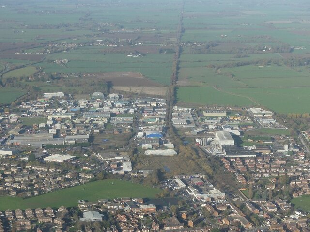
Keddington is a small civil parish located in the East Lindsey district of Lincolnshire, England. Situated approximately 3 miles northwest of the market town of Louth, it covers an area of about 3 square kilometers.

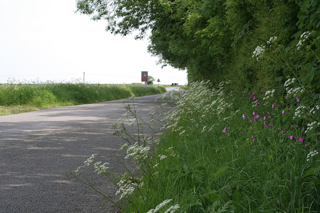
The parish is mainly rural, characterized by open fields, farmland, and scattered residential properties. The landscape is gently undulating, with some areas of woodland and hedgerows adding to its natural beauty. Keddington is surrounded by other parishes including South Elkington, Raithby cum Maltby, and North Cockerington.

The settlement itself is compact, consisting of a handful of houses and cottages. The centerpiece of the parish is the Grade II listed St. Margaret's Church, which dates back to the 12th century. This historic church features an impressive bell tower and is known for its beautiful stained glass windows.

Although small in size, Keddington has a strong community spirit. Regular events and activities are organized by local residents, such as coffee mornings, charity fundraisers, and village fairs. The parish also has a strong focus on preservation and conservation, with efforts made to protect and enhance its natural and historical assets.

Overall, Keddington offers a peaceful and picturesque setting, making it an attractive place to live for those seeking a rural lifestyle. Its proximity to the amenities of Louth adds convenience, while its strong community spirit fosters a sense of belonging among residents.

If you have any feedback on the listing, please let us know in the comments section below.

Keddington Images

Images are sourced within 2km of 53.380632/0.025116 or Grid Reference TF3488. Thanks to Geograph Open Source API. All images are credited.

Part of Brackenborough DMV: aerial 2022 See: <span class="nowrap"><a title="https://www.heritagegateway.org.uk/Gateway/Results_Single.aspx?uid=MLI43572&resourceID=1006" rel="nofollow ugc noopener" href="https://www.heritagegateway.org.uk/Gateway/Results_Single.aspx?uid=MLI43572&resourceID=1006">Link</a><img style="margin-left:2px;" alt="External link" title="External link - shift click to open in new window" src="https://s1.geograph.org.uk/img/external.png" width="10" height="10"/></span> and
<span class="nowrap"><a title="http://web.archive.org/web/20170225235146/http://cwr.defra.gov.uk/mapboards/pdfs/247010012.pdf" rel="nofollow ugc noopener" href="http://web.archive.org/web/20170225235146/http://cwr.defra.gov.uk/mapboards/pdfs/247010012.pdf">Archive Link</a><img style="margin-left:2px;" alt="External link" title="External link - shift click to open in new window" src="https://s1.geograph.org.uk/img/external.png" width="10" height="10"/></span>
Part of Brackenborough DMV: aerial 2022
See: LinkExternal link and Archive LinkExternal link
Site of Louth Park Abbey: aerial 2022  A Cistercian Abbey founded in 1139, as a daughter-house of Fountains Abbey. See: <span class="nowrap"><a title="https://www.heritagegateway.org.uk/Gateway/Results_Single.aspx?uid=MLI43579&resourceID=1006" rel="nofollow ugc noopener" href="https://www.heritagegateway.org.uk/Gateway/Results_Single.aspx?uid=MLI43579&resourceID=1006">Link</a><img style="margin-left:2px;" alt="External link" title="External link - shift click to open in new window" src="https://s1.geograph.org.uk/img/external.png" width="10" height="10"/></span>

See also: <a href="https://www.geograph.org.uk/photo/2981597">TF3588 : Cistercian abbey site at Louth Park Farm</a>.
Site of Louth Park Abbey: aerial 2022
A Cistercian Abbey founded in 1139, as a daughter-house of Fountains Abbey. See: LinkExternal link See also: TF3588 : Cistercian abbey site at Louth Park Farm.
River Lud and Louth Canal at Keddington: aerial 2022 (1)
River Lud and Louth Canal at Keddington: aerial 2022 (2)
River Lud and Louth Canal at Keddington: aerial 2022 (3)
Former railway, and Fairfield Industrial Estate, Louth: aerial 2022
New development on Brackenborough Road, Louth: aerial 2023
Site of Louth Park Abbey: aerial 2023 A Cistercian Abbey founded in 1139, as a daughter-house of Fountains Abbey. The monks at Fountains were approached by Bishop Alexander of Lincoln in 1137, who initially offered them land at Haverholme, near Sleaford. This land proved unsuitable for the monks' needs, however, and new land was offered by Alexander in 1139, in his parkland near Louth. Water was brought to the site by an aqueduct known as the Monks' Dyke, some two miles long. The only parts above ground are bits of two bays of the east end of the church, built of chalk rubble with facing (very little left) of sandstone or chalk.

See: <span class="nowrap"><a title="https://www.heritagegateway.org.uk/Gateway/Results_Single.aspx?uid=MLI43579&resourceID=1006" rel="nofollow ugc noopener" href="https://www.heritagegateway.org.uk/Gateway/Results_Single.aspx?uid=MLI43579&resourceID=1006">Link</a><img style="margin-left:2px;" alt="External link" title="External link - shift click to open in new window" src="https://s1.geograph.org.uk/img/external.png" width="10" height="10"/></span> and
<span class="nowrap"><a title="https://www.heritagegateway.org.uk/Gateway/Results_Single.aspx?uid=MLI43579&resourceID=1006" rel="nofollow ugc noopener" href="https://www.heritagegateway.org.uk/Gateway/Results_Single.aspx?uid=MLI43579&resourceID=1006">Link</a><img style="margin-left:2px;" alt="External link" title="External link - shift click to open in new window" src="https://s1.geograph.org.uk/img/external.png" width="10" height="10"/></span>
Site of Louth Park Abbey: aerial 2023
A Cistercian Abbey founded in 1139, as a daughter-house of Fountains Abbey. The monks at Fountains were approached by Bishop Alexander of Lincoln in 1137, who initially offered them land at Haverholme, near Sleaford. This land proved unsuitable for the monks' needs, however, and new land was offered by Alexander in 1139, in his parkland near Louth. Water was brought to the site by an aqueduct known as the Monks' Dyke, some two miles long. The only parts above ground are bits of two bays of the east end of the church, built of chalk rubble with facing (very little left) of sandstone or chalk. See: LinkExternal link and LinkExternal link
Site of Louth Park Abbey: aerial 2023 (1) Cistercian Abbey founded in 1139, as a daughter-house of Fountains Abbey. The only parts above ground are bits of two bays of the east end of the church (centre shot).

See: <span class="nowrap"><a title="https://www.heritagegateway.org.uk/Gateway/Results_Single.aspx?uid=MLI43579&resourceID=1006" rel="nofollow ugc noopener" href="https://www.heritagegateway.org.uk/Gateway/Results_Single.aspx?uid=MLI43579&resourceID=1006">Link</a><img style="margin-left:2px;" alt="External link" title="External link - shift click to open in new window" src="https://s1.geograph.org.uk/img/external.png" width="10" height="10"/></span>
Site of Louth Park Abbey: aerial 2023 (1)
Cistercian Abbey founded in 1139, as a daughter-house of Fountains Abbey. The only parts above ground are bits of two bays of the east end of the church (centre shot). See: LinkExternal link
Site of Louth Park Abbey: aerial 2023 (2) Cistercian Abbey founded in 1139, as a daughter-house of Fountains Abbey. The only parts above ground are bits of two bays of the east end of the church (centre shot).

See: <span class="nowrap"><a title="https://www.heritagegateway.org.uk/Gateway/Results_Single.aspx?uid=MLI43579&resourceID=1006" rel="nofollow ugc noopener" href="https://www.heritagegateway.org.uk/Gateway/Results_Single.aspx?uid=MLI43579&resourceID=1006">Link</a><img style="margin-left:2px;" alt="External link" title="External link - shift click to open in new window" src="https://s1.geograph.org.uk/img/external.png" width="10" height="10"/></span>
Site of Louth Park Abbey: aerial 2023 (2)
Cistercian Abbey founded in 1139, as a daughter-house of Fountains Abbey. The only parts above ground are bits of two bays of the east end of the church (centre shot). See: LinkExternal link
Site of Louth Park Abbey: aerial 2023 (1) Cistercian Abbey founded in 1139, as a daughter-house of Fountains Abbey. The only parts above ground are bits of two bays of the east end of the church (centre shot).

See: <span class="nowrap"><a title="https://www.heritagegateway.org.uk/Gateway/Results_Single.aspx?uid=MLI43579&resourceID=1006" rel="nofollow ugc noopener" href="https://www.heritagegateway.org.uk/Gateway/Results_Single.aspx?uid=MLI43579&resourceID=1006">Link</a><img style="margin-left:2px;" alt="External link" title="External link - shift click to open in new window" src="https://s1.geograph.org.uk/img/external.png" width="10" height="10"/></span>
Site of Louth Park Abbey: aerial 2023 (1)
Cistercian Abbey founded in 1139, as a daughter-house of Fountains Abbey. The only parts above ground are bits of two bays of the east end of the church (centre shot). See: LinkExternal link
Site of Louth Park Abbey: aerial 2023 (4) Cistercian Abbey founded in 1139, as a daughter-house of Fountains Abbey. The only parts above ground are bits of two bays of the east end of the church (centre shot).

See: <span class="nowrap"><a title="https://www.heritagegateway.org.uk/Gateway/Results_Single.aspx?uid=MLI43579&resourceID=1006" rel="nofollow ugc noopener" href="https://www.heritagegateway.org.uk/Gateway/Results_Single.aspx?uid=MLI43579&resourceID=1006">Link</a><img style="margin-left:2px;" alt="External link" title="External link - shift click to open in new window" src="https://s1.geograph.org.uk/img/external.png" width="10" height="10"/></span>
Site of Louth Park Abbey: aerial 2023 (4)
Cistercian Abbey founded in 1139, as a daughter-house of Fountains Abbey. The only parts above ground are bits of two bays of the east end of the church (centre shot). See: LinkExternal link
Field with Red Gate Unusual to see such a riot of colour in this landscape but the red gate really makes an impact in early March.
Field with Red Gate
Unusual to see such a riot of colour in this landscape but the red gate really makes an impact in early March.
On the edge of Brackenborough Wood Sharp right angled bends are common in Lincolnshire, following the windbreak tree planting, dykes and ditches that criss-cross the landscape. Cow parsley <span class="nowrap"><a title="http://www.arkive.org/species/ARK/plants_and_algae/Anthriscus_sylvestris/more_info.html" rel="nofollow ugc noopener" href="http://www.arkive.org/species/ARK/plants_and_algae/Anthriscus_sylvestris/more_info.html">Link</a><img style="margin-left:2px;" alt="External link" title="External link - shift click to open in new window" src="https://s1.geograph.org.uk/img/external.png" width="10" height="10"/></span> and red campion <span class="nowrap"><a title="http://www.arkive.org/species/ARK/plants_and_algae/Silene_dioica/more_info.html" rel="nofollow ugc noopener" href="http://www.arkive.org/species/ARK/plants_and_algae/Silene_dioica/more_info.html">Link</a><img style="margin-left:2px;" alt="External link" title="External link - shift click to open in new window" src="https://s1.geograph.org.uk/img/external.png" width="10" height="10"/></span> on the verge.
On the edge of Brackenborough Wood
Sharp right angled bends are common in Lincolnshire, following the windbreak tree planting, dykes and ditches that criss-cross the landscape. Cow parsley LinkExternal link and red campion LinkExternal link on the verge.
Cross Farm near Louth The farmhouse sits across the grid boundary with <a href="https://www.geograph.org.uk/gridref/TF3490">TF3490</a>. A broad margin of cow parsley edges the field of oil seed rape.
Cross Farm near Louth
The farmhouse sits across the grid boundary with TF3490. A broad margin of cow parsley edges the field of oil seed rape.
Medieval Brackenborough (3) Could either be an ancient ditch or one of the "streets" of the old village.
Medieval Brackenborough (3)
Could either be an ancient ditch or one of the "streets" of the old village.
House and cattle grid Could have been a gatehouse in the past, but a handsome home nonetheless.
House and cattle grid
Could have been a gatehouse in the past, but a handsome home nonetheless.
Brackenborough Hall grounds The ancient village site is on the right, mostly on and adjacent to the rising land.  Also there are signs in the field to the left of the driveway that ancient remains may exist in there too.
Brackenborough Hall grounds
The ancient village site is on the right, mostly on and adjacent to the rising land. Also there are signs in the field to the left of the driveway that ancient remains may exist in there too.
Show me another place!

Keddington is located at Grid Ref: TF3488 (Lat: 53.380632, Lng: 0.025116)

Administrative County: Lincolnshire

District: East Lindsey

Police Authority: Lincolnshire

What 3 Words

///otters.removers.gateway. Near Louth, Lincolnshire

Nearby Locations

Louth Park Keddington

Related Wikis

Keddington

Keddington is a village and civil parish in the East Lindsey district of Lincolnshire, England. It is 2 miles (3 km) north-east from Louth. Keddington...
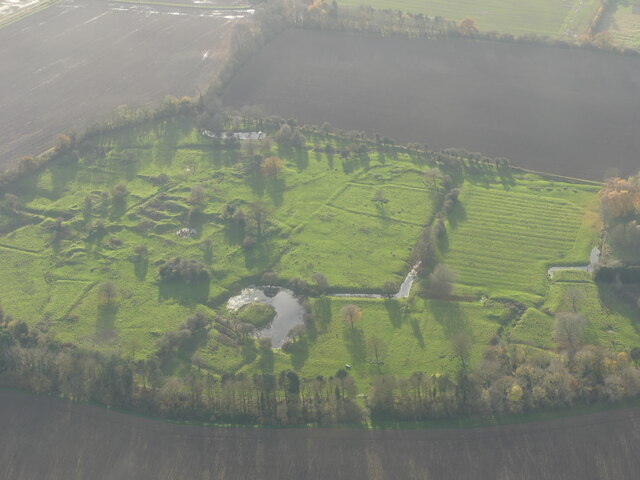
Louth Park Abbey

Louth Park Abbey was a Cistercian abbey in Lincolnshire, England. It was founded in 1139 by the Bishop Alexander of Lincoln as a daughter-house of Fountains...

Louth Rural District

Louth was a rural district in Lincolnshire, Parts of Lindsey from 1894 to 1974. It was created in 1894 from Louth rural sanitary district. It did not...

Brackenborough, Lincolnshire

Brackenborough is a hamlet in the civil parish of Brackenborough with Little Grimsby, in the East Lindsey district of Lincolnshire, England. At the census...

Nearby Amenities

Located within 500m of 53.380632,0.025116
Keddington
Is In: Lincolnshire, England, UK
Place: village
Source: npe
Lat/Long: 53.3773844/0.021885
Bus Stop
Church Lane
Naptan AtcoCode: 2700LKC04106
Naptan Bearing: SW
Naptan CommonName: Church Lane
Naptan Indicator: SW - bound
Naptan Landmark: Church Lane
Naptan NaptanCode: lindjatg
Naptan Street: Alvingham Road
Naptan Verified: no
Source: naptan_import
Lat/Long: 53.3785019/0.020427
Bus Stop
Church Lane
Naptan AtcoCode: 2700LKCLM863
Naptan Bearing: NE
Naptan CommonName: Church Lane
Naptan Indicator: NE - bound
Naptan Landmark: Church Lane
Naptan NaptanCode: linagmtj
Naptan Street: Alvingham Road
Naptan Verified: no
Source: naptan_import
Lat/Long: 53.3785665/0.0203248
Power: pole
Lat/Long: 53.3825245/0.0284783
Power: pole
Lat/Long: 53.3837708/0.0300367
Power: pole
Lat/Long: 53.3843763/0.0259168
Power: pole
Lat/Long: 53.3834508/0.0305664
Power: pole
Lat/Long: 53.3839134/0.0282602
Power: pole
Lat/Long: 53.38315/0.0292615
Power: pole
Lat/Long: 53.3848524/0.0234617
Power: pole
Lat/Long: 53.3774765/0.0221554
Power: pole
Lat/Long: 53.3780117/0.0239857
Power: pole
Lat/Long: 53.3781421/0.0229681
Power: pole
Lat/Long: 53.3782006/0.0238429
Power: pole
Lat/Long: 53.3787581/0.0237486
Power: pole
Lat/Long: 53.3793795/0.0245184
Power: pole
Lat/Long: 53.3799949/0.0252944
Power: pole
Lat/Long: 53.3806221/0.0260821
Power: pole
Lat/Long: 53.3812572/0.0268992
Power: pole
Lat/Long: 53.3819014/0.0276923
Archaeological Site: fortification
Historic: archaeological_site
Source: Bing
Lat/Long: 53.3815119/0.0183354
Grange Farm
Place: farm
Source: Bing
Lat/Long: 53.3822861/0.0181651
Ivy House Farm
Place: farm
Source: Bing
Lat/Long: 53.3773315/0.0229367
Abbey House
Place: isolated_dwelling
Lat/Long: 53.3782795/0.0313647
Abbey Lodge
Place: isolated_dwelling
Lat/Long: 53.3786702/0.0296929
Ticklepenny Lock (site of)
Source: Bing;survey;GPS
Waterway: weir
Lat/Long: 53.3799123/0.0284142
Barrier: kissing_gate
Foot: no
Material: steel
Source: Bing;survey;GPS
Lat/Long: 53.3799462/0.0286058
The data included in this document is from www.openstreetmap.org. The data is made available under ODbL.

Have you been to Keddington?

Leave your review of Keddington below (or comments, questions and feedback).