Inkberrow

Civil Parish in Worcestershire Wychavon

England

Inkberrow

Farmland at Inkberrow Farmland beside Withypool Lane near Inkberrow.
Farmland at Inkberrow Credit: Philip Halling

Inkberrow is a civil parish located in the county of Worcestershire, England. Situated approximately 10 miles southeast of the city of Worcester, Inkberrow spans an area of about 2,000 acres and is home to a population of around 1,500 residents.

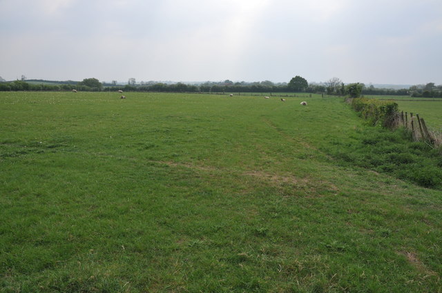
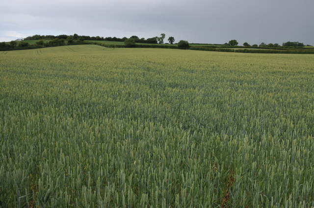
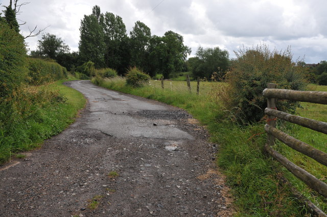
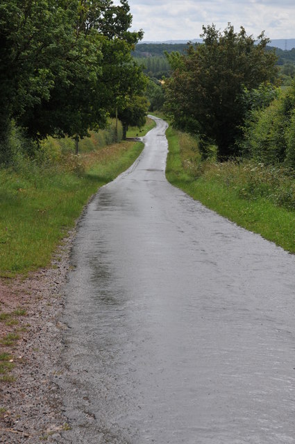
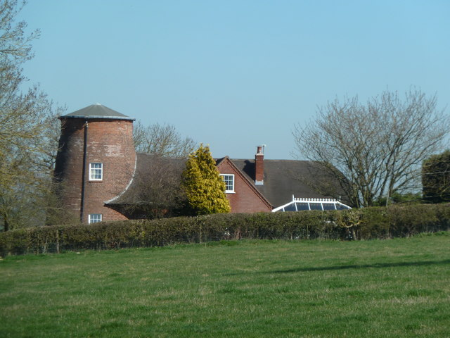
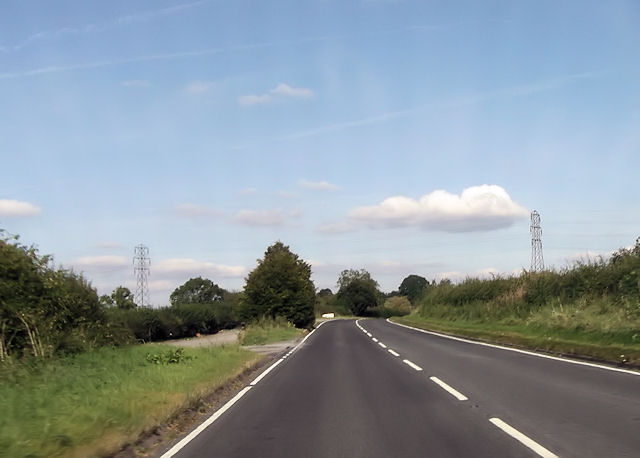
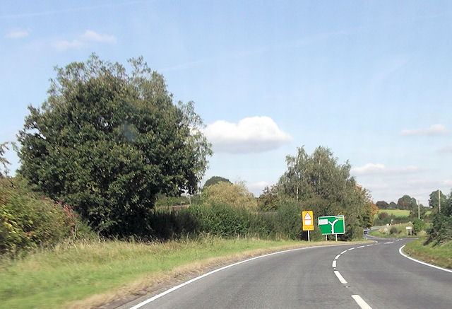
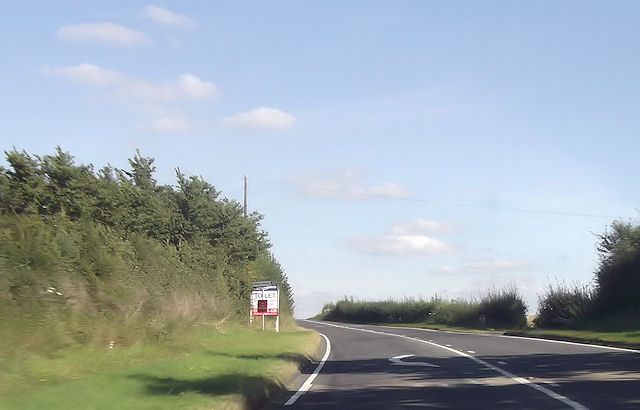
The village of Inkberrow is nestled in the picturesque countryside, offering stunning views and a tranquil atmosphere. The area is characterized by rolling hills, expansive farmland, and charming country lanes. The village itself boasts a range of traditional cottages and buildings, some of which date back to the 17th century, adding to its historic charm.

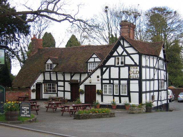
Inkberrow is known for its tight-knit community and strong sense of pride among its residents. The village has a thriving social scene, with various community events and activities taking place throughout the year. The local pub, The Old Bull, is particularly popular and has gained fame for being the inspiration behind the fictional pub, The Bull, in the long-running BBC radio drama, "The Archers."

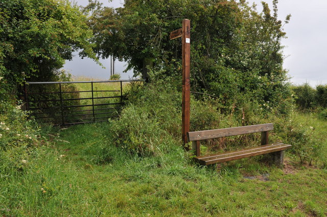
The parish also offers a range of amenities and services to its residents. These include a primary school, a village hall, a post office, and a small selection of local shops. The surrounding countryside provides ample opportunities for outdoor pursuits such as walking, cycling, and horse riding.

Overall, Inkberrow is a charming and vibrant civil parish, offering a peaceful rural lifestyle, a strong community spirit, and an abundance of natural beauty.

If you have any feedback on the listing, please let us know in the comments section below.

Inkberrow Images

Images are sourced within 2km of 52.218788/-1.974396 or Grid Reference SP0157. Thanks to Geograph Open Source API. All images are credited.

Farmland at Inkberrow Farmland beside Withypool Lane near Inkberrow.
Farmland at Inkberrow
Farmland beside Withypool Lane near Inkberrow.
Block gateway Large sewer pipes have been place in this field gateway to obstruct unauthorised access.
Block gateway
Large sewer pipes have been place in this field gateway to obstruct unauthorised access.
Farmland at Inkberrow Sheep in a field near Inkberrow.
Farmland at Inkberrow
Sheep in a field near Inkberrow.
Memorial seat, Holberrow Green A recently made memorial seat in memory of those from Holberrow Green who gave their lives in the First World War.  The seat is round the trunk of an oak tree on the junction of a no through road to Morton Hall with the B4092.
Memorial seat, Holberrow Green
A recently made memorial seat in memory of those from Holberrow Green who gave their lives in the First World War. The seat is round the trunk of an oak tree on the junction of a no through road to Morton Hall with the B4092.
Names on a memorial seat, Holberrow Green The names of the men of Holberrow Green who gave their lives in the First World War on a memorial seat.
Names on a memorial seat, Holberrow Green
The names of the men of Holberrow Green who gave their lives in the First World War on a memorial seat.
Memorial seat, Holberrow Green Memorial seat to the men of Holberrow Green who gave their lives in the First World War.
Memorial seat, Holberrow Green
Memorial seat to the men of Holberrow Green who gave their lives in the First World War.
Field of wheat A footpath Appletree Lane to Inkberrow is supposed to cross this field of wheat.
Field of wheat
A footpath Appletree Lane to Inkberrow is supposed to cross this field of wheat.
Farm road to Great Norbury Farm Farm road to Great Norbury Farm from Appletree Lane near Inkberrow.  For part of the way this is also a footpath.
Farm road to Great Norbury Farm
Farm road to Great Norbury Farm from Appletree Lane near Inkberrow. For part of the way this is also a footpath.
Road past Lench Farm Country road past Lench Farm near Inkberrow.
Road past Lench Farm
Country road past Lench Farm near Inkberrow.
Footpath and seat, Inkberrow A footpath sign and convenient seat near Inkberrow.
Footpath and seat, Inkberrow
A footpath sign and convenient seat near Inkberrow.
Country road near Little Mearse Farm Country road near Little Mearse Farm near Inkberrow.
Country road near Little Mearse Farm
Country road near Little Mearse Farm near Inkberrow.
Former windmill - Holberrow Green The stump of a tower mill with attached house. There is another nearby at Inkberrow but I have yet to see that (next time perhaps).
Former windmill - Holberrow Green
The stump of a tower mill with attached house. There is another nearby at Inkberrow but I have yet to see that (next time perhaps).
Junction for Stonepits near Withybed
Inkberrow from the south A422
Inkberrow from the south
A422
A422 through Inkberrow
A422 west of power lines The power lines can be seen. East of Inkberrow
A422 west of power lines
The power lines can be seen. East of Inkberrow
B4092 junction ahead
Priory Piece junction from A422
Show me another place!

Inkberrow is located at Grid Ref: SP0157 (Lat: 52.218788, Lng: -1.974396)

Administrative County: Worcestershire

District: Wychavon

Police Authority: West Mercia

What 3 Words

///term.spicy.amplified. Near Inkberrow, Worcestershire

Nearby Locations

Inkberrow Inkberrow

Related Wikis

Sporting Club Inkberrow F.C.

Sporting Club Inkberrow Football Club is a football club based in Inkberrow, England. They are currently members of the Hellenic League Division One and...

Inkberrow Castle

Inkberrow Castle was situated in the village of Inkberrow in Worcestershire, some 10 km south of Redditch (grid reference SP017572). It was a castle built...

Inkberrow

Inkberrow is a village in Worcestershire, England, often thought to be the model for Ambridge, the setting of BBC Radio 4's long-running series The Archers...

Little Inkberrow

Little Inkberrow is a village in Worcestershire, England. Ralph Ardern inherited the Worcestershire manor of Little Inkberrow between 1382 (the death...
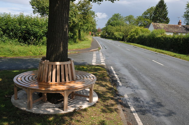
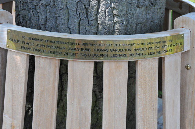
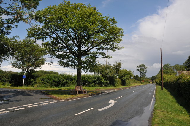
Holberrow Green

Holberrow Green is a village in Worcestershire, England. == External links == Media related to Holberrow Green at Wikimedia Commons

Abbots Morton

Abbots Morton is a village and civil parish in the English county of Worcestershire. It consists of approximately 70 dwellings and 250 people. It retains...

Radford, Worcestershire

Radford is a hamlet in the Wychavon district of Worcestershire, England. It is 1 mile SSW of Inkberrow. In 2013, Landscan population maps show there to...

Dormston

Dormston is a village and civil parish in Worcestershire about 3 miles (4.8 km) south of Redditch. == Name == Dormston's toponym has evolved from Deormodesealdtune...

Nearby Amenities

Located within 500m of 52.218788,-1.974396
Stockwood Lane Junction
Naptan AtcoCode: 2000G675008
Naptan Bearing: N
Naptan BusStopType: CUS
Naptan CommonName: Stockwood Lane Junction
Naptan Crossing: Stockwood Lane Junction
Naptan Indicator: Adj
Naptan NaptanCode: wocdajdt
Naptan Street: Windmill Lane
Naptan Verified: no
Source: naptan_import
Lat/Long: 52.2171187/-1.9810445
Inkberrow First School
Naptan AtcoCode: 2000G675016
Naptan Bearing: S
Naptan BusStopType: CUS
Naptan CommonName: Inkberrow First School
Naptan Indicator: Adj
Naptan Landmark: School
Naptan NaptanCode: wocgadpa
Naptan Street: A422
Naptan Verified: no
Source: naptan_import
Lat/Long: 52.2172442/-1.9791855
Power: pole
Lat/Long: 52.2175096/-1.9760133
Power: pole
Lat/Long: 52.2173598/-1.978284
Waste Basket
Lat/Long: 52.2174505/-1.9793937
Power: pole
Lat/Long: 52.2178619/-1.9735157
Power: pole
Lat/Long: 52.2173686/-1.9770449
Power: pole
Lat/Long: 52.2176497/-1.9749702
Inkberrow School
Power: pole
Transformer: distribution
Voltage Primary: 11000
Lat/Long: 52.2173619/-1.978949
Post Box
Collection Times: Mo-Fr 16:30; Sa 10:45
Post Box Type: lamp
Ref: WR7 494
Royal Cypher: EIIR
Royal Cypher Wikidata: Q33102113
Lat/Long: 52.2173574/-1.9794607
Bench
Lat/Long: 52.2174735/-1.9793806
Power: tower
Lat/Long: 52.2215734/-1.9716539
Power: tower
Source: bing
Lat/Long: 52.2184644/-1.9699986
Power: tower
Source: bing
Lat/Long: 52.2223082/-1.9720549
Power: tower
Source: bing
Lat/Long: 52.2195883/-1.9706005
Priory Forge
Power: pole
Transformer: distribution
Voltage Primary: 11000
Lat/Long: 52.2180446/-1.968794
Power: pole
Lat/Long: 52.2172712/-1.9679381
Power: pole
Lat/Long: 52.2182245/-1.9709523
Power: pole
Lat/Long: 52.2180606/-1.9720675
Power: pole
Lat/Long: 52.2187292/-1.9696664
Bench
Millennium Seat
Lat/Long: 52.2158903/-1.9749801
Generator Method: photovoltaic
Generator Output Electricity: yes
Generator Source: solar
Generator Type: solar_photovoltaic_panel
Location: roof
Power: generator
Lat/Long: 52.2175908/-1.9801113
Turning Circle
Lat/Long: 52.2178805/-1.9782117
Barley Meadows
Power: transformer
Transformer: distribution
Voltage Primary: 11000
Lat/Long: 52.2167959/-1.9792637
Power: pole
Lat/Long: 52.2216537/-1.96964
Power: pole
Lat/Long: 52.2207951/-1.9696507
Power: pole
Lat/Long: 52.2198766/-1.9696641
Lower Wrens Nest
Power: pole
Transformer: distribution
Voltage Primary: 11000
Lat/Long: 52.2197607/-1.9736405
Power: pole
Lat/Long: 52.2192554/-1.9731604
Power: pole
Lat/Long: 52.218746/-1.9726883
Sand Lane
Power: pole
Transformer: distribution
Voltage Primary: 11000
Lat/Long: 52.2213834/-1.9789117
Location Transition: yes
Power: pole
Lat/Long: 52.2193454/-1.9816481
The data included in this document is from www.openstreetmap.org. The data is made available under ODbL.

Have you been to Inkberrow?

Leave your review of Inkberrow below (or comments, questions and feedback).