Inkberrow

Settlement in Worcestershire Wychavon

England

Inkberrow

Farmland at Inkberrow Farmland beside Withypool Lane near Inkberrow.
Farmland at Inkberrow Credit: Philip Halling

Inkberrow is a small village located in the county of Worcestershire, England. Situated in the Vale of Evesham, it lies approximately 10 miles southeast of the city of Worcester. With a population of around 1,700 residents, Inkberrow is a close-knit community known for its rural charm and picturesque countryside.

The village boasts a rich history dating back to Anglo-Saxon times, and evidence of its past can be seen in the architecture of the old buildings that line its streets. The centerpiece of Inkberrow is its historic church, St. Peter's, which dates back to the 12th century and is a Grade I listed building. The church serves as a focal point for the community and is known for its beautiful stained glass windows and intricate woodwork.

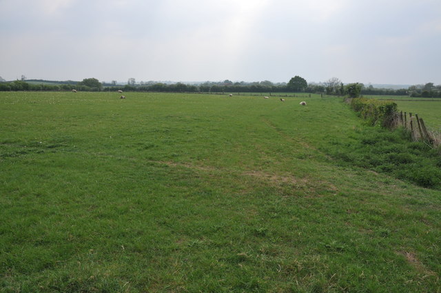
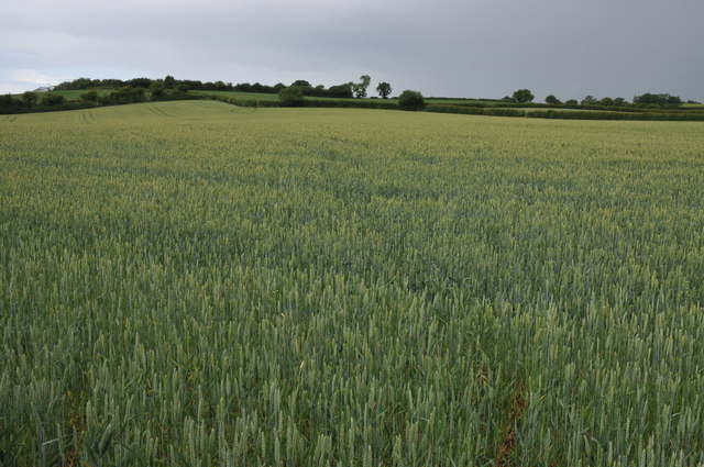
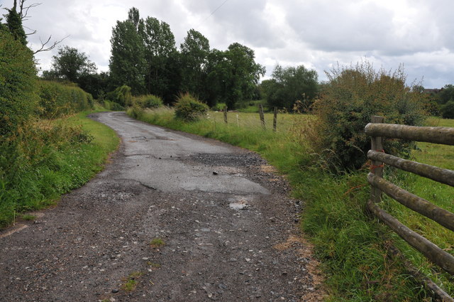
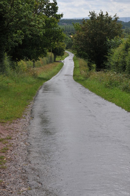
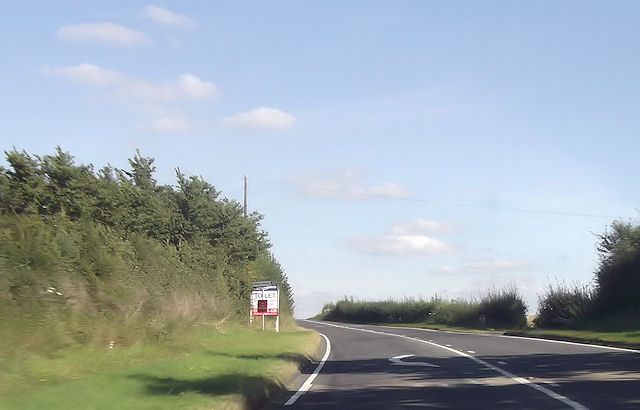
Inkberrow is surrounded by stunning natural beauty, with rolling hills, meandering rivers, and lush farmland defining the landscape. The village is an ideal location for outdoor enthusiasts, offering numerous walking and cycling routes that showcase the area's scenic vistas.

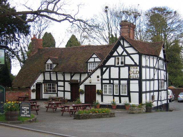
Despite its small size, Inkberrow is well-served by amenities for its residents. The village has a primary school, a post office, a village hall, and a local pub, The Old Bull, which is reputedly the inspiration for the fictional pub "The Bull" in the radio series "The Archers."

Inkberrow's idyllic setting, rich history, and strong sense of community make it a desirable place to live for those seeking a peaceful and picturesque countryside lifestyle.

If you have any feedback on the listing, please let us know in the comments section below.
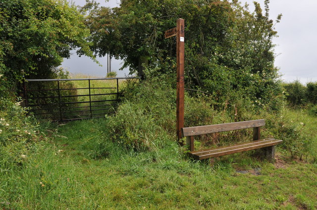
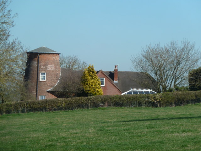
Inkberrow Images

Images are sourced within 2km of 52.213628/-1.980473 or Grid Reference SP0157. Thanks to Geograph Open Source API. All images are credited.

Farmland at Inkberrow Farmland beside Withypool Lane near Inkberrow.
Farmland at Inkberrow
Farmland beside Withypool Lane near Inkberrow.
Block gateway Large sewer pipes have been place in this field gateway to obstruct unauthorised access.
Block gateway
Large sewer pipes have been place in this field gateway to obstruct unauthorised access.
Farmland at Inkberrow Sheep in a field near Inkberrow.
Farmland at Inkberrow
Sheep in a field near Inkberrow.
Field of wheat A footpath Appletree Lane to Inkberrow is supposed to cross this field of wheat.
Field of wheat
A footpath Appletree Lane to Inkberrow is supposed to cross this field of wheat.
Farm road to Great Norbury Farm Farm road to Great Norbury Farm from Appletree Lane near Inkberrow.  For part of the way this is also a footpath.
Farm road to Great Norbury Farm
Farm road to Great Norbury Farm from Appletree Lane near Inkberrow. For part of the way this is also a footpath.
Road past Lench Farm Country road past Lench Farm near Inkberrow.
Road past Lench Farm
Country road past Lench Farm near Inkberrow.
Footpath and seat, Inkberrow A footpath sign and convenient seat near Inkberrow.
Footpath and seat, Inkberrow
A footpath sign and convenient seat near Inkberrow.
Former windmill - Holberrow Green The stump of a tower mill with attached house. There is another nearby at Inkberrow but I have yet to see that (next time perhaps).
Former windmill - Holberrow Green
The stump of a tower mill with attached house. There is another nearby at Inkberrow but I have yet to see that (next time perhaps).
Junction for Stonepits near Withybed
Inkberrow from the south A422
Inkberrow from the south
A422
A422 through Inkberrow
A422 west of power lines The power lines can be seen. East of Inkberrow
A422 west of power lines
The power lines can be seen. East of Inkberrow
B4092 junction ahead
Priory Piece junction from A422
Entering Inkberrow from the north
B4092 junction from A422
Lay by entrance near Springfields
The Old Bull, Inkberrow Shot taken at dusk in January.
This is the model for the Bull, Ambridge in Archerland.
The Old Bull, Inkberrow
Shot taken at dusk in January. This is the model for the Bull, Ambridge in Archerland.
Show me another place!

Inkberrow is located at Grid Ref: SP0157 (Lat: 52.213628, Lng: -1.980473)

Administrative County: Worcestershire

District: Wychavon

Police Authority: West Mercia

What 3 Words

///increased.styled.donor. Near Inkberrow, Worcestershire

Nearby Locations

Inkberrow Inkberrow

Related Wikis

Inkberrow

Inkberrow is a village in Worcestershire, England, often thought to be the model for Ambridge, the setting of BBC Radio 4's long-running series The Archers...

Inkberrow Castle

Inkberrow Castle was situated in the village of Inkberrow in Worcestershire, some 10 km south of Redditch (grid reference SP017572). It was a castle built...

Sporting Club Inkberrow F.C.

Sporting Club Inkberrow Football Club is a football club based in Inkberrow, England. They are currently members of the Hellenic League Division One and...

Little Inkberrow

Little Inkberrow is a village in Worcestershire, England. Ralph Ardern inherited the Worcestershire manor of Little Inkberrow between 1382 (the death...

Holberrow Green

Holberrow Green is a village in Worcestershire, England. == External links == Media related to Holberrow Green at Wikimedia Commons

Radford, Worcestershire

Radford is a hamlet in the Wychavon district of Worcestershire, England. It is 1 mile SSW of Inkberrow. In 2013, Landscan population maps show there to...

Abbots Morton

Abbots Morton is a village and civil parish in the English county of Worcestershire. It consists of approximately 70 dwellings and 250 people. It retains...

Dormston

Dormston is a village and civil parish in Worcestershire about 3 miles (4.8 km) south of Redditch. == Name == Dormston's toponym has evolved from Deormodesealdtune...

Nearby Amenities

Located within 500m of 52.213628,-1.980473
Inkberrow
Place: village
Wikidata: Q2715452
Wikipedia: en:Inkberrow
Lat/Long: 52.2117658/-1.9784307
Bus Stop
Bull's Head
Bus: yes
Naptan AtcoCode: 2000G032400
Naptan Bearing: N
Naptan CommonName: Bull's Head
Naptan Indicator: Adj
Naptan Landmark: Bull's Head Inn
Naptan NaptanCode: wocdjdwt
Naptan Street: High Street
Naptan Verified: no
Public Transport: platform
Source: naptan_import
Lat/Long: 52.2133246/-1.9807388
Bus Stop
Bull's Head
Bus: yes
Naptan AtcoCode: 2000G032401
Naptan Bearing: S
Naptan CommonName: Bull's Head
Naptan Indicator: Opp
Naptan Landmark: Bull's Head Inn
Naptan NaptanCode: wocdjgad
Naptan Street: High Street
Naptan Verified: no
Public Transport: platform
Source: naptan_import
Lat/Long: 52.2134414/-1.9804167
Bus Stop
Chaston Close
Bus: yes
Naptan AtcoCode: 2000G323357
Naptan Bearing: NW
Naptan BusStopType: CUS
Naptan CommonName: Chaston Close
Naptan Crossing: Chaston Close
Naptan Indicator: opp
Naptan NaptanCode: wocgmgaw
Naptan Street: High Street
Naptan Verified: no
Public Transport: platform
Source: naptan_import
Lat/Long: 52.2105825/-1.9808424
Bus Stop
Bull's Head
Bus: yes
Naptan AtcoCode: 2000G323358
Naptan Bearing: NE
Naptan CommonName: Bull's Head
Naptan Indicator: adj
Naptan Landmark: Bull's Head
Naptan NaptanCode: wocgmgda
Naptan Street: High Street
Naptan Verified: no
Public Transport: platform
Source: naptan_import
Lat/Long: 52.2134684/-1.9806655
Stockwood Lane Junction
Naptan AtcoCode: 2000G675008
Naptan Bearing: N
Naptan BusStopType: CUS
Naptan CommonName: Stockwood Lane Junction
Naptan Crossing: Stockwood Lane Junction
Naptan Indicator: Adj
Naptan NaptanCode: wocdajdt
Naptan Street: Windmill Lane
Naptan Verified: no
Source: naptan_import
Lat/Long: 52.2171187/-1.9810445
Bus Stop
Orchard Mead
Bus: yes
Naptan AtcoCode: 2000G675009
Naptan Bearing: SE
Naptan CommonName: Orchard Mead
Naptan Crossing: Orchard Mead
Naptan Indicator: Opp
Naptan NaptanCode: wocdajdw
Naptan Street: Greens Croft way
Naptan Verified: no
Public Transport: platform
Source: naptan_import
Lat/Long: 52.2137295/-1.9827584
Bus Stop
Chaston Close
Bus: yes
Naptan AtcoCode: 2000G675010
Naptan Bearing: S
Naptan BusStopType: CUS
Naptan CommonName: Chaston Close
Naptan Crossing: Chaston Close
Naptan Indicator: Adj
Naptan NaptanCode: wocdajga
Naptan Street: High Street
Naptan Verified: no
Public Transport: platform
Source: naptan_import
Lat/Long: 52.2106633/-1.9805789
Inkberrow First School
Naptan AtcoCode: 2000G675016
Naptan Bearing: S
Naptan BusStopType: CUS
Naptan CommonName: Inkberrow First School
Naptan Indicator: Adj
Naptan Landmark: School
Naptan NaptanCode: wocgadpa
Naptan Street: A422
Naptan Verified: no
Source: naptan_import
Lat/Long: 52.2172442/-1.9791855
Pub
The Old Bull
Lat/Long: 52.2136693/-1.9794175
Pub
The Bull's Head
Lat/Long: 52.2137141/-1.9808235
Post Box
Post Box Mounting: telegraph_pole
Post Box Type: lamp
Ref: WR7 430
Source: GPS
Lat/Long: 52.2119934/-1.9868151
Simply Fresh
Shop: convenience
Lat/Long: 52.2143167/-1.9806499
Barrier: stile
Foot: yes
Lat/Long: 52.2154285/-1.9850072
Barrier: kissing_gate
Foot: yes
Lat/Long: 52.2140249/-1.9844186
Turning Circle
Lat/Long: 52.2134526/-1.9837304
Power: pole
Lat/Long: 52.2173598/-1.978284
Doctors
Grey Gable Surgery
Healthcare: doctor
Lat/Long: 52.2153448/-1.9796698
Post Box
Collection Times: Mo-Fr 16:45; Sa 11:00
Post Box Type: pillar
Ref: WR7 396
Royal Cypher: EIIR
Royal Cypher Wikidata: Q33102113
Lat/Long: 52.2115825/-1.9790462
Power: pole
Lat/Long: 52.2111404/-1.9754921
Waste Basket
Lat/Long: 52.2174505/-1.9793937
Power: pole
Lat/Long: 52.2109233/-1.9748801
Power: pole
Lat/Long: 52.2113084/-1.9760364
Power: pole
Lat/Long: 52.2177739/-1.9830522
Location Transition: yes
Power: pole
Lat/Long: 52.2175341/-1.9820017
Location Transition: yes
Power: pole
Lat/Long: 52.2160202/-1.9821321
Turning Circle
Lat/Long: 52.2156993/-1.9821523
Power: pole
Lat/Long: 52.2173686/-1.9770449
Inkberrow East
Location Transition: yes
Power: pole
Transformer: distribution
Voltage Primary: 11000
Lat/Long: 52.2114983/-1.9766986
Power: pole
Lat/Long: 52.2167691/-1.9824167
Power: pole
Lat/Long: 52.2176569/-1.982538
Telephone
Booth: K6
Covered: booth
Listed Status: Grade II
Phone: +44 1386 792234
Wikidata: Q26405526
Lat/Long: 52.2132608/-1.9804919
Inkberrow School
Power: pole
Transformer: distribution
Voltage Primary: 11000
Lat/Long: 52.2173619/-1.978949
Post Box
Collection Times: Mo-Fr 16:30; Sa 10:45
Post Box Type: lamp
Ref: WR7 494
Royal Cypher: EIIR
Royal Cypher Wikidata: Q33102113
Lat/Long: 52.2173574/-1.9794607
Power: pole
Lat/Long: 52.2174247/-1.9826731
Post Box
Collection Times: Mo-Fr 16:45; Sa 10:30
Post Box Type: lamp
Ref: WR7 134
Royal Cypher: EIIR
Royal Cypher Wikidata: Q33102113
Lat/Long: 52.2145396/-1.9831681
Post Office
Inkberrow Post Office
Addr City: Worcester
Addr Postcode: WR7 4EJ
Addr Street: Pepper Street
Addr Village: Inkberrow
Brand: Post Office
Brand Wikidata: Q1783168
Opening Hours: Mo,Tu,Th,Fr 09:00-17:30; We 09:00-13:00; Sa 09:00-12:30
Ref Pol Id: 5525
Website: https://www.postoffice.co.uk/branch-finder/1832476/inkberrow
Lat/Long: 52.211528/-1.9789649
Crossing
Crossing: traffic_signals
Crossing Ref: pelican
Lat/Long: 52.2155583/-1.9799985
Bench
Lat/Long: 52.2174735/-1.9793806
Inkberrow
Man Made: survey_point
Ref: S3865
Tpuk Ref: TP4105
Lat/Long: 52.211012/-1.9857115
Barrier: stile
Foot: yes
Lat/Long: 52.2150676/-1.9847869
Bench
Lat/Long: 52.2129127/-1.9776805
Barrier: kissing_gate
Foot: yes
Lat/Long: 52.2125421/-1.9777639
Barrier: stile
Foot: yes
Lat/Long: 52.213515/-1.9767053
Barrier: stile
Source: survey
Lat/Long: 52.2102329/-1.9756871
Barrier: stile
Source: survey
Lat/Long: 52.2113861/-1.9760127
Barrier: stile
Source: survey
Lat/Long: 52.2119402/-1.976407
Barrier: stile
Source: survey
Lat/Long: 52.2109993/-1.9754824
Bench
Millennium Seat
Lat/Long: 52.2158903/-1.9749801
Generator Method: photovoltaic
Generator Output Electricity: yes
Generator Source: solar
Generator Type: solar_photovoltaic_panel
Location: roof
Power: generator
Lat/Long: 52.2098847/-1.9766995
Generator Method: photovoltaic
Generator Output Electricity: yes
Generator Source: solar
Generator Type: solar_photovoltaic_panel
Location: roof
Power: generator
Lat/Long: 52.2175908/-1.9801113
Generator Method: photovoltaic
Generator Output Electricity: yes
Generator Source: solar
Generator Type: solar_photovoltaic_panel
Location: roof
Power: generator
Lat/Long: 52.2166558/-1.9813156
Generator Method: photovoltaic
Generator Output Electricity: yes
Generator Source: solar
Generator Type: solar_photovoltaic_panel
Location: roof
Power: generator
Lat/Long: 52.2162564/-1.9819835
Generator Method: photovoltaic
Generator Output Electricity: yes
Generator Source: solar
Generator Type: solar_photovoltaic_panel
Location: roof
Power: generator
Lat/Long: 52.2162679/-1.9817233
Generator Method: photovoltaic
Generator Output Electricity: yes
Generator Source: solar
Generator Type: solar_photovoltaic_panel
Location: roof
Power: generator
Lat/Long: 52.2152178/-1.9837457
Generator Method: photovoltaic
Generator Output Electricity: yes
Generator Source: solar
Generator Type: solar_photovoltaic_panel
Location: roof
Power: generator
Lat/Long: 52.2146755/-1.982587
Generator Method: photovoltaic
Generator Output Electricity: yes
Generator Source: solar
Generator Type: solar_photovoltaic_panel
Location: roof
Power: generator
Lat/Long: 52.2140346/-1.9829786
Generator Method: photovoltaic
Generator Output Electricity: yes
Generator Source: solar
Generator Type: solar_photovoltaic_panel
Location: roof
Power: generator
Lat/Long: 52.2143567/-1.9827962
Generator Method: photovoltaic
Generator Output Electricity: yes
Generator Source: solar
Generator Type: solar_photovoltaic_panel
Location: roof
Power: generator
Lat/Long: 52.2142104/-1.9834453
Generator Method: photovoltaic
Generator Output Electricity: yes
Generator Source: solar
Generator Type: solar_photovoltaic_panel
Location: roof
Power: generator
Lat/Long: 52.2130255/-1.9835284
Generator Method: photovoltaic
Generator Output Electricity: yes
Generator Source: solar
Generator Type: solar_photovoltaic_panel
Location: roof
Power: generator
Lat/Long: 52.2127757/-1.9797707
Turning Circle
Lat/Long: 52.2178805/-1.9782117
Turning Circle
Lat/Long: 52.2110854/-1.9795369
Waste Basket
Colour: black
Covered: yes
Indoor: no
Material: plastic
Waste: mixed
Lat/Long: 52.2139553/-1.9803486
Bench
Backrest: yes
Material: wood
Lat/Long: 52.2143335/-1.980443
Barley Meadows
Power: transformer
Transformer: distribution
Voltage Primary: 11000
Lat/Long: 52.2167959/-1.9792637
Man Made: utility_pole
Operator: AirBand
Utility: telecom
Lat/Long: 52.2153829/-1.98207
Man Made: utility_pole
Utility: telecom
Lat/Long: 52.2102905/-1.9774715
Ele Ellipsoid: 124.953
Man Made: utility_pole
Material: wood
Utility: telecom
Lat/Long: 52.2097947/-1.9778884
Ele Ellipsoid: 128.449
Man Made: utility_pole
Utility: telecom
Lat/Long: 52.2098829/-1.9791317
Ele Ellipsoid: 129.516
Man Made: utility_pole
Utility: telecom
Lat/Long: 52.2113316/-1.9782869
Man Made: utility_pole
Utility: telecom
Lat/Long: 52.2106335/-1.9783337
Ele Ellipsoid: 128.437
Man Made: utility_pole
Utility: telecom
Lat/Long: 52.2098957/-1.9784245
Man Made: utility_pole
Utility: power
Lat/Long: 52.2126564/-1.9803569
Man Made: utility_pole
Utility: telecom
Lat/Long: 52.2122415/-1.9798762
Man Made: utility_pole
Utility: telecom
Lat/Long: 52.2128805/-1.9818588
Man Made: utility_pole
Utility: telecom
Lat/Long: 52.2138131/-1.9823727
Ele Ellipsoid: 131.534
Man Made: utility_pole
Utility: telecom
Lat/Long: 52.2118132/-1.9793967
Man Made: utility_pole
Utility: power
Lat/Long: 52.2128922/-1.9809679
Ele Ellipsoid: 138.730
Man Made: utility_pole
Utility: telecom
Lat/Long: 52.2128181/-1.9817034
Man Made: utility_pole
Utility: power
Lat/Long: 52.2128096/-1.9806137
Man Made: utility_pole
Utility: telecom
Lat/Long: 52.2128541/-1.9809452
Man Made: utility_pole
Utility: telecom
Lat/Long: 52.2124044/-1.9805507
Man Made: utility_pole
Utility: telecom
Lat/Long: 52.2134768/-1.9823331
Man Made: utility_pole
Utility: telecom
Lat/Long: 52.211532/-1.9786897
Man Made: utility_pole
Utility: telecom
Lat/Long: 52.2147552/-1.9832539
Man Made: utility_pole
Utility: telecom
Lat/Long: 52.2150714/-1.9829691
Man Made: utility_pole
Utility: telecom
Lat/Long: 52.2140321/-1.9833615
Man Made: utility_pole
Utility: telecom
Lat/Long: 52.2145597/-1.9828018
Man Made: utility_pole
Operator: AirBand
Utility: telecom
Lat/Long: 52.2156928/-1.981165
Man Made: utility_pole
Utility: telecom
Lat/Long: 52.2139374/-1.982939
The data included in this document is from www.openstreetmap.org. The data is made available under ODbL.

Have you been to Inkberrow?

Leave your review of Inkberrow below (or comments, questions and feedback).