Brook End

Settlement in Huntingdonshire Huntingdonshire

England

Brook End

Houses on Bustard Hill, Tilbrook The house on the right was built in 2021
Houses on Bustard Hill, Tilbrook Credit: David Howard

Brook End is a small rural village situated in the district of Huntingdonshire in the county of Cambridgeshire, England. It is located approximately 8 miles south of the town of Huntingdon and 15 miles north of the city of Cambridge. The village is nestled in the picturesque countryside, surrounded by lush green fields and meadows.

Brook End is a close-knit community with a population of around 500 residents. The village is known for its tranquility and peaceful atmosphere, making it an ideal place for those seeking a quiet and idyllic lifestyle. The architecture in Brook End is largely traditional, with charming cottages and farmhouses dotting the landscape.

The village benefits from its proximity to the River Great Ouse, which flows just a short distance away. This offers residents and visitors alike the opportunity to enjoy recreational activities such as boating, fishing, and riverside walks. The surrounding countryside also provides ample opportunities for outdoor pursuits, including hiking and cycling.

Despite its rural location, Brook End is within easy reach of amenities and services. The nearby town of Huntingdon offers a range of shops, supermarkets, and schools, while Cambridge provides a wider array of cultural and entertainment options.

In summary, Brook End is a charming and picturesque village in Huntingdonshire, offering a peaceful and rural lifestyle within easy reach of larger towns and cities. Its natural beauty and sense of community make it an appealing place to live or visit.

If you have any feedback on the listing, please let us know in the comments section below.
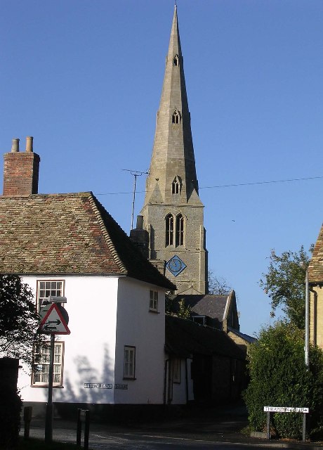
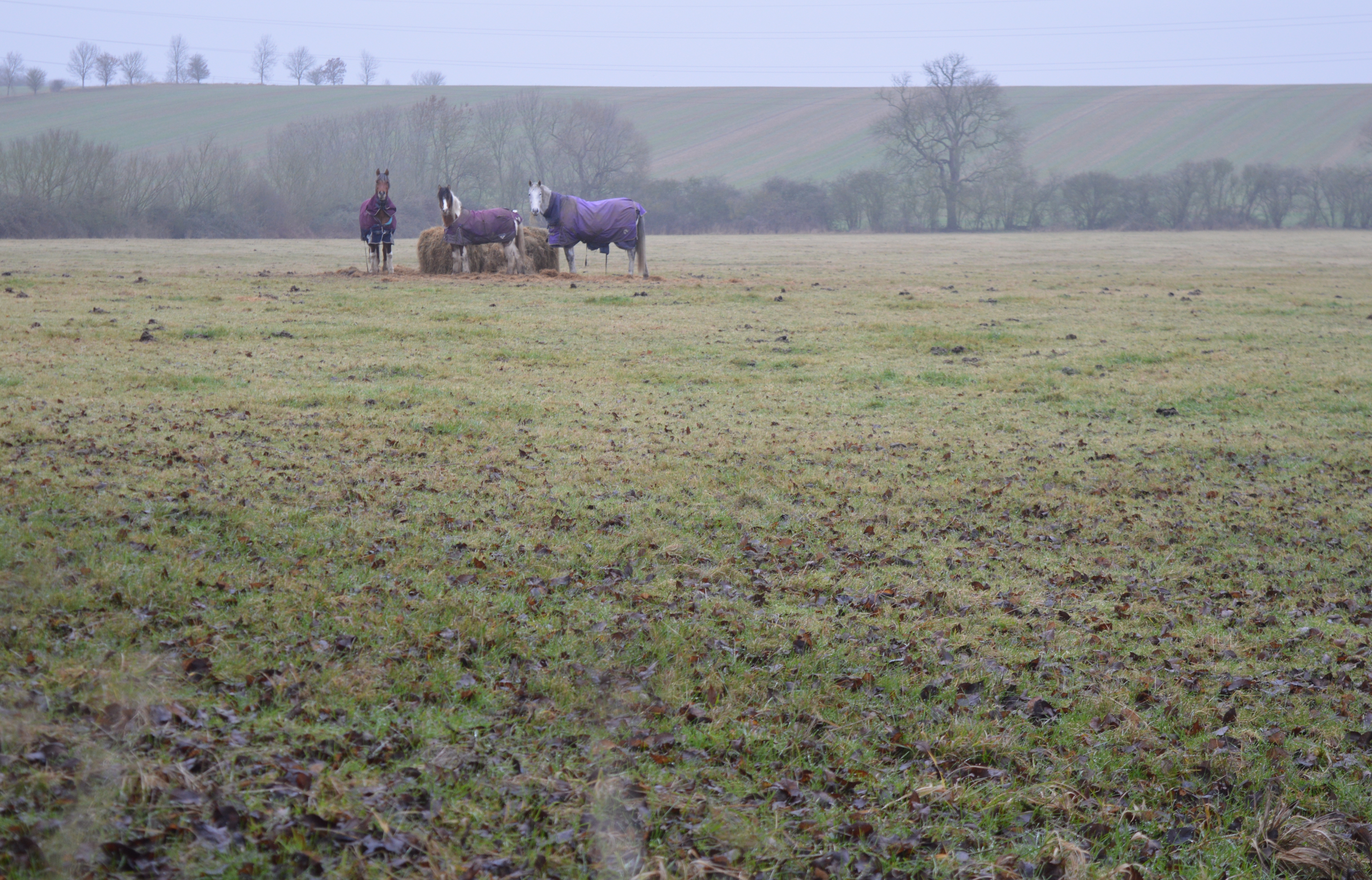
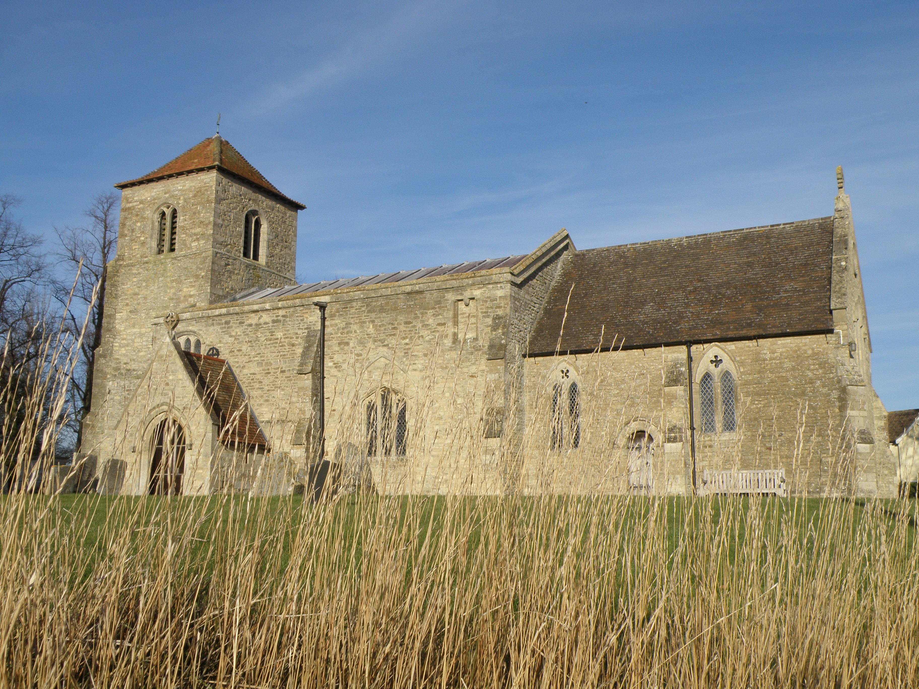
Brook End Images

Images are sourced within 2km of 52.336316/-0.415574 or Grid Reference TL0872. Thanks to Geograph Open Source API. All images are credited.

Houses on Bustard Hill, Tilbrook The house on the right was built in 2021
Houses on Bustard Hill, Tilbrook
The house on the right was built in 2021
May Tree on Bustard Hill, Tilbrook
High Street, Catworth
Three Shires Way just below Molly Rose Lodge
Recently planted trees by the Three Shires Way This part of the Three Shires Way has received a bit of a makeover with French drains installed, trees planted and overgrown scrub reined in.
Recently planted trees by the Three Shires Way
This part of the Three Shires Way has received a bit of a makeover with French drains installed, trees planted and overgrown scrub reined in.
Track to Molly Rose Lodge Part of the Three Shires Way
Track to Molly Rose Lodge
Part of the Three Shires Way
No Through Road Just happens to be facing the wrong way, pedestrian and horse access allowed as this is part of the Three Shires Way.
No Through Road
Just happens to be facing the wrong way, pedestrian and horse access allowed as this is part of the Three Shires Way.
Tilbrook Grange One of those unique farms where the road passes through the farmyard. The grain store is now complete <a href="https://www.geograph.org.uk/photo/747172">TL0871 : Grain Store Construction, Tilbrook Grange</a>
Tilbrook Grange
One of those unique farms where the road passes through the farmyard. The grain store is now complete TL0871 : Grain Store Construction, Tilbrook Grange
Brick Yard Cottage in the trees Of note is the narrow concrete vehicle bridge over the large ditch that provides access to the cottage.
Brick Yard Cottage in the trees
Of note is the narrow concrete vehicle bridge over the large ditch that provides access to the cottage.
Railway infrastructure remains Brick remains of a path access under the former Thrapston Huntingdon railway.
Railway infrastructure remains
Brick remains of a path access under the former Thrapston Huntingdon railway.
Catworth Lodge Viewed from the Three Shires Way.
Catworth Lodge
Viewed from the Three Shires Way.
Former railway infrastructure Brick remains of a path access under the former Thrapston Huntingdon railway.
Former railway infrastructure
Brick remains of a path access under the former Thrapston Huntingdon railway.
Former railway embankment Embankment of the former Thrapston Huntingdon railway. Closed in 1964.
Former railway embankment
Embankment of the former Thrapston Huntingdon railway. Closed in 1964.
Another end of the line An abrupt stop for the Huntingdon Thrapston railway line. Since it closed in 1964 no matter. The land has been returned to arable farming.
Another end of the line
An abrupt stop for the Huntingdon Thrapston railway line. Since it closed in 1964 no matter. The land has been returned to arable farming.
Footbridge for footpath branching off the Three Shires Way Footpath 43/8a to Catworth.
Footbridge for footpath branching off the Three Shires Way
Footpath 43/8a to Catworth.
Old Milepost Old milepost on the B660 near to Tilbrook, Cambridgeshire. For overall view see <a title="https://www.geograph.org.uk/photo/2883390" href="https://www.geograph.org.uk/photo/2883390">Link</a>
Old Milepost
Old milepost on the B660 near to Tilbrook, Cambridgeshire. For overall view see Link
65 Miles From London Old milepost on the B660 near to Tilbrook, Cambridgeshire. For close up view see <a title="https://www.geograph.org.uk/photo/2883386" href="https://www.geograph.org.uk/photo/2883386">Link</a>
65 Miles From London
Old milepost on the B660 near to Tilbrook, Cambridgeshire. For close up view see Link
No Through Road Modern sign and old Pre-Worboys No Through Road sign near to Catworth, Cambridgeshire. For close up view see <a title="https://www.geograph.org.uk/photo/2883400" href="https://www.geograph.org.uk/photo/2883400">Link</a>
No Through Road
Modern sign and old Pre-Worboys No Through Road sign near to Catworth, Cambridgeshire. For close up view see Link
Show me another place!

Brook End is located at Grid Ref: TL0872 (Lat: 52.336316, Lng: -0.415574)

Administrative County: Cambridgeshire

District: Huntingdonshire

Police Authority: Cambridgeshire

What 3 Words

///manages.intersect.donor. Near Kimbolton, Cambridgeshire

Nearby Locations

Brook End

Related Wikis

Kimbolton railway station

Kimbolton railway station was a railway station in Kimbolton, Cambridgeshire. The station and its line closed in 1959. The journey from London St. Pancras...

Catworth

Catworth is a village and civil parish in Cambridgeshire, England. Catworth lies approximately 9 miles (14 km) west of Huntingdon. The civil parish covers...

Little Catworth Meadow

Little Catworth Meadow is a 5.2-hectare (13-acre) biological Site of Special Scientific Interest between Catworth and Spaldwick in Cambridgeshire.The meadow...

Covington, Cambridgeshire

Covington is a village and civil parish in Cambridgeshire, England. Covington lies approximately 10 miles (16 km) west of Huntingdon near to Catworth and...

Nearby Amenities

Located within 500m of 52.336316,-0.415574
Power: pole
Lat/Long: 52.3318781/-0.41644
Power: pole
Lat/Long: 52.3359754/-0.4148266
Power: pole
Lat/Long: 52.3368409/-0.4143913
Power: pole
Lat/Long: 52.3348562/-0.413322
Power: pole
Lat/Long: 52.3329206/-0.4160006
Power: pole
Lat/Long: 52.3404098/-0.4130392
Power: pole
Lat/Long: 52.3385581/-0.4137368
Power: pole
Lat/Long: 52.3394627/-0.4133718
Power: pole
Lat/Long: 52.3339302/-0.4156037
Power: pole
Lat/Long: 52.3377062/-0.4140909
Power: pole
Lat/Long: 52.334966/-0.4151316
Power: pole
Lat/Long: 52.3342214/-0.4125266
Power: pole
Lat/Long: 52.3334872/-0.4115908
The data included in this document is from www.openstreetmap.org. The data is made available under ODbL.

Have you been to Brook End?

Leave your review of Brook End below (or comments, questions and feedback).