Horstead with Stanninghall

Civil Parish in Norfolk Broadland

England

Horstead with Stanninghall

The White Horse Crostwick Public House on the North Walsham Road
The White Horse Crostwick Credit: Phil Gaskin

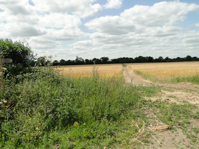
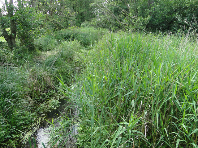
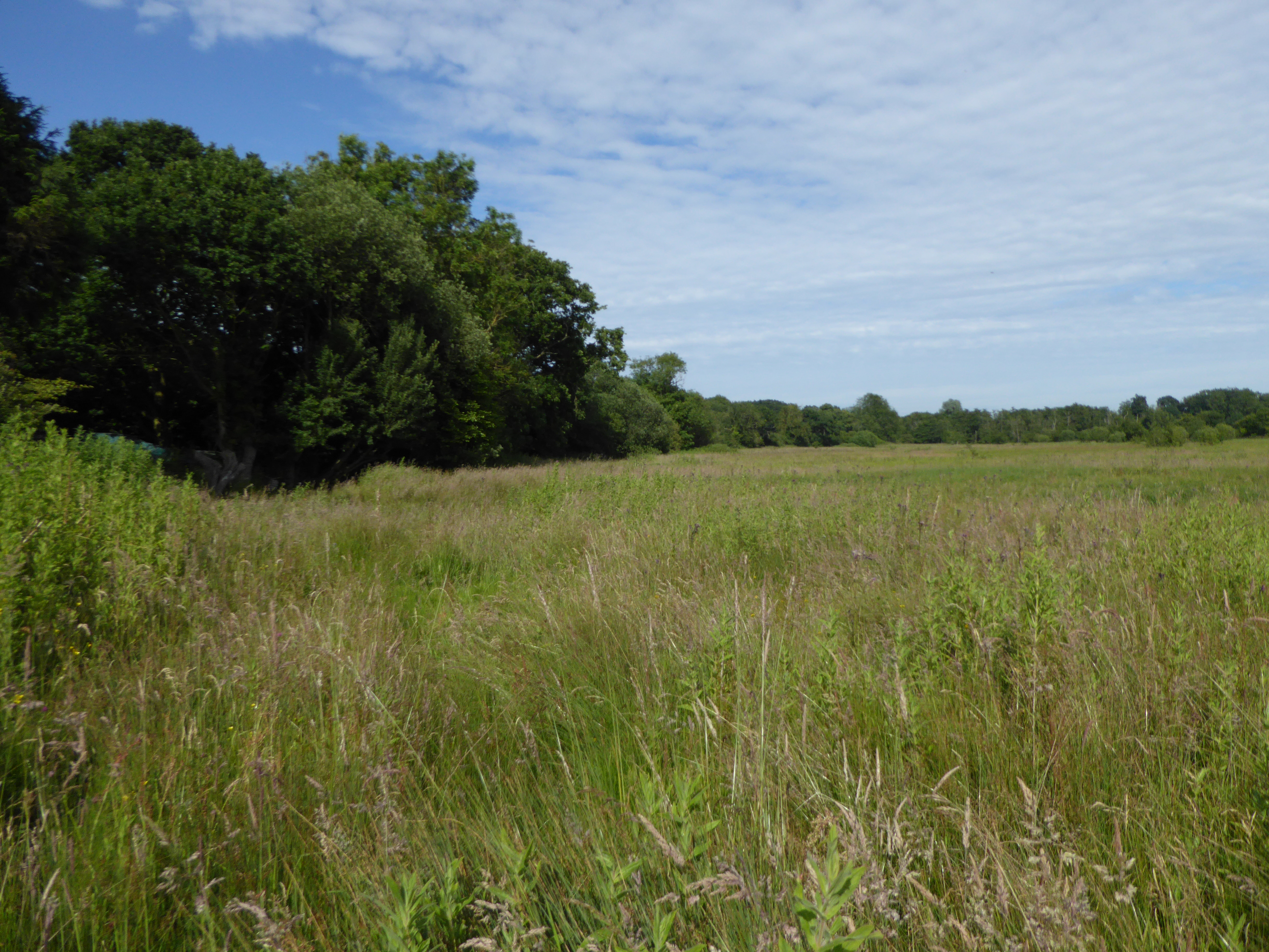
Horstead with Stanninghall is a civil parish located in the county of Norfolk, England. It is situated approximately 8 miles north of the city of Norwich. The parish encompasses the villages of Horstead and Stanninghall, along with the surrounding rural areas.

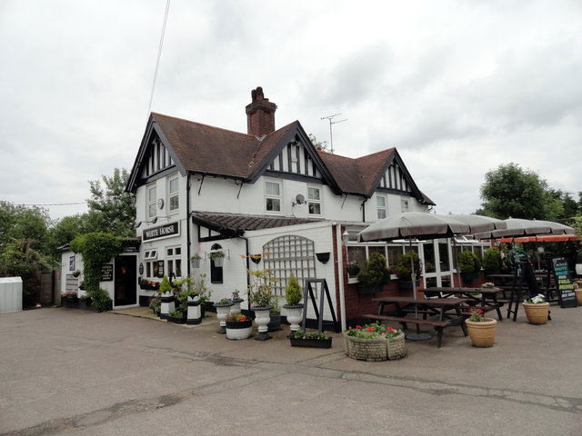
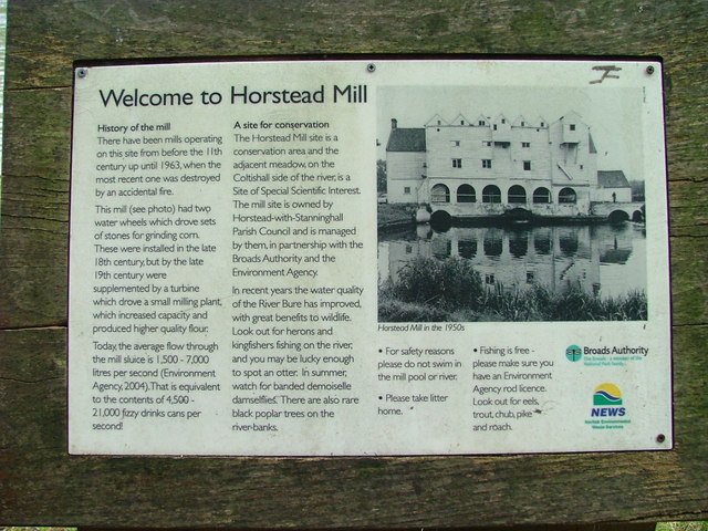
Horstead is a picturesque village that lies on the River Bure. It is known for its beautiful scenery and charming traditional cottages. The village has a long history, with evidence of human habitation dating back to the Neolithic period. It was mentioned in the Domesday Book of 1086 and has since been an important agricultural and trading center in the region.

In addition to its natural beauty, Horstead is also home to several notable landmarks. One such landmark is the Church of St. Margaret, a medieval church that dates back to the 14th century. The church features stunning architectural details and is a popular destination for visitors.

Stanninghall, on the other hand, is a smaller village within the parish. It is primarily a residential area and is known for its peaceful atmosphere. The village is characterized by its well-preserved historic buildings, including Stanninghall Farmhouse, a Grade II listed building.

Overall, Horstead with Stanninghall offers a tranquil and picturesque setting for both residents and visitors. With its rich history, natural beauty, and charming villages, it is a delightful destination for those looking to explore the rural beauty of Norfolk.

If you have any feedback on the listing, please let us know in the comments section below.

Horstead with Stanninghall Images

Images are sourced within 2km of 52.706978/1.349623 or Grid Reference TG2617. Thanks to Geograph Open Source API. All images are credited.

The White Horse Crostwick Public House on the North Walsham Road
The White Horse Crostwick
Public House on the North Walsham Road
Remains of Horstead Mill On the River Bure.For information board, see <a href="https://www.geograph.org.uk/photo/3133594">TG2619 : Information board for Horstead Mill</a>
Remains of Horstead Mill
On the River Bure.For information board, see TG2619 : Information board for Horstead Mill
Information board for Horstead Mill See <a href="https://www.geograph.org.uk/photo/3133585">TG2619 : Remains of Horstead Mill</a>
Information board for Horstead Mill
River Bure Looking downstream from near Horstead Mill.
River Bure
Looking downstream from near Horstead Mill.
Track through farmland to Water Tower
River Bure
River Bure
Coltishall ROC post Opened in December 1957 on the north side of water tower. All surface features remain intact; the ventilation louvres are missing.  Internally the post is empty and the walls are covered with graffiti. It used to contain cupboards and two single beds. A type-B Orlit post > <a title="https://www.geograph.org.uk/photo/3966742" href="https://www.geograph.org.uk/photo/3966742">Link</a> adjoins it.
Coltishall ROC post
Opened in December 1957 on the north side of water tower. All surface features remain intact; the ventilation louvres are missing. Internally the post is empty and the walls are covered with graffiti. It used to contain cupboards and two single beds. A type-B Orlit post > Link adjoins it.
Coltishall ROC post by Horstead - B Orlit Opened in December 1957 on the north side of water tower. All surface features remain intact; the ventilation louvres are missing > <a title="https://www.geograph.org.uk/photo/3966733" href="https://www.geograph.org.uk/photo/3966733">Link</a>.  Internally the post is empty and the walls are covered with graffiti. It used to contain cupboards and two single beds. The type-B Orlit post seen here adjoins it.
Coltishall ROC post by Horstead - B Orlit
Opened in December 1957 on the north side of water tower. All surface features remain intact; the ventilation louvres are missing > Link. Internally the post is empty and the walls are covered with graffiti. It used to contain cupboards and two single beds. The type-B Orlit post seen here adjoins it.
Coltishall ROC post by Horstead - B Orlit Opened in December 1957 on the north side of water tower. All surface features remain intact; the ventilation louvres are missing > <a title="https://www.geograph.org.uk/photo/3966733" href="https://www.geograph.org.uk/photo/3966733">Link</a>.  Internally the post is empty and the walls are covered with graffiti. It used to contain cupboards and two single beds. The type-B Orlit post seen here adjoins and this is the view from beneath it.
Coltishall ROC post by Horstead - B Orlit
Opened in December 1957 on the north side of water tower. All surface features remain intact; the ventilation louvres are missing > Link. Internally the post is empty and the walls are covered with graffiti. It used to contain cupboards and two single beds. The type-B Orlit post seen here adjoins and this is the view from beneath it.
Layby on the B1150 near Hills and Holes Farm
Converted windmill at Frettenham Frettenham tower mill was a 47 foot, five storey tarred brick mill that was built c.1870, and was one of the last tower mills to be built in Norfolk.
The mill is a private residence.
Converted windmill at Frettenham
Frettenham tower mill was a 47 foot, five storey tarred brick mill that was built c.1870, and was one of the last tower mills to be built in Norfolk. The mill is a private residence.
Properly defined footpath across a field of barley
Frettenham Road approaching Horstead
Council-type houses on Frettenham Road, Horstead
This is supposed to be a drain. Totally choked! It's no wonder all the roads locally have signs 'Liable to Flooding'.
This is supposed to be a drain. Totally choked!
It's no wonder all the roads locally have signs 'Liable to Flooding'.
Hump-back bridge near Old Hall Farm, Crostwick
Show me another place!

Horstead with Stanninghall is located at Grid Ref: TG2617 (Lat: 52.706978, Lng: 1.349623)

Administrative County: Norfolk

District: Broadland

Police Authority: Norfolk

What 3 Words

///bulb.condition.bolts. Near Coltishall, Norfolk

Related Wikis

Crostwick Marsh

Crostwick Marsh is an 11.6-hectare (29-acre) biological Site of Special Scientific Interest in Crostwick, north of Norwich in Norfolk. It is part of the...

Crostwick

Crostwick is a village in the English county of Norfolk. The village is part of the civil parish of Horstead with Stanninghall. Crostwick is located 2...

Hillside Animal Sanctuary

Hillside Animal Sanctuary, based in Frettenham, Norwich, and with a site at West Runton, North Norfolk, is the United Kingdom's largest home for different...

Frettenham

Frettenham is a village and civil parish in the English county of Norfolk. It is located 3.2 miles (5.1 km) west of Wroxham, and 5.7 miles (9.2 km) north...
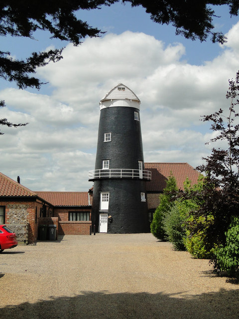
Frettenham Windmill

Frettenham Mill is a Grade II listed tower mill at Frettenham, Norfolk, England which has been converted to residential accommodation. == History == Frettenham...

River Hor

The River Hor is a short river in the county of Norfolk, England. It runs 13.3 kilometres (8.3 mi) east from its source near Felthorpe to its confluence...

Horstead with Stanninghall

Horstead with Stanninghall is a civil parish in the English county of Norfolk which is also known as 'The Gateway of The Broads' consisting of the former...

Spixworth

Spixworth is a village and civil parish in the English county of Norfolk. The village lies close to the B1150 road and is 5 miles (8.0 km) north of Norwich...

Nearby Amenities

Located within 500m of 52.706978,1.349623
Hills and Holes Farm
Place: farm
Source: NLS - OS 1:25k 1st Series 1937-61
Lat/Long: 52.705158/1.3470918
Barrier: bollard
Material: wood
Lat/Long: 52.7113536/1.3481281
Parking
Parking: layby
Lat/Long: 52.7038419/1.3445214
Hill Farm Shop
Shop: farm
Lat/Long: 52.7052392/1.3467483
The data included in this document is from www.openstreetmap.org. The data is made available under ODbL.

Have you been to Horstead with Stanninghall?

Leave your review of Horstead with Stanninghall below (or comments, questions and feedback).