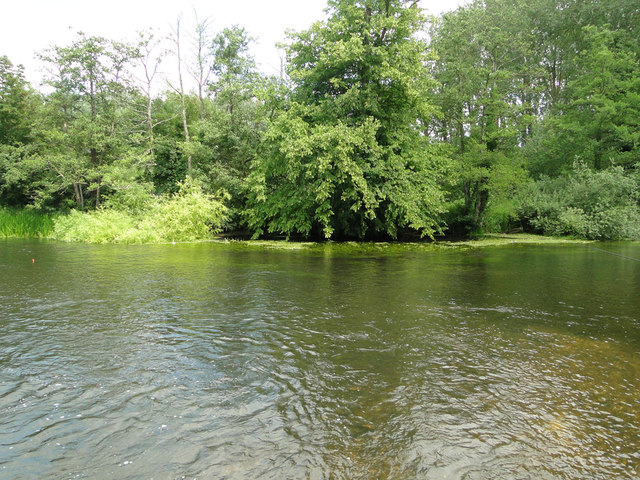
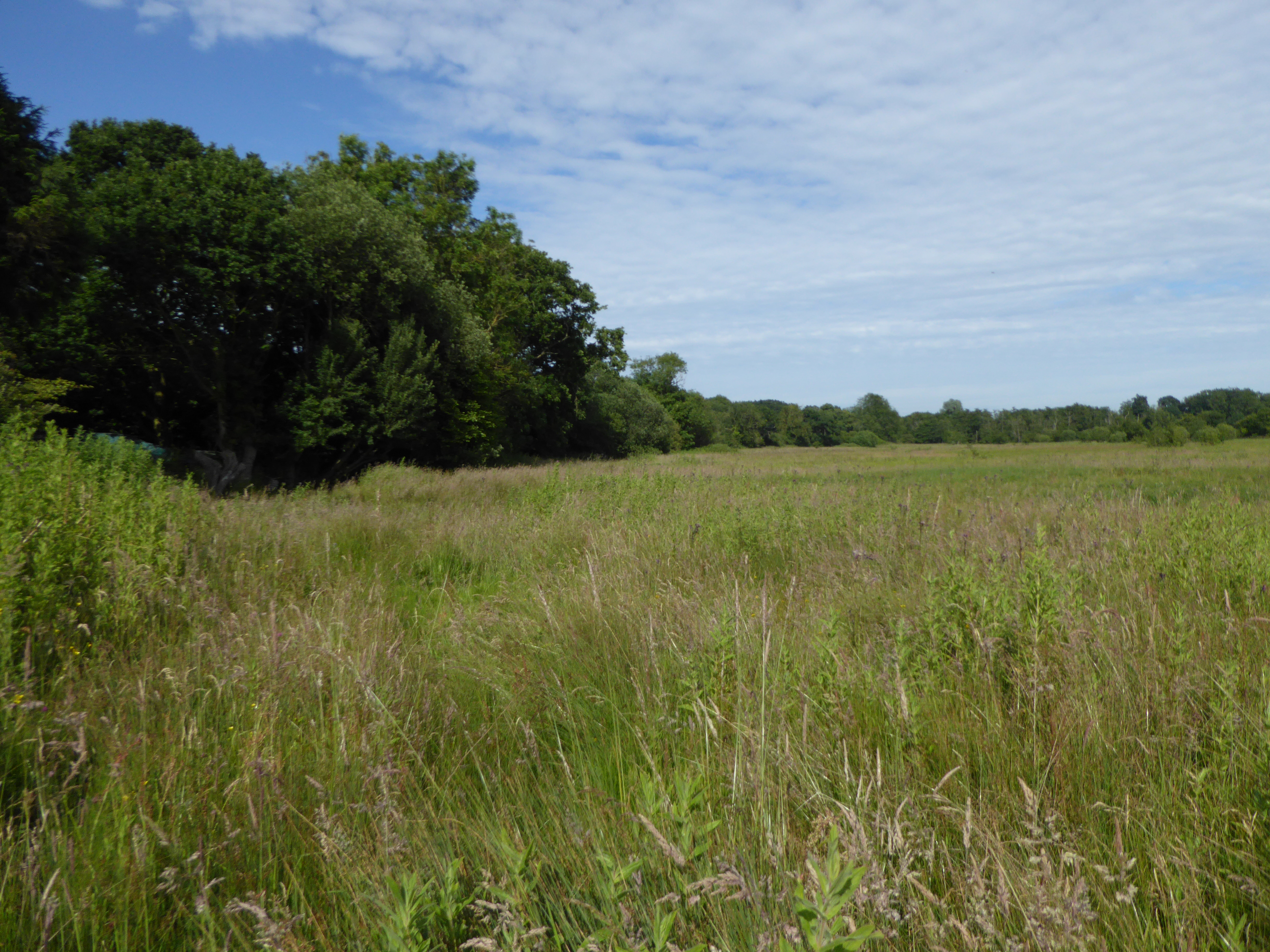
Burnt Wood

Wood, Forest in Norfolk Broadland

England

Burnt Wood

The White Horse Crostwick Public House on the North Walsham Road
The White Horse Crostwick Credit: Phil Gaskin

Burnt Wood is a small village located in the county of Norfolk, England. Situated within the heart of the Norfolk Forest, the village is surrounded by lush greenery and an abundance of tall, ancient trees. Burnt Wood is known for its tranquil and serene atmosphere, attracting those seeking a peaceful retreat away from the hustle and bustle of city life.

The village itself is comprised of a handful of charming cottages, some of which date back several centuries, giving the area a sense of history and character. The architecture is predominantly traditional, with thatched roofs and timber frames, blending harmoniously with the natural surroundings.

The Norfolk Forest, which encompasses Burnt Wood, is a vast expanse of woodland, providing ample opportunities for outdoor activities such as hiking, cycling, and birdwatching. The forest is home to a diverse range of flora and fauna, including ancient oaks, beech trees, and various species of birds and mammals.

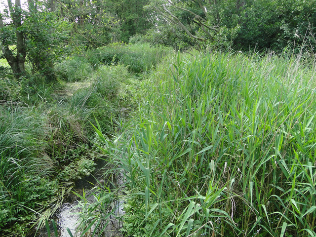
The nearby river, which meanders through the forest, offers a picturesque setting for fishing and boating enthusiasts. Additionally, the area boasts numerous walking trails and picnic spots, providing visitors with the chance to immerse themselves in the beauty of nature.

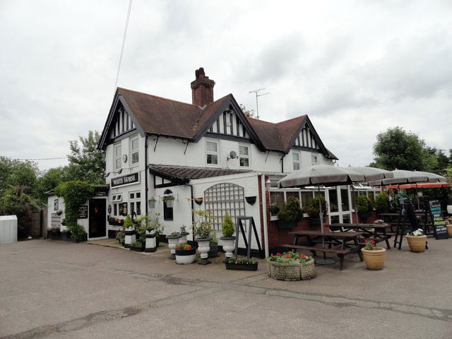
Although Burnt Wood is a small village, it is well-connected to larger towns and cities in Norfolk. The village has a small convenience store and a cozy country pub, where locals and visitors alike can enjoy a drink or a meal.

Overall, Burnt Wood, Norfolk is a charming and idyllic village that offers a peaceful escape into nature, making it a popular destination for those seeking tranquility and natural beauty.

If you have any feedback on the listing, please let us know in the comments section below.

Burnt Wood Images

Images are sourced within 2km of 52.708636/1.3582351 or Grid Reference TG2617. Thanks to Geograph Open Source API. All images are credited.

The White Horse Crostwick Public House on the North Walsham Road
The White Horse Crostwick
Public House on the North Walsham Road
Remains of Horstead Mill On the River Bure.For information board, see <a href="https://www.geograph.org.uk/photo/3133594">TG2619 : Information board for Horstead Mill</a>
Remains of Horstead Mill
On the River Bure.For information board, see TG2619 : Information board for Horstead Mill
Information board for Horstead Mill See <a href="https://www.geograph.org.uk/photo/3133585">TG2619 : Remains of Horstead Mill</a>
Information board for Horstead Mill
River Bure Looking downstream from near Horstead Mill.
River Bure
Looking downstream from near Horstead Mill.
Track through farmland to Water Tower
River Bure
River Bure
Coltishall ROC post Opened in December 1957 on the north side of water tower. All surface features remain intact; the ventilation louvres are missing.  Internally the post is empty and the walls are covered with graffiti. It used to contain cupboards and two single beds. A type-B Orlit post > <a title="https://www.geograph.org.uk/photo/3966742" href="https://www.geograph.org.uk/photo/3966742">Link</a> adjoins it.
Coltishall ROC post
Opened in December 1957 on the north side of water tower. All surface features remain intact; the ventilation louvres are missing. Internally the post is empty and the walls are covered with graffiti. It used to contain cupboards and two single beds. A type-B Orlit post > Link adjoins it.
Coltishall ROC post by Horstead - B Orlit Opened in December 1957 on the north side of water tower. All surface features remain intact; the ventilation louvres are missing > <a title="https://www.geograph.org.uk/photo/3966733" href="https://www.geograph.org.uk/photo/3966733">Link</a>.  Internally the post is empty and the walls are covered with graffiti. It used to contain cupboards and two single beds. The type-B Orlit post seen here adjoins it.
Coltishall ROC post by Horstead - B Orlit
Opened in December 1957 on the north side of water tower. All surface features remain intact; the ventilation louvres are missing > Link. Internally the post is empty and the walls are covered with graffiti. It used to contain cupboards and two single beds. The type-B Orlit post seen here adjoins it.
Coltishall ROC post by Horstead - B Orlit Opened in December 1957 on the north side of water tower. All surface features remain intact; the ventilation louvres are missing > <a title="https://www.geograph.org.uk/photo/3966733" href="https://www.geograph.org.uk/photo/3966733">Link</a>.  Internally the post is empty and the walls are covered with graffiti. It used to contain cupboards and two single beds. The type-B Orlit post seen here adjoins and this is the view from beneath it.
Coltishall ROC post by Horstead - B Orlit
Opened in December 1957 on the north side of water tower. All surface features remain intact; the ventilation louvres are missing > Link. Internally the post is empty and the walls are covered with graffiti. It used to contain cupboards and two single beds. The type-B Orlit post seen here adjoins and this is the view from beneath it.
Layby on the B1150 near Hills and Holes Farm
Frettenham Road approaching Horstead
Council-type houses on Frettenham Road, Horstead
This is supposed to be a drain. Totally choked! It's no wonder all the roads locally have signs 'Liable to Flooding'.
This is supposed to be a drain. Totally choked!
It's no wonder all the roads locally have signs 'Liable to Flooding'.
Hump-back bridge near Old Hall Farm, Crostwick
What remains of Horstead Mill Horstead has had a mill here on the River Bure since Domesday but a fire in 1963 ended 900 years of history. It is now a popular fishing spot for anglers.
The remains of the mill have been consolidated and made safe.
<a title="https://www.geograph.org.uk/photo/4557685" href="https://www.geograph.org.uk/photo/4557685">Link</a>
What remains of Horstead Mill
Horstead has had a mill here on the River Bure since Domesday but a fire in 1963 ended 900 years of history. It is now a popular fishing spot for anglers. The remains of the mill have been consolidated and made safe. Link
Horstead mill-pond on the River Bure <a title="https://www.geograph.org.uk/photo/4557599" href="https://www.geograph.org.uk/photo/4557599">Link</a>
Horstead mill-pond on the River Bure
Show me another place!

Burnt Wood is located at Grid Ref: TG2617 (Lat: 52.708636, Lng: 1.3582351)

Administrative County: Norfolk

District: Broadland

Police Authority: Norfolk

What 3 Words

///marble.sweeper.slurping. Near Coltishall, Norfolk

Related Wikis

Crostwick Marsh

Crostwick Marsh is an 11.6-hectare (29-acre) biological Site of Special Scientific Interest in Crostwick, north of Norwich in Norfolk. It is part of the...
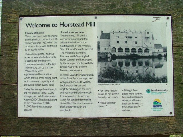
River Hor

The River Hor is a short river in the county of Norfolk, England. It runs 13.3 kilometres (8.3 mi) east from its source near Felthorpe to its confluence...

Crostwick

Crostwick is a village in the English county of Norfolk. The village is part of the civil parish of Horstead with Stanninghall. Crostwick is located 2...

Hillside Animal Sanctuary

Hillside Animal Sanctuary, based in Frettenham, Norwich, and with a site at West Runton, North Norfolk, is the United Kingdom's largest home for different...

Belaugh

Belaugh is a small village (population 105) increasing to 134 at the 2011 Census, that occupies a bend in the River Bure in Norfolk, England - within The...

Coltishall

Coltishall is a village on the River Bure, west of Wroxham, in the English county of Norfolk. The village is located within the Norfolk Broads. == Etymology... ==

Frettenham

Frettenham is a village and civil parish in the English county of Norfolk. It is located 3.2 miles (5.1 km) west of Wroxham, and 5.7 miles (9.2 km) north...

Frettenham Windmill

Frettenham Mill is a Grade II listed tower mill at Frettenham, Norfolk, England which has been converted to residential accommodation. == History == Frettenham...

Have you been to Burnt Wood?

Leave your review of Burnt Wood below (or comments, questions and feedback).