Honeybourne

Civil Parish in Gloucestershire Wychavon

England

Honeybourne

Farm buildings on former RAF Honeybourne Farm buildings in the site of the former RAF Honeybourne airfield.  The airfield opened in December 1940 and was used for training Canadian pilots.  The airfield closed in 1947 and reverted to farmland, though there is an industrial estate on the former site.
Farm buildings on former RAF Honeybourne Credit: Philip Halling

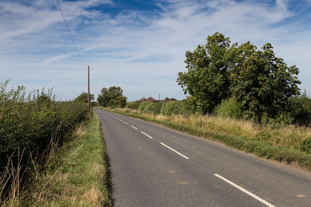
Honeybourne is a small civil parish located in the county of Gloucestershire, in the southwestern region of England. Situated approximately 20 miles south of the city of Worcester, Honeybourne is a quaint village that offers a peaceful and picturesque setting.

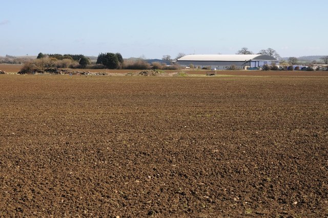
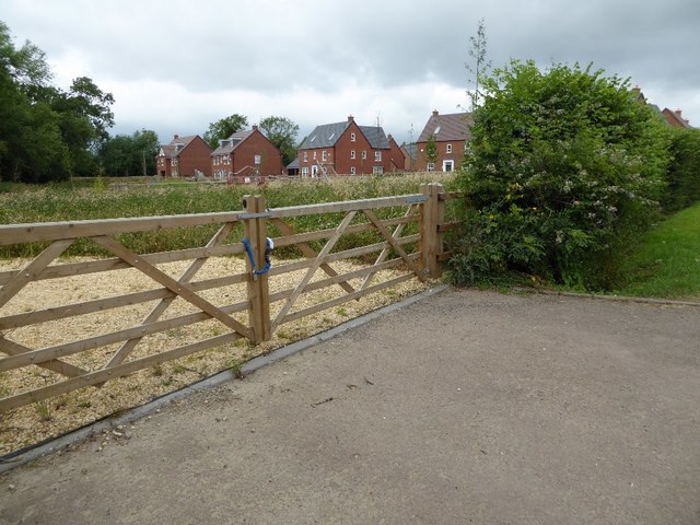
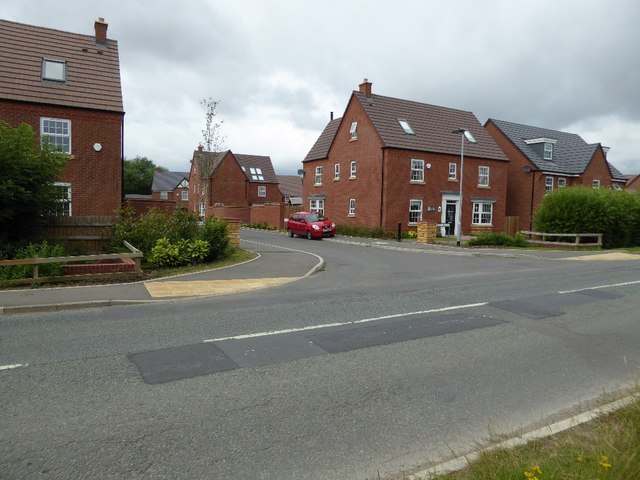
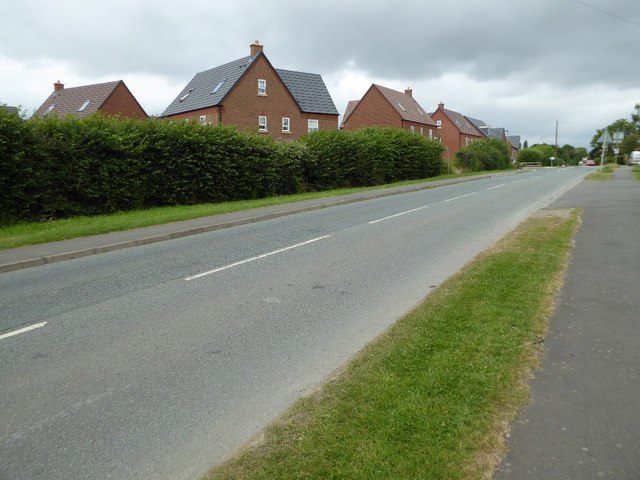
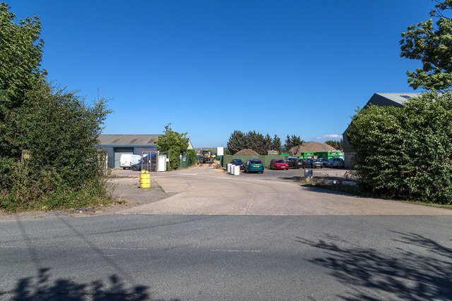
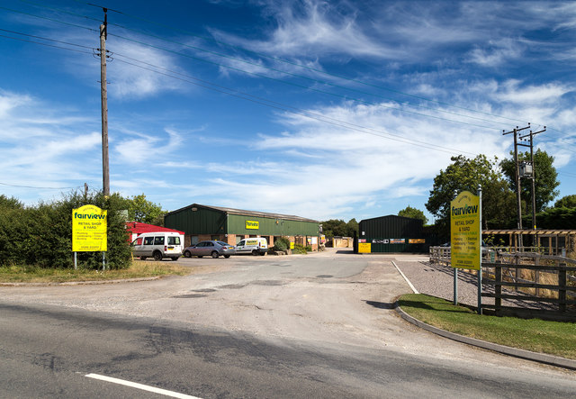
The parish has a population of around 1,500 residents, and its economy is primarily based on agriculture and small local businesses. Honeybourne is surrounded by beautiful countryside, with farmlands and rolling hills dominating the landscape. The village itself is characterized by charming cottages and historic buildings, giving it a traditional English village feel.

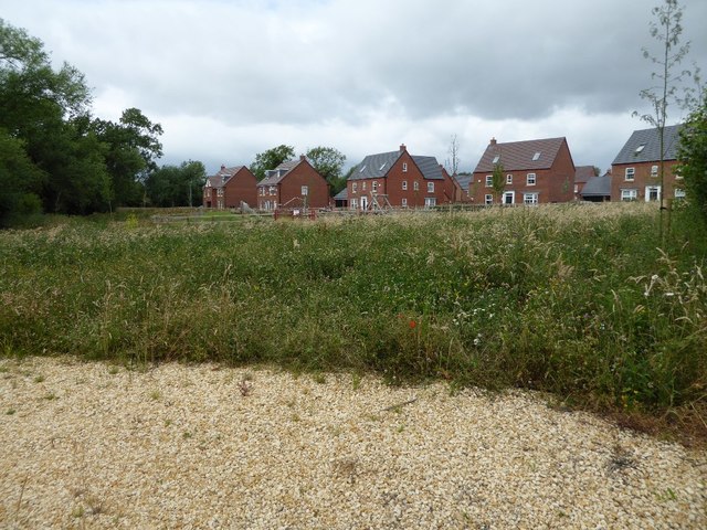
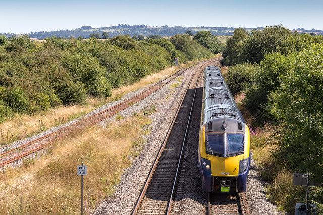
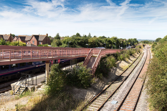
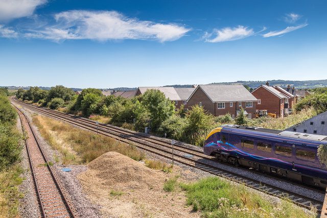
Despite its small size, Honeybourne offers a range of amenities for its residents. There is a primary school, a village hall, a post office, and a local convenience store. The village also has a railway station, which provides easy access to nearby towns and cities.

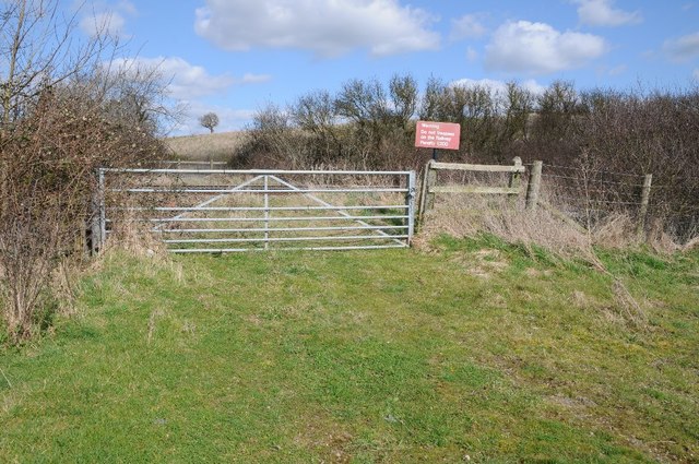
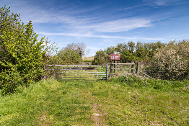
Nature lovers and outdoor enthusiasts will find plenty to enjoy in Honeybourne. The parish is located near the Cotswolds Area of Outstanding Natural Beauty, which offers stunning landscapes and opportunities for walking, hiking, and exploring. Additionally, the nearby River Avon provides opportunities for boating and fishing.

Overall, Honeybourne is a peaceful and idyllic village in Gloucestershire, offering a close-knit community and a beautiful natural environment. It is a place where residents can enjoy a slower pace of life while still having access to essential amenities and nearby attractions.

If you have any feedback on the listing, please let us know in the comments section below.

Honeybourne Images

Images are sourced within 2km of 52.094658/-1.828743 or Grid Reference SP1144. Thanks to Geograph Open Source API. All images are credited.

Farm buildings on former RAF Honeybourne Farm buildings in the site of the former RAF Honeybourne airfield.  The airfield opened in December 1940 and was used for training Canadian pilots.  The airfield closed in 1947 and reverted to farmland, though there is an industrial estate on the former site.
Farm buildings on former RAF Honeybourne
Farm buildings in the site of the former RAF Honeybourne airfield. The airfield opened in December 1940 and was used for training Canadian pilots. The airfield closed in 1947 and reverted to farmland, though there is an industrial estate on the former site.
Industrial estate on former RAF Honeybourne The airfield opened in December 1940 and was used for training Canadian pilots.  The airfield closed in 1947 and reverted to farmland, and this industrial estate on the former site.
Industrial estate on former RAF Honeybourne
The airfield opened in December 1940 and was used for training Canadian pilots. The airfield closed in 1947 and reverted to farmland, and this industrial estate on the former site.
Farm buildings on the former RAF Honeybourne airfield The airfield opened in December 1940 and was used for training Canadian pilots.  The airfield closed in 1947 and reverted to farmland, though there is an industrial estate on the former site.
Farm buildings on the former RAF Honeybourne airfield
The airfield opened in December 1940 and was used for training Canadian pilots. The airfield closed in 1947 and reverted to farmland, though there is an industrial estate on the former site.
Farm buildings on former RAF Honeybourne airfield The airfield opened in December 1940 and was used for training Canadian pilots.  The airfield closed in 1947 and reverted to farmland, though there is an industrial estate on the former site.
Farm buildings on former RAF Honeybourne airfield
The airfield opened in December 1940 and was used for training Canadian pilots. The airfield closed in 1947 and reverted to farmland, though there is an industrial estate on the former site.
Farmland beside Mickleton Road The field inclines to the hedgerow to the left behind which is the Oxford to Worcester railway line.
Farmland beside Mickleton Road
The field inclines to the hedgerow to the left behind which is the Oxford to Worcester railway line.
Farm access crossing Farm access crossing over the Oxford to Worcester railway near Honeybourne.  This crossing appears to be little used compared to when first photographed in 2005 <a href="https://www.geograph.org.uk/photo/180689">SP1344 : Level Crossing</a>.
Farm access crossing
Farm access crossing over the Oxford to Worcester railway near Honeybourne. This crossing appears to be little used compared to when first photographed in 2005 SP1344 : Level Crossing.
Closed level crossing The crossing that was here has been removed and the gate padlocked shut.
Closed level crossing
The crossing that was here has been removed and the gate padlocked shut.
New housing estate in Honeybourne This housing estate has been built on what used to be the site of sheep sales.  See <a href="https://www.geograph.org.uk/photo/1985487">SP1144 : Honeybourne Sheep Sale</a> for a similar view of the same site.
New housing estate in Honeybourne
This housing estate has been built on what used to be the site of sheep sales. See SP1144 : Honeybourne Sheep Sale for a similar view of the same site.
New housing estate in Honeybourne Until recently this was the site of annual sheep sales which took place on this site, see <a href="https://www.geograph.org.uk/photo/1985487">SP1144 : Honeybourne Sheep Sale</a> back in July 2010.
New housing estate in Honeybourne
Until recently this was the site of annual sheep sales which took place on this site, see SP1144 : Honeybourne Sheep Sale back in July 2010.
New houses in Honeybourne These houses have been built recently on a site which used to be the site of annual sheep sales <a href="https://www.geograph.org.uk/photo/1985492">SP1144 : Sheep sale site, Honeybourne</a>.  The roads are named after sheep breeds such as Herdwick and Clun.
New houses in Honeybourne
These houses have been built recently on a site which used to be the site of annual sheep sales SP1144 : Sheep sale site, Honeybourne. The roads are named after sheep breeds such as Herdwick and Clun.
The route of an old Roman Road in Honeybourne This straight road in Honeybourne follows the route of Ryknild Street, a former Roman Road.  The houses behind the hedge are a recent development, built on what was the site of annual sheep sales <a href="https://www.geograph.org.uk/photo/1985492">SP1144 : Sheep sale site, Honeybourne</a>.
The route of an old Roman Road in Honeybourne
This straight road in Honeybourne follows the route of Ryknild Street, a former Roman Road. The houses behind the hedge are a recent development, built on what was the site of annual sheep sales SP1144 : Sheep sale site, Honeybourne.
Entrance to Buckle Mill The entrance to Honeybourne Industrial Estate off Honeybourne Road.
Entrance to Buckle Mill
The entrance to Honeybourne Industrial Estate off Honeybourne Road.
Ploughed field north east of Weston Road Recently ploughed field off the B4035 Weston Road.
Ploughed field north east of Weston Road
Recently ploughed field off the B4035 Weston Road.
Bretforton Road View north west along the road out of Honeybourne.
Bretforton Road
View north west along the road out of Honeybourne.
Fairview Builders Merchants Seen from Buckle Street on the northern edge of Honeybourne village.
Fairview Builders Merchants
Seen from Buckle Street on the northern edge of Honeybourne village.
Train approaches Honeybourne Station A First Great Western train approaches Honeybourne from the ESE.
Taken from the Buckle Street road bridge over the railway.
Train approaches Honeybourne Station
A First Great Western train approaches Honeybourne from the ESE. Taken from the Buckle Street road bridge over the railway.
Honeybourne Station A First Great Western train stands in Honeybourne Station.
Taken from the Buckle Street road bridge over the railway.
Honeybourne Station
A First Great Western train stands in Honeybourne Station. Taken from the Buckle Street road bridge over the railway.
New housing by the station Looking SSE from the Buckle Street road bridge over the railway.
The stationary train pictured is a First Great Western, most of which is standing in the relatively short Honeybourne Station, just the other side of the bridge.
A new housing estate is nearing completion just beyond the railway.
New housing by the station
Looking SSE from the Buckle Street road bridge over the railway. The stationary train pictured is a First Great Western, most of which is standing in the relatively short Honeybourne Station, just the other side of the bridge. A new housing estate is nearing completion just beyond the railway.
Show me another place!

Honeybourne is located at Grid Ref: SP1144 (Lat: 52.094658, Lng: -1.828743)

Administrative County: Worcestershire

District: Wychavon

Police Authority: West Mercia

What 3 Words

///torso.whisk.most. Near Honeybourne, Worcestershire

Nearby Locations

Honeybourne Honeybourne

Related Wikis

Honeybourne

Honeybourne is a village and civil parish about 5 miles (8 km) east of Evesham in Worcestershire, England. Much of the parish is farmland. RAF Honeybourne...

Honeybourne railway station

Honeybourne railway station serves the village of Honeybourne in Worcestershire, England. Opened in 1853, it is on the Cotswold Line and was formerly a...

RAF Honeybourne

Royal Air Force Honeybourne, or more simply RAF Honeybourne, was a Royal Air Force station located 0.6 miles (0.97 km) south of Honeybourne, Worcestershire...

HM Prison Long Lartin

HM Prison Long Lartin is a Category A men's prison, located in the village of South Littleton (near Evesham) in the Wychavon district in Worcestershire...

Nearby Amenities

Located within 500m of 52.094658,-1.828743
Honeybourne
Place: village
Wikidata: Q303559
Lat/Long: 52.0947326/-1.8319572
Honeybourne- Gate
Naptan AtcoCode: 2000G086700
Naptan Bearing: N
Naptan BusStopType: CUS
Naptan CommonName: Honeybourne- Gate
Naptan Indicator: Adj
Naptan Landmark: Gate Inn
Naptan NaptanCode: wocdjpwm
Naptan Street: High Street
Naptan Verified: no
Source: naptan_import
Lat/Long: 52.0944833/-1.8314162
Bus Stop
Honeybourne- Dudley Road
Bench: no
Bin: no
Bus: yes
Naptan AtcoCode: 2000G086900
Naptan Bearing: SW
Naptan BusStopType: CUS
Naptan CommonName: Honeybourne- Dudley Road
Naptan Indicator: Adj
Naptan Landmark: Station Road
Naptan NaptanCode: wocdjpwp
Naptan Street: Dudley Road
Naptan Verified: no
Public Transport: platform
Shelter: yes
Source: naptan_import
Lat/Long: 52.0981825/-1.8306055
Honeybourne- Dudley Road- Grove Ave
Naptan AtcoCode: 2000G086901
Naptan Bearing: NE
Naptan BusStopType: CUS
Naptan CommonName: Honeybourne- Dudley Road- Grove Ave
Naptan Indicator: Adj
Naptan Landmark: Station Road
Naptan NaptanCode: wocdjpwt
Naptan Street: Dudley Road
Naptan Verified: no
Source: naptan_import
Lat/Long: 52.098106/-1.8309792
Gate Inn
Naptan AtcoCode: 2000G323275
Naptan Bearing: SW
Naptan BusStopType: CUS
Naptan CommonName: Gate Inn
Naptan Indicator: opp
Naptan Landmark: Gate Inn
Naptan NaptanCode: wocgjpjp
Naptan Street: High Street
Naptan Verified: no
Source: naptan_import
Lat/Long: 52.094402/-1.8311829
Stratford Road
Naptan AtcoCode: 2000G323277
Naptan Bearing: SW
Naptan BusStopType: CUS
Naptan CommonName: Stratford Road
Naptan Indicator: opp
Naptan Landmark: Station Road
Naptan NaptanCode: wocgjpjt
Naptan Street: Stratford Road
Naptan Verified: no
Source: naptan_import
Lat/Long: 52.0955689/-1.829821
Station Road
Naptan AtcoCode: 2000G323278
Naptan Bearing: E
Naptan BusStopType: CUS
Naptan CommonName: Station Road
Naptan Indicator: opp
Naptan Landmark: Station Road
Naptan NaptanCode: wocgjpjw
Naptan Street: Station Road
Naptan Verified: no
Source: naptan_import
Lat/Long: 52.0957397/-1.8297911
Bus Stop
Honeybourne- Thatched Tavern
Bus: yes
Naptan AtcoCode: 2000G677003
Naptan Bearing: NE
Naptan CommonName: Honeybourne- Thatched Tavern
Naptan Indicator: Adj
Naptan Landmark: Thatched Tavern
Naptan NaptanCode: wocdgwdp
Naptan Street: High St
Naptan Verified: no
Public Transport: platform
Source: naptan_import
Lat/Long: 52.0920156/-1.8343902
Barrier: stile
Lat/Long: 52.0936018/-1.8340909
Defibrillator
Booth: K6
Covered: booth
Defibrillator Location: inside old red phone box, High Street, Honeybourne
Emergency: defibrillator
Indoor: no
Man Made: telephone_box
Ref GB The Circuit: 45865217-3D2F-4E31-ACD5-AE1C00DD671D
Lat/Long: 52.0932229/-1.8325286
Bus Stop
Thatched Tavern
Bus: yes
Naptan AtcoCode: 2000G323274
Naptan Bearing: SW
Naptan CommonName: Thatched Tavern
Naptan Indicator: adj
Naptan Landmark: Thatched Tavern Inn
Naptan NaptanCode: wocgjpjm
Naptan Street: High Street
Naptan Verified: no
Public Transport: platform
Shelter: no
Source: naptan_import
Lat/Long: 52.0919152/-1.8344654
Church Honeybourne
Place: locality
Lat/Long: 52.0971535/-1.8269685
Post Box
Collection Times: Mo-Fr 16:15; Sa 09:30; Su off
Post Box Type: lamp
Ref: WR11 24
Royal Cypher: EIIR
Royal Cypher Wikidata: Q33102113
Lat/Long: 52.0963276/-1.8268822
Barrier: stile
Lat/Long: 52.0980176/-1.8266522
Barrier: stile
Lat/Long: 52.0945152/-1.8258331
Barrier: stile
Lat/Long: 52.0957634/-1.8259852
Barrier: stile
Lat/Long: 52.0957133/-1.8264671
Barrier: stile
Lat/Long: 52.097216/-1.8237278
Barrier: stile
Lat/Long: 52.0970524/-1.8236816
Barrier: stile
Material: wood
Stile: stepover
Lat/Long: 52.09131/-1.8275697
Barrier: stile
Lat/Long: 52.0916894/-1.8301235
Barrier: stile
Lat/Long: 52.0945336/-1.8215779
Barrier: stile
Lat/Long: 52.0945005/-1.8219299
Barrier: stile
Lat/Long: 52.0945127/-1.8239335
Bus Stop
Bus: yes
Public Transport: platform
Lat/Long: 52.0990535/-1.8277821
Post Office
Honeybourne Post Office
Addr Country: GB
Addr Postcode: WR11 7PP
Branch: Honeybourne
Brand: Post Office
Brand Wikidata: Q1783168
Check Date: 2020-02-20
Contact Website: https://www.postoffice.co.uk/branch-finder/4594584/honeybourne
Ref Pol Id: 124343
Lat/Long: 52.0965171/-1.8272188
Cafe
Speckled Hen Cafe
Lat/Long: 52.0974842/-1.8326725
Bench
Backrest: yes
Lat/Long: 52.0949815/-1.8308946
Bench
Backrest: yes
Lat/Long: 52.095115/-1.8310126
Defibrillator
Defibrillator Location: On the outside wall of the Honeybourne Stores, facing the Stratford Road.
Emergency: defibrillator
Ref GB The Circuit: ACBDB7F4-9209-42CB-AD8B-AF4F0149EF0E
Lat/Long: 52.0964684/-1.8270998
Post Box
Collection Times: Mo-Fr 09:00; Sa 07:00
Post Box Type: lamp
Ref: WR11 159D
Royal Cypher: EIIR
Royal Cypher Wikidata: Q33102113
Lat/Long: 52.0932792/-1.8324168
Noexit: yes
Lat/Long: 52.0912147/-1.8304179
Generator Method: photovoltaic
Generator Output Electricity: yes
Generator Source: solar
Generator Type: solar_photovoltaic_panel
Location: roof
Power: generator
Lat/Long: 52.098452/-1.831474
Generator Method: photovoltaic
Generator Output Electricity: yes
Generator Source: solar
Generator Type: solar_photovoltaic_panel
Location: roof
Power: generator
Lat/Long: 52.0987716/-1.8288454
Generator Method: photovoltaic
Generator Output Electricity: yes
Generator Source: solar
Generator Type: solar_photovoltaic_panel
Location: roof
Power: generator
Lat/Long: 52.0988952/-1.8286362
Generator Method: photovoltaic
Generator Output Electricity: yes
Generator Source: solar
Generator Type: solar_photovoltaic_panel
Location: roof
Power: generator
Lat/Long: 52.0985772/-1.8278128
Generator Method: photovoltaic
Generator Output Electricity: yes
Generator Source: solar
Generator Type: solar_photovoltaic_panel
Location: roof
Power: generator
Lat/Long: 52.0977781/-1.8296555
Generator Method: photovoltaic
Generator Output Electricity: yes
Generator Source: solar
Generator Type: solar_photovoltaic_panel
Location: roof
Power: generator
Lat/Long: 52.097404/-1.8288213
Generator Method: photovoltaic
Generator Output Electricity: yes
Generator Source: solar
Generator Type: solar_photovoltaic_panel
Location: roof
Power: generator
Lat/Long: 52.0972887/-1.8289849
Generator Method: photovoltaic
Generator Output Electricity: yes
Generator Source: solar
Generator Type: solar_photovoltaic_panel
Location: roof
Power: generator
Lat/Long: 52.0948483/-1.8295804
Generator Method: photovoltaic
Generator Output Electricity: yes
Generator Source: solar
Generator Type: solar_photovoltaic_panel
Location: roof
Power: generator
Lat/Long: 52.0949126/-1.8292397
Generator Method: photovoltaic
Generator Output Electricity: yes
Generator Source: solar
Generator Type: solar_photovoltaic_panel
Location: roof
Power: generator
Lat/Long: 52.0949851/-1.8289393
Generator Method: photovoltaic
Generator Output Electricity: yes
Generator Source: solar
Generator Type: solar_photovoltaic_panel
Location: roof
Power: generator
Lat/Long: 52.0953229/-1.8309054
Generator Method: photovoltaic
Generator Output Electricity: yes
Generator Source: solar
Generator Type: solar_photovoltaic_panel
Location: roof
Power: generator
Lat/Long: 52.0952767/-1.8308303
Crossing
Crossing: unmarked
Crossing Island: no
Tactile Paving: yes
Lat/Long: 52.0924958/-1.8306987
Noexit: yes
Lat/Long: 52.092503/-1.8322015
Noexit: yes
Lat/Long: 52.091066/-1.8313044
Bella Hair
Addr Housenumber: 34A
Addr Street: High Street
Description: Unisex Salon
Phone: +44 1386 833470
Shop: hairdresser
Lat/Long: 52.0929006/-1.8329204
Addr Housenumber: 34B
Addr Street: High Street
Lat/Long: 52.0929161/-1.8329051
Crossing
Crossing: unmarked
Crossing Island: no
Tactile Paving: yes
Lat/Long: 52.096152/-1.8315297
Board Type: notice
Information: board
Operator: Honeybourne Parish Council
Tourism: information
Lat/Long: 52.0963498/-1.8271007
Board Type: notice
Information: board
Operator: St Ecgwin's Chuch
Tourism: information
Lat/Long: 52.0960039/-1.8272777
Restaurant
Moubourne
Cuisine: indian
Note: Appears to be part of the Gate Inn pub
Phone: +44 1386 833323
Website: https://moubourneorder.co.uk/
Lat/Long: 52.0946974/-1.8304866
Defibrillator
Emergency: defibrillator
Outdoor: yes
Ref GB The Circuit: BA7ED932-E98B-46F3-81B7-AE3000C30206
Lat/Long: 52.0927479/-1.8310616
Grit Bin
Lat/Long: 52.0924983/-1.8312756
Board Type: notice
Information: board
Tourism: information
Lat/Long: 52.0925012/-1.8312959
Generator Method: photovoltaic
Generator Output Electricity: yes
Generator Source: solar
Generator Type: solar_photovoltaic_panel
Location: roof
Power: generator
Lat/Long: 52.0926403/-1.8308859
Generator Method: photovoltaic
Generator Output Electricity: yes
Generator Source: solar
Generator Type: solar_photovoltaic_panel
Location: roof
Power: generator
Lat/Long: 52.0926432/-1.830768
Bench
Backrest: yes
Colour: #6c6060
Material: plastic
Lat/Long: 52.0973808/-1.8317318
Crossing
Crossing: marked
Crossing Island: no
Tactile Paving: yes
Lat/Long: 52.0960472/-1.831335
Barrier: kissing_gate
Bicycle: no
Foot: yes
Horse: no
Motor Vehicle: no
Lat/Long: 52.0947014/-1.826738
Grit Bin
Colour: yellow
Lat/Long: 52.0967371/-1.8320105
Entrance: yes
Lat/Long: 52.0974828/-1.832621
Weston Road
Power: transformer
Transformer: distribution
Voltage Primary: 11000
Lat/Long: 52.0928898/-1.8313774
Power: pole
Lat/Long: 52.0916481/-1.8234958
Power: pole
Lat/Long: 52.0921779/-1.8247631
Power: pole
Lat/Long: 52.0926649/-1.8259554
Power: pole
Lat/Long: 52.0930414/-1.8269075
Perrie Drive
Power: transformer
Transformer: distribution
Voltage Primary: 11000
Lat/Long: 52.0984334/-1.8296689
Westbourne
Power: transformer
Transformer: distribution
Voltage Primary: 11000
Lat/Long: 52.0982565/-1.826525
Location Transition: yes
Power: pole
Lat/Long: 52.0980129/-1.8252245
Power: pole
Lat/Long: 52.0980685/-1.8249073
Power: pole
Lat/Long: 52.0979222/-1.8244164
Power: pole
Lat/Long: 52.097605/-1.8236265
Power: pole
Lat/Long: 52.0964994/-1.8228648
Power: pole
Lat/Long: 52.0960751/-1.8233174
Power: pole
Lat/Long: 52.0953909/-1.8227421
Power: pole
Lat/Long: 52.0956471/-1.8237687
Power: pole
Lat/Long: 52.0952149/-1.8242173
Power: pole
Transformer: distribution
Voltage Primary: 11000
Lat/Long: 52.0950609/-1.8243957
Power: pole
Lat/Long: 52.0946769/-1.8248945
Power: pole
Lat/Long: 52.0941991/-1.8257944
Power: pole
Lat/Long: 52.0937624/-1.8265937
Church Honeybourne
Power: pole
Transformer: distribution
Voltage Primary: 11000
Lat/Long: 52.0945628/-1.8292384
Power: pole
Lat/Long: 52.0944483/-1.8292793
Power: pole
Lat/Long: 52.0936602/-1.8277431
Power: pole
Lat/Long: 52.0938196/-1.8281621
Power: pole
Lat/Long: 52.0942592/-1.8293376
Power: pole
Lat/Long: 52.0943029/-1.8301396
Cow Honeybourne
Location Transition: yes
Power: pole
Transformer: distribution
Voltage Primary: 11000
Lat/Long: 52.0937517/-1.8336895
Power: pole
Lat/Long: 52.0939997/-1.8351044
Shop: gift
Lat/Long: 52.0973943/-1.8327161
The data included in this document is from www.openstreetmap.org. The data is made available under ODbL.

Have you been to Honeybourne?

Leave your review of Honeybourne below (or comments, questions and feedback).