Hollinsclough

Civil Parish in Staffordshire Staffordshire Moorlands

England

Hollinsclough

View over Stoop Farm
View over Stoop Farm Credit: David Martin

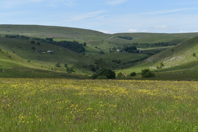
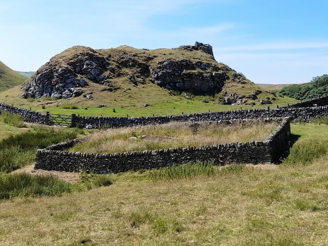
Hollinsclough is a small civil parish located in the Staffordshire Moorlands district of Staffordshire, England. It is situated in the heart of the Peak District National Park, surrounded by stunning natural beauty and picturesque landscapes. The parish covers an area of approximately 1.9 square miles and has a population of around 200 residents.

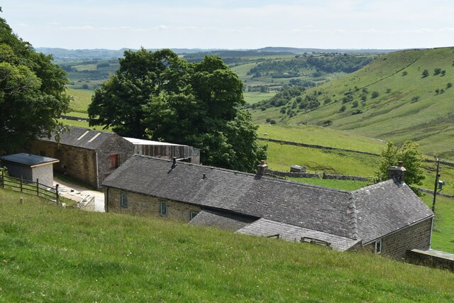
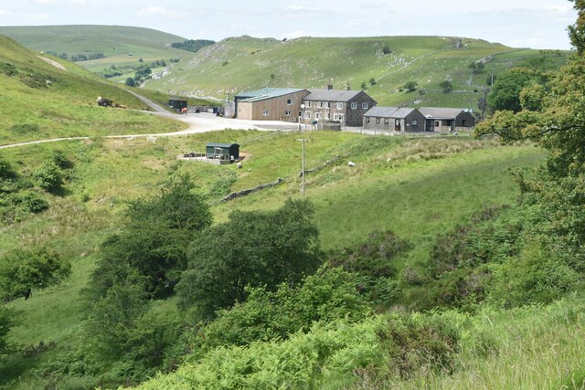
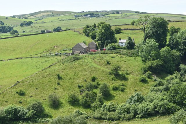
The village of Hollinsclough itself is a charming and tranquil rural settlement. It features a collection of stone-built cottages, farmhouses, and agricultural buildings, giving it a traditional and rustic feel. The village is nestled in a valley, surrounded by rolling hills and lush green fields.

Although small in size, Hollinsclough boasts a strong sense of community spirit. It has a village hall, which serves as a hub for local events and gatherings. The hall provides a space for various activities, including community meetings, social events, and recreational activities.

The parish is primarily an agricultural area, with farming being the predominant occupation. The fertile land in the area supports livestock farming, mainly sheep and cattle. Additionally, there are several small-scale businesses and enterprises that contribute to the local economy.

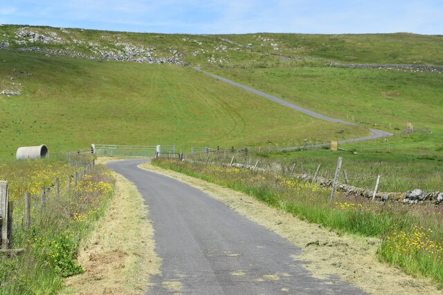
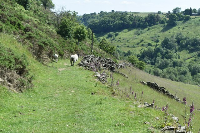
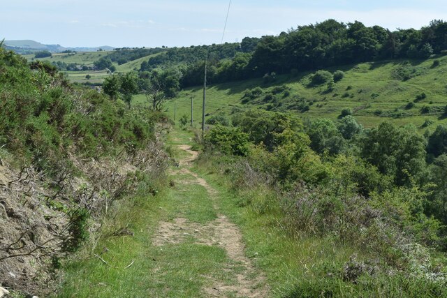
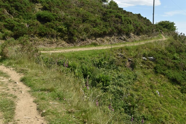
Hollinsclough is a haven for outdoor enthusiasts and nature lovers. It offers numerous opportunities for walking, hiking, and exploring the surrounding countryside. The nearby River Dove is a popular spot for fishing and attracts anglers from far and wide.

Overall, Hollinsclough is a charming and idyllic rural parish, offering a peaceful and scenic retreat for residents and visitors alike.

If you have any feedback on the listing, please let us know in the comments section below.

Hollinsclough Images

Images are sourced within 2km of 53.197602/-1.923759 or Grid Reference SK0566. Thanks to Geograph Open Source API. All images are credited.

View over Stoop Farm
Chrome Hill from path near Stoop Farm
Road from Booth Farm
Valley view north of Booth Farm
View towards Booth Farm
Cross-valley view towards Leycote
Path descending from Fough towards Hollinsclough
Bend in path below Fough The path takes a diversion here around a gulley.
Bend in path below Fough
The path takes a diversion here around a gulley.
Chapel and Old Vicarage, Hollinsclough
View towards High Wheeldon
View across Hollins Farm to Chrome Hill
Reservoir at Tor Rock Fed from a nearby spring.
Reservoir at Tor Rock
Fed from a nearby spring.
Footpath and steps A well built set of steps to gain access to the footpath.
Footpath and steps
A well built set of steps to gain access to the footpath.
Field wall and stile The footpath down to Ball Bank.
Field wall and stile
The footpath down to Ball Bank.
Resting animals All the grazing animals are resting except one.
Resting animals
All the grazing animals are resting except one.
Footpath and stile This stile appears to be ready for some maintenance.
Footpath and stile
This stile appears to be ready for some maintenance.
Grazing cattle Grazing cattle and a derelict stone enclosure.
Grazing cattle
Grazing cattle and a derelict stone enclosure.
Show me another place!

Hollinsclough is located at Grid Ref: SK0566 (Lat: 53.197602, Lng: -1.923759)

Administrative County: Staffordshire

District: Staffordshire Moorlands

Police Authority: Staffordshire

What 3 Words

///swooning.dizzy.heap. Near Buxton, Derbyshire

Related Wikis

Hollinsclough

Hollinsclough is a small rural village in the county of Staffordshire in the English Midlands. It is within the Peak District National Park. == Location... ==

Hollins Hill

Hollins Hill is a gritstone hill in the Derbyshire Peak District near the village of Hollinsclough. The summit is 450 metres (1,480 ft) above sea level...

Chrome Hill

Chrome Hill is a limestone reef knoll in Derbyshire, England, in the upper Dove valley beside the border with Staffordshire, within the civil parish...

High Edge

High Edge is a limestone hill overlooking Harpur Hill, Buxton in Derbyshire, in the Peak District. The summit is 472 metres (1,549 ft) above sea level...

Nearby Amenities

Located within 500m of 53.197602,-1.923759
Ele: 378.0000000
Lat/Long: 53.1964103/-1.9177136
Ele: 343.0000000
Lat/Long: 53.1968336/-1.9220164
Barrier: stile
Ele: 343.0000000
Material: stone
Source: survey;gps
Stile: squeezer
Lat/Long: 53.1968315/-1.9219794
Ele: 370.0000000
Lat/Long: 53.1964727/-1.9187769
Ele: 369.0000000
Lat/Long: 53.1963542/-1.9188843
Barrier: stile
Ele: 369.0000000
Material: wood
Source: survey;gps
Steps: 2
Stile: stepover
Lat/Long: 53.196346/-1.9190612
Barrier: stile
Ele: 365.0000000
Material: wood
Source: survey;gps
Steps: 1
Stile: stepover
Lat/Long: 53.1963554/-1.9194801
Ele: 363.0000000
Lat/Long: 53.1963967/-1.9196244
Ele: 348.0000000
Lat/Long: 53.1967169/-1.921046
Ele: 360.0000000
Lat/Long: 53.1968214/-1.9230658
Barrier: stile
Ele: 364.0000000
Material: stone
Source: survey;gps
Stile: stepover
Lat/Long: 53.1967803/-1.9232209
Ele: 388.0000000
Lat/Long: 53.1960917/-1.9283835
Ele: 396.0000000
Lat/Long: 53.196179/-1.9292977
Ele: 371.0000000
Lat/Long: 53.1970334/-1.9252091
Ele: 370.0000000
Lat/Long: 53.1972409/-1.9257457
Ele: 378.0000000
Lat/Long: 53.1972098/-1.9266116
Ele: 387.0000000
Lat/Long: 53.1966122/-1.9277242
Barrier: cattle_grid
Ele: 389.0000000
Lat/Long: 53.1963193/-1.928159
Ele: 389.0000000
Lat/Long: 53.1963147/-1.928157
Barrier: cattle_grid
Ele: 396.0000000
Lat/Long: 53.1961846/-1.9291875
Ele: 368.0000000
Lat/Long: 53.1969756/-1.924526
Barrier: stile
Material: stone
Source: survey;gps
Stile: stepover
Lat/Long: 53.1969424/-1.924608
Ele: 370.0000000
Lat/Long: 53.1969579/-1.9249439
Ele: 370.0000000
Lat/Long: 53.1985787/-1.9301838
Ele: 363.0000000
Lat/Long: 53.199461/-1.9303287
Barrier: stile
Material: stone
Source: survey;gps
Stile: stepover
Lat/Long: 53.1999541/-1.9209754
Barrier: stile
Lat/Long: 53.2001341/-1.9200696
Barrier: stile
Material: stone
Source: survey;bing
Steps: 3
Stile: stepover
Lat/Long: 53.2009665/-1.9241135
Barrier: stile
Steps: 1
Stile: stepover
Lat/Long: 53.2009749/-1.9241077
Barrier: entrance
Source: survey;gps
Lat/Long: 53.1960344/-1.9237743
Barrier: stile
Material: stone
Source: survey;gps
Stile: squeezer
Lat/Long: 53.1962999/-1.9169006
Barrier: stile
Material: stone
Source: survey;gps
Stile: squeezer
Lat/Long: 53.1970252/-1.9254428
Barrier: stile
Material: wood
Source: survey;gps
Stile: stepover
Lat/Long: 53.1956494/-1.9298488
Barrier: stile
Material: steel
Source: survey;gps
Stile: squeezer
Lat/Long: 53.1966118/-1.9307161
Barrier: stile
Material: wood
Source: survey;gps
Stile: stepover
Lat/Long: 53.1954128/-1.9302704
Barrier: entrance
Source: survey;gps
Lat/Long: 53.1982102/-1.9294514
Barrier: stile
Material: wood
Source: survey;gps
Stile: stepover
Lat/Long: 53.1986458/-1.9301726
Barrier: stile
Material: stone
Source: survey;gps
Stile: squeezer
Lat/Long: 53.1977581/-1.9265337
Barrier: stile
Material: wood
Source: survey;gps
Stile: stepover
Lat/Long: 53.1994113/-1.9231837
Barrier: stile
Material: wood
Source: survey;gps
Stile: stepover
Lat/Long: 53.2007994/-1.9240532
Edge Top Farm
Place: farm
Lat/Long: 53.1940851/-1.9280523
The data included in this document is from www.openstreetmap.org. The data is made available under ODbL.

Have you been to Hollinsclough?

Leave your review of Hollinsclough below (or comments, questions and feedback).