Hollinsclough Moor

Downs, Moorland in Staffordshire Staffordshire Moorlands

England

Hollinsclough Moor

Parkhouse and Chrome Hills Looking southwest through the Parkhouse and Chrome Hills, near Earl Sterndale in the Derbyshire Peak District.

- image by Phil Brandon Hunter - philbhu.com - P1060685A
Parkhouse and Chrome Hills Credit: Phil Brandon Hunter

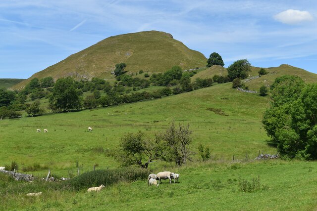
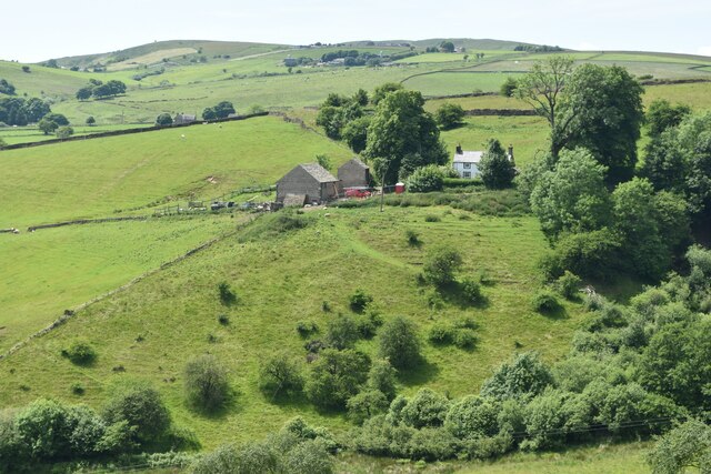
Hollinsclough Moor is a picturesque area located in the Staffordshire Moorlands district of Staffordshire, England. Situated near the village of Hollinsclough, the moorland covers an expanse of approximately 2.5 square kilometers.

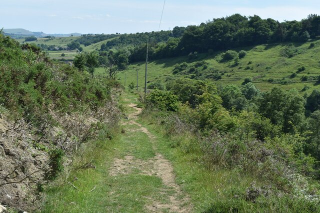
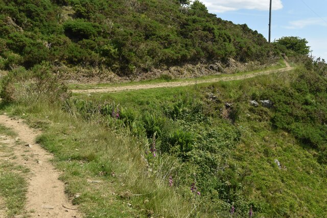
Characterized by its rolling hills, heather-covered moorland, and rocky outcrops, Hollinsclough Moor offers visitors a stunning natural landscape to explore. The terrain is predominantly upland with a mixture of peat bog and rocky areas, providing a diverse habitat for various plant and animal species.

The moorland is home to a wide range of wildlife, including birds such as curlews, lapwings, and golden plovers. Visitors may also spot mammals such as hares, rabbits, and foxes roaming the area. The diverse flora includes heather, bracken, and cotton grass, which add to the moor's scenic beauty.

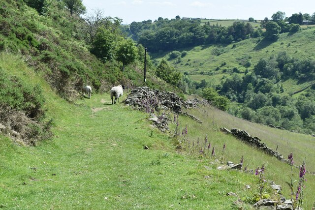
Hollinsclough Moor is a popular destination for hikers, nature enthusiasts, and photographers due to its tranquil atmosphere and stunning panoramic views. There are several walking trails and footpaths that allow visitors to explore the area, providing an opportunity to connect with nature and enjoy the peaceful surroundings.

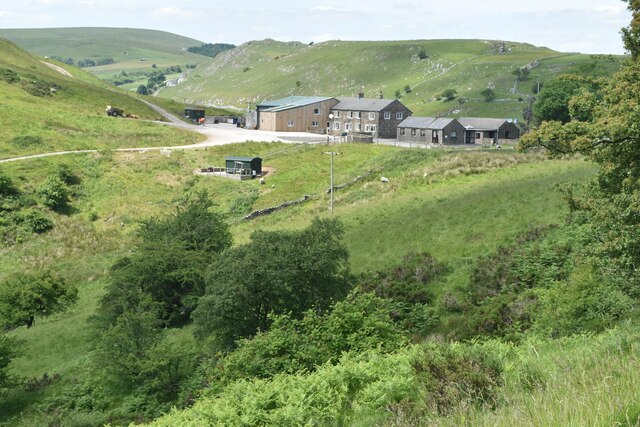
In addition to its natural beauty, the moorland also holds historical significance. It is believed that the area was once used for lead mining, as evidenced by the remains of mining shafts and spoil heaps that can still be found scattered across the landscape.

Overall, Hollinsclough Moor offers a unique and captivating experience for those seeking to immerse themselves in the natural beauty of Staffordshire's countryside.

If you have any feedback on the listing, please let us know in the comments section below.

Hollinsclough Moor Images

Images are sourced within 2km of 53.192314/-1.9124629 or Grid Reference SK0566. Thanks to Geograph Open Source API. All images are credited.

Parkhouse and Chrome Hills Looking southwest through the Parkhouse and Chrome Hills, near Earl Sterndale in the Derbyshire Peak District.

- image by Phil Brandon Hunter - philbhu.com - P1060685A
Parkhouse and Chrome Hills
Looking southwest through the Parkhouse and Chrome Hills, near Earl Sterndale in the Derbyshire Peak District. - image by Phil Brandon Hunter - philbhu.com - P1060685A
Hollinsclough Derbyshire Peaks The view northeast from south of Hollinsclough village, Derbyshire Peak District

- image by Phil Brandon Hunter - philbhu.com - P7230099A
Hollinsclough Derbyshire Peaks
The view northeast from south of Hollinsclough village, Derbyshire Peak District - image by Phil Brandon Hunter - philbhu.com - P7230099A
Hollinsclough Derbyshire Peaks Chrome Hill and Parkhouse Hill from the southwest, viewed from  southeast of Hollinsclough village

- image by Phil Brandon Hunter - philbhu.com - P7230106A
Hollinsclough Derbyshire Peaks
Chrome Hill and Parkhouse Hill from the southwest, viewed from southeast of Hollinsclough village - image by Phil Brandon Hunter - philbhu.com - P7230106A
Chrome Hill
Chrome Hill
Cattle grid south of Dowall Hall In the pass between Chrome Hill and Parkhouse Hill.
Cattle grid south of Dowall Hall
In the pass between Chrome Hill and Parkhouse Hill.
View along the ridge of Chrome Hill to Parkhouse Hill Along the “dragon’s back” of these two limestone reef knolls.
View along the ridge of Chrome Hill to Parkhouse Hill
Along the “dragon’s back” of these two limestone reef knolls.
The Dove Valley from the summit of Chrome Hill Parkhouse Hill on the left.
The Dove Valley from the summit of Chrome Hill
Parkhouse Hill on the left.
Chrome Hill from path near Stoop Farm
View towards Booth Farm
Cross-valley view towards Leycote
Path descending from Fough towards Hollinsclough
Bend in path below Fough The path takes a diversion here around a gulley.
Bend in path below Fough
The path takes a diversion here around a gulley.
Chapel and Old Vicarage, Hollinsclough
View towards High Wheeldon
View across Hollins Farm to Chrome Hill
Chrome Hill
Chrome Hill
Riverside track with Parkhouse Hill beyond
Show me another place!

Hollinsclough Moor is located at Grid Ref: SK0566 (Lat: 53.192314, Lng: -1.9124629)

Administrative County: Staffordshire

District: Staffordshire Moorlands

Police Authority: Staffordshire

What 3 Words

///highs.mistaking.sound. Near Buxton, Derbyshire

Related Wikis

Hollinsclough

Hollinsclough is a small rural village in the county of Staffordshire in the English Midlands. It is within the Peak District National Park. == Location... ==

Chrome Hill

Chrome Hill is a limestone reef knoll in Derbyshire, England, in the upper Dove valley beside the border with Staffordshire, within the civil parish...

Hollins Hill

Hollins Hill is a gritstone hill in the Derbyshire Peak District near the village of Hollinsclough. The summit is 450 metres (1,480 ft) above sea level...

Parkhouse Hill

Parkhouse Hill is a small but distinctive hill in the Peak District National Park of the Hartington Middle Quarter civil parish, in the English county...

High Edge

High Edge is a limestone hill overlooking Harpur Hill, Buxton in Derbyshire, in the Peak District. The summit is 472 metres (1,549 ft) above sea level...

Fawfieldhead

Fawfieldhead is a civil parish in Staffordshire, England. It is situated north-east of Leek and south of Buxton, in the Peak District National Park....

St Bartholomew's Church, Longnor

The Church of St Bartholomew is a Grade II* listed Anglican church in the village of Longnor in north-east Staffordshire. It was built in the late 18th...

Earl Sterndale

Earl Sterndale is a village in the Upper Dove Valley in the Peak District, Derbyshire, England, situated near the River Dove, 5 miles south of Buxton,...

Nearby Amenities

Located within 500m of 53.192314,-1.9124629
Ele: 413.0000000
Lat/Long: 53.1894631/-1.9182153
Bench
Ele: 369.0000000
Lat/Long: 53.1903469/-1.9093386
Ele: 369.0000000
Tourism: information
Lat/Long: 53.1904048/-1.9093654
Ele: 367.0000000
Lat/Long: 53.1902292/-1.9095695
Ele: 368.0000000
Lat/Long: 53.1900826/-1.9096256
Barrier: stile
Ele: 375.0000000
Steps: 2
Stile: stepover
Lat/Long: 53.1889331/-1.9105392
Barrier: stile
Material: wood
Source: survey
Stile: ladder
Lat/Long: 53.1919522/-1.9074454
Barrier: stile
Material: wood
Source: survey
Stile: ladder
Lat/Long: 53.192362/-1.9065859
Barrier: cattle_grid
Bicycle: yes
Foot: yes
Motorcar: yes
Lat/Long: 53.1927177/-1.9069833
Barrier: stile
Material: stone
Source: survey;gps
Stile: squeezer
Lat/Long: 53.1960425/-1.9150993
Barrier: block
Lat/Long: 53.1935636/-1.9081142
Man Made: utility_pole
Lat/Long: 53.1935009/-1.9086603
Power: pole
Lat/Long: 53.1930069/-1.9085878
Man Made: utility_pole
Lat/Long: 53.1927026/-1.9089328
Man Made: utility_pole
Lat/Long: 53.1924185/-1.9092726
The data included in this document is from www.openstreetmap.org. The data is made available under ODbL.

Have you been to Hollinsclough Moor?

Leave your review of Hollinsclough Moor below (or comments, questions and feedback).