Hindlip
Civil Parish in Worcestershire Wychavon
England
Hindlip

Hindlip is a civil parish located in the county of Worcestershire, England. Situated about 4 miles northeast of the city of Worcester, it covers an area of approximately 3 square miles. The parish is nestled in the picturesque countryside, surrounded by rolling hills and fields, offering stunning views of the Malvern Hills in the distance.
The village of Hindlip itself is small and charming, with a population of around 200 residents. It is primarily a residential area, with a scattering of traditional cottages and modern houses. The parish is known for its peaceful and tranquil atmosphere, making it an ideal place for those seeking a quiet countryside retreat.
Despite its small size, Hindlip has a rich history. The Hindlip Hall, a Grade II listed country house, is a prominent feature in the area. Built in the early 18th century, it boasts a beautiful Georgian architecture and is surrounded by well-maintained gardens. The hall has served as a residence for various notable families throughout the years and is now privately owned.
Nature enthusiasts will find plenty to explore in Hindlip. The parish is home to various wildlife and offers ample opportunities for walking, hiking, and birdwatching. The nearby Hindlip Hills Nature Reserve is a popular spot for outdoor activities, with its diverse flora and fauna.
Overall, Hindlip is a quaint and idyllic parish that offers a peaceful countryside living experience while still being within easy reach of nearby amenities and attractions.
If you have any feedback on the listing, please let us know in the comments section below.
Hindlip Images
Images are sourced within 2km of 52.224464/-2.165382 or Grid Reference SO8858. Thanks to Geograph Open Source API. All images are credited.


Hindlip is located at Grid Ref: SO8858 (Lat: 52.224464, Lng: -2.165382)
Administrative County: Worcestershire
District: Wychavon
Police Authority: West Mercia
What 3 Words
///redouble.above.unrealistic. Near Fernhill Heath, Worcestershire
Nearby Locations
Related Wikis
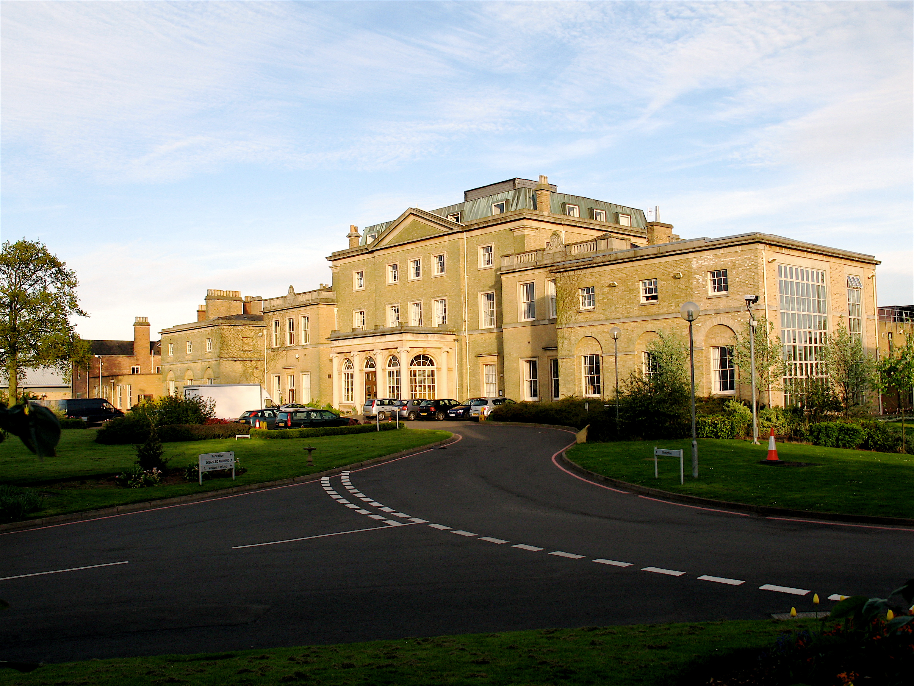
Hindlip Hall
Hindlip Hall is a stately home in Hindlip, Worcestershire, England. The first major hall was built before 1575, and it played a significant role in both...
Hindlip
Hindlip or Hinlip is a village and civil parish 3 miles (4.8 km) north east of Worcester, in the Wychavon district, in the county of Worcestershire, England...
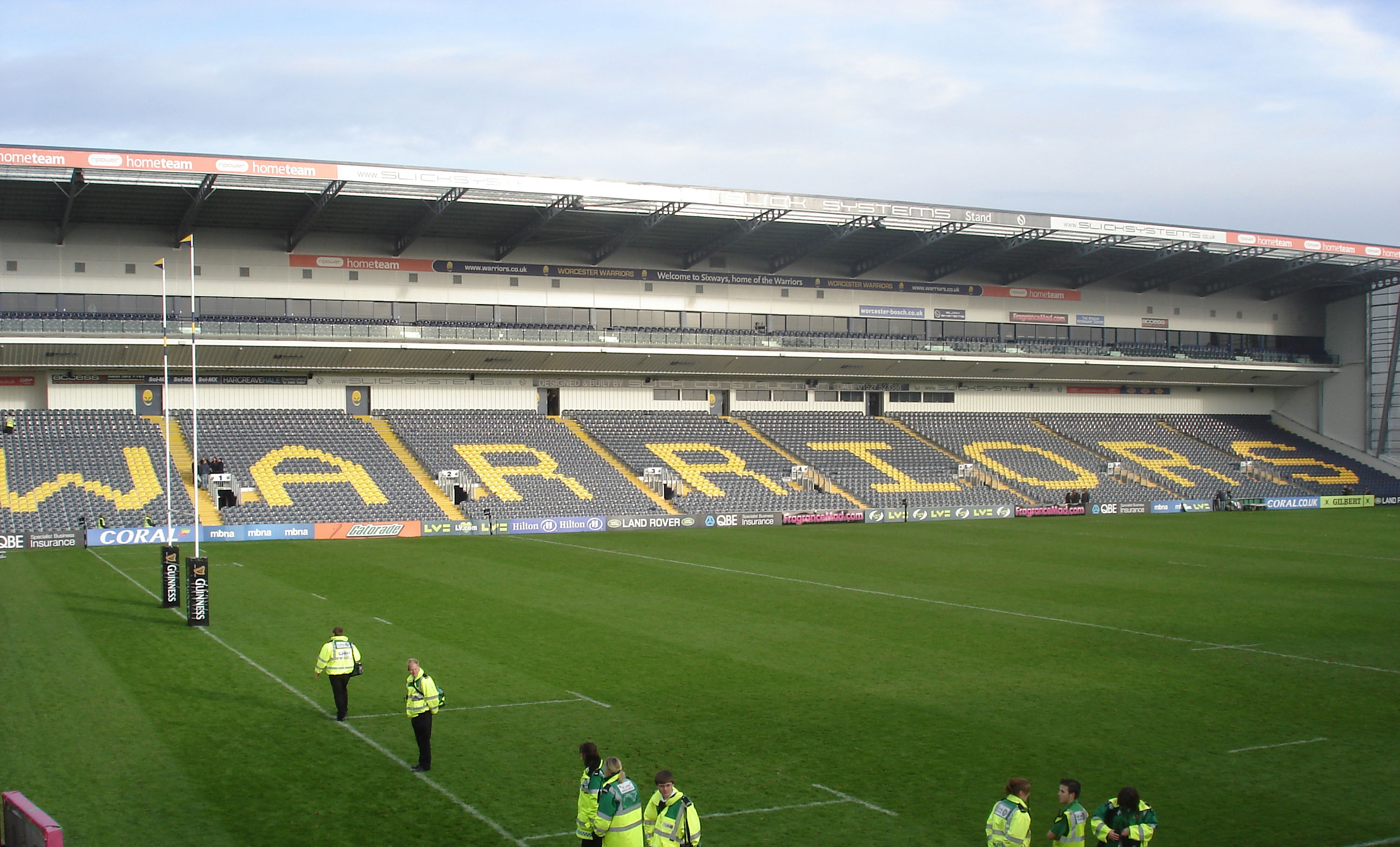
Sixways Stadium
Sixways Stadium is a stadium in Worcester, England. It is currently used for rugby union and association football matches and is the home stadium of Premier...

Worcester Raiders F.C.
Worcester Raiders Football Club is a football club based in Worcester, Worcestershire, England. They are currently members of the Hellenic League Premier...
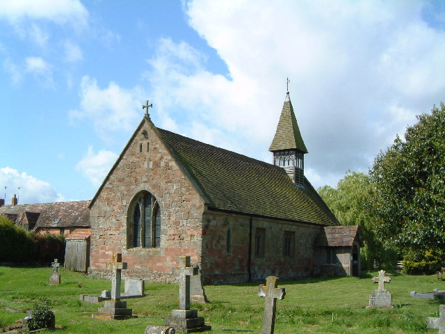
Church of St Michael and All Angels, Martin Hussingtree
The Church of St Michael and All Angels is a Grade I listed church in Martin Hussingtree, Worcestershire.The west wall is probably of 12th century origin...
Martin Hussingtree
Martin Hussingtree is a small village situated between Droitwich Spa and Worcester in the county of Worcestershire, England. It is north of another village...
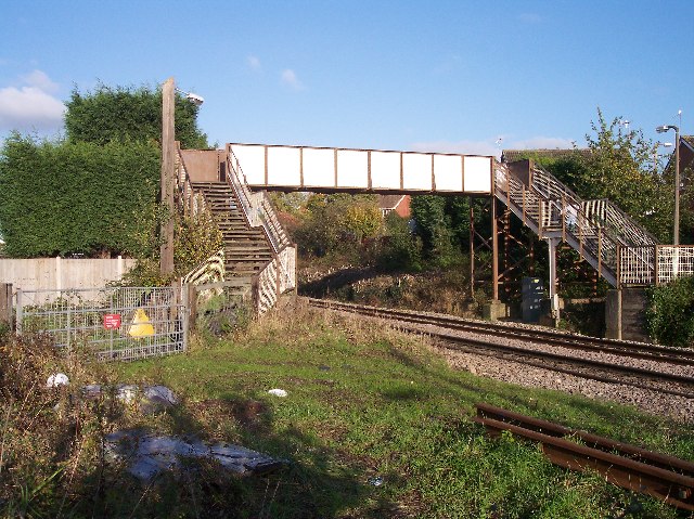
Fernhill Heath railway station
Fernhill Heath railway station was an intermediate railway station on the Oxford, Worcester and Wolverhampton Railway between Worcester (Tunnel Junction...
Fernhill Heath
Fernhill Heath is a village in Worcestershire, England. It is in the civil parish of North Claines in Wychavon district. Fernhill Heath is located on the...
Nearby Amenities
Located within 500m of 52.224464,-2.165382Have you been to Hindlip?
Leave your review of Hindlip below (or comments, questions and feedback).