Aldrington

Settlement in Sussex

England

Aldrington

Southern Railway Service Departing Hove Class 377 EMU - 377113 - seen departing Hove.
Southern Railway Service Departing Hove Credit: David Robinson

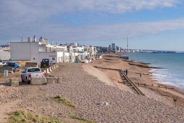
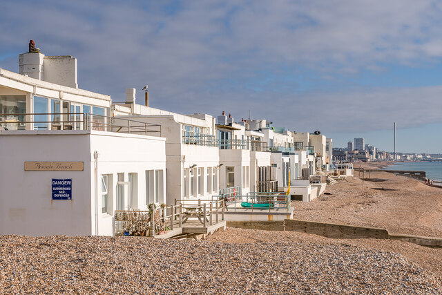
Aldrington is a small village located in the county of Sussex, England. It lies approximately 4 miles west of the vibrant city of Brighton and Hove, nestled between the towns of Hove and Portslade. With a population of around 3,000 residents, Aldrington retains a charming and close-knit community atmosphere.

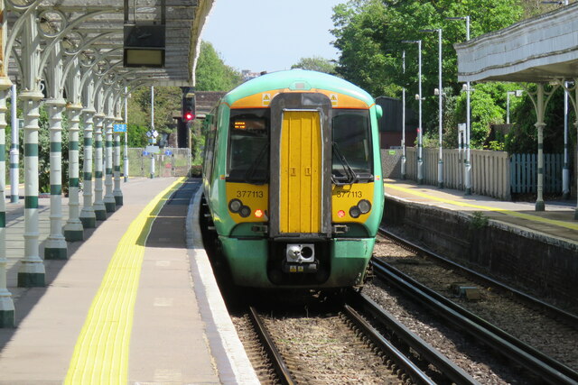
The village is well-connected to the surrounding areas, with regular bus services and a nearby train station, making it easily accessible for both residents and visitors. Aldrington is known for its picturesque setting, surrounded by beautiful countryside and boasting stunning views of the South Downs National Park.

Aldrington offers a range of amenities to cater to the needs of its residents. The village has a primary school that provides education for local children, as well as a post office and a few local shops to cater for everyday needs. For more extensive shopping and entertainment options, the bustling city of Brighton is just a short journey away.

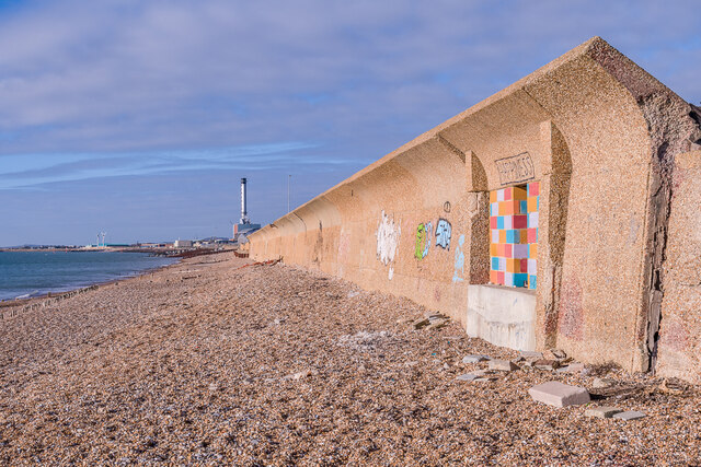
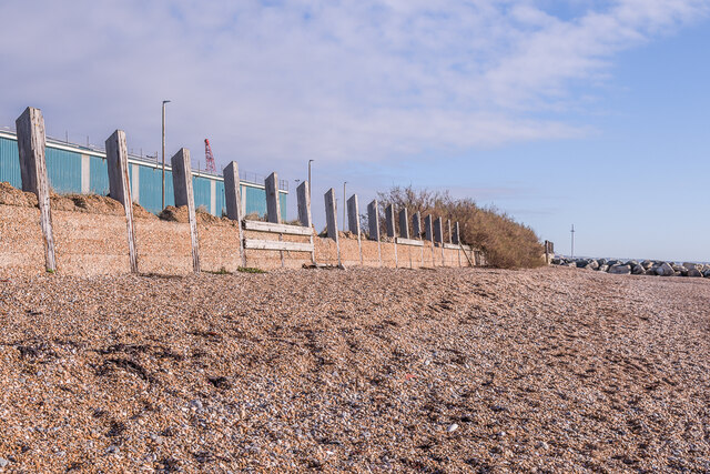
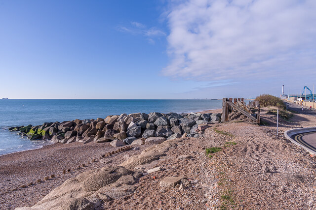
Outdoor enthusiasts will find plenty to enjoy in Aldrington, with numerous walking and cycling routes in the area. The nearby seafront also provides opportunities for water sports and leisurely walks along the beach. Additionally, the village is home to several parks and green spaces, offering a peaceful retreat for residents and visitors alike.

Overall, Aldrington embodies the charm of a quintessential English village, with its picturesque setting, strong sense of community, and convenient access to both urban and rural amenities.

If you have any feedback on the listing, please let us know in the comments section below.
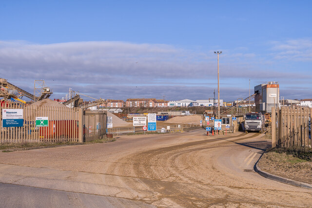
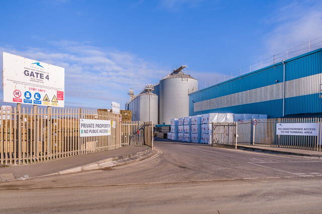
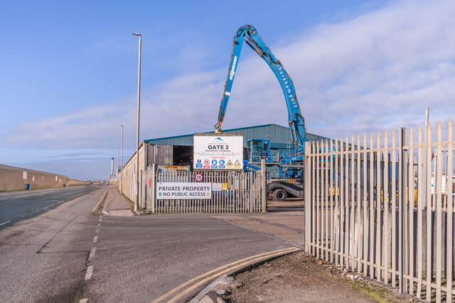
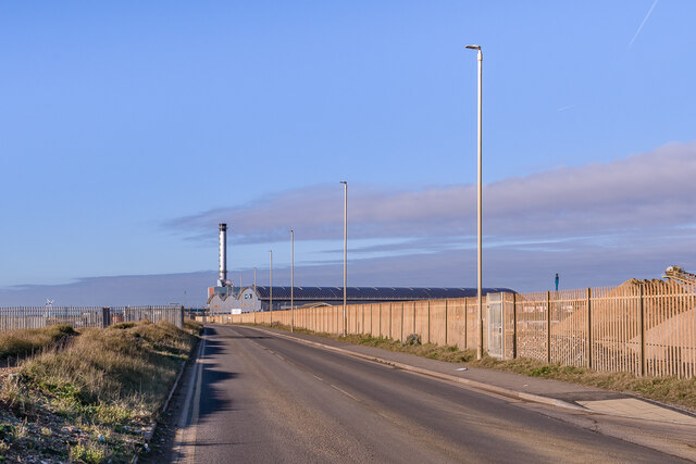
Aldrington Images

Images are sourced within 2km of 50.830245/-0.196028 or Grid Reference TQ2704. Thanks to Geograph Open Source API. All images are credited.

Southern Railway Service Departing Hove Class 377 EMU - 377113 - seen departing Hove.
Southern Railway Service Departing Hove
Class 377 EMU - 377113 - seen departing Hove.
Development, Sackville Road, Hove A trading estate (<a href="https://www.geograph.org.uk/photo/583902">TQ2805 : Entrance, Sackville Trading Estate</a>) has largely been cleared for a new housing development, which will also include offices and public gardens. Housing will include more than 500 build to rent homes and 260 care community homes (whatever they are). Developers Moda Living.
Development, Sackville Road, Hove
A trading estate (TQ2805 : Entrance, Sackville Trading Estate) has largely been cleared for a new housing development, which will also include offices and public gardens. Housing will include more than 500 build to rent homes and 260 care community homes (whatever they are). Developers Moda Living.
Sea wall Sea wall on the beach at Portslade-by-Sea, protecting Basin Road South and the warehouses beyond on Shoreham Harbour.  For a close up if the artwork on the right, see <a href="https://www.geograph.org.uk/photo/7077545">TQ2604 : Happiness</a>.  In the background is Shoreham Power Station.
Sea wall
Sea wall on the beach at Portslade-by-Sea, protecting Basin Road South and the warehouses beyond on Shoreham Harbour. For a close up if the artwork on the right, see TQ2604 : Happiness. In the background is Shoreham Power Station.
Happiness Artwork on the sea wall on the beach at Portslade-by-Sea (see <a href="https://www.geograph.org.uk/photo/7077537">TQ2604 : Sea wall</a>).
Happiness
Artwork on the sea wall on the beach at Portslade-by-Sea (see TQ2604 : Sea wall).
Western Esplanade Row of 12 houses (originally 11) with private beach on Western Esplanade, dubbed "Millionaire's Row" for the number of celebrities that have owned properties here over the years.  Initially called Aldrington Beach Bungalows, later Seaside Bungalows, and by the 1920s Hove Seaside Villas, they were built in 1908-10 with the architect being E J Holland.  In the distance is Brighton with the i360 tower prominent.
Western Esplanade
Row of 12 houses (originally 11) with private beach on Western Esplanade, dubbed "Millionaire's Row" for the number of celebrities that have owned properties here over the years. Initially called Aldrington Beach Bungalows, later Seaside Bungalows, and by the 1920s Hove Seaside Villas, they were built in 1908-10 with the architect being E J Holland. In the distance is Brighton with the i360 tower prominent.
Western Lawns Path alongside a lawn in Western Lawns, between Western Esplanade and Kingsway.
Western Lawns
Path alongside a lawn in Western Lawns, between Western Esplanade and Kingsway.
Cemex Go Innovation A hopper dredger built in 2020, seen here unloading at Cemex's wharf in Shoreham Harbour.
Cemex Go Innovation
A hopper dredger built in 2020, seen here unloading at Cemex's wharf in Shoreham Harbour.
Gate 6 Gate 6 on Basin Road South, serving aggregate wharfs on Shoreham Harbour.
Gate 6
Gate 6 on Basin Road South, serving aggregate wharfs on Shoreham Harbour.
Aggregates depot Aggregate depot on Shoreham Harbour, operated by Tarmac.
Aggregates depot
Aggregate depot on Shoreham Harbour, operated by Tarmac.
Aggregates depot Aggregate depot on Shoreham Harbour, operated by Tarmac.
Aggregates depot
Aggregate depot on Shoreham Harbour, operated by Tarmac.
Gate 5 Gate 6 on Basin Road South, serving Tarmac's aggregate depot and Hanson's concrete works on Shoreham Harbour.
Gate 5
Gate 6 on Basin Road South, serving Tarmac's aggregate depot and Hanson's concrete works on Shoreham Harbour.
Gate 4 Gate 4 on Basin Road South, serving grain and seed silos on Shoreham Harbour.
Gate 4
Gate 4 on Basin Road South, serving grain and seed silos on Shoreham Harbour.
Gate 3 Gate 3 on Basin Road South, serving premises on Shoreham Harbour.
Gate 3
Gate 3 on Basin Road South, serving premises on Shoreham Harbour.
Basin Road South Road serving premises on the south side of Shoreham Harbour.
Basin Road South
Road serving premises on the south side of Shoreham Harbour.
Sea wall Sea wall on the beach at Portslade-by-Sea, protecting Basin Road South and the warehouses beyond on Shoreham Harbour.
Sea wall
Sea wall on the beach at Portslade-by-Sea, protecting Basin Road South and the warehouses beyond on Shoreham Harbour.
Warehouse Warehouse on Basin Road South alongside Shoreham Harbour.
Warehouse
Warehouse on Basin Road South alongside Shoreham Harbour.
Sea defences Sea defences on the beach below Basin Road South..
Sea defences
Sea defences on the beach below Basin Road South..
Show me another place!

Aldrington is located at Grid Ref: TQ2704 (Lat: 50.830245, Lng: -0.196028)

Unitary Authority: Brighton and Hove

Police Authority: Sussex

What 3 Words

///mint.mostly.chins. Near Hove, East Sussex

Nearby Locations

Western Lawns Aldrington

Related Wikis

Aldrington

Aldrington is an area in the city of Brighton and Hove in the ceremonial county of East Sussex, England. It was formerly a civil parish. For centuries...

St Philip's Church, Hove

St Philip's Church is a Church of England parish church in Hove, in the city of Brighton and Hove, England. It was opened in 1895 and consecrated in 1898...

St Leonard's Church, Aldrington

St Leonard's Church is an Anglican church in Hove, in the English city of Brighton and Hove. It is on New Church Road in the Aldrington area of Hove,...

St Peter's Church, Aldrington

St Peter's Church is a Roman Catholic church in the Aldrington area of Hove, part of the English city of Brighton and Hove. It is one of three Roman Catholic...

Portslade railway station

Portslade railway station (in full, Portslade & West Hove station) is a railway station located in Portslade-by-Sea in the city of Brighton and Hove, East...

Capital Brighton

Capital Brighton was a local radio station owned and operated by Global Radio as part of the Capital radio network. It served the Brighton and Hove area...

Barford Court, Hove

Barford Court is a care home operated by the Royal Masonic Benevolent Institution and situated on the seafront in Hove, part of the English city of Brighton...

Hove Museum of Creativity

Hove Museum of Creativity is a municipally-owned museum in the town of Hove, which is part of the larger city of Brighton and Hove in the South East of...

Nearby Amenities

Located within 500m of 50.830245,-0.196028
Mini Roundabout
Direction: clockwise
Lat/Long: 50.8283107/-0.2004536
Millennium Milepost
Artist Name: Jon Mills
Artwork Type: sculpture
Bicycle: yes
Description: 1) Shoreham 42) Brighton 3
Destination: Shoreham;Brighton
Direction: 20
Distance: 4mi;3mi
Guide Type: destination
Image: https://www.cyclestreets.net/location/185638/cyclestreets185638.jpg
Information: guidepost
Material: cast iron
Ncn Milepost: mills
Operator: Sustrans
Source: survey
Sustrans Ref: MP 892
Tourism: information
Website: https://www.sustrans.org.uk/national-cycle-network/millennium-mileposts
Lat/Long: 50.8278262/-0.1979258
Seating,ornamental
Lat/Long: 50.826941/-0.20034
Seating,ornamental
Lat/Long: 50.8263876/-0.1978525
Seating,ornamental
Lat/Long: 50.8262481/-0.1961995
Beachhut
Lat/Long: 50.8263059/-0.195456
Post Box
Brand: Royal Mail
Brand Wikidata: Q638098
Brand Wikipedia: en:Royal Mail
Collection Times: Mo-Fr 09:00, Sa 07:00
Operator: Royal Mail
Operator Wikidata: Q638098
Ref: BN3 333
Royal Cypher: GR
Royal Cypher Wikidata: Q33102273
Lat/Long: 50.8322304/-0.2013021
Post Box
Collection Times: Mo-Fr 09:00, Sa 07:00
Post Box Type: lamp
Ref: BN3 180D
Royal Cypher: EIIR
Royal Cypher Wikidata: Q33102113
Lat/Long: 50.8288554/-0.2010681
Crossing
Bicycle: yes
Button Operated: yes
Crossing: traffic_signals
Crossing Ref: toucan
Kerb: lowered
Tactile Paving: yes
Traffic Signals Vibration: yes
Lat/Long: 50.8278565/-0.1969671
Traffic Signals
Traffic Signals: signal
Traffic Signals Direction: backward
Lat/Long: 50.8278532/-0.1978144
Bus Stop
Brittany Court
Bench: yes
Bus: yes
Naptan AtcoCode: 149000007570
Naptan NaptanCode: brimgpm
Public Transport: platform
Shelter: no
Tactile Paving: no
Toilets Wheelchair: no
Wheelchair: yes
Lat/Long: 50.8318274/-0.1995913
Bus Stop
Brittany Court
Bench: yes
Bus: yes
Departures Board: timetable
Naptan AtcoCode: 149000006570
Naptan NaptanCode: brijdwj
Operator: Brighton & Hove Buses
Public Transport: platform
Shelter: yes
Tactile Paving: no
Toilets Wheelchair: no
Wheelchair: yes
Lat/Long: 50.831706/-0.1979018
Bus Stop
Wish Road
Bench: yes
Naptan AtcoCode: 149000006571
Naptan NaptanCode: briajgp
Public Transport: platform
Shelter: yes
Tactile Paving: no
Lat/Long: 50.8310419/-0.1933543
Bus Stop
Wish Road
Bench: yes
Naptan AtcoCode: 149000007571
Naptan NaptanCode: brijdwm
Public Transport: platform
Shelter: no
Tactile Paving: no
Lat/Long: 50.8310672/-0.1942757
Bus Stop
Wish Road South
Bench: yes
Naptan AtcoCode: 149000006111
Shelter: yes
Lat/Long: 50.8271961/-0.1947914
Bus Stop
Tandridge Road
Bench: yes
Bin: no
Naptan AtcoCode: 149000006112
Shelter: yes
Tactile Paving: no
Lat/Long: 50.8282723/-0.1982865
Bus Stop
Wish Road South
Bench: yes
Naptan AtcoCode: 149000007111
Public Transport: platform
Shelter: yes
Lat/Long: 50.8270184/-0.1948151
Toilets
Fee: no
Wheelchair: yes
Lat/Long: 50.8302606/-0.1979893
Bus Stop
Coleman Avenue
Bench: yes
Bus: yes
Naptan AtcoCode: 149000006447
Naptan NaptanCode: brijatp
Public Transport: platform
Shelter: yes
Tactile Paving: no
Wheelchair: yes
Lat/Long: 50.8342996/-0.1931279
Bench
Backrest: yes
Check Date: 2021-03-27
Lat/Long: 50.8259951/-0.1937576
Bench
Backrest: yes
Check Date: 2021-03-27
Lat/Long: 50.8260293/-0.1941464
Bench
Backrest: yes
Check Date: 2021-03-27
Lat/Long: 50.8261528/-0.1955094
Bench
Backrest: yes
Check Date: 2021-03-27
Lat/Long: 50.8263118/-0.197365
Toilets
Fee: no
Female: no
Male: yes
Wheelchair: no
Lat/Long: 50.826821/-0.1959201
Bench
Backrest: yes
Check Date: 2021-03-27
Lat/Long: 50.8262902/-0.1971219
Bench
Backrest: yes
Check Date: 2021-03-27
Lat/Long: 50.8262665/-0.1968657
Bench
Backrest: yes
Check Date: 2021-03-27
Lat/Long: 50.8262458/-0.1966417
Bench
Backrest: yes
Check Date: 2021-03-27
Lat/Long: 50.8261793/-0.195831
Bench
Backrest: yes
Check Date: 2021-03-27
Lat/Long: 50.8261674/-0.1956882
Bench
Backrest: yes
Check Date: 2021-03-27
Lat/Long: 50.8261382/-0.1953603
Bench
Backrest: yes
Check Date: 2021-03-27
Lat/Long: 50.8261318/-0.1952537
Bench
Backrest: yes
Check Date: 2021-03-27
Lat/Long: 50.8261153/-0.1950693
Bench
Backrest: yes
Check Date: 2021-03-27
Lat/Long: 50.8260937/-0.1948366
Bench
Backrest: yes
Check Date: 2021-03-27
Lat/Long: 50.8260662/-0.1945288
Bus Stop
Coleman Avenue
Bench: yes
Bus: yes
Naptan AtcoCode: 149000007447
Naptan NaptanCode: brijawd
Public Transport: platform
Shelter: yes
Tactile Paving: no
Lat/Long: 50.834349/-0.194422
Charles Lodge care Home
Addr Street: 75 New Church Road
Lat/Long: 50.8311806/-0.1893
Dinnages
Addr City: Hove
Addr Housename: Unit
Addr Housenumber: 11
Addr Postcode: BN3 5RA
Addr Street: Lion Mews
Building: commercial
Building Levels: 1
Smoking: no
Lat/Long: 50.8309878/-0.1890207
Post Box
Collection Times: Mo-Fr 17:00, Sa 11:30
Operator: Royal Mail
Post Box Type: pillar
Ref: BN3 181
Royal Cypher: GR
Royal Cypher Wikidata: Q33102273
Lat/Long: 50.8282793/-0.1981291
Cafe
Big Beach Cafe
Addr Housename: Pavilion Cafe, Hove Lagoon
Addr Postcode: BN3 4LX
Addr Street: Kingsway
Contact Facebook: https://www.facebook.com/BigBeachCafeBrighton
Contact Instagram: https://www.instagram.com/thebigbeachcafe/
Fhrs Id: 578205
Opening Hours: Mo-Su 08:45-17:30
Website: https://bigbeachcafe.com/
Wikimedia Commons: Category:Big Beach Cafe, Hove
Lat/Long: 50.826742/-0.196013
Bicycle Rental
Hove Lagoon
Bicycle Rental: docking_station
Capacity: 13
Covered: no
Email: support@beryl.cc
Fee: yes
Network: btnbikeshare
Note: Hire scheme suspened in December 2022 and relaunched with new operator at end of March 2023, but with limited stations open, planned rollout until the summer when all stations will be open.
Payment App: yes
Phone: +44 020 3003 5044
Ref: 59
Website: https://beryl.cc/scheme/brighton
Lat/Long: 50.8264598/-0.1952694
Toilets
Fee: no
Female: yes
Male: no
Wheelchair: no
Lat/Long: 50.8266456/-0.1959612
Crossing
Bicycle: yes
Button Operated: yes
Crossing: traffic_signals
Crossing Markings: dots
Crossing Ref: toucan
Kerb: lowered
Tactile Paving: yes
Traffic Signals Vibration: yes
Lat/Long: 50.8272579/-0.1955296
Crossing
Bicycle: yes
Button Operated: yes
Crossing: traffic_signals
Crossing Ref: toucan
Kerb: lowered
Tactile Paving: yes
Traffic Signals Vibration: yes
Lat/Long: 50.8277667/-0.1970019
Crossing
Bicycle: yes
Crossing: traffic_signals
Crossing Ref: toucan
Kerb: lowered
Tactile Paving: yes
Lat/Long: 50.8277191/-0.1970517
Crossing
Bicycle: yes
Button Operated: yes
Crossing: traffic_signals
Crossing Ref: toucan
Kerb: lowered
Tactile Paving: yes
Traffic Signals Vibration: yes
Lat/Long: 50.8273733/-0.1955813
Traffic Signals
Traffic Signals Direction: forward
Lat/Long: 50.8280692/-0.1976675
Traffic Signals
Lat/Long: 50.8277018/-0.1969116
Cycleway: asl
Direction: forward
Lat/Long: 50.8277082/-0.1969876
Cycleway: asl
Direction: forward
Lat/Long: 50.8277465/-0.1969564
Post Box
Collection Times: Mo-Fr 09:00; Sa 07:00; Su off
Operator: Royal Mail
Ref: BN3 182D
Royal Cypher: GR
Royal Cypher Wikidata: Q33102273
Lat/Long: 50.8290529/-0.1945279
Bicycle Rental
Wish Road
Bicycle Rental: docking_station
Capacity: 10
Covered: no
Email: support@beryl.cc
Fee: yes
Network: btnbikeshare
Note: Hire scheme suspened in December 2022 and relaunched with new operator at end of March 2023, but with limited stations open, planned rollout until the summer when all stations will be open.
Payment App: yes
Phone: +44 020 3003 5044
Ref: 81
Website: https://beryl.cc/scheme/brighton
Lat/Long: 50.8304614/-0.1940134
Post Box
Brand: Royal Mail
Brand Wikidata: Q638098
Collection Times: Mo-Fr 09:00; Sa 07:00; Su off
Operator: Royal Mail
Operator Wikidata: Q638098
Ref: BN3 104D
Royal Cypher: GR
Royal Cypher Wikidata: Q33102273
Lat/Long: 50.8346291/-0.1972553
Toilets
Fee: no
Unisex: yes
Wheelchair: yes
Lat/Long: 50.8266865/-0.1959968
Public Bookcase
The Book Hut
Capacity: 20
Lit: yes
Operator: "At the house with the purple door"
Public Bookcase Type: reading_box
Lat/Long: 50.8335643/-0.1928507
Curtain Workshop
Addr City: Hove
Addr Housenumber: 329
Addr Postcode: BN3 4LD
Addr Street: Kingsway
Shop: curtain
Lat/Long: 50.8287026/-0.1997673
Lagoon Bait
Addr City: Hove
Addr Housenumber: 327
Addr Postcode: BN3 4LD
Addr Street: Kingsway
Shop: fishing
Website: https://www.lagoonbaithove.co.uk/
Lat/Long: 50.8286871/-0.1996749
Cafe
Feedwell Cafe
Addr Housenumber: 325
Lat/Long: 50.8286715/-0.1995825
Kingsway City Newsagents
Addr Housenumber: 323
Shop: newsagent
Lat/Long: 50.8286567/-0.1994947
Crossing
Bicycle: no
Button Operated: yes
Crossing: traffic_signals
Crossing Island: no
Crossing Ref: pelican
Kerb: lowered
Tactile Paving: yes
Traffic Signals Vibration: yes
Lat/Long: 50.8286195/-0.2004992
Cycleway: asl
Direction: forward
Lat/Long: 50.8280515/-0.1976045
Cycleway: asl
Direction: backward
Lat/Long: 50.8278405/-0.1977497
Give Way
Direction: forward
Lat/Long: 50.827714/-0.197248
Bicycle Parking
Access: yes
Bicycle Parking: stands
Capacity: 10
Covered: no
Fee: no
Lat/Long: 50.8265669/-0.1952525
The Garden Bar
Addr City: Hove
Addr Country: GB
Addr Housenumber: 324
Addr Postcode: BN3 5LF
Addr Street: Portland Road
Fhrs Id: 441962
Survey Date: 2019-05-23
Tourism: hotel
Lat/Long: 50.8344966/-0.1962854
Post Box
Brand: Royal Mail
Brand Wikidata: Q638098
Brand Wikipedia: en:Royal Mail
Collection Plate: CP1
Collection Times: Mo-Fr 09:00, Sa 07:00
Operator: Royal Mail
Operator Wikidata: Q638098
Post Box Type: pillar
Ref: BN3 177
Royal Cypher: GR
Royal Cypher Wikidata: Q33102273
Lat/Long: 50.8311126/-0.194612
Post Box
Brand: Royal Mail
Brand Wikidata: Q638098
Brand Wikipedia: en:Royal Mail
Collection Times: Mo-Fr 16:15, Sa 11:30
Operator: Royal Mail
Operator Wikidata: Q638098
Post Box Type: pillar
Ref: BN3 103
Royal Cypher: GR
Royal Cypher Wikidata: Q33102273
Lat/Long: 50.8341209/-0.1925587
Motorcycle Parking
Solo M/C Bay
Capacity: 6
Fee: no
Parking: lane
Parking Orientation: perpendicular
Supervised: no
Surface: asphalt
Lat/Long: 50.8345684/-0.1971947
Motorcycle Parking
Solo M/C Bay
Capacity: 6
Fee: no
Parking: lane
Parking Orientation: perpendicular
Supervised: no
Surface: asphalt
Lat/Long: 50.8344227/-0.1960212
Motorcycle Parking
Solo M/C Bay
Capacity: 6
Covered: no
Fee: no
Parking: lane
Parking Orientation: perpendicular
Supervised: no
Surface: asphalt
Lat/Long: 50.826839/-0.1930761
Motorcycle Parking
Solo M/C Bay
Capacity: 6
Fee: no
Parking: lane
Parking Orientation: perpendicular
Supervised: no
Surface: asphalt
Lat/Long: 50.8302739/-0.1894733
Motorcycle Parking
Solo M/C Bay
Capacity: 6
Fee: no
Parking: lane
Parking Orientation: perpendicular
Supervised: no
Surface: asphalt
Lat/Long: 50.830865/-0.1936739
Motorcycle Parking
Solo M/C Bay
Capacity: 6
Fee: no
Parking: lane
Parking Orientation: perpendicular
Supervised: no
Surface: asphalt
Lat/Long: 50.8307449/-0.1902833
Motorcycle Parking
Solo M/C Bay
Capacity: 6
Fee: no
Parking: lane
Parking Orientation: perpendicular
Supervised: no
Surface: asphalt
Lat/Long: 50.8281372/-0.1971977
Motorcycle Parking
Solo M/C Bay
Capacity: 6
Covered: no
Fee: no
Parking: lane
Parking Orientation: perpendicular
Supervised: no
Surface: asphalt
Lat/Long: 50.8276588/-0.1957184
Motorcycle Parking
Solo M/C Bay
Capacity: 6
Covered: no
Fee: no
Parking: lane
Parking Orientation: perpendicular
Supervised: no
Surface: asphalt
Lat/Long: 50.8271696/-0.1939609
Motorcycle Parking
Solo M/C Bay
Capacity: 6
Fee: no
Parking: lane
Parking Orientation: perpendicular
Supervised: no
Surface: asphalt
Lat/Long: 50.8268508/-0.1941081
Motorcycle Parking
Solo M/C Bay
Capacity: 6
Fee: no
Parking: lane
Parking Orientation: perpendicular
Supervised: no
Surface: asphalt
Lat/Long: 50.826635/-0.1930188
Motorcycle Parking
Solo M/C Bay
Capacity: 6
Covered: no
Fee: no
Parking: lane
Parking Orientation: perpendicular
Supervised: no
Surface: asphalt
Lat/Long: 50.8267852/-0.191562
Motorcycle Parking
Solo M/C Bay
Capacity: 6
Fee: no
Parking: lane
Parking Orientation: perpendicular
Supervised: no
Surface: asphalt
Lat/Long: 50.8319141/-0.2008381
Motorcycle Parking
Solo M/C Bay
Capacity: 6
Fee: no
Parking: lane
Parking Orientation: perpendicular
Supervised: no
Surface: asphalt
Lat/Long: 50.8317552/-0.1997994
Motorcycle Parking
Solo M/C Bay
Capacity: 6
Fee: no
Parking: lane
Parking Orientation: perpendicular
Supervised: no
Surface: asphalt
Lat/Long: 50.8316083/-0.198768
Motorcycle Parking
Solo M/C Bay
Capacity: 6
Fee: no
Parking: lane
Parking Orientation: perpendicular
Supervised: no
Surface: asphalt
Lat/Long: 50.8325553/-0.1984972
Generator Method: photovoltaic
Generator Output Electricity: yes
Generator Source: solar
Generator Type: solar_photovoltaic_panel
Power: generator
Lat/Long: 50.8290826/-0.2027808
Generator Method: photovoltaic
Generator Output Electricity: yes
Generator Source: solar
Generator Type: solar_photovoltaic_panel
Power: generator
Lat/Long: 50.8290654/-0.2026853
Motorcycle Parking
Capacity: 2
Covered: no
Lat/Long: 50.8314561/-0.1972964
Bicycle Parking
Bicycle Parking: stands
Capacity: 10
Covered: no
Fee: no
Lat/Long: 50.8315002/-0.1973929
Man Made: beacon
Lat/Long: 50.8264573/-0.1985719
Bench
Backrest: yes
Direction: 125
Material: wood
Lat/Long: 50.8308907/-0.1974698
Bench
Backrest: yes
Direction: 125
Material: wood
Lat/Long: 50.8308112/-0.1975356
Bench
Direction: 200
Lat/Long: 50.8310178/-0.1972728
Access: yes
Leisure: pitch
Sport: table_tennis
Lat/Long: 50.8305129/-0.1942827
Baby: yes
Playground: swing
Lat/Long: 50.8306734/-0.1953763
Playground: climbingframe
Lat/Long: 50.8306583/-0.1952666
Playground: roundabout
Lat/Long: 50.8305968/-0.1954429
Traffic Signals
Traffic Signals: pedestrian_crossing
Traffic Signals Direction: both
Lat/Long: 50.8310672/-0.1939393
Crossing
Crossing: uncontrolled
Crossing Island: yes
Crossing Markings: no
Tactile Paving: yes
Lat/Long: 50.831466/-0.1966839
Waste Basket
Colour: Black
Covered: yes
Material: plastic
Operator: Brighton & Hove City Council
Waste: trash;cigarettes
Lat/Long: 50.8317207/-0.1979352
Bench
Backrest: yes
Direction: 190
Lat/Long: 50.8316949/-0.1977576
Entrance: yes
Lat/Long: 50.8315344/-0.198229
Entrance: yes
Lat/Long: 50.8315569/-0.1984007
Entrance: yes
Lat/Long: 50.8315391/-0.1985876
Entrance: yes
Lat/Long: 50.8308618/-0.1939201
Leisure: picnic_table
Lat/Long: 50.8306072/-0.1948944
Leisure: picnic_table
Lat/Long: 50.8305234/-0.1949797
Leisure: slipway
Lat/Long: 50.8273672/-0.1971841
Leisure: slipway
Lat/Long: 50.8267155/-0.1977347
Direction: both
Traffic Calming: bump
Lat/Long: 50.826656/-0.1954622
Direction: both
Traffic Calming: bump
Lat/Long: 50.8266419/-0.1953882
Direction: both
Traffic Calming: bump
Lat/Long: 50.8266281/-0.1953146
Leisure: pitch
Sport: table_tennis
Lat/Long: 50.8263788/-0.1954645
Bench
Backrest: yes
Direction: 200
Lat/Long: 50.8280323/-0.1997172
Bench
Backrest: yes
Direction: 200
Lat/Long: 50.8279335/-0.1992116
Bench
Backrest: yes
Direction: 200
Lat/Long: 50.8278837/-0.1989846
Bench
Backrest: yes
Direction: 200
Lat/Long: 50.8278405/-0.1987551
Bench
Backrest: yes
Direction: 200
Lat/Long: 50.8277472/-0.1983004
Bench
Backrest: yes
Direction: 200
Lat/Long: 50.827592/-0.1975147
Bench
Backrest: yes
Direction: 200
Lat/Long: 50.8274475/-0.1967611
Bench
Backrest: yes
Direction: 135
Lat/Long: 50.8277758/-0.1999158
Playground: spinning_circle
Lat/Long: 50.8271014/-0.1960785
Waste Basket
Lat/Long: 50.8266983/-0.1955819
Bench
Backrest: yes
Direction: 325
Lat/Long: 50.8266951/-0.1955208
Bench
Backrest: yes
Direction: 25
Lat/Long: 50.8267127/-0.1956586
Bench
Backrest: yes
Direction: 55
Lat/Long: 50.8267277/-0.1957013
Artwork Type: sculpture
Tourism: artwork
Lat/Long: 50.8270778/-0.1967246
Artwork Type: sculpture
Tourism: artwork
Lat/Long: 50.8268774/-0.1970385
Drinking Water
Lat/Long: 50.8266908/-0.1956349
Man Made: street_cabinet
Lat/Long: 50.831415/-0.197751
Man Made: street_cabinet
Lat/Long: 50.8313994/-0.1977554
Man Made: street_cabinet
Lat/Long: 50.8313756/-0.1977652
Man Made: street_cabinet
Lat/Long: 50.8313678/-0.1977957
Man Made: street_cabinet
Lat/Long: 50.8313527/-0.1978032
Man Made: street_cabinet
Lat/Long: 50.831287/-0.1976475
Man Made: street_cabinet
Lat/Long: 50.8312583/-0.1976625
Street Lamp
Direction: 5
Lat/Long: 50.8316866/-0.1985879
Street Lamp
Direction: 5
Lat/Long: 50.8316107/-0.1980797
Give Way
Direction: forward
Lat/Long: 50.8276351/-0.1968339
Barrier: bollard
Bollard: fixed
Material: metal
Lat/Long: 50.8278308/-0.1974534
Traffic Calming: rumble_strip
Lat/Long: 50.8277133/-0.1972976
Barrier: kerb
Kerb: lowered
Lat/Long: 50.828218/-0.1999947
Give Way
Direction: backward
Lat/Long: 50.8277438/-0.1972505
Bicycle: yes
Colour Arrow: white
Colour Back: blue
Colour Text: white
Destination: City Centre
Direction: 290
Guide Type: destination
Information: guidepost
Operator: B&HCC
Tourism: information
Lat/Long: 50.827773/-0.1972011
Give Way
Direction: forward
Lat/Long: 50.8270565/-0.1951298
Give Way
Direction: backward
Lat/Long: 50.8270186/-0.1949982
Give Way
Direction: forward
Lat/Long: 50.8265643/-0.1928305
Give Way
Direction: backward
Lat/Long: 50.8265498/-0.1927426
The data included in this document is from www.openstreetmap.org. The data is made available under ODbL.

Have you been to Aldrington?

Leave your review of Aldrington below (or comments, questions and feedback).