Hevingham

Civil Parish in Norfolk Broadland

England

Hevingham

Queuing traffic at roadworks on the A140
Queuing traffic at roadworks on the A140 Credit: Helen Steed

Hevingham is a civil parish located in the county of Norfolk, in the East of England. Situated approximately 12 miles north of the city of Norwich, Hevingham covers an area of about 9 square miles. The parish is surrounded by the nearby villages of Stratton Strawless, Marsham, and Felmingham.

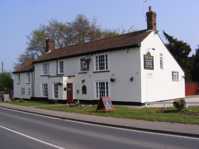
Hevingham has a population of around 1,500 residents, according to the latest available data. The village is primarily residential, with a mix of detached houses, cottages, and some newer developments. The architecture in Hevingham is diverse, ranging from traditional Norfolk flint buildings to more modern styles.

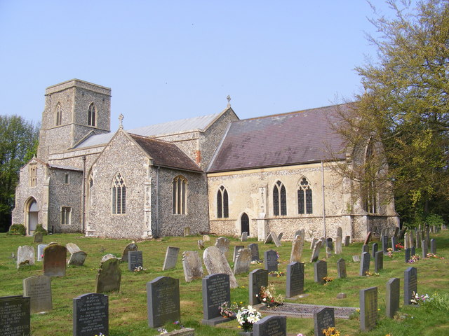
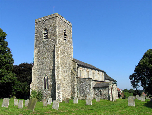
The village is home to St. Mary's Church, which dates back to the 14th century. The church is a prominent landmark in the area and holds regular services. Another notable feature in Hevingham is its village hall, which serves as a meeting place for community events and social activities.

Hevingham has a strong sense of community, with several local groups and organizations active in the area. These include a Women's Institute, a gardening club, and a cricket club. The village also has a primary school, providing education for children in the area.

The surrounding countryside offers picturesque landscapes and opportunities for outdoor activities such as walking and cycling. Hevingham is well-connected by road, with the A140 running nearby, providing easy access to Norwich and other nearby towns.

Overall, Hevingham is a charming and tranquil village, offering a peaceful rural lifestyle while still being within easy reach of larger towns and amenities.

If you have any feedback on the listing, please let us know in the comments section below.

Hevingham Images

Images are sourced within 2km of 52.747396/1.245244 or Grid Reference TG1921. Thanks to Geograph Open Source API. All images are credited.

Queuing traffic at roadworks on the A140
St.Botolph's Church, Hevingham Off the A140 Cromer Road
St.Botolph's Church, Hevingham
Off the A140 Cromer Road
St.Botolph's Church, Hevingham Off the A140 Cromer Road
St.Botolph's Church, Hevingham
Off the A140 Cromer Road
St.Botolph's Church, Hevingham Notice Board Off the A140 Cromer Road
St.Botolph's Church, Hevingham Notice Board
Off the A140 Cromer Road
A140 Cromer Road Looking towards Marsham
A140 Cromer Road
Looking towards Marsham
A140 Cromer Road Looking towards Stratton Strawless
A140 Cromer Road
Looking towards Stratton Strawless
The entrance to The Old Rectory Special Needs Home Off the A140 Cromer Road
The entrance to The Old Rectory Special Needs Home
Off the A140 Cromer Road
The Fox Inn, Hevingham On the A140 Cromer Road at Hevingham
<span class="nowrap"><a title="http://www.wheresbest.co.uk/venue/99484/The-Fox/" rel="nofollow ugc noopener" href="http://www.wheresbest.co.uk/venue/99484/The-Fox/">Link</a><img style="margin-left:2px;" alt="External link" title="External link - shift click to open in new window" src="https://s1.geograph.org.uk/img/external.png" width="10" height="10"/></span>
The Fox Inn, Hevingham
On the A140 Cromer Road at Hevingham LinkExternal link
The Fox Inn Public House On the A140 Cromer Road at Hevingham
<span class="nowrap"><a title="http://www.wheresbest.co.uk/venue/99484/The-Fox/" rel="nofollow ugc noopener" href="http://www.wheresbest.co.uk/venue/99484/The-Fox/">Link</a><img style="margin-left:2px;" alt="External link" title="External link - shift click to open in new window" src="https://s1.geograph.org.uk/img/external.png" width="10" height="10"/></span>
The Fox Inn Public House
On the A140 Cromer Road at Hevingham LinkExternal link
The Fox Inn, Public House sign On the A140 Cromer Road at Hevingham
The Fox Inn, Public House sign
On the A140 Cromer Road at Hevingham
War memorial in the grounds of St Botolph's Church, Hevingham
Names of the Fallen on Hevingham War Memorial 1 Close up of <a href="https://www.geograph.org.uk/photo/3175351">TG2022 : War memorial in the grounds of St Botolph's Church, Hevingham</a>
Names of the Fallen on Hevingham War Memorial 1
Names of the Fallen on Hevingham War Memorial 2 Close up of <a href="https://www.geograph.org.uk/photo/3175351">TG2022 : War memorial in the grounds of St Botolph's Church, Hevingham</a>
Names of the Fallen on Hevingham War Memorial 2
Names of the Fallen on Hevingham War Memorial 3 Close up of <a href="https://www.geograph.org.uk/photo/3175351">TG2022 : War memorial in the grounds of St Botolph's Church, Hevingham</a>
Names of the Fallen on Hevingham War Memorial 3
Names of the Fallen on Hevingham War Memorial 4 Close up of <a href="https://www.geograph.org.uk/photo/3175351">TG2022 : War memorial in the grounds of St Botolph's Church, Hevingham</a>
Names of the Fallen on Hevingham War Memorial 4
St Botolph's Church, Hevingham
The Street, Hevingham At the junction with the A140 Cromer Road & Town Corner
The Street, Hevingham
At the junction with the A140 Cromer Road & Town Corner
Roadsigns on the A140 Cromer Road At the junction with The Street & Town Corner
Roadsigns on the A140 Cromer Road
At the junction with The Street & Town Corner
Show me another place!

Hevingham is located at Grid Ref: TG1921 (Lat: 52.747396, Lng: 1.245244)

Administrative County: Norfolk

District: Broadland

Police Authority: Norfolk

What 3 Words

///ramble.elect.straying. Near Buxton, Norfolk

Related Wikis

Hevingham

Hevingham is a village and civil parish in the Broadland district of the English county of Norfolk. Situated between the A140 road Norwich to Cromer road...

St Faith's and Aylsham Rural District

St Faith's and Aylsham Rural Districts were adjacent rural districts in Norfolk, England from 1894 to 1935. They were formed under the Local Government...

Marsham, Norfolk

Marsham is a village and civil parish in the English county of Norfolk, about 10 miles (16 km) north of Norwich. It covers an area of 7.40 km2 (2.86 sq...

Brampton, Norfolk

Brampton is a small village and parish in the county of Norfolk, England, in the Bure Valley, east of Aylsham. == History == Brampton was the subject of...

Nearby Amenities

Located within 500m of 52.747396,1.245244
Hevingham
Inscription: WI / 2009
Man Made: village_sign
Material: metal
Start Date: 2009
Lat/Long: 52.7439467/1.2481512
Give Way
Lat/Long: 52.7440423/1.2478704
Give Way
Lat/Long: 52.7439118/1.2480211
Give Way
Lat/Long: 52.7440097/1.248161
Colour: red
Marker: post
Material: plastic
Utility: gas
Lat/Long: 52.7478098/1.2521466
Marker: post
Material: concrete
Utility: gas
Lat/Long: 52.7463334/1.2469207
Marker: post
Material: concrete
Utility: gas
Lat/Long: 52.7463054/1.2468318
Post Box
Operator: Royal Mail
Operator Wikidata: Q638098
Post Box Mounting: building
Post Box Type: wall
Ref: NR10 1063
Lat/Long: 52.7439547/1.2478451
The data included in this document is from www.openstreetmap.org. The data is made available under ODbL.

Have you been to Hevingham?

Leave your review of Hevingham below (or comments, questions and feedback).