Hevingham

Settlement in Norfolk Broadland

England

Hevingham

St.Botolph's Church, Hevingham Off the A140 Cromer Road
St.Botolph's Church, Hevingham Credit: Geographer

Hevingham is a charming village located in the county of Norfolk, England. Situated approximately 10 miles north of the city of Norwich, it is nestled amidst the picturesque Norfolk countryside. With a population of around 1,200 residents, Hevingham exudes a close-knit community atmosphere.

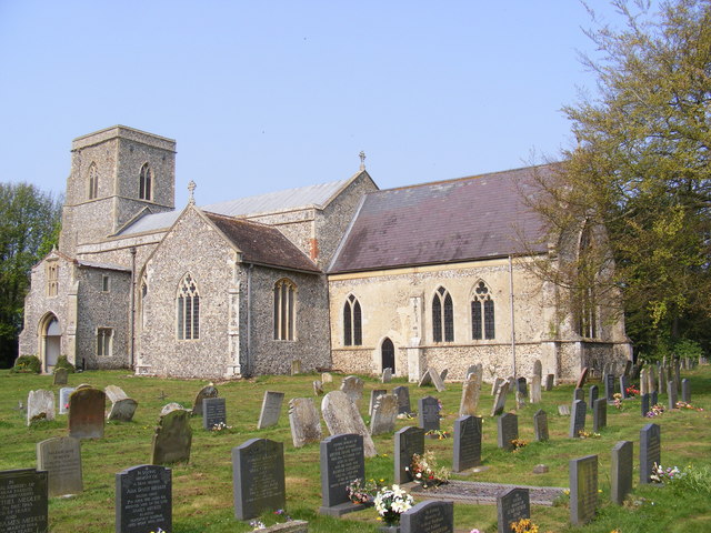
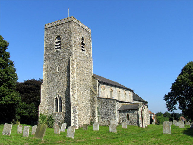
The village boasts a rich history that can be traced back to the Domesday Book of 1086, where it was referred to as "Hauingeham." Today, remnants of its past can still be seen in the form of historical landmarks such as St. Mary's Church, a beautiful flint building dating back to the 14th century.

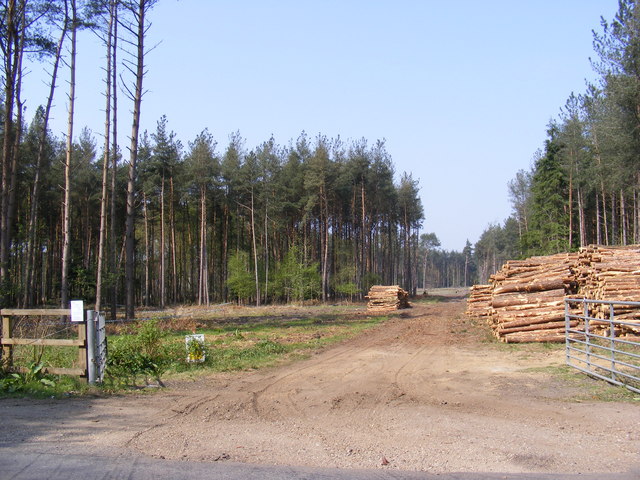
Hevingham offers its residents and visitors a peaceful and idyllic setting. The surrounding countryside is characterized by rolling fields, meandering streams, and lush woodlands, making it an ideal destination for nature lovers and outdoor enthusiasts. The village itself is adorned with charming cottages, well-maintained gardens, and a sense of tranquility.

Despite its small size, Hevingham has a strong sense of community spirit. The village hosts various events and activities throughout the year, including a summer fete, a Christmas market, and a popular annual scarecrow festival. These events bring the community together and offer opportunities for locals and visitors to socialize and enjoy the village's vibrant atmosphere.

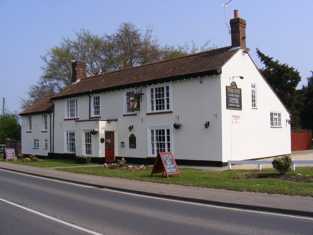
Hevingham provides basic amenities like a village hall, a primary school, a post office, and a local pub. For more extensive shopping and entertainment options, the bustling city of Norwich is easily accessible, offering a wide range of amenities just a short drive away.

Overall, Hevingham is a delightful village that offers a peaceful rural lifestyle, a strong community spirit, and easy access to both nature and urban amenities.

If you have any feedback on the listing, please let us know in the comments section below.

Hevingham Images

Images are sourced within 2km of 52.742997/1.255113 or Grid Reference TG1921. Thanks to Geograph Open Source API. All images are credited.

St.Botolph's Church, Hevingham Off the A140 Cromer Road
St.Botolph's Church, Hevingham
Off the A140 Cromer Road
St.Botolph's Church, Hevingham Off the A140 Cromer Road
St.Botolph's Church, Hevingham
Off the A140 Cromer Road
St.Botolph's Church, Hevingham Notice Board Off the A140 Cromer Road
St.Botolph's Church, Hevingham Notice Board
Off the A140 Cromer Road
A140 Cromer Road Looking towards Marsham
A140 Cromer Road
Looking towards Marsham
A140 Cromer Road Looking towards Stratton Strawless
A140 Cromer Road
Looking towards Stratton Strawless
The entrance to The Old Rectory Special Needs Home Off the A140 Cromer Road
The entrance to The Old Rectory Special Needs Home
Off the A140 Cromer Road
Short -Thorn Road & Short -Thorn Road Postbox Looking towards the A140 Cromer Road
Postbox No.NR10 1064
Short -Thorn Road & Short -Thorn Road Postbox
Looking towards the A140 Cromer Road Postbox No.NR10 1064
Short -Thorn Road Postbox On Short-Thorn Road
Postbox No.NR10 1064
Short -Thorn Road Postbox
On Short-Thorn Road Postbox No.NR10 1064
Short -Thorn Road Postbox On Short-Thorn Road
Postbox No.NR10 1064
In the background is a George V Postbox converted to a private residence letterbox
Short -Thorn Road Postbox
On Short-Thorn Road Postbox No.NR10 1064 In the background is a George V Postbox converted to a private residence letterbox
Short -Thorn Road At the junction with Serpentine Lane
Short -Thorn Road
At the junction with Serpentine Lane
Short - Thorn Road At the junction with the A140 Cromer Road
Short - Thorn Road
At the junction with the A140 Cromer Road
Serpentine Lane Looking towards the A140 Cromer Road
Serpentine Lane
Looking towards the A140 Cromer Road
Mansom Plantation Off Short Thorn Road
Mansom Plantation
Off Short Thorn Road
Short -Thorn Road Looking towards  Short Thorn & the A1149 Holt Road near Mansom Plantation
Short -Thorn Road
Looking towards Short Thorn & the A1149 Holt Road near Mansom Plantation
The Fox Inn, Hevingham On the A140 Cromer Road at Hevingham
<span class="nowrap"><a title="http://www.wheresbest.co.uk/venue/99484/The-Fox/" rel="nofollow ugc noopener" href="http://www.wheresbest.co.uk/venue/99484/The-Fox/">Link</a><img style="margin-left:2px;" alt="External link" title="External link - shift click to open in new window" src="https://s1.geograph.org.uk/img/external.png" width="10" height="10"/></span>
The Fox Inn, Hevingham
On the A140 Cromer Road at Hevingham LinkExternal link
The Fox Inn Public House On the A140 Cromer Road at Hevingham
<span class="nowrap"><a title="http://www.wheresbest.co.uk/venue/99484/The-Fox/" rel="nofollow ugc noopener" href="http://www.wheresbest.co.uk/venue/99484/The-Fox/">Link</a><img style="margin-left:2px;" alt="External link" title="External link - shift click to open in new window" src="https://s1.geograph.org.uk/img/external.png" width="10" height="10"/></span>
The Fox Inn Public House
On the A140 Cromer Road at Hevingham LinkExternal link
The Fox Inn, Public House sign On the A140 Cromer Road at Hevingham
The Fox Inn, Public House sign
On the A140 Cromer Road at Hevingham
War memorial in the grounds of St Botolph's Church, Hevingham
Show me another place!

Hevingham is located at Grid Ref: TG1921 (Lat: 52.742997, Lng: 1.255113)

Administrative County: Norfolk

District: Broadland

Police Authority: Norfolk

What 3 Words

///geese.templates.supporter. Near Buxton, Norfolk

Related Wikis

St Faith's and Aylsham Rural District

St Faith's and Aylsham Rural Districts were adjacent rural districts in Norfolk, England from 1894 to 1935.They were formed under the Local Government...

Hevingham

Hevingham is a village and civil parish in the Broadland district of the English county of Norfolk. Situated between the A140 road Norwich to Cromer road...

Stratton Strawless

Stratton Strawless is a village in the county of Norfolk and district of Broadland. The civil parish covers 714 acres (289 ha) and has a population of...

Brampton, Norfolk

Brampton is a small village and parish in the county of Norfolk, England, in the Bure Valley, east of Aylsham. == History == Brampton was the subject of...

Marsham, Norfolk

Marsham is a village and civil parish in the English county of Norfolk, about 10 miles (16 km) north of Norwich. It covers an area of 7.40 km2 (2.86 sq...

Buxton, Norfolk

Buxton is a village in the parish of Buxton with Lamas, in the Broadland district of the county of Norfolk, England. It is located between Norwich and...

Bolwick Hall

Bolwick Hall is located at Marsham, Norfolk, 1 mile south of Aylsham. == History == The hall is recorded in the Domesday Book of 1086 and given to King...

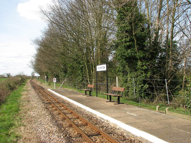
Brampton railway station (Norfolk)

Brampton railway station serves the village of Brampton in Norfolk and is operated by the Bure Valley Railway, a narrow gauge heritage railway operation...

Nearby Amenities

Located within 500m of 52.742997,1.255113
Bus Stop
A140 Cromer Road
Bench: no
Naptan AtcoCode: 2900H231
Naptan Bearing: N
Naptan BusStopType: CUS
Naptan CommonName: Town Corner
Naptan Indicator: opp
Naptan Latitude: 52.7433868
Naptan Locality: Hevingham
Naptan Longitude: 1.262425
Naptan NaptanCode: nfoawjmj
Naptan Street: Cromer Road
Shelter: no
Source: naptan_import;survey
Tactile Paving: yes
Lat/Long: 52.7432611/1.2624298
Turning Circle
Lat/Long: 52.7447914/1.260596
Turning Circle
Lat/Long: 52.7445336/1.2587707
Hevingham
Place: village
Lat/Long: 52.7427159/1.2518862
Pound Farm
Phone: +44 1603754639
Tourism: caravan_site
Lat/Long: 52.7434051/1.2543657
Give Way
Lat/Long: 52.7439295/1.259042
Hevingham
Inscription: WI / 2009
Man Made: village_sign
Material: metal
Start Date: 2009
Lat/Long: 52.7439467/1.2481512
Give Way
Lat/Long: 52.7439118/1.2480211
Give Way
Lat/Long: 52.7440097/1.248161
Give Way
Lat/Long: 52.7424552/1.2513055
Crossing
Crossing: unmarked
Lat/Long: 52.7425029/1.2512933
Post Box
Operator: Royal Mail
Operator Wikidata: Q638098
Post Box Mounting: pier
Post Box Type: lamp
Ref: NR10 1060
Lat/Long: 52.7432958/1.2591383
The data included in this document is from www.openstreetmap.org. The data is made available under ODbL.

Have you been to Hevingham?

Leave your review of Hevingham below (or comments, questions and feedback).