Hemington

Civil Parish in Somerset Mendip

England

Hemington

Old Milestone by A366, North of Hemington, just West of Crossroads The Milestone is located on grass verge on the South of the road.  Parish of Hemington (Mendip District). Metal plate attached to stone post, Radstock iron plate design, erected by the Radstock turnpike trust in the 18th century, top right corner of plate gone; chips on top left of stone. An earlier photograph can be found here: <a title="https://www.geograph.org.uk/photo/6035396" href="https://www.geograph.org.uk/photo/6035396">Link</a> 

Inscription reads:-  
RADSTOCK / 3 / P. NORTON / 3   

Grade II listed. List Entry Number: 1408656 <span class="nowrap"><a title="https://historicengland.org.uk/listing/the-list/list-entry/1408656" rel="nofollow ugc noopener" href="https://historicengland.org.uk/listing/the-list/list-entry/1408656">Link</a><img style="margin-left:2px;" alt="External link" title="External link - shift click to open in new window" src="https://s1.geograph.org.uk/img/external.png" width="10" height="10"/></span> 

Milestone Society National ID: SO_FRPN11
Old Milestone by A366, North of Hemington, just West of Crossroads Credit: Janet Dowding

Hemington is a civil parish located in the county of Somerset, in the southwest of England. It is situated approximately 5 miles southeast of the town of Frome and 10 miles southwest of the city of Bath. The parish covers an area of around 5 square miles and is home to a population of approximately 500 residents.

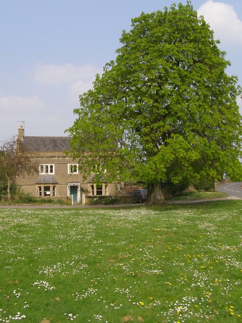
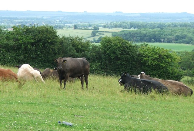
The village of Hemington itself is small and picturesque, with a charming mix of traditional stone cottages and newer houses. It is surrounded by beautiful countryside, including rolling hills, farmland, and woodlands. The River Frome runs through the parish, adding to the natural beauty of the area.

Hemington is known for its peaceful and rural atmosphere, making it an attractive place for those seeking a quiet and idyllic lifestyle. The parish has a strong sense of community, with various social and recreational activities organized for residents throughout the year. There is a local pub that serves as a gathering place for both locals and visitors.

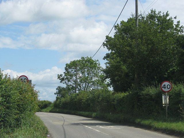
Despite its small size, Hemington is conveniently located near major transport links. The nearby A36 road provides easy access to Bath and Frome, while the larger cities of Bristol and Salisbury are within a reasonable driving distance. The village is also served by regular bus services, connecting it to the wider region.

Overall, Hemington offers a tranquil and picturesque setting for residents, with easy access to amenities and transport links. Its natural beauty and sense of community make it a desirable place to live.

If you have any feedback on the listing, please let us know in the comments section below.

Hemington Images

Images are sourced within 2km of 51.283687/-2.376661 or Grid Reference ST7353. Thanks to Geograph Open Source API. All images are credited.

Old Milestone by A366, North of Hemington, just West of Crossroads The Milestone is located on grass verge on the South of the road.  Parish of Hemington (Mendip District). Metal plate attached to stone post, Radstock iron plate design, erected by the Radstock turnpike trust in the 18th century, top right corner of plate gone; chips on top left of stone. An earlier photograph can be found here: <a title="https://www.geograph.org.uk/photo/6035396" href="https://www.geograph.org.uk/photo/6035396">Link</a> 

Inscription reads:-  
RADSTOCK / 3 / P. NORTON / 3   

Grade II listed. List Entry Number: 1408656 <span class="nowrap"><a title="https://historicengland.org.uk/listing/the-list/list-entry/1408656" rel="nofollow ugc noopener" href="https://historicengland.org.uk/listing/the-list/list-entry/1408656">Link</a><img style="margin-left:2px;" alt="External link" title="External link - shift click to open in new window" src="https://s1.geograph.org.uk/img/external.png" width="10" height="10"/></span> 

Milestone Society National ID: SO_FRPN11
Old Milestone by A366, North of Hemington, just West of Crossroads
The Milestone is located on grass verge on the South of the road.  Parish of Hemington (Mendip District). Metal plate attached to stone post, Radstock iron plate design, erected by the Radstock turnpike trust in the 18th century, top right corner of plate gone; chips on top left of stone. An earlier photograph can be found here: Link  Inscription reads:- RADSTOCK / 3 / P. NORTON / 3 Grade II listed. List Entry Number: 1408656 LinkExternal link Milestone Society National ID: SO_FRPN11
Road from Foxcote meets the A366
The A366 leaves Faulkland past a converted chapel
The A366 drops down the hill towards Tucker's Bottom
The A366 leaves Tucker's Bottom
St Mary's church, Hardington Bampfylde (interior) Belying the building's Norman origins is an interior that looks distinctly Georgian. The pulpit and altar rails are of the late C18, whilst the box pews are early C19; it followed much rebuilding in the early C17. The Royal Arms of Charles I above the chancel arch was repainted in 1817. The 'wonky' chancel arch itself is possibly Norman, whilst the nave is late C14. This little church sits amongst modern farm buildings and is now cared for by the Churches Conservation Trust.
St Mary's church, Hardington Bampfylde (interior)
Belying the building's Norman origins is an interior that looks distinctly Georgian. The pulpit and altar rails are of the late C18, whilst the box pews are early C19; it followed much rebuilding in the early C17. The Royal Arms of Charles I above the chancel arch was repainted in 1817. The 'wonky' chancel arch itself is possibly Norman, whilst the nave is late C14. This little church sits amongst modern farm buildings and is now cared for by the Churches Conservation Trust.
St Mary's church, Hardington Bampfylde - Bampfylde monument This fine wall monument to Colonel Warwick Bampfylde (†1694) in the chancel stands 12 feet tall. As well as the Colonel, the memorial inscription also commemorates three further generations of the Bampfylde family.
St Mary's church, Hardington Bampfylde - Bampfylde monument
This fine wall monument to Colonel Warwick Bampfylde (†1694) in the chancel stands 12 feet tall. As well as the Colonel, the memorial inscription also commemorates three further generations of the Bampfylde family.
Blessed Virgin Mary, Hemington
FAULKLAND, Hemington, Somerset The former Wesleyan Chapel was converted into a house recently
FAULKLAND, Hemington, Somerset
The former Wesleyan Chapel was converted into a house recently
HARDINGTON,  Somerset This small redundant church is in the care of the Churches Conservation Trust
HARDINGTON, Somerset
This small redundant church is in the care of the Churches Conservation Trust
Blessed Virgin Mary, Hemington
Hemington: Faulkland Looking west-north-west to houses on the green at Faulkland. Seen from the A366 road
Hemington: Faulkland
Looking west-north-west to houses on the green at Faulkland. Seen from the A366 road
Hemington: near Faulkland Looking east-south-east towards cottages on the A366 Norton St Philip road. The Westbury White Horse is just visible on the far hill, over the border in Wiltshire
Hemington: near Faulkland
Looking east-south-east towards cottages on the A366 Norton St Philip road. The Westbury White Horse is just visible on the far hill, over the border in Wiltshire
Ford on Faulkland Lane A view looking north along Faulkland Lane showing the ford on the stream which forms the county boundary at this point.  The ford is quite shallow, despite recent heavy rains.
Ford on Faulkland Lane
A view looking north along Faulkland Lane showing the ford on the stream which forms the county boundary at this point. The ford is quite shallow, despite recent heavy rains.
Horse chestnut tree on the green, Faulkland In the foreground is the village green at Faulkland, covered in daisies. The A366 road is to the right of the large horse chestnut tree.
Horse chestnut tree on the green, Faulkland
In the foreground is the village green at Faulkland, covered in daisies. The A366 road is to the right of the large horse chestnut tree.
Village pond and cottages, Faulkland This pond is to the south of the A366 road through Faulkland, near Bishop Street. The parish newsletter of October 2006 reports that the parish council is seeking to establish whether it has ownership of the pond, with a view to cleaning it out. It looks like it has been cleaned out.
Village pond and cottages, Faulkland
This pond is to the south of the A366 road through Faulkland, near Bishop Street. The parish newsletter of October 2006 reports that the parish council is seeking to establish whether it has ownership of the pond, with a view to cleaning it out. It looks like it has been cleaned out.
Signpost at the crossroads near Chickwell New Farm Chickwell (old) Farm is about half a mile down the road to the left.
Signpost at the crossroads near Chickwell New Farm
Chickwell (old) Farm is about half a mile down the road to the left.
Cattle Pasture between Faulkland and Hardington Looking across Somerset into Wiltshire.
The hills on the skyline are part of the Salisbury Plane escarpment between Westbury and Warminster.
Cattle Pasture between Faulkland and Hardington
Looking across Somerset into Wiltshire. The hills on the skyline are part of the Salisbury Plane escarpment between Westbury and Warminster.
Show me another place!

Hemington is located at Grid Ref: ST7353 (Lat: 51.283687, Lng: -2.376661)

Administrative County: Somerset

District: Mendip

Police Authority: Avon and Somerset

What 3 Words

///sketching.reckoned.steep. Near Wellow, Somerset

Related Wikis

Hemington, Somerset

Hemington is a village and civil parish 5.5 miles (8.9 km) north west of Frome, in the Mendip district of Somerset, England. It is located just off the...

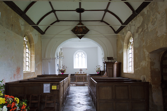
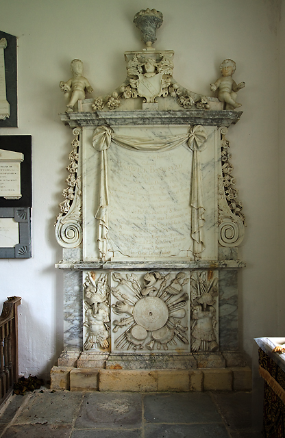
St Mary's Church, Hemington

St. Mary's Hemington is an Anglican church in Hemington, Somerset, England. The Norman church underwent major renovation in the 14th, 15th, 17th and 19th...

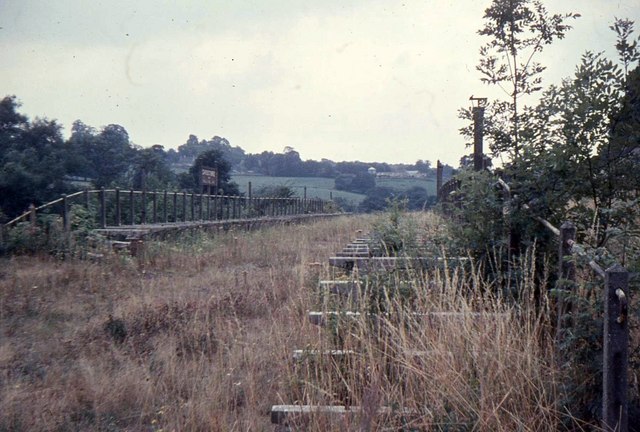
Shoscombe and Single Hill Halt railway station

Shoscombe & Single Hill Halt was a small railway station on the Somerset and Dorset Joint Railway serving small villages between Wellow and Radstock, about...

Church of St James The Less, Foxcote

The Anglican Church of St James The Less in Foxcote, within the English county of Somerset, was rebuilt in the early 18th century incorporating a 15th...

Nearby Amenities

Located within 500m of 51.283687,-2.376661
Barrier: stile
Lat/Long: 51.2850647/-2.377298
Turning Circle
Lat/Long: 51.2831835/-2.372605
The data included in this document is from www.openstreetmap.org. The data is made available under ODbL.

Have you been to Hemington?

Leave your review of Hemington below (or comments, questions and feedback).