Haverhill

Civil Parish in Suffolk St Edmundsbury

England

Haverhill

Roundabout on the Haverhill Bypass
Roundabout on the Haverhill Bypass Credit: David Howard

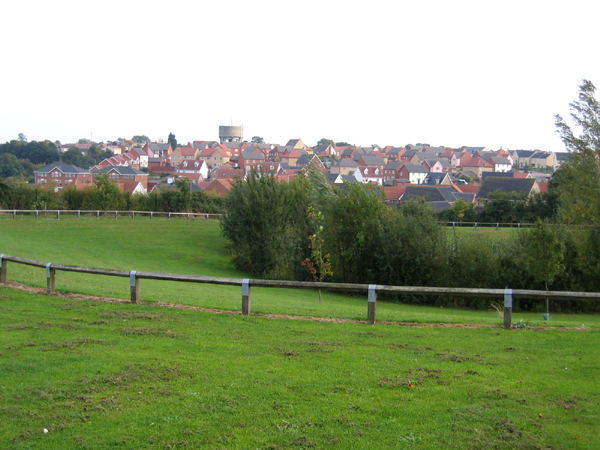
Haverhill is a civil parish located in the county of Suffolk, England. It is situated on the River Stour, about 20 miles southeast of Cambridge and 14 miles northeast of Bury St Edmunds. With a population of around 27,000, it is the second largest town in Suffolk.

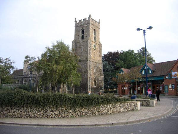
The town has a rich history dating back to the Saxon period, and evidence of Roman settlements has also been found in the area. In the 19th century, Haverhill became a major center for the manufacturing of agricultural machinery, and later, it transitioned into a hub for the textile industry. Although the textile industry has declined since the mid-20th century, Haverhill still retains some manufacturing and industrial presence.

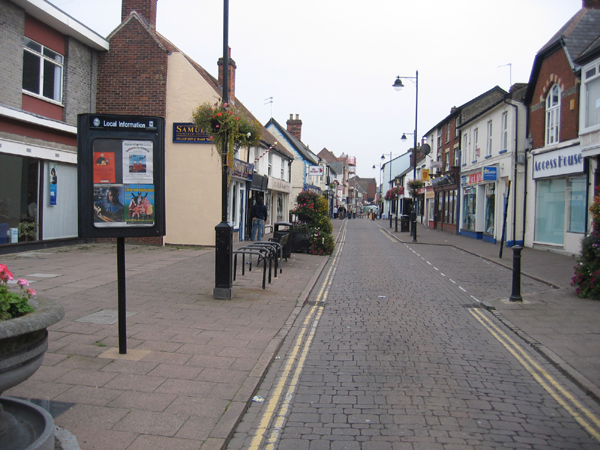
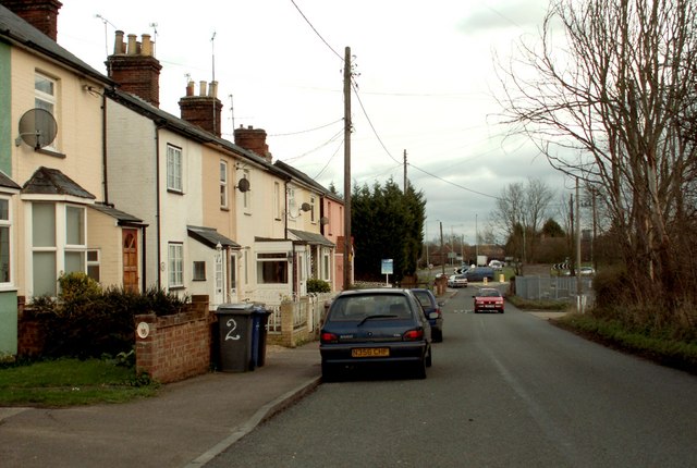
Haverhill offers a range of amenities and services to its residents. The town center is home to a variety of shops, restaurants, and businesses, providing a vibrant shopping experience. The community is well-served with several primary and secondary schools, as well as a public library and leisure center.

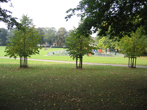
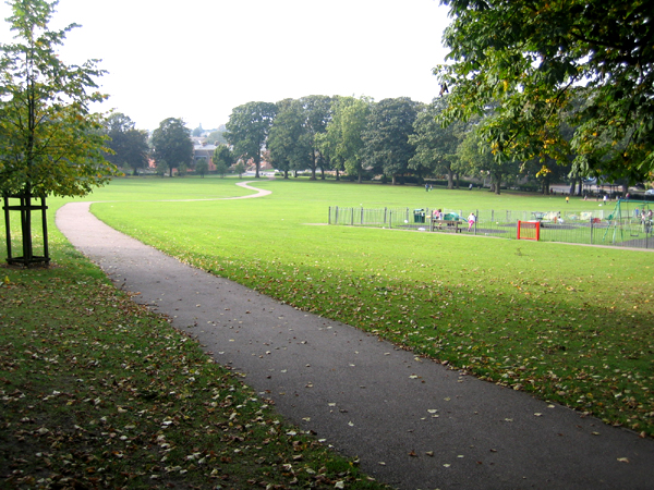
The town is surrounded by picturesque countryside, making it an attractive place for outdoor enthusiasts. Haverhill offers various green spaces, including the East Town Park and Haverhill Country Park, which provide opportunities for leisurely walks, cycling, and picnicking.

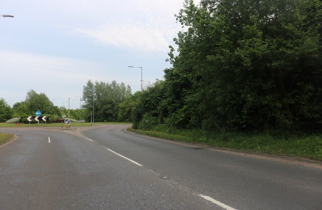
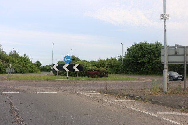
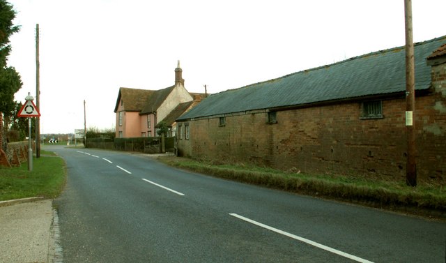
Haverhill benefits from good transport links, with the A1017 road passing through the town, connecting it to nearby towns and cities. The town also has bus services to neighboring areas and a railway station in nearby Audley End, providing access to London and other major cities.

Overall, Haverhill is a diverse and historically significant town that offers a range of amenities, beautiful surroundings, and convenient transport links for its residents.

If you have any feedback on the listing, please let us know in the comments section below.
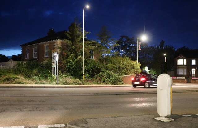
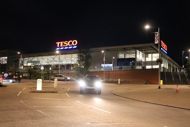
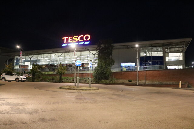
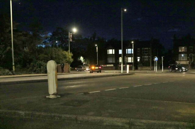
Haverhill Images

Images are sourced within 2km of 52.081352/0.434637 or Grid Reference TL6645. Thanks to Geograph Open Source API. All images are credited.

Roundabout on the Haverhill Bypass
Amazing roundabout on the Haverhill Bypass It says it is anyway.
Amazing roundabout on the Haverhill Bypass
It says it is anyway.
Tesco cafe, Haverhill On the side of the supermarket.
Tesco cafe, Haverhill
On the side of the supermarket.
Lord's Croft Lane, Haverhill
Tesco supermarket, Haverhill
Lord's Croft Lane, Haverhill
KFC on Lord's Croft Lane, Haverhill
Market Hill and parish church, Haverhill, Suffolk Dedicated to St Mary; the Drabbet Smock pub on the right.
Market Hill and parish church, Haverhill, Suffolk
Dedicated to St Mary; the Drabbet Smock pub on the right.
Queen Street, Haverhill, Suffolk Quiet for a Saturday afternoon, but England were playing Austria (1-0).
Queen Street, Haverhill, Suffolk
Quiet for a Saturday afternoon, but England were playing Austria (1-0).
The recreation ground and bandstand, Haverhill, Suffolk The rec was presented to the community of Haverhill by the Gurteen family at the end of the 19th century; the Millennium Bandstand was opened in June 1999 <span class="nowrap"><a title="http://www.haverhill-uk.com/photo/rec.shtml" rel="nofollow ugc noopener" href="http://www.haverhill-uk.com/photo/rec.shtml">Link</a><img style="margin-left:2px;" alt="External link" title="External link - shift click to open in new window" src="https://s1.geograph.org.uk/img/external.png" width="10" height="10"/></span>.
The recreation ground and bandstand, Haverhill, Suffolk
The rec was presented to the community of Haverhill by the Gurteen family at the end of the 19th century; the Millennium Bandstand was opened in June 1999 LinkExternal link.
The recreation ground, Haverhill, Suffolk
The town of Haverhill, Suffolk View from Chivers Road with small wetland in foreground, rooftops of the town in the middle distance and water tower in the far distance <a href="https://www.geograph.org.uk/gridref/TL6747">TL6747</a>.
The town of Haverhill, Suffolk
View from Chivers Road with small wetland in foreground, rooftops of the town in the middle distance and water tower in the far distance TL6747.
Hazel Stub Farm This is the road from Nosterfield End looking towards Haverhill.
Hazel Stub Farm
This is the road from Nosterfield End looking towards Haverhill.
The end of the road from Withersfield
Spring Cottages along the A.143
Show me another place!

Haverhill is located at Grid Ref: TL6645 (Lat: 52.081352, Lng: 0.434637)

Administrative County: Suffolk

District: St Edmundsbury

Police Authority: Suffolk

What 3 Words

///importing.garages.families. Near Haverhill, Suffolk

Nearby Locations

Haverhill Clements

Related Wikis

Haverhill, Suffolk

Haverhill ( HAY-vər-hil, HAYV-ril) is a market town and civil parish in the county of Suffolk, England, next to the borders of Essex and Cambridgeshire...

Corn Exchange, Haverhill

The Corn Exchange is a commercial building in Withersfield Road in Haverhill, Suffolk, England. The structure, which is currently vacant and deteriorating...

Haverhill South railway station

Haverhill South railway station was located in Haverhill, Suffolk. It was a terminus on the Colne Valley and Halstead Railway. In 1924 passenger services...

Haverhill railway station (England)

Haverhill railway station was a station in Haverhill, Suffolk, on the Stour Valley Railway, which opened in 1865 and closed in 1967. It was sometimes known...

Nearby Amenities

Located within 500m of 52.081352,0.434637
Haverhill
Name Ru: Хейверилл
Place: town
Population: 27041
Wikidata: Q262092
Wikipedia: en:Haverhill, Suffolk
Lat/Long: 52.0832721/0.4353932
Mini Roundabout
Direction: clockwise
Lat/Long: 52.0846879/0.4365746
Mini Roundabout
Direction: clockwise
Lat/Long: 52.0772087/0.4364384
Mini Roundabout
Direction: clockwise
Lat/Long: 52.0789524/0.437818
Mini Roundabout
Direction: clockwise
Lat/Long: 52.0820395/0.4313909
Give Way
Direction: SW
Lat/Long: 52.0779408/0.4328418
Mini Roundabout
Direction: clockwise
Lat/Long: 52.0814363/0.4276848
Fire Station
Haverhill Fire Station
Lat/Long: 52.0826037/0.4416042
Doctors
Christmas Maltings Surgery
Addr Postcode: CB9 8HF
Addr Street: Camps Road
Healthcare: doctor
Lat/Long: 52.0827194/0.4353865
Crossing
Crossing: uncontrolled
Crossing Ref: zebra
Lat/Long: 52.0850094/0.4359906
Bus Station
Haverhill bus station
Bus: yes
Naptan AtcoCode: 390GHAV1
Public Transport: station
Lat/Long: 52.0823228/0.4407815
Parking
Created By: Potlatch 0.6
Lat/Long: 52.0817802/0.4416733
Post Box
Brand: Royal Mail
Brand Wikidata: Q638098
Brand Wikipedia: en:Royal Mail
Collection Times: Mo-Fr 17:30; Sa 11:30
Operator: Royal Mail
Operator Wikidata: Q638098
Post Box Design: type_b
Post Box Type: pillar
Ref: CB9 14
Royal Cypher: EIIR
Royal Cypher Wikidata: Q33102113
Source: survey
Lat/Long: 52.0820079/0.4274829
Telephone
Booth: KX100
Covered: booth
Lat/Long: 52.0815757/0.4275761
Post Box
Brand: Royal Mail
Brand Wikidata: Q638098
Brand Wikipedia: en:Royal Mail
Collection Times: Mo-Fr 09:00; Sa 07:00
Operator: Royal Mail
Operator Wikidata: Q638098
Post Box Type: lamp
Ref: CB9 21
Royal Cypher: EIIR
Royal Cypher Wikidata: Q33102113
Source: survey
Lat/Long: 52.0833554/0.4313594
Turning Circle
Source: Bing
Lat/Long: 52.0797465/0.4379777
Turning Circle
Source: Bing
Lat/Long: 52.0801725/0.4372457
Turning Circle
Lat/Long: 52.0796652/0.4346735
Fuel
BP
Brand: BP
Brand Wikidata: Q152057
Brand Wikipedia: en:BP
Operator: BP
Lat/Long: 52.0781905/0.4338038
Post Box
Brand: Royal Mail
Brand Wikidata: Q638098
Brand Wikipedia: en:Royal Mail
Collection Times: Mo-Fr 09:00; Sa 07:00
Operator: Royal Mail
Operator Wikidata: Q638098
Post Box Design: type_b
Post Box Type: pillar
Ref: CB9 12
Royal Cypher: EIIR
Royal Cypher Wikidata: Q33102113
Source: survey
Lat/Long: 52.0778176/0.432479
Noexit: yes
Lat/Long: 52.0791053/0.4283882
Bus Stop
Bus Station
Bus: yes
Local Ref: G
Naptan AtcoCode: 390050225
Naptan CommonName: Bus Station
Naptan Indicator: Stand G
Naptan Landmark: Bus Station
Naptan NaptanCode: sufgdptm
Naptan Street: Bus Station
Naptan Verified: no
Public Transport: platform
Source: naptan_import
Lat/Long: 52.0827315/0.4402719
Bus Stop
Bus Station
Bus: yes
Local Ref: F
Naptan AtcoCode: 390050226
Naptan CommonName: Bus Station
Naptan Indicator: Stand F
Naptan Landmark: Bus Station
Naptan NaptanCode: sufgdptp
Naptan Street: Bus Station
Naptan Verified: no
Public Transport: platform
Source: naptan_import
Lat/Long: 52.0826129/0.4404489
Bus Stop
Bus Station
Bus: yes
Local Ref: E
Naptan AtcoCode: 390050227
Naptan CommonName: Bus Station
Naptan Indicator: Stand E
Naptan Landmark: Bus Station
Naptan NaptanCode: sufgdptw
Naptan Street: Bus Station
Naptan Verified: no
Public Transport: platform
Source: naptan_import
Lat/Long: 52.0824792/0.4406104
Bus Stop
Bus Station
Bus: yes
Local Ref: D
Naptan AtcoCode: 390050228
Naptan CommonName: Bus Station
Naptan Indicator: Stand D
Naptan Landmark: Bus Station
Naptan NaptanCode: sufgdpwa
Naptan Street: Bus Station
Naptan Verified: no
Public Transport: platform
Source: naptan_import
Lat/Long: 52.0823588/0.4407789
Bus Stop
Bus Station
Bus: yes
Local Ref: C
Naptan AtcoCode: 390050229
Naptan CommonName: Bus Station
Naptan Indicator: Stand C
Naptan Landmark: Bus Station
Naptan NaptanCode: sufgdpwd
Naptan Street: Bus Station
Naptan Verified: no
Public Transport: platform
Source: naptan_import
Lat/Long: 52.0822291/0.4409616
Bus Stop
Bus Station
Bus: yes
Local Ref: B
Naptan AtcoCode: 390050230
Naptan CommonName: Bus Station
Naptan Indicator: Stand B
Naptan Landmark: Bus Station
Naptan NaptanCode: sufgdpwg
Naptan Street: Bus Station
Naptan Verified: no
Public Transport: platform
Source: naptan_import
Lat/Long: 52.0821151/0.4411302
Bus Stop
Bus Station
Bus: yes
Local Ref: A or 1
Naptan AtcoCode: 390050231
Naptan CommonName: Bus Station
Naptan Indicator: Stand A Arrival
Naptan Landmark: Bus Station
Naptan NaptanCode: sufgdpwj
Naptan Street: Bus Station
Naptan Verified: no
Public Transport: platform
Source: naptan_import
Lat/Long: 52.0819931/0.4412804
Bus Stop
Health Centre
Bus: yes
Naptan AtcoCode: 390050232
Naptan Bearing: SW
Naptan CommonName: Health Centre
Naptan Indicator: adj
Naptan Landmark: Health Centre
Naptan NaptanCode: sufgdpwm
Naptan Street: Camps Road
Naptan Verified: no
Public Transport: platform
Source: naptan_import
Lat/Long: 52.0825611/0.4353455
Bus Stop
Health Centre
Bus: yes
Naptan AtcoCode: 390050233
Naptan Bearing: NE
Naptan BusStopType: CUS
Naptan CommonName: Health Centre
Naptan Indicator: opp
Naptan Landmark: Health Centre
Naptan NaptanCode: sufgdpwp
Naptan Street: Camps Road
Naptan Verified: no
Public Transport: platform
Source: naptan_import
Lat/Long: 52.0826342/0.4352911
Bus Stop
Priory Avenue
Bus: yes
Naptan AtcoCode: 390050234
Naptan Bearing: S
Naptan CommonName: Priory Avenue
Naptan Indicator: adj
Naptan Landmark: Priory Avenue
Naptan NaptanCode: sufgdpwt
Naptan Street: Clements Way
Naptan Verified: no
Public Transport: platform
Source: naptan_import
Lat/Long: 52.0814962/0.4316092
Bus Stop
Priory Avenue
Bus: yes
Naptan AtcoCode: 390050235
Naptan Bearing: S
Naptan BusStopType: CUS
Naptan CommonName: Priory Avenue
Naptan Indicator: opp
Naptan Landmark: Priory Avenue
Naptan NaptanCode: sufgdtad
Naptan Street: Clements Way
Naptan Verified: no
Public Transport: platform
Source: naptan_import
Lat/Long: 52.0814804/0.4315062
Bus Stop
Castle Lane
Bus: yes
Naptan AtcoCode: 390050236
Naptan Bearing: N
Naptan CommonName: Castle Way
Naptan Indicator: adj
Naptan Landmark: Castle Way
Naptan NaptanCode: sufgdtag
Naptan Street: Crowland Road
Naptan Verified: no
Public Transport: platform
Source: naptan_import
Lat/Long: 52.0824954/0.4311235
Bus Stop
Castle Lane
Bus: yes
Naptan AtcoCode: 390050237
Naptan Bearing: S
Naptan BusStopType: CUS
Naptan CommonName: Castle Way
Naptan Indicator: opp
Naptan Landmark: Castle Way
Naptan NaptanCode: sufgdtaj
Naptan Street: Crowland Road
Naptan Verified: no
Public Transport: platform
Source: naptan_import
Lat/Long: 52.0825374/0.4312717
Bus Stop
Hazel Close
Bus: yes
Naptan AtcoCode: 390050241
Naptan Bearing: S
Naptan BusStopType: CUS
Naptan CommonName: Hazel Close
Naptan Indicator: opp
Naptan Landmark: Hazel Close
Naptan NaptanCode: sufgdtaw
Naptan Street: North Avenue
Naptan Verified: no
Public Transport: platform
Source: naptan_import
Lat/Long: 52.0823359/0.4275241
Bus Stop
Layer Road
Bus: yes
Naptan AtcoCode: 390050254
Naptan Bearing: E
Naptan CommonName: Layer Road
Naptan Indicator: adj
Naptan Landmark: Layer Road
Naptan NaptanCode: sufgdtgt
Naptan Street: Burton End
Naptan Verified: no
Public Transport: platform
Source: naptan_import
Lat/Long: 52.0815235/0.4281076
Bus Stop
Layer Road
Bus: yes
Naptan AtcoCode: 390050255
Naptan Bearing: W
Naptan BusStopType: CUS
Naptan CommonName: Layer Road
Naptan Indicator: opp
Naptan Landmark: Layer Road
Naptan NaptanCode: sufgdtgw
Naptan Street: Burton End
Naptan Verified: no
Public Transport: platform
Source: naptan_import
Lat/Long: 52.081425/0.4280877
Bus Stop
Cornwallis Road
Bench: no
Bin: no
Bus: yes
Naptan AtcoCode: 390050272
Naptan Bearing: SW
Naptan CommonName: Cornwallis Road
Naptan Indicator: adj
Naptan Landmark: Cornwallis Road
Naptan NaptanCode: sufgdtpg
Naptan Street: Greenfields Way
Naptan Verified: no
Public Transport: platform
Shelter: no
Source: naptan_import
Tactile Paving: no
Lat/Long: 52.0774863/0.4320042
Bus Stop
Cornwallis Road
Bus: yes
Naptan AtcoCode: 390050273
Naptan Bearing: NE
Naptan CommonName: Cornwallis Road
Naptan Indicator: opp
Naptan Landmark: Cornwallis Road
Naptan NaptanCode: sufgdtpj
Naptan Street: Greenfields Way
Naptan Verified: no
Public Transport: platform
Source: naptan_import
Lat/Long: 52.0776539/0.4321593
Bus Stop
Mill Hill
Bench: no
Bin: no
Bus: yes
Naptan AtcoCode: 390050274
Naptan Bearing: W
Naptan CommonName: Mill Hill
Naptan Indicator: adj
Naptan Landmark: Mill Hill
Naptan NaptanCode: sufgdtpm
Naptan Street: Duddery Hill
Naptan Verified: no
Public Transport: platform
Shelter: no
Source: naptan_import
Tactile Paving: no
Lat/Long: 52.0784577/0.4359102
Bus Stop
Mill Hill
Bench: no
Bin: no
Bus: yes
Lit: yes
Naptan AtcoCode: 390050275
Naptan Bearing: E
Naptan CommonName: Mill Hill
Naptan Indicator: opp
Naptan Landmark: Mill Hill
Naptan NaptanCode: sufgdtpt
Naptan Street: Duddery Hill
Naptan Verified: no
Public Transport: platform
Shelter: no
Source: naptan_import
Tactile Paving: no
Lat/Long: 52.0785125/0.4358694
Bus Stop
Helions Walk
Bus: yes
Naptan AtcoCode: 390050276
Naptan Bearing: W
Naptan CommonName: Helions Walk
Naptan Indicator: opp
Naptan Landmark: Helions Walk
Naptan NaptanCode: sufgdtpw
Naptan Street: Duddery Hill
Naptan Verified: no
Public Transport: platform
Source: naptan_import
Lat/Long: 52.0795544/0.4402756
Bus Stop
White Hart
Bench: no
Bin: no
Bus: yes
Naptan AtcoCode: 390050284
Naptan Bearing: NE
Naptan CommonName: White Hart
Naptan Indicator: o/s
Naptan Landmark: White Hart
Naptan NaptanCode: sufgdwad
Naptan Street: Duddery Hill
Naptan Verified: no
Public Transport: platform
Shelter: no
Source: naptan_import
Lat/Long: 52.0800094/0.4413221
Bus Stop
Broad Street
Bus: yes
Naptan AtcoCode: 390050311
Naptan Bearing: S
Naptan BusStopType: CUS
Naptan CommonName: Broad Street
Naptan Indicator: adj
Naptan Landmark: Broad Street
Naptan NaptanCode: sufgdwjw
Naptan Street: Withersfield Road
Naptan Verified: no
Public Transport: platform
Source: naptan_import
Lat/Long: 52.0853717/0.4356112
Bus Stop
Broad Street
Bus: yes
Naptan AtcoCode: 390050312
Naptan Bearing: N
Naptan CommonName: Broad Street
Naptan Indicator: opp
Naptan Landmark: Broad Street
Naptan NaptanCode: sufgdwma
Naptan Street: Withersfield Road
Naptan Verified: no
Public Transport: platform
Source: naptan_import
Lat/Long: 52.0854185/0.4354573
Taxi
Car Park
Naptan AtcoCode: 390059004
Naptan CommonName: Car Park
Naptan Landmark: Taxi Rank
Naptan Street: Brook Service Road
Naptan Verified: no
Source: naptan_import
Lat/Long: 52.0822369/0.4405825
Taxi
Church
Naptan AtcoCode: 390059005
Naptan CommonName: Church
Naptan Landmark: Taxi Rank
Naptan Street: Market Hill
Naptan Verified: no
Source: naptan_import
Lat/Long: 52.0827286/0.4385512
Crossing
Crossing: traffic_signals
Crossing Island: no
Crossing Ref: puffin
Tactile Paving: yes
Lat/Long: 52.084748/0.4381145
Turning Circle
Lat/Long: 52.0810776/0.4307848
Haverhill (CVHR)
Historic Railway: station
Railway: site
Source: Wikipedia + OS7
Wikidata: Q5683783
Wikipedia: en:Haverhill South railway station
Lat/Long: 52.0788013/0.4394742
Vapor Quip E-cigarette Shop
Addr City: Haverhill
Addr Postcode: CB9 8BG
Addr Street: Recreation Road
Check Date Currency XBT: 2023-01-25
Currency XBT: yes
Email: timirving@outlook.com
Payment Lightning: no
Payment Lightning Contactless: no
Payment Onchain: yes
Phone: +44 1440 710235
Shop: yes
Website: http://www.vaporquip.co.uk/
Lat/Long: 52.0810729/0.4359992
Pharmacy
Boots
Addr City: Haverhill
Addr Housenumber: 13-15
Addr Postcode: CB9 8AD
Addr Street: Market Hill
Brand: Boots
Brand Wikidata: Q6123139
Brand Wikipedia: en:Boots (company)
Fhrs Id: 1674619
Healthcare: pharmacy
Source Addr: FHRS Open Data
Website: https://www.boots.com/stores/166-haverhill-high-street-cb9-8ad
Lat/Long: 52.0827104/0.4388013
Telephone
Booth: KX100
Covered: booth
Lat/Long: 52.0825888/0.4385514
Addr City: Haverhill
Addr Housename: Chauntry Mills
Addr Postcode: CB9 8AZ
Lat/Long: 52.0818974/0.438466
Crossing
Crossing Island: yes
Lat/Long: 52.0798877/0.4319015
1st Stop Recruitment
Addr City: Haverhill
Addr Housenumber: 6
Addr Postcode: CB9 8DA
Addr Street: Jubilee Walk
Lat/Long: 52.0814303/0.4410427
Crossing: informal
Lat/Long: 52.0793777/0.4393645
Post Box
Brand: Royal Mail
Brand Wikidata: Q638098
Brand Wikipedia: en:Royal Mail
Collection Times: Mo-Fr 17:45; Sa 11:30
Operator: Royal Mail
Operator Wikidata: Q638098
Post Box Design: type_b
Post Box Type: pillar
Ref: CB9 22
Royal Cypher: EIIR
Royal Cypher Wikidata: Q33102113
Source: survey
Lat/Long: 52.0843835/0.4366033
Post Box
Brand: Royal Mail
Brand Wikidata: Q638098
Brand Wikipedia: en:Royal Mail
Collection Times: Mo-Fr 17:30; Sa 11:30
Operator: Royal Mail
Operator Wikidata: Q638098
Post Box Design: type_a
Post Box Type: pillar
Ref: CB9 62
Royal Cypher: EIIR
Royal Cypher Wikidata: Q33102113
Source: survey
Lat/Long: 52.0848363/0.4390892
Post Box
Brand: Royal Mail
Brand Wikidata: Q638098
Brand Wikipedia: en:Royal Mail
Collection Times: Mo-Fr 18:00; Sa 12:00
Operator: Royal Mail
Operator Wikidata: Q638098
Post Box Apertures: 2
Post Box Design: type_c
Post Box Type: pillar
Ref: CB9 53
Royal Cypher: EIIR
Royal Cypher Wikidata: Q33102113
Source: survey
Lat/Long: 52.0828257/0.4385722
Post Box
Brand: Royal Mail
Brand Wikidata: Q638098
Brand Wikipedia: en:Royal Mail
Collection Times: Mo-Fr 09:00; Sa 07:00
Operator: Royal Mail
Operator Wikidata: Q638098
Post Box Type: lamp
Ref: CB9 11
Royal Cypher: EIIR
Royal Cypher Wikidata: Q33102113
Source: survey
Lat/Long: 52.0809379/0.4359984
Post Box
Brand: Royal Mail
Brand Wikidata: Q638098
Brand Wikipedia: en:Royal Mail
Collection Times: Mo-Fr 17:30; Sa 11:30
Operator: Royal Mail
Operator Wikidata: Q638098
Post Box Design: type_a
Post Box Type: pillar
Ref: CB9 10
Royal Cypher: EIIR
Royal Cypher Wikidata: Q33102113
Source: survey
Lat/Long: 52.0781677/0.4382147
Defibrillator
Access: yes
Defibrillator Location: On the right-hand side of the job centre, facing the Woolpack.
Emergency: defibrillator
Indoor: no
Not Ref GB The Circuit: 5DCBEB8C-3496-428E-A899-B12B00B1FFB8
Operator: Community Heartbeat Trust
Ref: CHT-10054
Lat/Long: 52.0845125/0.436528
Crossing
Crossing: uncontrolled
Crossing Ref: zebra
Lat/Long: 52.0843248/0.4366703
Pharmacy
Haverhill Pharmacy
Addr Postcode: CB9 8HF
Addr Street: Camps Road
Healthcare: pharmacy
Lat/Long: 52.0827491/0.4355418
Pharmacy
Well Pharmacy
Addr Housenumber: 2
Addr Postcode: CB9 8BD
Addr Street: Mill Road
Brand: Well Pharmacy
Brand Wikidata: Q7726524
Brand Wikipedia: en:Well Pharmacy
Healthcare: pharmacy
Website: https://finder.well.co.uk/store/haverhill-mill-road
Lat/Long: 52.0827321/0.4372439
Extremes
Shop: hairdresser
Lat/Long: 52.0832098/0.4376908
Magic Scissors
Shop: hairdresser
Lat/Long: 52.08318/0.4375969
Crossing
Crossing: marked
Lat/Long: 52.083276/0.440812
Crossing
Crossing: marked
Lat/Long: 52.0835733/0.4404888
Crossing
Crossing: marked
Lat/Long: 52.0834272/0.4406169
Generator Method: photovoltaic
Generator Output Electricity: yes
Generator Source: solar
Generator Type: solar_photovoltaic_panel
Location: roof
Power: generator
Lat/Long: 52.0840323/0.4297167
Generator Method: photovoltaic
Generator Output Electricity: yes
Generator Source: solar
Generator Type: solar_photovoltaic_panel
Location: roof
Power: generator
Lat/Long: 52.0839087/0.4299206
Generator Method: photovoltaic
Generator Output Electricity: yes
Generator Source: solar
Generator Type: solar_photovoltaic_panel
Location: roof
Power: generator
Lat/Long: 52.0833944/0.4299661
Generator Method: photovoltaic
Generator Output Electricity: yes
Generator Source: solar
Generator Type: solar_photovoltaic_panel
Location: roof
Power: generator
Lat/Long: 52.0833647/0.4281154
Generator Method: photovoltaic
Generator Output Electricity: yes
Generator Source: solar
Generator Type: solar_photovoltaic_panel
Location: roof
Power: generator
Lat/Long: 52.0833944/0.4283944
Generator Method: photovoltaic
Generator Output Electricity: yes
Generator Source: solar
Generator Type: solar_photovoltaic_panel
Location: roof
Power: generator
Lat/Long: 52.0831109/0.4281583
Generator Method: photovoltaic
Generator Output Electricity: yes
Generator Source: solar
Generator Type: solar_photovoltaic_panel
Location: roof
Power: generator
Lat/Long: 52.0831142/0.4282361
Generator Method: photovoltaic
Generator Output Electricity: yes
Generator Source: solar
Generator Type: solar_photovoltaic_panel
Location: roof
Power: generator
Lat/Long: 52.0825258/0.430221
Generator Method: photovoltaic
Generator Output Electricity: yes
Generator Source: solar
Generator Type: solar_photovoltaic_panel
Location: roof
Power: generator
Lat/Long: 52.0823659/0.4298481
Generator Method: photovoltaic
Generator Output Electricity: yes
Generator Source: solar
Generator Type: solar_photovoltaic_panel
Location: roof
Power: generator
Lat/Long: 52.0823741/0.4299313
Generator Method: photovoltaic
Generator Output Electricity: yes
Generator Source: solar
Generator Type: solar_photovoltaic_panel
Location: roof
Power: generator
Lat/Long: 52.0823131/0.4299286
Generator Method: photovoltaic
Generator Output Electricity: yes
Generator Source: solar
Generator Type: solar_photovoltaic_panel
Location: roof
Power: generator
Lat/Long: 52.0823082/0.4298562
Generator Method: photovoltaic
Generator Output Electricity: yes
Generator Source: solar
Generator Type: solar_photovoltaic_panel
Location: roof
Power: generator
Lat/Long: 52.0777949/0.4322246
Generator Method: photovoltaic
Generator Output Electricity: yes
Generator Source: solar
Generator Type: solar_photovoltaic_panel
Location: roof
Power: generator
Lat/Long: 52.0774372/0.4313689
Generator Method: photovoltaic
Generator Output Electricity: yes
Generator Source: solar
Generator Type: solar_photovoltaic_panel
Location: roof
Power: generator
Lat/Long: 52.0778015/0.4312456
Generator Method: photovoltaic
Generator Output Electricity: yes
Generator Source: solar
Generator Type: solar_photovoltaic_panel
Location: roof
Power: generator
Lat/Long: 52.0777537/0.431141
Generator Method: photovoltaic
Generator Output Electricity: yes
Generator Source: solar
Generator Type: solar_photovoltaic_panel
Location: roof
Power: generator
Lat/Long: 52.0776532/0.4308781
Generator Method: photovoltaic
Generator Output Electricity: yes
Generator Source: solar
Generator Type: solar_photovoltaic_panel
Location: roof
Power: generator
Lat/Long: 52.0778559/0.4306501
Generator Method: photovoltaic
Generator Output Electricity: yes
Generator Source: solar
Generator Type: solar_photovoltaic_panel
Location: roof
Power: generator
Lat/Long: 52.0776499/0.4305321
Generator Method: photovoltaic
Generator Output Electricity: yes
Generator Source: solar
Generator Type: solar_photovoltaic_panel
Location: roof
Power: generator
Lat/Long: 52.07809/0.4296577
Generator Method: photovoltaic
Generator Output Electricity: yes
Generator Source: solar
Generator Type: solar_photovoltaic_panel
Location: roof
Power: generator
Lat/Long: 52.0799445/0.4290247
Generator Method: photovoltaic
Generator Output Electricity: yes
Generator Source: solar
Generator Type: solar_photovoltaic_panel
Location: roof
Power: generator
Lat/Long: 52.0800763/0.4287055
Generator Method: photovoltaic
Generator Output Electricity: yes
Generator Source: solar
Generator Type: solar_photovoltaic_panel
Location: roof
Power: generator
Lat/Long: 52.0800632/0.4284668
Generator Method: photovoltaic
Generator Output Electricity: yes
Generator Source: solar
Generator Type: solar_photovoltaic_panel
Location: roof
Power: generator
Lat/Long: 52.0810307/0.4275843
Generator Method: photovoltaic
Generator Output Electricity: yes
Generator Source: solar
Generator Type: solar_photovoltaic_panel
Location: roof
Power: generator
Lat/Long: 52.0810456/0.427992
Generator Method: photovoltaic
Generator Output Electricity: yes
Generator Source: solar
Generator Type: solar_photovoltaic_panel
Location: roof
Power: generator
Lat/Long: 52.0810456/0.4280966
Generator Method: photovoltaic
Generator Output Electricity: yes
Generator Source: solar
Generator Type: solar_photovoltaic_panel
Location: roof
Power: generator
Lat/Long: 52.0808247/0.428912
Generator Method: photovoltaic
Generator Output Electricity: yes
Generator Source: solar
Generator Type: solar_photovoltaic_panel
Location: roof
Power: generator
Lat/Long: 52.0805742/0.4283971
Generator Method: photovoltaic
Generator Output Electricity: yes
Generator Source: solar
Generator Type: solar_photovoltaic_panel
Location: roof
Power: generator
Lat/Long: 52.0805758/0.4285124
Generator Method: photovoltaic
Generator Output Electricity: yes
Generator Source: solar
Generator Type: solar_photovoltaic_panel
Location: roof
Power: generator
Lat/Long: 52.0802824/0.4286304
Generator Method: photovoltaic
Generator Output Electricity: yes
Generator Source: solar
Generator Type: solar_photovoltaic_panel
Location: roof
Power: generator
Lat/Long: 52.0802857/0.428786
Generator Method: photovoltaic
Generator Output Electricity: yes
Generator Source: solar
Generator Type: solar_photovoltaic_panel
Location: roof
Power: generator
Lat/Long: 52.0802906/0.4288986
Generator Method: photovoltaic
Generator Output Electricity: yes
Generator Source: solar
Generator Type: solar_photovoltaic_panel
Location: roof
Power: generator
Lat/Long: 52.0808115/0.4312965
Generator Method: photovoltaic
Generator Output Electricity: yes
Generator Source: solar
Generator Type: solar_photovoltaic_panel
Location: roof
Power: generator
Lat/Long: 52.0808742/0.4312643
Generator Method: photovoltaic
Generator Output Electricity: yes
Generator Source: solar
Generator Type: solar_photovoltaic_panel
Location: roof
Power: generator
Lat/Long: 52.0809483/0.4312322
Generator Method: photovoltaic
Generator Output Electricity: yes
Generator Source: solar
Generator Type: solar_photovoltaic_panel
Location: roof
Power: generator
Lat/Long: 52.0806978/0.4308271
Generator Method: photovoltaic
Generator Output Electricity: yes
Generator Source: solar
Generator Type: solar_photovoltaic_panel
Location: roof
Power: generator
Lat/Long: 52.0807077/0.4309559
Generator Method: photovoltaic
Generator Output Electricity: yes
Generator Source: solar
Generator Type: solar_photovoltaic_panel
Location: roof
Power: generator
Lat/Long: 52.0809566/0.4309773
Generator Method: photovoltaic
Generator Output Electricity: yes
Generator Source: solar
Generator Type: solar_photovoltaic_panel
Location: roof
Power: generator
Lat/Long: 52.080945/0.4308915
Generator Method: photovoltaic
Generator Output Electricity: yes
Generator Source: solar
Generator Type: solar_photovoltaic_panel
Location: roof
Power: generator
Lat/Long: 52.0808709/0.4306474
Generator Method: photovoltaic
Generator Output Electricity: yes
Generator Source: solar
Generator Type: solar_photovoltaic_panel
Location: roof
Power: generator
Lat/Long: 52.0808577/0.4305589
Generator Method: photovoltaic
Generator Output Electricity: yes
Generator Source: solar
Generator Type: solar_photovoltaic_panel
Location: roof
Power: generator
Lat/Long: 52.0811544/0.4303899
Generator Method: photovoltaic
Generator Output Electricity: yes
Generator Source: solar
Generator Type: solar_photovoltaic_panel
Location: roof
Power: generator
Lat/Long: 52.0811709/0.4305053
Generator Method: photovoltaic
Generator Output Electricity: yes
Generator Source: solar
Generator Type: solar_photovoltaic_panel
Location: roof
Power: generator
Lat/Long: 52.0812022/0.430752
Generator Method: photovoltaic
Generator Output Electricity: yes
Generator Source: solar
Generator Type: solar_photovoltaic_panel
Location: roof
Power: generator
Lat/Long: 52.0812137/0.4308566
Generator Method: photovoltaic
Generator Output Electricity: yes
Generator Source: solar
Generator Type: solar_photovoltaic_panel
Location: roof
Power: generator
Lat/Long: 52.0815599/0.4301056
Generator Method: photovoltaic
Generator Output Electricity: yes
Generator Source: solar
Generator Type: solar_photovoltaic_panel
Location: roof
Power: generator
Lat/Long: 52.0816209/0.4304382
Generator Method: photovoltaic
Generator Output Electricity: yes
Generator Source: solar
Generator Type: solar_photovoltaic_panel
Location: roof
Power: generator
Lat/Long: 52.0816654/0.4306984
Generator Method: photovoltaic
Generator Output Electricity: yes
Generator Source: solar
Generator Type: solar_photovoltaic_panel
Location: roof
Power: generator
Lat/Long: 52.0837603/0.4378304
Generator Method: photovoltaic
Generator Output Electricity: yes
Generator Source: solar
Generator Type: solar_photovoltaic_panel
Location: roof
Power: generator
Lat/Long: 52.0851679/0.4339144
Generator Method: photovoltaic
Generator Output Electricity: yes
Generator Source: solar
Generator Type: solar_photovoltaic_panel
Location: roof
Power: generator
Lat/Long: 52.0844344/0.4327342
Generator Method: photovoltaic
Generator Output Electricity: yes
Generator Source: solar
Generator Type: solar_photovoltaic_panel
Location: roof
Power: generator
Lat/Long: 52.0836301/0.4292795
Generator Method: photovoltaic
Generator Output Electricity: yes
Generator Source: solar
Generator Type: solar_photovoltaic_panel
Location: roof
Power: generator
Lat/Long: 52.0836334/0.4292124
Barrier: bollard
Lat/Long: 52.0842515/0.4380343
Bench
Lat/Long: 52.0843817/0.4383348
Crossing
Crossing: traffic_signals
Crossing Ref: puffin
Lat/Long: 52.0832881/0.4402604
Barrier: bollard
Lat/Long: 52.0843144/0.438114
Bench
Lat/Long: 52.0843783/0.4383911
Barrier: bollard
Lat/Long: 52.0839263/0.4374222
Bus Stop
Helions Walk
Bench: no
Bin: yes
Bus: yes
Naptan AtcoCode: 390050277
Naptan BusStopType: CUS
Naptan NaptanCode: sufgdtwa
Naptan Verified: no
Public Transport: platform
Shelter: no
Source: naptan
Lat/Long: 52.0798639/0.4408824
Crossing
Crossing: uncontrolled
Crossing Ref: zebra
Kerb: flush
Tactile Paving: yes
Lat/Long: 52.0833207/0.4381947
Noexit: yes
Lat/Long: 52.0804744/0.4285701
Mithu's Continental Mart
Addr City: Haverhill
Addr Housename: 17A Market Hill
Addr Postcode: CB9 8AD
Addr Street: Market Hill
Shop: deli
Lat/Long: 52.0825703/0.438956
Generator Method: photovoltaic
Generator Output Electricity: yes
Generator Source: solar
Generator Type: solar_photovoltaic_panel
Location: roof
Power: generator
Lat/Long: 52.0807769/0.4356739
Generator Method: photovoltaic
Generator Output Electricity: yes
Generator Source: solar
Generator Type: solar_photovoltaic_panel
Location: roof
Power: generator
Lat/Long: 52.0807901/0.4358348
Generator Method: photovoltaic
Generator Output Electricity: yes
Generator Source: solar
Generator Type: solar_photovoltaic_panel
Location: roof
Power: generator
Lat/Long: 52.0808264/0.4366288
Generator Method: photovoltaic
Generator Output Electricity: yes
Generator Source: solar
Generator Type: solar_photovoltaic_panel
Location: roof
Power: generator
Lat/Long: 52.0808412/0.4363364
Generator Method: photovoltaic
Generator Output Electricity: yes
Generator Source: solar
Generator Type: solar_photovoltaic_panel
Location: roof
Power: generator
Lat/Long: 52.0808362/0.4362425
Generator Method: photovoltaic
Generator Output Electricity: yes
Generator Source: solar
Generator Type: solar_photovoltaic_panel
Location: roof
Power: generator
Lat/Long: 52.0802329/0.4338285
Generator Method: photovoltaic
Generator Output Electricity: yes
Generator Source: solar
Generator Type: solar_photovoltaic_panel
Location: roof
Power: generator
Lat/Long: 52.0802939/0.4340324
Generator Method: photovoltaic
Generator Output Electricity: yes
Generator Source: solar
Generator Type: solar_photovoltaic_panel
Location: roof
Power: generator
Lat/Long: 52.0799165/0.4316264
Generator Method: photovoltaic
Generator Output Electricity: yes
Generator Source: solar
Generator Type: solar_photovoltaic_panel
Location: roof
Power: generator
Lat/Long: 52.0798274/0.4316184
Generator Method: photovoltaic
Generator Output Electricity: yes
Generator Source: solar
Generator Type: solar_photovoltaic_panel
Location: roof
Power: generator
Lat/Long: 52.0789966/0.4343489
Generator Method: photovoltaic
Generator Output Electricity: yes
Generator Source: solar
Generator Type: solar_photovoltaic_panel
Location: roof
Power: generator
Lat/Long: 52.0790148/0.4346091
Generator Method: photovoltaic
Generator Output Electricity: yes
Generator Source: solar
Generator Type: solar_photovoltaic_panel
Location: roof
Power: generator
Lat/Long: 52.079028/0.4347485
Generator Method: photovoltaic
Generator Output Electricity: yes
Generator Source: solar
Generator Type: solar_photovoltaic_panel
Location: roof
Power: generator
Lat/Long: 52.0794566/0.4345635
Generator Method: photovoltaic
Generator Output Electricity: yes
Generator Source: solar
Generator Type: solar_photovoltaic_panel
Location: roof
Power: generator
Lat/Long: 52.0798785/0.4350463
Generator Method: photovoltaic
Generator Output Electricity: yes
Generator Source: solar
Generator Type: solar_photovoltaic_panel
Location: roof
Power: generator
Lat/Long: 52.0796346/0.4352018
Generator Method: photovoltaic
Generator Output Electricity: yes
Generator Source: solar
Generator Type: solar_photovoltaic_panel
Location: roof
Power: generator
Lat/Long: 52.0796906/0.4355156
Generator Method: photovoltaic
Generator Output Electricity: yes
Generator Source: solar
Generator Type: solar_photovoltaic_panel
Location: roof
Power: generator
Lat/Long: 52.0792604/0.4360574
Generator Method: photovoltaic
Generator Output Electricity: yes
Generator Source: solar
Generator Type: solar_photovoltaic_panel
Location: roof
Power: generator
Lat/Long: 52.0791582/0.4354325
Generator Method: photovoltaic
Generator Output Electricity: yes
Generator Source: solar
Generator Type: solar_photovoltaic_panel
Location: roof
Power: generator
Lat/Long: 52.0791994/0.43569
Generator Method: photovoltaic
Generator Output Electricity: yes
Generator Source: solar
Generator Type: solar_photovoltaic_panel
Location: roof
Power: generator
Lat/Long: 52.0789093/0.4355586
Generator Method: photovoltaic
Generator Output Electricity: yes
Generator Source: solar
Generator Type: solar_photovoltaic_panel
Location: roof
Power: generator
Lat/Long: 52.0787626/0.4364544
Pub
The Bull
Addr City: Haverhill
Addr Housenumber: 8
Addr Postcode: CB9 8HB
Addr Street: Camps Road
Fhrs Id: 1674669
Lat/Long: 52.0831062/0.437275
Pub
The Nine Jars
Addr City: Haverhill
Addr Housenumber: 9
Addr Postcode: CB9 8AA
Addr Street: High Street
Fhrs Id: 1673739
Lat/Long: 52.0829748/0.4385227
Pub
The Queen's Head
Addr City: Haverhill
Addr Housenumber: 9
Addr Postcode: CB9 9DZ
Addr Street: Queen Street
Fhrs Id: 1674631
Lat/Long: 52.0836082/0.4375367
Pub
The Royal Exchange
Addr City: Haverhill
Addr Housenumber: 69
Addr Postcode: CB9 8AH
Addr Street: High Street
Lat/Long: 52.0806196/0.4413851
Crossing
Crossing: uncontrolled
Crossing Ref: zebra
Lat/Long: 52.0827834/0.4401836
Place Of Worship
The Salvation Army - Haverhill
Addr City: Haverhill
Addr Country: GB
Addr Housenumber: 13-15
Addr Postcode: CB9 8BE
Addr Street: Chauntry Road
Denomination: salvation_army
Email: haverhill@salvationarmy.org.uk
Phone: +44 1440 705247
Religion: christian
Website: https://www.salvationarmy.org.uk/haverhill
Lat/Long: 52.0819011/0.4359743
Man Made: chimney
Material: concrete
Lat/Long: 52.0826408/0.4363568
Telephone
Booth: KX100
Covered: booth
Lat/Long: 52.0826033/0.4385487
Bench
Backrest: yes
Lat/Long: 52.0826338/0.4385227
Bicycle Parking
Bicycle Parking: stands
Capacity: 8
Covered: no
Lat/Long: 52.0824/0.43904
Poundstretcher
Addr City: Haverhill
Addr Housenumber: 12
Addr Postcode: CB9 8DA
Addr Street: Jubilee Walk
Brand: Poundstretcher
Brand Wikidata: Q7235675
Fhrs Id: 1673704
Shop: variety_store
Source Addr: FHRS Open Data
Website: https://www.poundstretcher.co.uk/haverhill-784
Lat/Long: 52.0814568/0.4415169
Recycling
Clothes and Shoes recycling
Recycling Type: container
Lat/Long: 52.0818896/0.4405321
Dentist
Dental Surgery
Lat/Long: 52.0848628/0.4356661
Clintons
Branch: Cards
Brand: Clintons
Brand Wikidata: Q5134299
Shop: gift
Lat/Long: 52.0817573/0.439558
Fast Food
Greggs
Addr City: Haverhill
Addr Housenumber: 30
Addr Postcode: CB9 8AR
Addr Street: High Street
Brand: Greggs
Brand Wikidata: Q3403981
Contact Website: https://www.greggs.co.uk/shop-finder?shop-code=0888
Cuisine: sandwich;bakery
Fhrs Id: 1674997
Opening Hours: Mo-Sa 07:00-19:00; Su 08:00-17:00
Source Addr: FHRS Open Data
Takeaway: yes
Lat/Long: 52.0812912/0.4401919
Original Haverhill Sweetshop
Shop: confectionery
Lat/Long: 52.0810001/0.4410232
Restaurant
Route 66 Diner
Addr City: Haverhill
Addr Housenumber: 42
Addr Postcode: CB9 8AR
Addr Street: High Street
Fhrs Id: 1114636
Source Addr: FHRS Open Data
Lat/Long: 52.0809427/0.4406114
Card Factory
Addr City: Haverhill
Addr Housenumber: 51
Addr Postcode: CB9 8AH
Addr Street: High Street
Brand: Card Factory
Brand Wikidata: Q5038192
Fhrs Id: 1674878
Shop: gift
Lat/Long: 52.0815117/0.4403923
Jamie's Meat Inn
Addr City: Haverhill
Addr Housenumber: 28
Addr Postcode: CB9 8AR
Addr Street: High Street
Fhrs Id: 1674120
Shop: butcher
Source Addr: FHRS Open Data
Lat/Long: 52.0814236/0.4400586
Addr Housenumber: 39
Addr Postcode: CB9 8AE
Addr Street: High Street
Disused Shop: yes
Lat/Long: 52.0818536/0.4400128
Simpkins Jewellers
Shop: jewelry
Lat/Long: 52.0815161/0.4399407
Cafe
Glasswells
Lat/Long: 52.0812518/0.4407001
Boots Opticians
Brand: Boots Opticians
Brand Wikidata: Q4944037
Shop: optician
Short Name: Boots
Lat/Long: 52.0816988/0.4401024
The Works
Brand: The Works
Brand Wikidata: Q7775853
Shop: gift
Website: https://www.theworks.co.uk/Store?storeId=1083
Lat/Long: 52.0814067/0.4405172
Fast Food
Papa John's
Addr City: Haverhill
Addr Housenumber: 36
Addr Postcode: CB9 8AR
Addr Street: High Street
Brand: Papa John's
Brand Wikidata: Q2759586
Cuisine: pizza
Fhrs Id: 1674215
Source Addr: FHRS Open Data
Takeaway: yes
Website: https://www.papajohns.co.uk/stores/haverhill
Lat/Long: 52.0811305/0.4404006
Magic Touch
Shop: dry_cleaning
Lat/Long: 52.0807887/0.4412138
Restaurant
Ceo's Kitchen Turkish Restaurant
Addr City: Haverhill
Addr Housenumber: 65
Addr Postcode: CB9 8AH
Addr Street: High Street
Fhrs Id: 1674611
Source Addr: FHRS Open Data
Lat/Long: 52.0808837/0.4411332
Clarks
Addr City: Haverhill
Addr Housenumber: 1
Addr Postcode: CB9 8DA
Addr Street: Jubilee Walk
Brand: Clarks
Brand Wikidata: Q1095857
Phone: +44 1440 761884
Shop: shoes
Website: https://www.clarks.com/en-gb/store-locator/UnitedKingdom/HAVERHILL/2411
Lat/Long: 52.0815611/0.4403366
First Class Turkish Barbers
Shop: hairdresser
Lat/Long: 52.0810223/0.4409159
Timpson
Craft: shoemaker
Lat/Long: 52.0834139/0.4378805
Specsavers
Addr City: Haverhill
Addr Housename: 8 The Chauntry
Addr Postcode: CB9 8AR
Addr Street: High Street
Brand: Specsavers
Brand Wikidata: Q2000610
Phone: +44 1440 765060
Shop: optician
Website: https://www.specsavers.co.uk/stores/haverhill
Lat/Long: 52.0820233/0.4393277
Bank
Suffolk Building Society
Addr City: Haverhill
Addr Housenumber: 16a
Addr Postcode: CB9 8AR
Addr Street: High Street
Brand Wikidata: Q6065542
Website: https://www.suffolkbuildingsociety.co.uk/branches/haverhill/
Lat/Long: 52.0820769/0.4392454
Fast Food
China Garden
Addr City: Haverhill
Addr Housenumber: 6
Addr Postcode: CB9 9EG
Addr Street: Queens Square
Fhrs Id: 1674366
Source Addr: FHRS Open Data
Lat/Long: 52.0842844/0.4376283
The Pet Hut (in Poundstretcher)
Shop: pet
Lat/Long: 52.0814389/0.441539
Sense Charity Shop
Shop: variety_store
Lat/Long: 52.0814032/0.4410783
YMCA
Brand: YMCA
Brand Wikidata: Q157169
Shop: charity
Lat/Long: 52.0819534/0.4397392
Shop: vacant
Lat/Long: 52.0824413/0.4391527
Chapman & Son
Shop: electronics
Lat/Long: 52.0822767/0.4388731
Savers
Brand: Savers
Brand Wikidata: Q7428189
Official Name: Savers Health & Beauty
Shop: chemist
Lat/Long: 52.0811647/0.4403714
Cheffins
Office: estate_agent
Lat/Long: 52.0823151/0.4393299
Waste Basket
Waste: trash; cigarettes; dog_excrement
Lat/Long: 52.0824884/0.4389451
Daylin Flavell Floral Design
Shop: florist
Lat/Long: 52.0823773/0.438706
Peacocks
Brand: Peacocks
Brand Wikidata: Q7157762
Shop: clothes
Lat/Long: 52.083241/0.4382938
Waste Basket
Waste: trash; cigarettes; dog_excrement
Lat/Long: 52.0793859/0.4392914
Shop: vacant
Lat/Long: 52.0810057/0.4405532
Shop: vacant
Lat/Long: 52.0819826/0.4393802
Post Office
Atm: yes
Brand: Post Office
Brand Wikidata: Q1783168
Lat/Long: 52.0828209/0.4386855
The co-operative funeral care
Shop: funeral_directors
Lat/Long: 52.0830416/0.4384785
Waste Basket
Waste: trash; cigarettes; dog_excrement
Lat/Long: 52.0787611/0.4367347
Time2Vape
Shop: e-cigarette
Lat/Long: 52.0816404/0.4401805
Waste Basket
Waste: trash; cigarettes; dog_excrement
Lat/Long: 52.0812846/0.4405101
Shop: vacant
Lat/Long: 52.0815565/0.4398906
Cafe
Costa
Brand: Costa
Brand Wikidata: Q608845
Cuisine: coffee_shop
Takeaway: yes
Lat/Long: 52.0823916/0.4392296
Holland & Barrett
Brand: Holland & Barrett
Brand Wikidata: Q5880870
Shop: health_food
Lat/Long: 52.082623/0.4388892
Bank
Lloyds Bank
Atm: yes
Brand: Lloyds Bank
Brand Wikidata: Q1152847
Website: https://branches.lloydsbank.com/suffolk/8-high-street
Lat/Long: 52.0823316/0.4387901
Shop: vacant
Lat/Long: 52.0818742/0.4395132
Camera Mount: wall
Camera Type: dome
Man Made: surveillance
Surveillance Type: camera
Lat/Long: 52.0827191/0.4373955
Restaurant
Gavin's Wok and Grill
Lat/Long: 52.0819011/0.4398168
Nicom IT Services
Shop: computer
Lat/Long: 52.0814856/0.4399862
Shop: vacant
Lat/Long: 52.0819342/0.4394429
Griffith Jones Jewellers
Shop: jewelry
Lat/Long: 52.0816721/0.440136
Loot Drop
Shop: collector
Lat/Long: 52.0813513/0.4401465
Community Centre
The LINK
Opening Hours: Tu-Fr 10:00-16:00
Phone: +44 01440 702134
Lat/Long: 52.0816147/0.4402074
HackettGriffey
Office: accountant
Lat/Long: 52.0821568/0.4394828
Shop: vacant
Lat/Long: 52.082076/0.4396077
Betfred
Brand: Betfred
Brand Wikidata: Q4897425
Shop: bookmaker
Lat/Long: 52.0821299/0.4391681
Bench
Backrest: yes
Material: wood
Lat/Long: 52.0777387/0.432719
Balmforth
Office: estate_agent
Lat/Long: 52.0822017/0.4390456
Waste Basket
Waste: trash; cigarettes
Lat/Long: 52.0824825/0.4387873
Camera Mount: wall
Camera Type: dome
Man Made: surveillance
Surveillance Type: camera
Lat/Long: 52.0827309/0.437431
Camera Mount: wall
Camera Type: dome
Man Made: surveillance
Surveillance Type: camera
Lat/Long: 52.0781616/0.433916
Camera Mount: wall
Camera Type: dome
Man Made: surveillance
Surveillance Type: camera
Lat/Long: 52.0827314/0.4376653
Waste Basket
Waste: trash; cigarettes; dog_excrement
Lat/Long: 52.0816799/0.4414449
Coral
Brand: Coral
Brand Wikidata: Q54621344
Shop: bookmaker
Lat/Long: 52.0810843/0.4404697
Fairhurst Menuhin & Co Solicitors
Office: lawyer
Lat/Long: 52.082354/0.4392803
Bank
Saffron Building Society
Lat/Long: 52.0833613/0.4381161
Martin's
Shop: convenience
Lat/Long: 52.082241/0.4394234
Camera Mount: wall
Camera Type: panning
Man Made: surveillance
Operator: West Suffolk Council
Surveillance: public
Surveillance Type: camera
Lat/Long: 52.0825627/0.4386035
Camera Mount: wall
Camera Type: dome
Man Made: surveillance
Surveillance Type: camera
Lat/Long: 52.0826192/0.4373864
Waste Basket
Waste: trash; cigarettes; dog_excrement
Lat/Long: 52.0798801/0.4408979
Camera Mount: wall
Camera Type: fixed
Man Made: surveillance
Surveillance Type: camera
Lat/Long: 52.0813849/0.4408055
OG. Nails and Beauty
Beauty: nails
Shop: beauty
Lat/Long: 52.0818223/0.4395763
WHSmith
Brand: WHSmith
Brand Wikidata: Q1548712
Shop: newsagent
Lat/Long: 52.0825059/0.4390535
Saffron Insurance
Office: insurance
Lat/Long: 52.0825491/0.4385301
Shop: vacant
Lat/Long: 52.0831311/0.4383868
Waste Basket
Waste: trash; cigarettes; dog_excrement
Lat/Long: 52.0777571/0.4327688
Bychoice
Office: estate_agent
Lat/Long: 52.0822769/0.4393786
Camera Mount: wall
Camera Type: dome
Man Made: surveillance
Surveillance Type: camera
Lat/Long: 52.0812675/0.4386745
The data included in this document is from www.openstreetmap.org. The data is made available under ODbL.

Have you been to Haverhill?

Leave your review of Haverhill below (or comments, questions and feedback).