Bromley Wood

Settlement in Staffordshire East Staffordshire

England

Bromley Wood

Hart's Farm Flat, fertile East Staffordshire.
The patches of woodland form a backdrop along with a sunny early November sky.
Hart's Farm Credit: Jonathan Billinger

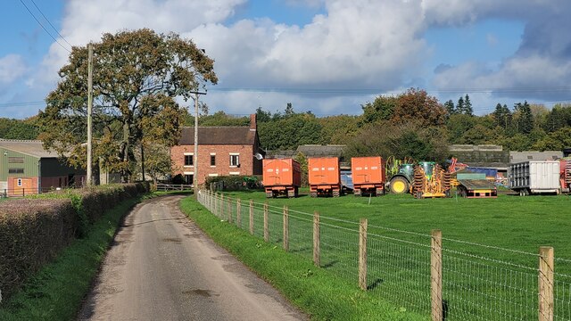
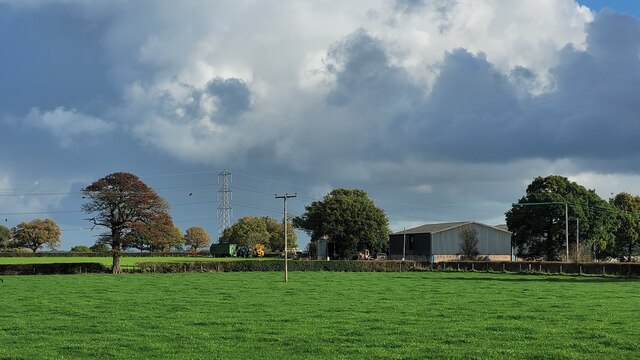
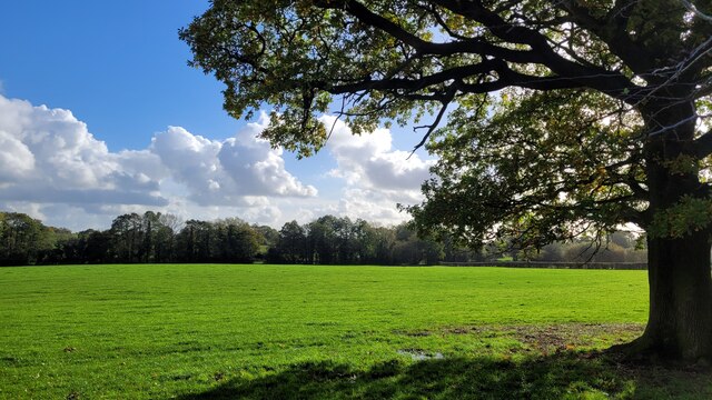
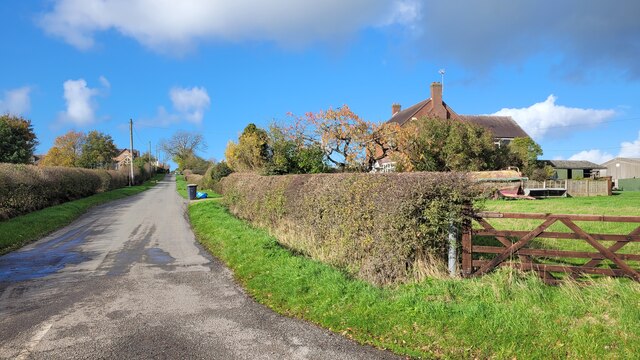
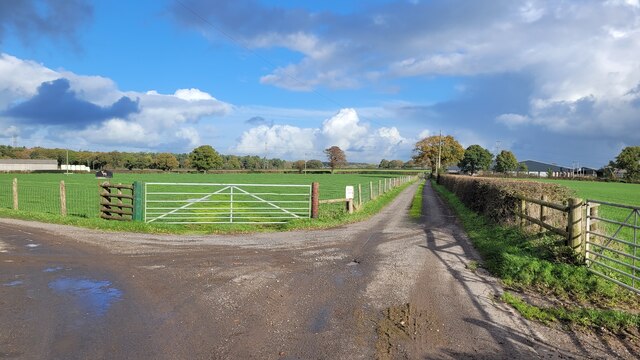
Bromley Wood is a small village located in the county of Staffordshire, England. Situated approximately 8 miles northwest of the town of Burton upon Trent, it is nestled in a rural area known for its picturesque landscapes and countryside charm.

The village is home to a tight-knit community of around 300 residents, and its history can be traced back several centuries. Evidence suggests that Bromley Wood was originally a wooded area, hence its name, before being developed into a settlement.

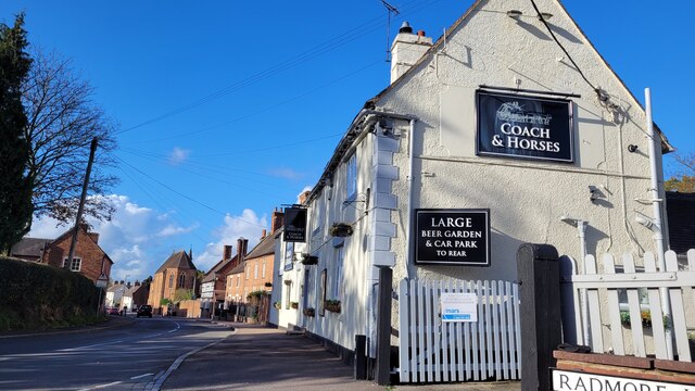
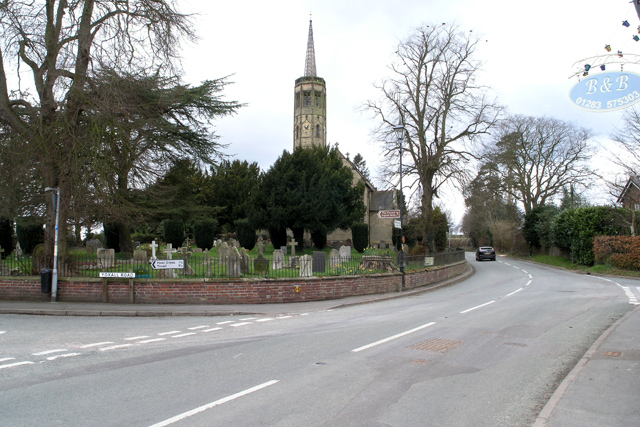
One of the prominent features of Bromley Wood is its traditional architecture. Many of the buildings in the village date back to the 18th and 19th centuries, showcasing the area's historical significance. The village is characterized by quaint cottages, farmhouses, and a charming church, which adds to its quaint and idyllic atmosphere.

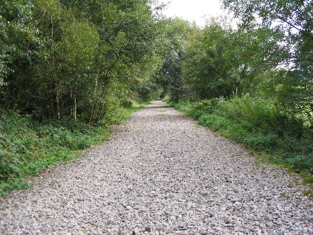
Agriculture plays a significant role in the local economy, with farming being a common occupation for many residents. The surrounding countryside also provides opportunities for outdoor activities such as walking, cycling, and horse riding, making it a popular destination for nature enthusiasts and visitors seeking a peaceful retreat.

Despite its small size, Bromley Wood benefits from its proximity to larger towns and cities. The village is well-connected to the transportation network, with easy access to major roads and nearby train stations, facilitating travel and commuting for residents.

Overall, Bromley Wood offers a serene and close-knit community, picturesque surroundings, and a rich history, making it an appealing place for those seeking a peaceful countryside lifestyle.

If you have any feedback on the listing, please let us know in the comments section below.

Bromley Wood Images

Images are sourced within 2km of 52.816214/-1.851293 or Grid Reference SK1024. Thanks to Geograph Open Source API. All images are credited.

Hart's Farm Flat, fertile East Staffordshire.
The patches of woodland form a backdrop along with a sunny early November sky.
Hart's Farm
Flat, fertile East Staffordshire. The patches of woodland form a backdrop along with a sunny early November sky.
Park Farm Two large farm units one field apart. This is Park Farm photographed from the same spot as <a href="https://www.geograph.org.uk/photo/7331944">SK1026 : Hart's Farm</a> was taken.
Park Farm
Two large farm units one field apart. This is Park Farm photographed from the same spot as SK1026 : Hart's Farm was taken.
The Coach and Horses One of several pubs in Abbot's Bromley.
The Coach and Horses
One of several pubs in Abbot's Bromley.
Flat pasture land View to the east of Radmore Lane.
Flat pasture land
View to the east of Radmore Lane.
Radmore Wood A small hamlet to the north east of Abbot's Bromley.
Radmore Wood
A small hamlet to the north east of Abbot's Bromley.
Farm tracks To the left to Hart's Farm, to the right to Park Farm.
Both are public rights of way.
Farm tracks
To the left to Hart's Farm, to the right to Park Farm. Both are public rights of way.
Ordnance Survey Flush Bracket 2504 This can be found on the wall of a disused field barn in Abbots Bromley.
Ordnance Survey Flush Bracket 2504
This can be found on the wall of a disused field barn in Abbots Bromley.
Ashbrook Lane (B5234) in Abbots Bromley Looking westward.
Ashbrook Lane (B5234) in Abbots Bromley
Looking westward.
High Street, Abbots Bromley A range of attractive houses and the school chapel, typical of the chapels of Victorian Woodard schools in its high narrow proportions.
High Street, Abbots Bromley
A range of attractive houses and the school chapel, typical of the chapels of Victorian Woodard schools in its high narrow proportions.
Abbots Bromley High Street
Old Milepost by the B5234, Abbots Bromley parish Cast iron post by the B5234, in parish of ABBOTS BROMLEY (EAST STAFFORDSHIRE District), roadside, in front of hedge, on South side of road. Lathe iron casting, erected by the County Council in the 19th/20th century. 

Inscription reads:-
: ABBOTS - / BROMLEY 1 : : ABBOTS / BROMLEY : : NEWBOROUGH 2½ / BURTON 10 : 
: Chas. Lathe, Tipton. :

Grade II listed.  
List Entry Number: 1038408 <span class="nowrap"><a title="https://historicengland.org.uk/listing/the-list/list-entry/1038408" rel="nofollow ugc noopener" href="https://historicengland.org.uk/listing/the-list/list-entry/1038408">Link</a><img style="margin-left:2px;" alt="External link" title="External link - shift click to open in new window" src="https://s1.geograph.org.uk/img/external.png" width="10" height="10"/></span>

Milestone Society National ID: ST_ASBT01.
Old Milepost by the B5234, Abbots Bromley parish
Cast iron post by the B5234, in parish of ABBOTS BROMLEY (EAST STAFFORDSHIRE District), roadside, in front of hedge, on South side of road. Lathe iron casting, erected by the County Council in the 19th/20th century. Inscription reads:- : ABBOTS - / BROMLEY 1 : : ABBOTS / BROMLEY : : NEWBOROUGH 2½ / BURTON 10 : : Chas. Lathe, Tipton. : Grade II listed. List Entry Number: 1038408 LinkExternal link Milestone Society National ID: ST_ASBT01.
Old Milepost by the B5014, Lichfield Road, Abbots Bromley Cast iron post by the B5014, in parish of ABBOTS BROMLEY (EAST STAFFORDSHIRE District), Lichfield Road, Abbots Bromley village, in pavement in front of bus shelter, on West side of road. Lathe iron casting, erected by the County Council in the 19th/20th century. 

Inscription reads:-
: UTTOXETER / 7 : : ABBOTS / BROMLEY : : NEWBOROUGH 3½ / HANDSACRE 6 / BURTON 11 / LICHFIELD 11 :
Maker:-
: Chas. Lathe, Tipton. :

Grade II listed.  
List Entry Number: 1038423 <span class="nowrap"><a title="https://historicengland.org.uk/listing/the-list/list-entry/1038423" rel="nofollow ugc noopener" href="https://historicengland.org.uk/listing/the-list/list-entry/1038423">Link</a><img style="margin-left:2px;" alt="External link" title="External link - shift click to open in new window" src="https://s1.geograph.org.uk/img/external.png" width="10" height="10"/></span>

Milestone Society National ID: ST_LFUT11.
Old Milepost by the B5014, Lichfield Road, Abbots Bromley
Cast iron post by the B5014, in parish of ABBOTS BROMLEY (EAST STAFFORDSHIRE District), Lichfield Road, Abbots Bromley village, in pavement in front of bus shelter, on West side of road. Lathe iron casting, erected by the County Council in the 19th/20th century. Inscription reads:- : UTTOXETER / 7 : : ABBOTS / BROMLEY : : NEWBOROUGH 3½ / HANDSACRE 6 / BURTON 11 / LICHFIELD 11 : Maker:- : Chas. Lathe, Tipton. : Grade II listed. List Entry Number: 1038423 LinkExternal link Milestone Society National ID: ST_LFUT11.
Coach and Horses Early 18th century inn at Abbots Bromley in Staffordshire. Grade II listed building. Abboys Bromley is famous for its ancient Horn Dance which takes place every year on Wakes Monday.
Coach and Horses
Early 18th century inn at Abbots Bromley in Staffordshire. Grade II listed building. Abboys Bromley is famous for its ancient Horn Dance which takes place every year on Wakes Monday.
Slate House Farm, Bromley Wood, near Abbots Bromley, Staffordshire. Slate House Farm is situated alongside the B5234, Abbots Bromley to Burton upon Trent road, in the hamlet of Bromley Wood. It is a dairy farm with 60 Holstein-Friesian milk cows. Brickwork in the gable end of the barn facing, proudly states the age of the building as 1859. The white farm sign on the end of the barn tells us that the farm not only supplies farm assured milk to the Dairy Crest creamery but also that food standards are assured with the 'little red tractor' symbol. It may be coincidence but the farmer has a new red Massey Ferguson tractor parked in the farmyard!
Slate House Farm, Bromley Wood, near Abbots Bromley, Staffordshire.
Slate House Farm is situated alongside the B5234, Abbots Bromley to Burton upon Trent road, in the hamlet of Bromley Wood. It is a dairy farm with 60 Holstein-Friesian milk cows. Brickwork in the gable end of the barn facing, proudly states the age of the building as 1859. The white farm sign on the end of the barn tells us that the farm not only supplies farm assured milk to the Dairy Crest creamery but also that food standards are assured with the 'little red tractor' symbol. It may be coincidence but the farmer has a new red Massey Ferguson tractor parked in the farmyard!
Fields of maize near Newborough, Staffordshire. Fields of maize look remarkably healthy in the early evening sunshine, despite a heatwave and lack of rain over the previous few weeks! The view is from the B5234 looking south-west. The edge of Birch Wood is on the left and Barn Farm can be clearly seen on the ridge in the middle distance. The cooling towers of Rugeley Power Station can just be picked out in the far distance, with Cannock Chase beyond.
Fields of maize near Newborough, Staffordshire.
Fields of maize look remarkably healthy in the early evening sunshine, despite a heatwave and lack of rain over the previous few weeks! The view is from the B5234 looking south-west. The edge of Birch Wood is on the left and Barn Farm can be clearly seen on the ridge in the middle distance. The cooling towers of Rugeley Power Station can just be picked out in the far distance, with Cannock Chase beyond.
The drive to Bentilee Park farm
Bentilee A substantial Victorian farmhouse graces this farm.
Bentilee
A substantial Victorian farmhouse graces this farm.
New farm drive, Bromley Park Farm One day this will have matured into the sort of avenue that was common in the nineteenth century.
New farm drive, Bromley Park Farm
One day this will have matured into the sort of avenue that was common in the nineteenth century.
Show me another place!

Bromley Wood is located at Grid Ref: SK1024 (Lat: 52.816214, Lng: -1.851293)

Administrative County: Staffordshire

District: East Staffordshire

Police Authority: Staffordshire

What 3 Words

///husbands.unions.interlude. Near Abbots Bromley, Staffordshire

Nearby Locations

Bromley Wood

Related Wikis

Abbots Bromley School

Abbots Bromley School (previously the School of S. Mary and S. Anne, Abbots Bromley before becoming Abbots Bromley School for Girls) was a coeducational...

Abbots Bromley

Abbots Bromley is a village and civil parish in the East Staffordshire district of Staffordshire and lies approximately 9.8 miles (15.8 km) east of Stafford...
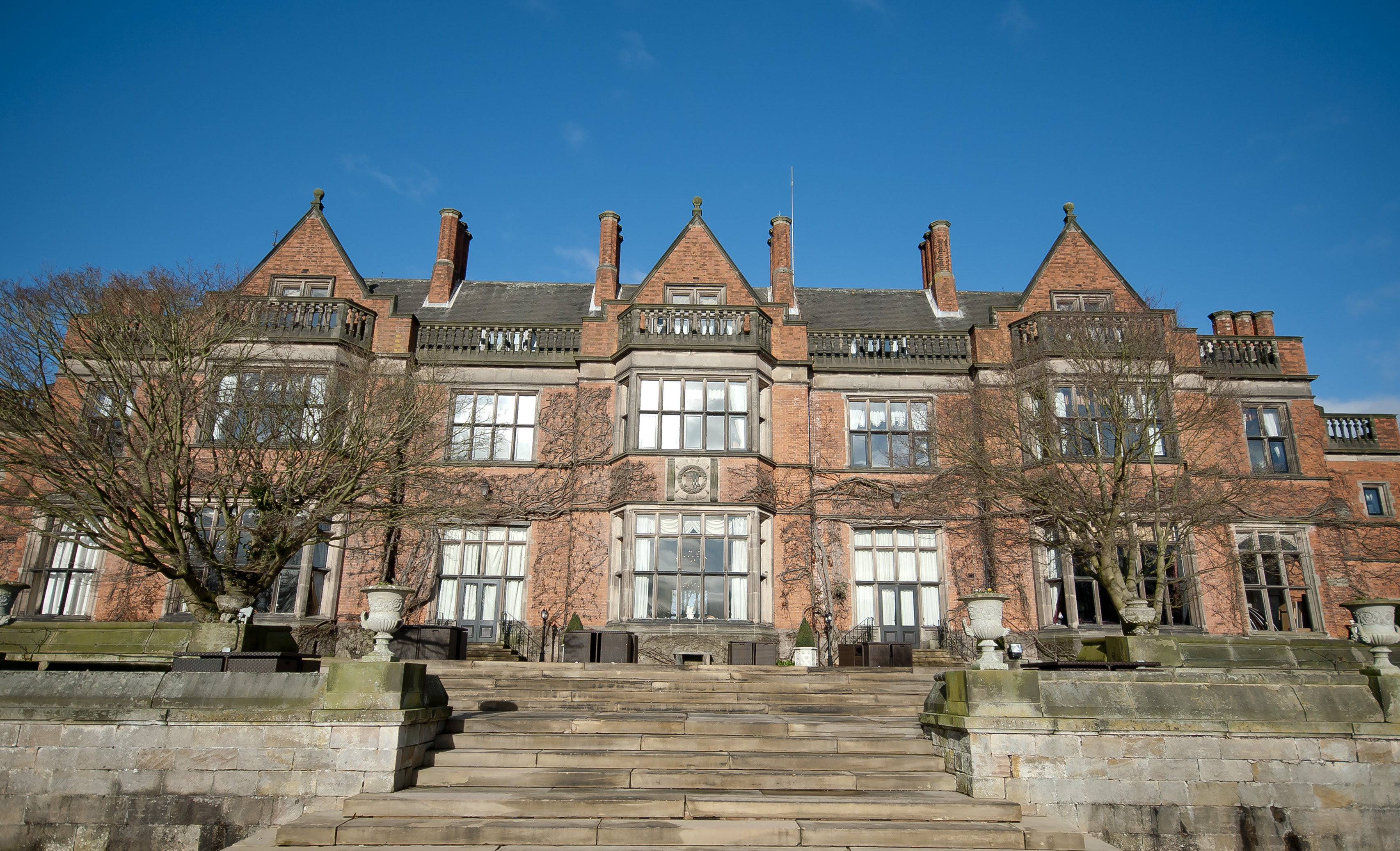
Hoar Cross Hall

Hoar Cross Hall is a 19th-century country mansion near the villages of Hoar Cross and Hamstall Ridware, Staffordshire. England. The Grade II listed building...

Church of the Holy Angels, Hoar Cross

The Church of the Holy Angels is an Anglican church in Hoar Cross, Staffordshire, England. It is a Grade I listed building. == History == It was built...

RAF Abbots Bromley

RAF Abbots Bromley is a former Royal Air Force Relief Landing Ground (RLG) located 0.7 miles (1.1 km) north-west of the village of Abbots Bromley, Staffordshire...

Staffordshire Way

The Staffordshire Way is a long-distance walk in Staffordshire, England. The path links with the Cheshire Gritstone Trail, the Heart of England Way and...

Newborough, Staffordshire

Newborough is a village and civil parish in the county of Staffordshire, England. It is located 3 miles (5 km) south west of Hanbury and 8 miles (13 km...

Bagot's Wood

Bagot's Wood is the largest extant piece of the ancient Needwood Forest, located near to Abbots Bromley, in Staffordshire, England. The forest derives...

Nearby Amenities

Located within 500m of 52.816214,-1.851293
Milestone
Source: survey
Lat/Long: 52.8152667/-1.8533716
Bromley Wood
Place: hamlet
Source: survey
Lat/Long: 52.8166905/-1.8518836
Barrier: stile
Steps: 1
Stile: stepover
Lat/Long: 52.8185084/-1.8538133
Barrier: stile
Steps: 1
Stile: stepover
Lat/Long: 52.8186143/-1.8560217
Barrier: stile
Steps: 1
Stile: stepover
Lat/Long: 52.818373/-1.8530282
Barrier: kissing_gate
Lat/Long: 52.8187007/-1.8522978
Bus Stop
Slate House Farm
Naptan AtcoCode: 3800C348202
Public Transport: platform
Lat/Long: 52.8163711/-1.8505123
Bus Stop
Slate House Farm
Naptan AtcoCode: 3800C348201
Public Transport: platform
Lat/Long: 52.8163723/-1.8499598
The data included in this document is from www.openstreetmap.org. The data is made available under ODbL.

Have you been to Bromley Wood?

Leave your review of Bromley Wood below (or comments, questions and feedback).