Harbledown and Rough Common

Civil Parish in Kent Canterbury

England

Harbledown and Rough Common

Westbound A2
Westbound A2 Credit: Robin Webster

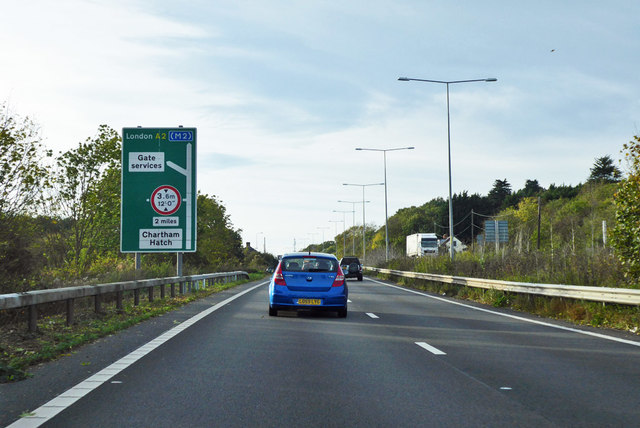
Harbledown and Rough Common is a civil parish located in the county of Kent, England. It is situated approximately two miles west of the historic city of Canterbury, and covers an area of around 6 square miles. The parish is surrounded by picturesque countryside and offers residents and visitors a peaceful and rural setting.

Harbledown, the larger of the two villages, is known for its charming historic buildings and traditional English architecture. The village is home to the famous St. Michael's Church, a Grade I listed building that dates back to the 14th century. The church features stunning stained glass windows and a beautiful carved wooden screen, making it a popular destination for history and architecture enthusiasts.

Rough Common, a smaller settlement within the parish, is primarily residential and offers a range of housing options, from quaint cottages to modern developments. The village benefits from a friendly and close-knit community, with a local primary school, community center, and several amenities within easy reach.

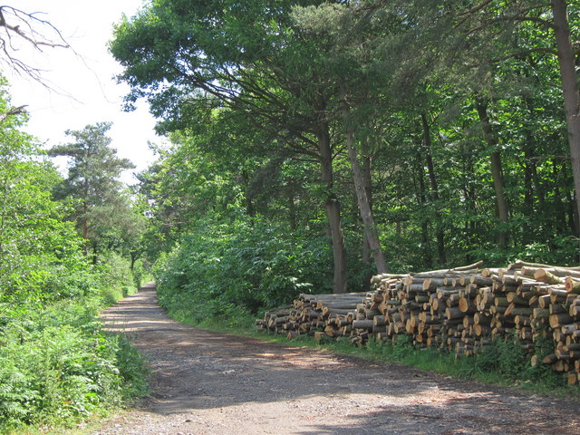
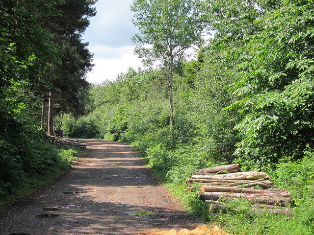
The surrounding countryside provides ample opportunities for outdoor activities, such as walking, cycling, and horse riding. The area is also home to several nature reserves and parks, offering a chance to explore the diverse flora and fauna of the region.

Overall, Harbledown and Rough Common provide a tranquil and idyllic setting for those seeking a peaceful village lifestyle, while still being within easy reach of the amenities and attractions of Canterbury.

If you have any feedback on the listing, please let us know in the comments section below.

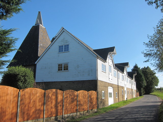
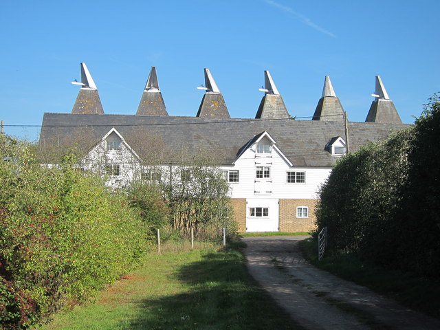
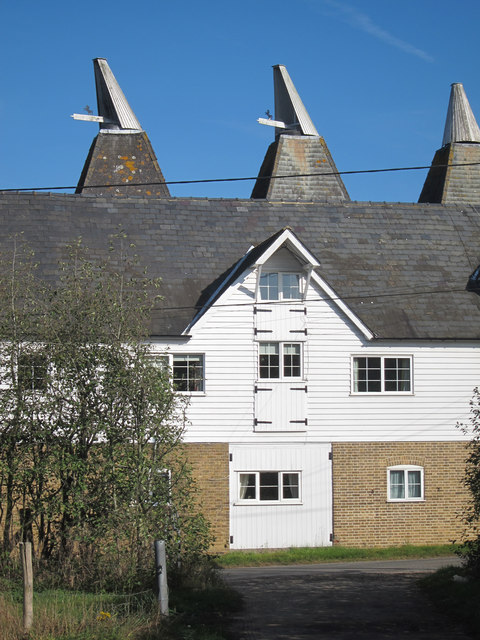
Harbledown and Rough Common Images

Images are sourced within 2km of 51.285016/1.033315 or Grid Reference TR1158. Thanks to Geograph Open Source API. All images are credited.
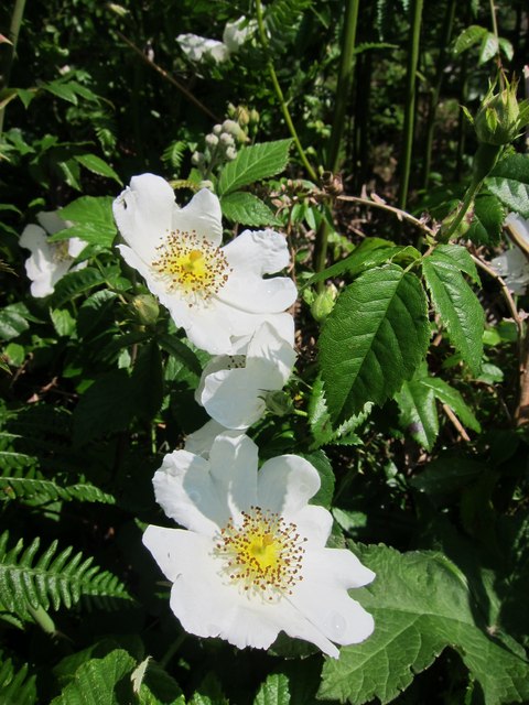
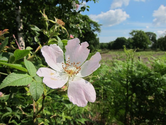
Westbound A2
Westbound A2
Field by Denstead Lane near Dunkirk
Denstead Lane near Dunkirk
Field by Denstead Lane near Dunkirk
Farm track off Denstead Lane near Dunkirk
Denstead Lane near Dunkirk
Fungus in Blean Woods, near Dunkirk I don't know what this is, possibly some sort of puffball in its early stages.
Fungus in Blean Woods, near Dunkirk
I don't know what this is, possibly some sort of puffball in its early stages.
Rosa canina near Bossenden Woods Beside track through the Blean Wood National Nature Reserve.
Rosa canina near Bossenden Woods
Beside track through the Blean Wood National Nature Reserve.
New Road Named track through Church Wood. Wood piles to the side of the track.
New Road
Named track through Church Wood. Wood piles to the side of the track.
Wild rose near Bossenden Woods Beside track through the Blean Wood National Nature Reserve.
Wild rose near Bossenden Woods
Beside track through the Blean Wood National Nature Reserve.
New Road Named track through Church Wood. Wood piles to each sides of the track.
New Road
Named track through Church Wood. Wood piles to each sides of the track.
Bee on Rosa canina near Bossenden Woods One of the largest areas of deciduous woodland in south-east England, Blean Woods has a wealth of wildlife to discover. Around 35 pairs of the legendary nightingale sing, delightfully, each spring, from thick coppice that also holds willow warbler, blackcap and garden warbler. The great blocks of woodland are also vital for breeding birds with significant populations of nightingale, nightjar and golden oriole. There are two areas of heather-dominated heath within the Blean Woods complex. The heathland is home to nightjar, tree pipit and whitethroat. There are many ponds in the Blean; some are known to support populations of great crested newts.

[Extract from <span class="nowrap"><a title="http://www.staykent.co.uk/blean-woods-national-nature-reserve-canterbury-kent.aspx" rel="nofollow ugc noopener" href="http://www.staykent.co.uk/blean-woods-national-nature-reserve-canterbury-kent.aspx">Link</a><img style="margin-left:2px;" alt="External link" title="External link - shift click to open in new window" src="https://s1.geograph.org.uk/img/external.png" width="10" height="10"/></span> ]
Bee on Rosa canina near Bossenden Woods
One of the largest areas of deciduous woodland in south-east England, Blean Woods has a wealth of wildlife to discover. Around 35 pairs of the legendary nightingale sing, delightfully, each spring, from thick coppice that also holds willow warbler, blackcap and garden warbler. The great blocks of woodland are also vital for breeding birds with significant populations of nightingale, nightjar and golden oriole. There are two areas of heather-dominated heath within the Blean Woods complex. The heathland is home to nightjar, tree pipit and whitethroat. There are many ponds in the Blean; some are known to support populations of great crested newts. [Extract from LinkExternal link ]
Orchards by Denstead Lane Footpath to the A2 to the right.
Orchards by Denstead Lane
Footpath to the A2 to the right.
Denstead Oast, Denstead Lane, Chartham Six square kilned oast house.

Grade II listed.
Denstead Oast, Denstead Lane, Chartham
Six square kilned oast house. Grade II listed.
Denstead Oast, Denstead Lane, Chartham Six square kilned oast house.

Grade II listed.
Denstead Oast, Denstead Lane, Chartham
Six square kilned oast house. Grade II listed.
Denstead Oast, Denstead Lane, Chartham Six square kilned oast house.

Grade II listed.
Denstead Oast, Denstead Lane, Chartham
Six square kilned oast house. Grade II listed.
Denstead Oast, Denstead Lane, Chartham Six square kilned oast house.

Grade II listed.
Denstead Oast, Denstead Lane, Chartham
Six square kilned oast house. Grade II listed.
Show me another place!

Harbledown and Rough Common is located at Grid Ref: TR1158 (Lat: 51.285016, Lng: 1.033315)

Administrative County: Kent

District: Canterbury

Police Authority: Kent

What 3 Words

///vertical.extreme.masses. Near Blean, Kent

Related Wikis

Upper Harbledown

Upper Harbledown is a village in Harbledown and Rough Common civil parish about 2 miles (3 km) west of Canterbury, Kent, England. The population is roughly...

Bigbury Camp

Bigbury Camp (formerly Bigberry Camp) is a univallate hill fort in the parish of Harbledown and Rough Common in Kent in England. The fort is a Scheduled...

Rough Common

Rough Common is a village in Canterbury in the parrish of Harbledown, Kent, England. It forms part of the civil parish of Harbledown and Rough Common...

No Man's Orchard

No Man's Orchard is a 4.1-hectare (10-acre) Local Nature Reserve west of Canterbury in Kent. It is owned by Chartham and Harbledown Parish Councils and...

Harbledown

Harbledown is a village in Kent, England, immediately west of Canterbury and contiguous with the city. At local government level the village is designated...

St Michael and All Angels Church, Harbledown

The Church of St Michael and All Angels is a Norman stone church in the village of Harbledown, near Canterbury, England. A part of the Church of England...

Kent College

Kent College, Canterbury is a co-educational private school for boarding and day pupils between the ages of 3 months and 18 years. It was founded in 1885...

St Edmund's School Canterbury

St Edmund's School Canterbury is a private day and boarding school located in Canterbury, Kent, England and established in 1749. The extensive school grounds...

Nearby Amenities

Located within 500m of 51.285016,1.033315
Man Made: monitoring_station
Monitoring Traffic: induction_loop
Vehicle: yes
Lat/Long: 51.2825053/1.033643
Motorway Junction
Harbledown
Lat/Long: 51.2829192/1.0325068
Man Made: monitoring_station
Monitoring Traffic: induction_loop
Vehicle: yes
Lat/Long: 51.2825896/1.033712
Upper Harbledown
Is In: Kent, England, UK
Place: village
Source: survey
Wikidata: Q7898680
Lat/Long: 51.2854641/1.0313975
Bus Stop
Wingate House
Naptan AtcoCode: 240097418
Naptan Bearing: SE
Naptan CommonName: Wingate House
Naptan Indicator: opp
Naptan Landmark: Wingate House
Naptan NaptanCode: kntgmpja
Naptan Street: London Road
Naptan Verified: no
Ref: KNTGMPJA
Source: naptan_import;survey
Lat/Long: 51.2830602/1.038993
Bus Stop
Willow Farm
Naptan AtcoCode: 240097493
Naptan Bearing: NW
Naptan CommonName: Willow Farm
Naptan Indicator: opp
Naptan Landmark: Willow Farm
Naptan NaptanCode: kntgmpmd
Naptan Street: London Road
Naptan Verified: no
Ref: KNTGMPMD
Source: naptan_import;survey
Lat/Long: 51.2840962/1.0354405
Bus Stop
The Plough
Naptan AtcoCode: 240097391
Naptan Bearing: W
Naptan CommonName: The Plough
Naptan Indicator: adj
Naptan Landmark: The Plough PH
Naptan NaptanCode: kntgmpam
Naptan Street: London Road
Naptan Verified: no
Source: naptan_import
Lat/Long: 51.2852058/1.0313389
Post Box
Collection Plate: CP7D
Collection Times: Mo-Fr 09:00; Sa 07:00
Note: The previous edit says that this postbox is a pillar but as at Monday 10.07.2023 this postbox is a lamp.
Old Ref: CT2 38
Operator: Royal Mail
Operator Wikidata: Q638098
Post Box Mounting: pier
Post Box Type: lamp
Postal Code: CT2
Ref: CT2 38D
Royal Cypher: EIIR
Source: survey
Survey Date: 2023-07-10
Lat/Long: 51.2854255/1.0309804
Bus Stop
The Plough
Naptan AtcoCode: 240097389
Naptan Bearing: E
Naptan CommonName: The Plough
Naptan Indicator: opp
Naptan Landmark: The Plough PH
Naptan NaptanCode: kntgmpaj
Naptan Street: London Road
Naptan Verified: yes
Shelter: yes
Source: naptan_import
Lat/Long: 51.2854153/1.0310868
Bus Stop
Flyover
Naptan AtcoCode: 2400A039020A
Naptan Bearing: S
Naptan CommonName: Flyover
Naptan Indicator: S-bound
Naptan Landmark: Motorway Bridge
Naptan NaptanCode: kntdpjmp
Naptan Street: London Road
Naptan Verified: no
Source: naptan_import
Lat/Long: 51.2853478/1.027246
Man Made: monitoring_station
Monitoring Traffic: induction_loop
Vehicle: yes
Lat/Long: 51.2814682/1.0368814
Board Type: notice
Information: board
Tourism: information
Lat/Long: 51.2854311/1.0309258
Board Type: notice
Information: board
Tourism: information
Lat/Long: 51.285853/1.0276207
Grit Bin
Lat/Long: 51.2853613/1.0302828
Generator Method: photovoltaic
Generator Orientation: 193
Generator Output Electricity: yes
Generator Source: solar
Generator Type: solar_photovoltaic_panel
Location: roof
Power: generator
Lat/Long: 51.2827561/1.0379612
Generator Method: photovoltaic
Generator Orientation: 173
Generator Output Electricity: yes
Generator Solar Modules: 10
Generator Source: solar
Generator Type: solar_photovoltaic_panel
Location: roof
Power: generator
Lat/Long: 51.2847424/1.0329375
The data included in this document is from www.openstreetmap.org. The data is made available under ODbL.

Have you been to Harbledown and Rough Common?

Leave your review of Harbledown and Rough Common below (or comments, questions and feedback).