Willows Wood

Wood, Forest in Kent Canterbury

England

Willows Wood

A2 The A2 runs 72 miles from Borough <a href="https://www.geograph.org.uk/photo/5739288">TQ3279 : Great Dover St</a> in London to Dover, through Kent, formerly known as the Dover Road or Great Dover Road. It follows roughly the course of the Roman Watling Street and historically it has always been an important road because it connects London with Canterbury and the port of Dover. In the 18th and 19th century it was turnpiked and given its present designation in the 1920s.
A2 Credit: N Chadwick

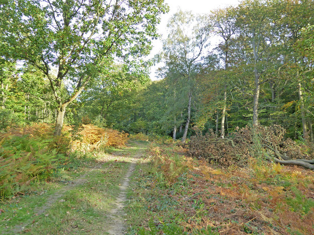
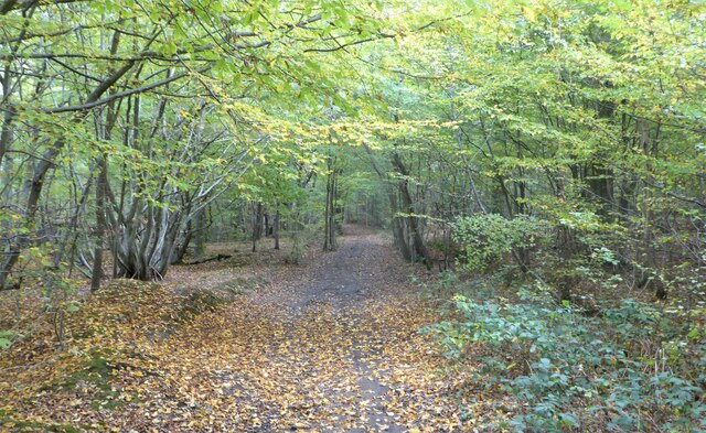
Willows Wood is a picturesque woodland located in the county of Kent, England. Covering an area of approximately 50 acres, this enchanting forest is known for its diverse flora and fauna, making it a popular destination for nature enthusiasts and hikers alike.

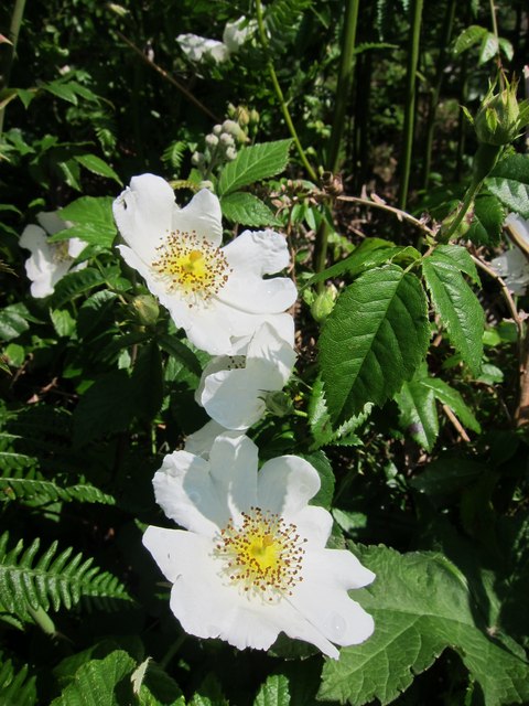
The wood is predominantly composed of willow trees, which lend their name to the area. These majestic trees provide a lush, green canopy that offers shade during the summer months, creating a tranquil and inviting atmosphere. The wood is also home to a variety of other tree species, including oak, birch, and beech, adding to its natural beauty.

Walking through Willows Wood, visitors can discover a network of well-maintained footpaths that wind their way through the trees, offering stunning views of the surrounding countryside. The wood is home to a rich array of wildlife, including deer, foxes, and various bird species, making it a haven for wildlife enthusiasts and photographers.

In addition to its natural beauty, Willows Wood is also known for its historical significance. The area has been inhabited for centuries, and evidence of ancient settlements can still be found within the wood. Archaeological excavations have uncovered remnants of pottery, tools, and other artifacts, shedding light on the lives of those who once called this woodland home.

Overall, Willows Wood in Kent is a captivating destination that offers a perfect blend of natural beauty and historical intrigue. Whether it's for a leisurely stroll, wildlife spotting, or an exploration of the area's rich history, this woodland has something to offer for everyone.

If you have any feedback on the listing, please let us know in the comments section below.
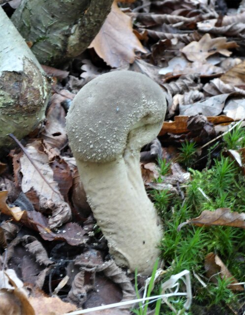
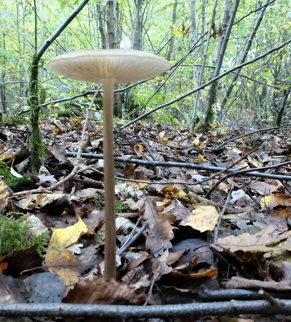
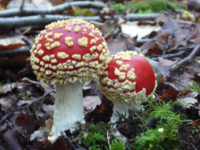
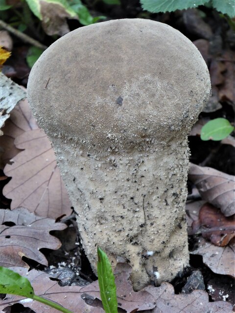
Willows Wood Images

Images are sourced within 2km of 51.290093/1.0250411 or Grid Reference TR1158. Thanks to Geograph Open Source API. All images are credited.

A2 The A2 runs 72 miles from Borough <a href="https://www.geograph.org.uk/photo/5739288">TQ3279 : Great Dover St</a> in London to Dover, through Kent, formerly known as the Dover Road or Great Dover Road. It follows roughly the course of the Roman Watling Street and historically it has always been an important road because it connects London with Canterbury and the port of Dover. In the 18th and 19th century it was turnpiked and given its present designation in the 1920s.
A2
The A2 runs 72 miles from Borough TQ3279 : Great Dover St in London to Dover, through Kent, formerly known as the Dover Road or Great Dover Road. It follows roughly the course of the Roman Watling Street and historically it has always been an important road because it connects London with Canterbury and the port of Dover. In the 18th and 19th century it was turnpiked and given its present designation in the 1920s.
Westbound A2
Westbound A2
Path in Blean Woods Acting as a diversion for one of the waymarked paths in the wood, which turns right here. A section was closed because of forestry work.
Path in Blean Woods
Acting as a diversion for one of the waymarked paths in the wood, which turns right here. A section was closed because of forestry work.
Old Milestone by the A2, London Road, Dunkirk parish Stone post (plate lost) by the A2, in parish of Dunkirk (Swale District), London Road, opposite Denstead Lane, West of Service area, at West end of crash barrier, on North side of road. Dover Road facet, erected by the Chatham & Canterbury turnpike trust in the 19th century. 

Inscription reads:-
(London 53 / Canterbury 3)

Kent HER.
HER Number: TR 05 NE 162 <span class="nowrap"><a title="https://www.heritagegateway.org.uk/Gateway/Results_Single.aspx?uid=MKE77994&resourceID=1005" rel="nofollow ugc noopener" href="https://www.heritagegateway.org.uk/Gateway/Results_Single.aspx?uid=MKE77994&resourceID=1005">Link</a><img style="margin-left:2px;" alt="External link" title="External link - shift click to open in new window" src="https://s1.geograph.org.uk/img/external.png" width="10" height="10"/></span>

Milestone Society National ID: KE_LD52
Old Milestone by the A2, London Road, Dunkirk parish
Stone post (plate lost) by the A2, in parish of Dunkirk (Swale District), London Road, opposite Denstead Lane, West of Service area, at West end of crash barrier, on North side of road. Dover Road facet, erected by the Chatham & Canterbury turnpike trust in the 19th century. Inscription reads:- (London 53 / Canterbury 3) Kent HER. HER Number: TR 05 NE 162 LinkExternal link Milestone Society National ID: KE_LD52
Denstead Lane at the Boughton Bypass junction
Denstead Lane near Dunkirk
Field by Denstead Lane near Dunkirk
Denstead Lane near Dunkirk
Field by Denstead Lane near Dunkirk
Farm track off Denstead Lane near Dunkirk
Denstead Lane near Dunkirk
Path in Blean Woods, near Dunkirk
Fungus in Blean Woods, near Dunkirk Next to a track running south east.
Fungus in Blean Woods, near Dunkirk
Next to a track running south east.
Fungus in Blean Woods, near Dunkirk
Fungus in Blean Woods, near Dunkirk Fly agaric or Amanita muscaria.
Fungus in Blean Woods, near Dunkirk
Fly agaric or Amanita muscaria.
Fungus in Blean Woods, near Dunkirk I don't know what this is, possibly some sort of puffball in its early stages.
Fungus in Blean Woods, near Dunkirk
I don't know what this is, possibly some sort of puffball in its early stages.
Rosa canina near Bossenden Woods Beside track through the Blean Wood National Nature Reserve.
Rosa canina near Bossenden Woods
Beside track through the Blean Wood National Nature Reserve.
Show me another place!

Willows Wood is located at Grid Ref: TR1158 (Lat: 51.290093, Lng: 1.0250411)

Administrative County: Kent

District: Canterbury

Police Authority: Kent

What 3 Words

///chills.displays.strutted. Near Blean, Kent

Related Wikis

Upper Harbledown

Upper Harbledown is a village in Harbledown and Rough Common civil parish about 2 miles (3 km) west of Canterbury, Kent, England. The population is roughly...

Church Woods, Blean

Church Woods, Blean is a 526.7-hectare (1,302-acre) biological Site of Special Scientific Interest north-west of Canterbury in Kent. It is a Nature Conservation...

Bigbury Camp

Bigbury Camp (formerly Bigberry Camp) is a univallate hill fort in the parish of Harbledown and Rough Common in Kent in England. The fort is a Scheduled...

Rough Common

Rough Common is a village in Canterbury in the parrish of Harbledown, Kent, England. It forms part of the civil parish of Harbledown and Rough Common...

No Man's Orchard

No Man's Orchard is a 4.1-hectare (10-acre) Local Nature Reserve west of Canterbury in Kent. It is owned by Chartham and Harbledown Parish Councils and...

Canterbury (UK Parliament constituency)

Canterbury is a constituency in Kent represented in the House of Commons of the UK Parliament since 2017 by Rosie Duffield of the Labour Party.The seat...

Kent College

Kent College, Canterbury is a co-educational private school for boarding and day pupils between the ages of 3 months and 18 years. It was founded in 1885...

Harbledown

Harbledown is a village in Kent, England, immediately west of Canterbury and contiguous with the city. At local government level the village is designated...

Nearby Amenities

Located within 500m of 51.290093,1.0250411
Bus Stop
Woodside
Description: Route 3 stop towards Canterbury
Naptan AtcoCode: 240097385
Naptan Bearing: E
Naptan CommonName: Woodside
Naptan Indicator: adj
Naptan NaptanCode: kntgmpgw
Naptan Street: London Road
Naptan Verified: no
Operator: Stagecoach
Source: naptan_import
Lat/Long: 51.286641/1.021077
Bus Stop
Limes Place
Bus: yes
Naptan AtcoCode: 240097387
Naptan Bearing: E
Naptan CommonName: Limes Place
Naptan Indicator: opp
Naptan Landmark: Limes Place
Naptan NaptanCode: kntgmjwt
Naptan Street: London Road
Naptan Verified: no
Network: 3
Operator: Stagecoach
Public Transport: platform
Source: naptan_import
Lat/Long: 51.286038/1.025929
Parking
Surface: asphalt
Lat/Long: 51.285744/1.0243924
Information: guidepost
Tourism: information
Lat/Long: 51.2928277/1.0270799
The data included in this document is from www.openstreetmap.org. The data is made available under ODbL.

Have you been to Willows Wood?

Leave your review of Willows Wood below (or comments, questions and feedback).