Bromley Cross

Settlement in Essex Tendring

England

Bromley Cross

Elmstead Church The parish church of St. Anne and St. Laurence. Like many Essex churches this lies over a kilometre from the village but next door to the manor house.
Elmstead Church Credit: Roger W Haworth

Bromley Cross is a small village located in the district of Essex, in the southeastern part of England. It is situated near the larger town of Brentwood, approximately 23 miles northeast of London. This picturesque village has a population of around 2,000 residents and is known for its tranquil and rural environment.

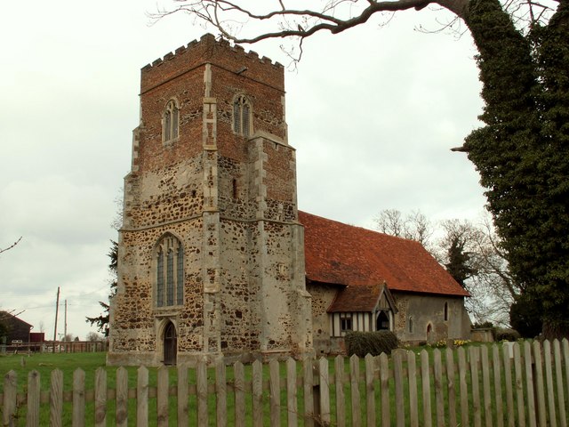
The village is characterized by its quaint and charming atmosphere, with traditional architecture and well-preserved historic buildings. The center of Bromley Cross is dominated by a beautiful medieval church, St. Mary's, which dates back to the 13th century. This architectural gem stands as a testament to the village's rich history and adds to its overall charm.

Surrounded by rolling countryside and scenic landscapes, Bromley Cross offers a peaceful and idyllic setting for residents and visitors alike. The village is blessed with numerous green spaces, including Bromley Cross Common, a designated local nature reserve that provides opportunities for walking and wildlife observation.

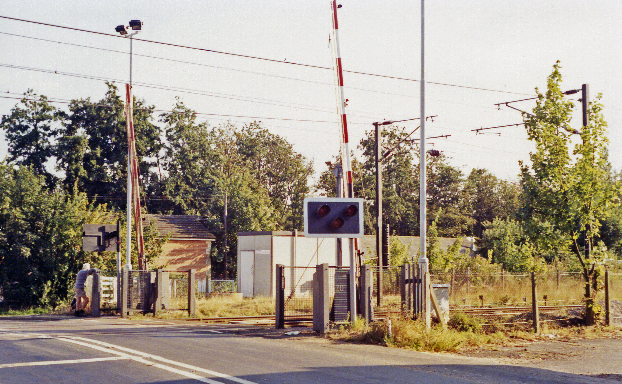
Despite its rural location, Bromley Cross benefits from excellent transport links. The nearby Brentwood railway station offers regular services to London Liverpool Street, making it an attractive place to live for commuters. Additionally, the village is well-connected by road, with easy access to major highways such as the M25 and A12.

Bromley Cross is a close-knit community that boasts several amenities, including a local primary school, a village hall, and a few shops and pubs. The village also hosts various community events throughout the year, fostering a strong sense of community spirit.

Overall, Bromley Cross is a charming and peaceful village that offers a perfect blend of rural tranquility and convenient access to nearby towns and cities.

If you have any feedback on the listing, please let us know in the comments section below.

Bromley Cross Images

Images are sourced within 2km of 51.907559/1.006068 or Grid Reference TM0627. Thanks to Geograph Open Source API. All images are credited.

Elmstead Church The parish church of St. Anne and St. Laurence. Like many Essex churches this lies over a kilometre from the village but next door to the manor house.
Elmstead Church
The parish church of St. Anne and St. Laurence. Like many Essex churches this lies over a kilometre from the village but next door to the manor house.
St George's Church Great Bromley
St George's Church
Great Bromley
Pylon taken from the point where Little Bromley Road, Great Bromley becomes Barlon Road, Little Bromley. The tower of the church of St Mary the Virgin, Little Bromley in <a href="https://www.geograph.org.uk/gridref/TM0927">TM0927</a> can be seen (to the right of the road).
Pylon
taken from the point where Little Bromley Road, Great Bromley becomes Barlon Road, Little Bromley. The tower of the church of St Mary the Virgin, Little Bromley in TM0927 can be seen (to the right of the road).
Elm Park This building is used by a company called, Partnerships In Care Ltd. That is an organisation that cares for mental health issues.
Elm Park
This building is used by a company called, Partnerships In Care Ltd. That is an organisation that cares for mental health issues.
Old Shields Farm
Old Shields Farm
Lane leading to Waterhouse Farm
Farmhouse at Hazel's Farm
'The Cross Inn' at Bromley Cross, Essex
Bush Farm, just northwest of Great Bromley, Essex The road on the right is the B.1029
Bush Farm, just northwest of Great Bromley, Essex
The road on the right is the B.1029
Collierswood Farm
Collierswood Farm
Home Farm Reservoir This is the view from Little Bromley Road
Home Farm Reservoir
This is the view from Little Bromley Road
Farmhouse at Bounds Farm
Normans Farm Normans Farm is on Ardleigh Rd near Little Bromley the photo was taken looking towards Ardleigh.
Normans Farm
Normans Farm is on Ardleigh Rd near Little Bromley the photo was taken looking towards Ardleigh.
Suicidal Footpath One of the more suicidal official footpaths in existence, this shot is looking along the footpath from Elmstead Market to Great Bromley as it crosses the A120. The Highways Agency have left a convenient gap in the crash barrier so if you are lucky enough to survive crossing the first carriageway you don’t have to exert yourself climbing over it. Thankfully there is a <a href="https://www.geograph.org.uk/photo/719824">TM0725 : Safer Crossing</a> a couple of hundred yards away.
Suicidal Footpath
One of the more suicidal official footpaths in existence, this shot is looking along the footpath from Elmstead Market to Great Bromley as it crosses the A120. The Highways Agency have left a convenient gap in the crash barrier so if you are lucky enough to survive crossing the first carriageway you don’t have to exert yourself climbing over it. Thankfully there is a TM0725 : Safer Crossing a couple of hundred yards away.
Safer Crossing This bridge is a safer crossing of the A120 than the <a href="https://www.geograph.org.uk/photo/395161">TM0725 : Suicidal Footpath</a>. It is totally crazy there is no sign to tell walkers of its existence. In fact this is a good case for the diversion of a footpath. I assume the bridge is in place for some future road development as at the time the picture was taken it was a bridge to nowhere.
Safer Crossing
This bridge is a safer crossing of the A120 than the TM0725 : Suicidal Footpath. It is totally crazy there is no sign to tell walkers of its existence. In fact this is a good case for the diversion of a footpath. I assume the bridge is in place for some future road development as at the time the picture was taken it was a bridge to nowhere.
St. Ann & St. Laurence; the parish church of Elmstead This church is mainly 14th century. Re-used Roman bricks can be seen on its north side, surrounding the Norman doorway.  Inside the church there is a very interesting oak effigy of a cross-legged Knight.
St. Ann & St. Laurence; the parish church of Elmstead
This church is mainly 14th century. Re-used Roman bricks can be seen on its north side, surrounding the Norman doorway. Inside the church there is a very interesting oak effigy of a cross-legged Knight.
A view of Elmstead Hall from Church Road It is a large timber-framed building, dated c.1500, which stands next to the parish church.
A view of Elmstead Hall from Church Road
It is a large timber-framed building, dated c.1500, which stands next to the parish church.
St. George; the parish church of Great Bromley Built during the 14th and 15th centuries, this is one of the finest churches in Essex with many beautiful architectural features. It seems quite strange that such a grand church stands in a village that seems to have no old buildings. The village looks entirely 20th century!
St. George; the parish church of Great Bromley
Built during the 14th and 15th centuries, this is one of the finest churches in Essex with many beautiful architectural features. It seems quite strange that such a grand church stands in a village that seems to have no old buildings. The village looks entirely 20th century!
Show me another place!

Bromley Cross is located at Grid Ref: TM0627 (Lat: 51.907559, Lng: 1.006068)

Administrative County: Essex

District: Tendring

Police Authority: Essex

What 3 Words

///gifted.lordship.bars. Near Elmstead Market, Essex

Nearby Locations

Burnt Heath Bromley Cross

Related Wikis

Ardleigh Gravel Pit

Ardleigh Gravel Pit is a 1.2-hectare (3.0-acre) geological Site of Special Scientific Interest south of Ardleigh in Essex. It is a Geological Conservation...

Harwich and North Essex (UK Parliament constituency)

Harwich and North Essex is a constituency represented in the House of Commons of the UK Parliament by Bernard Jenkin of the Conservative Party since its...

Great Bromley

Great Bromley is a village and civil parish in the Tendring district of Essex, England. It lies 6 kilometres (4 mi) south of Manningtree and 9 kilometres...

Ardleigh railway station

Ardleigh railway station served the village of Ardleigh in Essex, England. The station was situated on the Great Eastern Main Line. == History == Opened...

St Mary the Virgin's Church, Little Bromley

St Mary the Virgin's Church is a former Anglican church near the village of Little Bromley, Essex, England. It is recorded in the National Heritage List...

Ardleigh

Ardleigh is a village and civil parish in Essex, England. It is situated approximately 4 miles (6 km) northeast from the centre of Colchester and 26 miles...

Little Bromley

Little Bromley is a village and civil parish in the Tendring district of Essex, England. The name "Bromley" is Old English for "broomy wood/clearing"....

Crockleford Heath

Crockleford Heath is part of the village and civil parish of Ardleigh in Essex. It is located 2+1⁄2 miles south-west of the village centre.Crockleford...

Nearby Amenities

Located within 500m of 51.907559,1.006068
Power: tower
Source: OS_OpenData_VectorDistrict
Lat/Long: 51.9095422/1.0015946
Power: tower
Source: OS_OpenData_VectorDistrict
Lat/Long: 51.9111289/1.0052193
Cross Inn
Naptan AtcoCode: 1500IM1757
Naptan Bearing: NW
Naptan BusStopType: CUS
Naptan CommonName: Cross Inn
Naptan Indicator: o/s
Naptan Landmark: Cross Inn
Naptan NaptanCode: esxgmpjd
Naptan Street: Ardleigh Road
Naptan Verified: no
Public Transport: platform
Source: naptan_import
Lat/Long: 51.9074096/1.0055222
Cross Inn
Naptan AtcoCode: 1500IM1757AA
Naptan Bearing: SE
Naptan BusStopType: CUS
Naptan CommonName: Cross Inn
Naptan Indicator: Opp
Naptan Landmark: Cross Inn
Naptan NaptanCode: esxjajmd
Naptan Street: Ardleigh Road
Naptan Verified: no
Public Transport: platform
Source: naptan_import
Lat/Long: 51.9080201/1.0049257
Fixme: This telephone box appears to be missing on Street Level Imagery. Please confirm if it has been removed or is in a different location.
Mapillary: 266544438841548
Removed Amenity: telephone
Survey Date: 2022-04-06
Lat/Long: 51.9106923/1.000967
Post Box
Mapillary: 175654327853096
Post Box Mounting: pier
Post Box Type: lamp
Ref: CO7 106
Survey Date: 2021-06-08
Lat/Long: 51.9073852/1.0057043
Power: pole
Source: bing
Lat/Long: 51.9064936/1.0126517
Power: pole
Source: bing
Lat/Long: 51.9069249/1.0115969
Power: pole
Source: bing
Lat/Long: 51.9073535/1.010566
Power: pole
Source: bing
Lat/Long: 51.9077823/1.0095143
Power: pole
Source: bing
Lat/Long: 51.9082268/1.0084675
Power: pole
Source: Bing
Lat/Long: 51.9086016/1.0075446
Power: pole
Source: bing
Lat/Long: 51.9092183/1.0060468
Power: pole
Source: bing
Lat/Long: 51.9101421/1.0059344
Power: pole
Source: Bing
Lat/Long: 51.9063148/1.0005908
Power: pole
Source: Bing
Lat/Long: 51.9068033/1.0017263
Power: pole
Source: Bing
Lat/Long: 51.9069027/1.0025205
Power: pole
Lat/Long: 51.9072741/1.0037611
Power: pole
Source: Bing
Lat/Long: 51.9076428/1.0049592
Power: pole
Source: Bing
Lat/Long: 51.9078183/1.0055383
Power: pole
Source: Bing
Lat/Long: 51.9081605/1.0064131
Greensmere Canine Hydrotherapy
Shop: pet
Website: http://www.greensmere.co.uk
Lat/Long: 51.9083334/1.0052343
Post Office
Great Bromley Post Office
Addr City: Colchester
Addr Housename: The Cross Inn Public House
Addr Postcode: CO7 7TL
Addr Street: Ardleigh Road
Addr Village: Great Bromley
Brand: Post Office
Brand Wikidata: Q1783168
Contact Website: https://www.postoffice.co.uk/branch-finder/5044715/great-bromley
Opening Hours: We 10:00-12:00
Ref Pol Id: 144362
Lat/Long: 51.9073053/1.0055439
Hall Road
Naptan AtcoCode: 1500IM94Y1
Naptan BusStopType: CUS
Naptan NaptanCode: esxjpjtw
Naptan Verified: no
Public Transport: platform
Source: naptan
Lat/Long: 51.9069857/1.0050948
Hall Road
Naptan AtcoCode: 1500IM9401
Naptan BusStopType: CUS
Naptan NaptanCode: esxjpjtp
Naptan Verified: no
Public Transport: platform
Source: naptan
Lat/Long: 51.907007/1.0049653
Defibrillator
Defibrillator Location: On exterior of pub on north side (path leads between Ardleigh Road to car park)
Emergency: defibrillator
Ref GB The Circuit: 6B9AECA6-757D-4824-80CE-AD73009E9DF2
Lat/Long: 51.9073202/1.0055181
The data included in this document is from www.openstreetmap.org. The data is made available under ODbL.

Have you been to Bromley Cross?

Leave your review of Bromley Cross below (or comments, questions and feedback).